A large income should be shared with one's fellow citizens, and it is better to do so voluntarily. So the Bible teaches. Evidently it was with this in mind that the successful wine merchant Max Aschmann in 1903 bequeathed to Königsberg 100,000 marks for laying out a public park, which was to be based on an estate that he also donated, with 25 ha of open land, including an extensive oak grove of 17.5 ha, located in the new northern city district of Maraunenhof. The estate with its grove of oaks, already mature by then, passed into municipal ownership in 1904. The donor set only one condition in his will: the park bearing his name was to be inalienable, that is, it was to belong to the city and never be built on. "Were you a king, here would be your Sanssouci" (Theodor G. von Hippel).
From 1809 a large business, the Steffens und Wolter wine house, was located in the Kneiphof district at Kneiphöfsche Langgasse 27. From 1903 to 1932 its owners were the Aschmann family. This house was one of the most beautiful in Kneiphof (its door, carved and inlaid in the Renaissance style, was later kept in the Hamburg Museum of Arts and Crafts).
Below is part of a text from an 1895 source describing the house belonging to the wine merchant Max Aschmann, as an example of the luxury characteristic of mercantile Kneiphof:
"Of the streets of Kneiphof the oldest is the Langgasse (Langgasse), the main artery connecting the city's commercial life. Here stand the houses of the richest burghers. Their houses have every possible comfort, and their architecture looks most solid.
These cosy houses take pride in their luxury, which reveals the typical character of prosperous Königsberg. One such house, which still kept its charm at the end of the 19th century, is the trading house of Steffens und Wolter.
The house has a massive, wide front terrace up to three metres high, from which a staircase with iron railings adorned with brass balls leads down to the street. In front of the house is a front garden with an iron fence. In summer this area and the terrace were covered with awnings, and benches were placed beneath them where family members and guests sat on warm evenings. The richly carved doors were fitted with a brass knocker. From the terrace one entered the vestibule, a high room with a large window whose recesses were lined with stone slabs. Here stood cupboards of oak or pear wood, several chairs and a table, and from here there was access to the living quarters. Large windows and glazed doors made the rooms bright. There were a drawing room, guest rooms and the main hall, whose tall windows looked out onto the street. The furniture was heavy and bulky, upholstered in thick silk damask. Through the glass doors of the large cabinets one could see a rich variety of expensive tableware.
An oak staircase led to the upper floors, where the family bedrooms and the servants' rooms were. … The façades of these houses gave the old streets their charm…".
So the wealthy wine merchant gave the city the Maraunenhof estate he had bought, whose name passed to the new prestigious villa district that appeared in Königsberg at the beginning of the 20th century. Let me quote almost in full the recollections of our fellow townsman Yu. A. Gudkov, which I read in the newspaper "Strana Kaliningrad" (5–11 February 2003). These lines are so kind and poetic that it would be hard to say anything better about the garden city of Maraunenhof. I would point out that the author of these lines was born in Kaliningrad in the 1950s, so he saw all this in the 1960s too…
"Neat little houses, as if from a picture book, in orderly rows. Green front gardens. Roads without potholes or bumps… Low hedges mark the boundaries of gardens and front gardens. Clipped bushes with white berries, tea roses of creamy beauty embrace the picket fences. Bright scarlet and dark red flashes of climbing roses along the fences catch the eye. Vines on the walls of yellow houses. A larch by the gate. A hazel bush with dark red leaves. Two towering spruces with cones at their tops. A hedge of pyramidal thuja… Clipped elms along the road to school. The honey scent of lindens and the buzzing of bees…" (further on in the text, in my view, Max Aschmann Park is described). "A fire pond with crucian carp the size of your palm, and in spring – riding on ice floes.
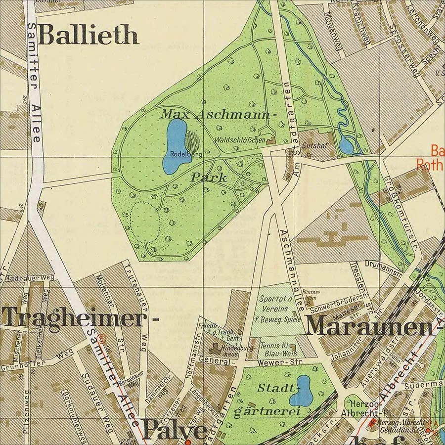
Max Aschmann Park on a map of Königsberg (Stadtgärtnerei – now the IKBFU Botanical Garden).
A yellow-brick path through the woods. A footbridge. Ponds with crucian carp. The broken foundations of a former house. A stairway down to the pond with balls along its edges. A mermaid on a stone. A beech grove. A glade with wild strawberries, a memorial slab of dark marble.
Good mushroom spots near Lake Lesnoye. A hill. A beach of fine white sand. The water clear and warm. Springs near the trees, where the water is colder. Tench splashing in the duckweed. Bleak moving in shoals. A cobbled road through the woods".
Another fellow townsman of ours, the writer Yu. Buida: "The smooth grey trunks stood like temple columns, soaring above a floor laid with a mosaic of carved beech leaves". As if Aschmann Park were before one's eyes…
Let us return to 1910. A guidebook to Königsberg published that year mentions the new park for the first time as "25 ha of open land, of which 17.5 ha is oak grove, and playgrounds". The 1938 guidebook is somewhat more interesting: "A large park area of 70 ha, a bathing pond with a beach, a toboggan hill, playgrounds, a bridle path, a memorial avenue of honour in memory of those who fell in the First World War, splendid groups of trees, views attractive in their naturalness".
Over thirty years of careful shaping, Königsberg's largest park area grew almost threefold and acquired the features of a landscape park with a succession of changing views and a distinctive combination of compositional and planning features.
There are still many people in Kaliningrad who do not know that this almost forest-like thicket – waterlogged in many places, squeezed between Gorkogo, Lugovaya and Gertsena Streets, with a swampy lake and fallen trees, and dug up with revetments – is a Königsberg park.
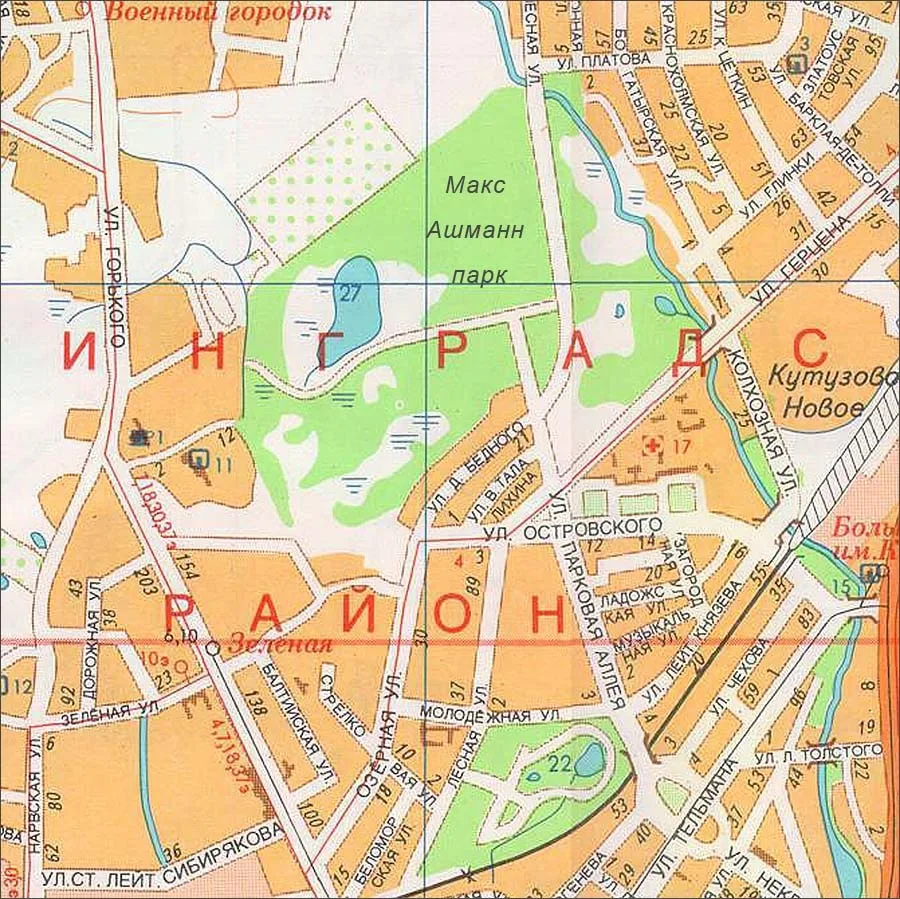 Max Aschmann Park on a map of Kaliningrad.
For several years the author of these lines and students of the Faculty of Geography and Geoecology of the Kant Russian State University tried to understand the intentions of their talented predecessors, to identify the compositional nodes and to establish the species and age composition of the trees.
First, however, let me simply sing the praises of this place, and later, in the dry language of an official document by an expedition from the capital, set everything out in order.
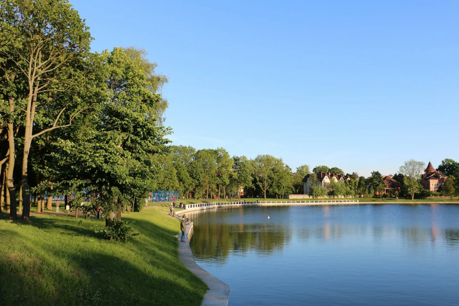
The main thing one notices at once in the park is its man-made lake and the hill formed from the excavated soil… In the past: the white sand of the beach embracing the clean lake with its cold springs. On the other side of the hill a green meadow, which in the landscape architect's design was almost equal in size to the beach. Along its larger diameter this part of the park is outlined by a bridle path paved with setts and lined on both sides with pedunculate oaks. In the eastern part of the park there is a sunny meadow by the Beydritter stream with several little bridges for strolling back and forth "aimlessly", a bouquet of several maples in this meadow and another pond with a stone-lined bed (it certainly had a practical purpose – surplus water from the large lake and the surrounding areas drained into it through underground pipes), yet framed by the silvery foliage of willows it was lovely too, all the more so since the full-flowing Beydritter, which feeds the Upper Pond, replenished and cleansed this tiny park pond on its way. The park had three entrances. The first, the main southern entrance, was from Aschmann Allee; within the park this charming street was surfaced with red brick chippings and set off by a hornbeam "wall" (some of the hornbeams can still be seen today, for now, on Parkovaya Alleya Street). Another street runs through the park from south to north and serves as a through route, evidently for the convenience of residents not inclined to stroll in the park but glad to cross it on their business.
This cobbled lane was called Am Stadtgarten, i.e. "by the city garden"; it is now part of Malaya Lesnaya Street. The third entrance was on the western side, and a path led to it across the meadows from Samitter allee (now Gorkogo Street).
The oldest part of the park, where the oak grove was already about two hundred years old by the beginning of the 20th century, is bounded on the south by the circular bridle path and lies to the north of it.
Mighty trunks of oaks, beeches and lindens shape this space; the sunlight lets grasses grow, including wild strawberries, and the half-shade brings forth appetising mushroom caps (a few can be gathered even now). Paths of red brick chippings make walking in the wooded part of the park easy.
On either side of the through street there are two very different sections, each with its own compositional centre. Adjoining the oak and hornbeam stand, i.e. on the western side of the street, is the Heldenhain – the Heroes' Avenue. On the 1927 plan of the park one can clearly see that this section is outlined by an avenue, and field surveys can still find remains of an avenue of pedunculate oaks today. A German source reports that oaks were planted here in honour of Königsberg residents who fell in the war of 1914–18. We did indeed find and photograph three surviving memorial stones, one of which, of dark red granite, bears the inscription "The Altstadt Gymnasium to its 100 fallen pupils 1914–1918". And further: "You were faithful to your duty until your death" or "for duty's sake you went to your death", roughly like that.
1914-1918 ALTSTAEDLISSCHE GYMNASIUM
SEINEN ł GEFALLENEN ł
IHR WARET GETREU BIS IN DEN TOD
The other two stones bear names.
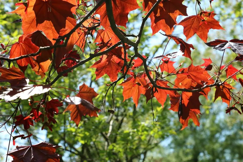
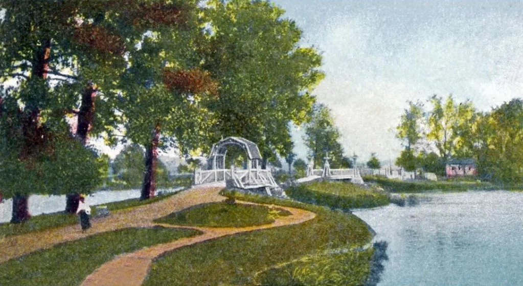
East of the through road lay a broad sunny meadow, in the middle of which a group of maples invited under its shady umbrella everyone tired by the bright light of this open space; along its eastern side, from north to south, it was bordered by a stream with little rustic-style bridges (the ruins of one of these bridges survive in the northern part, but now, alas, outside the reduced territory of the park).
Visitors who came in by the main southern entrance found themselves in a small special park where, on the bank of a small man-made pond, stood the Waldschloßchen – a little forest castle, from which steps ran down to the water; the stairway was adorned with balls, and according to descriptions there were also many sculptures on small pedestals here. One of the sculptures, whose pedestal of cement stone still stands in the park for now, depicted a recumbent knight, or a warrior, or a soldier – that is, it is now unclear from what era this warrior was, lying on his right side and embracing a sword (we were able to find out that the sculpture was taken away several years ago and is kept in the storerooms of the Museum of Fine Arts). The condition of the tuff sculpture is extremely poor. According to the official version, the sculptor Rosenberg depicted a dying warrior in memory of the members of the Königsberg sports club "Prussia" who fell in the First World War. The monument was erected in 1919.
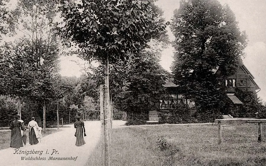
The "Forest Castle" (German: Waldschloßchen) – the main house of Max Aschmann's estate, deep in the park.
The little castle was in fact of normal size and was possibly the manor house of the estate. The ruined foundations of the outbuildings and of the "castle" can still be seen in the park today.
I once held in my hand a piece of green tiling – from either a pond or a bathroom of the "castle" – but this fragment was so sad that I carefully put it back in its historic place (six months later it was no longer there)…
Those who, on entering the park, turned into its southernmost part found another bright meadow at their feet, with two large flower beds and an open-air summer theatre set off by a "hornbeam wall" – an area clearly intended for public festivities and all kinds of mass gatherings (running ahead, I would note in passing that it is precisely this meadow that is now partly built over with a new street of upmarket private houses, and it is precisely here – and probably precisely for this reason – that the park reconstruction plan held by the Kaliningrad mayor's office proposes to create a zone of "medium intensity of use", because "the zone is close to the buildings on D. Bednogo Street" (and now, north of D. Bednogo Street (for some reason there are two of them: one to the south, the other to the north), another similar very upmarket street, Lugovaya, has appeared) and "the area is intended for recreation of citizens living in the nearby blocks, as well as for dog-walking areas, children's playgrounds, sports grounds, etc.". It is very interesting: if park land is to be "spent" in this way at all, why is such "design" not needed by the residents of the multi-storey blocks that press against the park from the west? After all, there are rather more residents, dogs and children there…
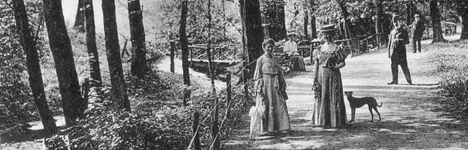
… The park gave people all it could: light and shade, the hot haze of glades with rustling grasses and flowering legumes, the pattern of sunlight dappling beneath the canopy, the intimacy and coolness of shady avenues, the fairy tale of the forest castle, the babbling of the stream, a chance to gather for dances, shows or rallies. The fortunes of war were kind to it. There are no shell craters in the park, but in some places there are trenches 1.5 m deep and twenty-year-old revetments, very often filled with water. These are traces of military exercises held in the park. The cobbled lane of Aschmann-Allee was broken up during exercises by tanks coming from the Kutuzovo-Novoye railway platform…
Another fellow townsman of ours, Yu. Shebalkin, writes so touchingly about this park, which he knew "as well as the pockets of his corduroy jacket", that I want to quote him:
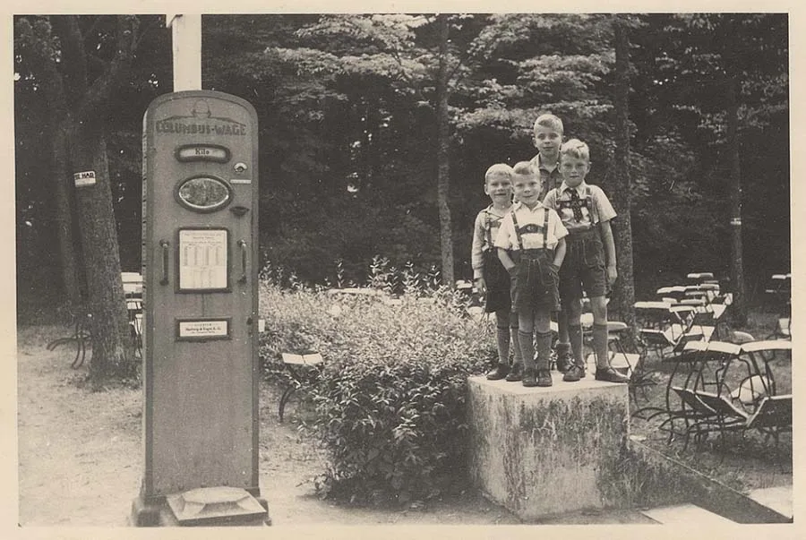 Children in Max Aschmann Park.
"…It was the place of our childhood games and, a little later, of our first teenage dates. Early on summer mornings the kids from the surrounding streets – Gorkogo, Zelenaya, Lesnaya, Strelkovaya, Gertsena and others – ran here, to Lake Lesnoye, to swim. And in the evening it was the grown-ups' turn.
Along the oak avenues and paths, not yet overgrown with bushes and nettles, dapper cadets of the Krasin Artillery School and the Naval Quartermaster School strolled with their girlfriends. Young people relaxed on benches that had survived the war and were still sturdy, looking with interest at the already plundered pavilions and at the building of some small castle. They swung on the chains that surrounded the oak planted here in honour of the German Kaiser. In short, people used the park as they should. As its creator, the Königsberg merchant Max Aschmann, had intended. … In the 1950s the park began to become overgrown. The mighty oaks were surrounded by wild undergrowth, the charming lawns by bushes. The man-made forest hill became overgrown and pitted with holes… A heavy blow was dealt to the green area by the military from a nearby unit. At some point tactical field exercises began to be held in the park. Recruits dug in and dug trenches… Maintenance services dumped rubbish and construction waste here. Mountains of junk towered among the greenery like slag heaps. Anyone who wanted to did as they pleased here… Around a mighty century-old oak stand granite posts. On one of them the figure 1900 can be seen – the year the tree was planted. Bronze chains were once fixed here. They are gone now. A sledgehammer has worked over the polished tops of the posts. The chains that surrounded the oak have disappeared… Once I happened to visit the headquarters of one of the garrison's military units. Passing "Post No. 1", where the unit's banner is kept under guard, I noticed the barrier. Bronze chains! They had once fenced off the "Kaiser's oak"…
Perhaps the park should be added to the list of treasures lost during the Second World War?"
The oak planted in honour of the Iron Chancellor Otto von Bismarck (there is such a legend) fell at the very beginning of the 21st century, and in 2008 its trunk still lies near the little lake with the castle, in a glade not yet overgrown.
Before the second part of our account of Max Aschmann's park, in which we will set everything out in order using official sources, I cannot resist quoting a lament for a park – a different one, admittedly, but also one of ours – by the poet Lada Viktorova:
"Fire and damp act alike: the foliage is charred as if by flame. The stream lies on this brown bed. It has fallen ill… To awaken is frightening, to turn back there is no strength. Four large-fingered trunks like the blades of a cross… And in the centre, winning back life… a whole forest of young growth crowded… And that is how we saw it".
* * *
Below is a description of the park set out in the precise, dry language of a document based on work carried out in 1997, commissioned by the Kaliningrad mayor's office, by the park-planning expedition of the Federal Forestry Service of Russia headed by the expedition leader V. A. Agaltsova.
The brief overview states that "the absence of any maintenance has led to the neglect of the area; cattle graze and dogs are walked here. Owing to the disruption of the drainage system, waterlogging has begun, causing trees to die off in some sections. Nevertheless, in certain parts the park has preserved magnificent views, a considerable number of promising plantings, historical planning elements and compositional nodes". "… The third period of the park's existence (i.e. 1946–96) was destructive. During this time, under the natural, spontaneous development of the plantings and in the absence of maintenance, it gradually degenerated into a forest park".
Land balance within the historical boundaries
No.
Land category
Present-day, ha
%
Historical, ha
%
1.
Buildings and structures
2.9
3.6
0.8
1.0
2.
Roads
0.4
0.5
2.5
3.1
3.
Grounds
-
-
2.3
2.9
4.
Water areas
3.4
4.3
3.4
4.3
5.
Dense plantings – closed spaces
55.0
68.7
32.0
40.0
6
Loose plantings – semi-open spaces
2.0
2.5
23.0
29.0
7.
Glades – open spaces
14.0
17.5
16.0
20.0
Total
80.0
100.0
80.0
100.0
The landscape description of the area followed the compositional and planning principle.
Section 1
Present state: An area in the western part of the park; the centre of its composition is a pond with a smooth shoreline. On the eastern side a regularly shaped hill covered with trees and shrubs adjoins the shore closely. On the western side there is a large glade. Around the perimeter of the section there is dense vegetation with poor visibility. The peripheral footpath is unimproved; its regular course is broken by diggings, and excessive moisture is observed in some sections. Multi-storey housing comes right up to the park boundaries.
Historical state: In terms of its date of creation, this part of the park belongs to Period II. The compositional centre of this section is an open space consisting of a water surface and a clear glade of roughly equal area. The hill next to the pond was not planted and was used for tobogganing. Walking paths were laid around these park elements. One of them, a closed loop, was a bridle path 6 m wide. This road is lined with an avenue of oaks along its entire length. The glade is framed around its perimeter by groups of trees of various species set at varying distances from one another. This ensured that the section could be viewed from different points along the route. On the western side was one of the main entrances to the park, now lost.
Section 2
Present state: The stand is an oak and hornbeam woodland of seed origin; the oaks are 170–180 years old. The relief has no general slope, and excess moisture accumulates in micro-depressions, where pedunculate oak is dying off intensively and black alder and shrubs are moving in. A large amount of fallen wood and standing dead trees accumulates in the section. The drainage has been disrupted by numerous trenches, although remains of the old drainage system still survive. Paths run through the section, in places coinciding with the historical paths, where brick surfacing can be seen. On the higher ground the condition and decorative value of the plantings are good. No natural regeneration of oak has been noted anywhere, whereas hornbeam has saplings of various ages.
Historical state: This area is the oldest part of the park, around which the park ensemble was artificially created. The oak grove had a stocking density of 0.6; hornbeam was present in this stand as an accompanying species in small numbers, there was no undergrowth and the area could be seen through well. All the walking paths were surfaced with brick, and crossings were made over the drainage ditches. In the grove there were small glades with solitary trees, memorial structures and benches.
Section 3
Present state: In shape the section is elongated between Lesnaya Street, lined with an avenue of maples, and the edge of the oak stand. In the southern part there is a small round pond with a small glade adjoining it. South of the pond are the remains of the foundations of a large building. This part is littered with construction debris and fallen wood and is overgrown with self-sown trees and shrubs. North of the pond, old trees stand in mixed-species groups. Their condition is good; in the avenue along the street it is severely weakened, since the root system was damaged when a drainage ditch was dug in the 1980s. The glades in the section take the form of small clearings. In the northern part the surface is heavily dug up, water stagnates, and the banks of the stream are covered with impenetrable thickets.
Historical state: In its layout this part of the park was organised as a self-contained mini-park. A building of unusual architecture called the "Little Forest Castle" stood on higher ground, with flights of steps leading from it down to the little pond. Numerous paths divided the area into small parts, where memorial structures in the form of obelisks, sculptures, pillars and slabs were placed. Memorial trees are also noted here. The layout took shape over both periods. The southern part is of earlier origin. In Period II a promenade was laid out along the existing dense oak planting, oriented towards the "Forest Castle" and planted with picturesque groups and solitary trees of various species.
On the northern side there was another park entrance, marked by a granite pillar. Paths from different parts of the park also converged here.
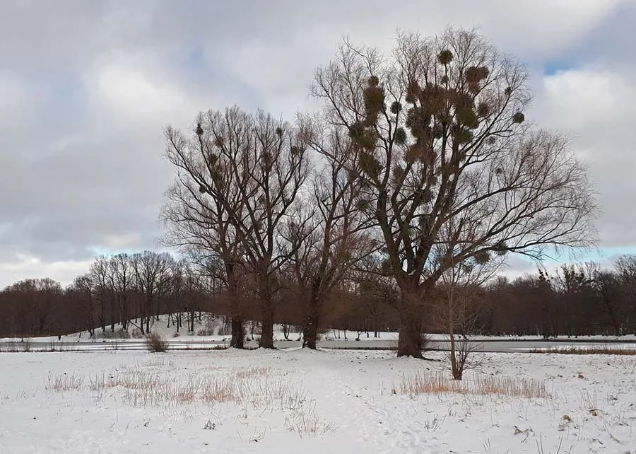
Max Aschmann Park in winter. The Rodelberg hill can be seen in the distance.
Section 4
Present state: The section lies between Lesnaya Street and the eastern boundary of the park. A stream with a winding bed flows through the whole section. Its banks are overgrown with low-value vegetation, and the flow is weak because the bed is clogged with debris. Along the banks there are vegetable plots with sheds and fences. On the whole the section has more open spaces in the form of ornamental glades with groups of trees. A dense planting of trees has survived along the street, where three-row avenues can be made out. In the southern part of the section there are two ponds, one of which is connected to the stream. The condition of the ponds is poor. Near them the remains of foundations, overgrown with self-sown trees, can be clearly seen.
Historical state: The rectangular southern part of the section with the ponds, bounded by two parallel roads, belongs to the early period of the park's formation. Here stood all the service buildings that formed part of the "Maraunenhof" estate and later belonged to the public park. The existence of the bridle path suggests that there were stables, coach and hay sheds and a smithy. A sluice was probably built to let water into the lower pond and on into the Beydritten stream. This watercourse, which extends far beyond this area, was the park's water management system. In addition, the stream with its picturesque banks was part of the park landscape. The walking paths crossed the stream bed in several places, which indicates the existence of little bridges (about ten). Groups of trees, poplars and willows, have survived along the banks; between them there were once views of the surrounding landscapes.
Section 5
Present state: A large area along the southern boundary of the park is a heavily overgrown section with plantings that are difficult or entirely impossible to get through. Heavy overgrowth with shrubs is noted in places with excess moisture where old trees of valuable species have died off. Only two large glades are relatively decorative and suitable for walking; the rest, shapeless clearings where the soil has turfed over, are closely enclosed by overgrown shrubs. Part of one large glade has been built over with cottages. A complete discord, both in layout and in architecture, is the concrete kindergarten building under construction. Random paths do not match the historical paths; the area is littered with defective timber, and there are remains of foundations.
Historical state: This extensive area of the park, formed in Period II, was filled with various park elements. In the south-western part there was a regular oval glade equipped with grounds for sports games. Along the road was an "open-air theatre", surrounded by a clipped hornbeam wall and oaks. An artificial rise of regular semicircular shape with flights of steps and a foundation has survived. A large open space planted with rows of trees could be approached from five sides and served for mass gatherings. Nearby was a large structure with a canopy roof, probably connected with the use of the second large elongated glade.
On the eastern side the section was bounded by the ceremonial approach road to the "Forest Castle", divided down the middle by a low clipped hornbeam wall. All these parts were separated by dense or open groups and clumps of trees and linked by walking paths.
Section 6
Present state: A triangular section in the south-eastern part of the surveyed area, most of which consists of open spaces with solitary and clumped self-sown trees of a wide range of species. Many specimens are healthy and decorative. In the centre of the glade, in a hollow, impenetrable thickets of shrubs occupy a large area. The entrance to Lesnaya Street is blocked with construction rubbish.
Historical state: This area was not part of the park, except for a small plot adjoining the stream, but in its layout it was linked to the rest. It was a huge open space. There were plantings only near the dwellings; rows of them have survived here.
Below is the range of trees and shrubs in the park as of 1997 (the list is arranged "in order of decreasing numbers in the park").
Pedunculate oak
(Qercus robur)
Common hornbeam
(Carpinus betulus)
Small-leaved lime
(Tilia cordata)
Black poplar
(Populus nigra)
Red oak
(Qercus rubra)
Black alder
(Alnus glutinosa)
European beech
(Fagus silvatica)
Norway maple
(Acer platanoides)
White willow
(Salix alba)
Sycamore
(Acer pseudoplatanus)
Common ash
(Fraxinus exselsior)
Horse chestnut
(Aesculus hippocastanum)
Silver maple
(Acer sacharinum)
Silver birch
(Betula pendula)
Balsam poplar
(Populus balsamifera)
Crack willow
(Salix fragilis)
European white elm
(Ulmus laevis)
White dogwood
(Cornus alba)
Common hawthorn
(Crataegyna monogyna)
Osier
(Salix viminalis)
Elder
(Sambucus nigra)
Common snowberry
Symphoricarpus albus)
Japanese rose
(Rosa rugosa)
Hazel
(Corilus avellana)
Willowleaf meadowsweet
(Spyrea salicifolia)
European spindle
(Evonymus europaea)
Below we take the liberty of quoting a few more paragraphs from the "Programme for Restoring the Water and Sanitary Regimes of the Watercourses of the City of Kaliningrad", drawn up by the Zapvodproekt Institute in 1998 and still not implemented in 2008:
"In the pre-war period, due attention was paid to the development and operation of the city's hydrographic network, which has a total length of at least 12 km, and of the hydraulic structures within the city, as a result of which a complex system of engineering structures was created that ensured a favourable regime for the water bodies.
…The complex engineering system of hydraulic structures… continues gradually to deteriorate owing to the unsatisfactory operation of the structures and the failure to take the necessary measures for their restoration and reconstruction.
…A typical example of a negative impact on the city's existing hydrographic network is the situation that arose during the development of new areas around Leytenanta Sibiryakova – Zelenaya – Gorkogo – Yefremova Streets, where the construction of a residential neighbourhood failed to take into account the course of the Molodezhny Stream, a section of which was completely eliminated.
…As a result, an area of about 100 ha fell into the waterlogging zone. About 70% of the total 85 ha of Max-Aschmann-Park is currently waterlogged. The park's land was drained by a combined network of pre-war construction (closed drainage and open regulating channels). The receiving waters of the drainage network are the Molodezhny and Severny Streams, and because of their poor condition the existing drainage network is backed up and does not provide the required drainage rate. In addition, the closed drainage has been damaged by the roots of trees and shrubs, and the open conveying and regulating channels are silted up, their slopes deformed and overgrown with trees. The structures on the channels are out of order, worsening their hydrological regime. The ponds in the park are unregulated, which leads to the waterlogging of the adjacent areas. The beds along the water bodies are silted up and overgrown with wetland vegetation".
* * *
Kaliningrad's ecological troubles, which are a complex of various problems, consist not only in the chemical pollution of its landscapes, typical today of most cities, but to a large extent in the long-standing neglect, littering and visible degradation of its historical, ecologically sound green areas, which has ultimately led to parts of them being alienated and to these wastelands, which have neither a name nor protected status, being further allocated for development as being of little value.
Among the administrative measures to be taken as a priority after design and survey work in the park, the park-planning specialist and the landscape architect propose:
- to place the park under protection in accordance with current legislation and give its territory protected status;
- to prohibit construction and the allocation of plots for private building until the protection zones of the monument of landscape art have been approved;
- to draw up a project for the reconstruction of the park.
Since then, i.e. since the specialists completed their survey of this park area – unique for Kaliningrad, if only in size – more than 10 years have passed. [It is now a quarter of a century, and the park continues to fall apart, as if it were being prepared for the fate of Devau airport. – Ed.]
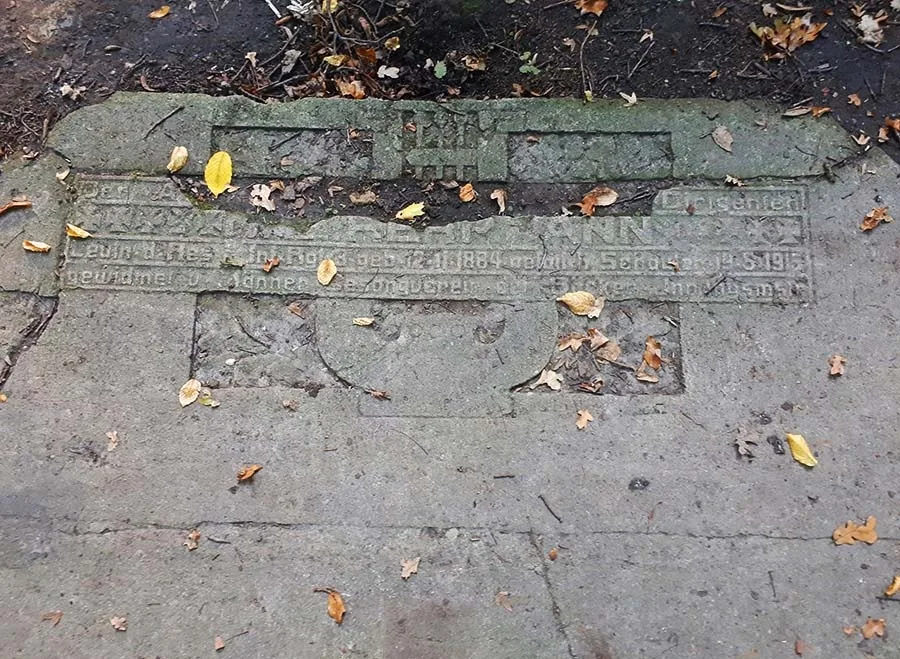 A memorial concrete slab sunk into the ground in Max Aschmann Park.
The park's boundaries have shrunk on all sides, as if mice, hiding in obscurity, had quietly nibbled away at a piece of tasty cheese – and in places not only at the edges.
All around the park's perimeter the boundary has been pulled in by at least 20 m (according to official data, a new red boundary was drawn on the map at the mayor's request). In the eastern part, however, the real boundary is in fact the stream, and consequently a much larger area has been taken; in the northern part the upper corner has been cut off, roughly 100 m along the avenue; the plot in the southern part of the park proved particularly tempting: there the boundary moved 160–200 m to the north along its entire length; the south-eastern corner retreated 120–140 m to the north.
And so the park's wild ass's skin has shrunk in accordance with the developers' wishes...
As the table shows, the spatial structure has changed: the proper ratio of dense and open spaces, which in parks is always shaped in favour of open and semi-open spaces, has changed for the worse – the closed spaces have swallowed up the semi-open ones. In the historical park the spaces were in the following ratio: closed 4 : semi-open 3 : open 2. In the present-day forest park this ratio is 7:0:2. The open spaces have shrunk slightly owing to the reduction of the southern and eastern boundaries of the park, but the surviving areas are becoming overgrown with shrubs. In addition, they are very waterlogged, and the herbaceous vegetation of these former grass-and-herb meadows already contains many hygrophytes typical of wet meadows and the edges of fens (both in the glades by the shallowed lake and in the eastern glades by the stream we recorded buttercup, rush, sedges, common bistort, meadowsweet, creeping Jenny, lady's mantle, timothy, wood small-reed and cocksfoot (these plants are lovers of water).
The overgrowing of the semi-open spaces of the landscape park prevents the artistic value of individual groups of trees, which were conceived as special accents in the glades, from being shown.
The rather complex historical network of paths and tracks has been lost, apart from the through street and the circular avenue around the lake.
The materials of the 1997 expedition certainly include records of geobotanical descriptions, i.e. data on the species composition and age groups of the park's trees. However, we were unable to see them, which made the task of writing this chapter considerably more difficult. For this reason we had to spend two summer-and-autumn seasons measuring trees and plotting them on a plan of the park. We managed to describe 2,600 trees – the huge Maraunenhof oaks, which, I repeat, were at least 200 years old by the beginning of the 20th century, and also every single one, down to the very thinnest hornbeams and maples, which, getting in each other's way, are trying to survive – they were counted in order to understand the future of the forest park, if, if, if... it is not built over and "improved". The seedlings of the ubiquitous hornbeam, 10–20 per m2, foretell its fate precisely.
If we consider the spatial structure and the tree composition of the present-day park area, the following picture emerges: undoubtedly, the oldest trees are found in the northern part, where the historical oak grove was. In 2008 we described 152 pedunculate oaks there with diameters a little under or a little over 100 cm, 7 small-leaved limes with trunk diameters of 60 to 70 cm, and 7 common hornbeams with diameters of up to 90 cm. Younger, self-sown trees are represented by common hornbeam (468 specimens with diameters under 40 cm), small-leaved lime (64 trees with diameters under 40 cm) and young pedunculate oaks – 24 specimens. In all, the trees surviving here from pre-war planting make up 30% of all the trees in the northern part of the park; of these, oak accounts for more than 70% and lime for about 30%. The dominant species in this part of the park today are self-sown common hornbeam, Norway maple and black alder. The structure of this part of the park has changed from semi-open with small closed sections to closed over the entire northern part, with a canopy closure of 0.8–0.9; that is, beneath the crowns there is darkness and waterlogged soil with almost no grass cover.
For the park as a whole, it turned out that trees of the first, i.e. oldest, age group – over 150–200 years old with trunk diameters of more than 60 cm – now make up just over 15% of the total number of trees; that is, of the 2,600 trees this group numbers about 400 specimens.
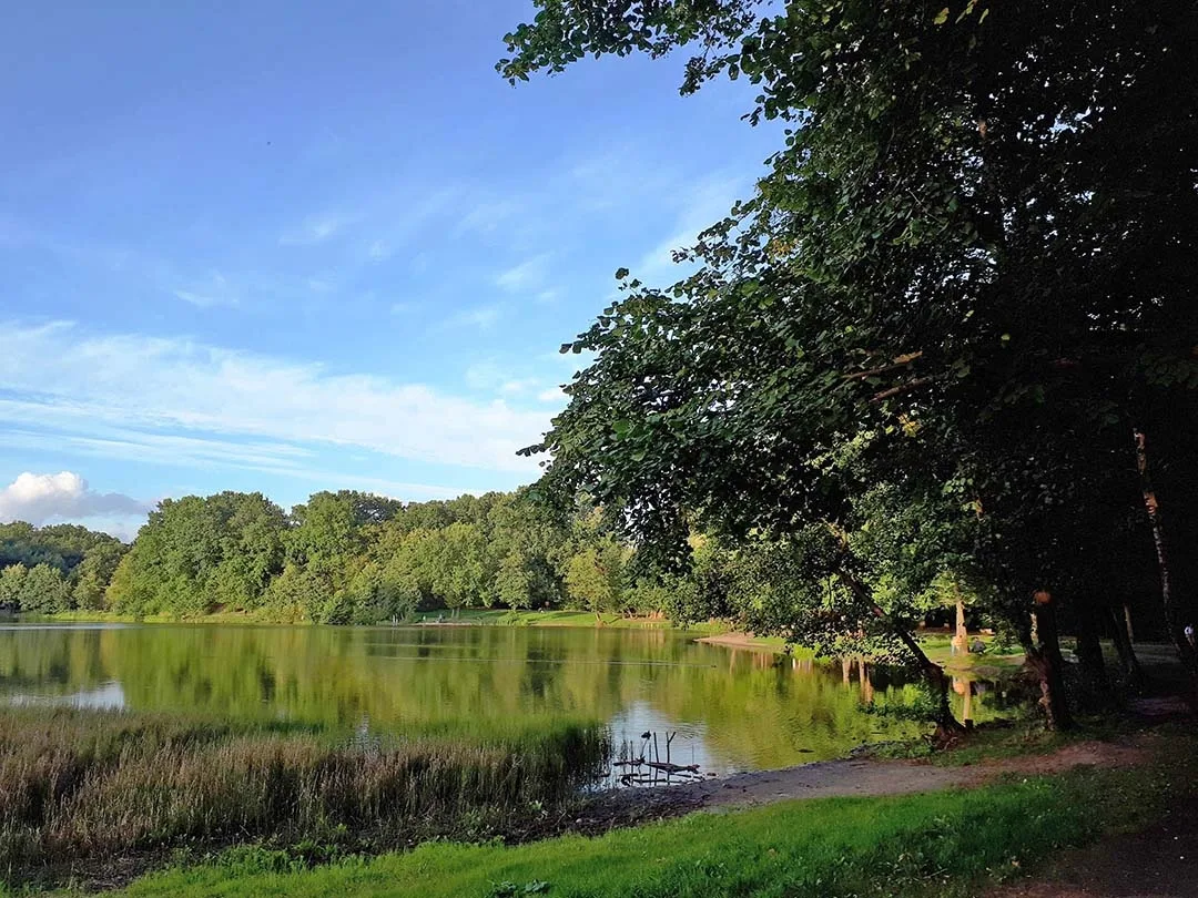
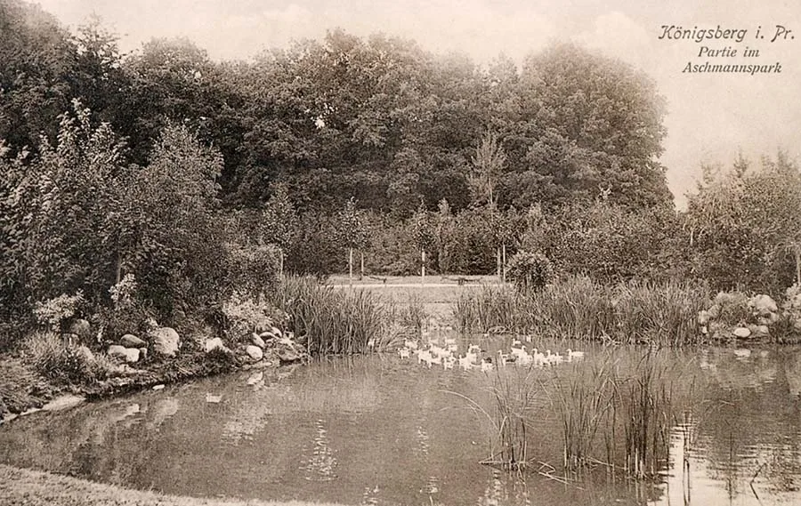 A pond in Max Aschmann Park.
This group consists of pedunculate oak, small-leaved lime and European beech (the last represented by particularly large specimens in the northern part of the park (43 specimens), north of the lake and in the oldest part of the park. There are also fairly large trees – 27 beeches with trunk diameters of about 60 cm – at the edge of the wood, almost on the border with the eastern meadow; in front of them young post-war maples have grown up through the foundations of some building, possibly a pre-war café.
Together with the first group, the spatial structure of the park is supported by trees of the second age group, aged 60 to 150 years with trunk diameters of 40 to 60 cm, which make up 31% of all the trees (European beech, small-leaved lime, pedunculate oak, common hornbeam, common ash, Norway maple).
The young trees of the third age group, self-sown in recent decades, with trunk diameters of less than 40 cm, which make the park denser (limes, Norway maple, common hornbeam and black alder as an indicator of waterlogged ground), make up 54% of all the trees.
The ratio between historical and self-sown tree species in the present-day park in 2008 is as follows: pedunculate oak – 12%, red oak – 2%, European beech – 2%, small-leaved lime – 11%, Norway maple – 14%, sycamore – 7%, horse chestnut – 1%, black alder – 10%, common hornbeam – 38%; the rest are common hawthorn, common ash, silver maple, balsam poplar and European white elm.
In connection with the 750th anniversary of Königsberg-Kaliningrad, the newspapers began to talk about Aschmann Park. Indeed, one of the conclusions of the 1997 park and forest planning expedition was a statement of the great natural, historical and cultural value of "this, one of the finest examples of a public park". In the depths of the mayor's office there appeared a "Draft concept for the reconstruction of Max-Aschmann-Park in the Leningradsky District of the city of Kaliningrad". The explanatory note to the project states that "large-scale restoration work is planned which should lead to the revival of the park".
"The basic principle of the concept is the degree of development and use of the area" – it is hard to judge how far this approach matches the expedition's conclusions about placing the park under protection as a historical monument. Our comments concern only one of the zones designated in the park: it coincides with the memorial area where oaks were planted in honour of those who fell in the First World War, where memorial stones were placed, where the main entrance was and where the "park within a park" with its "little forest castle" was located. It is precisely here that a "zone of active use of the area" is proposed, with cycle routes, an administration and maintenance building, a café, an extensive car park and a horse-riding arena...
...At present [2008] the ecological and aesthetic condition of this once exemplary landscape park, the largest in Königsberg, does not correspond to its artistic and historical character.
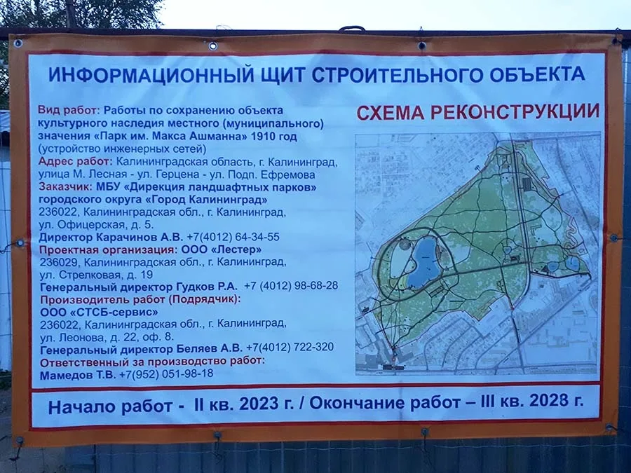 In 2024 the municipal "Directorate of Landscape Parks" promises to bring the park back to life... Some day.
Nevertheless, in the opinion of V. A. Agaltsova, "in certain parts the park has preserved magnificent views, a considerable number of promising plantings, historical planning elements and compositional nodes".
Will the planned reconstruction be true to its artistic character? If the park is not reconstructed, most of the aesthetically significant trees, especially the oaks and beeches, will disappear, dropping out of the stand. If a reconstruction that ignores the findings of the specialist expedition demands an extensive car park and other service buildings in the "heart of the park" (remember that in the historical park only 1% of the area was built on), the trees will fall under the saw.
Everything is in man's power, but let us remember that "respect for the past is the feature that distinguishes education from savagery" (A. S. Pushkin).
Modern photographs on this page by Mikhail Ogorodnikov.
Translated from Russian with the help of AI (Claude, Anthropic), October 2026.