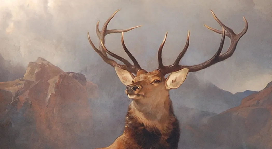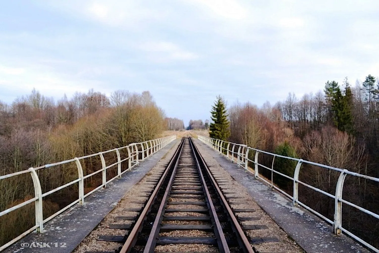
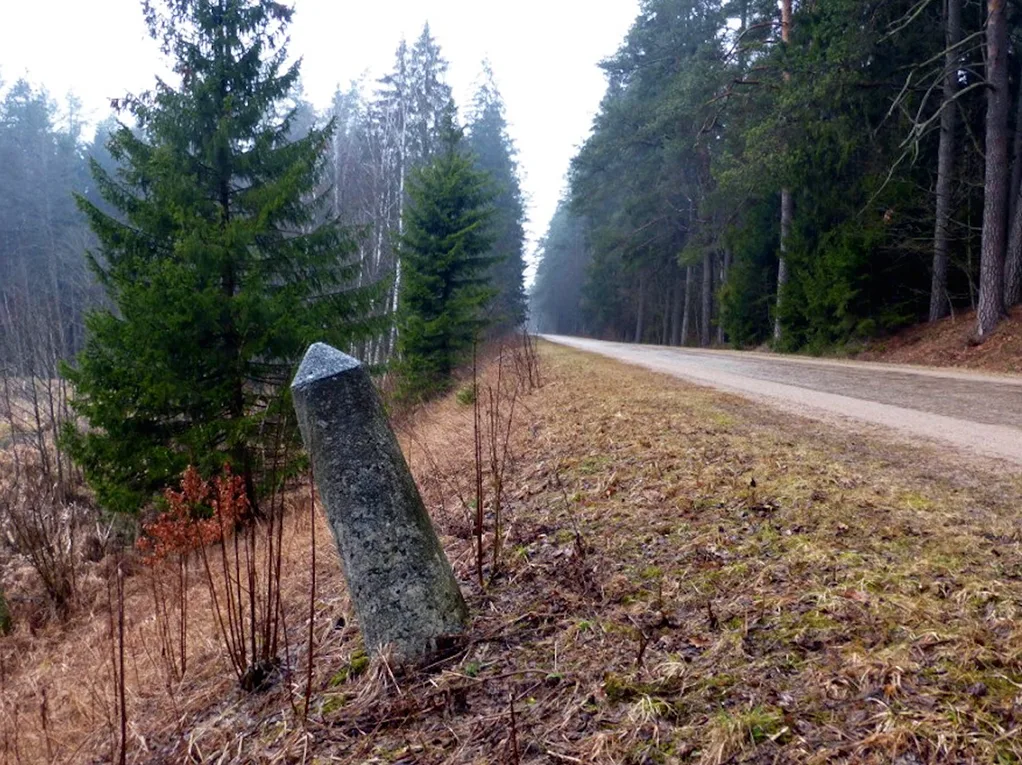
Rominte Heath is a vast forest covering several hundred square kilometres. Once a single whole, it is now divided by a border. To make it easier to find one's way and move through the forest, the entire woodland was divided by rides into blocks and plots. Deep in the Heath, untouched natural monuments survive: majestic boulders carried here by the last glacier. Forestry in Rominte Heath had been well organised since the days of the dukes. Roads were laid and rides were cut to make travel through the Heath easier, and signposts were put up to help people find their way.
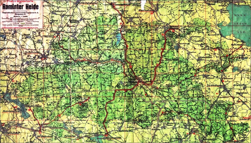 Map of Rominte Heath from the archive of Roman Shiroukhov.
Hunting Compartments (Jagen)
In the 18th century, hunting compartments for game replaced the earlier forest plots. Like their predecessors, they were rectangular sections of forest of 50 to 100 hectares, bounded by rides. They were numbered consecutively. The compartments were grouped into blocks (Blöcke), which in turn made up forest beats (Beläufen).
Forest Blocks (Blöcke)
The block was the basic unit of forest management from the 18th century onwards. Blocks were designated by capital letters. In 1780, for example, the Nassawen forest beat had 11 blocks, which coincided with its sub-beats. Blocks A, B, C, D, E, F, G and H were in turn divided into 70 consecutively numbered plots.
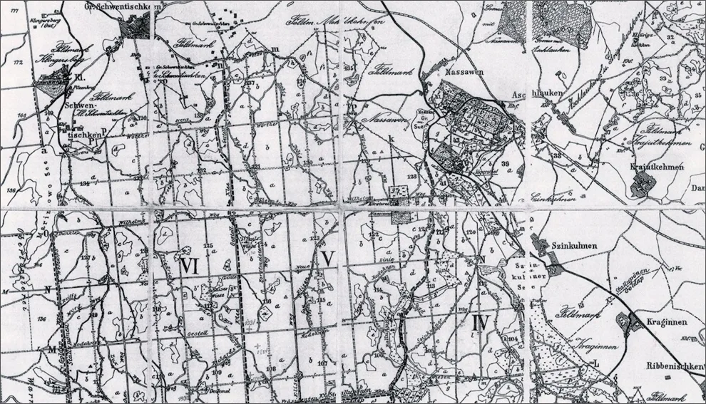 Section of a map of the Heath, showing blocks and compartments. From the archive of the Vishtynets Eco-Museum.
Eventually, at the turn of the 20th century, the entire territory of the Heath was divided into forest blocks. This was done to make it easier to find one's way through the forest. The whole woodland was divided by straight rides into square sections, or blocks, measuring roughly 800×800 metres. Each of them had its own number until 1945, as it still does today. Where rides and block roads begin, and where they cross, you can still come across old hewn stones carved with letters and numbers: these are Jagensteine, or compartment stones. At ride intersections a pair of compartment posts was set up, marking the main ride and the secondary one. For example, where rides D and d crossed (compartments 27/28/39/40), a stone numbered 27/28 was placed on the south side of ride D and to the west of ride d, while a stone bearing the figures 39/40 stood on the north side of ride D and to the east of ride d.
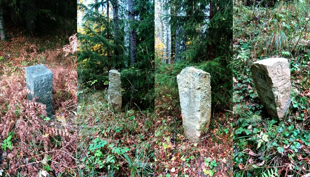 Compartment stones.
Even today these stones help scientists and researchers get their bearings, because German sources and scholarly publications refer precisely to compartments or blocks as the most accurate markers of where rare trees and plants grow, where memorial stones stand, where burials lie, and so on. Blocks were numbered from right to left and from bottom to top, and each of the four forest districts had its own numbering, starting from 01. The two neighbouring districts of Rominten and Warnen, however, shared a single numbering system.
Thus, to indicate the location of a natural monument or a memorial stone*, one gave the forest district, then the beat or ranger's station, then the number of the plot or block, and sometimes further details such as a riverbank, a named meadow and the like. With maps of the Heath, these sites are easy to find.
The block roads and rides that crossed the forest and separated the plots had names of their own, for example Hirsch Weg or Friedrich-Carl Gestell (German Weg – path, track; Gestell – ride). The main roads were called streets and likewise bore their own names: the central road to the Imperial Hunting Lodge, for instance, was called Jagdbuder Strasse, and the road to Goldap was, fittingly, Goldaper Strasse.
Road Signs
In some parts of the Heath and at road junctions you can still find hewn posts: signpost stones with carved arrows showing the direction of, and the distance to, the main towns and villages. (Distances were given in miles; a Prussian mile is 7.533 km.) The place names carved on them suggest that some of these stones were set up as early as the 18th century.
For example, the signpost on the outskirts of the village of Chistye Prudy, at a fork in the road, bears the following inscriptions with arrows:
Nach Goldapp über Iszlaudzen 3 Milen/Nach Pillupönen 3 Milen
Nach Goldapp über Warnen 3 Milen
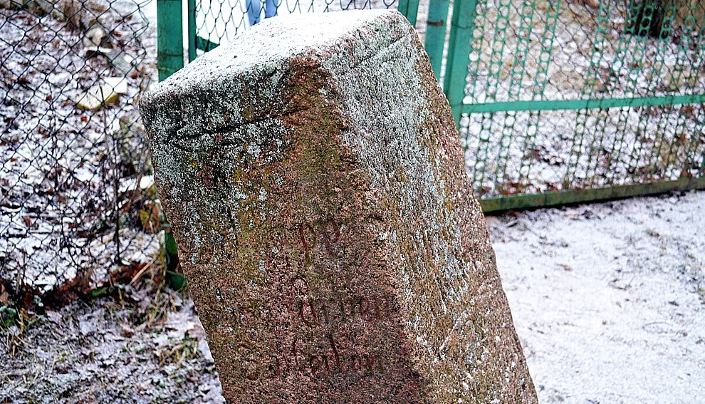 Road sign.
On most of the stones, admittedly, the inscriptions are now hard to make out or have been completely erased by merciless time.
Signpost stones surviving in the Heath and its surroundings (on the Russian side):
– in the centre of the village of Pugachyovo, no inscription;
– at a fork in the road in the village of Chistye Prudy, inscription legible;
– at the fork of the roads to Krasnolesye, Pugachyovo and Raduzhnoye, inscription erased, arrows visible;
– at the fork of the roads to Dmitriyevka, Raduzhnoye and Sosnovka, no inscription;
– by the Lesistoye–Raduzhnoye road, on the left at the fork, inscription hard to read;
– by the Uvarovo–Lesistoye road, on the left-hand verge;
– at a fork in the road near the cemetery of the village of Pugachyovo, no inscription.
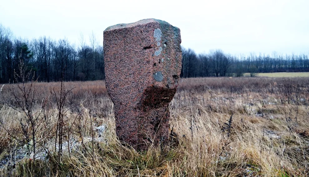 Signpost stone.
Today some of the rides and forest roads are no longer in use, and the compartment stones are covered in moss and overgrown with grass and shrubs. Yet they still serve their purpose: more than once the author of these lines has had to rely on the German marking system when searching for memorial stones and glacial boulders, and the surviving compartment stones have been a great help.
Natural Monuments
The last glacier left a great many stones and boulders of various shapes and types of rock across the Heath. All of them are fragments of bedrock carried here from what is now Scandinavia.
Some of them are marked on German maps as erratic boulders, or Erratische Blöcke – from the Latin “erraticus”, wandering. This is the term for huge unworked blocks of rock that lie far (from several hundred to thousands of kilometres) from the bedrock where they originally formed. The largest stones remained where they were left. In all, eight erratic boulders are recognised in Rominte Heath, some of which have names of their own, such as Teufelsstein / the Devil's Stone**, Annita, or Breiter Stein / the Broad Stone. One of these boulders has given rise to a legend*** as the Devil's Stone, or the Stone of the Devil.
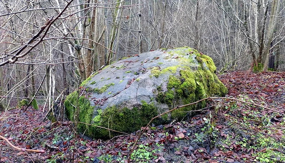 The Devil's Stone.
One of the largest erratic boulders lies not far from Mount Dozor; it is about 19 metres in circumference and more than 2.5 metres high.
Almost all of these stones bear traces of dressing and sawing. Most of the boulders brought here by the ice were later used to build the foundations of houses and mills in the Heath, and some were adapted as memorial and compartment stones.
A separate category of natural monuments (Naturdenkmal on German maps) comprises old or rare trees, both surviving and lost: oaks, beeches, hornbeams, spruces and pines.
The Great Wilderness as a whole once covered a vast territory with forest. Today its scattered remnants include, besides Rominte Heath, the Borecka Forest, the Biebrza Forest and, best preserved in its original state, the Białowieża Forest.
And although practically nothing remains of the relict virgin forest that originally formed the Heath, in some places you can still come across ancient trees around 50 metres tall.
Particularly large or striking trees were named after German emperors and their wives, prominent statesmen and military commanders – the Kaiser Fichte, or Emperor's Spruce, for example – or received names reflecting the dendrological peculiarities of the species, such as the shrub birch or the spherical spruce.
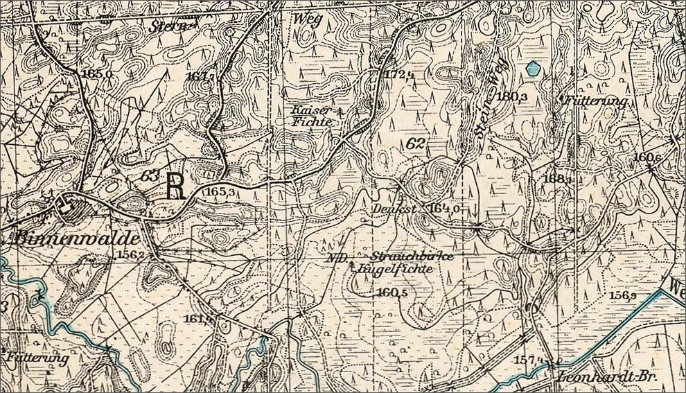 Section of a map of Rominte Heath showing the trees mentioned above.
Today there are several areas where old trees survive: for example, the area around Katharinenberg hill, in the village of Lesistoye, and a stretch on the right bank of the Krasnaya River not far from the village of Sosnovka. There, fenced off and with explanatory signs beside them, seed pines, hornbeams and spruces more than a hundred years old tower skywards.
The natural monuments are part of the History that has unfolded in the Heath from time immemorial to the present day. And they are surely destined to bear witness to the events that will take place on this land long after we are gone.
Based on:
Gautschi A. Rominten 1500 bis 1945: Ein alphabetisches Merkbuch. Nuemann-Neudamm Melsungen, 2009.
Rothe W. Dörfer der RominterHede. — Prussia-reihe, 2004.
Archive of the Vishtynets Ecological and Historical Museum.
German topographic maps, 1:25,000 / 4-cm Karte Messtischblatt, 1924–1938.
Photos by Aleksandr Kazyonnov.
______________
* The Kaiser's memorial stone commemorating his 40th hunting jubilee: Forstamt Rominten, Revierförsterei Fuchsweg, Jagen 93 — Rominten forest district, Fuchsweg forest beat, Jagen 93.
** The Devil's Stone is located at the following spot in the Heath: Forstamt Warnen, Revierförsterei Iszlaudszen, Jagen 164, «Teufelsstein» (oberhalb der Rominte) — Warnen forest district, Iszlaudszen forest beat, Jagen 164, above the Krasnaya River (left bank).
*** Hinze C. Ostpreussische Sagen: von Samland und der Kurische Nehrung bis zur Rominter Heide und den Masurischen Seen. Köln: Eugen Diederichs Verlag GmbH & Co. KG, 1983.
Translated from Russian with the help of AI (Claude, Anthropic), October 2026.