LEGENDS OF PRUSSIA in the blog of Tatyana Kolivay.
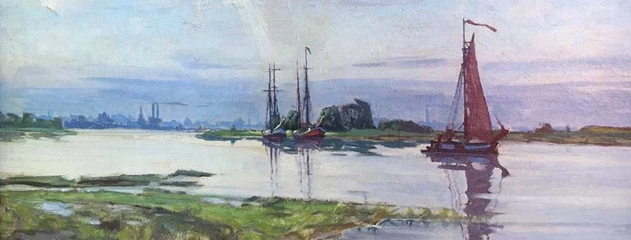
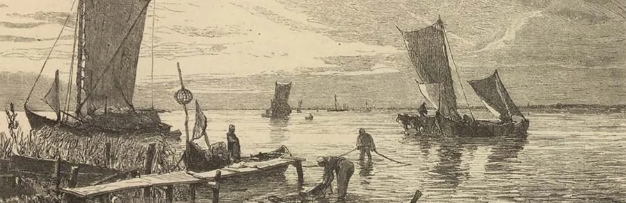
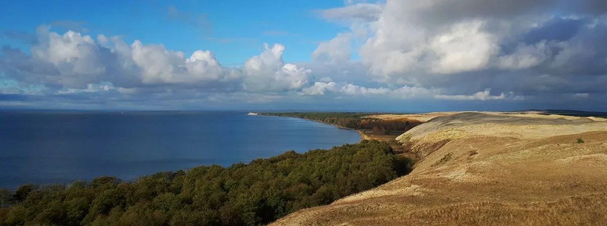
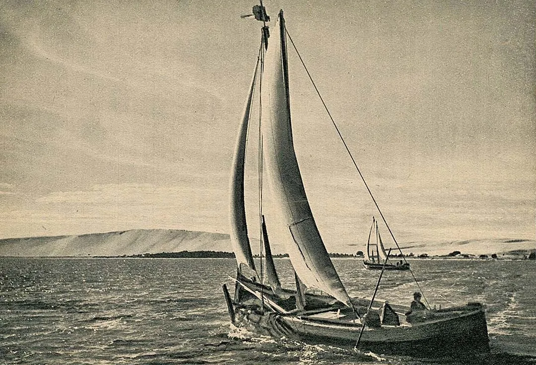
We take up our walking stick and set out from Cranz1 for one of the most deserted, yet at the same time most interesting places in our Fatherland — the Curonian Spit, which stretches for 96 km between Cranz and Süderspitze, not far from Memel2. We walk along the former passenger and post road that connected Prussia with Courland along the Spit. Today its course is marked only by solitary willows surviving here and there. This old post road knows nothing of such things as highways, cobbles, paving and so on. Once, bands of Lithuanians invaded the lands of the Teutonic Order along this narrow sandy strip. But the German knights barred their way by building the fortress of Rossitten3 on the Spit. And immediately after the military raids ceased, Latvians4 moved onto the Spit, thus taking possession of the remotest part of German land.
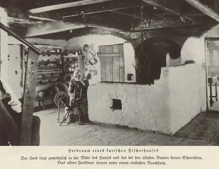 Interior of the house of a Curonian fisherman.
A document of 1258 gives us information about the origin of the name Nerung — "spit". It mentions Nergia / Nerung, and also Nestland. Undoubtedly the Curonian and the Vistula Spits are meant here, the latter also being called the Frische Nehrung.
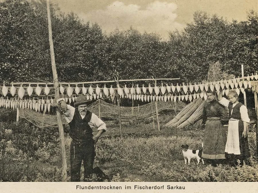 Inhabitants of the fishing village of Sarkau preparing (drying) flounder for the winter.
What is meant by "Nestland" remains unclear5. However, to distinguish the Vistula and Curonian Spits from each other, the qualifier curisch was added to the text of the document, since the point of the Curonian Spit is directed towards Courland. In ancient times it was also called Neria versus Memlam ("the Neria opposite Memlam", i.e. Memel), the Memel Spit, the Prussian Strand, or simply the Strand (German Strand — beach), names that are still used in the everyday speech of the local Germans.
About two kilometres from Cranz one may notice a barely perceptible dip in the ground, followed by a slight rise. Here the masses of sand lie on a marshy base. This spot points to an ancient depression, a former channel that connected the sea and the Curonian Lagoon. Five or six such places are known today, so the Curonian Spit must once have been a chain of small islands joined to one another by silty stretches.
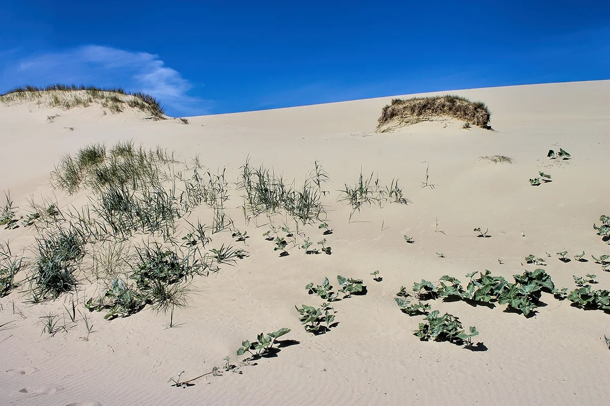
A mile and a half from Cranz we come to the first village. This is Sarkau6, which from the lagoon side seems to lie on a sandy plain, but when walking through it one sees on its outskirts fine green plantings, the so-called Plantage. They stretch far to the north. Five kilometres from the village of Sarkau, near which the spit is at its narrowest (0.5 km), the character of the landscape changes: here begins the main chain of dunes — majestic white mountains of sand, 30 to 60 m high, stretching on almost to the opposite end of the peninsula, which the Spit formally is.
A cross-section of the main dune shows a very gradual slope (5 to 10°) on the western side and a steep descent on the eastern side, the side facing the Curonian Lagoon. It is therefore evident that there is more open space on the side facing the sea.
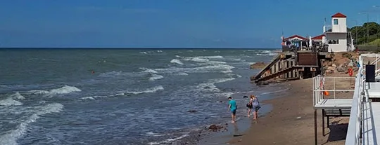
On the sea side, immediately beyond the beach, which is used here as a road, a man-made foredune runs the whole length of the Spit, protecting it from winter storms. Here the winds blow almost constantly from the west, and all year round the sea deposits layers of sand on the shore, which, once dry, is carried eastwards like a mist. This sand has completely destroyed the former forest cover, as is clearly shown by the layer of humus buried within the masses of sand. As this old forest disappeared, the sand became ever more mobile and regularly buried ever more distant areas7.
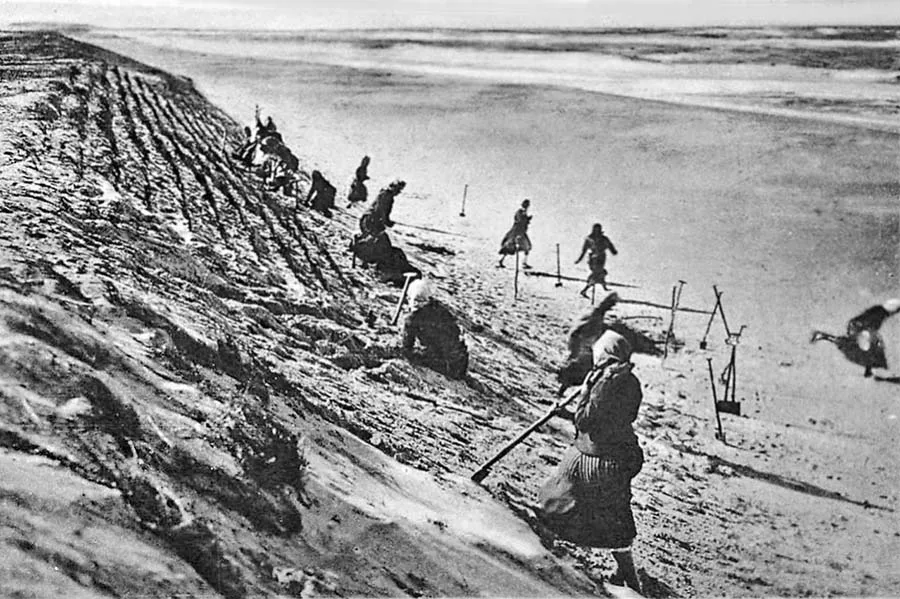 Reinforcing the foredune on the seashore.
Thus began the wandering of the dunes. Sand from the shore and the dunes, driven by the wind, is carried up the slopes of the hills. The heavier grains more slowly, the lighter ones faster. Often the sand flies far out into the Curonian Lagoon, pouring into its waters from the slopes of the dunes on which it accumulates. Seen from the Curonian Lagoon, this process resembles morning mist in a forest. In this case, however, the imaginary "mist" always has clear contours, and the outlines of the dunes, though blurred, can still be made out.
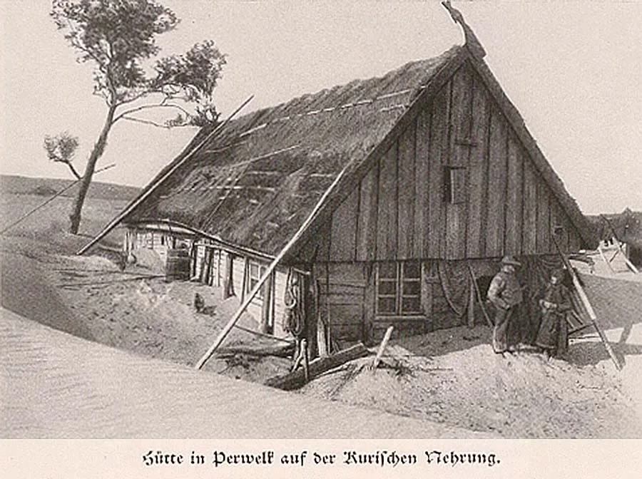 A fisherman's hut at the foot of a dune in Perwelk, awaiting its sad fate...
If you walk across such a wandering dune (and that is not so easy in a strong wind, because you have to make a considerable effort to stay on your feet, and the flying sand stings your face and hands unpleasantly), you clearly see that the ground underfoot is in motion: the fine sand whirls, the coarse sand rolls as if uphill, and the slow movement of the latter proceeds along elongated wavy lines, because the finer fractions are blown out of it. If you then sit down behind the crest of a hill to rest, you will soon notice that you are rapidly being covered with sand, and you will be surprised at how quickly it happens. Forests and villages can halt this migration for a time. But without active human intervention the moving dune will always emerge the victor and will gradually cover both trees and human buildings.
The villages of Alt-Negeln, Negeln8, Karwaiten9, Neu-Pillkoppen10, Preden11, Kunzen12 and others are examples of such settlements buried under the dunes. The so-called Deer Meadow — part of the Götzhöfen estate near Memel, situated on the Curonian Spit — once yielded up to 40 cartloads of hay, but within a few years was covered with sand and by 1788 was nothing but dreary sand hills. However, since the dune keeps moving eastwards towards the lagoon, the sand-covered surface on the sea side will in time be uncovered again — unless the sea once more throws up a large quantity of sand onto the shore.
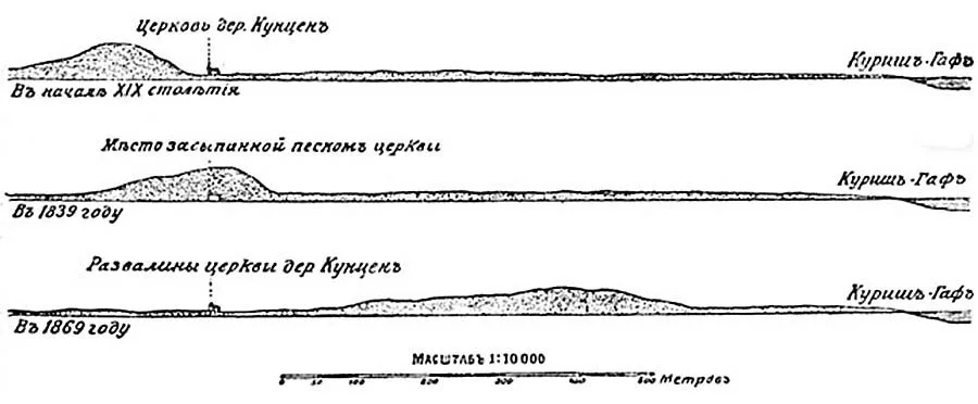
The best-known example of this phenomenon is the village of Kunzen, which at the beginning of the 19th century still stood at the eastern foot of a moving dune. By the 1830s the dune already towered over Kunzen to its full height, and at present it has advanced so far to the east that on the western side the remains of buildings, liberally powdered with sand, have been exposed again. But do not imagine that you will see ruins presenting a picture of terrible destruction, like the excavations of Pompeii. Since the dune advances slowly, the inhabitants can always calmly dismantle their houses and take away the usable material. So only the remains of foundations, broken bricks, potsherds and similar debris reappear on the surface.
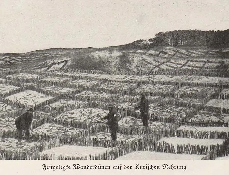 The process of recreating soil suitable for planting.
If man did not interfere with the workings of nature on the Curonian Spit, then, according to our geologists, in about 200 years the dunes would end up in the lagoon, slowly filling it with sand. But the stabilisation of the dunes, especially in our century, has placed a reliable barrier before the forces of nature.
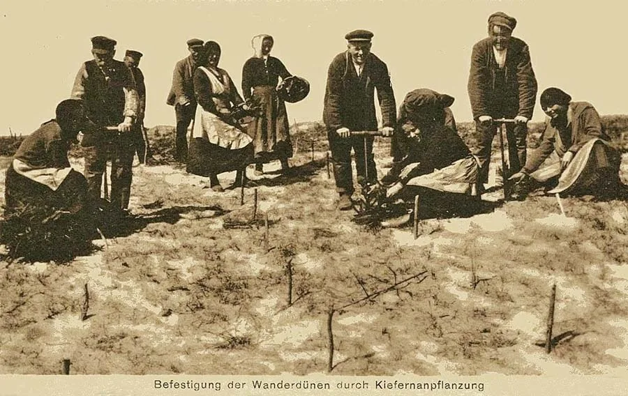 Planting trees in the dunes of the Curonian Spit.
On the sea side a foredune was built. It holds back the sand brought by the sea and serves as a protective barrier. Green plantings also help, causing the moving dunes to "settle down" gently. As early as the 18th century the Royal Prussian Chamber of War and Domains reported to Frederick II13 on the excellent growth of the millions of plants that had been planted on the spit at that time, but the king, who knew his people well, wrote sceptically in the margin of the report submitted to him: "It all reads very pleasantly and easily, if only it is not a lie, like a hunter's tale at a halt."
Be that as it may, what has been done in this respect so far deserves our unreserved admiration as a victory of human reason and will over the forces of nature.
Before planting begins, the stretches of shore are divided into small squares. [See photo above — ed.] Clay, silt and black earth are brought in to fertilise the soil. Only after such preparation can one-, two- and three-year-old plants be set out, e.g. sand lyme grass (Elymus arenarius), marram grass (Arundo Arenaria), and especially the European dwarf mountain pine (Pinus montana), brought from Denmark. It is with this species of pine that excellent results have been obtained, since it is as undemanding as it is weather-resistant. Moreover, the dwarf pine spreads vigorously, taking over large areas.
Pursuing the task of fully restoring the old forest cover, the administration of the Curonian Spit is laying out plantations and woodland plantings in the space between the outer and inner dunes at Sarkau, Rossitten, Nidden14 and Preil15. This will, we hope, make it possible in future to form a dense belt of forest on the spit.
The forest on the Spit consists mostly of pine; birch, alder, willow and aspen also grow here. In places even thinning is carried out. Such forest dwellers as the elk, the fox and the badger (the latter, admittedly, only occasionally) have appeared in the woods. Domestic livestock find sufficient fodder on the pastures near the Curonian Lagoon and in the green plantings (plantations). Bird life is richly represented on the Spit, especially marsh birds and waterfowl, from small sandpipers, snipe and great snipe to wild swans and cranes. Hundreds of thousands of gulls, terns, diving ducks and wild ducks nest in a hollow near Rossitten — a marsh of about 80 Morgen16, partly overgrown with reeds and rushes.
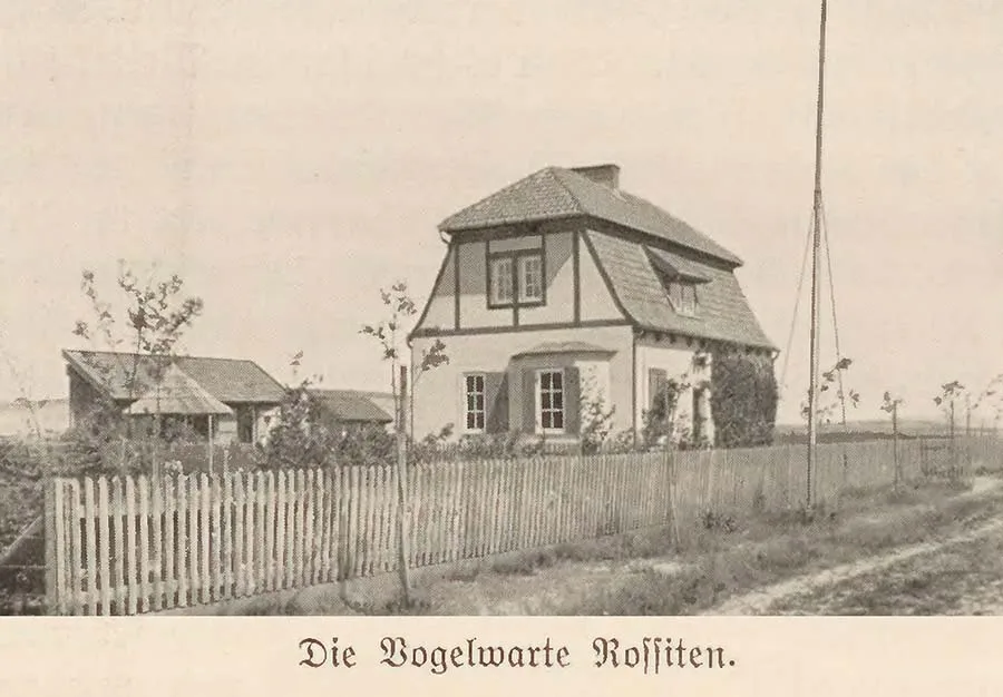 The ornithological station at Rossitten.
Since the Spit is a narrow strip of land between two vast expanses of water, migrating birds prefer to use it for resting on their migration route, and so in autumn whole flocks of northern marsh birds come to the area of this hollow.
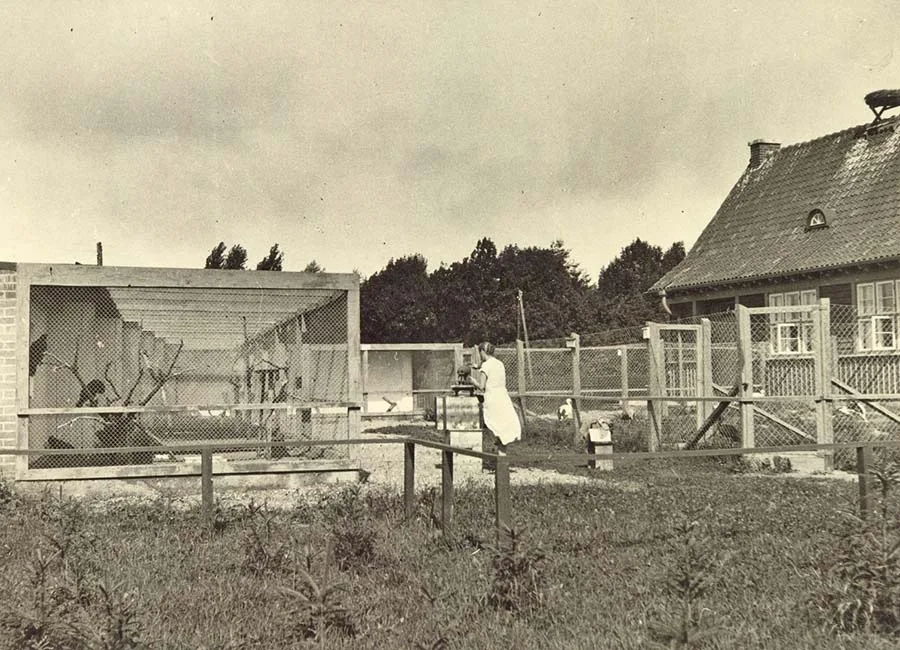 Aviaries for observing birds and keeping them temporarily at the Rossitten ornithological station.
In winter, too, there are many waterfowl from the north on the sea. The Rossitten area is a gathering place for the most varied and rare species of birds. Some 240 species have already been identified, including visitors from the Himalayas, Iceland, the Caspian Sea and Siberia.
The village of Rossitten, 20 km north of Sarkau, is a most remarkable place. Here the Curonian Spit reaches its greatest width — 3.5 km17. An unexpected and pleasant surprise for the traveller is the sight of the local grain fields, including wheat fields, and of neat peasant farmsteads with various outbuildings, cattle sheds and stables. How did all this become possible?
The earth drill with which a well was bored here in 1822 passed through a layer of clay about 18 m thick, then grey marl mixed with sandy soil, and finally struck large stones 4–5 feet in diameter down to a depth of about 30 m. Only then did water appear. The clay deposits not only explain the agricultural phenomenon of Rossitten, but also point to very similar geological conditions over a vast area around the Curonian Lagoon and along the whole coast of East Prussia: that is, to the formation of diluvial deposits18 with layers of dune sand resting on them.
In fact the Curonian Spit is nothing other than an old seashore, and the Curonian Lagoon a depression. In short, here in the far east of Germany the same geological conditions exist that we know well from the German North Sea coast with its many small islands, its shallow Wadden flats19 and its marine depressions, all the more so since repeated subsidence and uplift of the ground have, as is well known, also occurred in the geological history of the Curonian Spit.
The main dune, which gives the impression of a sandy mountain range, is broken for the first time near Rossitten: there was probably a depression here in ancient times. The dune ridge breaks up into six separate hills, but half a mile further north appears monolithic again, finally coming to an end at Pillkoppen. This gap was probably once created by the winds and is not an old waterway.
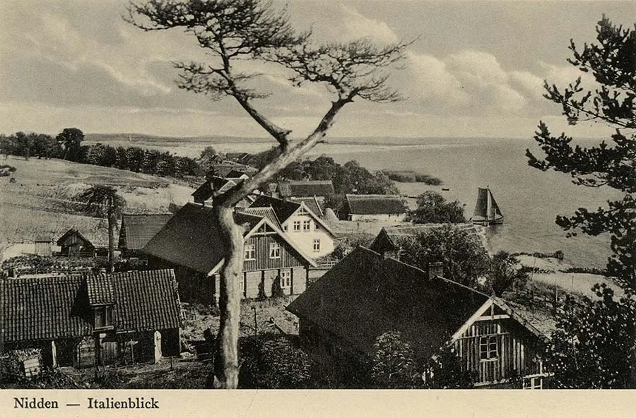 View from the dune of Nida — no worse than Italy!
Nidden, a prosperous fishing village surrounded by ancient forest, is a tempting goal for any archaeologist.
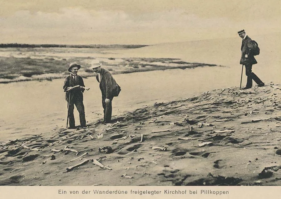 The cemetery in Pillkoppen, "ravaged" by the movement of the dune.
Of course, along the whole length of the Spit, on the forest floor of earlier vegetation periods buried under the dune sand, remains of the dwellings of long-departed generations are found. But on the Nidden plateau four barrows have yielded the richest finds: urns with handles, of coarse and fine workmanship, richly decorated; cords and ropes pressed into soft clay, with fingerprints preserved; stone hammers, arrowheads, net sinkers, millstones; amber, both in raw pieces and in the form of tubes and rings, and even an amber statuette; tools of stone and bone, and so on.
There are no grave excavations worth mentioning here, since in that cultural-historical period — the Stone Age — human remains were not cremated but buried, so the urns found probably served some purpose other than the usual one. Near Rossitten, however, a well-preserved burial was discovered: a man had been buried with a battle-axe, a flint knife, a blunt bone needle, an amber ring, a stone disc (a so-called Imatra stone) and a small fossilised coral. There is no doubt that in the Stone Age the settlements scattered all along the Curonian Spit were home to a comparatively numerous population possessing a variety of skills that were very advanced for their time.
Moving further north, we reach Preil20 and Perwelk21 — two very poor fishing villages, while the more prosperous Schwarzort22 is surrounded by ancient forest, has industry and lively bathing seasons. In recent years the spa list23 of Schwarzort has counted on average more than 1,700 people. North of this place, however, the dune is uninhabited until we reach the last outposts opposite Memel: the settlement of Sandkrug24 — a very popular summer resort, a forester's lodge, a few fishermen's cottages, a rescue station where shipwrecked sailors could find shelter (in fact a shed), a fort that has stood abandoned since 1897, and a quarantine house. All of this taken together, with the exception of the fort, forms the municipal district of Süderspitze or Süderhaken.

In the original edition A. W. Grube's travel notes were supplemented by notes from other authors. In particular, a short addition by Dr. Albert Zweck about the appearance and superstitions of the local natives was appended to the text about the journey along the Curonian Spit.
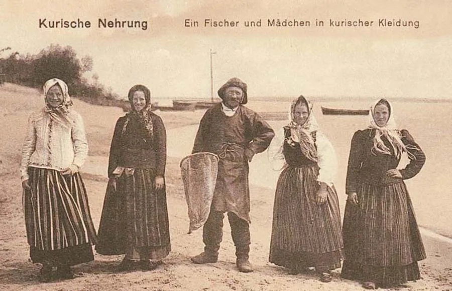 The Curonian Spit. A fisherman and girls in traditional local dress.
The local people are distinguished by a taciturn seriousness, which they retain even in taverns over a mug of beer. Their inclination to superstition shows itself in countless customs and habits: thus on holidays, on St John's Day and on Thursday evenings one must not fish.
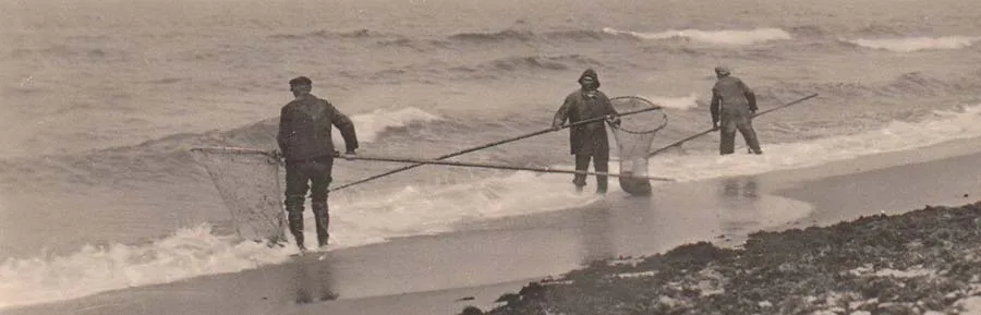
When a boat is finished, it must be turned over and a gun fired crosswise over its bottom. Before a new line is used for catching eels, it must be secretly crossed, and an old one must be spat on before it is thrown away. If you want to use a fishing net for the first time in the year, lay an axe on the threshold and carry the net over it. Anyone who is unlucky in fishing must fumigate his nets with gunpowder smoke, or cut pieces out of a luckier net and weave them into the unlucky one, and so on.
When a Curonian meets a stranger on the threshold of his hut, a certain sedate politeness can be read on his beardless face. But speak to him in his own language, and he will hospitably introduce the guest to his family, where the visitor will find a warm welcome and quiet friendliness.
At home the master of the house usually wears a woollen jersey (knitted from blue and white wool) or a dark jacket, trousers of damask cloth25 and a cap. On his feet, unless he goes barefoot, he wears heavy wooden clogs. But the Curonian looks more majestic when he leaves his house to go out onto the raging sea. He is dressed in grey Frisian clothing, with waders on his feet and a sou'wester on his close-cropped head. The female members of the family wear a coloured bodice under their jackets and striped skirts, the number of which also serves as an indicator of prosperity. Married women never take off their headscarves, while girls may go without one, at least at home.
LEGENDS OF PRUSSIA in the blog of Tatyana Kolivay.
NOTES
1. Zelenogradsk (until 1946 Cranz, German Cranz)
2. Klaipėda (Lithuanian; until 1923 and in 1939–45 officially called Memel; German Memel) .
3. Rybachy, until 1946 Rossitten (German Rossitten) — a settlement in the Zelenogradsk district of the Kaliningrad region, on the shore of the Curonian Lagoon of the Baltic Sea.
4. Some German authors, including August Grube and, for example, the well-known Adalbert Bezzenberger, often call the local population of the Curonian Spit Latvians, although in Russian-language local history literature the natives have "taken root" as Curonians. The Lithuanians, for understandable reasons, also do not mention the Latvian roots of the Curonians. — Ed. note.
5. It is said that the crusaders called the Spit the "Land of Nests" (Nestland). — Ed. note.
6. Lesnoy (until 1946 Sarkau, German Sarkau) — a settlement in the Zelenogradsk district of the Kaliningrad region.
7. The author does not write here that the destruction of the Spit's green cover was the work of the local population, who mercilessly felled the forest on the Spit and shipped the timber to the mainland for sale — conveniently, since across the smooth waters of the lagoon this was easy and cheap to do. — Ed. note.
8. The villages of Alt-Negeln and Negeln were buried by the sands of the Spit in 1728.
9. Karwaiten. No longer exists.
10. Pillkoppen (Neu-Pillkoppen) — today the settlement of Morskoye. Or rather, it lies a couple of kilometres from old Pillkoppen, buried under the Epha Dune, which is 62 metres high. It is named after the dune inspector W. F. Epha (Wilhelm Franz Epha, 1828–1904), author of the project for stabilising and afforesting the Curonian Spit.
11. Preden — the name comes from the Curonian-Latvian language and describes the landscape.
Latvian "priede" = pine, spruce.
"priedaine" = pine forest, spruce forest
Buried by sand. No longer exists.
12. The village of Kunzen. Buried by sand. No longer exists.
13. Frederick II (Friedrich II) (1712–1786) — King of Prussia from 1740, military commander. He doubled the territory of Prussia as a result of the Silesian Wars, the Seven Years' War of 1756–1763 and the partitions of Poland. One of the leading exponents of the "policy of enlightened absolutism".
14. Nida (Lithuanian Nida, German Nidden) — a resort village on the Curonian Spit in Lithuania.
15. Preila (Lithuanian Preila, German Preil) — a village in Lithuania, on the Curonian Spit, on the shore of the Curonian Lagoon, in Preila Bay.
16. Morgen — an obsolete unit of land area in medieval Western Europe and, in particular, in the Polish-Lithuanian Commonwealth, equal to approximately 0.56 ha.
17. Today the widest point is considered to be at Nida (German Nidden), where the Spit is about 4 km wide, more precisely 3.8. (Ed. note)
18. Diluvium (from Latin diluvium — deluge, flood, high water) — a genetic type of loose (uncemented) continental deposits formed by the accumulation of sediments in the drainage channels of catastrophic floods from ice-dammed lakes after the bursting of glacial dams in the recent geological past (the end of the last glacial epoch, 11,000–15,000 BC). In Germany the term "diluvial" was used until the 1950s as a synonym for the Quaternary period (the Ice Age).
19. Wadden (German Watten, Dutch wadden, Danish vade — coastal shallows) — a low-lying coastal strip of sea bed which, in accordance with the tidal cycle, is flooded at high tide and dries out at low tide; part of the seashore.
20. See note 15.
21. Perwelk (Lithuanian Pervalka, German Perwelk) on the Curonian Spit — today the village of Pervalka in Lithuania.
22. Juodkrantė (Lithuanian Juodkrantė, German Schwarzort) — a village in Lithuania.
23. Spa list — "Kurliste". In the 19th century the means of informing the public about resort life and the arrival of holidaymakers whose identity might arouse interest were the so-called Kurlisten, in other words resort bulletins.
24. Sandkrug — today the settlement of Smiltynė on the Lithuanian side of the Curonian Spit.)
25. Damask cloth (obsolete) — fabric with swirling patterns or figures, and also checked.
LEGENDS OF PRUSSIA in the blog of Tatyana Kolivay.
Translated from Russian with the help of AI (Claude, Anthropic), October 2026.