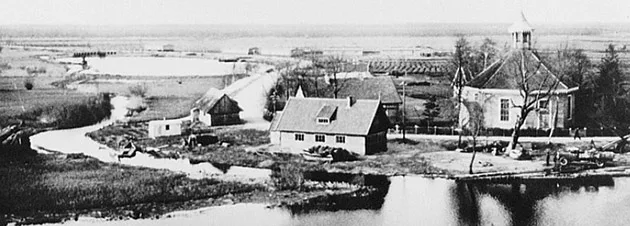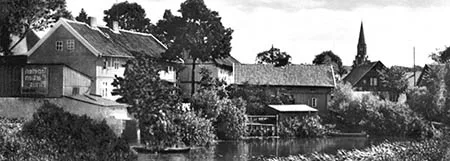
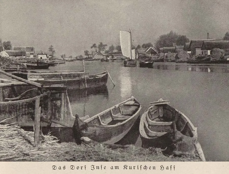
Until 1930 the settlement was called Alt Inse and Groß Inse. Before the German name Inse became established, other spellings are found: Inße (c. 1539), Insze (c. 1539), Ynse (c. 1540), Innsen (c. 1540), Innse (c. 1540). The settlement first arose on the northern bank of the river; later, fishermen's houses appeared on the southern bank as well. The northern village then came to be called Alt Inse, while the southern one, which grew quickly and soon outnumbered the northern village in houses, was named Groß Inse. The parish of Inse was founded in 1570. Until 1684 the Inse church was independent; in 1684 it became a daughter church of the parish of Kallningken (Prokhladnoye). In 1700 a new octagonal church building was erected in Alt Inse.
Both villages belonged to the parish of Inse. The short (approx. 1 km) Inse-Fließ river began at the confluence of the Pait-Fließ (Bicheva) and the Griebe-Fließ (Promyslovaya). To protect against floods, dyke-moles running out into the lagoon were built along both banks of the Inse-Fließ.
Despite their geographical proximity, until 1818 the villages of Alt and Groß Inse belonged not only to different Ämter but even to different Kreise.
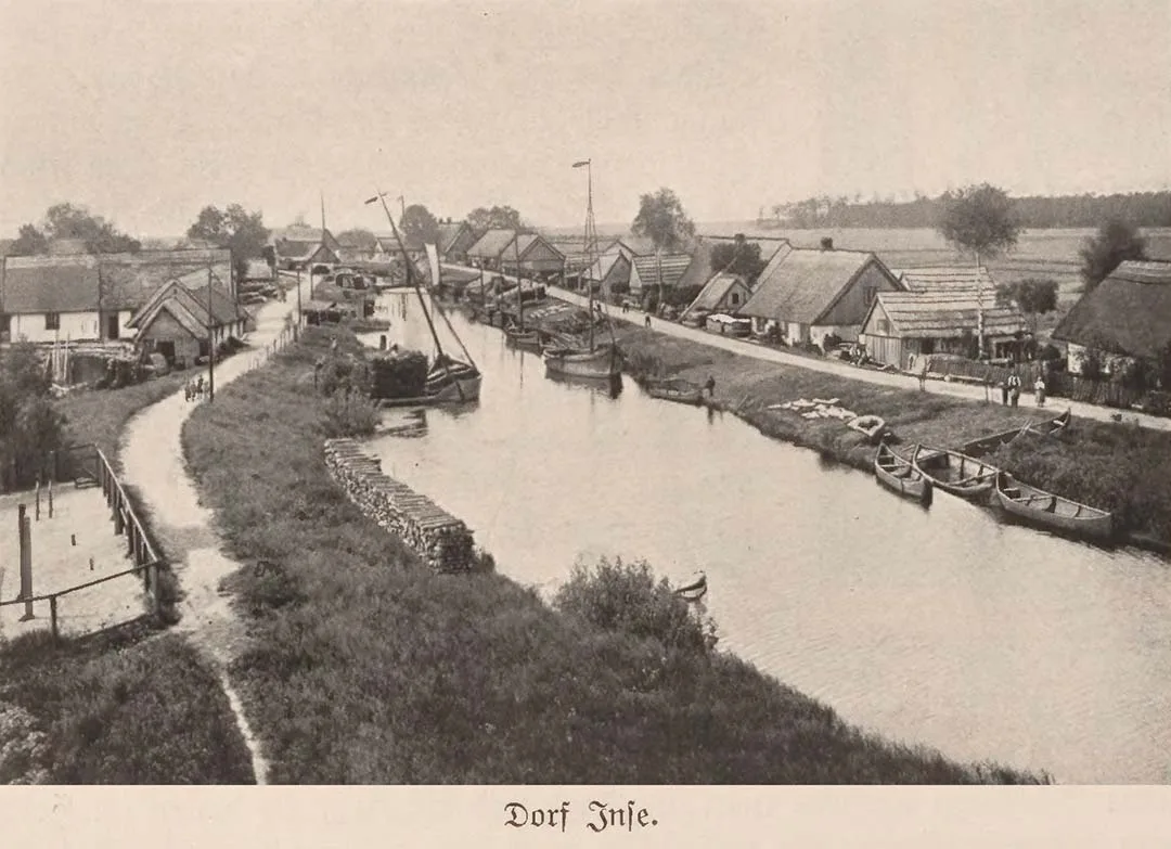
Alt Inse belonged to the Amt of Kuckerneese (Yasnoye) in the Kreis of Insterburg (Chernyakhovsk). Groß Inse belonged to the Amt of Seckenburg (Zapovednoye) in the Kreis of the same name, whose administration was located in Alt Seckenburg (Kuvshinovo). In 1785 both villages had the status of royal fishing villages (königlich Fischerdorf). In 1785 Alt Inse had a parish church and 29 households. Groß Inse had 31 households, 29 of which were classed as fishermen's households. Groß Inse also had an inn whose ownership rights went back to medieval Kulm law, which is why the inn itself was called "Kulmish". The inn owned one Hufe of land (approx. 17 ha). Groß Inse also had 14½ Morgen of gardens (approx. 8.2 ha), two Hufen of meadows and one house for hired labourers. The economy of both villages rested not only on fishing but also on market gardening, and families often did both at once. The onions and cucumbers grown here were noted for their high quality, and right up to the 20th century they were shipped by barge to the markets of Tilsit and Königsberg.
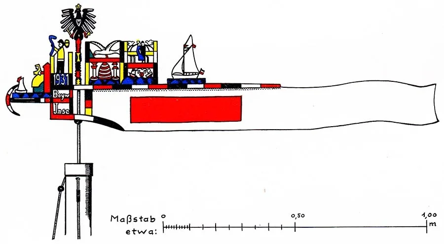
The fishing pennant of Inse.
Even so, fishing remained the main occupation and source of income for the people of Inse. Little had changed in this trade since ancient times. Fishermen still went out onto the lagoon in sailing boats or rowing boats. Even after steam launches appeared, fishing from motor vessels was prohibited.
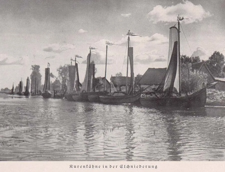 Kurenkähne with pennants on their masts at the piers of Inse.
Most of the fishermen sailed the lagoon in so-called kurenas — a single-masted, flat-bottomed fishing boat typical of these parts. In German it was called a Kurenkahn. They were built of oak and reached 14 m in length. Yet even fully laden with fish, a kurenas drew no more than 0.5 m, which was ideal for the shallow lagoon. To show which village a fishing boat belonged to, pennant-vanes bearing the identifying marks assigned to each village were fixed to the masts. For Inse it was a red rectangle on a white background. In 1841 the former mayor of Memel (Klaipėda), Ernst Wilhelm Beerbohm (1786–1865), became chief fisheries inspector of the Curonian Lagoon and the mouths of the rivers flowing into it. He ordered such pennants to be made compulsory for all sailing boats fishing in the waters of the Curonian Lagoon. This made it easier to enforce the fishing laws, avoid conflicts between fishermen from different communities and keep a register of fishermen.
The pennants were often embellished with additional decorations, and as a result, in the early 20th century tourists began buying them as souvenirs; collecting Curonian Lagoon pennants even became a hobby.
After the administrative reform and the creation of new Kreise in 1818, Alt and Groß Inse both became part of the Kreis of Niederung, but they still answered to different Ämter: Kuckerneese and Seckenburg. In 1871 Alt Inse had 28 houses, home to 73 families and nine of their unmarried fellow villagers. At the same time Groß Inse had 31 houses, and its population consisted of 90 families and two single fishermen.
Only after a further reform of the state's administrative structure in 1874 did the two villages on opposite banks come under a common Amtsbezirk of Inse.
The Amtsbezirk of Inse
On 26 March 1874 Amtsbezirk No. 28 Inse was formed in the Kreis of Niederung, comprising ten rural communities: Alt Inse (Prichaly), Augstutt, Groß Inse (Prichaly), Klein Inse (Primorye), Kurrenberg, Löckerorth, Loye (Rybachye), Matzgirren (from 1938 Kurrenberg, Khlebnoye), Pait (Khrustalnoye, part), Tawe (Zalivino), and the forest Gutsbezirk of Ibenhorst Forst, with its administrative centre at the Ibenhorst head forestry office (Oberförsterei Ibenhorst, Primorskoye). Residents of Alt Inse held the post of head of the Amtsbezirk in 1919–23 (landowner August Heyer) and in 1924–25 (postman Leo Block), residents of Groß Inse in 1923–24 (merchant and landowner Gustav Dobrigkeit) and in 1925–33 (landowner Ernst Engelke). Residents of the merged community of Inse ran the Amtsbezirk in 1933–35 (state forester Stöckmann), in 1935 (Emil Jodeit), in 1935–41 (Fritz Mertins) and in 1945 (Martin Knurbin).
By 1908, as a result of community mergers, the Amtsbezirk of Inse had shrunk to six rural communities and one forest Gutsbezirk, as follows: Alt Inse (Prichaly), Groß Inse (Prichaly), Klein Inse (Primorye), Loye (Rybachye), Matzgirren (Khlebnoye), Tawe (Zalivino), and the forest Gutsbezirk of Tawellningken.
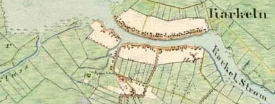
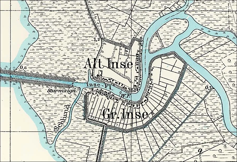 Inse on a topographic map of East Prussia from the early 20th century.
On 30 March 1910 the community of Klein Inse was incorporated into the forest Gutsbezirk of Tawellningken. On 30.09.1929 the Klein Inse forestry (Primorye, part) passed from the forest Gutsbezirk of Tawellningken to the community of Groß Inse. On 01.07.1930 the communities of Alt Inse and Groß Inse were merged into a single rural community of Inse. On 01.12.1934 the Klein Inse forestry was returned from the community of Inse to the forest Gutsbezirk of Tawellningken, which from that moment formed its own Amtsbezirk of Tawellningken. At the same time the community of Matzgirren (Khlebnoye) passed to the Amtsbezirk of Lappienen (from 1939 the Amtsbezirk of Rautersdorf, Malye Berezhki). This left only three rural communities in the Amtsbezirk of Inse: Inse (Prichaly), Loye (Rybachye) and Tawe (Zalivnoye). The composition of the Amtsbezirk of Inse did not change again until the fateful year of 1945.
In 1885 the community of Alt Inse owned 127 ha of land, of which 11 ha were arable land and 96 ha meadows. Groß Inse had similar proportions: of its 263 ha of landholdings, 29 ha were arable and 176 ha meadows. Alt Inse had 30 houses and 77 households, Groß Inse 36 and 91 respectively. By 1895 the number of houses in Alt Inse remained the same — 30 — but only 61 families and one woman without a family were now registered as living in them. In Groß Inse the number of houses rose to 38, home to 87 families and four women without families.
In 1905 property tax revenue for the village of Alt Inse amounted to 23.18 marks per hectare, almost 50% above the average for the communities of the Kreis of Niederung. The tax rate in Groß Inse was higher still — 24.99 marks per hectare.
Given that the Kreis of Niederung already had the highest average land tax rate in the whole Gumbinnen government district, the tax burden on landholders in Inse was considerable. This may well have been what triggered the decline in the villages' population that began in the late 19th century. By 1905 Alt Inse had 29 residential houses and the church building left, while the number of families in the village had fallen to 68, with two more people listed as single. The picture was similar in Groß Inse: the number of houses fell to 35, home to 67 families and ten single people.
The merger of Alt and Groß Inse into a single rural community on 01.07.1930 was accompanied by the fusion of the villages themselves and the loss of their former names. This kind of consolidation was less common than cases in which villages joining a new community continued to be counted as separate settlements. Here, evidently, the immediate proximity of Alt and Groß Inse played its part. Besides the merged village, the new rural community also included the Klein Inse forestry and the logging operations of Groß Inse, Klein Inse I and Klein Inse II. In all, at the time of the merger the village had 69 houses and 89 households.
In the pre-war years the village of Inse had a school and a post office. A ferry ran across the Inse-Fließ between the two parts of the village. On both banks there were wind-driven pumps for draining groundwater.
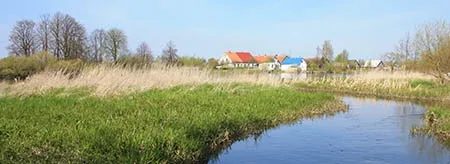
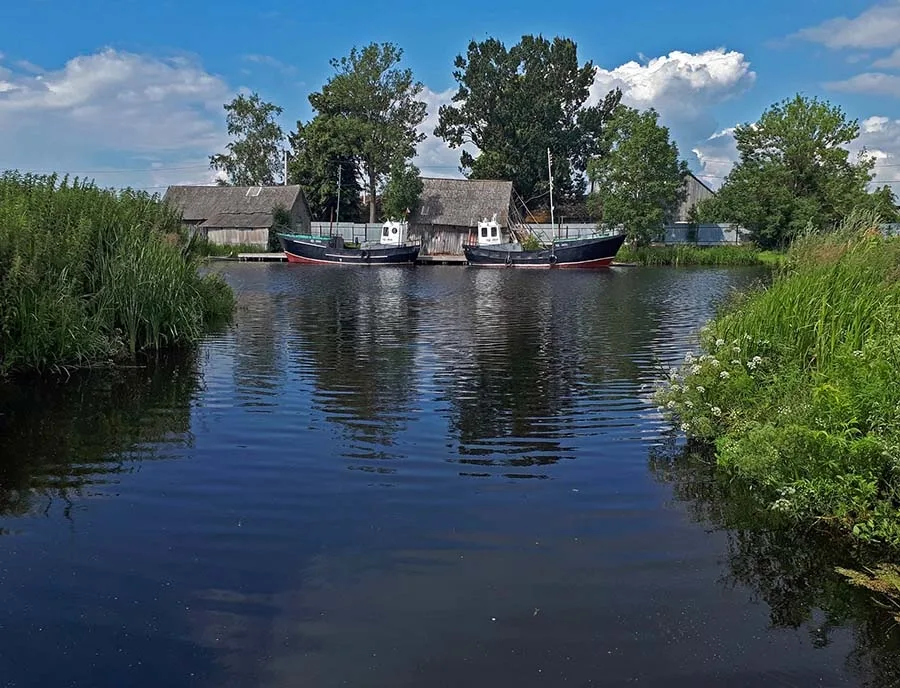 On the bank of the Promyslovaya in Prichaly.
On 17.11.1947 Inse was renamed Prichaly. It was initially part of the Zalivino village council. Even before the renaming, on 25.05.1947, settlers founded the Mikoyan fishing artel. In the mid-1950s the artel was converted into the A.I. Mikoyan collective farm, and in 1958 the "Prichaly" collective farm was formed on its basis.
 The "Elk Valley" ecotourism complex at Pait is 6.5 km from Prichaly.
However, the settlement's own collective farm did not last long — as early as 27.04.1959 it was merged into the "Rybak Baltiki" collective farm in Mysovka (Karkeln). In 1964 the Inse church was demolished; it had survived until then despite damage reportedly sustained during the fighting of 1945. From 12.01.1965, after the Zalivino village council was abolished, Prichaly came under the Prokhladnoye village council. In 1972 Prichaly had 41 homesteads. By then a bridge had been built between the two parts of the settlement. By 1985 about 30 homesteads remained in Prichaly. As of 2024 Prichaly has 42 registered buildings, 37 of them residential. The settlement has a rural medical post.
Coordinates: 55°06'46'' N 21°12'52'' E
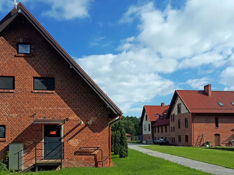
Sights: surviving old fishermen's buildings, a pre-war cemetery.
Population of Inse – Prichaly: 1818 – 3561, 1852 – 6281, 1867 – 6611, 1871 – 6491, 1885 – 6761, 1895 – 6171, 1905 – 5961, 1910 – 5851, 1925 – 566, 1933 – 543, 1939 – 545, 1985 – 160, 2002 – 136, 2010 – 123, 2012 – 117, 2017 – 121, 2018 – 106.
Population of Alt Inse: 1818 – 150, 1852 – 275, 1867 – 271, 1871 – 289, 1885 – 297, 1895 – 261, 1905 – 288, 1910 – 262.
Population of Groß Inse: 1818 – 206, 1852 – 353, 1867 – 390, 1871 – 360, 1885 – 379, 1895 – 356, 1905 – 308, 1910 – 323.
Population of Klein Inse: 1852 – 29, 1867 – 25, 1871 – 27, 1885 – 19, 1895 – 27, 1905 – 17.
Population of the Klein Inse forestry: 1885 – 5, 1895 – 6,
Composition of the population of Alt Inse in 1871: Protestant Christians – 269, Catholics – 14, Jews – 6, children under 10 – 58, literate – 146 (of 202 surveyed, 72%).
Composition of the population of Groß Inse in 1871: Protestant Christians – 354, Catholics – 3, Jews – 3, children under 10 – 82, literate – 142 (of 269 surveyed, 53%), deaf-mute – 1.
Composition of the population of Klein Inse in 1871: Protestant Christians – 25, Catholics – 2, children under 10 – 3, literate – 17 (71%).
The parish of Inse, c. 1925: Alt Inse (Prichaly), Groß Inse (Prichaly), Klein Inse (Primorye), Klein Inse forestry (Primorye, part), Loye (Rybachye), Loye forester's lodge / Forsthaus Loye (55°08'01'' N 21°12'17'' E), Matzgirren (Khlebnoye), Matzgirren forester's lodge / Forsthaus Matzgirren (from 1938 Kurrenberg forester's lodge / Forsthaus Kurrenberg, 55°07'43'' N 21°18'41'' E), Pait forester's lodge / Forsthaus Pait (Zalivino), Tawe forester's lodge / Forsthaus Tawe (55°03'35'' N 21°14'48'' E).
1 — combined population of Alt and Groß Inse.
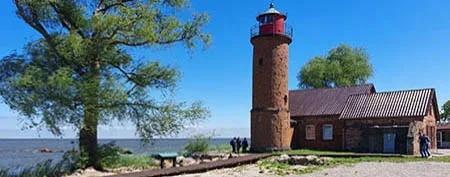
Present-day photos by Mikhail Ogorodnikov.
Translated from Russian with the help of AI (Claude, Anthropic), October 2026.