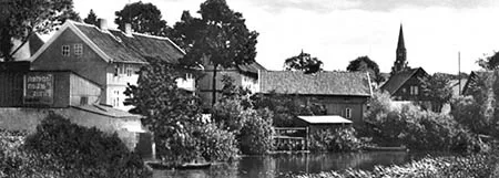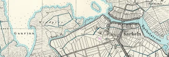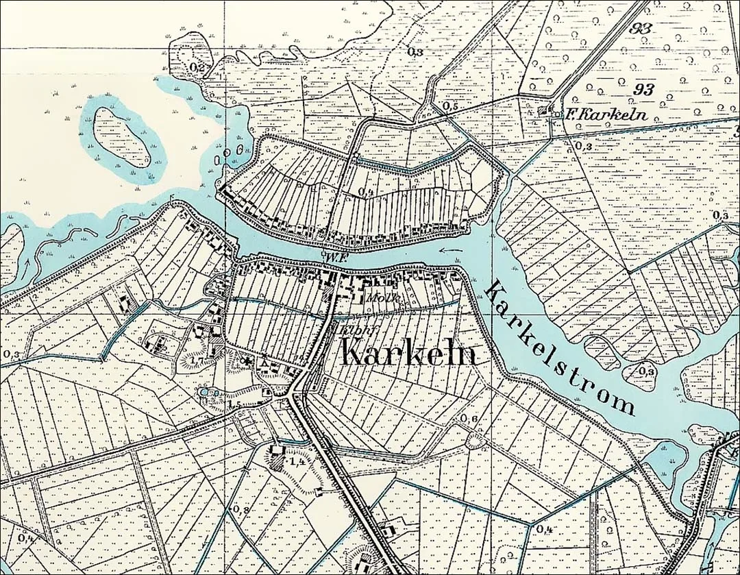
The locality of Karkeln became known no later than 1540 as Kerkell. A settlement was founded here in 1622. On 30 December 1622 the Elector ordered a school to be built in Karkeln, but for a long time afterwards children were taught in private houses. In 1660 Elector Frederick William granted the inn in Karkeln the right to trade in fish and beer. In return, state officials were to be served at the inn free of charge, and they also had the right to moor ships and boats in Karkeln harbour.
In 1644 the parish of Karkeln was established. In 1680 the first building of the local church was built of wood and clay; it later burned down. In 1722 a church of fieldstone and brick was built. In 1898–99 a Neo-Gothic tower was added to it. The organ was restored at the same time. The Karkeln parish twice became a branch of other parishes: for more than a hundred years (1711–1834) it was a branch of the parish of Schakuhnen (Levoberezhnoye), and then for more than ten more (1834–47) of the parish of Kallningken (Prokhladnoye), but from 1847 it became independent again.
From 1785 Karkeln belonged to the Amt Ruß (Rusnė, Lithuania). The village had 93 households.
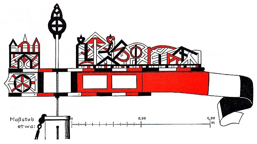
Fishing pennant of Karkeln.
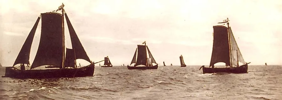
In the 19th century Karkeln was a fishing village forming a rural community in the Landkreis Heydekrug (Šilutė, Lithuania). The church in Karkeln was the parish church for four neighbouring villages.
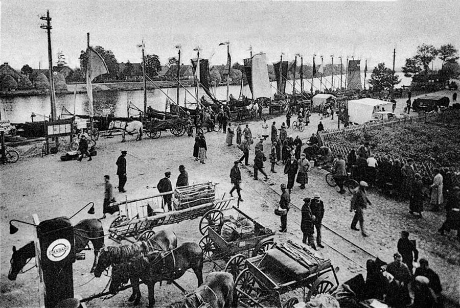 Market day on the embankment in Karkeln.
In 1829 the school in Karkeln became a two-class school, and in 1880 a new three-class school building was erected somewhat away from the village. The number of pupils reached 70–80.
In 1861 the village of Karkeln had 173 houses and 1,496 ha of land; there were 37 horses, 229 head of cattle and 80 pigs in the village. The estate in the village belonged to Ferdinand Gallien.
In 1874, in the Landkreis Heydekrug, the Amtsbezirk Karkeln was established, comprising 10 rural communities: Ackelingken (from 1938 Ackeln, Rovnoye), Derwehlischken (Razliv), Kallningken (from 1938 Herdenau, Prokhladnoye), Lukischken (from 1938 Lucken, Kruglyanka), Parungaln (Mysovka), Pustutten (from 1938 Antonswiese, Berezino), Tramischen (from 1938 Trammen, Razdolnoye), Wirballen (Warten, Perekhvatnoye), Wittken (Lipki).
On 1 July 1922, following Germany's loss of the Memel Territory, the rural community of Karkeln, together with the entire Amtsbezirk Karkeln, passed to the Landkreis Niederung (from 1938 Elchniederung).
On 30 September 1929 the Karkeln forester's lodge (Mysovka forester's lodge) passed to the Karkeln community from the forest Gutsbezirk Ibenhorst. On 1 July 1931 the Parungaln community, consisting of the villages of Parungaln (part of Mysovka) and Augsteglienen (part of Mysovka), was joined to the Karkeln community. On 1 January 1932 the Derwehlischken community (Razliv) lost its independence and was joined to the Kallningken community (Prokhladnoye). On 1 December 1934 the Karkeln forester's lodge (Mysovka forester's lodge) returned from the Karkeln community to the forest Gutsbezirk Ibenhorst. On 1 June 1936 the Lukischken community became part of the Kallningken community (Prokhladnoye). As a result, the Amtsbezirk Karkeln consisted of seven rural communities: Ackelingken (Rovnoye), Kallningken (Prokhladnoye), Karkeln (Mysovka), Pustutten (Berezino), Tramischen (Razdolnoye), Wirballen (Perekhvatnoye) and Wittken (Lipki). Its composition did not change again until 1945.
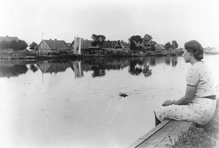
In 1883–84 a road to Karkeln was built. In 1894–96 (according to other sources, in 1893–94) a dyke (Haffdeich) was raised, and in 1905–06 a summer dyke; together they protected the village from floods.
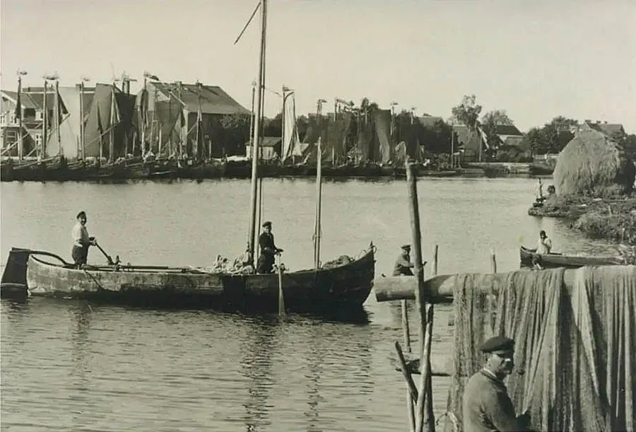
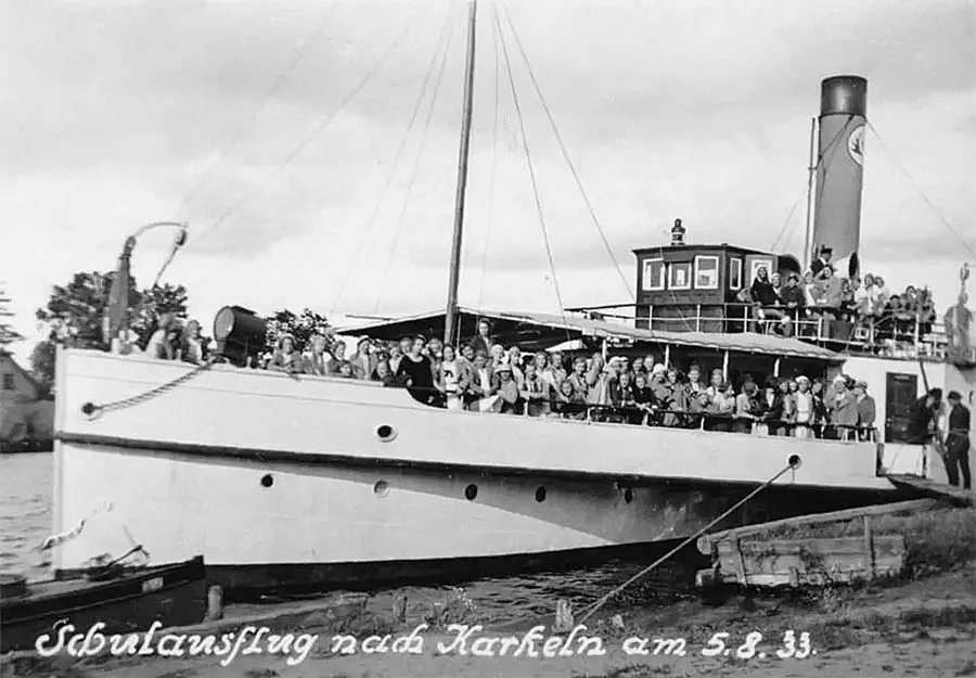
In 1902 the Brittanien (Shcheglovka) – Karkeln narrow-gauge railway was opened, and a station was built on it. In the pre-war years Karkeln had a dairy farm and a school, and there was a ferry across the Karkelstrom (Razliv) River. In the 20th century the village became a popular tourist destination.
On 13 October 1944, as Soviet troops approached, the evacuation of the villagers began. Before the Soviet troops entered, the Germans blew up about 25 houses in the village. On 20 January 1945 Karkeln was taken by Red Army units.
Parungaln has been known since 1785 as Parrugul. The village belonged first to the parish of Kallningken (Prokhladnoye), and from 1905 to the parish of Karkeln.
In the 19th century Parungaln was a village forming a rural community in the Landkreis Heydekrug (Šilutė, Lithuania). The village belonged to the parish of Kallningken (Prokhladnoye), and from 1905 to the parish of Karkeln (Mysovka).
In 1874 the Parungaln community was included in the newly established Amtsbezirk Karkeln (Mysovka). On 17 July 1893 the village of Augsteglienen (part of Mysovka) was joined to the Parungaln community. On 1 July 1931 the Parungaln community lost its independence and was incorporated into the Karkeln community.
Augsteglienen has been known since 1750 as August Eglien. In 1785 it was a small settlement of four farmsteads held under private and Kulm land tenure, and their number did not change until at least 1871.
In the 19th century Augsteglienen was a village forming a rural community in the Landkreis Heydekrug (Šilutė, Lithuania). The village belonged to the parish of Kallningken, and from 1885 to the parish of Karkeln. In 1874 the Augsteglienen community was included in the newly established Amtsbezirk Karkeln (Mysovka). On 17 July 1893 the village was incorporated into the Parungaln community (part of Mysovka). From 1 July 1931 the village of Augsteglienen became part of the Karkeln community (Mysovka).
On 17 November 1947 Karkeln was renamed Mysovka. Parungaln and Augsteglienen became its outlying farmsteads but were never officially renamed.
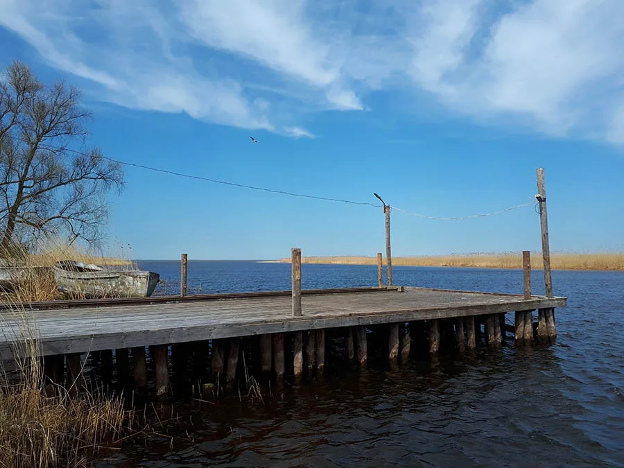
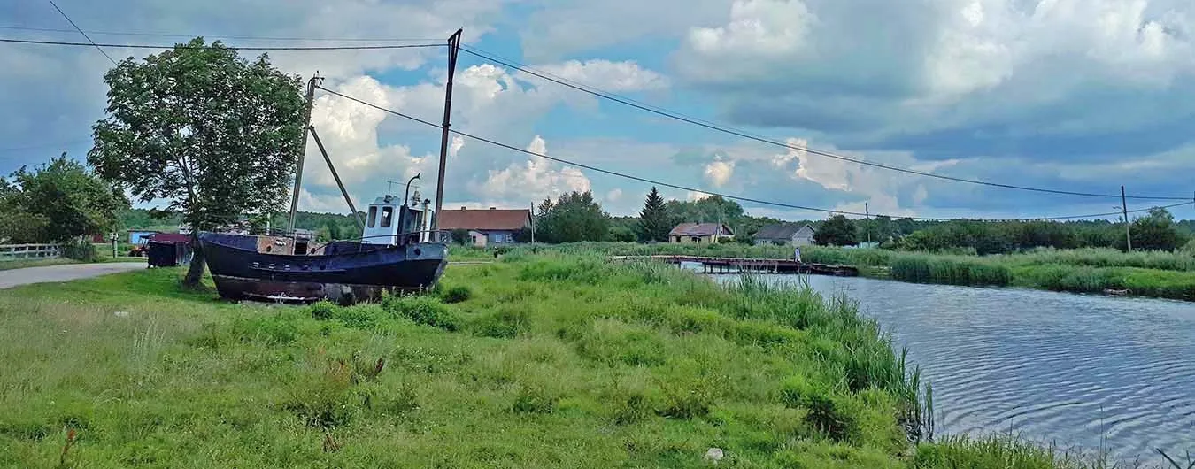
Later, dairy farms were located on the territory of both villages. Initially the settlement of Mysovka was part of the Yasnovsky Village Council. In 1949 the church tower burned down. In 1950–65 Mysovka belonged to the Levoberezhnensky Village Council. In 1959 there was a severe flood; the church was dismantled for building material, which was used to build a dyke. After the Levoberezhnensky Village Council was abolished on 12 January 1965, the settlement was included in the Prokhladnensky Village Council. In 1972 the settlement of Mysovka had 79 households and two dairy farms. The Karkeln forester's lodge was preserved with the same forestry functions. A bridge was built on the site of the ferry crossing. In 1985 the settlement had about 55 houses.
Coordinates: 55°11'28'' N 21°16'13'' E (Karkeln, modern settlement), 55°10'54'' N 21°16'21'' E (Parungaln, outlying farm buildings, dairy farm), 55°11'06'' N 21°16'08'' E (Augsteglienen, dairy farm), 55°11'50'' N 21°16'57'' E (Karkeln forester's lodge).
Population change of Mysovka: 1985 – 390, 2002 – 367, 2010 – 329, 2012 – 327 inhabitants.
Population change of the Karkeln community: 1816 – 709, 1852 – 987, 1861 – 1019, 1905 – 964, 1910 – 887, 1925 – 944, 1933 – 927, 1939 – 885 inhabitants.
Population change of the Parungaln community: 1905 – 59, 1910 – 64 inhabitants.
Population change of Augsteglienen: 1871 – 33, 1905 – 29 inhabitants.
Population of the Karkeln forester's lodge: 1905 – 6 inhabitants.
For reference
Karkeln parish: Ackminge (from 1938 Ibenwerder, Zelenets), Försterei Ackminge (from 1928 Försterei Ulrichwiese, 55°14'06'' N 21°18'20'' E), Augsteglienen (part of Mysovka), Baldzsiner Wiesen (part of Razdolnoye), Graschten (part of Razdolnoye), Karkeln (Mysovka), Karkeln forester's lodge (Mysovka forester's lodge), Parungaln (part of Mysovka), Tramischen (from 1938 Trammen, Razdolnoye).
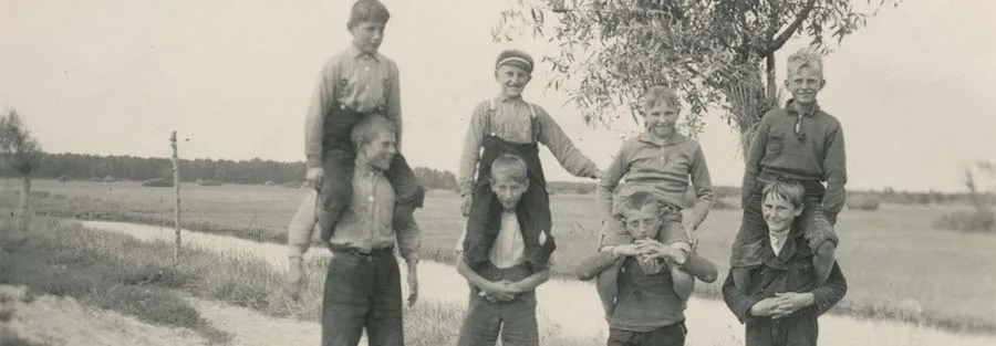
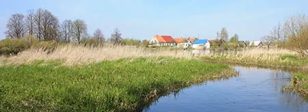
Photos:
20th century — Bildarchiv Ostpreußen.
21st century — Mikhail Ogorodnikov.
Translated from Russian with the help of AI (Claude, Anthropic), October 2026.