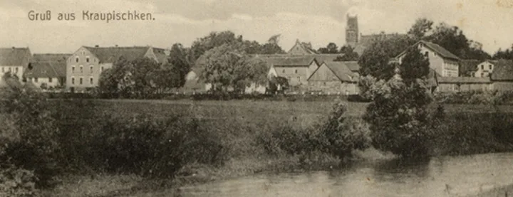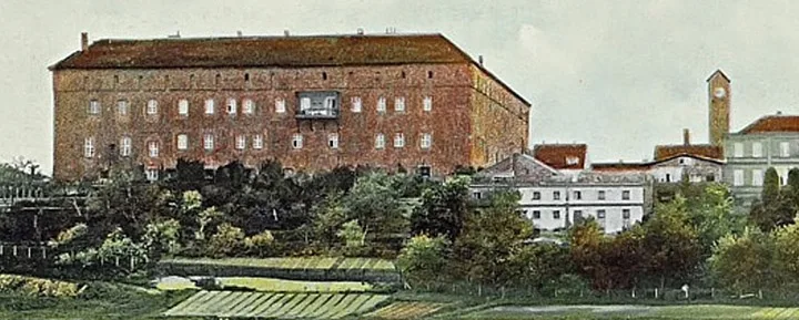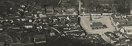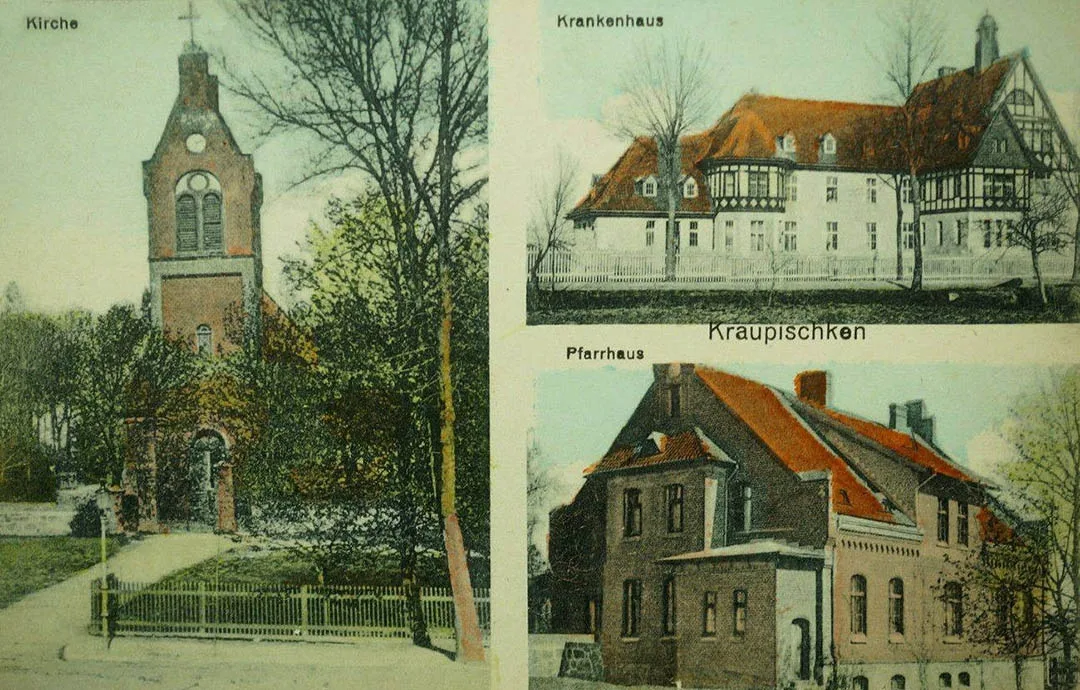
Kraupischken is first mentioned on 20.11.1352, in a treaty dividing territories between the Order and the Bishop of Samland, as Cropiskten an der Insterut. In 1554 a church was built in Kraupischken. In 1609 a parish was established for the surrounding villages. In 1708–09 a plague epidemic swept through the area, wiping out half the population. After this Frederick William I began a policy of resettling the deserted lands and invited Salzburg Protestants here. In 1723 a burial of noble Aesti (7th–9th centuries) was found near Kraupischken. In 1740 the church burned down; it was rebuilt only in 1772.
In 1785 Kraupischken was a royal village with two inns (a royal one and a noble one) and three noble farms.
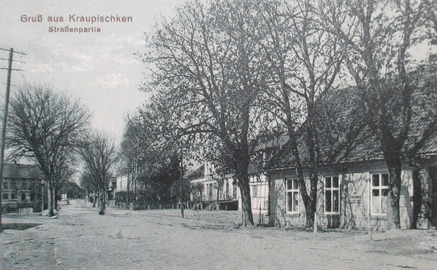
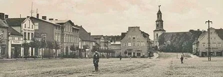
The village belonged to the Insterburg judicial district, Amt Moulienen (Mikhailovka). In 1856–57 a cobbled road was built to Kraupischken. From 1859 a weekly market was held, and from 1866 an annual cattle and horse fair. In 1866 a great fire destroyed more than 100 houses in the settlement.
In the 19th century Kraupischken was a village forming a rural community in Landkreis Ragnit (Neman), which in 1922 was merged into Landkreis Tilsit-Ragnit (Sovetsk-Neman). The church in Kraupischken was the parish church for 67 surrounding villages and estates. In 1874 Amtsbezirk No. 20 Kraupischken was established in Landkreis Ragnit. It comprised four rural communities: Graudßen (from 1938 Grautschen, 54°50'30'' N 22°05'59'' E), Juckstein (54°50'38'' N 22°05'21'' E), Kraupischkehmen (from 1938 Erdmannsruh, Zalivnoye), Kraupischken (Ulyanovo), and two Gutsbezirke: Breitenstein (Ulyanovo, part) and Rucken (54°49'53'' N 22°02'31'' E). Soon the Gutsbezirk of Friedrichswalde (54°50'21'' N 22°04'12'' E), which had separated from Breitenstein, joined the Amtsbezirk of Kraupischken. In 1928 the village of Kraupischken was connected to the electricity supply.
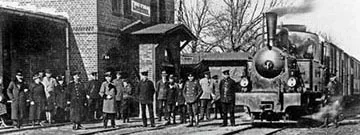
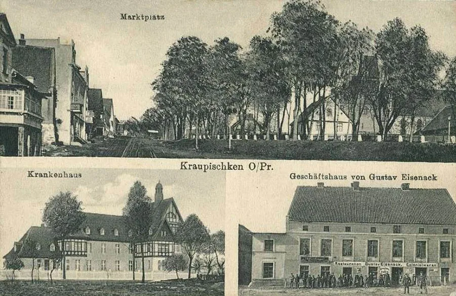
In 1902 a railway was brought to the settlement and a station was built. During the First World War a hospital was opened in Kraupischken.
On 30.09.1928 the Breitenstein and Friedrichswalde (54°50'21'' N 22°04'12'' E) estates, as well as the village of Juckstein (54°50'38'' N 22°05'21'' E), became part of the Kraupischken community. The Gutsbezirk of Rucken was merged with the Gutsbezirk of Birkenstrauch (54°50'05'' N 22°01'32'' E) from the Amtsbezirk of Moulienen (Mikhailovka) into a new rural community of Rucken. On 10.10.1929 the community of Graudßen lost its independence and was incorporated into the community of Kraupischken (Ulyanovo). The Amtsbezirk of Kraupischken came to consist of three rural communities: Kraupischken (Ulyanovo), Kraupischkehmen (Zalivnoye) and Rucken. Its composition did not change again until 1945.
Before the war Kraupischken had a mill, a post office, a hotel and a restaurant.
Breitenstein is first mentioned in 1551. It got its name from a large erratic boulder measuring 5x3 metres that stuck out of the ground on the site of the future estate and was mentioned as early as 1352. According to legend, the Grand Masters of the Order and the Dukes of Prussia used this boulder as a hunting table on which they dressed the carcasses of the game they had killed.
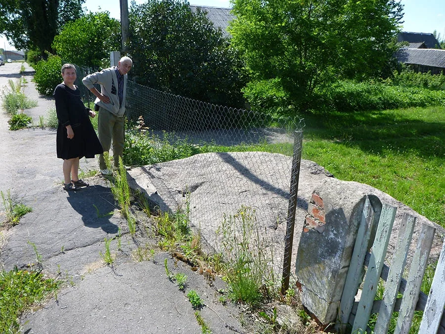 In 2018 the Svetly Kamen ("Bright Stone") erratic boulder (Breitenstein), after which the settlement was once named, was partly asphalted over.
In 1550 Duke Albrecht handed the area over to a certain Asmus Baumgart, and in 1562 the right to open an inn. From 1787 the Breitenstein estate belonged to Christian Friedrich Schimmelpfennig von der Oye, president of the chamber of East Prussian estates. In 1820 the estate was inherited by his son Friedrich Christian Benjamin. Under him it was an extensive estate with 1,190 ha of land, which included the Vorwerks of Graudßen, Juckstein and Friedrichswalde. The estate formed a Gutsbezirk in Landkreis Ragnit (Neman) and belonged to the Kraupischken (Ulyanovo) church parish. No later than 1874 the Vorwerks of Graudßen and Juckstein were separated off as independent rural communities. In 1874 the Gutsbezirk of Breitenstein was incorporated into the newly established Amtsbezirk of Kraupischken (Ulyanovo). Soon the Friedrichswalde estate was separated from the Gutsbezirk of Breitenstein and formed an independent Gutsbezirk. On 30.09.1928 the Gutsbezirk of Breitenstein was abolished and incorporated into the rural community of Kraupischken (Ulyanovo).
During the war, between 23 October and 2 November 1944, the civilian population of Kraupischken was evacuated. On 18.01.1945 Kraupischken was taken by Red Army troops without a fight. In October 1946 the first settlers (52 families) arrived here from the Penza Region.
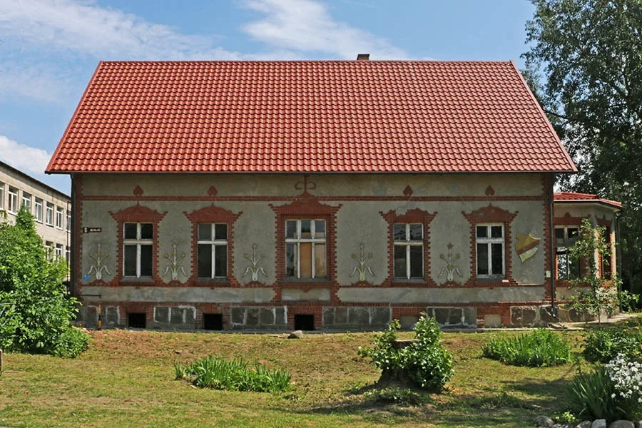 The local history museum in Ulyanovo.
On 17.06.1947 Kraupischken was renamed the settlement of Ulyanovo. At the same time the Ulyanovo village council was created, which existed until 1954. In 1953 the church burned down. From 1954 Ulyanovo belonged to the Zhilino village council. In 1972 the settlement had 89 houses and a school. A dairy farm was opened on the site of the Breitenstein estate. In the 1980s a new school building was built. In 1997–2008 Ulyanovo was the centre of the Ulyanovo rural district. In 2010 the settlement had 155 dwelling houses. There were a school, a library, a House of Culture, a feldsher-midwife station, three agricultural enterprises, three grocery shops and two shops selling manufactured goods.
Coordinates of the settlement: 54°49'34'' N 22°05'19'' E (Kraupischken), 54°49'47'' N 22°06'08'' E (Breitenstein).
Sights: Kraupischken Church (1772) and the pastor's house, a memorial at the burial place of eight German and 83 Russian soldiers who fell here during the First World War, the Svetly Kamen erratic boulder, the local history museum (1981), the Church of the Vladimir Icon of the Mother of God (2007).
Population: 1867 – 227, 1885 – 219, 1905 – 663, 1910 – 693, 2002 – 764, 2010 – 607 inhabitants.
Population of the community of Kraupischken: 1867 – 227, 1885 – 219, 1905 – 663, 1910 – 693, 1933 – 1045, 1939 – 1263 inhabitants.
Population of the Gutsbezirk of Breitenstein: 1905 – 127, 1910 – 83 inhabitants.
Population of the rural community of Juckstein: 1905 – 14, 1910 – 14 inhabitants.
Population of the Gutsbezirk of Friedrichswalde: 1905 – 76, 1910 – 81 inhabitants.
Population of the community of Graudßen: 1905 – 59, 1910 – 48 inhabitants.
FOR REFERENCE
The church parish of Kraupischken: Abschruten (from 1938 Steinflur, Medvedevo), Augsgirren (from 1938 Sassenhöhe, Zastolye), Barsden (from 1938 Barden, 54°50'31'' N 22°02'31'' E), Bergental (54°47'09'' N 22°11'43'' E), Breitenstein (Ulyanovo, part), Budeningken (from 1938 Langenflur, 54°47'43'' N 22°06'26'' E), Buttkuhnen (from 1938 Tilsental, Pokrovskoye), Errehlen (from 1938 Rehlen, Vorotynovka), Friedrichswalde, Gettkanten (from 1938 Kleinburental, 54°52'40'' N 22°02'42'' E), Gettschen (from 1938 Kleinradingen, Kaverino), Graudßen, Groß Wabbeln (from 1938 Winterlinden, 54°52'26'' N 22°03'36'' E), Girrehnen (from 1938 Güldengrund, Grivino), Groß Kummeln (from 1938 Großkummen, Vozvyshenka), Groß Perbangen (Grushevka), Groß Pillkallen (from 1938 Kallenfeld, Mezhdurechye), Guddaschen (from 1938 Freienfelde, 54°48'38'' N 22°00'04'' E), Karpotschen (from 1938 Karpenfeld, Mikhailovka, part), Kaschelen (from 1938 Kasseln, Koshelevo), Kauschen (Kashino), Kerstupönen (in 1928-38 Pleinlauken, from 1938 Kersten, Ryabinovka), Klein Ballupönen (from 1938 Kleinhöffkeshof, Vinogradovo), Klein Kummeln (from 1938 Kleinkummen, 54°45'58'' N 22°05'30'' E), Klein Moulienen (54°48'36'' N 22°01'44'' E), Klein Perbangen (54°51'32'' N 22°04'24'' E), Klein Wabbeln (from 1938 Wabben, 54°51'59'' N 22°03'12'' E), Krauleidszen (from 1938 Erlenfeld, 54°51'01'' N 22°02'09'' E), Kraupischken (Ulyanovo), Kraupischkehmen (Zalivnoye), Laugallen (from 1938 Insterweide, Kamanino, part), Maruhnen (54°53'04'' N 22°04'17'' E), Meldienen (Bolshevo), Maschken (from 1938 Maschenhof, Malinovka), Moulienen (Mikhailovka), Groß Kummeln mill / Mühle (54°46'55'' N 22°04'43'' E), Neu Moulienen (54°49'31'' N 22°03'55'' E), Neudorf (54°46'06'' N 22°08'35'' E), Opehlischken (from 1938 Opeln, 54°48'09'' N 22°10'33'' E), Paszleidszen (from 1938 Paßleiden, 54°47'18'' N 22°13'34'' E), Patilszen (from 1938 Tilsen, Koshelevo), Pautkandszen (from 1938 Grüntal, Solnechnoye), Plauschinnen (from 1938 Plauen, Kamanino), Pleinlauken (from 1938 Insterbrück, Podmostye, later Ryabinovka), Plimballen (from 1938 Grünweiden, Bryusovo), Radischen (from 1938 Radingen, Yuzhnoye), Raudonatschen (from 1938 Kattenhof, Volochayevo), Raudonatschen, sheep farm / Raudonatschen, Schäferei (from 1907 Insterfelde, Volochayevo, part), Rucken, Sakalehnen (from 1938 Falkenort, Vorotynovka), Sassupönen (from 1938 Sassenau, 54°47'43'' N 22°06'56'' E), Schuppinnen (from 1938 Kleinbergental, Dubovskoye), Schönwiese (Gorkovskoye), Skrudsen (from 1938 Kruden, 54°47'20'' N 22°07'34'' E), Spirginnen (from 1938 Hasenflur, 54°49'15'' N 22°10'23'' E), Staggen (54°49'46'' N 22°00'43'' E), Suttkehmen (54°49'01'' N 22°11'40'' E), Szwirpeln (from 1938 Schwörpeln, 54°52'18'' N 22°02'52'' E), Sziebarten (from 1938 Siebarten, 54°50'38'' N 22°00'32'' E), Tilsewischken (from 1938 Tilsenberg, Groznoye), Tutteln (54°48'50'' N 22°09'38'' E), Warnen (Shmelyovo), Werxnupönen (from 1938 Langenort, 54°48'09'' N 22°11'52'' E), Wiswainen (from 1938 Birkenstein, Groznoye, part), Wittschunen (from 1938 Wittenhöhe, Borovoye), Worreningken (from 1938 Woringen, Uspenskoye).
Modern photos by Mikhail Ogorodnikov.
Translated from Russian with the help of AI (Claude, Anthropic), October 2026.