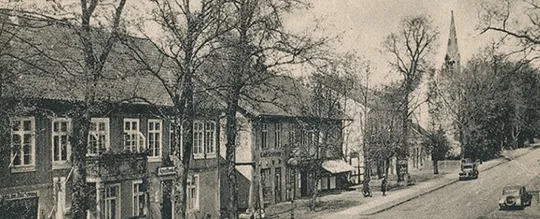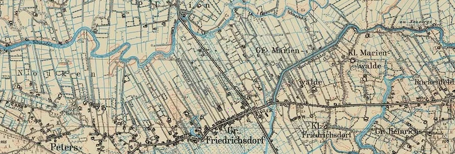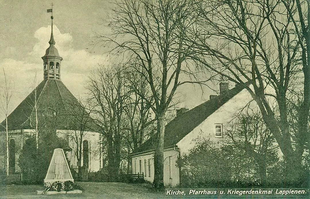
Alt Lappienen has been known since the 17th century, although a Prussian settlement existed here before the time of the Order. After the Teutonic Order conquered the territory, families of fishermen and hunters lived along the banks of the Gilge. The land was barely cultivated. In 1613–16, large-scale hydraulic works were carried out to straighten the river's course and make it navigable. From then on, the waterway between Königsberg and Tilsit ran along the Gilge, which laid the groundwork for new settlements to arise and grow on its banks.
In 1671, Alt Lappienen was acquired by Count Philipp de la Chiese (1629–73), master builder to Elector Frederick William (who later earned the epithet "the Great" — editor's note), chamberlain and quartermaster general. (The French and Italian versions of his name found in various documents can easily cause confusion: Philipp de Chièze, Philippo di Chieze, Filippo di Chieze, Filippo di Chiefa, Philippe de La Chièze, Philipp de la Chaise — editor's note.)
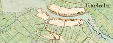
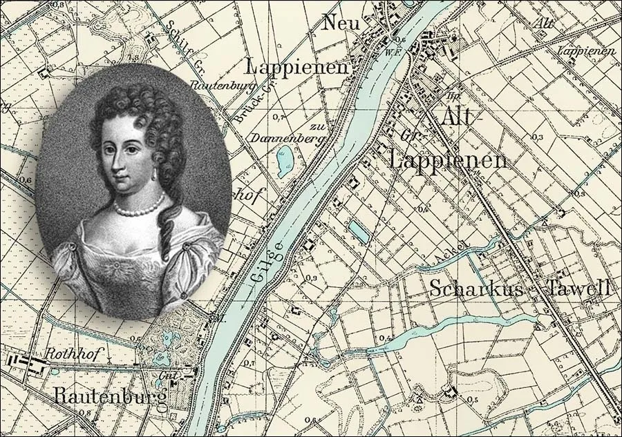 Luise Katharina, mistress of the Rautenburg estate (bottom left), against a pre-war map of Berezhki.
Here he built the Rautenburg estate (now the locality of Malinovka), naming it after his wife Luise Katharina (1650–1703), née von Rautter.
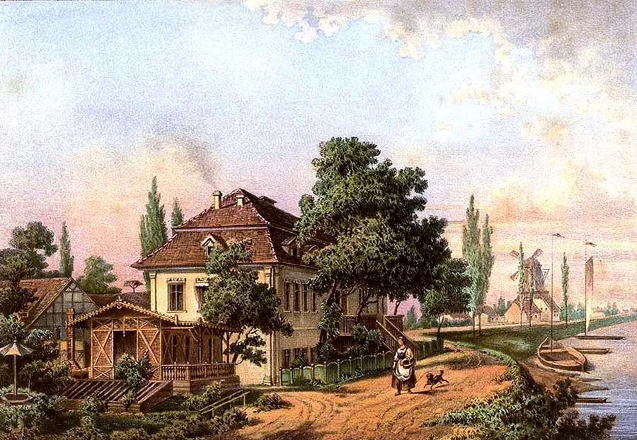 The Rautenburg estate. Lithograph from Alexander Duncker's collection "Prussian Country Palaces".
Since the count came from the Netherlands, one may assume that the Elector sent him to these parts by no means by chance, but with the task of organizing the drainage of the land in the delta of the Memel (Neman). Philipp founded a church next to his estate and then concluded a contract with Frederick William to build a navigable canal between the Gilge (Matrosovka) and Nemonien rivers – a contract whose terms it fell to his widow to fulfil... Nevertheless, in 1675–83 the canal, later named Klein Friedrichsgraben (the Nemonin Canal), was built. The church in Alt Lappienen, whose design was also left behind by Count de Chieze, took even longer to build than the canal; it was completed by 1703 and became the parish church for the inhabitants of the surrounding villages.
In 1679, Luise Katharina married for the second time – Colonel Count Wolfgang Christoph Truchsess von Waldburg (1643–88) – but outlived him as well. Until his last days her second husband was commandant of the fortress of Pillau (Baltiysk), so the cares of running the rather large holdings around the Rautenburg estate rested on the countess's shoulders.
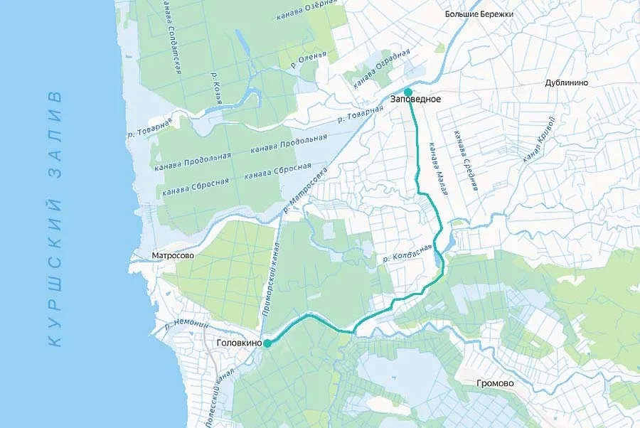 The first canal was originally called Greituschke. It became Klein Friedrichsgraben once the second part of the waterway system was built (see below), which was named in honour of the first Prussian king.
Besides building the church in Alt Lappienen, Luise Katharina distinguished herself by concluding, after her second husband's death, a contract with Frederick III to build a canal between the Nemonien and Deime (Deyma) rivers.
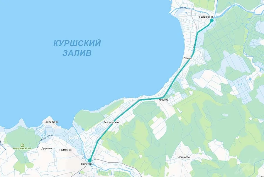
Groß Friedrichsgraben is now called the Polessk Canal.
The contract was signed on 4 June 1689, and work began as early as 11 June, directed on site by the construction engineer Johann Stawinski. The canal was opened to shipping in 1697 and named Groß Friedrichsgraben (the Polessk Canal). Tolls were levied for passage through the Klein and Groß Friedrichsgraben canals in favour of the Rautenburg estate, which considerably strengthened its finances. But in 1709–11 the surrounding area, like all of East Prussia, was devastated by plague, which also took its toll on the volume of traffic. In 1710, under King Frederick I, the canals were nationalized. Once the epidemic was over, King Frederick William I brought settlers here from Switzerland, Holland, Nassau, Württemberg, the Palatinate and Salzburg.
In 1785, Alt Lappienen was classified as a noble church village (adelich Kirchsdorf). At the time it had 18 households. The village belonged to Kreis Insterburg (Chernyakhovsk) and was part of the Rautenburg estate.
In the 19th century, Alt Lappienen was a count's church village (gräflich Kirchsdorf), forming from 1818 a rural municipality in Kreis Niederung (from 1938 Kreis Elchniederung). The church in Alt Lappienen served as the parish church for the surrounding villages and estates.
In 1818, the village had 11 households. In 1871, Alt Lappienen had eight dwelling houses, home to 15 families. On 26 March 1874, the municipality of Alt Lappienen was incorporated into the newly established Amtsbezirk Lappienen, administered from Neu Lappienen (from 1938 Rautersdorf, now Malye Berezhki).
In 1885, the municipality of Alt Lappienen owned 110 hectares of land, including 17 ha of arable land and 78 ha of meadows. In all, the village had 12 houses and 25 households. By 1895, the number of houses had risen to 13, while the number of families living in them had, on the contrary, fallen – Alt Lappienen was now home to 18 families, two single men and one single woman. By 1905, however, the number of households was growing again. At that time Alt Lappienen had 27 families and two people without families. Thirteen residential and two other buildings were registered. Property tax revenue per hectare of land amounted to 17.25 marks. This was somewhat higher (by 11.22%) than the district average for rural municipalities, while on the scale of the entire Gumbinnen (Gusev) administrative region such a tax rate was undoubtedly high.
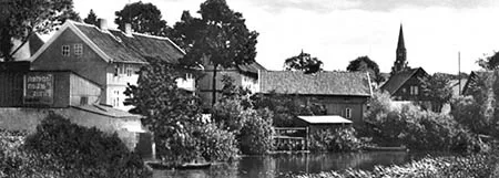
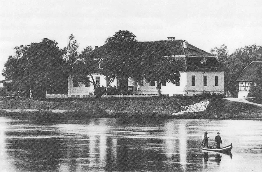 The main house of the Rautenburg estate faced east, towards the river.
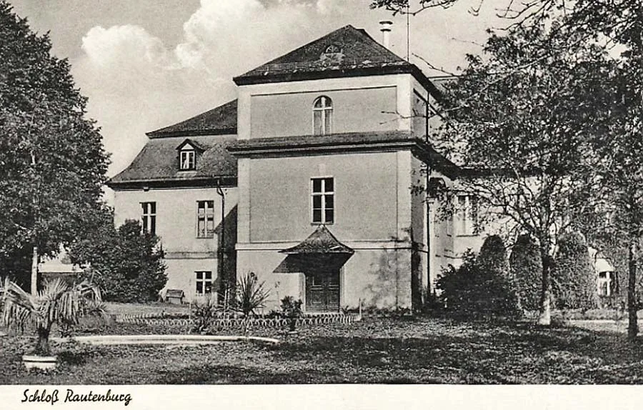 View from the park of the rear, western façade of the main house of the Rautenburg estate.
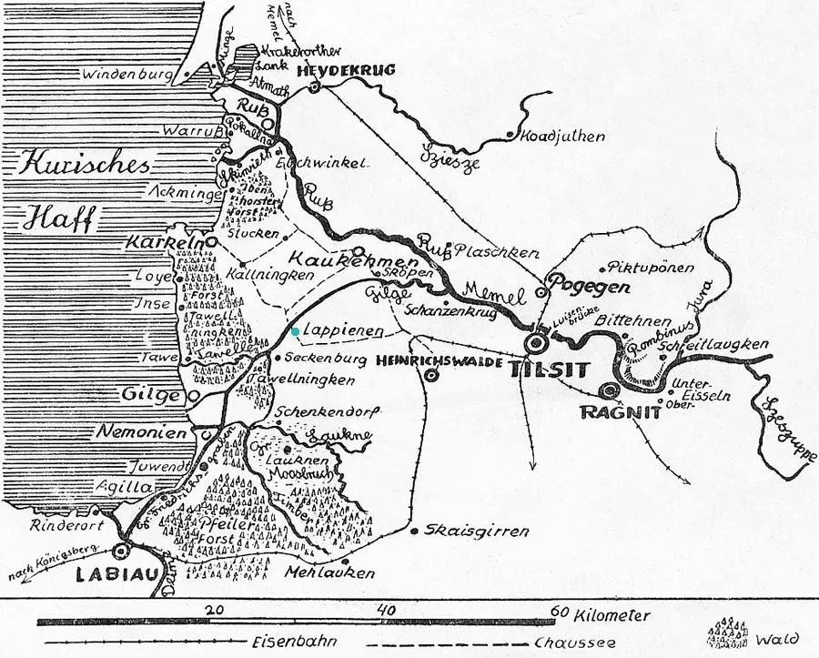
In 1911, a narrow-gauge (750 mm) branch of the Niederungsbahn railway system was laid through Alt Lappienen, leading to Groß Kryszahnen (from 1938 Seckenburg, now Zapovednoye). A halt was built in the village on this line.
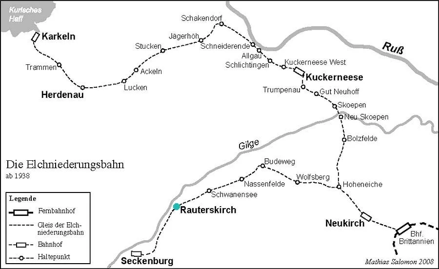 Map of the Elchniederungsbahn in 1938.
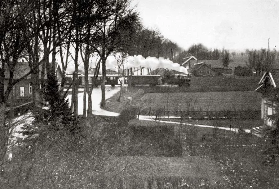 The railway brought a touch of dynamism to the pastoral village landscape.
On 09.03.1925 the community of Alt Lappienen was merged with the community of Groß Lappienen (part of Bolshiye Berezhki) from the Amtsbezirk of Norwischeiten (55°06'12'' N 21°26'25'' E) to form a new rural community of Alt Lappienen (from 1938 Rauterskirch). For some time the new community continued to straddle two Amtsbezirke (Lappienen and Norwischeiten), until on 26.02.1927 it passed entirely into the Amtsbezirk of Norwischeiten, which in 1939 was renamed the Amtsbezirk of Rauterskirch (Bolshiye Berezhki). In 1925 the merged community owned 249.5 ha of land, and its two villages had 74 residential houses and 150 households. In the pre-war years a ferry crossed the Gilge between Alt Lappienen and Neu Lappienen. In 1938 a new school with five classrooms and a sports ground was opened in Alt Lappienen. The village was also home to the local land registry office.
The last owner of the Rautenburg estate was Count Adalbert von Keyserlingk (1905–93). On 07.05.1945 the manor burned down. According to one account, it was set on fire by Soviet troops, either for unknown reasons or through carelessness.
Lappienen parish (Alt Lappienen, from 1938 Rauterskirch, from 1947 Bolshiye Berezhki) was established in 1664. Its first pastor, Johann Vollhard, was appointed in 1667. The foundation stone of the Alt Lappienen church, designed by Philipp von Chiese, the builder of the Potsdam City Palace, was ceremonially laid in 1675. Construction took more than a quarter of a century, and the church was not opened until 1703. In 1701 it received an altar and an organ by the Königsberg master Johann Josua Mosengel (1663–1731). The church had bells cast in 1670 and 1761. In 1807 it was plundered by French soldiers, who carried off all its silver vessels. In 1925 the parish of Lappienen comprised more than 40 settlements, and its congregation numbered over 5,000.
Amtsbezirk Rauterskirch. On 18.04.1939 Rauterskirch became the seat of an Amtsbezirk (formerly the Amtsbezirk of Norwischeiten) which, besides Alt Lappienen itself, comprised the communities of Alt Iwenberg (until 1926 Kallwellen, part of Zapovednoye), Budeweg (until 1938 Neuhof-Reatischken, Aisty), Iwenheide (until 1938 Scharkus-Tawell, 55°04'58'' N 21°25'33'' E), Nasserfelde (until 1938 Andreischken, Krutoye), Schwanensee (until 1938 Norwischeiten), Rauterskirch (Bolshiye Berezhki) and Tranatenberg (until 1929 An der Ulpesch, Kamyshino).
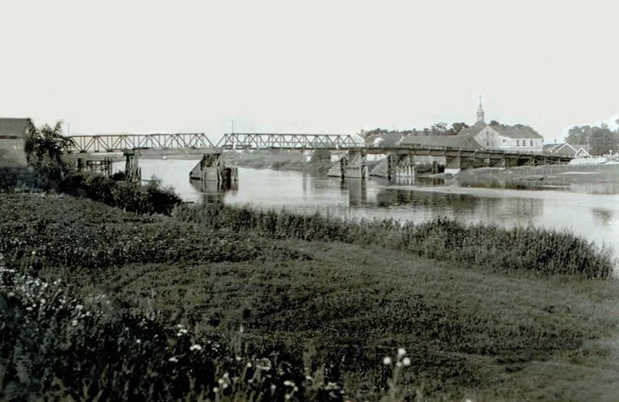 The bridge over the Gilge.
In 1785 Groß Lappienen was classified as a “Schatull-kölmisch” village (chatoulkölmisch Dorf)*, because some of its farms held their land under medieval Kulm law, while the others were organised on the model-village system on state forest land.
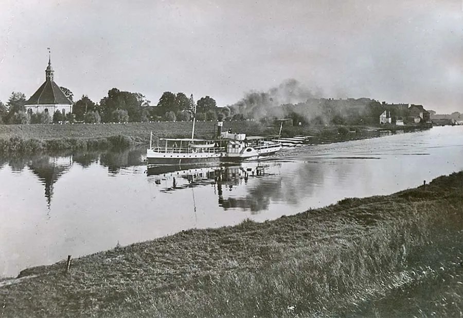 A steamer sails along the Gilge past the Alt Lappienen church.
Both kinds of farm belonged to free peasants, but Kulm status gave greater freedom when selling or bequeathing property. In all, the village had five peasant farms and four Hufen (approx. 68 ha) of land. It belonged to the Kreis of Tapiau (Gvardeysk) and the Amt of Seckenburg (Zapovednoye). At that time the boundary between the Kreise of Insterburg and Tapiau ran precisely between the villages of Alt and Groß Lappienen.
After the administrative reform of 1818, Groß Lappienen, like its neighbour, became part of the Kreis of Niederung (from 1938 Elchniederung), forming a rural community in the Amt of Linkuhnen (Rzhevskoye). The village belonged to the parish of Lappienen. In 1818 Groß Lappienen had 19 households. By 1871 the village had grown several times over and now had 39 residential houses, home to 83 families. On 26.03.1874 the community of Groß Lappienen was incorporated into the newly established Amtsbezirk of Norwischeiten (55°06'12'' N 21°26'25'' E), which in 1939 was renamed Rauterskirch (Bolshiye Berezhki).
In 1885 the community of Groß Lappienen owned 175 ha of land, of which 48 ha was arable and 74 ha meadow. The village had 57 houses and 85 households. In 1895 the number of houses remained the same, but the number of resident families had risen to 104.
In addition, three men and three women without families were living in Groß Lappienen at that time.
In 1905 property tax revenue per hectare of land amounted to 14.35 marks, 7.5% below the average for the Kreis of Niederung. The village of Groß Lappienen had 62 houses, home to 106 families and eight single persons.
On 09.03.1925 the community of Groß Lappienen lost its independence and was merged with the community of Alt Lappienen to form a new rural community of Alt Lappienen. For some time the new community continued to straddle two Amtsbezirke (Lappienen and Norwischeiten), until on 26.02.1927 it passed entirely into the Amtsbezirk of Norwischeiten.
Andreischken (from 1938 Nassenfelde) was classified in 1785 as a Kulm-law village (cölmisch Dorf) with eight households, two of which belonged to the local inn of the same name. The village was part of the Amt of Linkuhnen (Rzhevskoye) in the Kreis of Insterburg (Chernyakhovsk).
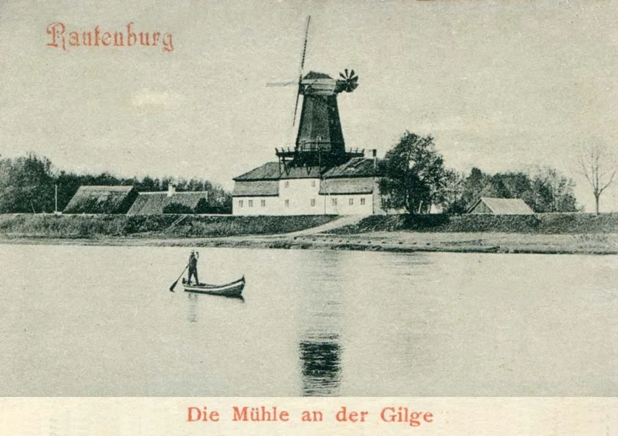 The mill of the Rautenburg estate.
As for the inn, it was subject both to Kulm law and to ownership rights over leased royal forest land, which is why it was described as “Schatull-kölmisch” (chatoulkölmisch Krug).
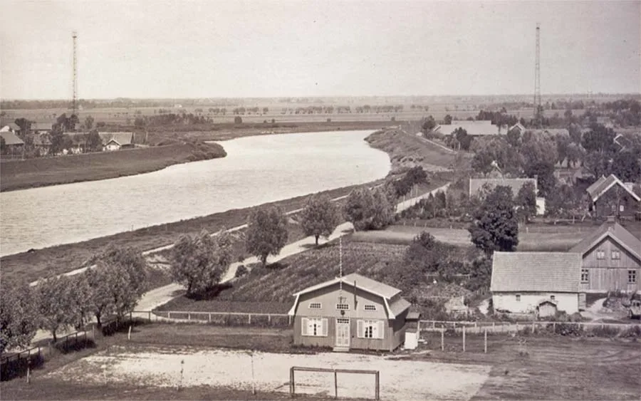 View from the church tower of Alt Lappienen towards Tilsit.
In the 19th century Andreischken was a Kulm-law village which from 1818 formed a rural community in the Kreis of Niederung (from 1938 Elchniederung). The village belonged to the parish of Lappienen. Until 1874 it remained under the Amt of Linkuhnen (Rzhevskoye). By 1818 the number of households in Andreischken had fallen to seven, but by 1871 the village already had 13 residential houses, home to 26 families and three single persons. On 26.03.1874 the community of Andreischken was incorporated into the newly established Amtsbezirk of Norwischeiten (from 1939 Rauterskirch). On 28.06.1876 the previously independent village of Mägdeberger Wiese was incorporated into the community of Andreischken – and after the merger it even lost its name.
In 1885 the community of Andreischken owned 171 ha of land, of which 58 ha was arable and 47 ha meadow. The village had 15 houses and 27 households. By 1895 the number of houses remained unchanged, but they were now home to 28 families, two single men and one single woman.
By 1905 the number of houses in the village had grown considerably (to 24), matching the number of households (23 families and one resident without a family). Property tax revenue per hectare of land amounted to 17.32 marks, almost 12% above the average for the communities of the Kreis of Niederung.
In 1911 a narrow-gauge railway belonging to the Niederungsbahn network was laid past Andreischken, and a platform was built on the edge of the village (Andreischken halt, Hp. Andreischken). On 01.04.1915 approx. 80 ha of land was transferred to the community of Andreischken from the community of An der Ulpesch (from 1929 Tranatenberg, Kamyshino). By 1925 Andreischken's landholdings had grown to a total of 338.2 ha. The village had 22 houses, home to 38 families. In the pre-war years Andreischken had a school and a local land registry office.
On 17 November 1947 the village of Alt Lappienen was renamed the settlement of Bolshiye Berezhki, and Andreischken became the settlement of Krutoye. Groß Lappienen was never officially renamed and simply became part of Bolshiye Berezhki in practice.
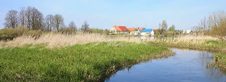
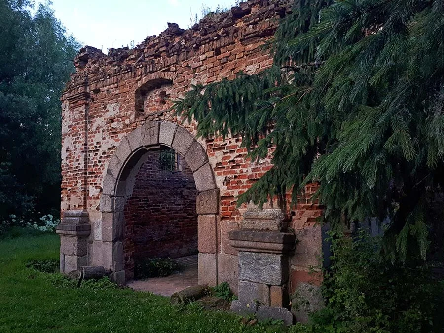 Ruins of the church in Alt Lappienen (August 2025).
By 1972 all that remained of the settlement of Krutoye was a single pumping station, which on maps was already shown as part of the settlement of Bolshiye Berezhki, which at that time had a school and 58 households. No later than 1975 Krutoye was officially struck off the register. In that same year, 1975, lightning struck the Alt Lappienen church, which burned down and partially collapsed. By 1985 there were 53 houses left in the settlement. In the 1990s the village school was closed. In 2004, with German participation, the rubble of the church was cleared. As of 2025 the settlement had 30 houses, 27 of which are occupied.
Sights: ruins of the church (late 17th century), monument to Kalinin.
Population (combined municipality of Alt Lappienen – Bolshiye Berezhki): 1925 – 551, 1933 – 547, 1939 – 599, 1985 – 220, 2002 – 163, 2010 – 153, 2012 – 152, 2017 – 135, 2018 – 105 inhabitants.
Population of Alt Lappienen: 1818 – 100, 1852 – 261, 1867 – 88, 1871 – 81, 1885 – 137, 1905 – 156, 1910 – 161 inhabitants.
Population of Groß Lappienen: 1818 – 203, 1852 – 369, 1867 – 382, 1871 – 351, 1885 – 406, 1905 – 469, 1910 – 524 inhabitants.
Population of Andreischken: 1818 – 73, 1852 – 126, 1867 – 137, 1871 – 139, 1885 – 146, 1905 – 131, 1910 – 104, 1925 – 221, 1933 – 209, 1939 – 113 inhabitants.
Composition of the population of Alt Lappienen in 1871: all 81 – Protestant Christians, children under 10 – 14, literate – 44 (66%).
Composition of the population of Groß Lappienen in 1871: Protestant Christians – 334, Jews – 17, children under 10 – 72, literate – 188 (70%), blind – 2, deaf-mute – 1, insane – 7.
Composition of the population of Andreischken in 1871: Protestant Christians – 138, Catholics – 1, children under 10 – 30, literate – 58 (53%).
For reference
Localities of the Lappienen parish: Ahlgarten (55°07'13'' N 21°23'06'' E), Alt Lappienen (from 1938 Rauterskirch, Bolshiye Berezhki), Alt Schemeiten (from 1938 Kleinschönwiese, Sedlovinka), An der Ulpesch (from 1929 Tranantenberg, Kamyshino, part), Andreischken (from 1938 Nassenfelde, Krutoye), Bretterhof (Malyye Berezhki, part), Dannenberg (Kholmistoye), Degimmen (from 1934 Brandenburg, Pereleski), Ellernbruch (Uzlovaya), Endreischken (from 1938 Endern, 55°07'29'' N 21°30'11'' E), Gräflich Endreischken (from 1938 Gut Endern, Lineynoye), Gräflich Prudimmen (from 1938 Erlenrode, Prudki), Groß Krauleiden (from 1938 Großheidenstein, Bolshoye Khrustalnoye), Groß Lappienen (Bolshiye Berezhki, part), Hohenberge (Utinoye), Iwenberg (55°04'35'' N 21°25'19'' E), Johanns-Eßer (from 1929 Birkenheim, Komissarovo), Joneiten (from 1938 Gilgenfeld, Vishnevka, part), Kallwellen (from 1938 Alt Iwenberg, Zapovednoye, part), Karlsdorf (Griboyedovo), Kiauken (from 1938 Wartenfeld, Zalomovo),
Klein Krauleiden (from 1938 Kleinheidenstein, Khrustalnoye), Königlich Prudimmen (from 1938 Kleinerlenrode, Khrustalnoye, part), Maßrimmen (from 1938 Kleinhohenberge, Kulikovka), Mosteiten (from 1938 Eschenberg, Slavyanskoye), Neu Lappienen (from 1938 Rautersdorf, Malyye Berezhki), Neu Norweischen (from 1938 Altdümpelkrug, 55°06'09'' N 21°25'26'' E), Neu Schemeiten (from 1938 Neuschönwiese, 55°07'18'' N 21°28'33'' E), Neuhof-Reatischken (from 1938 Budeweg, Aisty), Norweischen (from 1938 Mülmeistern, Divnoye), Norwischeiten (from 1938 Schwanensee, 55°06'12'' N 21°26'25'' E), Oszugarn (from 1936 Rehwalde, Shumnoye), Packuss (from 1938 Kussenberg, Shirokoye, later Dublinino), Raging (Klyuchevoye), Rautenburg (Malinovka), Reatischken (from 1938 Heinrichshof, Vishnevka), Rogainen (Shlyuznoye), Rothhof (Malyye Berezhki, part), Rucken (from 1938 Ruckenhagen, Kurgan), Schackwiese (Barzha), Scharkus-Tawell (from 1938 Iwenheide, 55°04'58'' N 21°25'33'' E), Schönwiese (Verkhovka), Schuppinnen (from 1938 Schuppen, Zabolotnoye), Waldburg (Lesnoye), Warskillen (55°07'33'' N 21°30'54'' E), Warsze an der Gilge (55°04'42'' N 21°28'31'' E), Warsze (from 1936 Warsche, Kirillovo), Warszlauken (from 1938 Warszfelde, Dolinnoye).
Archive photos: Bildarchiv Ostpreußen.
Modern photo: Mikhail Ogorodnikov.
Maps: Yandex, etomesto.ru.
—————————
* — Villages of this kind arose in the 17th and early 18th centuries as forest land was brought under cultivation. Like the royal villages, they were organised as model settlements, intended to counter the impoverishment of serf (noble-owned) peasants and to show the nobility that farming was possible without exploitation — a message which, however, hardly impressed the powerful East Prussian aristocracy.
The Schatuller, owners of chatoul-Kulm peasant holdings (Besitzer eines Chatoul-Cölmischen Gutes), were free landowners who could dispose of their land as they wished and even sell it. They were not required to perform any of the usual peasant labour duties, with the exception of transporting military supplies. The Schatuller were forest farmers. The term "Schatuller" or "Schatullbauer" derives from the name of the forest fund (Chatoulle) and privy purse of the Prussian electors, into which the interest paid by the Schatullbauern (private tenants) flowed. It was called the Schatullkasse. These settlers were sometimes also called "Berahmunger", after the title deed known as the "Berahmung" (Berahmung).
Source: "Complete Topography of the Kingdom of Prussia" (Vollständige Topographie des Königsreiches Preußen, Erster Theil, 1785).
Translated from Russian with the help of AI (Claude, Anthropic), October 2026.