The history of human society in our region began about ten thousand years ago. This was when the last glacier, which had covered vast areas of Northern and Eastern Europe, was melting. The ice sheet gradually retreated northward, towards the present-day Arctic. As it went, it freed huge expanses suitable for human settlement and left behind exposed soil, a multitude of lakes, marshland and morainic deposits. On average, the glacier retreated by 160 m a year. The climate in northern Europe changed several times. When the melting began, it was cold and differed little from that of the Ice Age. Later came the so-called Boreal period, with a drier and warmer climate. Today's landscapes took shape as the climate shifted from Arctic to more temperate. The Baltic Sea also formed and gradually acquired its present outline. First came the Yoldia Sea, named after the mollusc Yoldia, which was typical of the salt waters of that period. Then, about nine thousand years ago, the Yoldia Sea was cut off from the ocean, and the freshwater Ancylus Lake was formed. A thousand years later it reconnected with the ocean and became salty once more. The Baltic acquired its present outline around the middle of the fifth millennium BC.
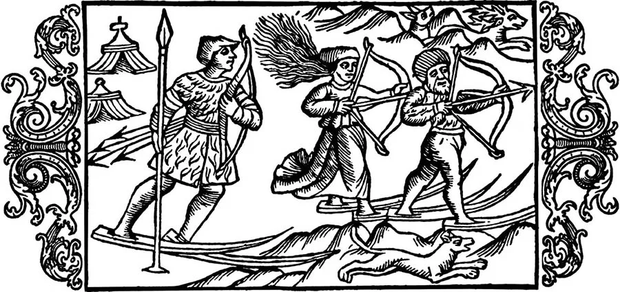
As the ice melted, prehistoric hunters and fishers moved north, following the herds of reindeer that were the main quarry of this period.
Gradually, as the fauna and flora changed, hunting elk and waterfowl, fishing and gathering came to play a major role in human economic life.
It was under these conditions that a new weapon was invented: the bow and arrow. This invention was a genuine revolution in the development of the productive forces. Earlier, people had used throwing weapons such as spears and darts, whose effect was limited by the strength of the human arm. Now they had a powerful long-range weapon. Individual hunting became far more important, and a variety of pitfalls, traps and snares came into use. Fishing took on a significant place in the economy. Fish were caught with harpoons, and nets, fish hooks and fish traps appeared for the first time and quickly spread. The dugout canoe was also invented.
In archaeology, the period when the first people appeared in the Baltic region is called the Mesolithic (Middle Stone Age). The Mesolithic brought fundamental changes in the technique of making tools. A new insert technique emerged. The body of an object such as a knife, dagger or spearhead was made of bone or wood. Longitudinal grooves were cut into it, and separate blades made from flint flakes were inserted and fixed into these slots. Alongside insert tools, massive chopping tools known as macroliths also appeared.
During the Mesolithic, the so-called Neman culture spread across the Baltic region. Its sites are found from the Vistula in the south to the Gulf of Finland in the north. Early Mesolithic sites were temporary camps of hunting groups, while long-term hunters' settlements appeared in the Late Mesolithic.
The main Mesolithic sites of the Kaliningrad Region lie in its eastern part. They include the sites near the village of Sinyavino in the Gusev District, near Talniki in the Krasnoznamensk District, near Gorbatovka in the Zelenogradsk District, and others.
These sites are usually located on high sandy terraces above rivers and lakes and on coastal dunes. Such locations protected the dwellings well from rain and snow. What suited prehistoric people, however, creates certain difficulties for archaeologists, since sand speeds up the decay of organic matter. As a result, what has survived at the remains of these settlements is mainly stone tools: flint axes without shaft holes, blades, scrapers, awls and the like.
Around the middle of the fifth millennium BC, the next archaeological era began: the Neolithic (New Stone Age). In Neolithic times, the natural environment came to look very much like it does today. The coastline of the Baltic Sea reached its final form, and the fauna and flora became close to those of the present. The transition to the Neolithic is sometimes compared to a revolution, because it brought major changes to the economic life of human society: an appropriating economy gradually gave way to a producing one. New methods of working stone appeared. Axes, adzes and other chopping tools were now ground and polished. First, a blank was made, and chipping gave it the basic features of the future tool. Then the axe was ground, either entirely or only along its working edge. This new technique allowed people to use rocks such as diorite, serpentine, slate and schist, which had played no role in tool-making in the previous era.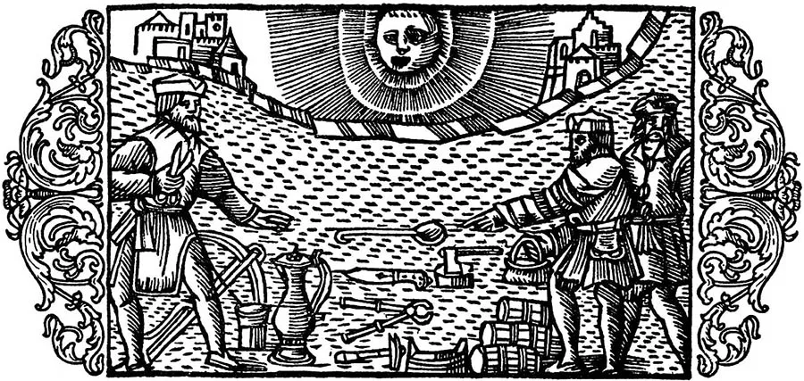
In this period, people learned not only to grind stone but also to saw it and drill holes in it. Stone was sawn in various ways: with small flint saws, with a cord and sand, and with bone tools.
Shaft holes for handles were drilled through stone axes with a tubular bone. The bone was rotated while sand was continually poured beneath it.
Polished axes and adzes mounted on wooden handles were fairly sophisticated tools. They made it possible to build wooden dwellings and to make boats and various wooden implements.
One of the most important inventions of the Neolithic was pottery. The earliest pottery was very simple. Vessels had a conical, slightly pointed base and walls that widened towards the top. They resembled an egg with part of its blunt end cut off, and are therefore called “egg-shaped”. The very oldest clay vessels were probably made over a frame woven from twigs. Another method was also used: coils of wet clay were laid one on top of another. Hand-built pottery was very crude and poorly, unevenly fired. Neolithic vessels were decorated with simple ornament in the form of notches and impressions.
Another major achievement of the Neolithic was the invention of weaving. Fibre suitable for spinning thread was most often obtained from plants such as hemp, wild flax and nettle. The development of weaving is confirmed by numerous finds of spindle whorls. These are small stone or clay discs with a hole in the centre, which were fitted onto the lower end of a spindle so that it would spin evenly and for longer.
Neolithic people thus won a significant victory over nature. They created new materials not found in nature, ceramics and textiles. They also laid the foundations for a broad transition from an appropriating mode of production (hunting, fishing and gathering) to a producing one: farming and stockbreeding.
All of these Neolithic achievements were most evident in the most favourable regions of the globe, such as North Africa, the Mediterranean and Mesopotamia. In the forest zone, which includes the Baltic region, they took hold more slowly. Here, the so-called Narva culture developed during the Neolithic. Flint tools are very rare among its finds. Instead, the culture is characterised by a variety of bone and antler tools and by distinctive clay vessels with pointed bases and straight rims. It also produced small flat-bottomed bowls, some of them shaped like boats.
Cattle bones found at Narva culture sites point to the beginnings of stockbreeding. Hunting, however, still played an important role in the economy.
The Neolithic in the Kaliningrad Region is represented by sites of the Zedmar (Serovo) type. They are named after sites near the village of Serovo in the Ozyorsk District. They date from the Late Neolithic and represent two types of settlement. One, Zedmar A, lies on an island. The other, Zedmar D, is a pile-dwelling settlement.
From an archaeological point of view, the most interesting site is Zedmar D. While the pile settlement was inhabited, some of its tools and household objects, along with production waste, fell into the water, sank to the bottom and were gradually covered with silt. Over the millennia the lakes turned into bogs and then into peatlands, which kept out the air and prevented the decay of the organic material that had settled on the lake beds in Neolithic times. This is why the site has yielded the ancient piles on which the settlement stood, as well as objects of wood, bone and antler, remains of textiles and the like. The Zedmar type of sites shows a kinship with the Neman Mesolithic and the Narva Neolithic cultures. At the same time it has certain distinctive features, probably due to influence from the population of the southern regions (the so-called Funnel Beaker culture). These differences appear above all in the pottery: flat-bottomed vessels decorated around the rim with notches and finger impressions. This tradition of ornamenting vessels would persist for four millennia, right up to the appearance of wheel-thrown pottery.
In the Neolithic the number of sites in the region rises sharply. They are found practically everywhere, from the Baltic coast to the Šešupė River. A new type of site appears: Neolithic burials, which German archaeologists had already discovered on the Curonian Spit. The hoard of amber objects and raw amber found near the present-day village of Juodkrantė also dates from this period.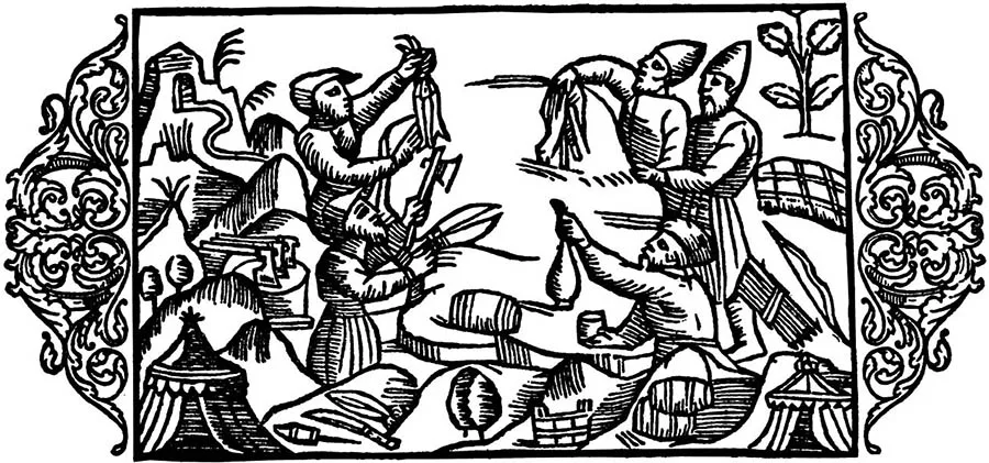
It was in the Neolithic that the local population began to form ties with neighbouring territories. In exchange for amber, they obtained flint and rare kinds of stone.
The very composition of the hoard and the shapes of the ornaments point to the emergence of a certain system of beliefs based on a solar cult. Amber, the "sun stone", became its attribute.
The beginning of the Bronze Age was the era when the first metal appeared and spread widely, replacing stone as a raw material. In the Baltic region it was linked not to a new stage in the development of the local economy but to an invasion of newcomers across the entire Baltic region. The new population, whom archaeologists call the bearers of the Corded Ware or Battle Axe culture, appeared at the end of the third millennium BC.
The newcomers' culture is distinguished by the following features: 1) drilled stone hammer-axes with a blade on one side and a flat butt on the other, so that seen from above they resemble the outline of a boat (such axes are often called boat axes); 2) the drilled axes are frequently accompanied by flat-bottomed vessels with corded decoration, that is, the impression of a cord wound around the body of the vessel.
The arrival of the new population was connected with the rise of a pastoral economy, which, to be pursued intensively, required constant migration. According to a number of modern researchers, this pastoral economy took shape in the foothill and steppe zone, namely in the North Caucasus and the northern Black Sea region. Rapid population growth made it necessary to look for new pastures, which in turn meant settling new lands. At the end of the third millennium, nomadic Indo-European tribes began to spread across Eurasia. Some of them reached the British Isles in the west. Others moved east and settled the territory of present-day Iran and India, and still others, under the name of the Hyksos, conquered ancient Egypt. These peoples are called Indo-Europeans because it was after their dispersal across Eurasia that the modern Indo-European peoples began to take shape: the Slavs, Germanic peoples, Greeks, Romance peoples and others.
The history of our land is connected with those incoming nomadic tribes that made their way through the Vistula basin into the Eastern Baltic and later settled the forest zone of Eastern Europe, from the Baltic to the upper reaches of the Volga.
No change of population can be observed in the Eastern Baltic over the following three millennia. For this reason the beginning of the ethnogenesis of the Balts (the Prussians, Lithuanians and Latvians) is dated to the Battle Axe culture, which is sometimes called "Baltic". The migrants dominated the territory from the Vistula to the Western Dvina, where they subjugated the local population. North of the Western Dvina the old way of life persisted, and on its basis the Finno-Ugric peoples (the Livonians, Estonians, Karelians and others) began to form.
The Bronze Age in the Kaliningrad region is divided into two stages, the Early Bronze Age and the Late Bronze Age. The first covers the middle of the second millennium BC. The second runs from the end of the second millennium to the first half of the first millennium BC.
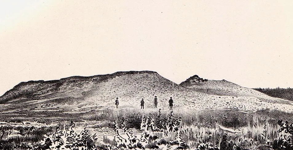
Since Bronze Age settlements have been little studied, our picture of this period rests on burial sites. The Early Bronze Age is characterised by collective inhumation burials in stone cists, over which large mounds of earth and stone were raised. These structures probably served as family or clan tombs. The dead usually lie on their side in a crouched position. Besides stone axes and pottery, the graves contain flint tools, bone harpoons, necklaces of animal teeth and amber ornaments. Bronze objects are very rare.
In the Late Bronze Age the burial rite changed. The dead were still buried in collective graves under barrows, but now the burial was preceded by cremation, which took place in a special sanctuary. After cremation the remains of the deceased were placed in a special vessel, the funerary urn. Some urns bear a human face modelled in clay. This was probably done so that the soul of the deceased, having lost its physical shell in the fire, could easily find its new dwelling place and easily enter it through an opening. Grave goods became more varied. Besides axes and pottery, numerous bronze objects appear: short swords, daggers, pins, bracelets, pendants and other ornaments.
Since there are no raw materials for making bronze in the Kaliningrad region, the widespread appearance of bronze objects can only be explained by the growth of exchange between tribes. Amber was the main commodity traded for raw bronze and bronze goods.
This is borne out by finds of Baltic amber in lands far from the region, in Greece, England, Asia Minor and the Caucasus. Conversely, objects from Egypt, Asia Minor, the British Isles and the Caucasus have been found at Bronze Age sites in the south-eastern Baltic.
Most Bronze Age sites are located on the Sambian (Kaliningrad) Peninsula, in the area of the towns of Svetlogorsk and Pionersky.
The Iron Age begins in the 5th century BC. For our region it is divided into three stages: the Early Iron Age, from the 5th century BC to AD 50; the Middle Iron Age, or Roman period, from AD 50 to the 5th century AD; and the Late Iron Age, from the 6th to the 13th century.
Sites of the Early Iron Age are marked by the persistence of traditions established in the Bronze Age. Iron objects are relatively rare, even though our region had deposits of meadow, bog and lake ores that could have been used to produce iron by the bloomery process. The reason is that iron smelting is a chemical process, and mastering it took longer than mastering the production of bronze. Yet the introduction of iron tools made from local raw materials immediately brought about a whole series of changes in local society. Iron tools raised the productivity of agricultural labour, and this had an immediate effect on the life of the local population, among whom the old clan-based communal order began to break down. At archaeological sites this process shows itself in a shift from collective burials under barrows to individual burials in flat-grave cemeteries, where stone settings survived as a relic of the old rite.
The Aesti
Around the turn of the Common Era, the period of the region's most ancient history, known to us only from archaeological finds, comes to an end, and the period of ancient history begins, when the distant past can be reconstructed not only from archaeological evidence but also from written historical sources. These were not sources created and left to posterity by the local population, which had no writing of its own at the time, but those left by other peoples who had advanced further along the path of historical development.
In the first half of the 1st millennium AD, four groups of archaeological sites took shape on the basis of the single culture that had existed between the Vistula and the Neman in the Bronze Age: the Neman, Pregolya, Western Masurian and Eastern Masurian groups, which are distinguished on the basis of burial-ground material. The first two groups lie within the present-day Kaliningrad Region.
The Neman group occupies the lower reaches of the Neman River and the northern shore of the Curonian Lagoon. Its most striking sites are located near the modern Lithuanian towns of Klaipėda and Palanga. Around the turn of the 1st and 2nd centuries AD, flat cemeteries with stone settings became widespread here. Collective cremations in urns gave way to inhumation burials. The grave goods of male burials consist mainly of weapons and tools.
Female burials are distinguished by a large number of bronze ornaments, among which neck rings of various shapes and spiral bracelets display local specificity. Pottery is almost entirely absent from both male and female burials.
The Pregolya group covers a territory bounded to the north by the Curonian Lagoon, to the west by the Baltic Sea and to the east by the basins of the lower Instruch and Angrapa rivers; its southern boundary roughly coincides with the region's present-day border with Poland.
The early stage, the first centuries AD, is characterised by cremation, with inhumation also practised to some extent. In the 3rd–5th centuries only cremations are found, and Roman coins are a characteristic feature of the grave goods. The cemeteries of this period are flat cemeteries located near water and contain up to several hundred burials. The dead were buried in shallow pits, both in urns and without them. A characteristic feature of the burials of the Pregolya group is the presence of stone settings.
Horse burials appear from the beginning of the Common Era. Around the turn of the 2nd and 3rd centuries, burials with rich grave goods, in which the owner is accompanied by a horse, stand out clearly. Such burials are usually called "princely". They are characterised above all by a rich assemblage of weapons and ornaments: socketed axes (celts), spearheads, shield bosses, swords and so on. The most interesting sites of this group are Kovrovo, Povarovka and Khrustalnoye in the Zelenogradsk District.
The Eastern Masurian group covers a territory bounded to the west by the Masurian Lakes and to the east by the middle and upper reaches of the Neman. The northern boundary of the group reaches Lake Vištytis, the southern one the Narew River.
Traditionally, barrow cemeteries are regarded as the characteristic burial sites of this territory in the first half of the 1st millennium AD. They are small earthen mounds covering stone "shells", that is, a covering of stones. The burials were inhumations and were collective: several members of one clan were buried under a single mound. This indicates that in this territory the disintegration of clan-based communal relations lagged roughly half a millennium behind the rest of the south-eastern Baltic. A characteristic feature of male burials is the presence of weapons, which disappear entirely from the grave goods of ordinary burials after the 5th century, at the same time as the burial rite changed and inhumation gave way to cremation without urns.
From the 3rd century onwards, horse burials also appear here, among them princely ones (the cemeteries of Osowa, Szwajcaria and Netta).
The burial sites of Western Masuria are flat cemeteries of the Pregolya type with cremations in urns or small pits. Unburnt horse bones occur only occasionally. Male burials are distinguished by a considerable quantity of weapons (spearheads, socketed axes, shield bosses, fighting knives and so on), similar to those from the Pregolya and Neman cemeteries. Female burials contain many ornaments. Openwork ornaments decorated with white and red enamel are not uncommon; they are a distinctive feature of the Western Masurian group, which is the closest to the Pregolya sites.
It should be noted that horse burials are found throughout the entire south-eastern Baltic.
The earliest such sites have been discovered near the town of Kretinga (Western Lithuania). In the first centuries AD they appear on the Sambian Peninsula, and during the 3rd–5th centuries they spread across the whole region. The highest density of sites of this type is observed in the Pregolya group and in the north of the Eastern Masurian group. Most researchers interpret these sites as the burials of retinue warriors, among which princely burials stand out for their rich grave goods.
The specific features of the cultural development of the four groups of burial sites in the first half of the 1st millennium AD allow us to say that, on the basis of the homogeneous cultural community of the Bronze Age, cultural communities began to form that shared a common origin but developed in distinct ways. In ethnic terms, their formation most likely reflects the process by which tribes came into being.
Unlike the cemeteries, the settlement material reveals no sharp cultural differences. In this period the territory of the region was dominated by open settlements, that is, unfortified villages. They were usually situated on the first terrace above the floodplain of rivers, streams and lakes and covered a considerable area (1–1.5 ha). The villages consisted of above-ground post-framed dwellings; the walls and the flat roof were clad or filled in with poles and plastered with clay. Inside the dwellings were open hearths built of cobblestones, up to 40 cm in diameter.
Among the best-studied sites are Kovrovo, Grachevka, Logvino-1 and Russkoye-1 in the Zelenogradsk District.
The most abundant material yielded by the settlements is pottery. The local pottery of this period is entirely handmade and falls into three large groups: storage vessels; kitchenware (pots for cooking food); and tableware (bowls, mugs, jugs). The main ways of decorating vessels were finger impressions, pinching and incisions placed on the rim and body of the vessel.
The first information about the territory and population of the south-eastern Baltic appears in the works of ancient scholars. As early as the modern era, it came to be believed that the first mentions of the Baltic Sea and the Land of Amber belonged to Pytheas of Massalia, a scholar who lived in the 4th century BC and travelled to the lands of Western and Northern Europe.
It has now been proven that the most north-easterly part of Europe accessible to Pytheas could only have been Norway, and that his Land of Amber must be sought on the islands near the mouth of the Elbe.
In the second half of the 1st century AD, an extraordinarily high demand for amber arose in Rome, which led to intensive use of the overland Amber Road linking Rome with the mouth of the Vistula and to the appearance of information about the area where amber was obtained.
Traditionally, the fact that Rome developed an interest in amber goods is accepted without any comment: decadent Rome had found yet another new toy and began to amuse itself with it. We, however, who have entered the third millennium, know very well how any fashion comes about. First something new is created, and then this novelty is promoted with the aim of capturing the imagination and arousing the interest of as many people as possible. That is exactly what happened in Rome in the 1st century AD. Emperor Nero was preparing for a visit from the King of Armenia and, to receive and entertain his distinguished guest and the people of the empire, decided to build a wooden circus (theatre) and adorn its interior with amber, for which a special expedition was dispatched. The amber safely reached the capital, and everything possible was decorated with it, from the walls to the stretchers on which defeated gladiators were carried away. Since the games were held not only by day, one can imagine the impression the circus interior made on the Romans by the light of lamps whose flames flickered, making the amber ornaments literally shimmer in the dancing tongues of fire. Rome was dazzled and conquered by amber. From that moment on, the sun stone became firmly established in everyday life. Amber was used mainly for jewellery, but that was not its only application. It was also used to make vials for perfumes. All one had to do was drill a hollow in a piece of the ornamental stone, insert a metal sleeve (bronze, silver or gold), close it with a stopper, and the vial was ready. Rome, especially its female half, made extensive use of perfumes. The fashion for making vessels from amber spread further east. This is borne out by two Chinese perfume vessels from the collection of the Peter the Great Museum of Anthropology and Ethnography (the Kunstkamera), which are on display at the Kaliningrad Amber Museum.
Only one question remains unanswered: why did Nero turn his attention to the sun stone? The answer is fairly simple. By virtue of his position, the emperor was deified during his lifetime in the image of Jupiter, the chief god of the Roman pantheon. Nero, who had a particular passion for Greece, where he even took part in the Olympic Games, chose a second divine patron for himself in the person of the Greek sun god, Helios. Every cult needs its attributes. The appearance of the sun stone in Rome therefore undoubtedly enhanced the popularity and veneration of the emperor Nero-Helios.
The first scholar of antiquity who reliably knew of the existence of the Baltic Sea and of the territory where amber was obtained was Gaius Plinius Secundus (23–79 AD), most often called Pliny the Elder.
His work “Natural History” contains an account of the journey of Emperor Nero’s envoy who went to fetch amber for the gladiatorial games. He reached the Land of Amber and “visited the trading posts and shores there”. Further on comes a description of the Land of Amber: “No smaller in size is (the island of) Eningia. According to some reports, this land extends as far as the Vistula and is inhabited by the Sarmatians, Veneti, Sciri and Hirri. The sea gulf is called Cylipenus. At its mouth lies the island of Latris. Adjoining it is another bay, which bears the name Lagnus and stretches to the end of Cimbern. A narrow strip of the land of the Cimbri juts far out into the sea and forms a peninsula called Tastris”1.
There are many different interpretations of this passage. Particular mention should be made of the study by J. Kolendo2. In our view, the most interesting interpretation, in the form of a working hypothesis, was put forward by R. Hennig3. He believes that Roman merchants could only have reached the immediate vicinity of the Vistula estuary. Since in those days the main branch of the Vistula flowed not into the Baltic Sea near Gdańsk but into the Vistula Lagoon along the course of today’s Nogat, Cylipenus should be understood as the Vistula Lagoon. The island of Latris refers to the Vistula Spit, since at that time it was a strip of land resembling an island, not joined to the mainland in the west. The author identifies the bay of Lagnus with the Curonian Lagoon and Tastris with the Curonian Spit. It thus turns out that Pliny’s Land of Amber is nothing other than the western part of today’s Kaliningrad Region.
The information Pliny gives about the peoples inhabiting the southern coast of the Baltic Sea is difficult to correlate with any particular ethnic groups. It is therefore most likely that the population of the south-eastern Baltic appears in Pliny’s account under the general name of Sarmatians, who, according to a tradition that took shape in Ancient Greece in the Hellenistic era, and in Rome going back to Strabo and Pomponius Mela, inhabited the territory of European Sarmatia west of the Vistula and north of the Ister4.
At the same time, Pliny writes that the place where amber is obtained lies in Germania.
“It has recently been established with certainty that from Carnuntum in Pannonia it is 600,000 Roman paces to that coast of Germania from which amber is brought to us”5.
If Pliny’s Germania is considered identical to that of Tacitus, then there can be no question of Pliny’s account containing a description of the south-eastern Baltic. This identification of Pliny’s and Tacitus’s Germania is found, for example, in O. Ya. Neverov6. There are two possible ways of resolving this contradiction. The first is that amber was obtained both in Germania and somewhere else; the second is that it was obtained only in Germania. Let us try to resolve this complex contradiction.
Pliny’s predecessor, the Roman geographer Pomponius Mela (first half of the 1st century AD), believed that Germania extended eastwards as far as the Codanus Gulf, which lies beyond the mouth of the river Albis (Elbe), after which “the coastline bends and forms an elongated gulf. Here live the Cimbri and the last Germanic tribe, the Hermiones”7. Pomponius Mela also knew of the Vistula, which marks the boundary of the lands lying east of Sarmatia and belonging to Scythia. If one draws a logical line from Pomponius Mela to Pliny, the Land of Amber should be placed in Scythia or Sarmatia, but by no means in Germania.
Pliny had at his disposal a brief description of the Land of Amber, or a rough sketch of the terrain: there is a gulf, an island at its mouth, the gulf is bounded by a peninsula, and beyond the peninsula there is another gulf. But he had no data linking this sketch to the general map of Europe. This assumption is supported by the absence of a name for the people from whom the amber was obtained and by the strange detachment of the description of the amber-producing area from the rest of the text. Considering that Pliny served for a long time in Germania and had probably heard of the amber islands off the Germanic coast, and was familiar with the account of Pytheas’s voyage, it was natural for him to place the Land of Amber in Germania. At the same time, for the Romans of this period the southern coast of the Baltic east of the Elbe was, on the whole, a blank spot on the map of Europe.
All these circumstances must have led the scholar to attempt to fit concrete facts into some traditional scheme of geographical constructions, placing them at the limit of the reliable. That limit was the eastern border of Germania, which had not yet been precisely defined, but somewhere to the east of which the Land of Amber lay. Hence the appearance in the description of the Land of Amber of the peninsula inhabited by the Cimbri, which, according to Pomponius Mela, is the extreme north-eastern point of Germania.
In most cases, researchers regard the presence of the Cimbrian peninsula in the description of the amber-producing area as an error on the part of Pliny the Elder8.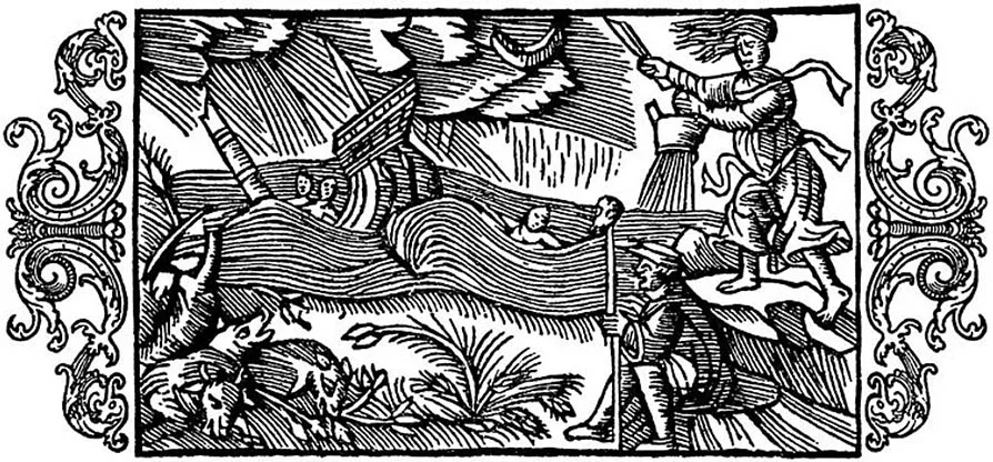
All the arguments we have presented give grounds to believe that the scholar knew of the Land of Amber in the south-eastern Baltic but could not yet link it to the already known map of Northern Europe, since in those days the region between the Elbe and the Vistula was a blank spot for Roman scholars.
The first reliable information about the territory and population of the south-eastern Baltic comes from the Roman scholar Cornelius Tacitus (55–117): “And so the right shore of the Suebian Sea washes the land of the tribes of the Aestii, whose customs and appearance are like those of the Suebi, while their language resembles British. They worship the mother of the gods and, as an emblem of their faith, wear images of boars. This serves them in place of weapons as a protection against everything, guaranteeing the goddess’s worshipper safety even among enemies. They seldom use iron weapons, but often clubs. They labour over grain and the other fruits of the earth with more patience than befits the usual indolence of the Germans. They also search the sea, and they alone of all peoples gather amber in its shallows and even on the shore itself; they themselves call it ‘glaseum’. But what its nature is and where it comes from, they, being barbarians, do not inquire and have no exact knowledge. Indeed, it long lay among them amid the other refuse of the sea, until our passion for luxury made it famous. They themselves have no use for it at all. It is gathered in its raw state, brought to market unworked, and they receive payment for it with astonishment”9.
It follows from this passage that the inhabitants of the eastern coast of the Suebian (Baltic) Sea are called the Aestii, and that amber, much sought after in Rome, is extracted in the territory where they live. Such a description can only apply to the region between the lower reaches of the Vistula and the Neman, that is, the south-eastern Baltic, where the largest amber deposits lie. Although Tacitus reports little about the Aestii, the importance of his information can hardly be overestimated. It was he who laid the foundations of the classical tradition according to which the territory of European Sarmatia east of the Vistula is inhabited by the tribes of the Aestii, who possess the richest deposits of amber and trade with Rome.
Claudius Ptolemy (c. 90–168), the last great geographer of antiquity, devoted a separate chapter of his “Guide to Geography” (often simply called the “Geography”) to describing the position of European Sarmatia: “European Sarmatia is bounded in the north by the Sarmatian Ocean along the Venedic Gulf and by part of the unknown land. The description is as follows: after the mouth of the Vistula... there follow: the mouth of the river Chronus... the mouth of the river Ruvon (Rudon, Bubon, Rubon, Sudon)... the mouth of the river Turunt (Taurunt)... the mouth of the river Chesinus (Chersius)...”10.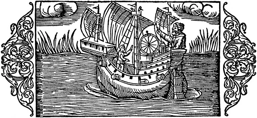
The prevailing view today is that the rivers east of the Vistula listed by Ptolemy are to be identified as follows: the Chronus is the Pregolya, the Rudon the Neman, the Turunt the Venta (Windau), and the Chesinus the Western Dvina11.
Thus, in modern terms, Ptolemy’s northern part of European Sarmatia is nothing other than the territory belonging to the Balts: the Vistula marks the border with the Slavs, and the Western Dvina the border with the Finno-Ugric peoples. This means that the peoples Ptolemy placed east of the Vistula must belong to the Balts.
“East of the aforementioned tribes (those living south of the mouth of the Vistula — our comment) live: below the Venedi, the Galindae (Galidanae), the Sudini and the Stavani, as far as the Alans... Then the coast of the Ocean along the Venedic Gulf is occupied by the Veltae, above them the Ossii, and then, northernmost of all, the Carbones”12.
At this point in the ancient geographer’s work a surprise awaits us. On the one hand, the names of two tribal groupings appear that would remain known for the next thousand years, the Galindae and the Sudini; on the other, the Aestii, mentioned by Tacitus and by all later followers of the classical tradition, are missing. This contradiction, which never ceases to puzzle researchers, remains unresolved to this day. We believe that the key to this geographical riddle lies in identifying three peoples: the Veltae, the Ossii and the Carbones. If we follow Ptolemy strictly, these peoples must be placed along the Baltic coast from the Vistula in the west to the Western Dvina in the north-east. In that case one of them should be regarded as the Aestii, since the south-eastern Baltic accounts for half the length of this region. It is worth recalling here the ethnonym Ostii used by the Anglo-Saxon translator of Orosius’s work13. It is quite possible that the Ostii and the Ossii are different forms of the ethnonym Aestii, while the Carbones are one of the names of the Curonians (Cori). That leaves the enigmatic Veltae, whose territory extends between the Venedi and the Ossii, that is, where Jordanes would place the people of the Vidivarii in the 6th century.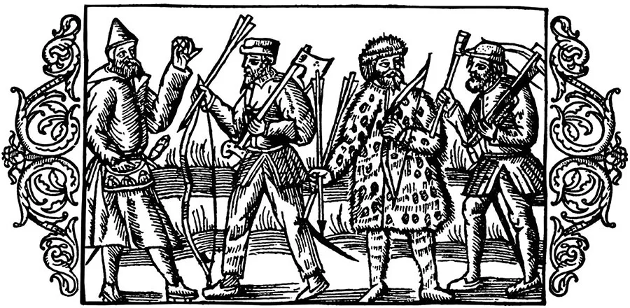
If we accept the identification of the tribes proposed above, the ethnic map of the eastern Baltic in Ptolemy’s time looks as follows: the coast of the Vistula Lagoon east of the Vistula is occupied by the Veltae, beyond them by the Ossii and the Carbones; the left bank of the lower Vistula is held by the Venedi, and south-east of the Venedi live the Galindae, the Sudini and the Stavani.
Marcus Aurelius Cassiodorus Senator (c. 480 – second half of the 6th century), a Roman scholar and statesman at the court of the Gothic king Theodoric, includes in his twelve-book work “Variae”, a collection of letters and edicts that he himself wrote and edited, the text of a letter from King Theodoric to the Aesti. The letter was written in reply to an embassy that the Aesti had sent to Rome. Theodoric thanks them for their rich gifts of amber, pays due tribute to the courage of the envoys who had dared “for the first time to set out on a road passing through so many peoples”, and cites Tacitus’s explanation of the nature of amber in order to show that this knowledge is no secret of theirs14.
Most researchers take the Aesti to be Tacitus’s Aestii, since it is precisely Tacitus whom Theodoric cites. Cassiodorus probably mentioned the Aestii in his “History of the Goths”, a work that has not survived and is known only from Jordanes’s abridgement.
The Gothic historian Jordanes (mid-6th century), in his work “On the Origin and Deeds of the Goths”, places the Aestii east of the mouth of the Vistula: “On the shore of the ocean, where the waters of the river Vistula are swallowed up through three mouths, live the Vidivarii, gathered together from various tribes; beyond them the shore of the ocean is held by the Aesti, a wholly peaceable people...”15
Paulus Orosius (late 4th – first half of the 5th century), a Spanish priest, was the author of the “History Against the Pagans”, which contains a brief geographical description of the world as it was known at the time. The territory of Europe east of the Rhine and north of the Danube was left out of the description, since it was not part of the Roman Empire. At the end of the 9th century Orosius’s work was translated into Anglo-Saxon and became known as “King Alfred’s Orosius”. The translation differs from the original in that, alongside the classical tradition, it presents a new and original geography of Central Europe, styled in the manner of Orosius.
A tribute to the classical tradition is the description of the people of the Ostii, who live on the eastern shore of the Ostian Sea. Orosius’s Ostii recall Ptolemy’s Ossii; Ptolemy’s work was evidently used by Orosius, which is what allowed us to suggest a link between these terms.
Besides the mention of the Ostii in connection with the description of Europe, the translation also gives another ethnonym referring to the population living east of the Vistula: the Aesti (it does not appear in Orosius).
The Aesti appear in the account of Wulfstan, a merchant or perhaps a traveller, who around 890 journeyed from Schleswig to the town of Truso at the mouth of the Vistula: “The Vistula is a very large river, and it divides Witland and Weonodland; and Witland belongs to the Aesti... Estland is very large, and there are a great many towns there, and in every town there is a king. And there is a great deal of honey and fishing there. And the king and the richest men drink mare’s milk, while the poor and the slaves drink mead. And there is much strife among them”16.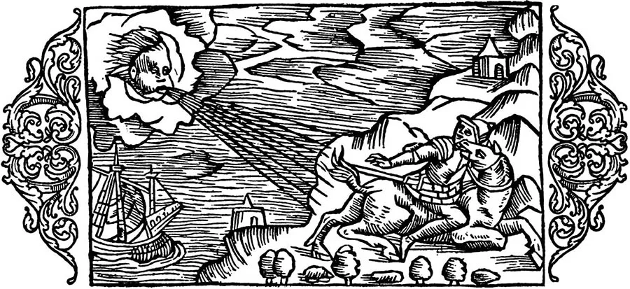
It follows from this passage that Witland is the name of a territory east of the Vistula that belongs to the Aesti but is not part of Estland. Another reading of the text is also possible: Witland is part of Estland but had not previously belonged to it. In either case it is clear that in earlier times the territory of Witland did not belong to the Aesti.
Scholars have suggested a possible link between the terms Witland and Vidivarii, the former being derived from the latter17. If this is accepted, the following picture emerges: the territory east of the Vistula, occupied by the Vidivarii in the 6th century, is called Witland in the 9th century and belongs to the Aesti.
Estland is a land of towns. The society of the Ests is highly stratified, with the following groups: kings, the very rich, the rich, the poor (probably personally free community members) and slaves. This social stratification extends even to the drinks they consume. The reports of enmity among the Ests should probably be understood as constant armed clashes between separate groups of the population. Taken together, all the features described are characteristic of a barbarian society in the period when the primitive communal system was breaking down.
“King Alfred’s Orosius” is the last work produced in Western Europe in which the classical tradition of describing the population of the south-eastern Baltic predominates. After that, the classical tradition would survive until the 14th century only in Scandinavian sources.
Let us dwell on the origin of the term Aestii. The most plausible explanation was offered as early as the last century by the Czech archaeologist P. Šafařík, who regarded the Aestii as Balts and understood the term as a geographical designation used by the Germanic peoples for their eastern neighbours (Aestii meaning “the people who live in the east”)18. Today this view is shared by most researchers19.
As for the question of who the Aestii were in ethnic terms, there are two main points of view. Supporters of the first see the Aestii as Balts, in a wide range of variants — from the Western Balts between the Vistula and the Neman20 to the Balts stretching from the Baltic to the Volga21. The second, less popular today, counts all the peoples of the eastern Baltic among the Aestii22.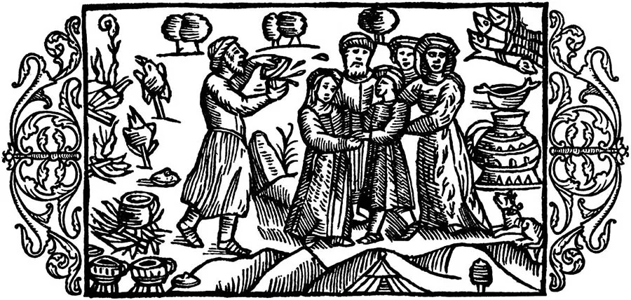
We side with the first view and take the Aestii to be a grouping of Western Balts consisting of four tribes (the Aestii, Galindians, Sudovians and Carbones) and occupying the territory between the Vistula and the Neman. It must be noted, however, that the population of the south-eastern Baltic were not the first Aestii.
Before the beginning of the Common Era, this ethnonym referred to the peoples living between the Oder and the Vistula; it was they who were the eastern neighbours of the Germanic tribes. They worshipped the goddess Zhiva and wore her symbol — the image of a boar — on their chests. As classical authors’ knowledge of Germania and its neighbours grew, the name “Aestii” was transferred to the next peoples to the east, still not entirely known to scholarship, who lived between the Vistula and the Neman. This is why the description of the Aestii given by Cornelius Tacitus combines features of the first and the second Aestii (they live on the eastern shore of the Baltic, yet wear boar images typical of the territory between the Oder and the Vistula). Later, at the end of the 1st millennium, when the population of the south-eastern Baltic had become well known in Europe under the name “Prussians”, the term “Aestii” would be carried further on to less well-known peoples and would settle on the territory of present-day Estonia, whose inhabitants, from the 9th–10th centuries onwards, would become the last Aestii, in the form “Ests”. This happened because no one lived beyond them, since past Estonia lies the Gulf of Finland.
To this day scholarship faces an as yet unresolved problem: who should be understood by the “Ests” of the 9th–13th centuries? The problem arose because Scandinavian sources do not use the new term “Prussians” for the population of the south-eastern Baltic but retain the old one, “Ests”. At the same time, the very same sources use the term “Ests” for the population of present-day Estonia.
The Prussians
Prussian society and culture took shape in the 6th–8th centuries on the basis of the culture of the Aestii, as the “Great Migration of Peoples” was drawing to a close — a migration that had a considerable impact on local society. The “Great Migration of Peoples” refers to the migratory processes that took place across Europe in the 4th–7th centuries. Many peoples were on the move, but the ones that most affected the life of the ancient population of our region were the Goths and the Slavs.
The Goths originally lived in Scandinavia, from where they crossed the Baltic Sea to the land between the Oder and the Vistula (Polish Pomerania). They did not stay there long, however: in the 3rd century AD they moved on and reached the northern Black Sea coast, where they founded their own state. Yet as early as the 4th century, under pressure from the Huns, they were forced to leave this territory too. Some of the Goths stayed where they were (the Ostrogoths), while others (the Visigoths) first moved to the Danube, where they became allies of Rome, and then seized Italy. In the 6th century the Goths were driven out of Italy by Byzantium and withdrew to Spain.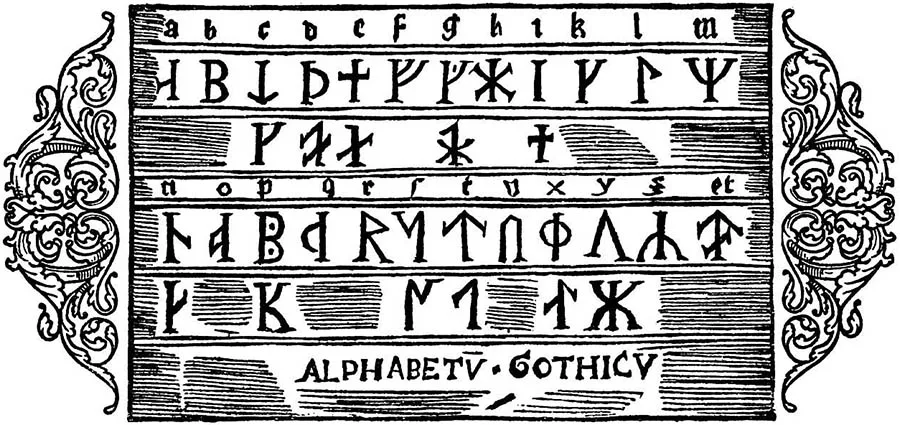
Many peoples took part in the Gothic campaigns, becoming their allies (the Gepids). When the Goths began their migration to the northern Black Sea coast in the 3rd century AD, part of the local population probably set off with them as their allies.
The view now widespread in scholarship is that these were at least some part of the Galindian tribe, who continued their journey across Europe together with the Goths and reached Spain, where the knightly family of the Galindos rose to fame in the time of the Reconquista23.
After the Goths were expelled from Italy by Byzantium, some of their Aestian allies returned home. This is borne out by the appearance of new cultural elements in burial sites west of Masuria, where the Galindians lived: weapons and vessels from the Danube lands and Central Europe and, most importantly, the saddle as part of a horse’s gear. Before the 6th century AD the saddle was unknown in Europe. It was brought from the depths of Asia by the Avars, and it was contact with the Avars that introduced the local population to this novelty. It is quite possible that not only new influences from the south but also the people who carried them came to the land between the Vistula and the Neman. One may suppose that the sudden disappearance of the Avars from the European historical stage was connected with their partial migration to this region. That would easily explain why Wulfstan recorded such vivid traditions of a nomadic society in an area at least two thousand kilometres away from the steppe zone.
After the Goths left Pomerania, part of the Aestian population began to move into the vacated lands, in particular from the Kaliningrad Peninsula, where burial grounds temporarily ceased to be used. Later, elements of the Pregolya group culture are recorded in the area of present-day Elbląg and further west, in Pomerania. But the newcomers from Estland failed to gain a foothold in this territory, because in the 6th century the Slavic tribes began to spread out. The Slavs, recorded at this time in the Danube region, had been defeated by Byzantium. Those of them who remained under Byzantine rule later formed the South Slavic group, while the second group moved north, reached the Vistula and began to settle, among other places, the territory of Pomerania, where the Pomeranians established themselves. This settlement took place amid fierce struggle with the Aestii, who had already occupied the territory. Fortified settlements of this period bear traces of fires. In the end the Aestii lost and were forced to return to their old lands. The burial grounds came back into use, and, according to Wulfstan, the Vistula became the border between the Western Slavs and the Aestii.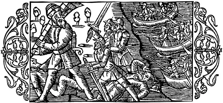
The third group of Slavic tribes, the future Eastern Slavs, moved north-east and reached the Middle Dnieper region, later spreading north as far as Lake Ladoga. This expansion caused a whole series of ethnic conflicts and led to shifts in tribal and ethnic boundaries.
Since the Eastern Baltic tribes, which by this time inhabited the southern part of the forest zone of Eastern Europe, were at the same level of economic development as the Slavic tribes, the arrival of the latter led to competition and struggle. Just as in Pomerania, a whole series of fortified settlements taken by storm and bearing traces of fires is recorded in Eastern Europe in the 6th–7th centuries. The most striking example is the Tushemlya hillfort in Smolensk Oblast. Some of the Balts were probably subjugated and later assimilated. Others were forced to seek new territories to the north-west, which led to a crowding of the tribal groupings living in present-day Lithuania, Latvia and Belarus. The Curonians, for example, who occupied the territory north of the Curonian Lagoon, were literally pressed against the Baltic coast.
In the 7th century, the settlement of the East Slavic tribes who had come from the Danube was followed by the migration of the Radimichs and the Vyatichs, who did not stay on the Vistula but moved east, taking part of the local Baltic population with them along the way. Evidence of this is the appearance on the Protva River of the Golyad tribe, which many researchers associate with the figure of Nightingale the Robber from the Russian byliny.
All these processes led to active economic and cultural interaction between Balts and Slavs. The mutual borrowings of the 6th and subsequent centuries became the basis for the theory that at the beginning of the 2nd millennium BC a single Balto-Slavic community existed in the Eastern Baltic, which later split into Balts and Slavs. These ideas, which became widespread in linguistics, took shape because Russian scholarship of the 1930s–1980s was dominated by the autochthonous theory, according to which the Slavs were the indigenous inhabitants of Eastern Europe rather than its colonizers.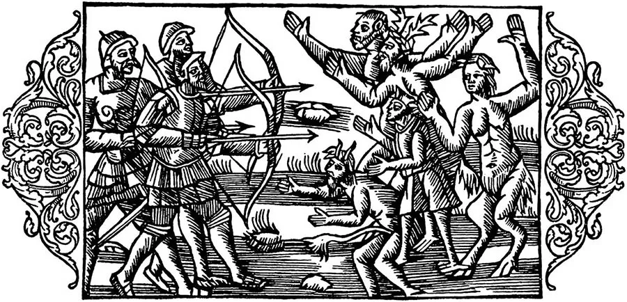
In the second half of the 1st millennium AD, a Christian civilization was taking shape in Europe, founded on young feudal states.
As part of the formation of this new culture, a medieval geographical tradition emerged in which peoples and territories received new names. This process of renaming also affected the south-eastern Baltic. In the 9th century, the term “Aesti” gave way to a new ethnonym — “Prussians”. The term “Prussians” first appears in the work of the anonymous Bavarian Geographer as the name of a people living east of the Vistula24. Later, in the forms “Bruteri”, “Prezun”, “Pruteni”, “Brusi” and “Borussi”, this term would figure in European and Eastern medieval sources, denoting the population living between the Vistula and the Neman. In the 10th century, Prussia as the land of the Prussians begins to appear in documents of the papal curia. Thus, an inventory of ecclesiastical estates of the Roman Catholic Church that were to be Christianized lists the land of “Prussia”, beyond which lies “Russia”25.
The source of this information was most likely Poland, the Prussians’ nearest neighbour, which by then had already adopted Catholicism, had entered the orbit of papal Rome and was striving to subjugate its pagan neighbours.
On the basis of written sources, above all the chronicles of the Order, treaties and charters, it can be said that the foundation of Prussian society was the community. Given the level of the society’s development and the data from neighbouring territories, its form was that of an agricultural (neighbourhood, territorial, proto-peasant) community. It consisted of a rural settlement (village) or several settlements. According to V. T. Pashuto’s calculations, a Prussian community comprised 12 farmsteads, or 12 heads of household26. The community was headed by an elder.
A group of communities formed a district. The administrative centre of a district was probably a fortified settlement (hillfort), which was home to a member of the local nobility who governed the surrounding area, and which served as a refuge for the population in times of danger. It is possible that when the Scandinavian traveller Wulfstan speaks of Prussian kings residing in towns, he has precisely these district rulers in mind.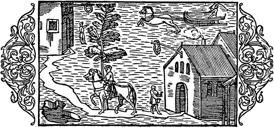
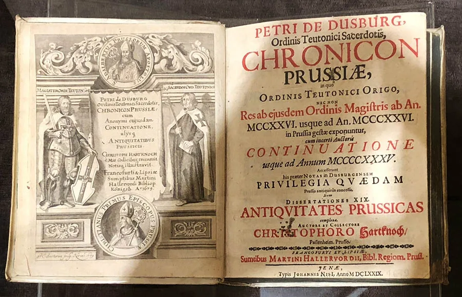
Districts were united into larger territorial units — lands. According to Peter of Dusburg, at the beginning of the 13th century there were 11 such lands in Prussia: Scalovia, Nadrovia, Sambia, Natangia, Warmia, Barta, Pomesania, Pogesania, Galindia, Sudovia and Sassovia (Lubovia).
This view is now generally accepted, although P. I. Kushner held that these names are artificial and were introduced by the knights of the Order. He drew this conclusion from an analysis of the names of the lands: Nadrovia, for example, derives from the Lithuanian word “dravis”, meaning “wild-bee hive”, which characterizes this land as a forest region. The name “Warmia” goes back to “varmus”, meaning “red”, and is explained by the abundance of steep red-clay banks along the Vistula (Kaliningrad) Lagoon. In other words, P. I. Kushner believes that the knights of the Order, while conquering Prussia, divided its territory for ease of administration into districts named after the most notable features of the terrain27. Each Prussian land was governed by a council of nobles, among whom particularly powerful families had emerged by the mid-13th century (the Vida in Warmia, the Sklodo in Sambia, the Monte in Natangia and others). However, the institution of sole hereditary rulers of the lands never developed among the Prussians. V. T. Pashuto’s view, widespread in Russian scholarship, that a confederation of Prussian lands existed in the mid-13th century28 is not supported by any evidence. The only attempt, by Heinrich Monte, to unite the military forces of several Prussian lands during the Second Prussian Uprising ended in failure. The war leaders whom the Order’s chroniclers single out among the nobility did not have time to rise to the leading positions in Prussian society, a consequence of the fragmentation of the lands at the time the crusaders began their conquest.
Nevertheless, from the 10th century onwards there existed a concept defining the political structure of the territory between the Vistula and the Neman as an aggregate of 11 lands — Prussia.
To this day it remains unclear how the tribal and territorial structures related to each other. The land of Sudovia (Yotvingia) corresponds to the territory of the Sudovian tribe of the first half of the 1st millennium, which is explained by the social backwardness of this part of Prussia: it was, so to speak, a remote backwater. Sambia, Natangia and Warmia lie on the lands of the former Aesti tribe, by then the Prussians. As for Pomesania, Pogesania, Sassovia and Nadrovia, they were most likely complex border formations. Nadrovia, for instance, was a buffer zone between the Sudovians and the Prussians proper. A more precise picture of how the political and ethnic boundaries of Prussia related to each other can only be obtained in the future, as archaeological sites, above all settlements, are studied more thoroughly.
By the beginning of the 13th century, agriculture was the leading branch of the Prussian economy. This is because at the turn of the 1st and 2nd millennia the Prussians, like their neighbours in the Baltic region, went through the transition to agriculture of a medieval type. This was reflected in the appearance of a full set of farming implements (iron ploughshare, sickle, short-handled scythe, etc.), a new set of harness, the spread of two- and three-field rotation, and the emergence of winter rye as the main crop. These innovations are linked to the cultural processes that swept the Baltic in the Viking Age. The Prussians sowed oats, barley, wheat and rye, grew flax, and engaged in vegetable gardening and forest beekeeping — especially in the eastern areas, where there were vast forests — as well as fishing and possibly the hunting of seals at sea. The relative importance of agriculture and stock-raising among the Prussians remains unclear to this day. It can be stated that the Prussians bred horses in large numbers, whose meat they ate, as well as cattle and pigs. At the same time, archaeological data show that in the forest areas hunting, above all of elk, played a major role in supplying meat. Hunting for fur-bearing animals, especially pine marten and beaver, was also widespread.
Alongside the development of agriculture and stock-raising at the turn of the 1st and 2nd millennia, crafts developed vigorously: ironworking, bronze casting, pottery, weaving, wood- and boneworking and others. However, crafts never fully separated from agriculture, since by the beginning of the 13th century no centres of trade and craft had yet emerged in the Prussian lands.
Turning to the everyday life of the Prussians, it should be noted that it was precisely at the turn of the 1st and 2nd millennia that timber-frame buildings, rectangular in plan and measuring from 3.5x3 m to 5.6x4.4 m, became widespread in the territory between the Vistula and the Neman. The frame was set on stone footings, which formed a kind of plinth (the base of the building). The walls were clad with poles, which were then daubed with clay. The ceiling of the dwelling was flat and likewise coated with clay. Inside the dwelling was a hearth, round in plan, consisting of a ring or oval of cobblestones up to 1 metre in diameter. Sunken buildings of the same type are also found.
By the time the knights of the Teutonic Order arrived, Prussian society could be described as patriarchal, that is, a society in which men played the leading role.
According to the Treaty of Christburg of 1249 and the testimony of Peter of Dusburg29, a Prussian man held unlimited power over his family. He could sell any family member into slavery or kill them, either himself or with the help of others. Property passed only through the male line. Wives were bought and were therefore entirely under their husbands' authority. A wife did not eat at the same table as her husband and had to wash his feet every day. There were cases in which a father and son pooled their money to buy a wife for the father, and after his death the stepmother became the son's wife. Naturally, local (Prussian) women were expensive, so it was cheaper to buy women captured in raids. This probably explains why the burial grounds of the Sambian Peninsula contain many graves of women from other lands, for example from Gotland.
Prussian society was undergoing an active process of social differentiation. According to Wulfstan, whose account dates from the late 9th century, three social groups can be distinguished in local society: the nobility, the free and the slaves. The nobility comprised the richest, the noblest and the kunings (the term is traditionally translated as “kings”, though in the Russian tradition it is legitimate to use the word “princes”). The Prussian nobility was set apart by the fact that it drank mare's milk, or kumis. The second stratum of society consisted of free commune members, whom Wulfstan describes as the free poor. They drank mead, as did the third stratum, the slaves.
Documents and chronicles of the 13th century show that over four centuries Prussian society had evolved considerably. The homogeneous free population of the 9th century, the commune members, had by the 13th century split into the free and the free dependent, which brings to mind the social development of Kievan Rus' in the 11th century (the free being the smerdy, the free dependent the zakupy and ryadovichi). Changes were also taking place among the nobility, which in the German tradition came to be called the “nobility” (Nobilität). Within it, a class of service nobility, the members of the retinue, was rapidly taking shape.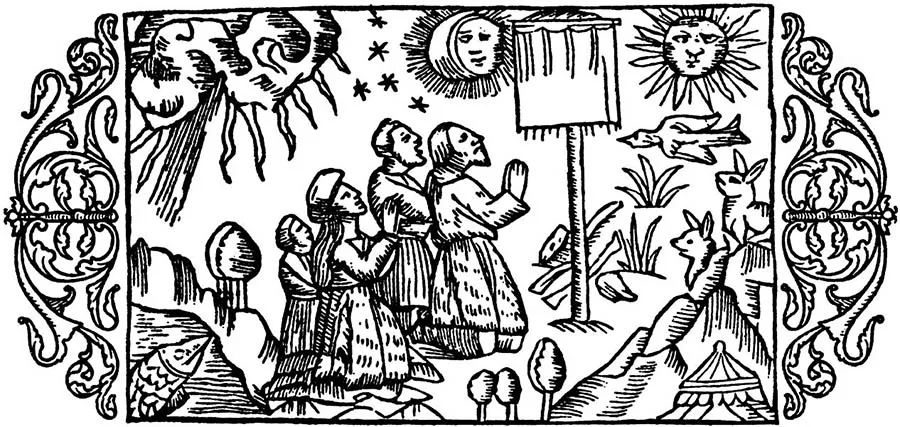
Early written sources (before the mid-14th century) pay comparatively little attention to the beliefs of the Prussians. According to Peter of Dusburg, the Prussians “worshipped all of nature in place of God, namely the sun, the moon and the stars, thunder, birds, and four-footed beasts too, even down to the toad.
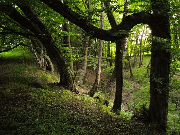
They also had sacred woods, fields and rivers, so that they dared not fell trees, plough or fish in them”30. Sacred groves served as places of worship. Beliefs about the afterlife, bound up with the funeral cult, were highly developed. The dead were cremated in special sanctuaries, and not a single bone was to remain unburnt. “It happened that weapons, horses, menservants and maidservants, clothing, hunting dogs and birds of prey, and other things pertaining to warfare were burnt together with deceased nobles. With commoners, the things that pertained to their occupation were burnt”31.
The most vivid description of the funeral of a deceased Prussian, or Est, is found in Wulfstan's account. “It is a custom among the Ests that when a man dies, he lies in (his) house unburnt with his kinsmen and friends for a month, sometimes two. And the king and other men of high rank lie even longer, according to how wealthy they are; sometimes they remain unburnt for half a year. And they lie above ground in their houses. And all the while the body is in the house, they must drink and hold contests until the day it is burnt. Then, on the day they are to carry him to the pyre, they divide his property, whatever is left after the drinking and the contests, into five or six (parts), sometimes more, according to how much property he has. Then they lay the largest part of it about one mile from the town, then another, then a third, until it has all been laid out within the one mile; and the last part must lie nearest to the town where the dead man is. Then, some five or six miles from the property, all the men who own the swiftest horses in the land must gather. Then they all race towards the property; and the man with the swiftest horse gets the very first and largest part; and so one after another, until they have taken it all; and the smallest part goes to the one who reaches the property (lying) nearest to the town. And then each rides off on his way with the property and may keep all of it; and for that reason swift horses are uncommonly dear there. And when his property has been divided in this way, he is carried out and burnt with his weapons and clothing. And most often they squander all his wealth during the long time the dead man lies in the house, and with what they lay along the road, which strangers race for and take”32.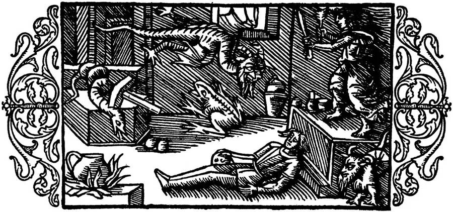
This description of the rite has puzzled many scholars, who believe that Wulfstan conflated several different customs. What raises the greatest doubts is the haphazard squandering of the deceased's movable property.
In our view, Wulfstan did not get anything wrong. At least two explanations of this episode can be proposed. In the period when the paternal clan held sway and the power of men became unlimited, they sought to secure the inheritance of property exclusively for their direct heirs, above all their sons. It is known that a man sometimes demanded the destruction of all his movable property, which was burnt on the funeral pyre or given away if there was no heir. Among the tribes of the south-eastern Baltic, only a man's own son was recognised as his heir. It is therefore possible that in this case Wulfstan witnessed, or described from someone else's account, a rite connected with the death of a nobleman who had left no heir.
A second explanation can be put forward on the basis of the process of differentiation in barbarian society. The emergence of war leaders and their closest circle, the retinue, was a phenomenon common to all territories. It is possible that it is the funeral of such a leader that Wulfstan describes. And since the leader had acquired his property through the activities of the organisation he headed, any of its members could most likely lay claim to some share of it.
The Prussians imagined the afterlife as a mirror image of the world of the living; one entered it with the grave goods and accompanying offerings that had been placed on the funeral pyre. The funeral cult was administered by special priests, the tulissones and ligaschones, who supposedly beheld the passage into the other world, invisible to ordinary mortals. “They are, as it were, clan priests and therefore consider themselves entitled to attend the funerals of the dead, and they deserve the torments of hell for calling evil good and praising the dead for their thefts and robberies, for the filth of their lives and their plundering and the other vices and sins they committed while alive; and so, raising their eyes to heaven, they cry out, falsely claiming that they see the dead man before them flying across the sky on horseback, adorned with gleaming weapons, bearing a falcon in his hand, and travelling with a great retinue to the other world”33. The Prussians attached great importance to honouring the spirits of the dead. On the day of remembrance, in autumn, horse hides were left on the graves so that the spirit of the deceased could make its way to its former home, where food and drink awaited it at the threshold.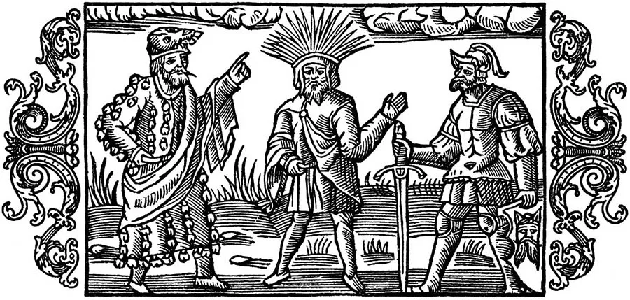
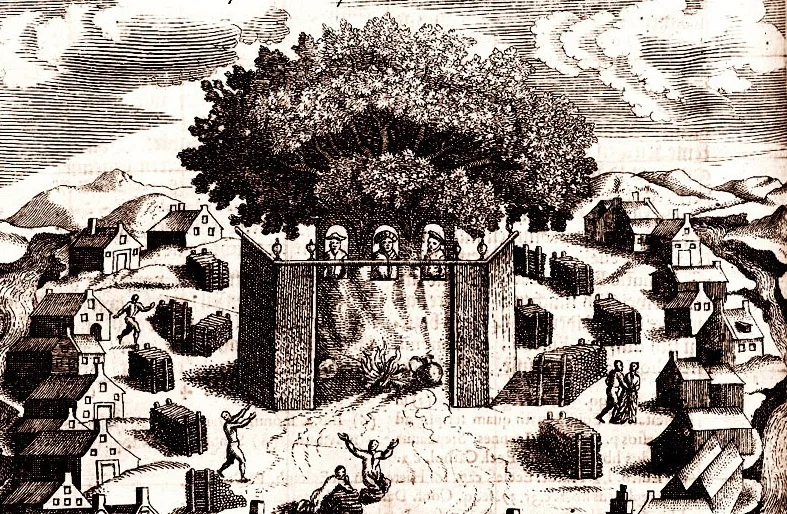
The foremost role among the priests was played by the Krive, whose sanctuary was at Romove, where the sacred oak stood with an eternal fire burning beside it, and whose authority extended to the Lithuanian and Livonian lands as well.
More detailed information on the Prussian pantheon appears in written sources of the 16th and 17th centuries34. First place in the list of Prussian gods belonged to Okopirms, the god of heaven and earth, the ruler of all. He was followed by Swaigstix, the god of light, and Autrimps, the god of the sea. The next tier was occupied by three gods who enjoyed special veneration and whom Simon Grunau places on the Prussian banner: Perkunas, Patols and Potrimps. Perkunas was the god of thunder, lightning and rain, an angry middle-aged man with a curly black beard, crowned with flames. He symbolised the supreme surge of generative forces, courage, success, the sky, thunder and heavenly fire (lightning). Patols, a deathly pale old man with a long grey beard, his head covered with a white cloth, was the god of the underworld and of death. His attributes were the skulls of a man, a horse and a cow. Potrimps, a beardless youth wearing a wreath of ears of grain, was the god of rivers, springs and fertility.
The triad of gods, described both horizontally (Potrimps on the left, Perkunas as the chief god in the centre, Patols on the right) and vertically, corresponds to the spatial model of the world (heaven – earth – underworld) and to the structure of time, since the different members of the triad embody different stages of the life cycle (youth, maturity, old age). The evergreen oak in the sanctuary of Ramove was divided into three parts, each of which had a small niche holding the idols of Perkunas, Patols and Potrimps. A fire burned perpetually before the idol of Perkunas. The cult of each god was probably served by a particular class of priests.
The lowest tier of the pantheon was occupied by spirits and demons. The best known of them is Kurke, a demon of fertility, whose image the Prussians made once a year at harvest time and worshipped.
The evidence of sources from the 14th to the 17th centuries suggests a close kinship between the spiritual cultures of the peoples of the Baltic area, and also points to a rapid transformation of the cult, possibly under the influence of Christianity, brought into this milieu by the knights of the Teutonic Order.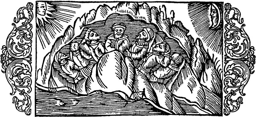
Let us dwell on the problem of interpreting the term “Prussians”.
For a long time, the most widespread explanations of this term were those that had already taken shape in German scholarship35.
The first: the Prussians are the people living along the Russ (as the lower course of the Neman was called until 1945; this tradition survives in the name of one of the Neman’s branches, the Rusnė).
The second: the Prussians are the people living before (in front of) the Rus. This view finds ample support in medieval sources, where the various forms of the names Russia and Prussia are constantly used in pairs: Russia – Borussia, Ruthenia – Pruthenia, Rus – Prus, and so on. The third: the term “Prussian” goes back to the Sanskrit puru-sa-h, meaning “person, man”.
Relatively recently, in 1973, the Polish scholar J. Okulicz proposed a new interpretation of the term36. His view rests on the premise that the meaning of an ethnonym should be sought in the languages of close neighbours, that is, in Old Gothic and Old Slavonic. As it turned out, in Old Gothic the term “prus” means a horse or gelding, and in Old Slavonic a horse or mare. Therefore, in Okulicz’s opinion, the term “Prussian” should be read as “owner of horses”, and its origin attributed to the Prussians’ neighbours.
While accepting the first part of Okulicz’s findings on the Old Gothic and Old Slavonic meanings of the term “Prussians”, the author of this section proposes his own interpretation. The term “Prussians” has been, and still is, used in three different senses: ethnic, political and social. In the ethnic sense, the Prussians of the 9th–13th centuries were the population of Sambia, Natangia and Warmia, that is, the former Aesti. In the political sense, the Prussians were the inhabitants of the country of Prussia. This is an artificial term derived from the term “Prussians”, of the same order as, for example, Livonia in the first quarter of the 13th century. Any inhabitant of Prussia was a Prussian, but at the same time a Sambian, a Natangian, a Warmian and so on. The third layer of meaning of the term “Prussians” lies in the sphere of social relations. According to the written sources, it was the nobility who were most closely bound up with horses. They had the fastest horses in the country, drank mare’s milk (kumis), and were buried together with a horse. In ancient times every drink had its own ritual significance, so people who drank the milk of mares became connected with them. If we accept Okulicz’s semantics of the term “prus”, it follows that whoever drank mare’s milk himself became a horse (a prus), and since this applied only to men, one may even use the term “stallions”. In other words, the term should be understood literally: the Prussians were horse-men.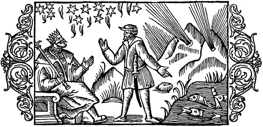
Our interpretation is confirmed by the fact that one of the progenitors of the Romanov family was Andrey Kobyla, whose name, without the translation into Old Slavonic, was in fact Andrey Prus – something borne out by the chronicle’s account of his arrival from Lithuania.
Since a social structure in which horsemen held a privileged position persisted almost unchanged throughout the 9th–13th centuries, that structure must have taken shape no later than the 7th–8th centuries. In other words, “Prussian” in the sense of “rider, horseman” is a social term masking a new, pre-feudal stratum of warriors and retinues. It is a supra-tribal concept, embracing both the Prussians proper in the ethnic sense of the term and the social elite of the Galindians, Sudovians, Curonians and others, that is, the conglomerate of lands we call Ancient Prussia. The term “Prussians” in its social meaning is of the same order as the Old Russian terms “rus” and “rusin”.
Traditionally, both Russian and German scholarship hold that the Prussians were assimilated and dissolved into the German and Lithuanian population. In our view, the disappearance of the Prussians is a political aspect of the cultural policy of Duke Albrecht and his successors. It was not the people, not the ethnic group, that disappeared; what disappeared – or, more precisely, changed – was its name.
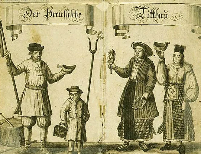
As noted above, the term “Prussia” appeared in the 10th century as a derivative of the term “Prussians”; that is, the name of the country arose from the name of the people. When a new state, the Duchy of Prussia, came into being at the beginning of the 16th century, its subjects naturally had to be called Prussians, regardless of their particular ethnic origin (Germans, Prussians, Poles, Lithuanians and others). At the same time, a difficulty arose in the use of the term “Prussians”, since it became necessary to distinguish between the “Old Prussians”, the inhabitants of the pre-Order period, and the “New Prussians”. This contradiction was resolved by the chronicler Simon Grunau, who in his work, the “Prussian Chronicle”, introduced a new term, “Prussian” or “Lesser Lithuania”37, which covered both the Lithuanians proper who had settled in Prussia and the remnants of the local Old Prussian population. Their cultural affinity later gave rise to a mixed cultural community that gravitated towards Lithuania as the main centre of Baltic culture. That is to say, the Prussians did not vanish in the 17th century; they became Prussian Lithuanians. It is precisely on the basis of this understanding of the ethnic processes that took place in Prussia in the 16th and 17th centuries that one can explain A. Büsching’s view that the Prussians were the descendants of the local population and German colonists38. In this last sense, denoting the population of East Prussia, the term “Prussians” survived until the middle of the 20th century. Many prominent political and cultural figures of East Prussia, especially in the 19th century, proudly called themselves Prussians.
The Prussians and Their Neighbours
Between the 7th and the 13th centuries, the early forms of class society were taking shape not only in Ancient Prussia. All the peoples living along the shores of the Baltic went through similar changes, as early feudal states and nationalities were forming around it. Only in the third quarter of the 11th century did the Baltic Sea receive its present name, first used by the chronicler Adam of Bremen (Mare Balticum). This name survives to this day in a number of languages, including Russian and English. It is believed that the name may go back to the word baltas, “white, bright”, in Lithuanian and other Baltic languages (the Slavic equivalent being “bĕl, white”); in other words, linguistically it is linked to the Balto-Slavic world, and it is in this same linguistic milieu that other names of seas based on colours are found (the White Lake, the Black Sea)39. Another interpretation of the name can be proposed on the basis of the Old Gothic language. Jordanes wrote that the word “balt” meant “bold”.
The Balts were the name of the royal house of the Goths to which Alaric belonged40. Read in this way, the Baltic Sea is the sea of the bold.
The period in the history of the peoples of Europe from 793 to 1066 is commonly called the Viking Age. For a long time this name reflected the notion that it was an era of vigorous conquest in which the leading role was played by the northern peoples (the Danes, Swedes and Norwegians). In Old Rus they were called Varangians, in Europe Normans (Northmen), while they called themselves Vikings. Small bands of warriors aboard warships (drakkars) would suddenly appear off foreign shores and begin plundering the local population. Medieval chronicles and Scandinavian sagas tell of constant Scandinavian raids on the coast of the Eastern Baltic. The most vivid description of a pirate expedition to the land of the Curonians, the northern neighbours of the Prussians, is given in “Egil’s Saga”41.
According to Adam of Bremen, the Prussians were very “humane and selfless people, who always hasten to help those in peril at sea or under attack by pirates”42. It is very hard to believe that the Prussians’ military activity was confined to dry land alone. All the more so since their neighbours the Curonians, who had long suffered Scandinavian raids, had themselves learned the enemy’s lessons well and by the 11th century had become famous as pirates. According to M. Gimbutas, in the mid-11th century the Danes were forced to guard their eastern coast winter and summer against the Curonians and other pirates from the east. Under Kings Sweyn and Magnus a special weekly prayer for protection against the Curonians was even introduced. The Curonians plundered not only Denmark but also Sweden and Norway, carrying off even church bells43.
As already mentioned above, in Scandinavian sources, above all the sagas, it is difficult to tell where Prussia (the old Eastland) is meant and where the territory of present-day Estonia (the new Eastland). For example, the events described in the saga “Of Olaf, Son of Tryggvi” are associated solely with the new Eastland. The gist of the saga is as follows. After the death of his father, a king, Olaf set off with his mother to her brother, who served in the retinue of the Prince of Novgorod. As they were sailing across the Baltic Sea, Estonian pirates attacked them, took them captive and sold them into slavery at a market.
The price paid for Olaf was a black goat. After several years in captivity, an envoy of the Prince of Novgorod came to the settlement where the boy was being held. He turned out to be Olaf’s uncle; he recognised him, ransomed him and his mother from bondage and took them to Novgorod. After serving in the local retinue, Olaf returned to his homeland and became king44.
Two facts are cited in support of the view that Olaf was sold into slavery in Estonia: the mention of the term “Ests” and the appearance of an envoy of the Prince of Novgorod. But the Ests may well have been not the new ones but the old ones, that is, the Prussians. The best-known Prussian market (vik), as already mentioned, lay near present-day Zelenogradsk. If Simon Grunau is to be believed, it was precisely here, in Sambia, that a black goat, regarded as the sacred animal of the god Patols, was often offered in sacrifice. That leaves the question of the Novgorod envoy. An envoy of the Prince of Novgorod could quite easily have visited Prussia. Novgorod had an entire Prussian Street where merchants lived, which means that the existence of active trade links between Sambia and Novgorod in the 10th century can hardly be denied. Princes and their families were always in need of rare goods, which were procured for them by trusted agents (merchants or special envoys). Olaf’s uncle, visiting Prussia, could well have been just such a trusted envoy.
Today the view of the processes of the Viking Age has changed dramatically. Alongside the conquest and colonisation of many territories, it was in this very era that trade links took shape within the Baltic region and that cultural assets were actively exchanged between individual territories and peoples. It is these links that explain the changes in the Prussian economy at the turn of the 1st and 2nd millennia (the appearance of the potter’s wheel, innovations in agriculture and so on). In the 8th and 9th centuries a whole series of trading and craft settlements arose on the shores of the Baltic, which, following Scandinavian tradition, are called viks. As a rule they arose on the fringes of tribal territories, and their populations were multi-ethnic. They include Birka in Sweden, Hedeby in Denmark, Truso at the mouth of the Vistula near present-day Elbląg, Grobiņa near Liepāja, and Staraya Ladoga on the lower Volkhov. A similar settlement also existed on the territory of our region: Kaup (Mokhovoye), located south-west of present-day Zelenogradsk. The emergence of the viks was directly linked to the development of trans-European trade.
It was at the turn of the 8th and 9th centuries that the trade route “from the Varangians to the Khazars” (the Volkhov–Volga route) came into being, linking the Baltic region with the Arab East.
By the early 8th century, as a result of the Islamic conquests, virtually the whole of the Middle East had come within the sphere of Arab trade. Arab merchants reached as far as China in the east, the Indian Ocean in the south, Byzantium and Spain in the west and the Caspian Sea in the north. Nevertheless, the enterprise and energy of the Arab merchant class, embodied in the figure of Sinbad the Sailor, stopped at the shores of the northern Mediterranean. The European market was closed to them. Byzantium and other Mediterranean cities acted as intermediaries in trade with Europe. That is why, towards the end of the 8th century, the Arabs tried to create a roundabout route to Europe via the Caspian and the Volga. At the same time, Scandinavian merchants were opening up the same route from the Baltic to the Volga. The meeting point of their interests became Volga Bulgaria (present-day Nizhny Novgorod). The Arab East offered silk fabrics, spices, wines, various artistic wares of precious metals and, most importantly of all, glass ornaments. The secrets of glassmaking had been lost in Northern and Eastern Europe in the middle of the 1st millennium AD, and so glass beads aroused wild enthusiasm among the barbarian population, above all its female half, just as they did among the American Indians in the time of Columbus. For their part, the traders of the North could offer the goods the East needed: furs, dressed animal hides, slaves (mostly women), amber and so on. With the emergence of this trans-European trade artery, a flood of Arab silver poured into Europe in the form of coins (dirhams and dinars) and bullion. The trade brought mutual benefit to both sides. A marten pelt cost two and a half dirhams (1 dirham = 3 grams of silver), a slave woman 300 dirhams, and a single (glass) bead 1 dirham. For comparison, here are a few prices for animals and craft goods in 10th-century Kievan Rus: a horse cost 50 dirhams, a sheep 5 dirhams, a knife 1 dirham, a sword 42 dirhams. In Europe prices were lower still. In Prague in 965, for example, 1 dirham could buy 25 chickens, or 75 daily rations of wheat for one person, or 100 daily rations of barley for one horse45.
For a handful of cheap beads the Arabs obtained furs, which they then sold at exorbitant prices in the Islamic world, while for the same handful the Scandinavians bartered for a heap of cheap furs. Through these deals, merchants on both sides secured profits of 1,000 per cent and more.
This mutual benefit meant that Scandinavian merchants amassed enormous fortunes in just one or two trading voyages. Their scale can be judged from the words of the Arab traveller Ibn Fadlan, who visited Volga Bulgaria in 922: “As for each of their women, on their necks they wear several rows of necklaces of gold and silver, for if a man owns ten thousand dirhams, he has one necklace (of a single row) made for his wife, and if he owns twenty thousand, he has two necklaces made for her; and so for every ten thousand that he gains, another necklace is added for his wife, so that some of them wear many rows of necklaces around their necks”46. In other words, each necklace a wife wore meant that her husband possessed a fortune of thirty kilograms of silver. Here we have an example of medieval advertising. As we know from the Scandinavian sagas, merchants made as many as two voyages in a single summer and built up great fortunes.
Two problems stood in the way of brisk trade along this route. The first was the security of the trade routes, the second the turnover of goods. The Scandinavians solved the first problem by turning for help to the tribes through whose lands the route passed. They paid a toll (the Varangian tribute)47, and the local tribes guaranteed their safety. This is probably what explains the emergence of two tribal groupings: Slavia around Novgorod and Artania on the upper Volga. Until the mid-9th century this system of cooperation worked perfectly, and both sides profited from it. Then it broke down. The local tribes fell to fighting among themselves over the size of the tribute they received from the Varangians, and in the process killed and robbed the merchants as well. The route ceased to function, and the revenues vanished with it. Naturally, the question arose of how to get it working again. And a way out of the crisis was found. In 862 it was decided to invite the Danish prince Rurik and his retinue to Slavia, so that he could act as a policeman, keeping order and, among other things, preventing new conflicts over the division of the tolls. Since in 9th-century Europe the Danes were called Rus, it was only natural that Rurik came to be known as the Danish prince (khagan of the Rus).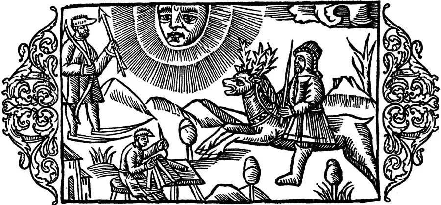
It was from him and his Danish retinue (the Rus) that the union of Slavs around Novgorod, known from Arab sources as “Slavia”, received its new name — “Rus”. This term had the same history as the term “Aestii”. In the 8th–9th centuries the Rus were the Danes, and afterwards the name passed to the population living around Novgorod48.
While the first problem concerned only the Scandinavian merchants and the tribes of Slavia and Artania, the second affected the interests of all the peoples of the Baltic. Selling goods retail, as the peddlers of 19th-century Russia did, was troublesome and dangerous: a merchant could simply be robbed at any moment, and at best retail selling took a great deal of time. So, in order to sell the goods they had brought quickly, merchants had to look for wholesale buyers, as well as wholesale sellers to supply the next voyage. The wish for a good trading partner found expression in special prayers described by Ibn Fadlan: “O my lord… I wish that you would grant me a merchant with many dinars and dirhams, who would buy from me as I wish and would not gainsay me in anything I say”49. But whereas in Volga Bulgaria the counterparties in trade were also merchants, it is unclear who became their partners in the Baltic — who had a sufficient quantity of goods to conclude a wholesale deal. Such partners, buying and selling wholesale, were the warrior retinues, which after their raids would come to certain places (wics) and wait for trading partners. It is precisely this partnership that explains why Scandinavian burial grounds and warrior burial grounds appear simultaneously near trading and craft settlements, and why, in this very period, the entire region around the Baltic Sea saw a sharp rise in the number of warrior bands and an intensification of their raids on their neighbours — developments that cannot be attributed to the particular way local societies were evolving. In the case of the Prussians, the explanation is as follows: the evidence of economic development in Prussian society shows that, had it depended solely on local economic and social conditions, the growth of retinues would have come at least two centuries later, that is, at the turn of the 1st and 2nd millennia, when, as noted above, the economy was restructured and the foundations of the feudal mode of production were laid.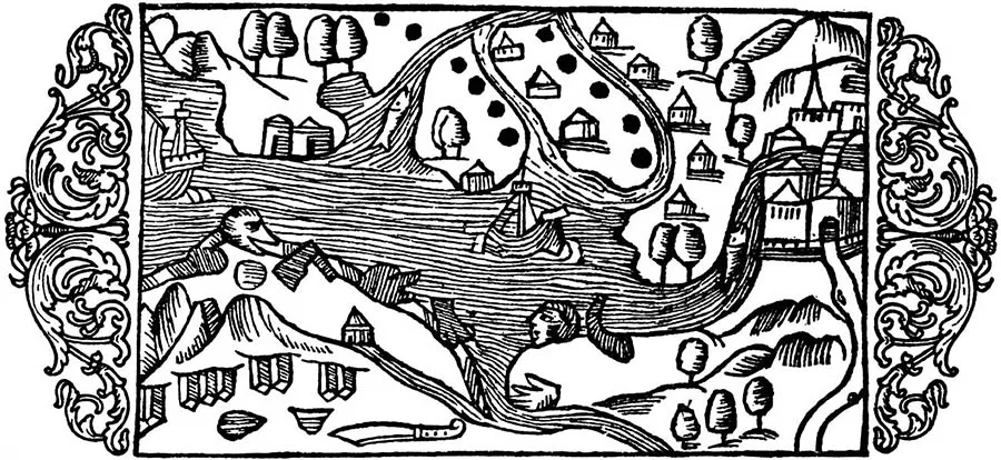
In the second half of the 10th century, trans-European trade underwent dramatic changes. The route “from the Varangians to the Khazars” gave way to the route “from the Varangians to the Greeks”.
This reorientation of trade was linked to the campaigns of Prince Sviatoslav in the second half of the 960s. What is usually regarded as a struggle against an external threat — the destruction of Volga Bulgaria and the Khazar Khaganate — was in fact a struggle against trade rivals. By destroying the Volkhov–Volga route, whose centre (Volga Bulgaria) lay outside the Old Rus state, Sviatoslav channelled European trade onto the Volkhov–Dnieper route, which by then had become the main trade artery of Old Rus. Since from that moment on Byzantium became the chief partner in the trade in Eastern goods, it turns out that the Rus prince's foreign policy returned trade between Europe and the East to the conditions of the 8th century, once again tying it to the Mediterranean. Without going into the reasons behind Sviatoslav's actions, it is worth noting that, since one of the aims of the later Crusades was to secure a supply of cheap Eastern goods to Europe, one cannot help wondering: did the destruction of the Volga route become one of the causes of the Crusades?
It was from the end of the 10th century that the system of trade within the Baltic region took its final shape, the system on which the Hanseatic League would later arise. The trading and craft settlements (wics) began to disappear or to be displaced by medieval towns. The rulers of the young states were unwilling to tolerate the presence of “free towns” within their borders. For example, Truso ceased to exist, and the princely town of Smolensk arose in place of Gnezdovo. Trade routes took shape that would remain in use for centuries to come. The range of exports and imports of each territory became established. Prussia continued to be renowned for its furs, while iron, salt and woollen cloth became its chief imports. Prussian merchants took an active part in Baltic trade. This is confirmed not only by the existence of a Prussian Street in Novgorod, but also by archaeological evidence and written sources. In burials on the Kaliningrad Peninsula, the grave goods that accompanied the dead include scales with weights — an indispensable part of a merchant's equipment.
One such “merchant” burial was discovered in the early 1990s near the village of Povarovka. Adam of Bremen reports that merchants from Prussia came to Hamburg to sell the furs of the black marten, which they exchanged for woollen clothing50.
In the 10th century, statehood was taking shape in the lands neighbouring Old Prussia — Rus and Poland. Young early class states are always characterised by a drive to seize the territories of their pagan neighbours. Poland's attempts to establish feudal and state control over the Prussians began with the penetration of Catholic missionaries into Prussian lands.
The first missionary to set out for the lands along the Vistula, in 997, was Adalbert, Bishop of Prague, a Czech by birth (his Czech name, Vojtěch, is known). The Polish prince provided him and his companions with a ship, on which Adalbert sailed across the Vistula (Kaliningrad) Lagoon to the land of the Prussians (probably the area of the present-day town of Svetly), where he began to preach. In the very first settlement, the local elder asked the preacher to cease his activities and leave the country, since the inhabitants of the territory where strangers came ashore answered with their property and their freedom for letting them into the country. Adalbert and his retinue then sailed around the lagoon for several days until they landed, it is believed, near the present-day town of Primorsk. While his companions rested, the missionary went into a nearby forest, and as he emerged from it, mounted Prussians fell upon him and killed him. What caused his death remains unclear: perhaps he had violated the bounds of a sacred grove, or perhaps there were some personal motives. According to one of the authors of his Life, one of the attackers had a brother who had either been taken captive in Poland or had died there, which is why he was the most zealous and was the first to strike the missionary, twice, with a spear. Adalbert's companions fled, while the Prussians burned his body and later sold the martyr's remains to the Polish prince51.
Adalbert's feat made a deep impression on his contemporaries, and only three years later the first account of the preacher's sojourn and violent death in the land of the Prussians appeared, written by an unknown monk from the town of Meseritz. The author of the second "Life of Saint Adalbert", Bruno (sometimes called Brun), a monk of the monastery of Saint Alexius in Rome, resolved to repeat his missionary feat. He first set off to preach among the Pechenegs. Having failed there, he moved to the court of the Prince of Kiev, but met with no success there either. Bruno then went to Prussia, most likely to the region of Sudovia (Yotvingia), where at first he managed to baptize the local prince and a number of people from his entourage.
But then the prince's brother arrived and killed the new converts for betraying the faith of their ancestors, and Bruno along with them. After the martyrdom of two missionaries in a row, the stream of those eager to bring the Prussian barbarians to Christianity dried up.
Over the following two centuries, Polish princes and kings made repeated attempts to subjugate Prussia. The greatest success in these campaigns was achieved by Bolesław III, who carried off enormous booty in his winter campaign of 1110–111152. The Prussians repaid in kind: their mounted war bands constantly plundered Polish territory along the Vistula. The situation had not changed by the time the knights of the Teutonic Order arrived.
As early as the turn of the 10th and 11th centuries, Old Rus came into conflict with the Yotvingians (Sudovians). Attempts to bring them under control met with fierce resistance, which grew into raids on the lands of Rus. Under Yaroslav the Wise, a number of fortresses were built in the upper reaches of the Neman to hold back the Yotvingian onslaught. Yet, judging by the chronicles, Yotvingian raids continually troubled the western borders of Old Rus.
The vigour with which Prussian war bands raided neighbouring lands, where statehood had already existed for three centuries, naturally comes as a surprise, but the surprise fades once one becomes acquainted with the military potential of the Prussians. According to Peter of Dusburg, Sambia could field four thousand mounted warriors alone, and Sudovia six thousand53.
By the end of the 12th century, the crusades to Palestine had reached an impasse, and instead of campaigns to the Holy Land a new target for Christianization emerged: the eastern Baltic, inhabited by pagans or, as they were called in Europe, the Saracens of the North. The penetration of the eastern shore of the Baltic Sea was begun by Saxon merchants, who appeared at the mouth of the Western Dvina and entered into trade with the local population. They were followed in the late 1180s by the first missionaries, who arrived in Livonia — the name given to the territory along the lower Western Dvina after the Finno-Ugric tribe of the Livs who lived in the area. A bishopric was established in Livonia. The second Bishop of Livonia, Berthold, having appealed to the Pope, organized a crusade in 1198 to hasten the conversion of the pagans to the new faith, but was killed in battle. Greater success was achieved by Bishop Albert of Buxhoeveden, who founded the city of Riga (1201). Wishing to have a permanent standing army at his disposal, Albert, with the Pope's consent, established the Order of the Knights of God, or the Order of the Sword Brothers. The rule of the Templars was adopted as its statute. With the help of the Order, a vast territory covering present-day Estonia and Latvia was conquered within twenty years.
The successes of Christianization in Livonia served as an example, and the conversion of Prussia was carried out according to the Livonian model.
The Cistercian Order, having established itself in Poland, put forward from its ranks Brother Christian, who began missionary work in Prussia in 1209 and, for his success in Pomesania and Pogesania, was appointed Bishop of Prussia in 1216. To speed up the process of Christianization, a crusade was organized in 1222–1223 in which the entire knighthood of Poland took part. The campaign proved unsuccessful, although it was announced that the Chełmno (Kulm) Land, situated on the right bank of the middle Vistula, had come under Polish control. Konrad of Masovia, whose lands suffered particularly from Prussian raids, decided to create a military-monastic organization modelled on the Order of the Sword Brothers, but under secular control. In 1228, the Order of Dobrzyń Brothers was founded, based at the fortress of Dobrzyń; it consisted mainly of German knights, and knights from Livonia were sent to assist it. However, the Order achieved no real success in conquering Prussia and in 1235 was merged into the Teutonic Order. It was the failure of the Livonian model as applied to Prussia that forced the Polish princes to seek a new way of subjugating their pagan neighbours. Since the knights of the Teutonic Order had the greatest experience in fighting mounted barbarians (the Pechenegs and the Cumans), it was they whom Konrad of Masovia invited to conquer Prussia.
1 Древние германцы. Сб. документов. М.. 1937. С. 54.
2 Kolendo J. A la recherche de l’ambre beltique. L’expedition d’un chevalier roman sous Neron. Warszawa. 1981.
5 Хенниг P. Неведомые земли. T. 1. M., 1961. С. 372–373.
4 Боднарский М. С. Античная география. Книга для чтения. М„ 1953. С. 225.
5 Древние германцы. С. 254.
6 Неверов О. Я. Нерон-Юпитер и Нерон-Гелиос // Художественные изделия античных мастеров. Л., 1982. С. 107.
7 Боднарский М. С. Указ. соч. С. 107.
8 Хенниг Р. Указ. соч. Т. 1. С. 373; Kolendo J. Ibid. S. 59.
’Тацит Корнелий. О происхождении германцев и местоположении Германии. Гл. 45 // Сочинения Т. 1. М., 1969. С. 162.
10 Боднарский М. С. Указ. соч. С. 319.
11 Боднарский М. С. Указ. соч. С. 285.
12 Там же. С. 321.
13 Матузова В. И. Английские средневековые источники IX–XIII вв. М., 1979. С. 23.
14 Хенниг Р. Указ. соч. Т. 2. С. 60—61.
15 Иордан. О происхождении и деяниях готов. М., 1960. С. 72.
16 Матузова В. И. Указ. соч. С. 26.
17 Gaerte W. Urgeschichte Ostpreussens. Königsberg, 1929. S. 308.
18 Шафарик П. Славянские древности. Т. 1. Кн. 2. М., 1848. С. 181–184.
19 Кушнер П. И. Указ. соч. С. 149; Гуревич Ф. Д. Из истории юго-восточной Прибалтики в I тысячелетии н. э. (по материалам Калининградской области) // Древности северо-западных областей РСФСР в I тысячелетии н. э. М. — Л., 1960. С. 410; Седов В. В. Этногеография Восточной Европы I тысячелетия н. э. по данным археологии и Иордана // Восточная Европа в древности и средневековье. М.. 1978. С. 13.
20 Гуревич Ф. Д. Указ. соч. С. 410.
21 Седов В. В. Указ. соч. С. 13–15.
22 Боднарский М. С. Указ. соч. С. 367. Карта 2.
23 Топоров В. Н. Галинды в Западной Европе // Балто-славянские исследования 1982 года. М., 1983. С. 12–140; Gaerte W. Urgeschichte Ostpreussens. Königsberg, 1929.
24 Древняя Русь в свете зарубежных исследований. М.. 1999. С. 292–293.
25 Кушнер П. И. Указ. соч. С. 152.
26 Пашуто В. Т. Образование Литовского государства. М.. 1959. С. 333.
27 Кушнер П. И. Указ. соч. С. 156.
28 Пашуто В. Т. Указ. соч. С. 335–337.
29 Пашуто В. Т. Указ. соч. С. 501–503; Петр из Дусбурга. Хроника земли Прусской. Ч. 111. Ст. 5. М., 1997. С. 51-52.'
30 Петр из Дусбурга. Указ. соч. Ч. III. Ст. 5.
31 Там же.
32 Матузова В. И. Указ. соч. С. 26.
33 Пашуто В. Т. Указ. соч. С. 501.
34 Топоров В. Н. // Мифологический словарь. М., 1990.
35 Матузова В. И. Примечание 1 к ст. 3 ч. III. // Петр из Дусбурга. Указ. соч. С. 270–271.
36 Okulicz J. Pradzieje ziem pruskich od poznego paleolitu do VII w. n. e. Wroclaw, 1973. S. 4.
37 Simon Grunau. Preussische Chronik. Leipzig, 1875. Bd. 1. S. 93.
38 Бишинг А. Ф. Королевство Прусское из новой географии. СПб., 1774. С. 13.
39 Херрман Й. Славяне и норманны в ранней истории Балтийского региона // Славяне и скандинавы М 1986. С. 10.
40 Иордан. Указ. соч. С. 95.
41 Сага об Эгиде // Исландские саги. М., 1956. С. 141–145.
42 Gimbutas М. The Baris. London, 1963. S. 155.
43 Хрестоматия по истории средних веков. Т. 1. М., 1949. С. 42.
44 Снорри Стурлусон. Круг земной. М.. 1980. С. 99–105.
45 Херрман Й. Указ. соч. С. 80—82.
46 Путешествие Ибн Фадлана на Волгу. М.—Л., 1939. С. 78–79.
47 The author of “The Tale of Bygone Years” subsequently confused the situation and transferred the system of collecting the Khazar tribute to the Varangian tribute as well.
48 For more on the “Rus’” problem, see: Петрухин В. Я. Начало этнокультурной истории Руси IX–XI веков. М., 1995.
49 Путешествие Ибн Фадлана на Волгу. С. 79.
50 Gimbutas М. Ibid. S. 168.
51 Хенниг Р. Указ. соч. Т. 2. С. 218–232.
32 Галл Аноним. Хроника и деяния князей или правителей польских. М., 1961. С. 132.
53 Петр из Дусбурга. Указ. соч. С. 50.
The design features illustrations from Olaus Magnus’s book “History of the Northern Peoples” (1555).
Translated from Russian with the help of AI (Claude, Anthropic), October 2026.