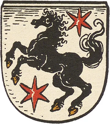
 Coat of arms
of Nordenburg
The castle on a hill on the right bank of the Aschwöne River (from 1938 Swine) was founded in 1305, as a document of 1366 states. The river was dammed, so that the hill was completely surrounded by water. In 1368 Kuno von Hattenstein is mentioned as Pfleger of the castle. In 1372 the Marshal of the Order, Rüdiger von Elner, settled ten free Prussians in the first small settlement by the castle walls, allotting them 30 Hufen (about 5 km2) of land. The Order's timber-and-earth castle was burned down during one of the Lithuanian raids (in 1376 or 1403; opinions differ on this). Unlike the neighbouring castle of Gerdauen (Zheleznodorozhny), Nordenburg was not rebuilt in stone.
In 1405, on the instructions of Grand Master Ulrich von Jungingen, another settlement was founded by the already ruined castle, and on 24.07.1407 it received Kulm town rights.
The first burgomaster was Nitsche Döring. The town received its own fortifications in the form of a town wall. The lands allotted to the town amounted to 130 Hufen (about 21.8 sq km). The town belonged to the Pflegeramt of Gerdauen (Zheleznodorozhny), to which taxes and dues were paid. At the same time, in 1407, a Dominican monastery was founded in Nordenburg, and in 1409 a church was built. In 1429 the monastery was moved from Nordenburg to Gerdauen (Zheleznodorozhny). In 1445 the Nordenburg municipality returned 60 Hufen of land (about 10 km2) to the Order, on which the settlement of Truntlack (Shevtsovo) was founded for free Prussians.
During the Thirteen Years' War (1454–66) the townspeople sided with the Prussian Confederation, for which the Order stripped Nordenburg of its town privileges.
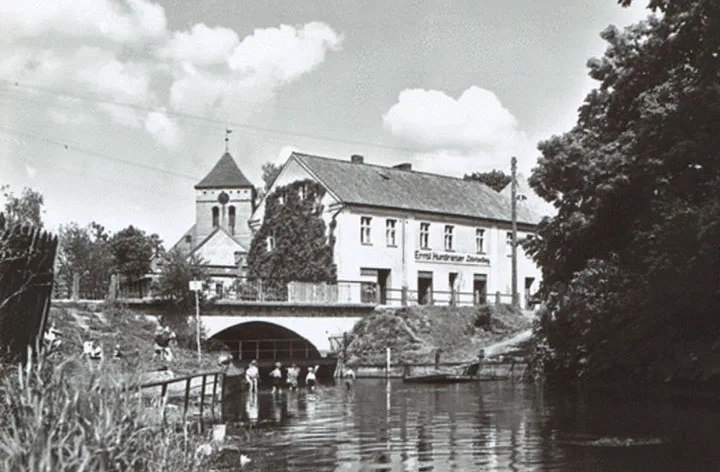
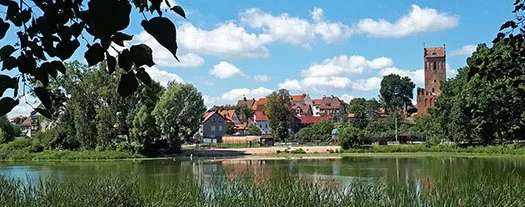
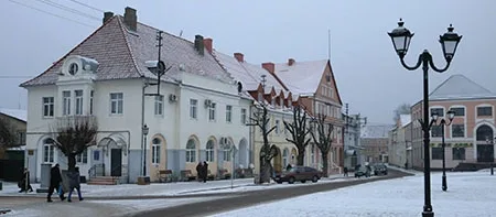
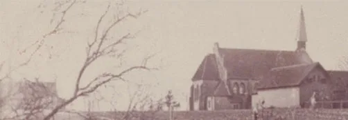
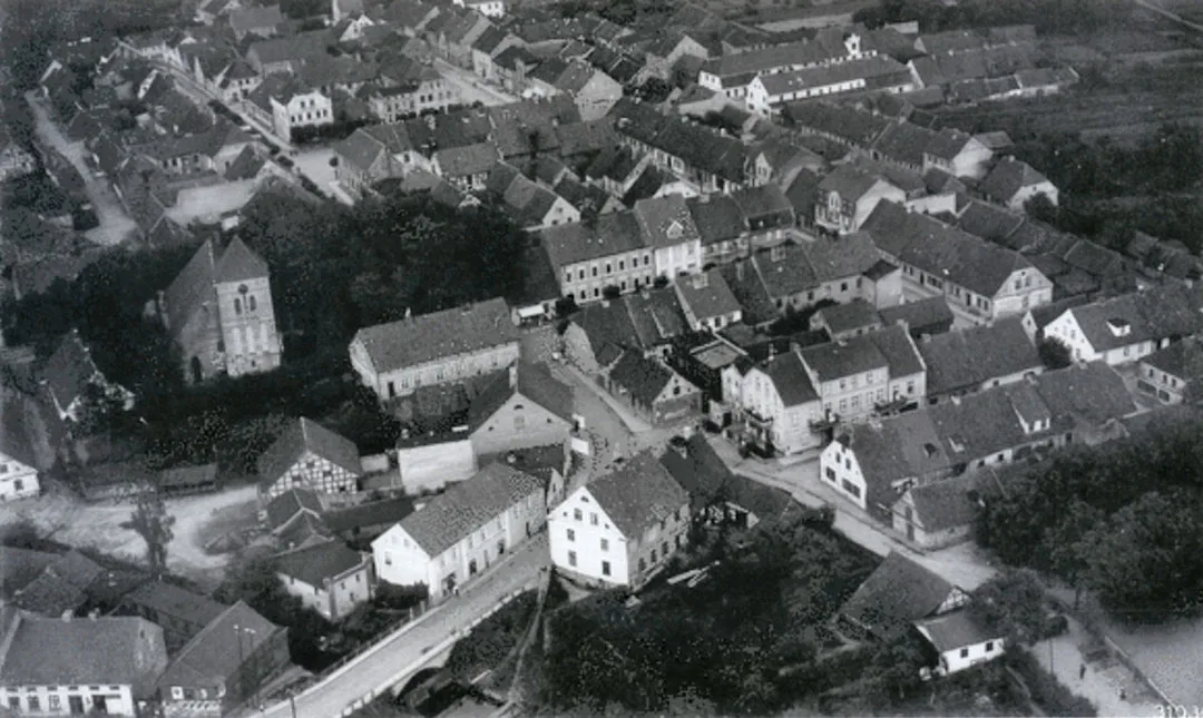
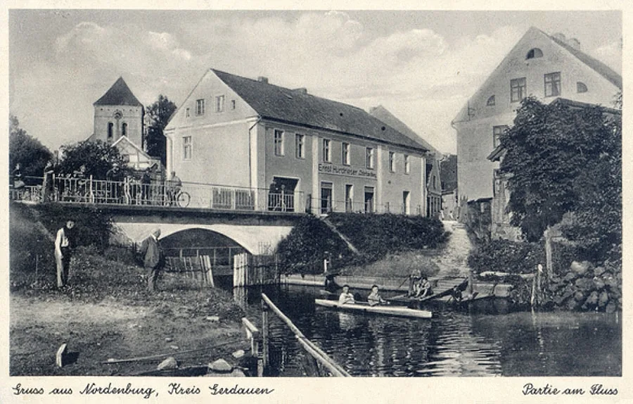
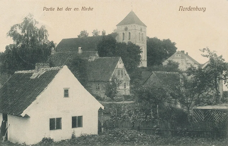 Townscapes with the local church.
On 08.05.1469 the town was handed over as property to the Saxon mercenary captain Georg von Schlieben and his brother Christoph in payment for military services. A school was opened in Nordenburg even before the secularisation of the Order. In 1523 a great fire broke out in the town.
Another fire broke out in 1564. In 1611 Katharina von Schlieben built a hospital in Nordenburg, which operated until 1945. In 1692 the medieval town walls were pulled down as no longer needed.
In 1700 Nordenburg ceased to be the property of the von Schlieben family and regained its town rights.
In 1705 the church in the town burned down, which made it unfit for services, and the plague epidemic that raged in 1709–11 prevented its swift restoration. More than half of the townspeople died of the plague. The church was restored only in 1726. In 1737 there was another plague epidemic, on a much smaller scale. It killed 86 people.
On 13–14.06.1820 another major fire broke out in Nordenburg, engulfing 60 houses. In 1831 Nordenburg suffered an outbreak of cholera, which claimed 54 victims. The same disease took another 200 lives in 1852 and another 150 in 1857–58. In 1856, because the church walls were subsiding, it had to be rebuilt and reinforced.
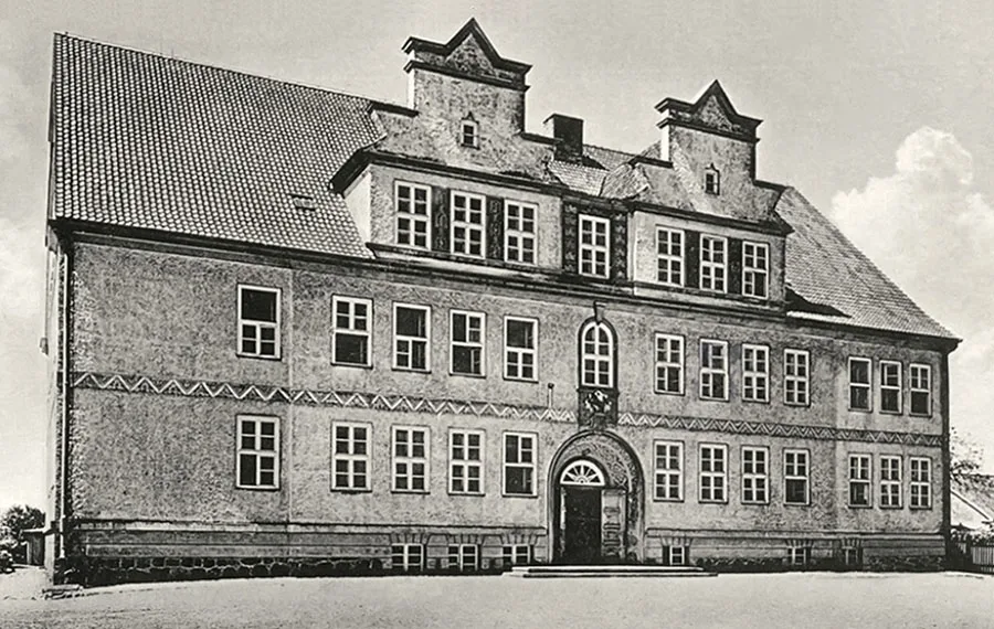 The school in Nordenburg.
In 1871 the Nordenburg municipality included, besides the town itself, eight more surrounding villages and Vorwerks. Together they had 206 dwelling houses.
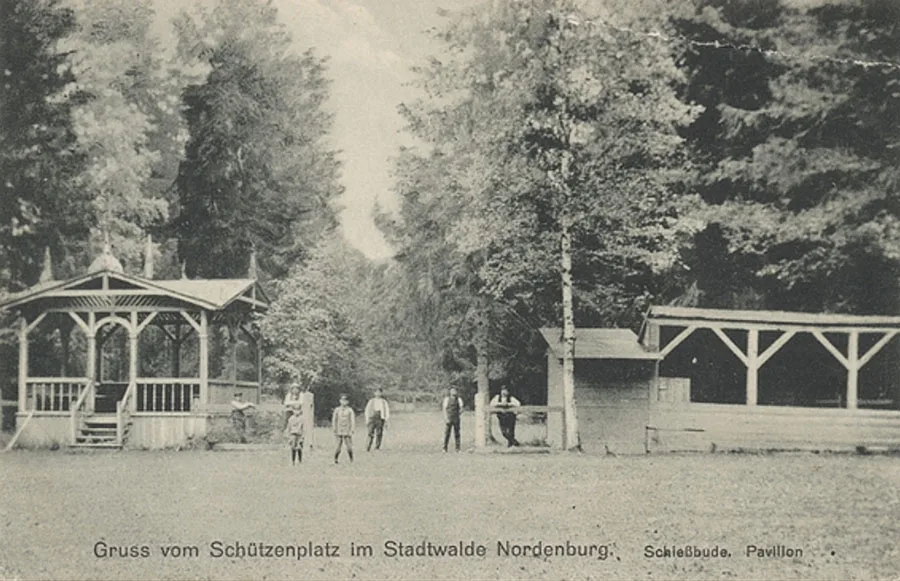 The shooting range in the town forest.
From 1876 a town newspaper, the "Nordenburger Zeitung", began to be published in Nordenburg. Soon, however, it became a copy of the district newspaper, the "Gerdauener Zeitung".
In 1885 it was recorded that 70 Jews lived in the town, who had a synagogue and their own cemetery. In 1898 the Gerdauen–Angerburg railway line (Zheleznodorozhny – Węgorzewo, Poland) was opened. The line ran through Nordenburg, where a station was opened on it. In 1899 a new synagogue building was built.
On 25.08.1914, during the East Prussian operation of the Russian army, Nordenburg was taken by units of the 4th Army Corps (General Sultan Girey Aliyev) of the Russian 1st Army. But as early as the beginning of September the Russian troops were forced to leave the town. On 10–13 September 1914 the commander of the German 8th Army, Paul von Hindenburg, was quartered in the Nordenburg post office building.
In 1920 a narrow-gauge (750 mm) railway to Insterburg (Chernyakhovsk) was opened, part of the Insterburg narrow-gauge network (Insterburger Kleinbahnen).
In 1931 Nordenburg had about 300 dwelling houses and 670 outbuildings. In the pre-war period the town had a brickworks, a dairy, a mill and a power station. The people of Nordenburg were mainly engaged in processing agricultural produce, and peasants from the surrounding villages traded at the local market. As for administrative institutions, the town had a magistrate, an administrative court and a post office. Children were taught at the elementary school and the secondary school. There was a sports ground for sport. Places of worship were represented by a Protestant church, a Baptist chapel and a synagogue. On 09.11.1938, on the so-called "Kristallnacht", the synagogue in Nordenburg was destroyed by the Nazis and the residents who supported them.
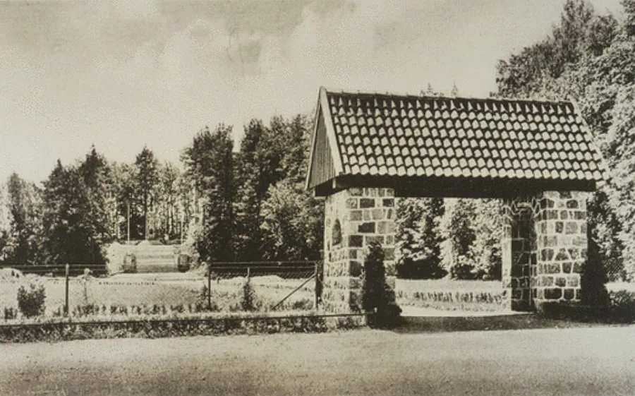 The entrance to the Nordenburg Thingplatz.
At the end of the 1930s a Thingplatz — an open-air amphitheatre for mass events — was built on the Stadinberg.
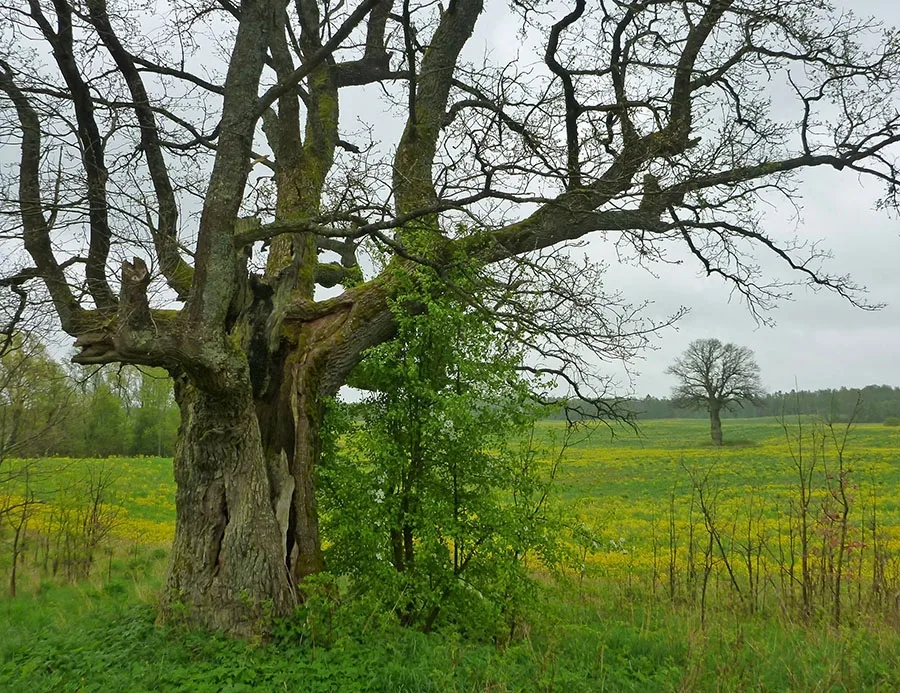 One of the most beautiful roadside landscapes in Prussia, with ancient oaks, on the approach to Krylovo.
On 26.01.1945 Nordenburg was taken by soldiers of the 2nd Guards Rifle Division (Major General N.S. Samokhvalov), the 3rd Guards Rifle Division (Colonel G.F Polishchuk), the 1390th Self-Propelled Artillery Regiment and the 150th Anti-Tank Artillery Brigade of the 11th Guards Rifle Corps of the 2nd Guards Army. The town suffered only minor damage in the fighting.
In 1945 Nordenburg was handed over to the Polish administration and given the name Nordembork. At the end of 1945, when the border between the USSR and Poland was being finalised, the town came under Soviet jurisdiction. For a while it again bore the name Nordenburg. At the end of 1946 the Red Army collective farm was organised in Nordenburg and two nearby villages. The main problem in organising peaceful life was an acute shortage of labour, since the settlement's population had fallen more than 20-fold compared with before the war. That is precisely why there was no question of Nordenburg keeping its town status. On 17.06.1947 the settlement of Nordenburg was included in the newly formed Pravdinsk District, but as early as 25.07.1947 it was transferred to the newly formed Zheleznodorozhny District.
On 05.07.1950 Nordenburg was renamed Krylovo. Karlsburg and Korellen were not officially renamed and became part of Krylovo de facto. The settlement became the centre of the V.M. Molotov collective farm (from 1957 the "Na Strazhe" ("On Guard") collective farm).
In 1962, with the abolition of the Zheleznodorozhny District, Nordenburg again came under the Pravdinsk District. By 1966 the historic centre had already been destroyed and overgrown with trees. The settlement developed mainly in the western part of the former Nordenburg. The former Karlsburg was already in ruins by 1966, whereas at the Korellen estate, on the contrary, buildings still survived.
The development of the settlement was seriously hampered by its border location, as a result of which the railways ceased to be needed and its role as a railway junction was completely lost. The railways in Krylovo are shown on 1955 maps as operational, but by 1985 all the lines had been completely dismantled.
As of 2011 the settlement had a secondary school, a children's boarding home, a kindergarten, a House of Culture, a feldsher-midwife station and a private local history museum.
Sights: the church (1726–1856), the district court building (19th century), the town hall (late 19th century), the ruined water tower (1898), the Baptist chapel (House of Culture), the burial of 13 Russian and 28 German soldiers (1914), the mass grave of Soviet soldiers (250 people, memorial 1955)
For reference
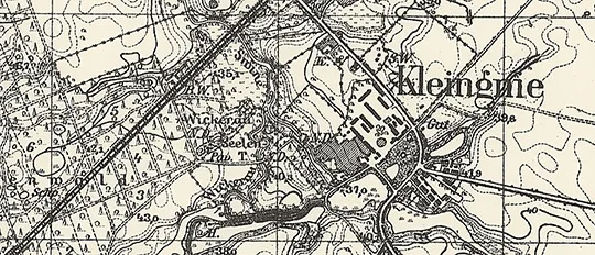
According to the 1931 municipal directory, the Nordenburg municipality comprised the following towns, estates, villages and town districts: Ahrau (Orłowo, Poland), Nordenburg station / Bahnhof Nordenburg (Krylovo, 37 Stroitelnaya St.), Bergenthal (Zielony Ostrów, Poland), Nordenburg forestry / Forsthaus Nordenburg (Zavidovo forestry), Friedrichsflur (Aralovo), Karlsburg (Krylovo, part), Kurkowken (from 1938 Kurkau, 54°20'57'' N 21°37'20'' E), Nordenburg (Krylovo), Nordenthal (Nekrasovka), Ottoshof (Mrowiny, Poland), Plikow (from 1938 Plickau, Shevtsovo), Raude (54°19'35'' N 21°36'03'' E), Sandelsruh (from 1938 Nordenhof, 54°20'02'' N 21°34'58'' E),Treuhof (54°20'33'' N 21°34'39'' E), Werder (Czarny Ostrów, Poland). Other directories also listed the following settlements and districts: slaughterhouse / Schlachthaus (54°19'59'' N 21°33'56'' E), Waldhaus (Shevtsovo, part), Windmühlen (Severny), brickworks / Ziegelei (54°19'52'' N 21°34'29'' E).
Karlsburg was founded on 06.03.1854 as an estate. Until 1912 the name was spelled Carlsburg. The estate was part of the rural community of Nordenburg (Krylovo) and belonged to the Nordenburg church parish.
Korellen was a Vorwerk in the rural community of Birkenfeld (Brzeźnica, Poland) and belonged to the Nordenburg (Krylovo) church parish. Until 1871 the name was spelled Corellen.
Population of Nordenburg – Krylovo: 1740 – 852, 1782 – 1300, 1820 – 1493, 1867 – 2764, 1871 – 2714, 1875 – 2547, 1880 – 2515, 1885 – 2451, 1905 – 2291, 1910 – 2149, 1925 – 2743, 1933 – 3100, 1939 – 3173, 1947 (Jan.) – 137, 1947 (Oct.) – 36, 2002 – 756, 2010 – 785, 2011 – 831 inhabitants.
Population of Karlsburg: 1905 – 100 inhabitants.
Population of Korellen: 1905 – 94 inhabitants.
Composition of the population of Nordenburg in 1871: Protestants – 2932, Catholics – 27, Jews – 50, children under 10 – 706, literate – 1865 (85%), blind – 2, deaf-mute – 1, insane – 1.
Population of the localities and suburbs belonging to the Nordenburg municipality:
Ahrau: 1885 – 56, 1905 – 44 inhabitants.
Bergenthal: 1905 – 33 inhabitants.
Waldhaus: 1905 – 2 inhabitants.
Werder: 1905 – 30, 1910 – 31 inhabitants.
Windmühlen: 1905 – 15 inhabitants.
Sandelsruh: 1905 – 65 inhabitants.
Brickworks: 1905 – 3 inhabitants.
Nordenburg forestry: 1905 – 3 inhabitants.
Ottoshof: 1905 – 24 inhabitants.
Raude: 1905 – 51 inhabitants
Slaughterhouse: 1905 – 5 inhabitants.
Treuhof: 1905 – 25 inhabitants.
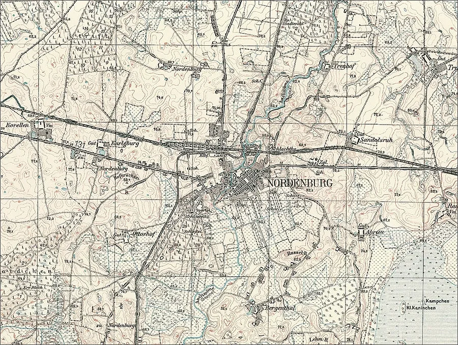
The church parish of Nordenburg: Abelischken (from 1938 Ilmenhorst, Belkino), Adolfshof (Goszczewo, Poland), Adolfschlieben (54°22'25'' N 21°34'45'' E), Adolfswalde (Danilovo), Ahrau (Orłowo, Poland), Bajohrental (from 1938 Blankenwalde, Bajorski, Poland), Bajohrenwalde (from 1938 Blankenwalde, Bajory Gaj, Poland), Bergenthal (Zielony Ostrów, Poland), Birkenfeld (Brzeźnica, Poland), Birkenkrug (54°20'05'' N 21°27'23'' E), Blendowen (from 1938 Blendau, Bareyevka), Brägsigwalde (54°20'07'' N 21°42'10'' E), Ellernbruch (Vatutino), Friedenshof (Wyskok, Poland), Friedrichsflur (Aralovo), Gendrinn (from 1938 Gendern, Vskhody), Groß Bajohren (from 1938 Großblankenfelde, Bajory Wielkie, Poland), Groß Pentlack (from 1938 Pentlack, Kamenka), Grünhagen (Grebnoye), Hochlindenberg (Podlipovo), Karlsburg (Krylovo, part), Klarahof (Przybki, Poland), Klein Bajohren (from 1938 Kleinblankenfelde, Bajory Małe, Poland), Klein Pentlack (Sergeyevka), Korellen (Krylovo, part), Kurkowken (from 1938 Kurkau, 54°20'57'' N 21°37'20'' E), Langenfeld (54°19'17'' N 21°27'49'' E), Langental (54°18'50'' N 21°26'55'' E), Liskendorf (Liskino), Mally Park (from 1938 Schönheim, from 1939 Burgsdorff, Pavlinovo), Mazurhöfchen (Mazurkowo, Poland), Neu Bajohren (from 1938 Neublankenfelde, Bajory Gaj, Poland), Nordenburg (Krylovo), Nordenthal (Nekrasovka), Oschkin (from 1938 Oschern, Korolenkovo), Ottoshof (Mrowiny, Poland), Plaitil (from 1938 Plattau, Tarasovo), Plikow (from 1938 Plickau, Shevtsovo), Raude (54°19'37'' N 21°36'04'' E), Raudischken (from 1938 Raudingen, Rudziszki, Poland), Reuschenfeld (Ruskie Pole, Poland), Sandelsruh (from 1938 Nordenhof, 54°20'02'' N 21°34'58'' E), Sawadden (from 1938 Bruchort, Zavidovo), Sechserben (Kałki, Poland), Sophienwalde (from 1910 Katzborn, Makeyevka), Sutzken (from 1938 Sutzen, Suczki, Poland), Treuhof (54°20'33'' N 21°34'39'' E), Trotczin (from 1938 Trotzenau, Ostrovki), Truntlack (Shevtsovo, part), Waldau (Przylasek, Poland), Waldhof (Pasternak, Poland), Werder (Czarny Ostrów, Poland), Wilhelmssorge (Garshino).
Photos on this page: Bildarchiv Ostpreußen, bildarchiv-ostpreussen.de, Mikhail Ogorodnikov.
Translated from Russian with the help of AI (Claude, Anthropic), October 2026.