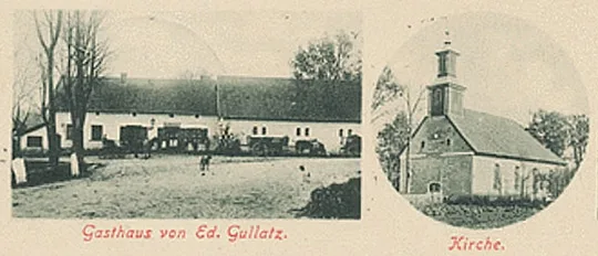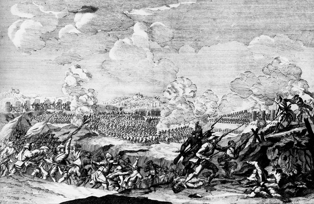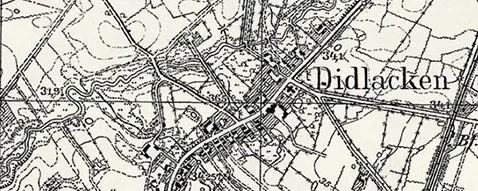
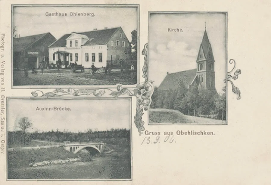
Obehlischken has been known since 1539 as the village of Abelischken, with eleven peasant households. In 1551 it was a village under Kulm law with a free population (Köllmischdorf); the village had an inn, its land allotments amounted to 4 Hufen 11 Morgen, and the Amt's headman lived in the village. In 1656 Abelischken suffered from the Tatar invasion during the Swedish–Polish War. In 1731 Obehlischken became a royal domain. In 1763 the village was renamed Obehlischken. In 1768 the village had 16 peasants, each with a land allotment of 1 Morgen (17 ha).
In 1785 Obehlischken was a village on royal land with 29 households.
The village was the centre of an Amt in the Insterburg (Chernyakhovsk) district; the village belonged to the parish of Norkitten (Mezhdurechye). Obehlischken had a two-class school.
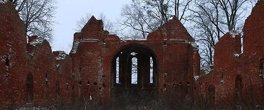
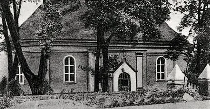
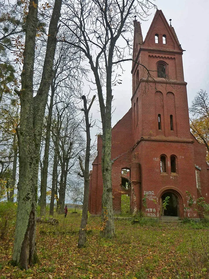
In the 19th century Obehlischken was a village forming a rural community in the Landkreis Insterburg (Chernyakhovsk). Until 1845 the village continued to belong to the parish of Norkitten (Mezhdurechye). In 1845 a church was founded in Obehlischken, which became the parish church for the surrounding villages and estates. By 1889 the church building with its tower had been completed, and in 1904 an organ was installed in it.
On 11 March 1874 the Obehlischken community was included in the newly established Amtsbezirk Obehlischken. Despite its name, the head of this Amtsbezirk never lived in Obehlischken.
As of 1927 Obehlischken had a restaurant, a grocery shop, a household goods shop, an ironmonger's and a savings bank.
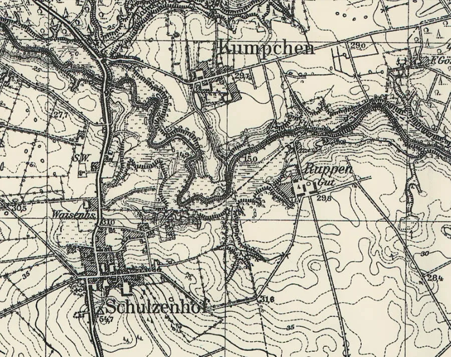
On 30 September 1929 the forester's lodge Försterei Saubucht, with a population of five (1905), was added to the Obehlischken community. In 1938 Obehlischken was renamed Schulzenhof. In the pre-war years the village had a sawmill, and an orphanage stood in its northern part.
On 17 November 1947 Romanuppen was renamed the settlement of Savino. On 5 July 1950 Obehlischken was renamed the settlement of Zelentsovo, and Kumpchen the settlement of Maloye Zelentsovo. In 1972 the settlement of Zelentsovo had 29 houses. By that time the settlements of Savino and Maloye Zelentsovo had been incorporated into Zelentsovo. On the territory of former Maloye Zelentsovo there were five houses and a poultry farm. From the late 1990s there were no longer any buildings on the territory of Savino and Maloye Zelentsovo. In 1997 Zelentsovo had 39 registered houses. As of 2018 the settlement had 27 houses.
Coordinates of the settlement: 54°35'11'' N 21°36'20'' E (Obehlischken), 54°35'39'' N 21°36'53'' E (Kumpchen), 54°35'20'' N 21°37'23'' E (Romanuppen).
Sights: the church (1889), the bridge over the Golubaya River, the base of a monument to those who fell in the First World War.
Population change of Obehlischken (Zelentsovo): 1871 – 397, 1905 – 358, 1910 – 332, 1933 – 481, 1939 – 435, 1985 – 160, 1997 – 103, 2002 – 98, 2010 – 102 inhabitants.
Population change of Kumpchen: 1905 – 62, 1910 – 58, 1933 – 68, 1939 – 58 inhabitants.
Population change of Romanuppen: 1905 – 34, 1910 – 48 inhabitants.
Population structure of Obehlischken in 1871: Protestants – 395, Catholics – 2, born in the village – 200, under 10 years old – 102, literate – 225, illiterate – 70, blind – 1.
Population structure of Obehlischken in 1905: Protestants – 352, other Christians – 6; native language German – 357, Lithuanian – 1.
Population of the Saubucht forester's lodge: 1905 – 5 inhabitants.
For reference
Amtsbezirk Obehlischken
On 11 March 1874 Amtsbezirk No. 9 Obehlischken was established in the Landkreis Insterburg (Chernyakhovsk), comprising 10 rural communities: Ackmenischken (from 1938 Sittenfelde, Udarnoye), Eszeratschen (from 1938 Eschenhang, Lozovoye), Groß Auxkallen (from 1913 Friedensfelde, Pastukhovo), Groß Wittgirren (from 1928 Mittenwalde, Rodnikovo), Klein Auxkallen (from 1913 Friedensfelde, 54°35'57'' N 21°39'26'' E), Kumpchen (Maloye Zelentsovo), Lenkeningken (54°34'50'' N 21°38'09'' E), Obehlischken (from 1938 Schulzenhof, Zelentsovo), Schernupchen (from 1938 Kirschland, 54°35'44'' N 21°35'11'' E) and Skungirren (from 1938 Scheunenort, Penki), as well as three Gutsbezirke: Klein Wittgirren (from 1938 Kleinwittgern, 54°34'22'' N 21°40'20'' E), Romanuppen (from 1938 Ruppen, Savino) and Wittgirren (from 1938 Wittern, Belomorskoye). By 1879 the number of rural communities had fallen by one: the village of Lenkeningken became part of the Gutsbezirk Romanuppen (Savino).
On 19 May 1913 the communities of Groß Auxkallen (Pastukhovo) and Klein Auxkallen merged into the new rural community of Friedensfelde, and the villages themselves lost their place names.
On 30 September 1928 the Gutsbezirk Klein Wittgirren was abolished and incorporated into the rural community of Groß Wittgirren (Rodnikovo), and the rural community itself was renamed Mittenwalde. On 17 October 1928 the Gutsbezirke Romanuppen (Savino) and Wittgirren (Belomorskoye) were also abolished and incorporated into the rural community of Friedensfelde (Pastukhovo). As a result of these changes, the number of rural communities in the Amtsbezirk Obehlischken fell to eight: Ackmenischken (Udarnoye), Eszeratschen (Lozovoye), Friedensfelde (Pastukhovo), Kumpchen (Maloye Zelentsovo), Mittenwalde (Rodnikovo), Obehlischken (Zelentsovo), Schernupchen and Skungirren (Penki). In 1939, after the merger of the communities of Kirschland (until 1938 Schernupchen) and Sittenfelde (until 1938 Ackmenischken, Udarnoye), 7 communities remained in the Amtsbezirk Schulzenhof, after which the composition of the Amtsbezirk did not change.
Kumpchen was a village forming a rural community in the Landkreis Insterburg (Chernyakhovsk). The village belonged to the parish of Obehlischken (from 1938 Schultzenhof, Zelentsovo). On 11 March 1874 the Kumpchen community was included in the newly established Amtsbezirk Obehlischken (Zelentsovo). Fritz Kairies, a landowner from Kumpchen, served as head of the Amtsbezirk from 1919.
Romanuppen was an estate forming a Gutsbezirk in the Landkreis Insterburg (Chernyakhovsk). The estate belonged to the parish of Obehlischken (from 1938 Schulzenhof, Zelentsovo). On 11 March 1874 the Gutsbezirk Romanuppen was included in the newly established Amtsbezirk Obehlischken (from 1938 Schulzenhof, Zelentsovo). The first head of the Amtsbezirk Obehlischken, in 1874–89, was the owner of the Romanuppen estate, Freiherr von Burstini. On 11 August 1879 the small village of Lenkeninken (54°34'51'' N 21°38'08'' E), which had previously formed a rural community of its own, was incorporated into the Gutsbezirk Romanuppen. On 17 October 1928 the Gutsbezirk Romanuppen was abolished and, together with the Gutsbezirk Wittgirren (from 1938 Wittern, Belomorskoye), incorporated into the rural community of Friedensfelde (part of Pastukhovo).
Obehlischken parish: Ackmenischken (from 1938 Sittenfelde, Udarnoye), Eszeratschen (from 1938 Eschenhang, Lozovoye), Försterei Birkenwalde (54°32'26'' N 21°37'46'' E), Försterei Eichenwalde (54°35'44'' N 21°39'55'' E), Groß Auxkallen (from 1913 Friedensfelde, Pastukhovo), Försterei Görschenwalde (54°35'42'' N 21°37'55'' E), Groß Wittgirren (from 1928 Mittenwalde, Rodnikovo), Försterei Jagdhaus (54°33'14'' N 21°37'00'' E), Kastaunen (54°35'00'' N 21°40'43'' E), Försterei Kirschland (54°35'55'' N 21°34'41'' E), Klein Auxkallen (from 1913 Friedensfelde, 54°35'57'' N 21°39'26'' E), Klein Wittgirren (from 1938 Kleinwittgern, 54°34'22'' N 21°40'20'' E), Kumpchen (Maloye Zelentsovo), Matheningken (from 1938 Mattenau, Ugryumovo), Obehlischken (Zelentsovo), Romanuppen (from 1938 Ruppen, Savino), Försterei Saubucht (54°34'26'' N 21°34'51'' E), Schernupchen (from 1938 Kirschland, 54°35'44'' N 21°35'11'' E) and Skungirren (from 1938 Scheunenort, Penki), Wittgirren (from 1938 Wittern, Belomorskoye).
Translated from Russian with the help of AI (Claude, Anthropic), October 2026.