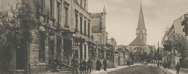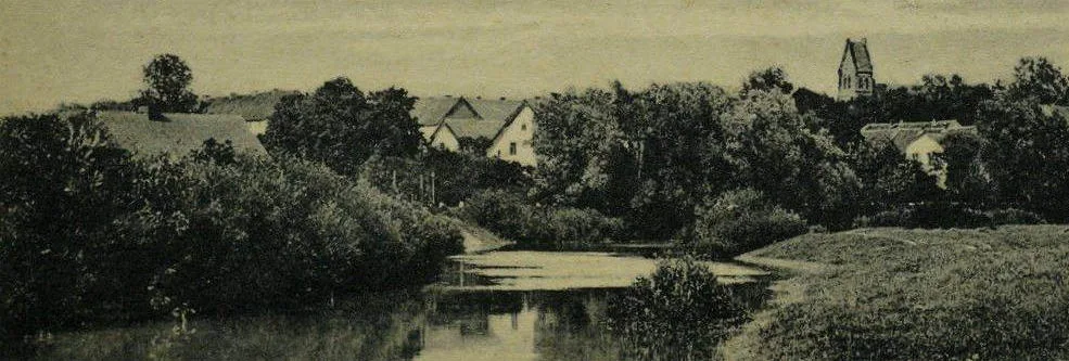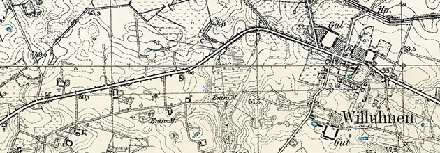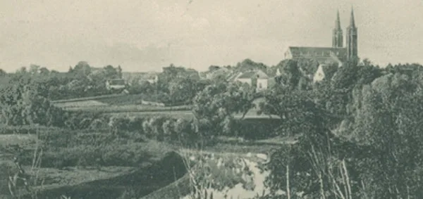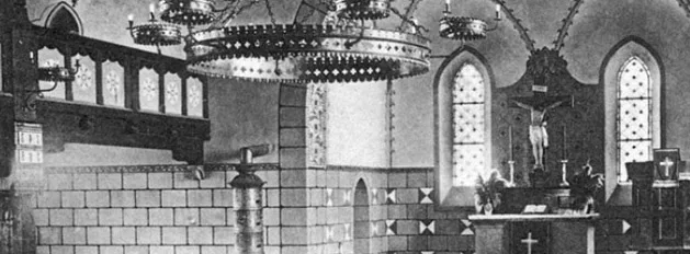
The year 1509 is considered the founding year of Pillkallen. On 14.09.1516, it is mentioned as the scattered settlement of Schlosberk, named after a nearby hill. In the time of the Order, the settlement belonged to the Komturei of Ragnit (Neman). In 1545, it is first mentioned as Pilkaln. In 1559, it received the status of a church village (Kirchsdorf); services were probably held in some building adapted for the purpose. In 1566, Burchard von Stein received the right to open an inn here. In 1582, the first church was built in Pillkallen. At the end of the 16th century, a market in Pillkallen is mentioned, and at the beginning of the 17th century a well-developed brewing industry. In 1612, three inns are reported in the village. The plague epidemic of 1709–11 claimed the lives of a large number of Pillkallen's inhabitants; only 14 families remained in the settlement. After the plague ended, settlers from Germany, above all from Nassau, were brought to the Pillkallen area.
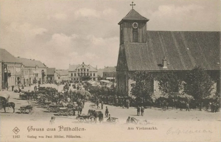
On 16.03.1725, Pillkallen received town rights from King Frederick William I.
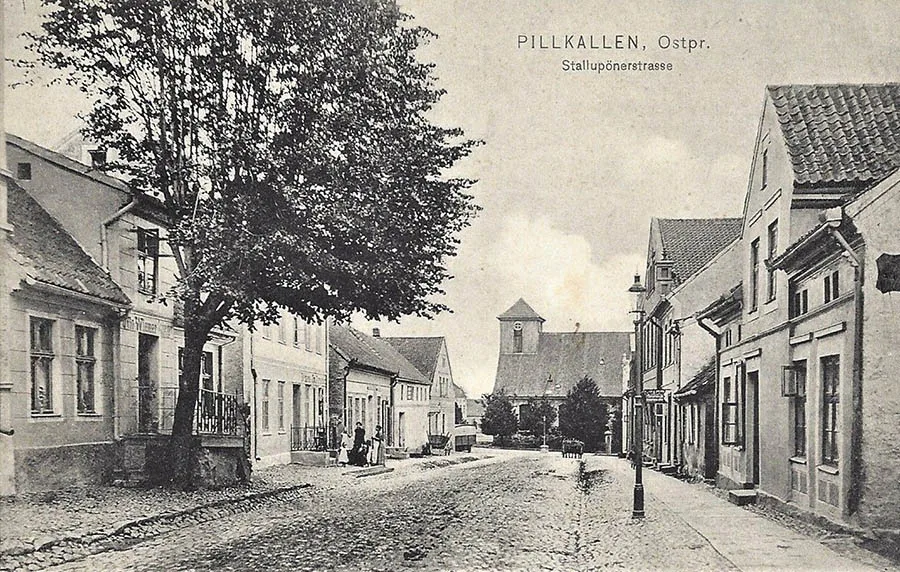
Pillkallen's new status created the conditions for rebuilding the settlement. The royal master builder Joachim Ludwig Schultheiß von Unfriedt (1678–1753) took a direct part in designing the town plan. By the mid-18th century, the old church had become dilapidated and was demolished. In 1756, the foundation stone was laid for a new Reformed church built of fieldstone, which was consecrated in 1758. From 1762, the town had a military garrison.
From 1762 to 1807, Kristijonas Milkus (1733–1807) worked in Pillkallen as a teacher and cantor; he was the author of Lithuanian–German and German–Lithuanian dictionaries, one of the creators of a grammar of the Lithuanian language, and the author of one of the first Lithuanian poetic works on a historical theme.
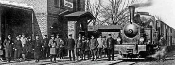
In 1818, in accordance with the administrative reform, Pillkallen became the centre of the district of the same name – a Kreis, later a Landkreis. In 1871, the town had 120 residential houses. On 26.07.1872, a great fire destroyed 50 houses and 85 other buildings. In 1877, after the new law on court procedure was introduced, a district court was established in Pillkallen. In 1892, the Tilsit – Stallupönen railway line was built through Pillkallen. In 1894, a new slaughterhouse opened in the town and construction of a municipal sewerage system began. In 1901, traffic opened on the Pillkallen narrow-gauge railway (Pillkaller Kleinbahn). The gauge was initially 750 mm, but in 1916–17 it was widened to 1,000 mm. In 1908, a folk school was opened and a town park was laid out. In 1909, a new town hall was built. At the beginning of the 20th century, Pillkallen had a district court, a Reichsbank office, an iron foundry, an engineering works and a brickworks. Market days were held twice a week.
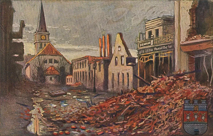
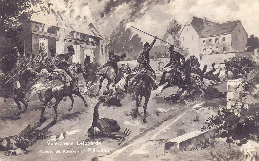
On 17.08.1914, at the start of the Russian army's East Prussian Operation, Pillkallen was taken by Russian troops. The town changed hands twice and suffered considerable damage in the fighting.
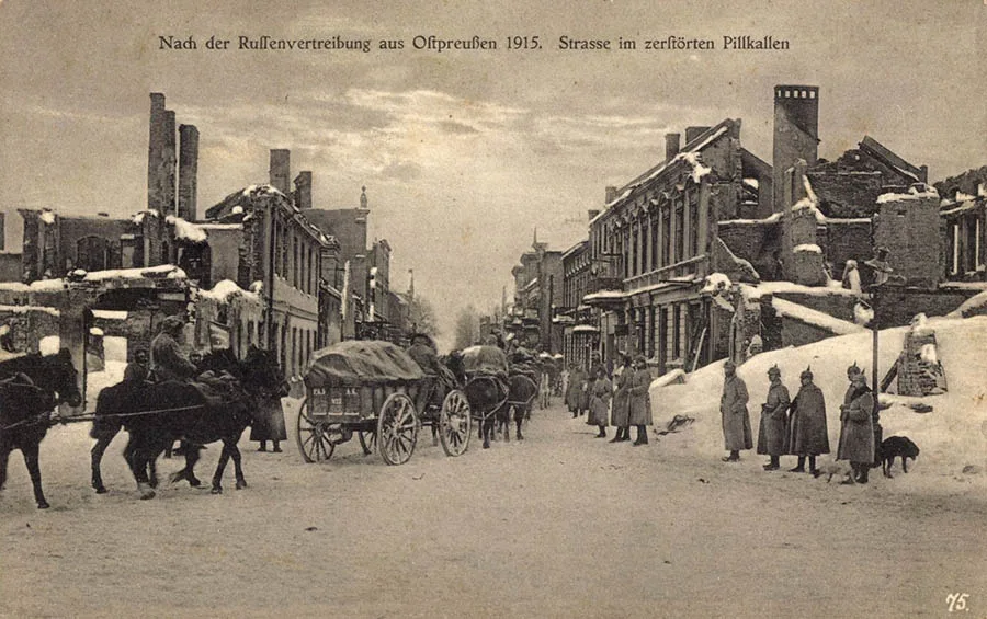
The town was first taken on 17.08.1914 by the Russian 1st Army of Gen. P. K. Rennenkampf. The unit that actually entered the town was the 1st Guards Cavalry Division of Gen. N. N. Kaznakov. Several fires broke out in the town during the occupation. In September 1914, units of the retreating 26th Army Corps (Gen. A. A. Gerngross) passed through the town, and soldiers of the German army occupied it right after them. In mid-November 1914, units of the Russian army's 3rd Corps (Gen. N. A. Yepanchin) entered Pillkallen. The combined Pillkallen Detachment was left in the town. At the end of January 1915, Russian infantry and cavalry forces gathered near the town in an attempt to advance on Lasdehnen (Krasnoznamensk), but on 08.02.1915 the German 10th Army went over to the counter-offensive and drove the Russian units out of Pillkallen.
After the war, the twin town of Breslau (now Wrocław, Poland) helped rebuild the town.
As part of the reconstruction work, a water supply system was laid in 1921 and a new water tower was erected. In 1933–34, a new 116-bed hospital was opened, soon expanded to 130 beds. Before the Second World War, two windmills operated on the outskirts of the town, and Pillkallen had a brickworks and a sawmill, a dairy and two agricultural machinery repair works.
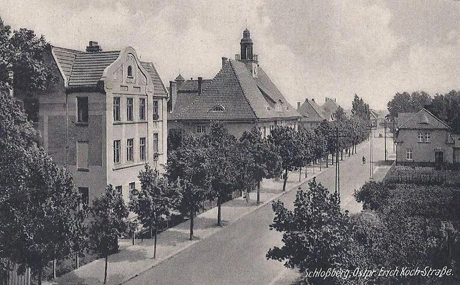
The town had two railway stations (one on the standard railway and one on the local narrow-gauge line).
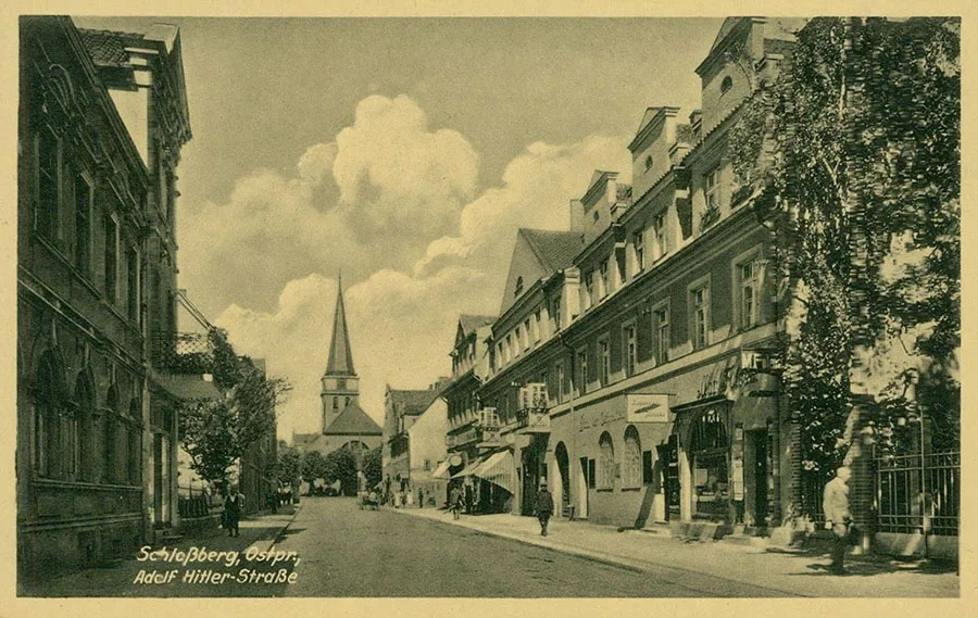
Children and young people were taught at the folk school and the trade school, as well as at the Friedrich Wilhelm district agricultural gymnasium. There was also a youth hostel for recreation. The town's administrative institutions included the town hall, the town council, the court, the tax office, a Reichsbank branch and the post office. Crafts were well developed, and a fair was held four times a year. Pillkallen also produced "Pillkaller Machandel", a juniper spirit popular in Prussia. This earned Pillkallen's inhabitants a reputation as drunkards and brawlers:
"Man drinks, the horse swills. In Pillkallen it's the other way round," went a Prussian saying ("Es trinkt der Mensch, es säuft das Pferd. In Pillkallen ist es umgekehrt").
In the pre-war period, however, Pillkaller vodka and Pillkallen had nothing but the name in common: it was produced on an industrial scale in Tapiau (Gvardeysk).
In October 1944, during the Gumbinnen–Goldap Operation, Red Army troops advanced towards Pillkallen but were unable to take it. In January 1945, Pillkallen lay in the 39th Army's zone of advance. Fighting for the town began on 15.01.1945, and on 16 January soldiers of the 781st Rifle Regiment of the 124th Rifle Division of the 94th Rifle Corps of the 39th Army entered it. The town was very badly destroyed in the fighting.
By 1946, post-war Pillkallen housed a machine and tractor station, and a bakery, a hospital and an orphanage were operating. A little later, a Soviet and a German primary school were opened. On 10.04.1946, State Farm No. 28 was established (from 30.06.1947 State Farm No. 142, from 1955 the Dobrovolsky State Farm).
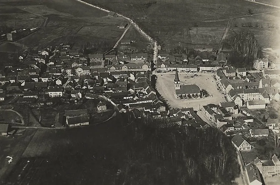
Originally it was intended to rename Pillkallen Krasnoarmeysk, but on 25.07.1947 it was renamed Dobrovolsk and lost its town status. The Dobrovolsk Village Soviet was established the same year.
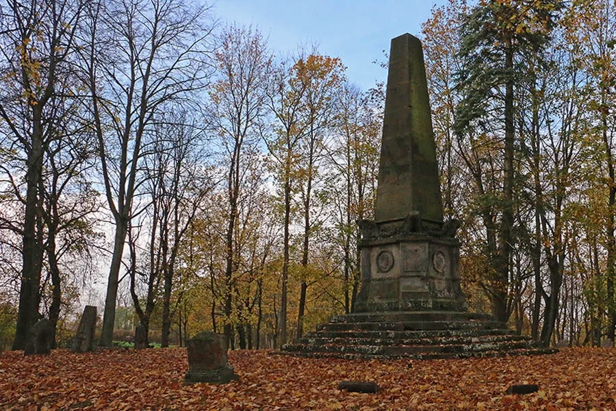 Memorial to those who fell in the Franco-Prussian War of 1870−1871.
In 1948, a seven-year school was opened, which became a secondary school in 1952. With the transition to a market economy, the agricultural company "Orbita" was set up on the basis of the Dobrovolsky State Farm, but it had closed by 2009. A dairy farm and a machine and tractor workshop operated until 2007. In 2008, the Dobrovolsk rural municipality was formed, comprising the Dobrovolsk, Pobedino and Pravdino rural districts. In 2009, Dobrovolsk took 2nd place in a competition for the best-kept settlements in the region. In 2011, Dobrovolsk had 578 households. As of 2018, the settlement had a school, a kindergarten, a medical unit, a psychoneurological care home, a house of culture and a centre for culture and historical heritage.
Sights: the church, the monument to the soldiers of the Franco-Prussian War of 1870–71, the park, the memorial to Soviet soldiers (1978, 5,300 people), the German and Russian First World War cemeteries, a private museum.
Population over time: 1772 – 1,2301, 1782 – 1,162, 1802 – 1,290, 1810 – 1,142, 1816 – 1,0572, 1821 – 1,374, 1867 – 2,253, 1871 – 2,293, 1875 – 2,386, 1880 – 2,648, 1890 – 2,8693, 1900 – 3,860, 1905 – 4,2904, 1910 – 4,347, 1925 – 4,541, 1933 – 5,005, 1939 – 5,833, 1947 – 4885, 1984 – 1,300, 1993 – 1,400, 2002 – 1,555, 2010 – 1,693 inhabitants.
1 — excluding the garrison.
2 — 1,035 Protestants and 22 Catholics.
3 — 1,015 Protestants, 8 Catholics and 34 Jews.
4 — including 23 Catholics.
5 — including 226 Germans.
Composition of the population of Pillkallen in 1871: Protestant Christians — 2,274, Catholics — 6, Jews — 13, children under 10 — 447, literate — 1,651 (92%), blind — 3, deaf-mute — 3, insane — 1.
For reference
Composition of the Pillkallen church parish: Grieben (Gribanovo), Groß Rudszen (from 1938 Mühlenhöhe, Poltavskoye), Groß Tullen (from 1938 Reinkenwalde, Tushino), Jutschen (from 1938 Weidenbruch, Velikolukskoye), Kallnehlischken (from 1938 Ebenhausen, Izmaylovo), Karczarningken (from 1929 Blumenfeld, Zheleznodorozhnoye), Kurschehlen (from 1938 Siedlerfelde, Novosyolovo), Kurschen (Arkhangelskoye), Laschen (54°45'25'' N 22°27'37'' E), Lobinnen (from 1938 Loben, 54°44'35'' N 22°32'14'' E), Neu Rudschen (Poltavskoye), Ossienen (from 1938 Ossen, 54°44'20'' N 22°31'16'' E), Paslöpen (54°46'08'' N 22°32'11'' E), Petereithelen (from 1938 Schleswighöfen, Lukashovka), Petereitschen (from 1938 Petershausen, 54°45'31'' N 22°32'35'' E), Pentzingken (from 1938 Hainort, Pskovskoye), Pillkallen (Dobrovolsk), Puschinnen (from 1938 Grenzhöhe, 54°47'57'' N 22°26'46'' E), Salten (Lozovoye), Schaaren (from 1938 Scharen, Shchedrino), Scharkabude (from 1938 Friedfelde, Beryozki tract, 54°48'19'' N 22°34'47'' E), Schwarpeln (from 1938 Schwarpen, Shlakovo tract, 54°47'12'' N 22°34'36'' E), Stehlischken (from 1938 Stenau, 54°43'19'' N 22°29'36'' E), Szameitkehmen (from 1938 Lindenhaus, Bolotnikovo), Treczaken (from 1938 Treufelde, Trekovo tract, 54°46'44'' N 22°33'01'' E), Uszballen (from 1938 Eichbruch, Luzhskoye), Uszpiaunehlen (from 1938 Fohlental, Novouralsk), Uszpiaunen (from 1938 Kiesdorf, Nikitovka), Uszrudszen (from 1938 Talwiesen, Shatilovo), Werskepchen (from 1938 Schwarzwiesen, 54°44'57'' N 22°33'50'' E), Werszkallen (from 1938 Forsthusen, Gruzdevo), Wiltauten (from 1938 Schatzhagen, 54°48'19'' N 22°32'54'' E).
Modern photo by Mikhail Ogorodnikov.
Translated from Russian with the help of AI (Claude, Anthropic), October 2026.