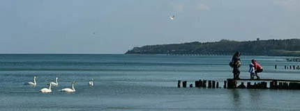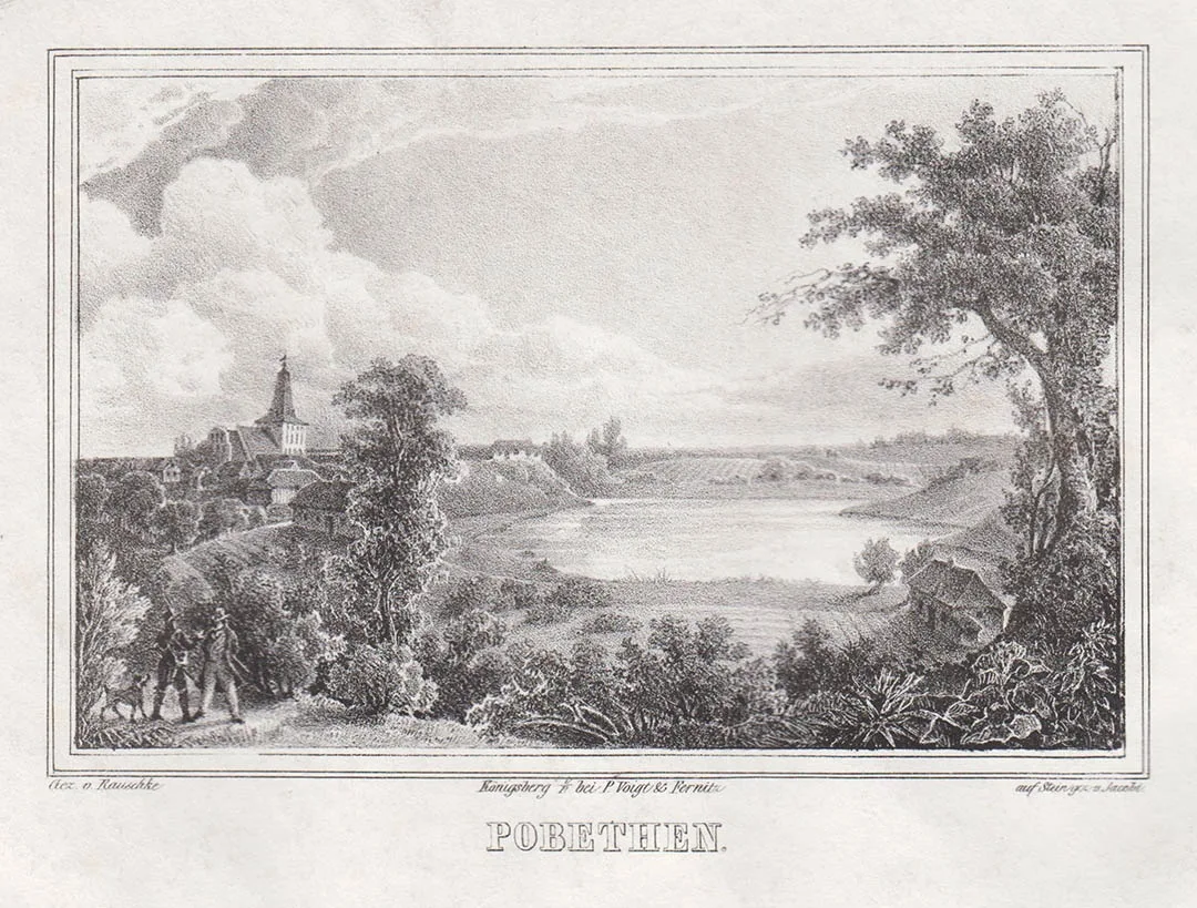
The locality of Pobethen is first mentioned in the chronicles of the Order in 1258. Before the Teutonic invasion, a Prussian fortress stood here, inhabited by the Pobetin clan.
Around 1270, Johannes Sachse, Komtur of Königsberg, founded Pobethen Castle. In 1283, 1289 and 1307 the timber-and-earth castle was raided by the Lithuanians, after which it was decided to rebuild the castle in stone. The stone castle was probably completed before 1325. In 1320 a chapel was built in the castle, and in 1321 a church was built next to the castle, which became one of the largest in Samland. In the 15th century a tower was added to the church. In 1479 an innkeeper is mentioned who held a licence to make brandy.
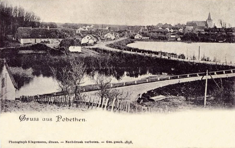
In 1525 the castle, which by then belonged to the brother of Bishop von Polenz, was destroyed by rebellious peasants led by Hans Gericke, who were dissatisfied with the labour duties introduced by von Polenz.
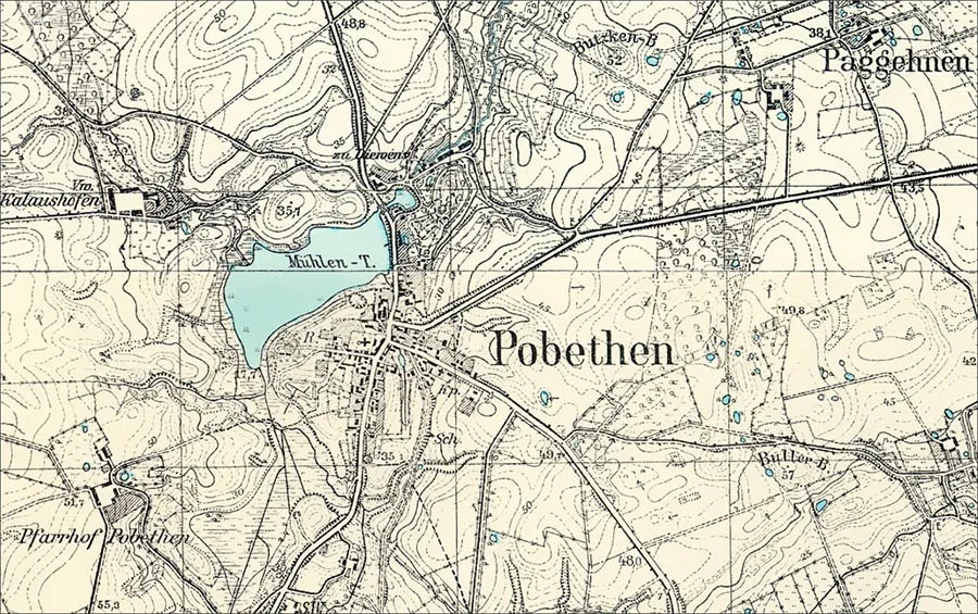
Until 1535 Pobethen was the seat of a Kammeramt, which was then moved to Grünhof (Roshchino). A school was opened in Pobethen at roughly the same time. In 1535 Pobethen had nine inns, 183 Prussian peasant farmsteads under Kulm law and 25 free farmsteads. In the mid-16th century Abel Will, the pastor of Pobethen, made the first and only translation of the catechism into the Prussian language; the catechism in Prussian was published in 1546–61. In 1621 Pobethen Castle is still mentioned as the remains of walls and fortifications.
In the 17th century an altar was installed in Pobethen church. In 1680 an organ built by the master Casparini was installed. In 1773 the church underwent a major renovation. In 1869 the roof tiles were replaced with slate sheets, and in 1888 the plaster was removed from the outer brickwork.
In the 19th century Pobethen consisted of two administrative units: the church village (Kirchendorf) of Pobethen, which formed a rural community, and the mill estate (Mühlengut) of Pobethen.
The village and the estate belonged to the Landkreis Fischhausen (from 1939 the Landkreis Samland). Pobethen church was the parish church for 48 villages and estates in the surrounding area. In 1861 the pastor of Pobethen was Heinrich Friedrich Adolf Rogge (1827–86), a German historian and theologian.
In 1874 Amtsbezirk No. 35 Pobethen was established in the Landkreis Fischhausen, comprising seven rural communities: Diewens (54°54'32'' N 20°16'46'' E), Goythenen (Geroyskoye), Jaugehnen (54°53'35'' N 20°18'42'' E), Lauknicken (54°54'54'' N 20°16'13'' E), Paggehnen (54°54'24'' N 20°18'10'' E), Pobethen (Romanovo) and Sorthenen (54°54'14'' N 20°19'29'' E), as well as the Pobethen estate (Romanovo). The first head of the Amtsbezirk, in 1874–80, was the leaseholder Beer from Pobethen. From 12 October 1896 the Pobethen estate formed a Gutsbezirk within the Amtsbezirk Pobethen. Besides the estate itself, the Gutsbezirk included the Vorwerk Kalaushöfen (54°54'02'' N 20°15'41'' E) and (from 1 December 1905) the forester's house Skardelies, Waldwärterhaus. Later, residents of Pobethen headed the Amtsbezirk in 1898–1912 (the leaseholder Max Möhrke) and in 1912–45 (the leaseholder Hennig).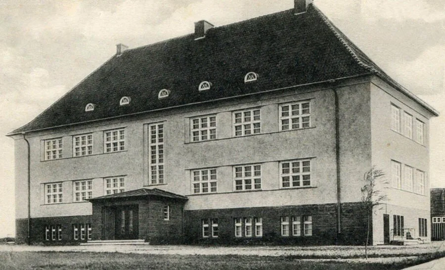
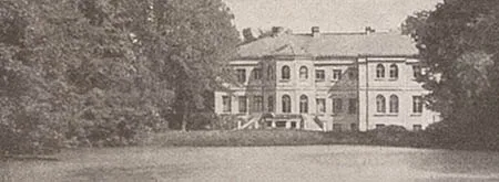
In 1900 a new school building was erected in Pobethen (pictured above).
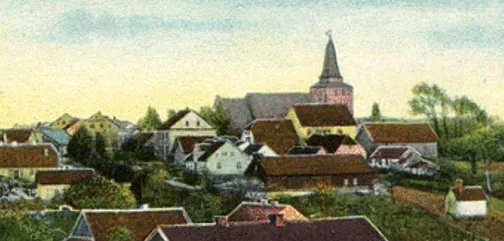
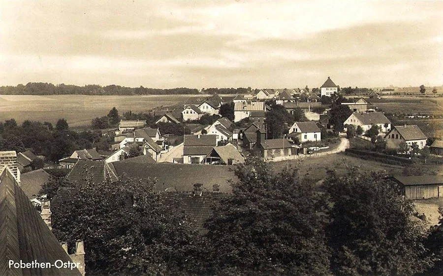 View of Pobethen from the tower of the local church.
On 19 September 1903 the Pobethen parsonage farm (Pfarrhof Pobethen; 54°53'28'' N 20°15'37'' E) became part of the Pobethen community.
On 25 May 1910 the Amtsbezirk Strobjenen (Kulikovo) was abolished, and as a result the Amtsbezirk Pobethen received the rural communities of Barthenen (54°55'00'' N 20°18'12'' E), Biegiethen (part of Kulikovo), Eisseln (Beregovoye), Garbseiden (part of Kulikovo), Strobjenen (Kulikovo) and the Gutsbezirk Kringitten (54°54'27'' N 20°19'24'' E). On 29 January 1912 the Diewens community was converted into a Gutsbezirk of the same name.
In 1912 the community sold the ruins of Pobethen Castle as building material.
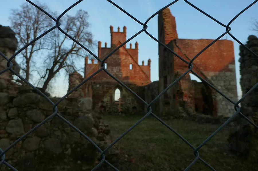
On 30 September 1928 the Gutsbezirke of Pobethen (Romanovo) and Diewens were abolished and incorporated into the rural community of Pobethen (Romanovo). The Gutsbezirk Kringitten became part of the rural community of Sorthenen. On 17 October 1928 the Jaugehnen community became part of the rural community of Paggehnen. On 23 April 1930 the Eisseln community (Beregovoye) passed to the Amtsbezirk Grünhoff (Roshchino). As a result, the Amtsbezirk Pobethen consisted of seven rural communities: Biegiethen, Garbseiden (part of Kulikovo), Goythenen (Geroyskoye), Lauknicken, Paggehnen, Pobethen (Romanovo) and Sorthenen. Its composition did not change again until 1945. Before the war Pobethen had a school, a sawmill and a mill.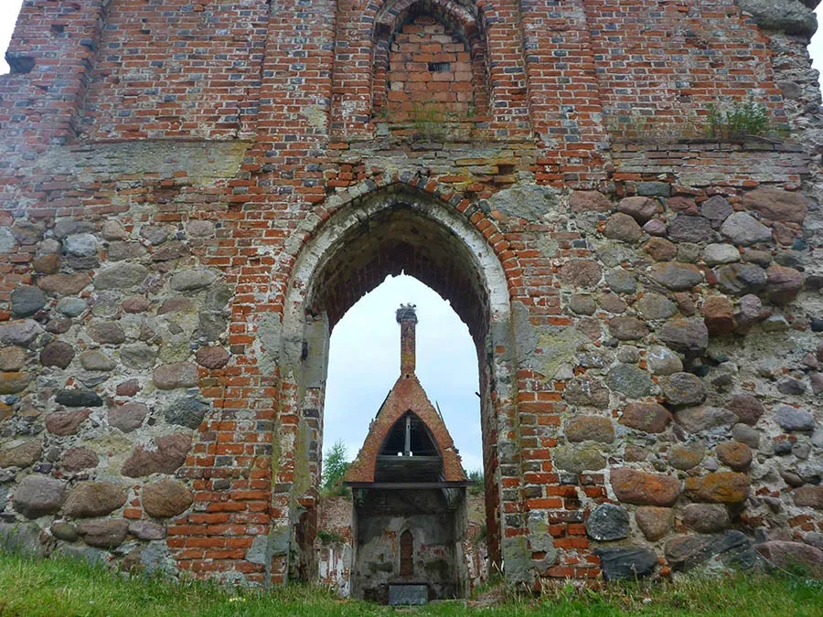 Ruins of Pobethen church.
During the Second World War, Pobethen was taken by Red Army units twice. On 6 February 1945 the village was occupied by the 182nd Rifle Division of the 90th Rifle Corps, 43rd Army. Soon, however, the enemy drove the Soviet troops out. On 4 March 1945 the settlement was taken again by soldiers of the 68th Rifle Regiment of the 70th Rifle Division, 43rd Army.
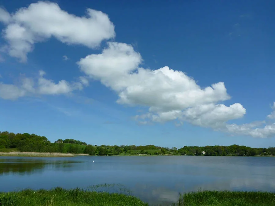 Pugachevsky (Mill) Pond.
Almost immediately after the war (28 June 1945), a primary school was opened in Pobethen, which had not yet been renamed.
On 25 July 1947 Pobethen was renamed the settlement of Romanovo in honour of P.I. Romanov, Hero of the Soviet Union. The Romanovo Village Council was formed at the same time. On 15 August 1947 the school in Romanovo became a seven-year school. In 1955 Romanovo had 79 houses, and in that year the Romanovo school became a secondary school. In 1977 the school in Romanovo moved into a new building.
Sights: the ruins of the 14th-century church, a monument to those who fell in the First World War, a memorial to fallen Soviet soldiers (opened in 1982, designed by V.G. Yeremeyev; 1,202 soldiers are buried here).
Population change: 1984 – 730, 2002 – 966, 2010 – 938 inhabitants.
Population change of the Pobethen community: 1905 – 830, 1910 – 857, 1933 – 1119, 1939 – 1359 inhabitants.
Population change of the Pobethen Gutsbezirk: 1905 – 181, 1910 – 190 inhabitants.
Population change of Diewens: 1905 – 95, 1910 – 113 inhabitants.
Population of the Pobethen parsonage farm: 1905 – 32 inhabitants.
Population of the Vorwerk Kalaushöfen: 1905 – 77 inhabitants.
For reference
Pobethen parish: Adlig Delgienen (54°50'52'' N 20°14'38'' E), Alk (54°51'29'' N 20°15'40'' E), Alknicken (Pribrezhnoye), Alleinen (54°55'56'' N 20°16'39'' E), Alt Kupzau (54°53'46'' N 20°21'38'' E), Ankrehnen (Perovo), Barschkahnen (54°53'23'' N 20°19'45'' E), Barthenen, Biegiethen (part of Kulikovo), Diewens, Eislithen (54°53'39'' N 20°20'03'' E), Eisseln (Beregovoye), Forsthaus Waschke (Zvyagintsevo), Garbseiden (part of Kulikovo), Gardwingen (Panayevo), Goythenen (Geroyskoye), Grünhoff (Roshchino), Jaugehnen, Karschau (54°51'56'' N 20°14'09'' E), Kiautrienen (54°51'31'' N 20°14'37'' E), Kringitten, Königlich Radnicken (part of Rodniki), Kösnicken (54°53'02'' N 20°15'04'' E), Langehnen (54°52'54'' N 20°20'06'' E), Lauknicken, Mogaiten (Perovo), Neu Kupzau (Rodniki), Paggehnen, Perteltnicken (Ternovka), Pfarrhof Pobethen, Pobethen (Romanovo), Pokirren (part of Roshchino), Preußisch Rockeln (54°56'00'' N 20°17'14'' E), Radnicken (Rodniki), Rantau (Zaostrovye), Rantauer Palwe (Rantau cottage settlement), Regehnen (Dubrovka), Schupöhnen (Shumnoye), Skardelies Waldwärterhaus, Sorthenen, Strobjenen (Kulikovo), Suppliethen (Ternovka), Tannenhain (54°51'35'' N 20°18'35'' E), Vorwerk Jouglauken (54°51'18'' N 20°21'06'' E), Watzum (Gorkovskoye), Woytnicken (Volodino), Ziegelei Grünhoff (part of Kovrovo).
Modern photos by Mikhail Ogorodnikov.
Translated from Russian with the help of AI (Claude, Anthropic), October 2026.