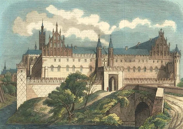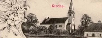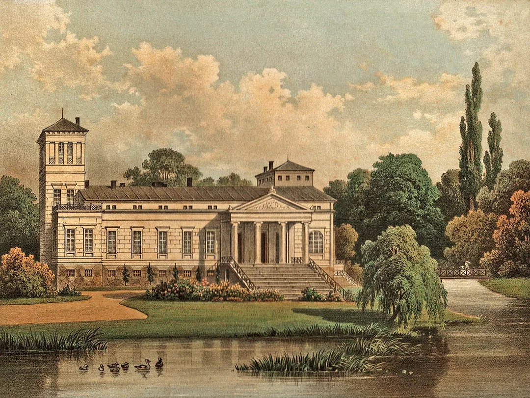
Saalau was founded in December 1352 as a bishop's castle. Until 1276 the Prussian fortress of Wostopolo stood on this site. After yet another division of the territory of Prussia between the Order and the Bishop of Samland, the territory of the future Saalau passed into the possession of the bishop.
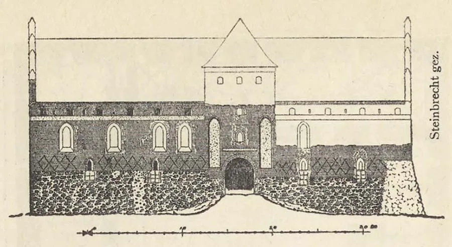
The castle was completed by 1355. In the summer of 1376 Saalau was besieged by the troops of Vytautas and Kęstutis, and as a result the castle was captured and burned. It was rebuilt in 1390. A village of the same name grew up near the castle.
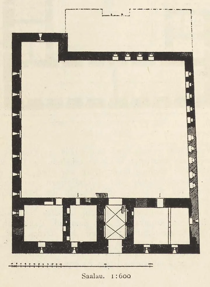
Architectural plan of Saalau Castle.
In the 14th century a parish was established in the castle chapel in the village of Saalau.
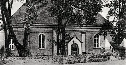
After the secularisation of the Teutonic Order, canons lived in the castle for some time. From 1540 the parish of Saalau became Lutheran. After the area had been devastated by plague in 1709–11, the Saalau estate, at the instigation of King Frederick William I, became the property of Prince Leopold I of Dessau (1676–1747). In 1734 a parish church was built in the village of Saalau. Bells cast in 1768 and 1818 were hung in a separately built half-timbered tower.
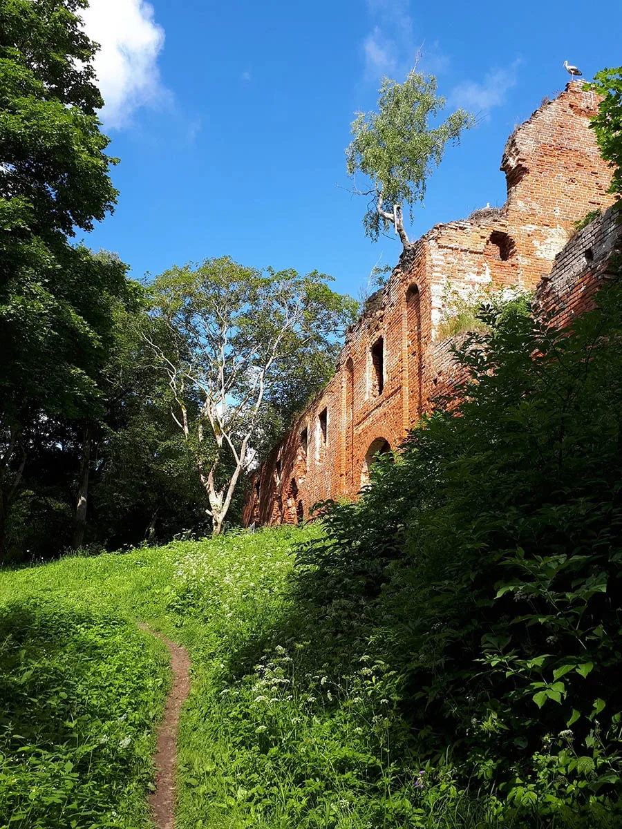
In the 19th century Saalau Castle was returned to state ownership and became a royal domain.
In the 19th century there were two administrative units on the territory of present-day Kamenskoye: the rural community of Saalau and the Saalau domain, which formed a Gutsbezirk of the same name that also included the Vorwerk of Kathrinlacken (Novo-Kamenskoye). From 1818 the community and the Gutsbezirk of Saalau belonged to the Landkreis of Insterburg (Chernyakhovsk). On 11.03.1874 the rural community of Saalau and the Gutsbezirk of Saalau were included in the newly established Amtsbezirk of Saalau. Residents of Saalau held the post of head of the Amtsbezirk in 1908–19 (the estate owner Ebers), in 1923–33 (the domain leaseholder Franz Girod) and in 1933–45 (the innkeeper Rudolf Habert). On 9.07.1895 the community of Groß Pruskehmen (Kamenskoye, eastern part) was attached to the community of Saalau. The village of Groß Pruskehmen thereby lost its place name and merged with the village of Saalau.
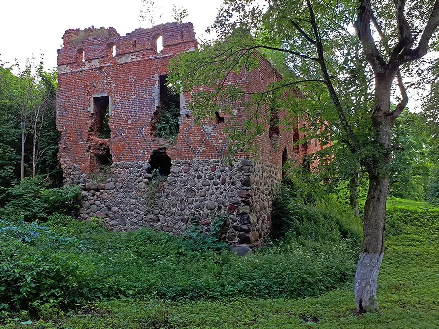 Saalau Castle in the settlement of Kamenskoye (2020).
On 30 September 1928 the following were incorporated into the community of Saalau: the Saalau domain (Kamenskoye), the village of Rudlaucken (from 1938 Jägersruh, Priglyadnaya), the village of Pruskehmen (formerly Klein Pruskehmen) and the Vorwerk of Kathrinlacken (Novo-Kamenskoye).
Paplacken is mentioned in 1680 as Paplaugken. Later, until 1785, it bore the name Paplauken. From 1818 Paplacken was a village forming a rural community in the Landkreis of Insterburg (Chernyakhovsk). The village belonged to the parish of Saalau (Kamenskoye). On 11.03.1874 the community of Paplacken was included in the newly established Amtsbezirk of Gnottau (Ganino). On 30.09.1928 the communities of Paplacken and Paschmackern and the Gutsbezirk of Gnottau (Ganino) were merged into the new rural community of Gnottau.
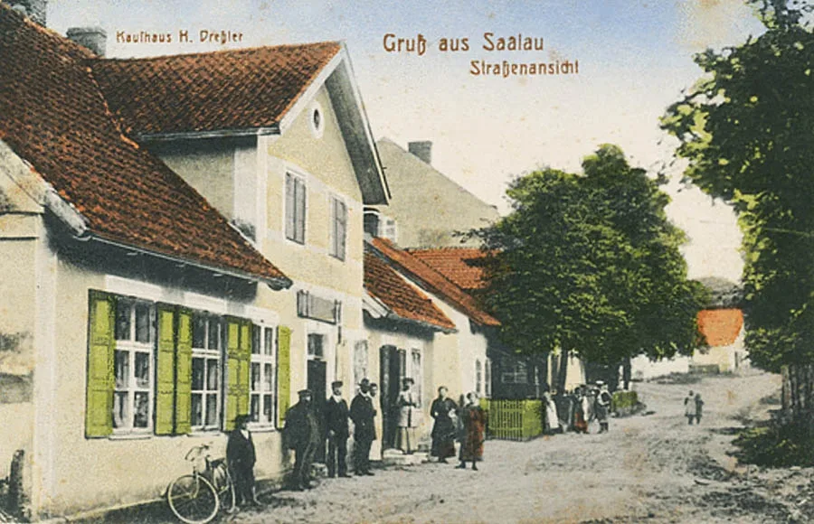
On the night of 23.01.1945 Saalau was taken by soldiers of the 11th and 84th Rifle Divisions of the 11th Guards Army.
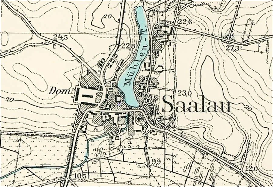
On 17.06.1947 Saalau was renamed Kamenskoye. At the same time the Kamenskoye village soviet of Chernyakhovsk District was created. Paplacken was not renamed and became an outlying part of the settlement of Kamenskoye de facto. In 1963–65 the Kamenskoye village soviet was transferred to Ozyorsk District, as Chernyakhovsk District had been dissolved. After Chernyakhovsk District was re-established, the Kamenskoye village soviet was returned to it. In 1971 the settlement of Kamenskoye had 71 houses and a school. By 1984 two houses remained in former Paplacken, and a dairy farm operated in Kamenskoye itself. By 1999 there were no buildings left on the site of Paplacken. The school in Kamenskoye was closed in the 1990s. The children of the settlement began attending the school in the settlement of Mezhdurechye. In 1997 Kamenskoye had 227 houses and buildings. After 2001 the dairy farm buildings on the site of the Saalau domain were abandoned and dismantled.
Coordinates of the settlement: 54°39'20'' N 21°32'58'' E (Saalau, now Kamenskoye), 54°40'03'' N 21°31'42'' E (Paplacken, now destroyed).
Sights: ruins of Saalau Castle (1390), the church (1734, now a House of Culture), mass grave of Soviet soldiers (142 people, memorial 1949), old farm buildings.
Population: 1984 – 570, 1997 – 642, 2002 – 615, 2010 – 487 inhabitants.
Population of the Saalau community: 1905 – 543, 1910 – 474, 1933 – 750, 1939 – 725 inhabitants.
Population of the Gutsbezirk of Saalau: 1905 – 232, 1910 – 238 inhabitants.
Population of Paplacken: 1905 – 84, 1910 – 75 inhabitants.
Population of Klein Pruskehmen: 1905 – 55, 1910 – 50 inhabitants.
For reference
Amtsbezirk Saalau
On 11.03.1874 Amtsbezirk No. 42 Saalau was formed in the Landkreis of Insterburg, comprising six rural communities: Groß Pruskehmen (Kamenskoye, part), Klein Pruskehmen (from 1938 Preußendorf, 54°40'06'' N 21°34'55'' E), Rudlaucken (from 1938 Jägersruh, Priglyadnaya), Saalau (Kamenskoye), Schönwiese (Poddubnoye) and Siemohnen (Sirenevka), and two Gutsbezirke: Auer (Poddubnoye) and Saalau Domäne (Kamenskoye). In 1882, after the abolition of the Amtsbezirk of Laßeningken (Derzhavino), the rural communities of Groß Laßeningken (Derzhavino) and Klein Laßeningken (Sablino) were included in the Amtsbezirk of Saalau.
On 9.07.1895 the community of Groß Pruskehmen lost its independence and was attached to the community of Saalau. Klein Pruskehmen was renamed the community of Pruskehmen. As a result the Amtsbezirk of Saalau came to consist of seven rural communities: Groß Laßeningken (Derzhavino), Klein Laßeningken (Sablino), Pruskehmen, Rudlacken (Priglyadnaya), Saalau (Kamenskoye), Schönwiese (Poddubnoye) and Siemohnen (Sirenevka), as well as two Gutsbezirke — Auer (Poddubnoye, part) and Saalau (Kamenskoye).
On 30.09.1928 the Gutsbezirke were abolished and incorporated into rural communities. The Gutsbezirk of Saalau was merged with the communities of Saalau (Kamenskoye), Pruskehmen and Rudlacken (Priglyadnaya) into the new rural community of Saalau. The Gutsbezirk of Auer (Poddubnoye, part) became part of the community of Schönwiese (Poddubnoye). The Amtsbezirk of Saalau now consisted of only five rural communities: Groß Laßeningken (Derzhavino), Klein Laßeningken (Sablino), Saalau (Kamenskoye), Schönwiese (Poddubnoye) and Siemohnen (Sirenevka).
On 1.03.1939 the communities of Siemohnen (Sirenevka) and Schönwiese (Poddubnoye) were transferred to the Amtsbezirk of Norkitten (Mezhdurechye); at the same time the Amtsbezirk of Gnottau (Ganino) was abolished, and its communities became part of the Amtsbezirk of Saalau. As a result, from 1.03.1939 the Amtsbezirk of Saalau comprised seven rural communities: Albrechtshöfen (54°41'23'' N 21°34'59'' E), Gnottau (Ganino), Großlaschnicken(until 1938 Groß Laßeningken, Derzhavino), Kleinlaschnicken (until 1938 Klein Laßeningken, Sablino), Saalau (Kamenskoye), Schönwiese (Poddubnoye), Schmackerau (until 1938 Schmackerlauken, Vakhrushevo) and Wirbeln (Zhavoronkovo).
The last change in the composition of the Amtsbezirk of Saalau took place a month later, on 1.04.1939. The community of Albrechtshöfen lost its independence and became part of the community of Wirbeln (Zhavoronkovo), and the communities of Großlaschnicken (Derzhavino) and Kleinlaschnicken (Sablino) were merged into the new rural community of Laschnicken. The Amtsbezirk of Saalau now consisted of five rural communities: Gnottau (Ganino), Laschnicken (Derzhavino, Sablino), Saalau (Kamenskoye), Schönwiese (Poddubnoye) and Wirbeln (Zhavoronkovo), and existed in this form until 1945.
The parish of Saalau comprised: Adamsruhe (Zhavoronkovo, part), Albrechtshöfen (54°41'23'' N 21°34'59'' E), the Alischken estate (Gut Alischken; Karpovo), Auer (Poddubnoye), Berszienen (from 1938 Berlacken, Vakhrushevo, part), Gnottau (Ganino), Groß Laßeningken (from 1939 Laschnicken, Derzhavino), Kathrinlacken (Novo-Kamenskoye), Klein Laßeningken (from 1939 Kleinlaschnicken, Sablino), Klein Pruskehmen (from 1938 Preußendorf, 54°40'06'' N 21°34'55'' E), the Laßeningken forester's lodge (Forsthaus Laßeningken; Sablino, part), the Laubhorst forester's lodge (Forsthaus Laubhorst; 54°42'00'' N 21°32'16'' E), Paplacken (Kamenskoye, part), Paschmackern (Vakhrushevo, part), Rudlacken (Priglyadnaya), Saalau (Kamenskoye), Schmackerlauken (from 1938 Schmackerau, Vakhrushevo), Schönwiese (Poddubnoye), Siemohnen (Sirenevka), Wirbeln (Zhavoronkovo), Wirtkallen (from 1938 Wirtberg, Polikarpovo).
Modern photos by Mikhail Ogorodnikov.
Translated from Russian with the help of AI (Claude, Anthropic), October 2026.