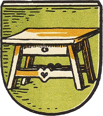
 Coat of arms
of Stallupönen
Stallupönen is first mentioned in 1539, although an Old Prussian settlement had existed on this site since before the Teutonic Order. In 1539 the village had nine households, and the parish was in Pillupönen (Nevskoye).
In 1585 a church was built in Stallupönen. In 1586 the Stallupönen parish was established. In 1665 Stallupönen received the right to hold fairs. At the end of the 17th century a cattle and horse market was held in Stallupönen once a week, on Thursdays.
As a result of the plague epidemic of 1709–11, Stallupönen and its surroundings were almost completely depopulated.
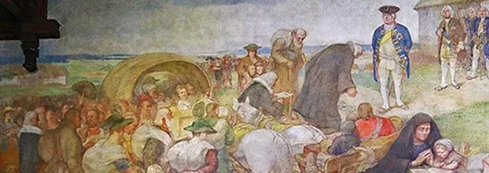
To resettle the territory, King Frederick William I took measures to attract settlers to the region from German Nassau, Austrian Salzburg, Franconia and Switzerland. From 1717 a cavalry garrison was stationed in Stallupönen. On 26.04.1722 Stallupönen received town rights. The royal master builder Joachim Ludwig Schultheiß von Unfriedt (1678–1753) was directly involved in planning the town's layout. New houses were built around the market square, and in 1726 a new church building. In the 18th century leather-making became Stallupönen's most important industry.
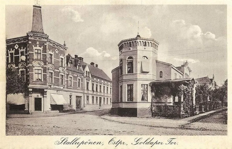 The Goldap Gate.
During the Seven Years' War (1756–63), the army of S. F. Apraksin was encamped near Stallupönen on 1–4 August 1757. On 03.08.1757 the inhabitants of Stallupönen were sworn in to Empress Elizabeth I. In 1812 part of Napoleon's Grande Armée passed through Stallupönen on its way to Russia. Among others, the Emperor himself travelled through the town.
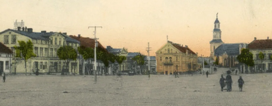
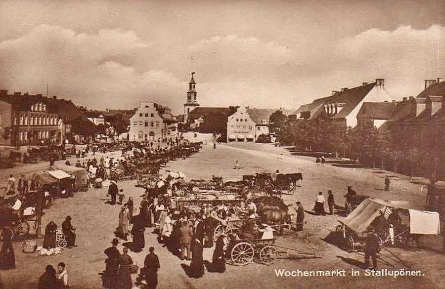 Sunday market in Stallupönen.
In 1818, as part of the administrative reform, Stallupönen became the centre of the Kreis (district) of the same name. In 1860 the Prussian Eastern Railway (Preußische Ostbahn) was built through the town. In 1871 the town had 178 residential houses. In 1894 the Stallupönen – Tilsit (Sovetsk) branch line was built, and in 1901 the Stallupönen – Goldap (Gołdap, Poland) line. By the early 20th century the town had a Realschule, a court, a post office, a customs office, and branches of the state bank and a commercial bank. Markets were held twice a week, on Mondays and Thursdays. The town's garrison consisted of two uhlan squadrons.
During the First World War and the East Prussian operation of the Russian army, on 17.08.1914, the first major battle between the Russian and German armies took place near Stallupönen. The day before, the 25th, 27th, 29th and 49th Infantry Divisions of the Russian army had moved forward, unaware that two German infantry divisions and one cavalry division under the overall command of General Hermann von François had made the same advance. The result was a meeting engagement. The Russian 25th Infantry Division (General K. M. Adaridi, 1857–1940) fought directly in the Stallupönen area. Overall, the Russian troops lost about 6,000 men killed, while the Germans lost around 1,600 soldiers.
However, the battle was followed by a planned retreat of the German army, abandoning Stallupönen, so the battle cannot be regarded as an unqualified German victory.
The front returned to Stallupönen in September 1914, when the rear units of the retreating Russian army passed through it, followed by the 25th Infantry Division. On 12.09.1914 shelling caused fires in the town, and by the end of the day German units had occupied Stallupönen.
In November 1914 Stallupönen was occupied again by the same Russian 25th Infantry Division, now part of the 10th Army. The headquarters of the 3rd Army Corps (General N. A. Yepanchin) was set up in Stallupönen. When the German 10th Army launched a counteroffensive on 08.02.1915, it became clear that the Russian units could not hold the town, and they left it on 10.02.1915. During the war the town suffered severe destruction, and cases of looting were recorded.
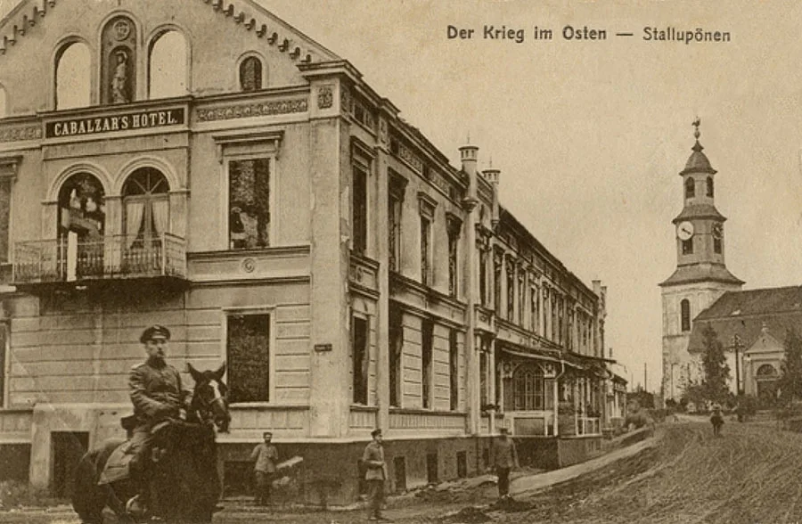 Russian soldiers in the streets of Stallupönen.
Reconstruction began immediately after the war, with Stallupönen assisted by the municipality of Kassel (Hesse). The work was led by the district architect Kurt Frick (1884–1963). In 1927 a new water tower was built in Stallupönen, and in 1928 a Catholic chapel was opened.
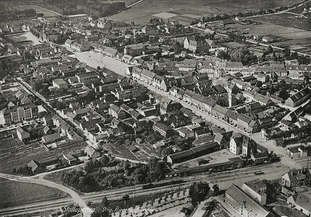
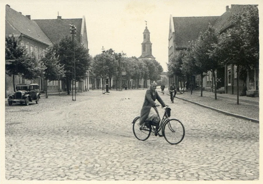 Stallupönen after the First World War.
In 1931 Stallupönen had 430 residential houses and 1,606 farm buildings. On the eve of the war the town had a town hall, district administrative, financial and judicial institutions, a school, a Realgymnasium, a girls' school, an agricultural school, a continuation school, a hospital and a customs office. There were sports and cultural facilities. As for places of worship, there were a Protestant and a Catholic church.
On 19.10.1944, during the Red Army's Gumbinnen–Goldap operation, troops of the 8th Guards Rifle Corps of the 11th Guards Army reached Stallupönen. Units of the 5th Army also took part in the offensive. On 20.10.1944 units of the 28th Army joined the offensive in the Stallupönen direction. The fighting for the town met with strong enemy resistance. Only on the night of 25 October was the town taken by soldiers of the 96th Guards Rifle Division of the 28th Army.
From May 1946 settlers began to be brought into the Stallupönen district, mainly families from the Kirov, Ulyanovsk, Penza and Vladimir regions.
On 07.09.1946 Stallupönen was renamed Nesterov (in honour of Guards Colonel S. K. Nesterov, who was killed near the town), and the Nesterov district was formed at the same time.
By 1947 the town had a court, a prosecutor's office, a police station, a registry office and a traffic police department. An incomplete secondary school, a district hospital, a pharmacy, a hotel, a pharmacy and an orphanage for German orphans were opened. The railway station was put back into operation. A branch of the Zagotzerno office, an industrial plant and a machine and tractor station began operating. In March 1947 a butter and cheese factory was launched, and in June 1947 a House of Culture opened. At the same time the town had only 52 residential houses. The district focused primarily on livestock farming, and preference was also given to growing barley, wheat, oats, potatoes and fodder beet. In January 1948 a district food processing plant was set up. In May 1948 the district hospital moved to a new building. After the deportation of the German population, the orphanage for German children was converted into an ordinary orphanage. Also in 1948 the district newspaper Leninsky Put began publication. In 1949 a bookshop and the 200-seat Zvezda cinema opened in Nesterov. In 1951 a stadium was opened for the townspeople. In 1959 a boarding school and inter-kolkhoz workshops were established in Nesterov.
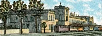
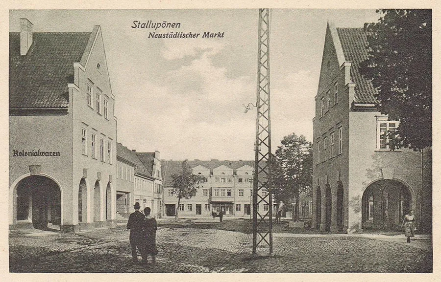 Stallupönen in the early 20th century and...
In the 1950s the ruined building of Stallupönen's Protestant church was demolished.
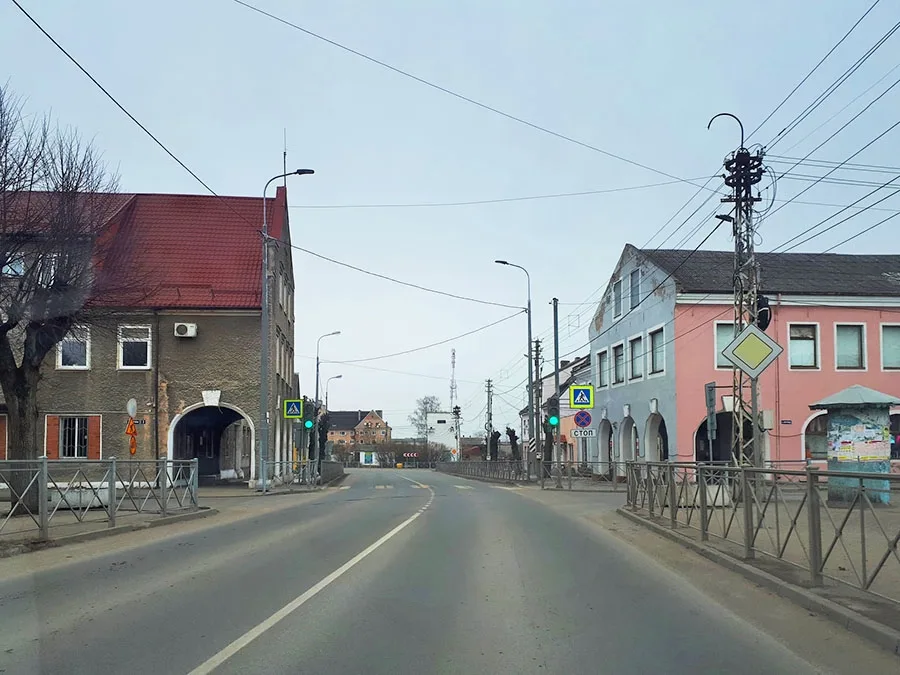 ...in the early 21st century – Nesterov.
In the 1960s the development of the town's infrastructure and the construction of social facilities continued: a department store with an area of 500 m2 (1960), consumer service workshops (1961), a people's university of culture (1964), and the Yubileyny department store (1967). Peat extraction (1965) and processing (1968) also began.
By the end of the 1970s Nesterov had: a secondary school, an evening school, a music school and a boarding school, two kindergartens, a nursery, a Pioneers' House, a hospital, a maternity hospital, a pharmacy, a sanitary and epidemiological station, two libraries, a registry office, a hotel, a savings bank, a railway station, a bus station, a communications centre, a household appliance repair shop, a consumer services centre, a network of shops, a restaurant and a cinema. Industry was represented by an asphalt and concrete plant, a peat works, a butter and cheese factory, construction and land reclamation organisations, and a branch of Selkhoztekhnika.
In 1984 a memorial complex was opened on the mass grave of Soviet soldiers.
In 1986 one of the largest children's centres in the region, the Zolotoy Petushok kindergarten complex (280 places) with a swimming pool, was built.
The transition to a market economy had a negative impact on the town's enterprises: in the 1990s the town's only hotel closed, and in 1998 the asphalt and concrete plant and the butter and cheese factory stopped production. The latter was turned into a milk collection point for the rural population. By 2008 the town officially had 12 production enterprises, including those engaged in peat harvesting, the production of bakery products, canned meat and sausages, woodworking and garment manufacturing. There were 52 retail outlets, a restaurant, a bar and four cafés. The town has a secondary school, an evening school, an art school, a children's creativity centre, Boarding School No. 8, a district library and a children's library, a House of Culture and a stadium. The district newspaper is now published under the name Selskaya Nov.
Sights: Catholic church (1927, Orthodox cathedral), railway water tower (1916), water tower (1927), school building (early 20th c.), railway station (early 20th c.), hospital building (early 20th c.), residential and administrative buildings of the late 19th – early 20th c., arched road bridge over the railway (20th c.), burial site of 339 Russian and 165 German soldiers (1914–15), ruins of the Hindenburg monument (1916), monument to the 8th Uhlan Regiment (1920s), monument to S. K. Nesterov (1956), memorial on the mass grave of Soviet soldiers (more than 1,500 people, memorial 1984).
Population: 1782 – 2,357, 1802 – 2,262, 1810 – 2,389, 1816 – 2,599, 1821 – 2,523, 1831 – 2,570, 1867 – 3,696, 1871 – 3,760, 1875 – 3,763, 1880 – 3,997, 1890 – 4,673, 1910 – 5,646, 1925 – 6,171, 1933 – 6,294, 1939 – 6,644, 1946 – 6231, 1947 – 1,2452, 1959 – 3,205, 1970 – 4,004, 1979 – 4,700, 1989 – 4,800, 2002 – 5,049, 2010 – 4,595, 2012 – 4,514, 2013 – 4,436, 2014 – 4,383, 2015 – 4,333, 2016 – 4,225, 2017 – 4,086, 2018 – 4,001, 2019 – 3,978, 2020 – 3,933 inhabitants.
Population of Stallupönen in 1871: Protestant Christians – 3,619, Catholics – 31, Jews – 110, children under 10 – 814, literate – 2,591 (94%), blind – 4, deaf-mute – 4, insane – 8.
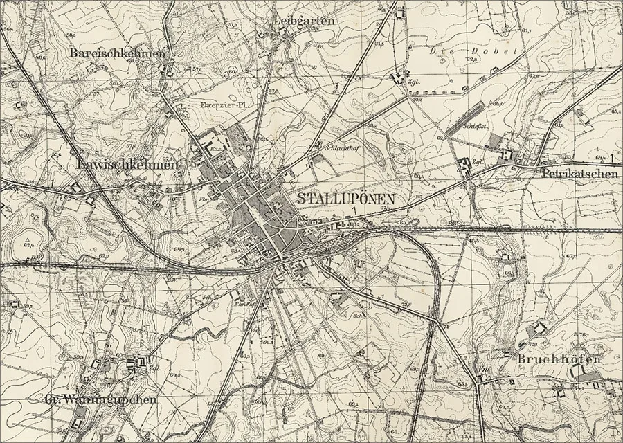
The Stallupönen parish in 1890 included: Abracken (from 1938 Kornfelde, Vasilkovo)3, Alexkehmen (from 1938 Alexbrück, Rechki, later Voskresenskoye), Amalienhof (54°36'51'' N 22°29'43'' E), Bareischkehmen (from 1938 Baringen, Pervomayskoye), Deeden (54°37'58'' N 22°40'18'' E), Doblendszen (Parkhof, 54°40'49'' N 22°33'56'' E), Drusken (Bolshoye Zarechnoye), Enskehmen (from 1938 Rauschendorf, 54°38'24'' N 22°30'21'' E), Groß Wannagupchen (from 1938 Rohren, Svobodnoye), Grünhof (Vorobyovo), Hopfenbruch (54°36'47'' N 22°30'28'' E), Kerrin (from 1938 Stubbenhof, 54°37'28'' N 22°28'41'' E), Kischen (from 1938 Krähenwalde, 54°39'50'' N 22°31'05'' E), Klein Degesen (from 1938 Kleinlucken, Vyselki)4, Klein Wannagupchen (Zelyonoye), Kögsten (54°40'55'' N 22°31'52'' E), Krausen (Sibiryakovo), Lawischkehmen (from 1938 Stadtfelde, Petrovskoye), Lucken (54°39'53'' N 22°35'43'' E), Lukoschen (from 1938 Neulucken, Surki tract, 54°40'19'' N 22°34'54'' E), Malissen (54°38'19'' N 22°38'35'' E), Mehlschücken (from 1938 Kleinschellendorf, 54°41'57'' N 22°35'02'' E), Paballen (from 1938 Kleinhopfenbruch, Shcherbatovo), Packern (54°39'30'' N 22°36'20'' E), Patilschen (from 1938 Brücken, 54°38'52'' N 22°30'28'' E), Peschicken (from 1938 Altbruch, 54°37'44'' N 22°39'33'' E), Peterlauken (from 1938 Petersort, Mayakovskoye)3, Petrikatschen (from 1938 Schützenort, Prigorodnoye), Plicken (Shaturskoye), Raudohnen (from 1938 Rauhdorf, Trudovoye), Ribben (Petrovskoye, part), Schöckstupönen (from 1938 Pohlau, Brigadnoye), Skarullen (from 1938 Ebenflur, 54°37'04'' N 22°38'15'' E), Stallupönen (from 1938 Ebenrode, Nesterov), Szillen (from 1938 Schellendorf, Chuykovo)3, Szillehlen (from 1938 Lehmau, 54°40'01'' N 22°37'51'' E), Uszballen (from 1928 Bruchhöfen, Voskresenskoye), Wagohnen (54°38'56'' N 22°40'01'' E), Wertimlauken (from 1938 Kleinföhrenhorst, 54°42'30'' N 22°33'34'' E)3, Wilpischen (from 1938 Wilpen, Nagornoye).
1 — including 197 Germans.
2 — including 245 Germans.
3 — until 1895; afterwards in the parish of Groß Warningken (from 1938 Steinkirch, Zabolotnoye).
4 — according to other sources, it belonged to the parish of Bilderweitschen (from 1938 Bilderweiten, Lugovoye).
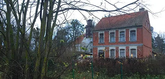
Contemporary photo by Mikhail Ogorodnikov.
Translated from Russian with the help of AI (Claude, Anthropic), October 2026.