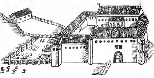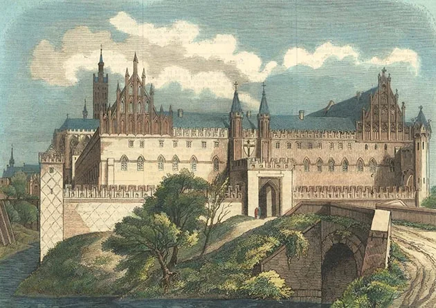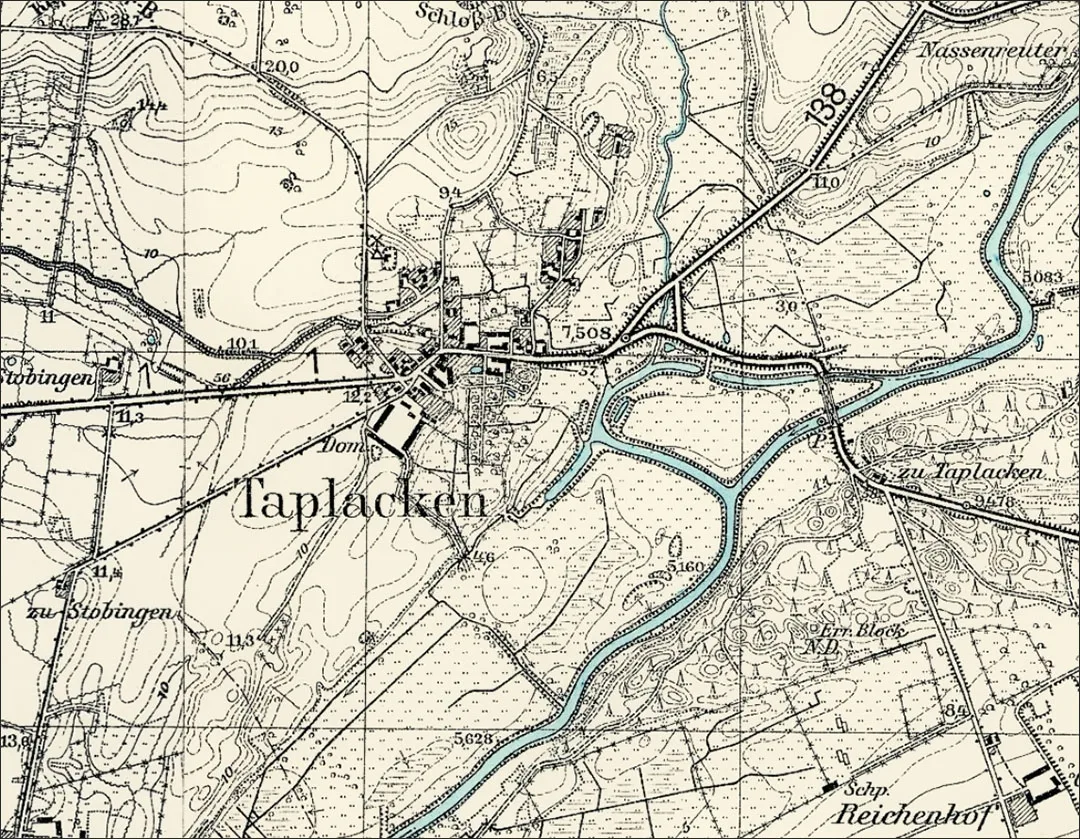
The Taplacken fortification was originally built away from the present settlement (0.9 km to the north), on the site of an ancient Prussian rampart fortress. In the second half of the 14th century Taplacken became the centre of a Kammeramt. In 1376 the castle was attacked by troops led by Prince Kęstutis; the wooden fortification was taken and burned, and the surviving defenders, led by the castle's Pfleger, were taken prisoner. Given the importance of the castle, in that same year of 1376 construction began on a stone castle in a better protected place, under the cover of marshes and the river. The result was a castle square in plan, measuring 46 x 46 m, surrounded by a stone wall with a single gate on the east, which was defended by two small towers. The residential wing stood on the west, and service buildings were later added on the north and south. There was a well in the courtyard and a chapel in the residential wing. An underground passage from the castle to the river is mentioned.
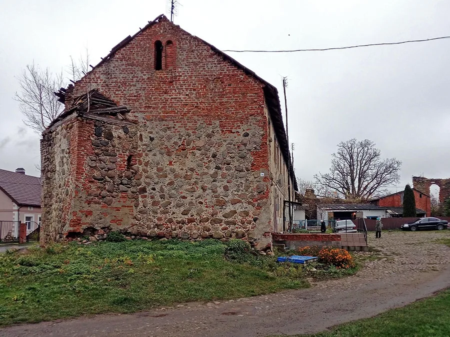
Taplacken Castle is mentioned in the text of the Second Peace of Thorn (1466) and of the Treaty of Kraków (1525). This means that at that time the castle was an active defensive structure.
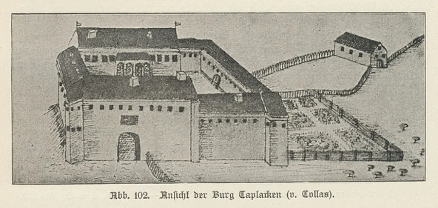
In addition, Taplacken Castle administered salt mines, which were worked until the 16th century. After 1525 Taplacken Castle became a ducal domain. In the 17th century the small towers of the south wall were dismantled down to the level of the walls because they had become dilapidated.
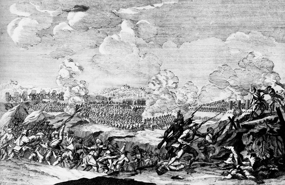
In the 18th century Taplacken was the centre of an Amt. The castle housed administrative bodies and the postal service. At the start of the Seven Years' War in 1756, defensive positions were prepared in Taplacken in case of an advance by the Russian army, but they played no role in the two campaigns in East Prussia.
In 1803–34 the Königsberg–Taplacken–Tilsit road was built. In 1807 retreating Russian army units passed along it through Taplacken towards Tilsit (Sovetsk), followed by detachments of Napoleon's army. In January 1813 the situation repeated itself in exactly the reverse order: this time it was the French who were retreating, pursued by the vanguard units of the Russian army.
In the 19th century there were two administrative units: the village of Taplacken and the Taplacken domain. The village formed a community, and the domain a Gutsbezirk, in the Landkreis Wehlau (Znamensk). The village and the domain of Taplacken belonged to the parish of Petersdorf (Kuybyshevskoye). Besides the village itself, the Taplacken community also included the small village of Reichenhof (Balashevskoye). On 13 June 1874 the community and the Gutsbezirk of Taplacken were included in the newly established Amtsbezirk Taplacken. The first head of the Amtsbezirk was the domain's leaseholder Schmidtke. In 1889–1902 the next head of the Amtsbezirk was another member of the Schmidtke family. Later, residents of Taplacken held this post in 1919–22 (the merchant Adolf Jackstell), 1922–25 (the hotel owner Salzmann), 1925–33 (the senior inspector Babbel) and from 1933 (Knobloch).
Amtsbezirk Taplacken. On 13 June 1874 Amtsbezirk No. 7 Taplacken was established in the Landkreis Wehlau (Znamensk), comprising three rural communities, Petersdorf (Kuybyshevskoye), Stobingen (Livny) and Taplacken (Talpaki), as well as the Gutsbezirk Taplacken (Talpaki). On 30 September 1928 the Gutsbezirk Taplacken was abolished and incorporated into the rural community of Taplacken. The composition of the Amtsbezirk did not change again until 1945.
In 1871 the village of Taplacken had 32 dwelling houses, and the Gutsbezirk Taplacken 16.
During the First World War the cavalry of the Russian 1st Army reached Taplacken on 24 August 1914. The next day the area was occupied without serious fighting. On 27 August 1914 the Russian troops moved on, occupying the area south-east of Königsberg.
In 1921–26 Lock No. 2 was built on the Pregel (Pregolya) near Taplacken to improve navigation.
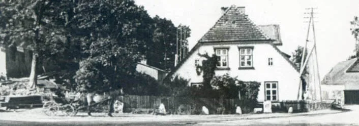
On 30 September 1928 the Taplacken domain lost its status as a Gutsbezirk and was incorporated into the rural community of Taplacken. In the pre-war years the village had a hotel with a petrol station and a post office, and a windmill worked on the north-western edge of the village.
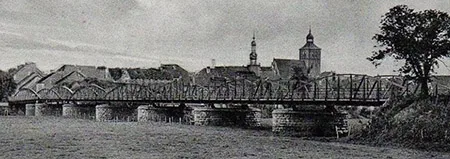
On 21 January 1945 units of the 89th Tank Brigade (Col. A.I. Sommer), dashing in from Groß Skaisgirren (Bolshakovo), seized the bridge at Taplacken on the move; units cooperating with the brigade captured bridgeheads on the opposite bank of the Pregel, which sealed the retreat of the German troops from Taplacken. During the fighting the castle buildings were damaged by artillery fire.
After the fighting ended, Red Army units were stationed on the castle grounds at Taplacken. According to a number of accounts, careless attitudes to fire safety led to a fire in the castle, which caused it considerable damage.
On 17 June 1947 Taplacken was renamed the settlement of Talpaki. The Talpaki Village Council was created at the same time. In 1948, because of the housing shortage, the castle was given over for housing. In 1955 the settlement of Talpaki had 27 houses. By 1971 the settlement already had 52 houses and a school. On a map of 1971–75 the settlement is marked as "Pushkino (Talpaki)", but no other evidence has been found that the settlement was ever called Pushkino. In 1996 the dilapidated gable of Taplacken Castle, added by the estate's leaseholders at the end of the 19th century, was dismantled.
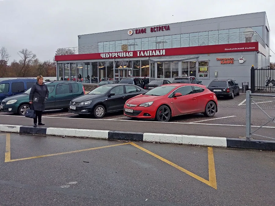
In 1996 a cheburek café opened in Talpaki, originally consisting of a tent and a few tables outdoors.
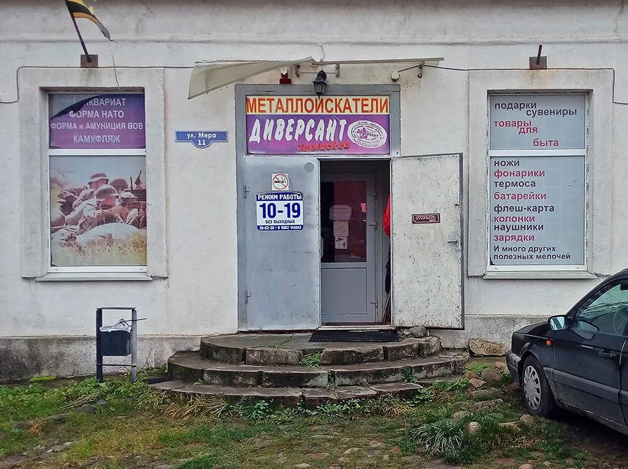 Entrance to the Diversant shop, whose range of goods will surprise many.
Thanks to the quality of its food (at first only chebureki and drinks), the cheburek café became popular not only with passing drivers but also with Kaliningraders, who would drive 60 km each way for the local chebureki, cooked right in front of them. By 2010 the tent had grown into a small café with an open-air terrace and indoor tables, and the menu had been expanded with various kinds of pastries (belyashi, samsa, pizza), hot dishes and cold starters. In 2014 the café was rebuilt as a large catering complex. The café's popularity helped the settlement develop into an informal food stop for motorists, with several shops, cafés and a bathhouse opening. The settlement also has a club, a library and Diversant, a specialist shop for metal-detecting enthusiasts, historical re-enactors and hikers.
Sights: the ruins of Taplacken Castle, the old bridge over the Pregolya and Lock No. 2, an old Prussian earthwork 0.9 km north of the settlement (54°39'36'' N 21°20'30'' E), the ruins of a First World War mass grave (54°39'45'' N 21°21'16'' E).
Population change: 1867 – 788, 1871 – 772, 1905 – 679, 1910 – 588, 1933 – 436, 1939 – 415, 2002 – 394, 2010 – 374 inhabitants.
Population change of the Taplacken community: 1867 – 479, 1871 – 474, 1905 – 334, 1910 – 280 inhabitants.
Population change of the Taplacken Gutsbezirk: 1867 – 309, 1871 – 298, 1905 – 345, 1910 – 305 inhabitants.
Population of the Taplacken community in 1871: Evangelical Christians – 464, Catholics – 3, other Christians – 7, children under 10 – 120, literate – 269 (81%), insane – 2.
Population of the Taplacken Gutsbezirk in 1871: all 298 Evangelical Christians, children under 10 – 82, literate – 183 (93%), deaf-mute – 1.
Modern photos by Mikhail Ogorodnikov.
Translated from Russian with the help of AI (Claude, Anthropic), October 2026.