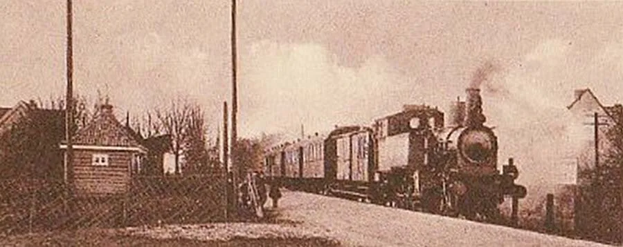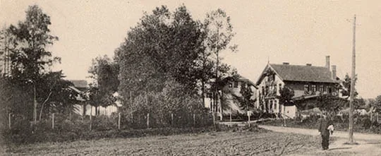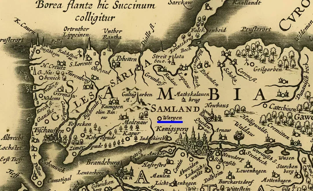
As early as pre-Order times there was a Prussian earthwork fortress with mighty ramparts in Wargen. In the Order chronicles the locality of Wargen is first mentioned in 1281, as the place where four Prussians loyal to the Order settled. In 1299 they were joined by another eight Prussians who had accepted Christianity. According to other sources, the first Order fortification — the residence of a Kämmerer — was built here as early as 1270.
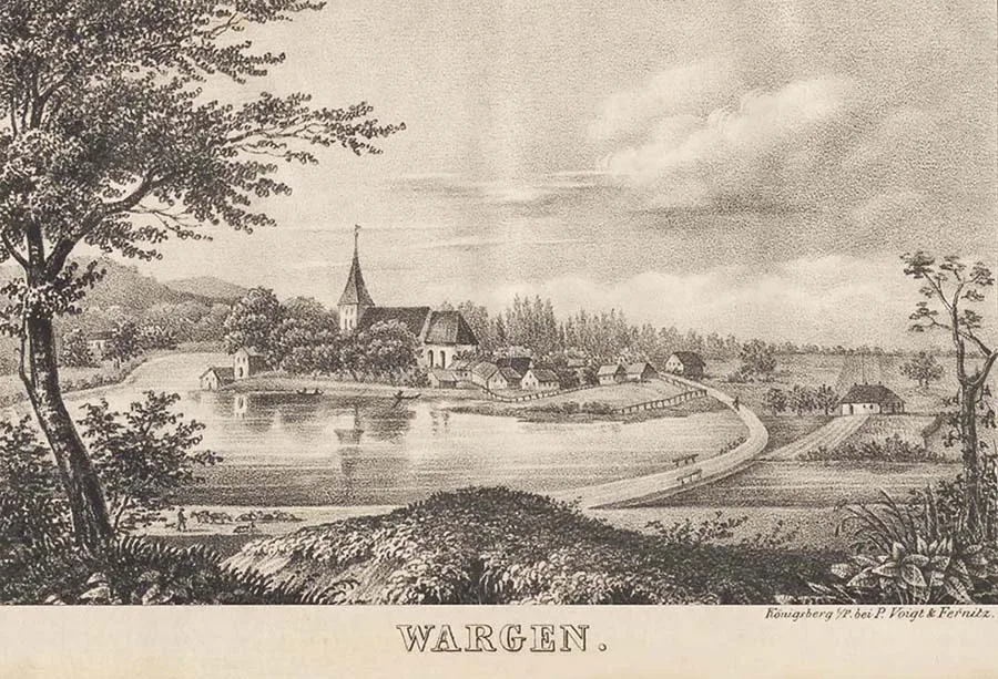
In this case the Teutonic Knights did not make use of the Prussian earth ramparts but built their castle to the north of the Prussian fortress. It was a small single-wing building measuring roughly 25 x 13 metres in plan.
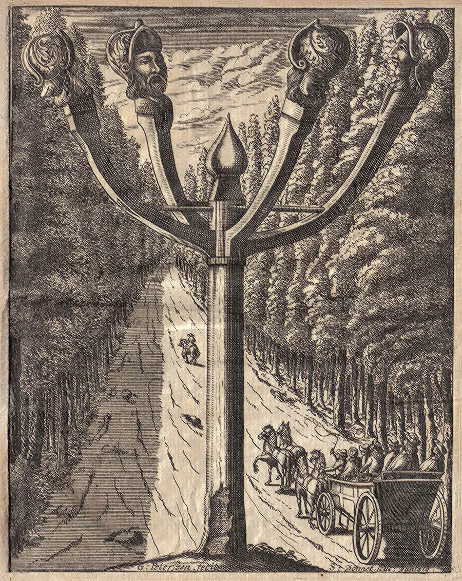 Illustration to the legend of the four knights from Wargen who were beheaded on the road to Fischhausen.
In the 14th century, to resist Lithuanian raids, an outer bailey (Vorburg) measuring roughly 140 x 80 m was built. A church was built at the same time. From 1436 the fortifications were used as a prison. By 1507 the castle had lost its military value, and in 1539 it was handed over to Jörg von Kanitz on condition that he keep it in good repair and be ready to receive the Duke. From 1561 the castle passed to Wilhelm Tiesel von Talnitz, whose son sold it in 1593 to Christoph von Kanitz. He in turn gave the castle to the church in 1611. By 1621 a village had grown up at the castle walls, whose inhabitants took the fortifications apart for building materials. By 1780 only ruins remained of the castle. By the beginning of the 19th century nothing was left of the stone fortifications.
In the 19th century Wargen was a village forming a rural community in the Landkreis of Fischhausen (from 1939 the Landkreis of Samland). The Wargen church was the parish church for 65 surrounding villages and estates. In 1874 the community of Wargen was included in the newly established Amtsbezirk of Landkeim.
In 1904–05 the post of head of the Amtsbezirk was held by Thulke, a landowner from Wargen.
On 30.09.1928 the following abolished Gutsbezirke were incorporated into the community of Wargen: Katzenblick (54°45'39'' N 20°22'14'' E), Landkeim (54°44'22'' N 20°20'43'' E) and Warglitten (Bugrovo), as well as the Gutsbezirk of Mednicken (Druzhnoye) from the Amtsbezirk of Mednicken and the Gutsbezirk of Regitten (54°45'53'' N 20°19'14'' E) from the Amtsbezirk of Rogehnen. The community now comprised the following localities: the village of Wargen (Kotelnikovo); the estates of Greibau (54°46'37'' N 20°17'52'' E), Katzenblick, Landkeim, Rablacken (54°44'29'' N 20°21'47'' E), Regitten (54°45'53'' N 20°19'14'' E), Preyl (Bugrovo, part), Warglitten (Bugrovo) and Mednicken (Druzhnoye); and the Vorwerke of Bugsienen (54°46'53'' N 20°21'38'' E), Lehndorf (54°44'44'' N 20°19'22'' E), Mühlenfeld (54°46'37'' N 20°20'20'' E), Pilzenkrug (54°47'15'' N 20°20'17'' E), Tannenkrug (54°48'09'' N 20°22'03'' E) and Wassermühle (54°46'30'' N 20°20'33'' E). On 18.05.1930 the Amtsbezirk of Landkeim was renamed the Amtsbezirk of Wargen. It consisted of two rural communities: Wargen (Kotelnikovo) and Trankwitz (Zapadnoye). Its composition did not change until 1945.
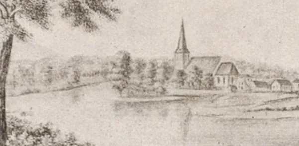
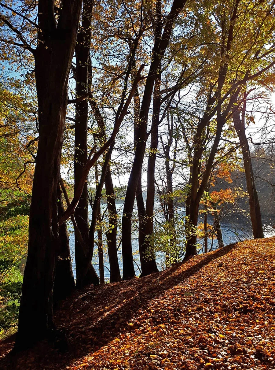 Shkolny (School) Pond, also known as Church Pond, also known as Wargen Pond.
During the fighting in 1945, Preyl Castle, the Wargen church and the village buildings were destroyed.
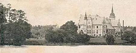
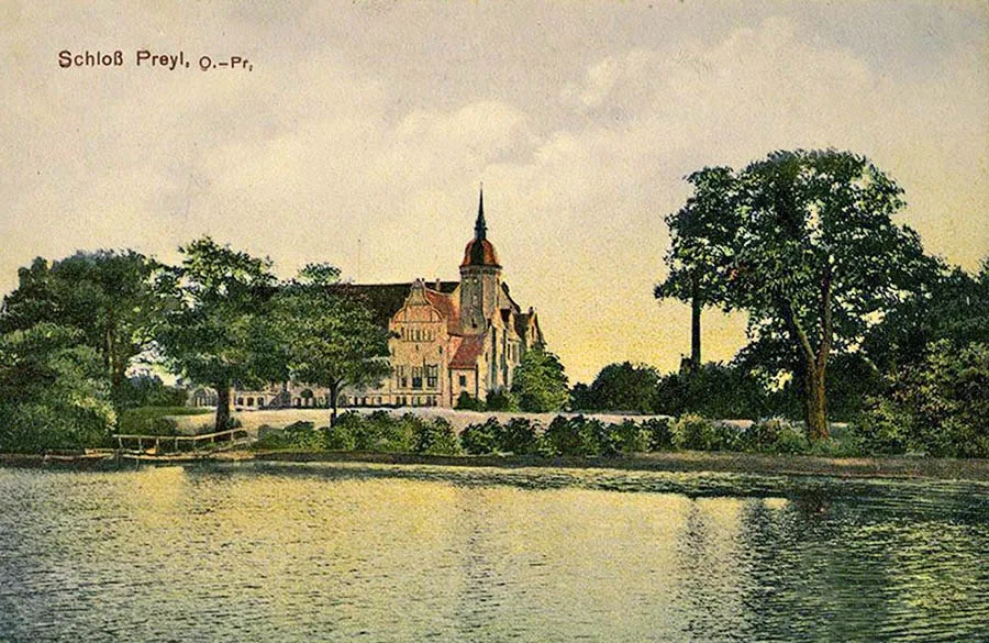 Postcard with a view of Preyl Castle.
On 17.11.1947 Wargen was renamed the settlement of Kotelnikovo. In 1955 the settlement had four houses. By 1984 three remained, and at the end of the 1990s two. As of 2018 the settlement had 10 houses.
Coordinates of the settlement: 54°45'43'' N 20°20'56'' E.
Sights: remains of the ramparts of the Order fortress, a memorial stone in honour of Wilhelm I, his son and his grandson.
Population: 1905 – 158, 1910 – 135, 2002 – 18 inhabitants.
Population of the Wargen community: 1905 – 158, 1910 – 135, 1933 – 925, 1939 – 906 inhabitants.
For reference
Population of the Greibau estate: 1895 – 10, 1905 – 12 inhabitants.
Population of the Gutsbezirk of Katzenblick: 1905 – 79, 1910 – 70 inhabitants.
Population of the Gutsbezirk of Landkeim: 1905 – 81, 1910 – 83 inhabitants.
Population of the Preyl estate: 1905 – 41 inhabitants.
Population of the Gutsbezirk of Rablacken: 1905 – 84, 1910 – 34 inhabitants.
Population of the Gutsbezirk of Regitten: 1905 – 108, 1910 – 115 inhabitants.
Population of the Bugsienen Vorwerk: 1905 – 6 inhabitants.
Population of the Lehndorf Vorwerk: 1905 – 122 inhabitants.
Population of the Mühlenfeld Vorwerk: 1905 – 32 inhabitants.
Population of the Pilzenkrug Vorwerk: 1905 – 4 inhabitants.
Population of the Tannenkrug Vorwerk: 1905 – 7 inhabitants.
Population of the Wassermühle Vorwerk: 1905 – 11 inhabitants.
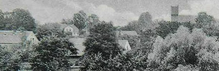
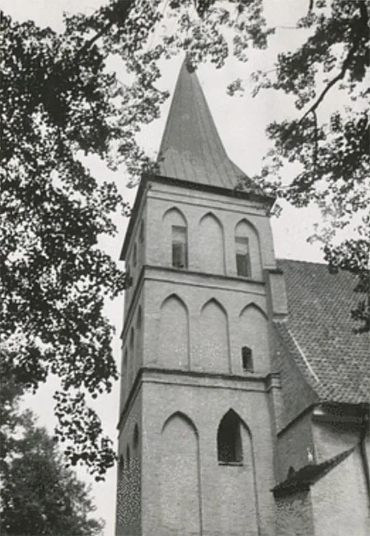 The tower of the Wargen church.
The parish of Wargen comprised: Adlig Kaporn (Spasskoye)1, Amalienhof (Chkalovsk, near the Navigator hotel), Auschlacken (Alekseyevka), Backelfeld (Kuznetskoye), Bärwalde (Veselovka), the Bärwalde forester's lodge (Forsthaus Bärwalde; 54°42'54'' N 20°16'54'' E), Barrücken (54°47'31'' N 20°18'34'' E), Barsenicken (54°46'30'' N 20°17'37'' E), Brasnicken (Voloshino), Bugsienen, Dammhoff (54°47'59'' N 20°26'34'' E), Dammkrug (54°48'08'' N 20°26'46'' E), Dommelkeim (Pavlinino), Elchdorf (until 1906 Pojerstieten bei Wargen, Kulikovo), Emillienhof (54°45'08'' N 20°21'36'' E), Ernstgrund (54°49'45'' N 20°19'04'' E), Fuchsberg (Kholmogorovka), Gallhöfen (54°46'10'' N 20°23'48'' E), Goldschmiede (Dimitorovo), Greibau, Groß Mischen (Svobodnoye), Kaporn (Spasskoye)1, Katzenblieck, Klein Mischen (54°49'48'' N 20°24'43'' E), Köllmisch Delgienen (54°51'09'' N 20°14'10'' E), Korniten (Lyublino), Landkeim, Laserkeim (54°46'03'' N 20°17'00'' E), Lehndorf, Margen (Zhukovskoye)1, the Margen forester's lodge (Forsthaus Margen; Zhukovskoye, part)1, Mednicken (Druzhnoye), Mühlenfeld, Ober Alkehnen (Morozovka), Ober Nautzwinkel (Zhukovskoye)1, Parschwitz (54°50'18'' N 20°19'35'' E), Perkuiken (54°49'23'' N 20°26'37'' E), Pilzenkrug2, Pokaiten (54°41'15'' N 20°26'46'' E)1, Preyl (Bugrovo, part), Prowehren (Chkalovsk), Quanditten (Sinyavino), Rablacken, Regitten, Rogehnen (54°45'13'' N 20°16'00'' E), Rosignaiten (Otkosovo), Saggehnen (54°45'50'' N 20°22'35'' E), Schorschehnen (Malinovka), Seerappen (Lyublino), Strittkeim (Chkalovsk), Tannenkrug, Tannenwalde (Chkalovsk), Taukitten (54°46'37'' N 20°18'41'' E), Trankwitz (Zapadnoye), Trenk (Vyazovka), Unter Nautzwinkel (54°41'22'' N 20°20'21'' E)3, Vierbrüderkrug (54°42'25'' N 20°18'55'' E)1, Waldhausen (Pereleski), Unter Alkehnen (Morozovka), Waldkater (54°44'31'' N 20°25'03'' E)2, Wargen (Kotelnikovo), Warglitten (Bugrovo), Wassermühle, Willgaiten (Kolosovka), Zielkeim (Petrovo).
___________
1 – until 1931, then in the parish of Groß Heydekrug (Vzmorye).
2 – the locality does not appear on maps of the 1930s.
3 – the locality does not appear on maps of the 1930s; after 1931 the area passed to the parish of Groß Heydekrug (Vzmorye).
Modern photo by Mikhail Ogorodnikov.
Translated from Russian with the help of AI (Claude, Anthropic), October 2026.