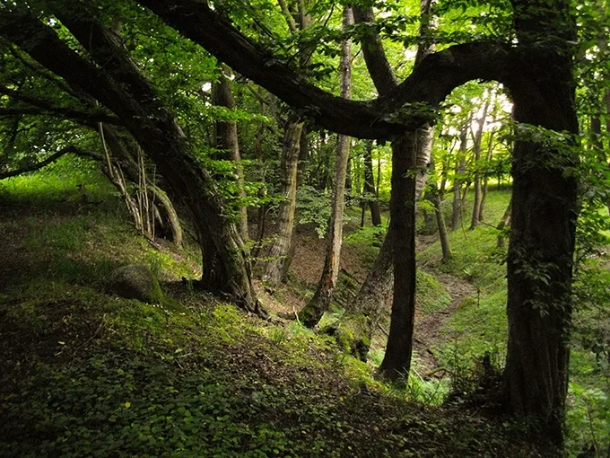
The summer heat is on its way. When you want to escape into the cool without straying far from the sea, to take shelter beneath broad chestnut leaves that barely let the scorching sun through, in a place where time slows down and the everyday becomes sacred, it is hard to imagine anything better than a walk through the Warnicken Forest (Warnicksche Forst). It stretches along the northern coast of the Sambia Peninsula, from the outskirts of modern-day Svetlogorsk westwards to the village of Lesnoye, which before the war was called Warnicken (from the Prussian Warnikai, “young ravens”).
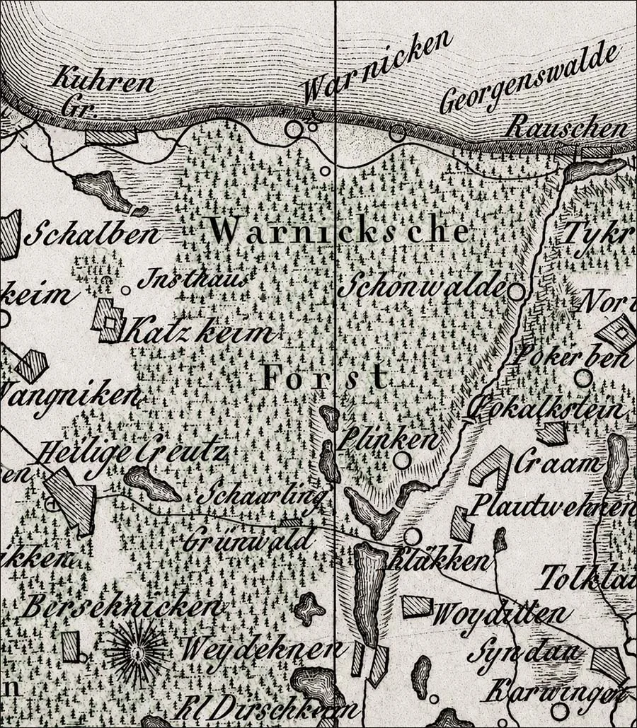
The Warnicken Forest on an early 19th-century map (Topographisch-militairischer Atlas).
The name of this area most likely derives from the name of an ancient Prussian family with “Warn” at its root, which left us this toponym. It resembles the modern Lithuanian surname Varnas — Prussian and Lithuanian were, after all, neighbours. In essence, this forest is the only woodland in the western part of the Kaliningrad Region to have survived in something close to its medieval state. And, much like the Rominte Forest (Rominter Heide), so popular today, it has kept an atmosphere all of its own, unlike anywhere else.
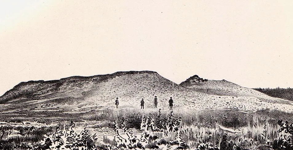
The Warnicken Forest begins with the most ancient burial monuments — Bronze Age barrows (the Georgenswalde cemetery), which can be seen a couple of hundred metres from the Yantarny Bereg (“Amber Coast”) sanatorium. The Georgenswalde–Otradnoye barrow cemetery belongs to the Sambian group of monuments of the West Baltic Barrow culture, typical of burials from the end of the 2nd millennium BC to the last centuries of the 1st millennium BC. The most significant feature of the complex is Barrow III, about 15 metres in diameter, excavated by Karl Engel (1895–1947) in the 1930s.
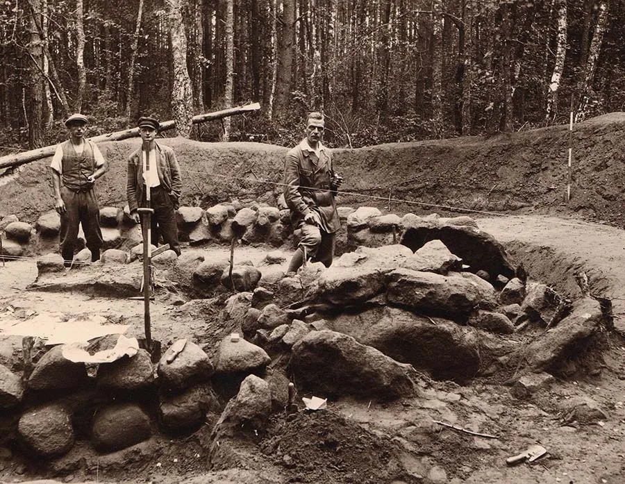 Karl Engel's excavations (in the foreground) on the barrows in the Warnicken Forest near Georgenswalde-Otradnoye (R. Grenz Archive, C. Engel Nachlass).
These are the family tombs of the distant ancestors of the Prussians. Some of them were investigated by Königsberg archaeologists in the 1930s and turned into an open-air exhibition. The barrows of the Warnicken Forest hold the mysteries of the emergence of cremation, of the family and of faith in the sky gods. Strolling unhurriedly through this “forest of the dead”, one can imagine how, generation after generation, people left their dreams here along with clay urns and bronze ornaments, sending them on into the future — to us. Another cluster of ancient barrows, where people buried their dead for centuries, lies in the heart of the Warnicken Forest, among the bogs north of the former Hirschau forestry station. Incidentally, before the war this was also where the oldest lime tree in the northern part of Prussia grew, six metres in girth. Until the mid-1920s visitors could climb up into its thick branches by special ladders, which were later removed so as not to disturb the tree.
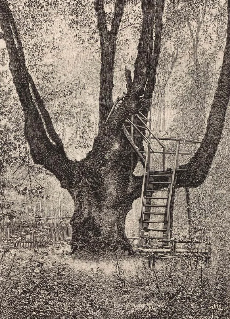
The ancient lime tree at Hirschau (Ambrassat, 1912).
After the Second World War the lime tree disappeared — as did a small grove near “Bismarck's Oak” nearby, planted in the shape of the Iron Cross (Eisernes Kreuz).
If you head south into the Warnicken Forest from Svetlogorsk itself or from Otradnoye, you may stumble upon a mysterious ravine, referred to in pre-war German sources as Hölle (German for “Hell”).
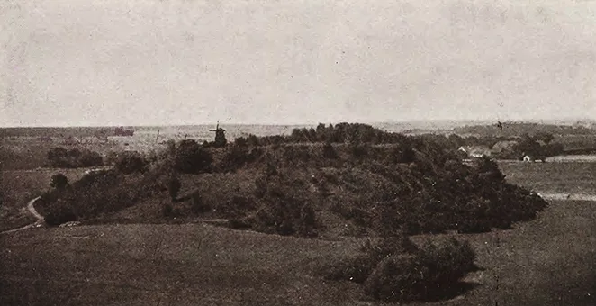
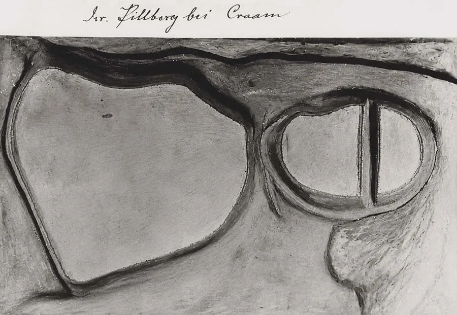 The Kraam-Pillberg/Grachyovka hillfort. Photograph of a model of the site from an exhibition of the former Prussia Museum in Königsberg (Ibsen et al. 2024).
“Devilish” place names are not uncommon in East and West Prussia (today's Poland). Deep within this enigmatic place, in the heart of the forest on the Cat Brook (Katzenbach), rises an “earthen pyramid”, once a Prussian castle — the Pillberg or Kraam/Plinken hillfort. Pillberg is a typical hybrid formation for East Prussia, going back to the Prussian Pils, “castle”, and the German Berg, “mountain”. This Prussian castle, which was of course built of timber, probably served as the seat of the local pre-German “administration”. Today it is an imposing fortification with multiple ramparts and deep ditches. At various times it has been interpreted as a cult site or as a refuge used for shelter from Lithuanian raids in the 14th century. We, however, have known this site since the early 1950s as the Grachyovka hillfort, from the excavations of the Leningrad archaeologist Frida Gurevich.
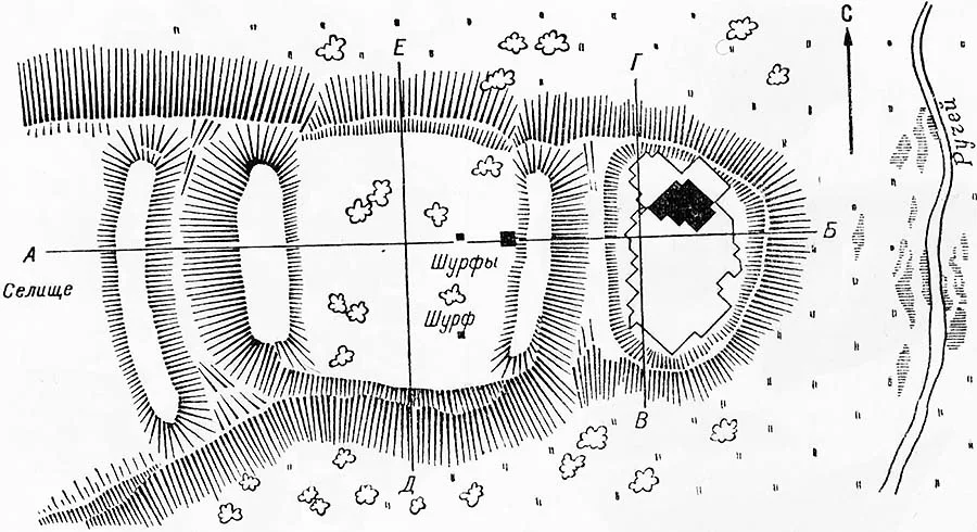 The Kraam-Pillberg/Grachyovka hillfort. Photograph of a model of the site from an exhibition of the former Prussia Museum in Königsberg (Ibsen et al. 2024).
She identified two main phases in the site's existence: an early one, from the Late Roman period, and a late one, from the 9th–13th centuries, with traces of fires probably dating to the mid-13th century — the beginning of the German colonisation of Sambia.
Modern research, including geo-drilling and radiocarbon analysis, has shown that the site was part of a wider settlement system in north-western Sambia. Once, ploughed fields stretched around the castle and children's laughter could be heard. Now, beneath the dark canopy of the forest, the earthen pyramid, wrapped in ramparts and ditches, keeps its ancient secrets. As late as the mid-19th century, a huge “devil's stone” lay at the foot of the castle mound — a Prussian sacrificial altar, sunk into the darkness of the ages (see “Legends of the Ancient Stones”). And still, when you walk here, especially at dusk, a shiver runs down your spine and you seem to hear those very voices.
Another Prussian fortified mound lies in the southern part of the Warnicken Forest. The German name of the hillfort — Klein Hausen (“Little Hamlet”) — can be misleading. In fact, the site is by no means small: it covers a considerable area and stands on a hill about 80 metres above sea level. The word Haus here should probably be understood in the sense of a “castle-house” or a “fortified residence”. The hillfort consists of two parts — the castle and the outer bailey (Vorburg) — and most likely took on this form in the time of the Teutonic Order, when it may have been one of the residences of the Bishop of Samland (Sambia).
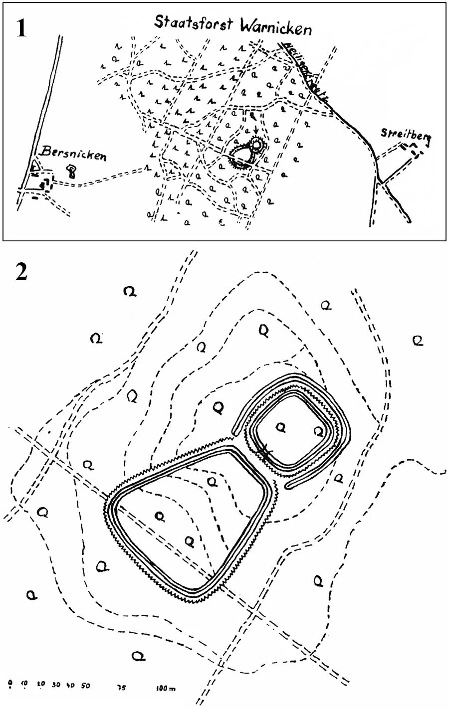
Plan of the Prussian hillfort — the Order and episcopal castle of Klein Hausen (Wendt 2011).
Before the Second World War, tourists loved coming here to admire the surrounding landscape from the top of the hill (you could even see Galtgarben!), but today, as so often happens here, the road to the high ramparts and deep ditches of the Prussian hillfort is blocked by a fence...
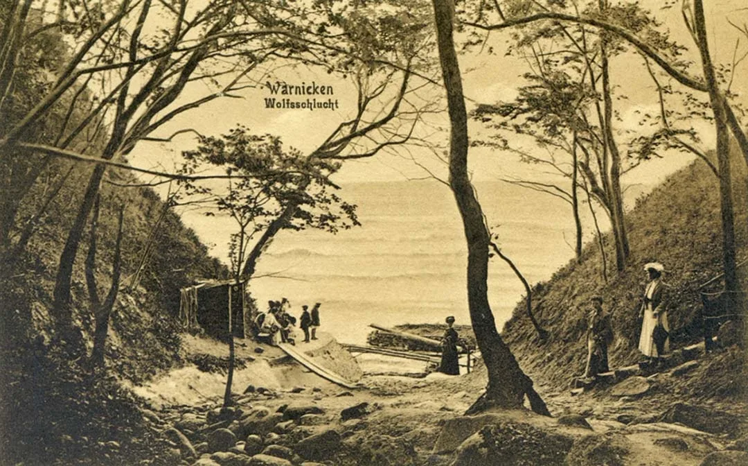
To the north-west, near today's Lesnoye, the Warnicken Forest runs up against the Wolf Gorge (Wolfsschlucht) — a favourite leisure spot of the people of Königsberg, captured on many idyllic postcards.
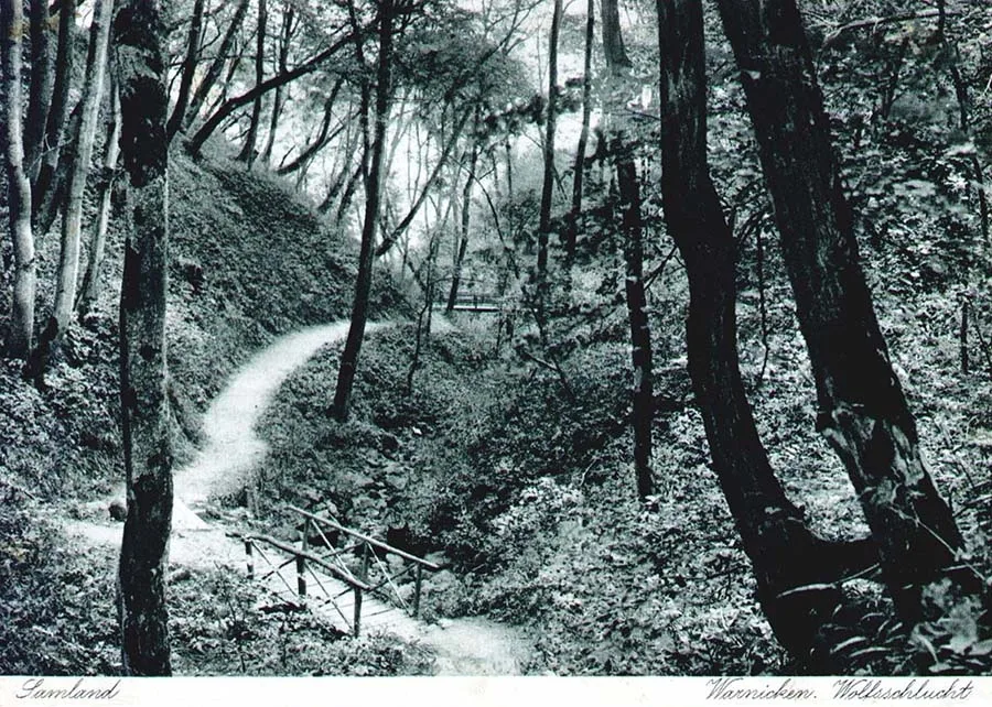 Warnicken — the Wolf Gorge (postcard from the author's collection).
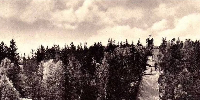
And not far from it, a real “Stairway to Heaven” climbed to the top of the cliff.

Warnicken — "Stairway to Heaven" (postcard from the author's collection).
Travellers who want a closer look at the forest's natural life can turn into the thicket at the abandoned railway bridge in Svetlogorsk and head towards Lesnoye, to the old Forest Museum, which, after many years of neglect, has reopened its doors and introduces visitors to the diversity of the local flora and fauna. I remember coming here for the first time on a misty October morning in 1995 on a school trip, and being spellbound by the cross-sections of huge trees with hundreds of growth rings (perhaps from that very lime tree?) and by the stories of the forester who founded the museum.
For me, the Warnicken Forest is a special place, a reserve of atmospheres, of other people's memories and of spirits — a Sambian Rominte. It began long ago as a sacred grove surrounding the ancient tombs of the ancestors, and today, just as hundreds of years ago, its old trees every now and then tumble down the sea cliffs into the Prussian night.
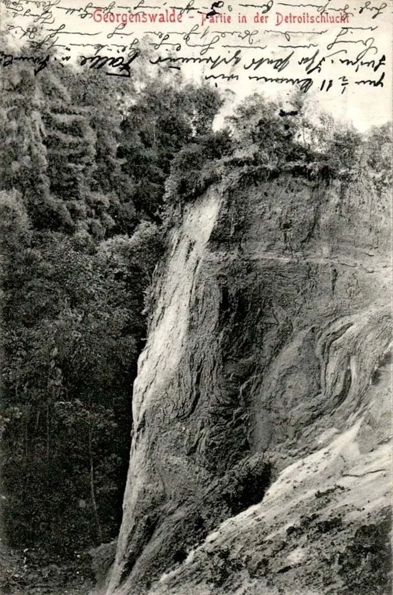 Georgenswalde — the cliff at the so-called “Detroit Gorge”
(postcard from the author's collection).
To be continued.
SOURCES
Гуревич, Ф.Д. Древности северо-западных областей РСФСР в I тысячелетии н.э. Отдельный оттиск. Материалы и исследования по археологии СССР, №76. М.-Л.1960.
Ambrassat, A. Die Provinz Ostpreußen: Ein Handbuch der Heimatkunde. 2., überarb. Aufl. Königsberg: J. H. Bon’s Verlag, 1912.
Ibsen, T., Prassolow A-J., Eilbracht, H., Kriesch, S., v. Carnap-Bornheim, C., Wemhoff, M. “The Hillfort Complex of Kraam and Pokirben in East Prussia in the Light of Archives and Modern Fieldwork.” In: G. Zabiela (Hrsg.), Prakalbinta priešistorė / Unveiling Prehistory. A Book on the Occasion of Audronė Bliujienė’s Jubilee. Klaipėda: Klaipėdos universiteto leidykla, 2024, S. 92–122.
Schlicht, O. Das westliche Samland: Ein Heimatbuch des Kreises Fischhausen. Zweiter Band / bearb. von Konrad Haberland. Dresden: Verlag von Kolbe & Schlicht, 1922. [8], 312 S.
Topographisch-militairischer Atlas von dem Königreiche Preußen mit dem Gebiete von Danzig: in 30 Blättern / hrsg. von dem Geographischen Institute; entw. von F. W. Streit. Berlin, 1802–1808; Wolfenbüttel: Melchior-Verlag, 2006.
Wendt, A. Samländische Burgwälle. Studien zur Archäologie Europas, Bd. 13. Bonn: Verlag Dr. Rudolf Habelt, 2011. ISBN 978-3-7749-3510-5.
Translated from Russian with the help of AI (Claude, Anthropic), October 2026.