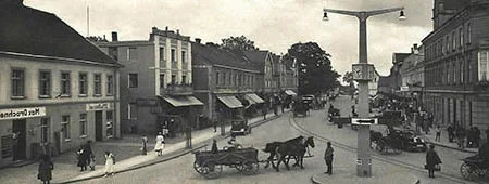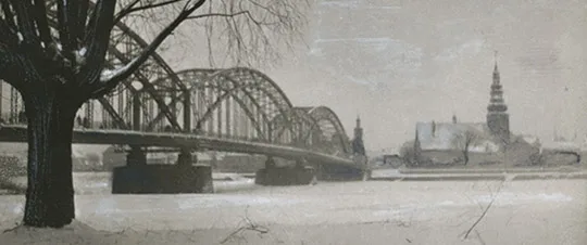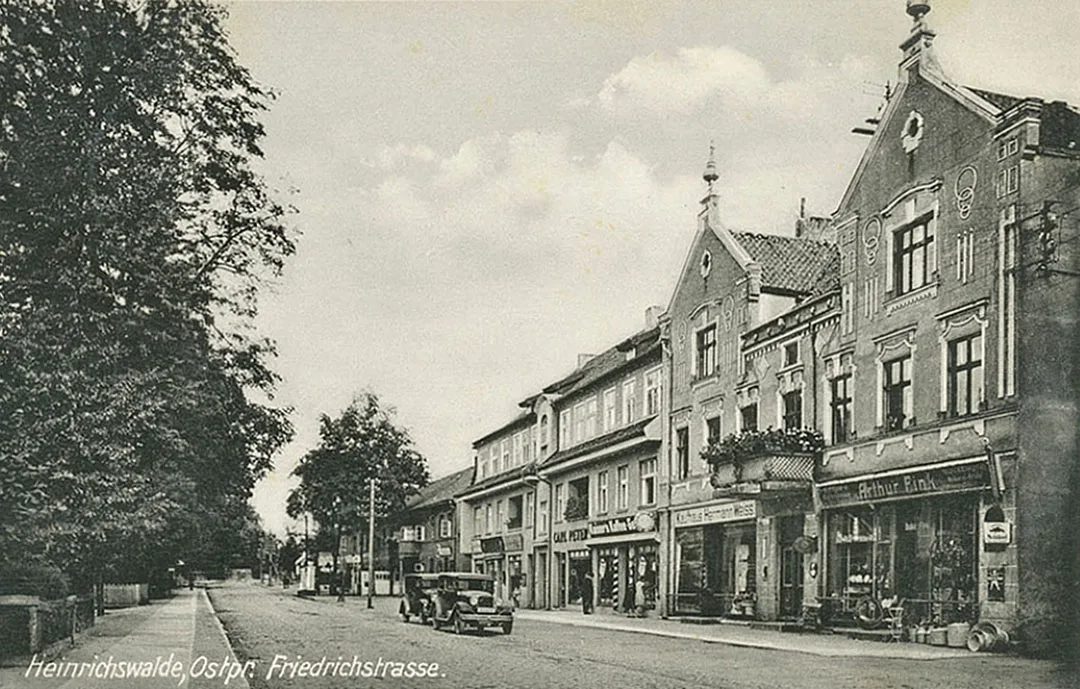
Heinrichswalde is believed to have been founded in 1292, but reliable documentary evidence of a settlement on this site dates only from the 17th century. For a long time several localities existed on the site of Heinrichswalde, which were later merged into Heinrichswalde: the village of Heinrichswalde, the Adlig Heinrichswalde estate (55°02'56'' N 21°41'20'' E), Gassen (55°02'51'' N 21°40'27'' E), Heinrichswalde Mühle (Heinrichswalde Mill) (55°03'12'' N 21°42'10'' E), the Stuttberg estate (55°02'39'' N 21°41'27'' E) and Hinterwäldchen (Slavsk, part).
In 1657 Frederick William, Elector of Brandenburg and Duke of Prussia, granted his huntsman and captain Heinrich Ehrenreich von Halle 50 Hufen and 30 Morgen of land (832.5 ha), as mentioned in documents of 1678. The new estate was named Heinrichswalde, "Heinrich's forest", since the territory was mostly covered by forest.
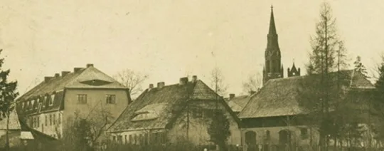
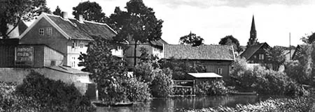
According to the same documents, in 1678 the estate passed to von Halle's son, Wilhelm Reinhard. At about the same time the village of Heinrichswalde appeared next to the estate, settled by peasants from the surroundings of Tilsit (Sovetsk). In 1686 a wooden church was built in the village with the direct involvement of Wilhelm Reinhard von Halle. It soon needed rebuilding. The reconstruction was directed by Wilhelm Reinhard's widow, Rosina von Halle, and in its final stage (after Rosina's death) by her second husband and the new owner of the estate, von Kalnein. The renewed church was opened in 1694. However, in 1792 the tower was dismantled because it was in danger of collapse, and in 1862 the church itself was closed. The neo-Gothic brick church that survives today was built in 1867–69. Parts of the surviving structure of the old church were used in its construction.
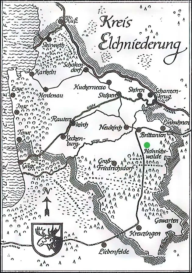
Map of Kreis Elchniederung (Russian: Losinaya Dolina, "Elk Valley").
After the plague epidemic of 1709–11 the lands in the area were depopulated, and as a result King Frederick William I took measures to attract settlers persecuted for their religion from Germany, Switzerland, France and Denmark to Prussia.
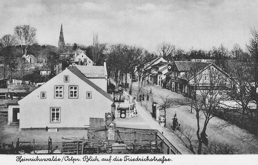 Friedrichstraße, the main street of Heinrichswalde.
In 1738 the lands of Heinrichswalde came under the patronage of the King. Adlig Heinrichswalde became a state domain and the seat of a Domänenamt (domain office). The village of Heinrichswalde was a "royal" one, that is, it lay on royal land where supreme judicial authority belonged to the King. In 1812 the Adlig Heinrichswalde domain was bought by Count Otto Karl Dietrich von Keyserlingk, who had fought in the wars against Napoleon in the Russian army; after retiring in 1816 he settled in Heinrichswalde, where he set about developing agriculture.
In the 19th century Adlig Heinrichswalde was an estate which from 1867 formed a Gutsbezirk (estate district) in Kreis Niederung (from 1938 Kreis Elchniederung). The estate belonged to the parish of Heinrichswalde.
In 1871 Adlig Heinrichswalde had four dwelling houses. On 26.03.1874 the Gutsbezirk Adlig Heinrichswalde was included in the newly established Amtsbezirk Heinrichswalde. On 30.09.1928 the Gutsbezirk Adlig Heinrichswalde was abolished. The estate and the adjacent territory became part of the community of Heinrichswalde. Plots of 37.8 and 56.2 ha were incorporated into the communities of Groß Friedrichsdorf (Gastellovo) and Clemenswalde (Slavsk, part; Mayskoye, part) respectively.
From 1818 the village of Heinrichswalde formed a rural community in Kreis Niederung (from 1938 Kreis Elchniederung).
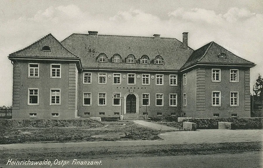 The tax office of the Kreis looked very elegant.
Heinrichswalde housed the administrative bodies of the Kreis, which was quite rare for a locality without town status. The church in Heinrichswalde was the parish church for the surrounding villages and estates.
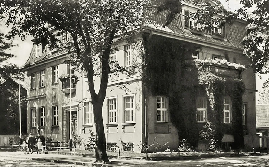 Savings bank of Heinrichswalde.
In 1871 the village of Heinrichswalde had 64 dwelling houses. On 26.03.1874 the rural community of Heinrichswalde was included in the newly established Amtsbezirk Heinrichswalde. The heads of the Amtsbezirk were invariably residents of the village of Heinrichswalde: the merchant and chairman of the district municipal fund Arcelli (from 1874), the merchant Lörke (from 1885), the community head Raudies (1908–1919), the office manager Fritz Dannappel (1919–26), the head of the district committee Karl Denke (1929–29) and the community head Franz August Bethke (from 1929).
On 14.11.1876 the lands of Schnecker Wiesen, mentioned in 1874 as an established rural community, became part of the community of Heinrichswalde. In 1878 a telegraph station opened in Heinrichswalde, connecting the village with Tilsit (Sovetsk), Kaukehmen (Yasnoye), Sköpen (Mostovoye), Neukirch (Timiryazevo), Groß Skaisgirren (Bolshakovo) and Alt Lappienen (Bolshiye Berezhki). On 07.11.1879 the territories of Hinterwäldchen (Slavsk, part) were annexed to the community of Heinrichswalde.
In 1891 the Königsberg–Tilsit railway line was laid through Heinrichswalde. In the same year the district hospital was opened.
On 11.12.1893 the community of Gassen (Slavsk, part) was integrated into the community of Heinrichswalde. From 1905 a district newspaper was published in Heinrichswalde. Its distance from industrial sites, the nearby forest, the presence of mineral water and, above all, a visit to these parts by Kaiser Wilhelm II helped to popularise Heinrichswalde and its surroundings as a resort. All the more so since the spa business was booming in Germany at the very beginning of the 20th century. Both residents of East Prussia and tourists from the rest of Germany began to visit Heinrichswalde for recreation.
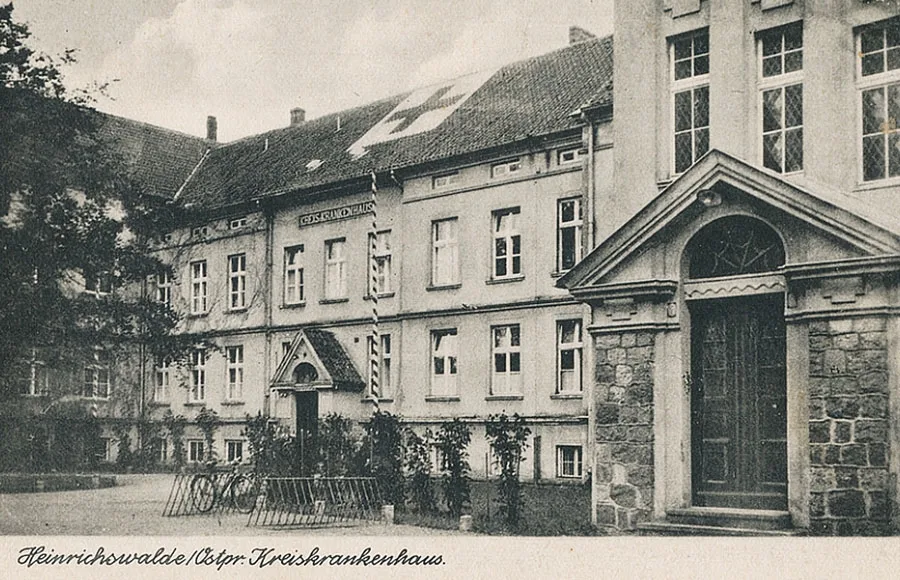 District hospital in Heinrichswalde.
On 9–12 September 1914, during the First World War, Heinrichswalde was occupied by Russian troops. On 13.09.1914 a battle between Russian and German troops took place near the Nassenthal estate (Kryzhovnikovo). Soldiers of the 270th Gatchina Infantry Regiment covered the retreat of the Russian army across the Memel.
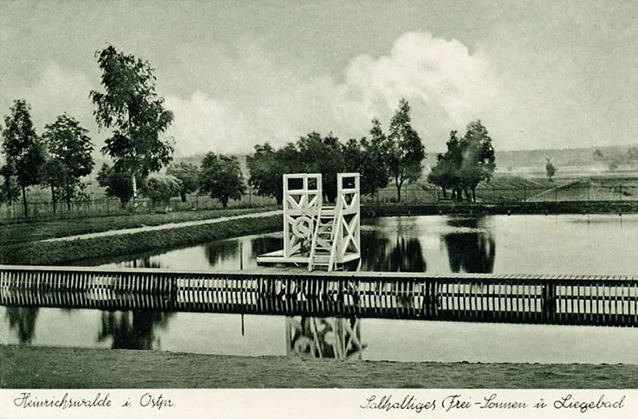 The mineral water pool is still the town's main attraction today.
The fallen Russian soldiers were buried in Heinrichswalde (22 men), and another 15 soldiers at the fork of the roads Heinrichswalde (Slavsk) – Neukirch (Timiryazevo) and Linkuhnen (Rzhevskoye).
In 1923 construction of a street lighting network began in Heinrichswalde, and by 1930 the streets had been put in proper order and provided with pavements. On 30.09.1928 the central part of the abolished Gutsbezirk Adlig Heinrichswalde, together with the estate itself, was incorporated into the community of Heinrichswalde. From then on Heinrichswalde developed as a single locality. Also in 1928 a new, modern wing of the Heinrichswalde district hospital was built. In 1936 the mineral water pool, which survives to this day, was opened. In 1939 Heinrichswalde was granted town status.
In October 1944, as Soviet troops approached, the evacuation of the population to the Heiligenbeil (Mamonovo) area began. On 20.01.1945 units of the 263rd Rifle Division of the Red Army entered the town.
On 07.09.1946 Heinrichswalde was renamed the town of Slavsk. The Slavsk District was created at the same time. Clemenswalde was not officially renamed; its eastern part de facto became part of the town of Slavsk. Shortly before, on 04.09.1946, the first train of settlers arrived in the town: 129 families (625 people). By the end of the year another 526 families had arrived, who were housed in Slavsk itself and in the settlements of the district. By the time the settlers arrived, the secondary school was ready; it opened on 01.09.1946, and a little later a school for German children began operating. In 1947 a post office and a 500 W radio relay hub were opened in Slavsk.
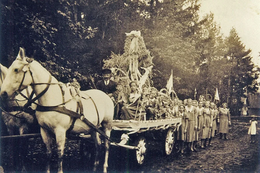
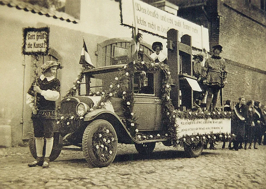 Harvest festival in the Elk Valley.
In 1947 the district newspaper "Kolkhoznaya Slava" began publication, and a 200-seat cinema, a veterinary station, a district consumer cooperative, an industrial plant, a food-processing plant, an industrial cooperative and a cooperative for disabled people were opened. Street lighting was restored in the town.
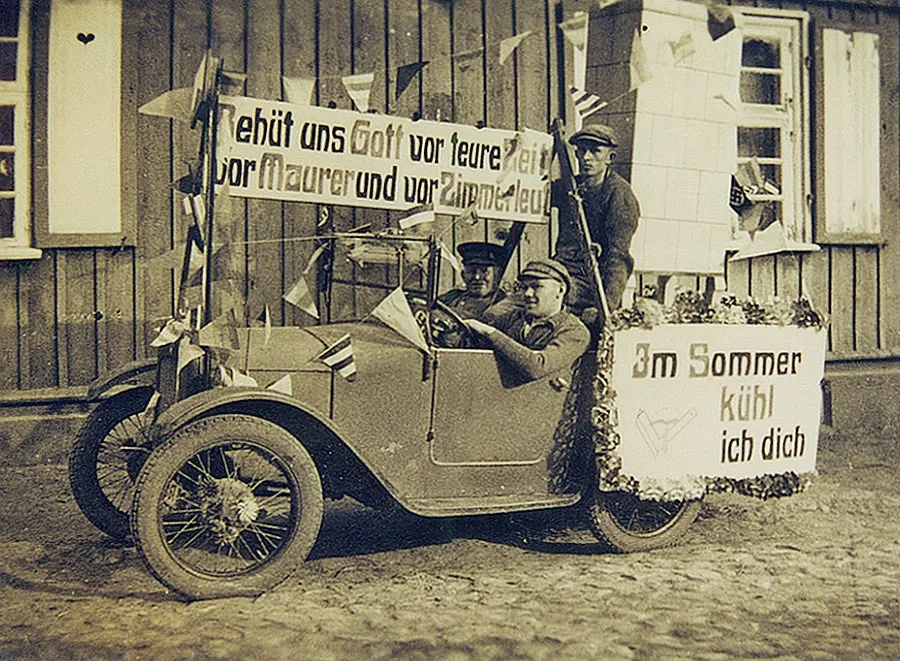 Local librarians (above) and stove makers also took part in the Harvest Festival.
In 1948 the town kindergarten opened and the railway station began serving passengers. A cheese factory was launched, and the first agricultural exhibition was held. By 1951 Slavsk had a hospital, a polyclinic, a sanitary-epidemiological station, an anti-malaria station and a psychiatric hospital. The town's infrastructure was supplemented by nurseries, a bathhouse, a hotel and consumer service facilities. In 1952 a stadium with a football pitch and volleyball and basketball courts was completed. In 1961 a town park was laid out and named after Yu. Gagarin. In 1965 a music school opened. In 1966 a new department store and a dairy began operating. In 1976 a new school building was opened.
In 1970 an enterprise as unusual for the USSR as a mushroom-cooking workshop began operating in Slavsk.
The town developed along the lines typical of a district centre. In the 1970s several small apartment buildings were built; in 1977 a new food market and the "Oktyabr" cinema opened; in 1978 the centralised district library system and a new kindergarten began operating. The most important field of activity in the Soviet period was land reclamation.
After 1987 the first cooperatives began to open in Slavsk; they were mainly engaged in buying up and processing agricultural produce, carp farming, and repairing housing and household radio equipment. In 1991 the first private shop opened in the town, and a video hall began operating in the "Oktyabr" cinema. By 1994 a Lutheran congregation and an Orthodox parish had been established in the town. At the same time the "Oktyabr" cinema was converted into the "Mirazh" youth centre.
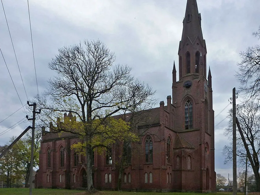 Heinrichswalde church before restoration began (2016).
In 2006 Russian-Swedish enterprises producing roller shutters and electronic circuit boards began operating in Slavsk. In 2008 the bus station resumed operation and a tourist centre was opened. In 2009 the town museum welcomed its first visitors. In 2019 restoration work began on the Lutheran church building.
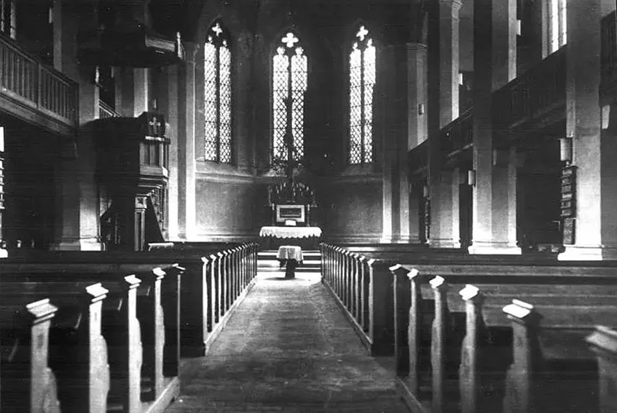 Interior of the church of Heinrichswalde.
At present (2020) Slavsk has a school, a kindergarten, a children's creativity centre, a children's and youth sports school, a hotel, a district hospital, a polyclinic, a music school, a central library and a children's library, and a museum of history and local lore.
Sights: the church building (1869), the railway station building, the railway water tower, the mineral water pool, the district hospital building (1891–1928), the grave of 12 Russian and 2 German soldiers (1914), the grave of 15 Russian soldiers of the 270th Infantry Regiment at the exit from the town (1914, 55°03'51'' N 21°41'32'' E), the memorial complex at the mass grave of Soviet soldiers (345 people, monument 1954), the "Neukirch-Skaisgirren" road sign.
Population (community and Gutsbezirk of Heinrichswalde – Slavsk): 1816 – 248, 1852 – 862, 1861 – 975, 1885 – 1725, 1900 – 2257, 1925 – 2581, 1933 – 3180, 1939 – 3467, 1947 – 1546, 1959 – 3862, 1970 – 4052, 1989 – 4682, 2002 – 5172, 2010 – 4614, 2012 – 4575, 2013 – 4503, 2014 – 4408, 2015 – 4330, 2016 – 4269, 2017 – 4145, 2018 – 4074, 2018 – 4019, 2020 – 3984 inhabitants.
For Reference
Population of the community of Heinrichswalde: 1816 – 150, 1852 – 711, 1861 – 868, 1867 – 907, 1871 – 960, 1885 – 1592, 1933 – 3180, 1939 – 3467 inhabitants.
Population of Adlig Heinrichswalde: 1816 – 98, 1852 – 151, 1867 – 140, 1871 – 108, 1885 – 133 inhabitants.
Population of the community of Clemenswalde: 1867 – 60, 1871 – 70, 1885 – 59, 1905 – 194, 1910 – 169, 1939 – 337 inhabitants.
Population of Heinrichswalde Mühle (mill): 1867 – 4, 1871 – 5, 1885 – 3 inhabitants.
Population of Gassen: 1867 – 431, 1871 – 361, 1885 – 423 inhabitants.
Population of Hinterwäldchen: 1867 – 9, 1871 – 33 inhabitants.
Population of Sternwäldchen: 1867 – 364, 1871 – 394 inhabitants.
Population of Stuttberg: 1867 – 15, 1871 – 16, 1885 – 15 inhabitants.
Amtsbezirk Heinrichswalde
On 26.03.1874 Amtsbezirk No. 13 Heinrichswalde was established in Landkreis Niederung, comprising 10 rural communities: Clemenswalde (Slavsk, part; Mayskoye, part), Gassen (Slavsk, part), Heinrichswalde (Slavsk), Heinrichswalde Mühle (Slavsk cemetery), Hinterwäldchen (Slavsk, part), Klaar (55°01'54'' N 21°39'35'' E), Linkuhner Warnie, Schnecker Wiesen, Sternwäldchen (Slavsk, part) and Szalloge (55°03'05'' N 21°38'02'' E), as well as six Gutsbezirke: Adlig Heinrichswalde (Slavsk, part), Adlig Lembruch (Lepestkovo), Klaarhof (Paporotnikovo), Stuttberg (Slavsk, Tikhaya Street), Wenzischken (from 1838 Wenzen (Motylkovo) and Willkehlen (from 1938 Kleinheinrichswalde, Yarovoye).
On 14.11.1876 the lands of Schnecker Wiesen were annexed to the rural community of Heinrichswalde (Slavsk). On 07.11.1879 the territories of Hinterwäldchen (Slavsk, part) were also annexed to the community of Heinrichswalde. On 23.01.1893 the community of Klaar lost its independence and became part of the rural community of Clemenswalde (Slavsk, part; Mayskoye, part). On 11.12.1893 the rural community of Gassen (Slavsk, part) gave up its independence and was likewise incorporated into the rural community of Heinrichswalde (Slavsk). As a result, Amtsbezirk Heinrichswalde came to consist of three rural communities: Heinrichswalde (Slavsk), the community of Clemenswalde (Slavsk, part; Mayskoye, part) and Szalloge, and four Gutsbezirke (Adlig Heinrichswalde, Slavsk, part), Adlig Lembruch (Lepestkovo), Heinrichswalde Mühle (55°03'12'' N 21°42'10'' E) and Willkehlen (Yarovoye).
Clemenswalde was founded in 1654. Until 1785 it was called Clementswalde. From 1818 Clemenswalde was a village forming a rural community in Kreis Niederung (from 1938 Kreis Elchniederung). The village belonged to the parish of Heinrichswalde (Slavsk). In 1871 Clemenswalde had seven dwelling houses. On 26.03.1874 the rural community of Clemenswalde was included in the newly established Amtsbezirk Heinrichswalde (Slavsk). In 1891 the Königsberg–Tilsit (Sovetsk) railway was built. Heinrichswalde station (now Slavsk-Novy) was opened on this line and became part of the rural community of Clemenswalde. On 23.01.1893 the village of Klaar, previously an independent rural community, was also incorporated into the community of Clemenswalde. On 30.09.1929 the forest colony of Klaarhof (Paporotnikovo, later Mayskoye) passed from the forest Gutsbezirk Schnecken (Paporotnikovo) to the community of Clemenswalde. On 01.01.1933 the community of Szalloge was also incorporated into the community of Clemenswalde.
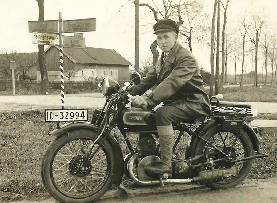 A young motorcyclist on the road in Heinrichswalde.
Localities incorporated into the community of Heinrichswalde
Heinrichswalde Mühle was in the 19th century a village forming a rural community in Kreis Niederung (from 1938 Kreis Elchniederung). The village belonged to the parish of Heinrichswalde (Slavsk). In 1871 Heinrichswalde Mühle had one house. On 26.03.1874 the rural community of Heinrichswalde Mühle was included in the newly established Amtsbezirk Heinrichswalde. No later than 1908 the rural community was converted into a Gutsbezirk, and the village of Heinrichswalde Mühle into an estate. On 30.09.1928 the Gutsbezirk Heinrichswalde Mühle was abolished and annexed to the rural community of Heinrichswalde.
Gassen was founded in 1656. Originally the name was spelled Gaßen, changing after 1818 to Gassen. From 1818 Gassen was a village forming a rural community in Kreis Niederung (from 1938 Kreis Elchniederung). The village belonged to the parish of Heinrichswalde (Slavsk). In 1871 Gassen had 32 dwelling houses. On 26.03.1874 the rural community of Hinterwäldchen was included in the newly established Amtsbezirk Heinrichswalde. On 11.12.1893 the community of Gassen gave up its independence and became part of the rural community of Heinrichswalde.
Hinterwäldchen is mentioned from 1736 as Hinterm Heinrichswaldschen Wäldschen (literally "Behind the Heinrichswalde Grove"). After 1785 it was called Hinterm Wäldschen. In the 19th century Hinterwäldchen was a village forming a rural community in Kreis Niederung (from 1938 Kreis Elchniederung). The village belonged to the parish of Heinrichswalde (Slavsk). In 1871 Hinterwäldchen had two houses. On 26.03.1874 the rural community of Hinterwäldchen was included in the newly established Amtsbezirk Heinrichswalde. On 07.11.1879 the community of Hinterwäldchen was dissolved and the village incorporated into the community of Heinrichswalde.
Sternwäldchen was founded in 1811 as a forest colony (a settlement on land reclaimed from the forest), which belonged to the forest Gutsbezirk Schnecken, Forst, administered from the Oberförsterei (head forestry) Schnecken (Paporotnikovo, later Mayskoye). The forest colony belonged to the parish of Heinrichswalde (Slavsk). In 1871 Sternwäldchen had 20 dwelling houses. On 24.11.1873 the forest colony of Sternwäldchen was annexed to the rural community of Heinrichswalde. Nevertheless, on 26.03.1874, when Amtsbezirk Heinrichswalde was formed, a rural community of Sternwäldchen is mentioned, which was included in the Amtsbezirk as an independent community. But soon afterwards (probably before 1881) the community of Sternwäldchen was finally abolished, and the locality became part of the rural community of Heinrichswalde.
Stuttberg was founded in 1798 as a Vorwerk (outlying farm) of Heinrichswalde. In 1871 Stuttberg had one dwelling house. By this time Stuttberg had the status of an estate and formed a Gutsbezirk in Kreis Niederung (from 1938 Kreis Elchniederung). The estate belonged to the parish of Heinrichswalde (Slavsk). On 26.03.1874 the Gutsbezirk Stuttberg was included in the newly established Amtsbezirk Heinrichswalde. No later than 1908 (probably before 1881) the Gutsbezirk Stuttberg was abolished and incorporated into the rural community of Heinrichswalde.
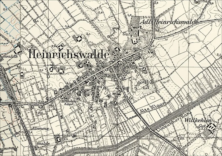 Heinrichswalde on the topographic map of East Prussia, 1937.
Population composition of the community of Heinrichswalde (1871): Protestant Christians – 953, Catholics – 2, other Christians – 5, children under 10 – 230, literate – 533 (74%), blind – 1, insane – 4.
Population composition of Adlig Heinrichswalde (1871): all 108 – Protestant Christians, children under 10 – 34, literate – 44 (59%)
Population composition of Clemenswalde (1871): Protestant Christians – 68, other Christians (excluding Catholics) – 2, children under 10 – 15, literate - 39 (78%.)
Population composition of the Heinrichswalde mill (1871): all 5 – Protestant Christians, no children under 10, literate 4 (80%).
Population composition of Hinterwäldchen (1871): Protestant Christians – 32, Catholics – 1, children under 10 – 13, literate – 11 (55%)
Population composition of Gassen (1871): Protestant Christians – 343, other Christians (excluding Catholics) – 18, children under 10 – 75, literate – 170 (62%), blind – 1, deaf-mute – 1.
Population composition of Sternwäldchen (1871): Protestant Christians – 390, Catholics – 2, other Christians – 2, children under 10 – 110, literate – 131 (53%).
Population composition of Stuttberg (1871): all 16 – Protestant Christians, children under 10 – 1, literate – 11 (73%).
The parish of Heinrichswalde comprised: Adlig Lehmbruch (Lepestkovo), Adlig Linkuhnen (Rzhevskoye), Argolothen (from 1938 Argendorf, Priozyorye), Augustlauken (from 1938 Hohensprindt, Priozyorye, part), Baltruscheiten (55°03'30'' N 21°43'37'' E), Brunischken (55°03'50'' N 21°41'51'' E), Börgerhuben (55°04'18'' N 21°41'26'' E),Clemenswalde or Clemenswalde (Slavsk, part), Dittballen (from 1938 Streulage, Luzhki), Grigoliegen (from 1938 Lehmbruch, Zapovedniki), Groß Brittanien (from 1928 Brittanien, Shcheglovka), Grünbaum (Prigorodnoye, part), Grüneberg (Shcheglovka, part), Heinrichswalde (Slavsk), Försterei Hohensprindt forestry (Priozyorye, part), Klaarhof (Paporotnikovo), Klein Brittanien (from 1928 Brittanien, Shcheglovka), Köllmisch Linkuhnen (Zheleznodorozhnoye), Nassenthal (Kryzhovnikovo), Neu Descherin (from 1938 Deschen, 55°01'13'' N 21°43'54'' E), Neusorge (Paporotnikovo), Noragehlen (from 1938 Urbansprind, Luzhki, part), Försterei Reussenhof forestry (Prigorodnoye, part), Sandfluß (from 1931 Lindental (Prigorodnoye), Schnecken, Forst (Paporotnikovo, later Mayskoye), Schneckendorf, Forst forestry (55°01'32'' N 21°37'36'' E), Szalloge (55°03'05'' N 21°38'02'' E), Thomaten (Dalneye), Warnie (from 1938 Warnien, Tumanovka, part), Willkehler Moor (Prigorodnoye, part).
Photos: Bildarchiv Ostpreußen, bildarchiv-ostpreussen.de and Mikhail Ogorodnikov.
Translated from Russian with the help of AI (Claude, Anthropic), October 2026.