 Coat of arms
of Insterburg
Once the main construction work was completed, Insterburg Castle was a four-winged structure of impressive size (45x44 m), typical of a Teutonic Order komtur castle, with an extensive outer bailey (Vorburg, 50x100 m) on its western side. In 1339 Insterburg became the seat of a commandery. Two of its komturs are known: Heroldus in 1339–40 and Erhard Kulling in 1343–46. In 1347 Insterburg was downgraded to a Pflegeramt subordinate to the Königsberg commandery. The reason was evidently that, although it lay at the crossroads of important waterways and overland routes, Insterburg proved unable to supply itself with everything it needed (provisions, weapons, equipment and so on), as the Order's statutes required.
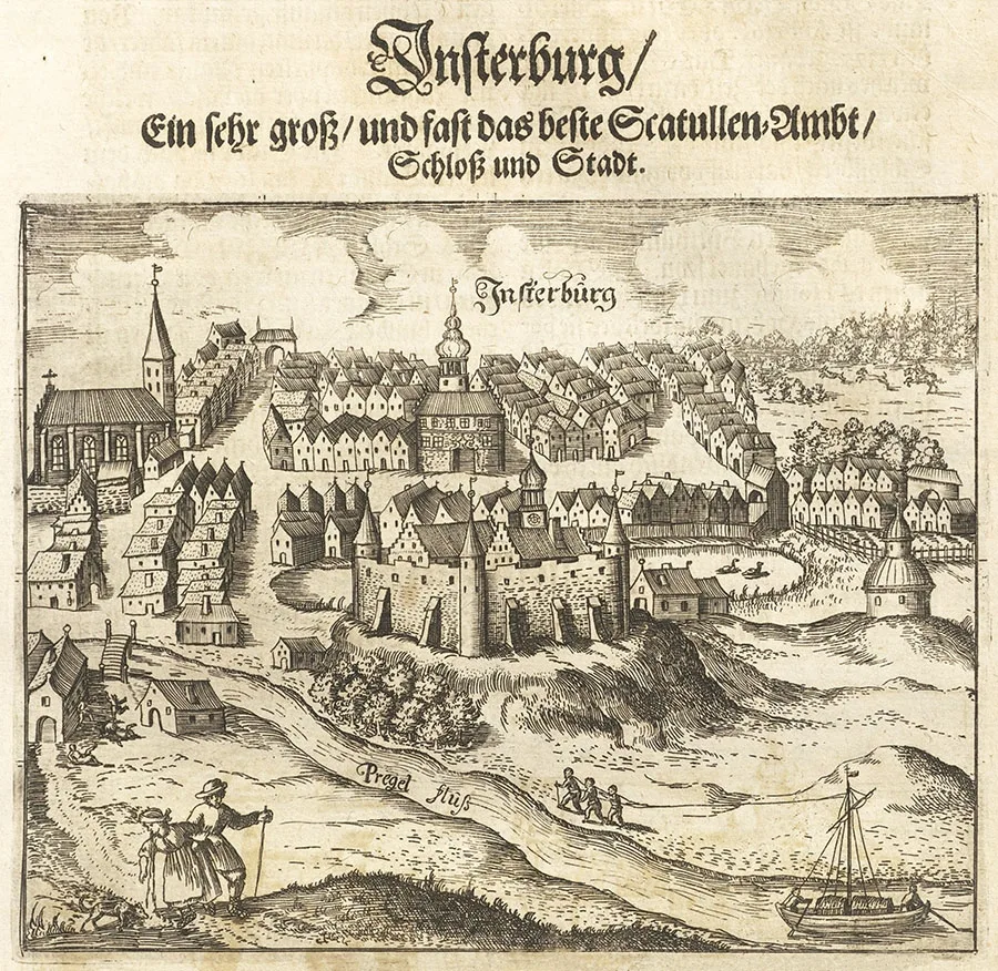 View of Insterburg from the north. Engraving by Christoph Hartknoch (17th century).
The sparse population of the territory controlled from the castle could not support the garrison of knights and priest-brothers of the Order, as well as half-brothers and foot soldiers (Knechte), that a commandery required.
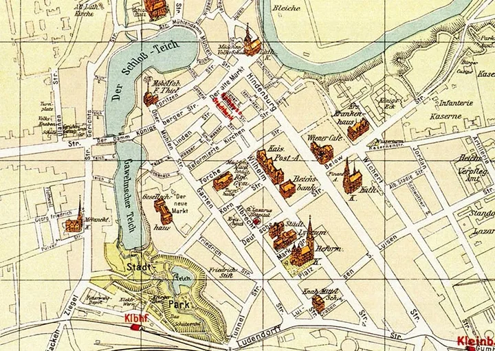
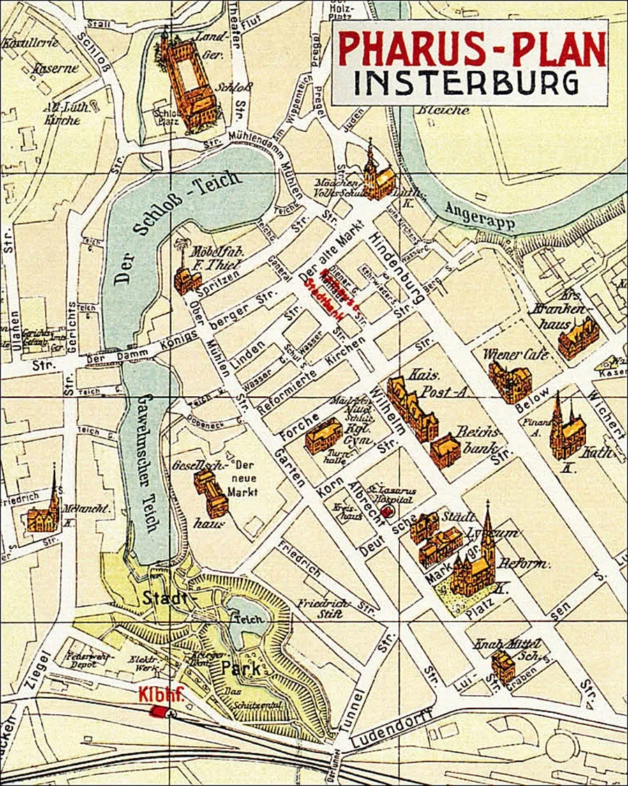 Map of the sights of Insterburg (1923).
Besides serving as a staging point for the Order's troops during raids into Lithuania, Insterburg was engaged in horse breeding; records of a stud farm here date from 1374. For this purpose the Order's estate of Althof-Insterburg / Althof-Insterburg (Portovoye) was founded next to the castle, its very purpose being agricultural production for the needs of the Order.
Insterburg Castle was attacked by the Lithuanian princes on several occasions. The Lithuanians first appeared beneath its walls as early as 1347. The next attack, led by Prince Kęstutis, came in 1366.
At that very time the Order's Marshal Henning Schindekopf and the Pfleger of Insterburg, Heinrich von Schenningen, had set off to Lithuania to negotiate with that same Kęstutis. Yet even with its garrison weakened, the castle held out, and the Lithuanians failed to take Insterburg, though they ravaged the surrounding countryside and captured 50 Christians. But in 1367 Kęstutis managed to burst into Insterburg Castle in a surprise attack and burn it down. Nine years later, in 1376, Insterburg was again taken and burned by the Lithuanians (probably led by Skirgaila, son of Algirdas). After each attack the castle was rebuilt, and its fortifications only grew stronger. By the end of the 14th century it had become the Order's most important rear base for campaigns against Lithuania, in which the Insterburg garrison itself, headed by its Pfleger, repeatedly took part.
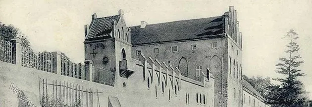
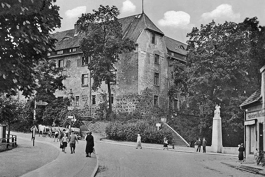 Insterburg Castle. On the right is a memorial to the uhlans of the 12th Lithuanian Uhlan Regiment, based in Insterburg, who fell in the First World War (unveiled in 1924, destroyed in the 1950s, restored in 2006).
In 1402 Insterburg Castle was the venue for a treaty between Grand Master Konrad von Jungingen and the Lithuanian prince Vytautas on a joint war against King Jogaila of Poland. Vytautas, however, soon broke the treaty, and as early as 1403 another Lithuanian attack on Insterburg had to be repelled.
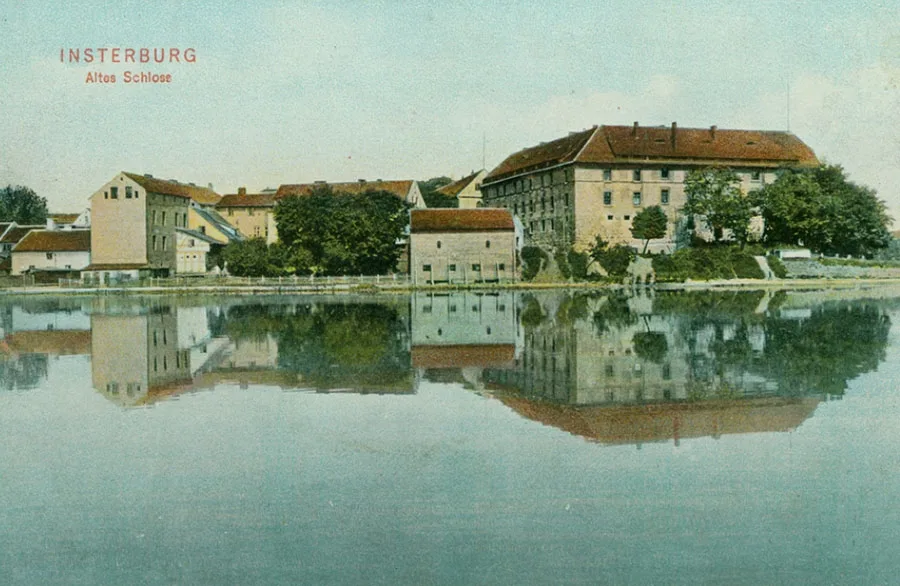
Situated in the second line of fortifications (behind the castles along the Neman) and serving as a transit base, Insterburg Castle received various distinguished guests of the Order in the 14th century: in 1367 Kęstutis's son Butautas, who had earlier been baptised and gone over to the Teutonic Knights, stayed here. In 1377 Insterburg was visited by Duke Albrecht III of Austria (1349–95). In 1390 Henry of Derby, the future King Henry IV of England, passed through Insterburg.
After the Order's defeat in the Great War (1410–11), Insterburg lost its former military importance as a stronghold in Nadrovia. Around this time a settlement grew up by the castle walls, which later acquired its own rampart with a palisade.
During the Thirteen Years' War (1454–66), Insterburg Castle was apparently taken and burned in 1457 by the Poles and supporters of the Prussian Confederation, although the details of these events were not recorded in the documents.
After the secularisation of the Teutonic Order in 1525, Insterburg became the seat of a Hauptamt, which had 13 surrounding Schulzenämter (local districts) under its authority.
The first head of the Insterburg Hauptamt, in 1525–45, was Johann Pein / Johann Pein. On 12.03.1541 the settlement by the castle, referred to in the document as Sparge / Sparge, received the right to hold markets. At the same time the village was renamed Inster / Inster. Later, through the efforts of chamber councillor Kaspar von Nostitz / Nostitz (1500–1588) and the starost Konrad von der Albe / Albe, a pond for breeding crucian carp, the Strauchmühlenteich / Strauchmühlenteich (Verkhny), was created, along with a second mill on it, the Strauchmühle. By 1565 the number of taverns in Inster had grown to five. On 25.07.1572, under Duke Albrecht Friedrich, the settlement, by then already called Insterburg like the castle, was granted certain town privileges.
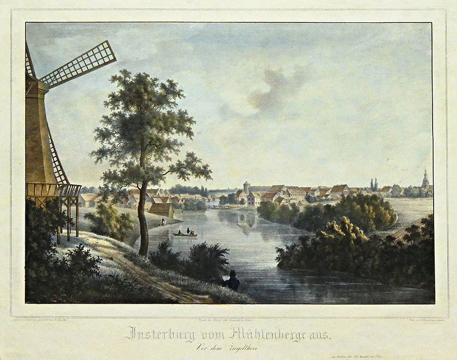 View of Insterburg from Mill Hill (engraving, 19th century).
Finally, on 10 October 1583, Insterburg received Culm town law (including a coat of arms and a seal) from Margrave Georg Friedrich of Brandenburg, who was then regent for Duke Albrecht Friedrich.
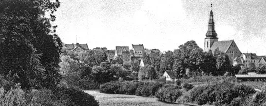
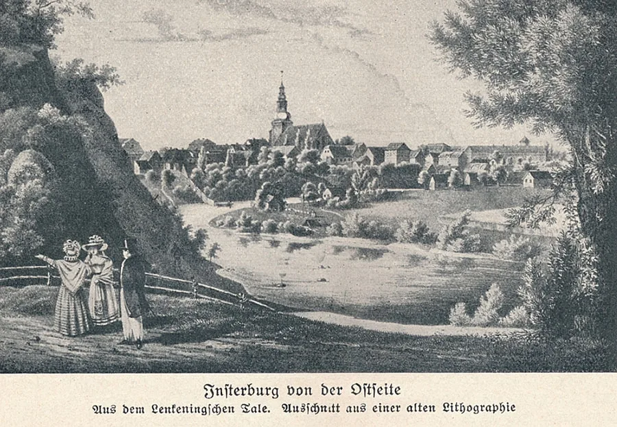 The banks of the Angerapp southeast of the town centre (detail of a lithograph, 19th century).
Under the charter, the 100 Hufen of land granted (approx. 1,700 ha) were divided as follows: 15 Hufen went to the five taverns, 4 Hufen to the pastor, 2 Hufen to the hospital, 20 Hufen and 4 Morgen were set aside for pasture and woodland, and 58 Hufen and 26 Morgen for estates. Fields and additional building plots the townspeople were to obtain themselves by clearing the forest. The town was granted a coat of arms bearing the initials of Margrave Georg Friedrich, a seal, a charter and the right of jurisdiction. It was permitted to hold a fair once a year and a market every Sunday. The charter also obliged the municipality to keep the roads, embankments and landing stages in exemplary condition. Wooden pavements and bridges were to be replaced with stone ones. Fishing was permitted in the Angerapp for a mile below and above the town. The town was required to build a timber-drying house, a brickworks, and food and goods shops. There were also some rather unusual provisions, such as a ban on hand mills and the obligation to have all grain ground at the castle mill. On 06.11.1583 the town of Insterburg was also given the Schweispau farmland, which later became known as Sprindt (the area of today's Chernyakhovskogo Street).
In 1590, seven years after the ceremonial granting of town rights, Insterburg suffered a devastating fire in which 140 of its 149 houses burned down, although the church, the school and the pastor's house survived. Insterburg, however, was rebuilt quite quickly afterwards. In 1610 a town hall was built here.
In 1610–12 a new building of the Luther Church was erected. In 1638 it was adorned with images of the apostles; the church also housed a magnificent fountain depicting King David playing the harp. In the early 17th century, under Burgrave Fabian zu Dohna / Dohna (d. 1631), a marksmen's guild was founded in Insterburg. Although Fabian zu Dohna's activities benefited the town's development, the townspeople clashed with the burgrave over his Calvinist faith, which ultimately led to his recall from Insterburg. Under the new administrator, Count Wolf Heinrich Truchsess von Waldburg / Waldburg, a topographical survey was made of all the lands of the Insterburg Hauptamt and of the town itself.
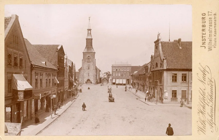 View of the Luther Church across the Old Market. Mid-19th century.
Throughout 1632 Insterburg served as the temporary residence of Duke and Elector Georg Wilhelm (1895–1640).
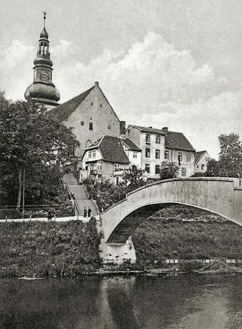
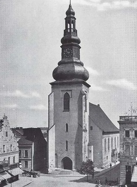
On 24 December 1642, Maria Eleonora of Sweden (1599–1655), the dowager Queen of Sweden and sister of Duke George William, set out from Denmark for Insterburg. She did not reach Insterburg until the summer of 1643 and lived there until 1648.
Curiously, despite its key geographical position, Insterburg never acquired town walls of its own. Nor was it given a ring of bastions of the kind typical of European towns of the period. As a result, enemy armies entered the town with ease during the military conflicts of the 17th century.
The town's entire defences consisted of gates on the main approach roads. Five gates are recorded: the Goldap Gate / Goldap-Tor, the Swine Gate / Scweinertor, the Brick Gate / Ziegeltor, the Castle Gate / Burgtor (also known as the Königsberg Gate / Königsberger Tor) and the Tilsit Gate / Tilsit-Tor. These gates were closed at night, but they served more as symbolic talismans than as fortifications.
Only Insterburg Castle had some protection in the form of a rampart and a moat. Yet even the castle was taken in the very last days of December 1688, during the march on Königsberg by the Swedish army under Field Marshal Henrik Horn (1618–93).
On 14 May 1697, the Grand Embassy from Russia passed through Insterburg. Contrary to popular belief, Tsar Peter I did not visit the town on that occasion — he travelled from Libau to Königsberg by sea.
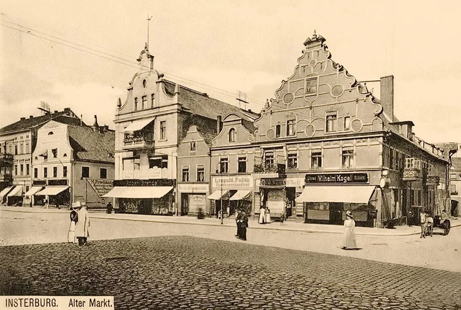 A Baroque architectural ensemble at the corner of the Old Market (Alter Markt) and Pregelstraße (right).
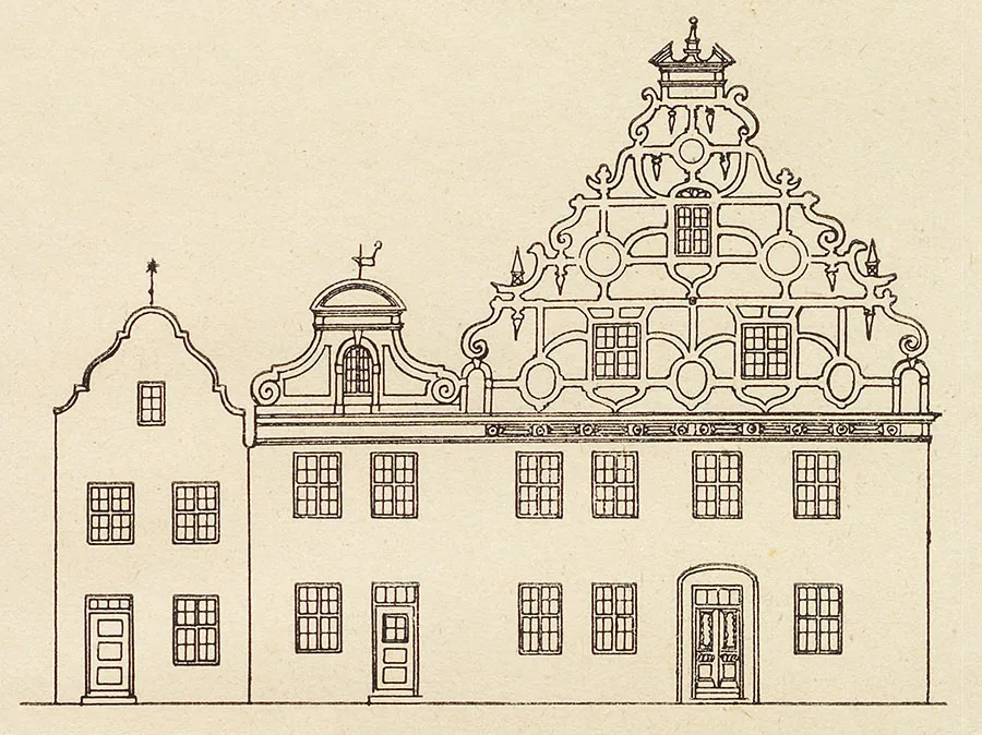
Peter I did, however, pass through Insterburg — on 28–29 November 1709, when he stayed here with the postmaster Dönitz.
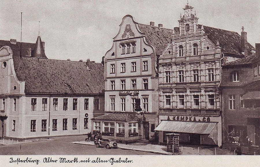
Like many other Prussian towns, Insterburg suffered badly from the plague epidemic that swept through it in 1709–10. Then, in 1711, the harvest in the fields around the town was destroyed by a plague of locusts. Three quarters of the livestock perished for lack of fodder. The loss of population caused by these disasters was partly offset by the programme of settling religious refugees from across Europe in the region, promoted by King Frederick William I.
In 1723, a navigable canal was dug between the Angerapp and the Inster, shifting the point of their confluence. In the same year, Insterburg Castle became the seat of the Insterburg Court (Hofgericht zu Insterburg) — the highest judicial authority in East Prussia, established in the course of yet another reform of the judicial system.
During the Seven Years' War (1756–63), the army of Field Marshal S.F. Apraksin (1702–58) passed through Insterburg. On 19 August 1757, Apraksin's main army joined forces near Insterburg with the army of General-in-Chief V.V. Fermor (1702–1771).
During the War of the Fourth Coalition (1806–07), a 12,000-strong corps of Napoleon's army under Marshal Michel Ney (1769–1815) entered Insterburg in pursuit of the Russian army retreating after the Battle of Friedland (2 July 1807). In Insterburg, the French carried out a large-scale requisition of food and livestock for the army. The French also occupied the castle, converting it into a 200-bed military hospital.
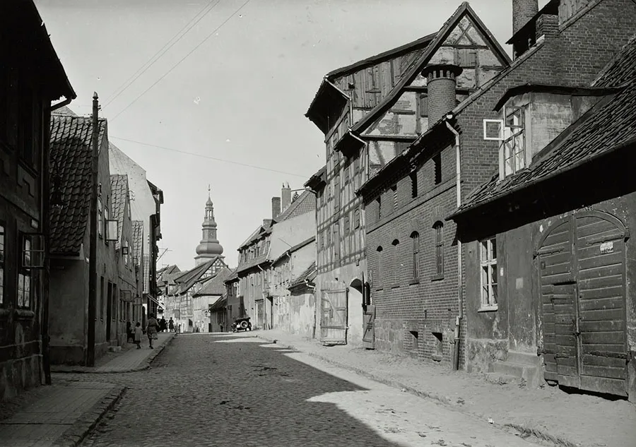 Spritzenstraße (Vodoprovodnaya Street).
After the Peace of Tilsit, during the period of reforms in the Prussian state, Insterburg held its first elections to the town assembly in 1809 under the new municipal ordinance.
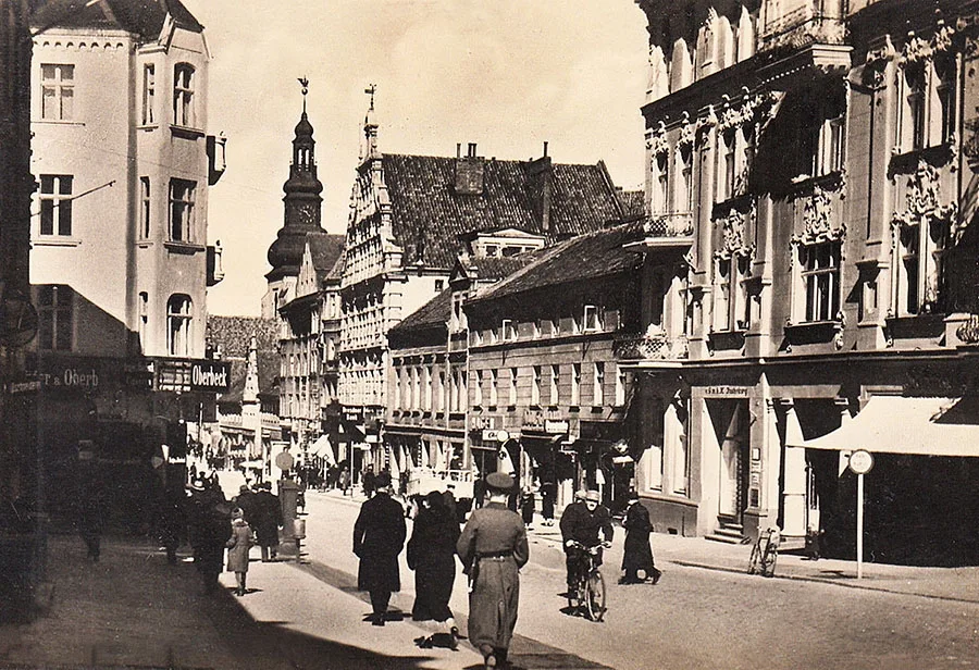 Hindenburgstraße — south of the Lutherkirche (Lenina Street).
In 1809, the town had 396 houses, home to 759 families. The average Insterburg family at that time consisted of six people.
Napoleon's army passed through Insterburg twice more in 1812: from 7 June to 15 July on its way to the borders of the Russian Empire, and again on its retreat from Russia, from 14 to 24 December. Hard on the heels of the French, the advance Cossack units of the Russian army entered Insterburg on 23 December 1812.
In 1818, under Prussia's new administrative structure, Insterburg became the seat of a district, or Kreis.
In 1821, the Central Agricultural Society was founded in the town. In 1827, a school following the system of the Swiss educator Pestalozzi was opened. The most important event for Insterburg was the opening in 1860 of traffic on the Prussian Eastern Railway (Preußische Ostbahn), whose trains ran from Berlin to the Russian border at Eydtkuhnen (Chernyshevskoye). In 1861, Karl Braunschweig's sawmill opened in Insterburg. In 1863, a linen factory began operating. In 1865, the Tilsit–Insterburg railway (Sovetsk–Chernyakhovsk) was opened, and Insterburg began to take shape as a railway junction. On 16 January 1871, the Insterburg–Gerdauen branch line (Chernyakhovsk–Zheleznodorozhny) was put into service. By 1873, it had been extended to Thorn (Toruń, Poland).
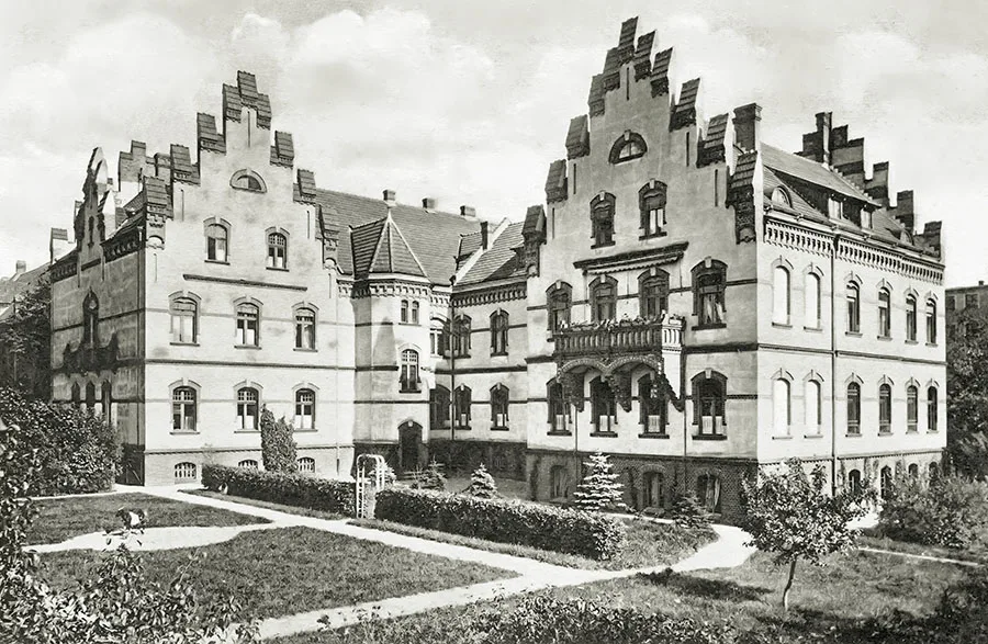 The Insterburg Kreishaus had the air of a well-fed burgher.
In 1871, the municipality of Insterburg comprised, in addition to the town itself, another 17 settlements and sites of equivalent status.
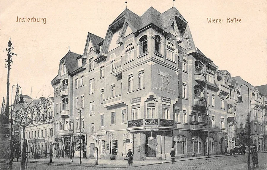 The Viennese Café was one of the town's showpieces.
It included the estates of Albertshof (Chernyakhovsk, Chapayeva Street), Drebolienen (from 1938 Insterburg-Drebplienen, 54°34'46'' N 21°51'09'' E), Eckertshöfchen (from 1895 Eckertshof, Chernyakhovsk, Kurchatova Street), Eichenthal (54°36'33'' N 21°51'41'' E), Grünhof (Chernyakhovsk, Kaliningradskoye Shosse 20, 22), Hermannshof (Chernyakhovsk, Pobedy Street 54), Heinehof, Heinsterbruch (54°36'46'' N 21°51'03'' E), Janzonsruh (Yarki), Johannsthal (54°36'36'' N 21°46'00'' E), Sprindt (Chernyakhovsk, Chernyakhovskogo Street) and Tannenhof (now part of Chernyakhovsk); the forest lodge Waldhaus Drebolienen (54°35'05'' N 21°51'58'' E); the Tilsiter and Eydtkuhner railway stations; a penal institution / Strafanstalt (Chernyakhovsk, Prigorodnaya Street) and a knacker's yard / Abdeckerei (54°36'36'' N 21°46'48'' E). The town also owned five brickworks and 10 track-keepers' houses along the railways.
In total, the municipality numbered 646 residential buildings, home to 2,635 families and 199 single people.
Of these, 544 residential buildings were in Insterburg proper; the suburban estates had the following: Albertshof — 2 houses, Drebolienen — 2, Eckertshöfchen — 3, Eichenthal — 4, Grünhof — 3, Hermannshof — 4, Heinehof — 2, Heinsterbruch — 3, Janzonsruh — 2, Johannsthal — 1, Sprindt — 4, Tannenhof — 1; Insterburg's stations owned: Tilsiter — 1 house, Eydtkuhner — 7 houses; 1 house belonged to Waldhaus Drebolienen, 7 to the penal institution and 1 to the knacker's yard. In addition, 38 houses were registered to outlying town farmsteads, 6 belonged to the five brickworks, and 10 formed part of the railway infrastructure (track-keepers' houses).
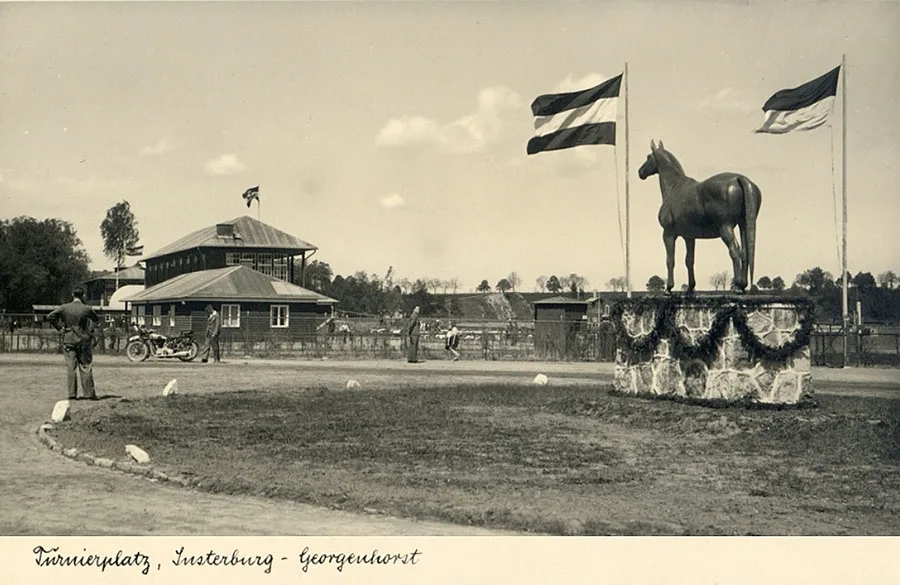 The Insterburg racecourse opened shortly after the end of the First World War.
In 1876, Insterburg Castle was converted to house the 12th Uhlan Regiment.
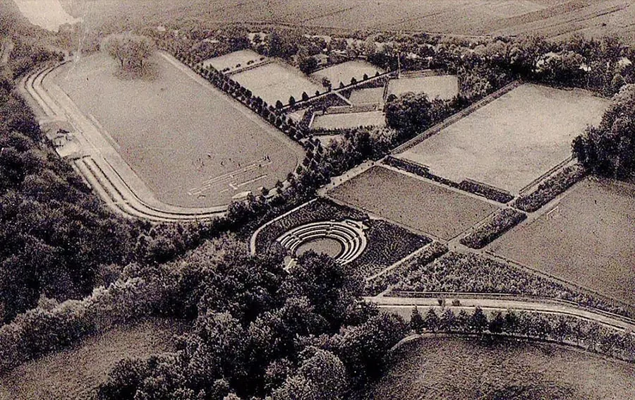 A bird's-eye view of the stadium and tennis courts.
Later, barracks were also built along the road from the castle to the Althof-Insterburg estate (Portovoye). The Insterburg garrison became the second largest after Königsberg (within the territory that passed to the Kaliningrad Region after the Second World War).
In 1878 the Insterburg–Goldap railway line (Gołdap, Poland) was built, once again boosting the town's importance as a railway hub. In the 1880s construction of the New Town / Neustadt began. Today this is the area around Gospitalnaya, Suvorova, Tolyatti, Sadovaya and Telmana streets. In 1890, in the centre of the Neustadt, on Markgrafenplatz / Markgrafenplatz, the architect Friedrich Adler / Adler (1827–1908) built the Reformed Church, which also served as the garrison church. In 1902 the local Catholic community likewise acquired a new place of worship — the Church of St. Bruno (architect Friedrich Heitmann / Heitmann, 1853–1921).
In 1887 a district fruit and vegetable market was established in Insterburg. Thanks to this market, the produce of the orchards and kitchen gardens of Kreis Insterburg began to be sold far beyond its borders.
As early as 1889, varietal apples from Insterburg took first place at an exhibition in Stuttgart.
In 1890 the German brewery Bruhn & Fröse / Deutsches Brauhaus Bruhn & Fröse was founded.
In 1889–93 the construction of barracks for army units continued in Insterburg. This time infantry barracks were built along the road to Alt Kamswicken (now Gagarina Street). In 1892–1900 barracks for the artillery were built in the same area, followed in 1913–14 by barracks for Jäger units.
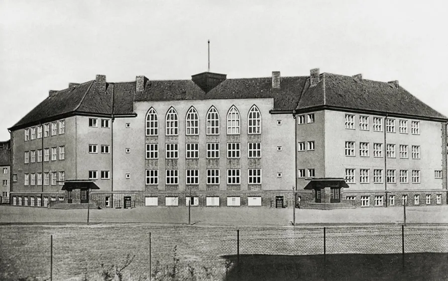 Pestalozzi School.
On 25.06.1900 the company Insterburger Kleinbahn AG / Insterburger Kleinbahn AG was founded. Its founders were the Prussian government, the provincial government of East Prussia, the district administrations of Insterburg, Niederung / Niederung, Ragnit / Ragnit (Neman) and Tilsit / Tilsit (Sovetsk), and the railway construction company “Lenz & Co” / “Lenz & Co”.
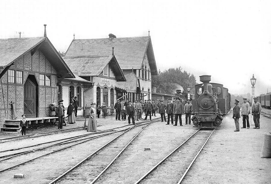 The narrow-gauge railway — operated by the joint-stock company Insterburger Kleinbahn (Insterburger Kleinbahn AG).
The purpose of the new joint-stock company was to build a network of local narrow-gauge railways. The first two lines opened on 01.08.1902. Both started from a narrow-gauge station built specially for them in Insterburg. One ran to Trempen / Trempen (Novostroyevo) and was 32.2 km long. It was joined by a branch from Warnascheln / Warnascheln (54°25'21'' N 21°44'51'' E) to Albrechtau / Albrechtau (Alyoshkino), later extended to Piontken / Piontken (Kazachye). This branch was 10.2 km long. The second line ran to Kraupischken / Kraupischken (Ulyanovo) and was 38 km long. At Moulienen / Moulienen (Mikhaylovka) passengers could change to a train to Ragnit / Ragnit (Neman); that branch was 28.5 km long. Soon afterwards, on 12.11.1902, a 39.3 km line from Insterburg to Groß Skaisgirren / Groß Skaisgirren (Bolshakovo) was opened, together with the Juckeln–Mehlauken / Juckeln - Mehlauken (Bukhovo–Zalesye) branch, 21.7 km long.
The construction of the narrow-gauge railway considerably enhanced Insterburg's role both as a transport hub and as an industrial and trading centre for agricultural producers from the surrounding districts.
On 01.09.1909 yet another line was opened, from Luxenberg / Luxenberg (now within Chernyakhovsk, 54°38'56'' N 21°50'01'' E) to the station at the Pregeltor / Pregeltor (Chernyakhovsk, 1 Oktyabrskaya Street). At first it also carried passengers, but later it was used exclusively for freight.
On 01.05.1901 the town of Insterburg was separated from Kreis Insterburg and became an independent urban district — a Stadtkreis. Accordingly, the remaining part of Kreis Insterburg became a rural district — a Landkreis.
In 1913 the German aviation pioneer Alfred Friedrich / Friedrich (1891–1968) ended his long-distance flight along the route Berlin–Schneidemühl–Königsberg–Insterburg in Insterburg. Friedrich went down in aviation history as the inventor of the aerobatic manoeuvre known as the spin. The event boosted the popularity of aviation in the town, and in 1914 the first airfield was built on the outskirts of Insterburg.
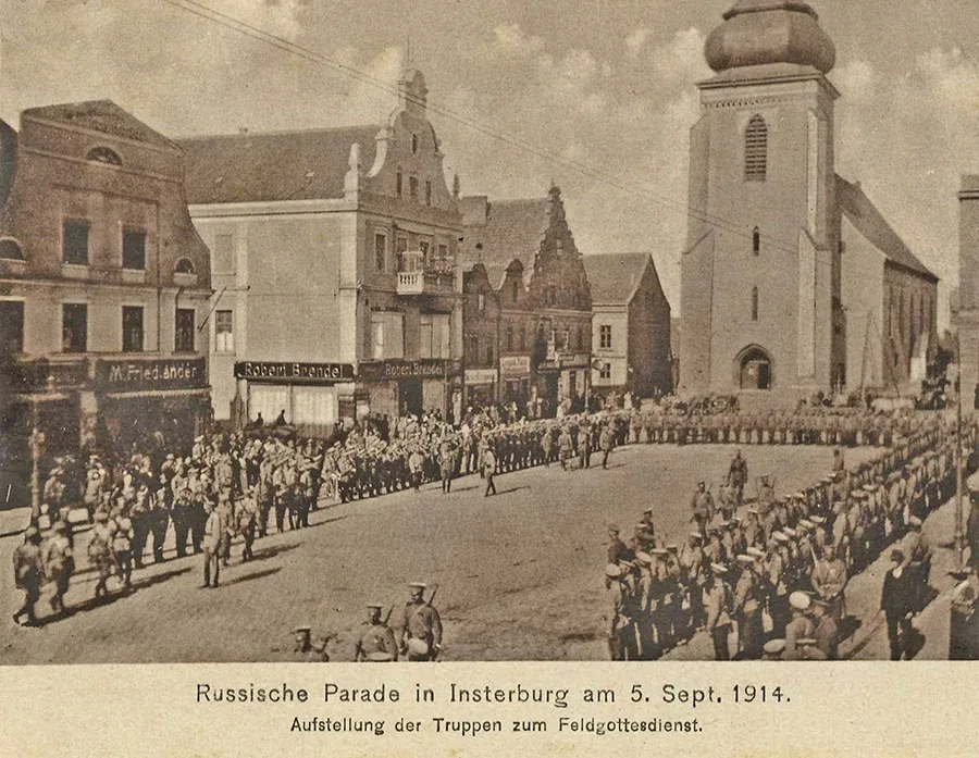 Parade of Russian troops on the Old Market, 5 September 1914.
At the start of the First World War, Insterburg lay in the path of the main thrust of P. K. Rennenkampf's Russian 1st Army. After their defeat at the Battle of Gumbinnen (20.08.1914), the German forces began to retreat, and as a result Russian advance cavalry units entered Insterburg as early as the morning of 24.06.1914.
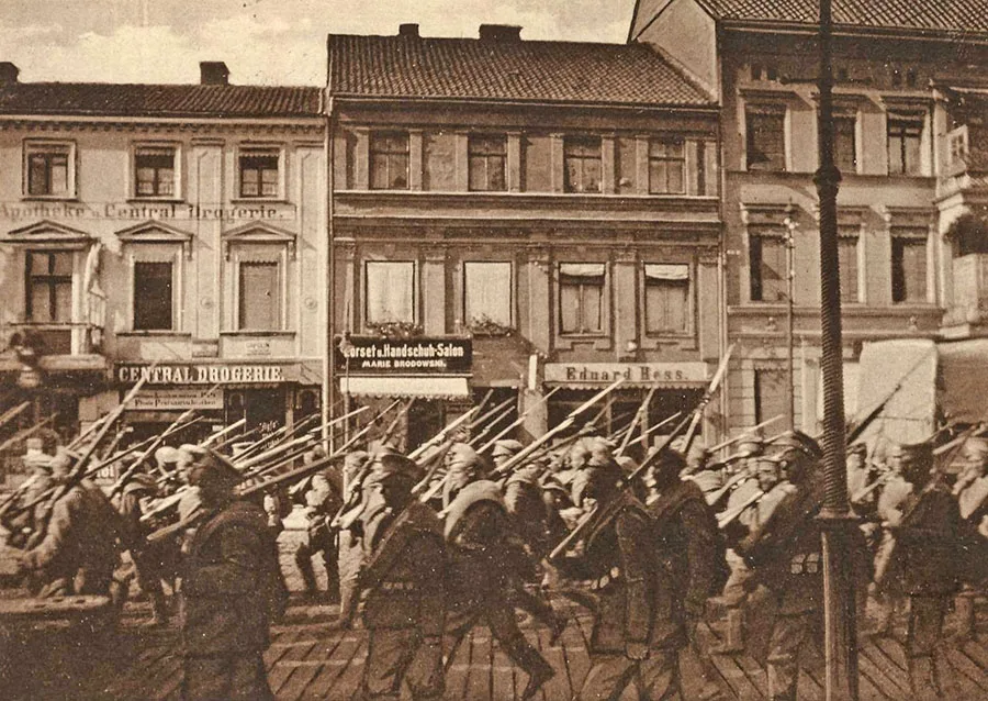 Russian soldiers in the streets of Insterburg.
The occupying troops are noted for their exemplary conduct in the town: life essentially went on as usual, all businesses and establishments remained open, and municipal affairs were run by a German governor appointed by Rennenkampf, Dr. M. Bierfreund. The Russian army left Insterburg on 11.09.1914 during the general retreat.
During the First World War the Insterburg narrow-gauge network was extended by two more lines. The first, 14.3 km long, opened on 27.03.2015 and ran from Kauschen / Kauschen (now part of Pereslesnoye) to Wirbeln / Wirbeln (Zhavoronkovo). The second, 26 km long, entered service on 26.06.1917 and linked Warnascheln with Nordenburg / Nordenburg (Krylovo). Also in 1917, a wire factory began operating in the building of the Bruhn & Fröse brewery, which also housed a small sausage plant.
After the war, despite the general economic crisis in Germany, several significant projects were carried out in Insterburg.
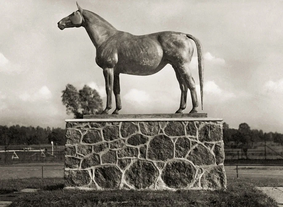
A world-class racecourse was built, serving not only for equestrian competitions but also to promote the Trakehner horse breed. The racecourse became famous as the training base of the German Olympic equestrian team ahead of the 1936 Olympic Games.
In 1921 work began on building a navigable canal, which was opened on 17.09.1926. The police services and a museum moved into Insterburg Castle in place of the uhlan regiment. In 1926 the town acquired the airfield, and on its basis the Insterburg Aviation Association “Old Prussia” was founded. Under the direction of the architect H. Kaufmann, landscaping work began in Insterburg, with the creation of public parks and gardens. Urban development also began in the area of the Sprindt estate (Chernyakhovskogo Street).
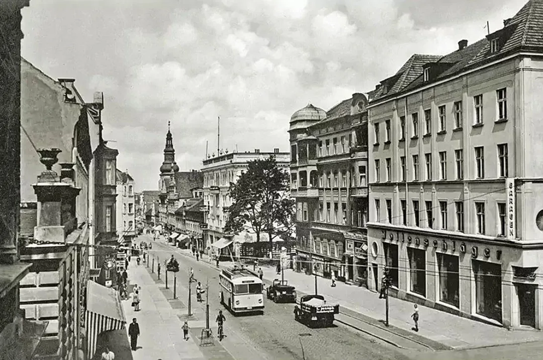
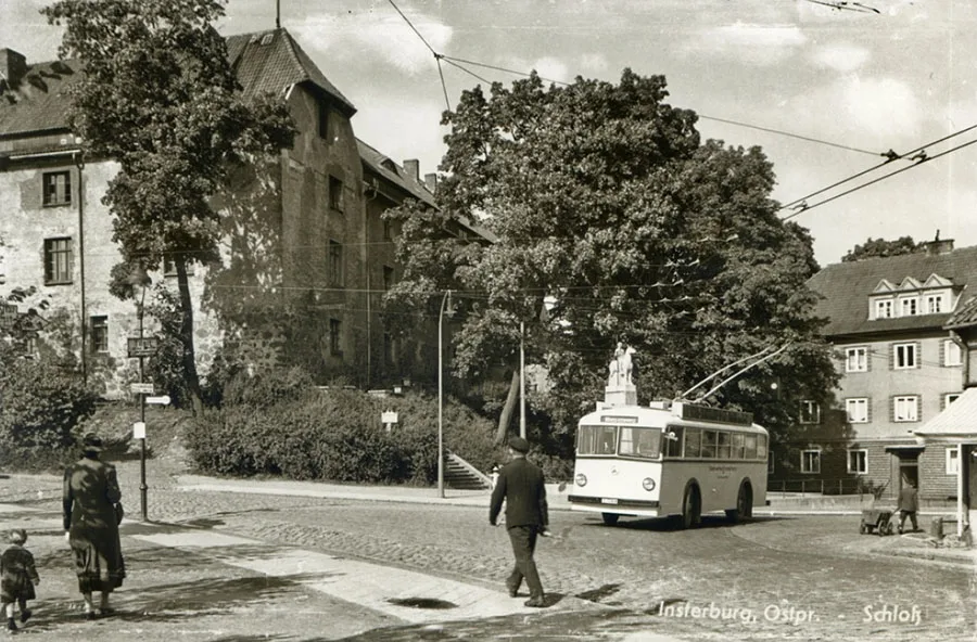 Trolleybus near Insterburg Castle.
On 27.11.1936 Insterburg became the first town in Germany to introduce trolleybus service. A new town hall was built in the same year.
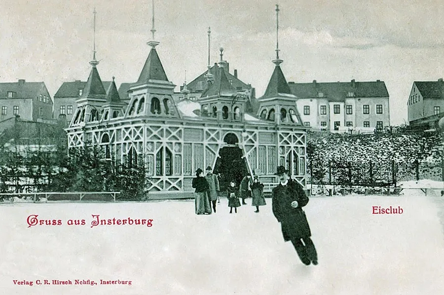 Skating rink on the Upper Lake (German: Gawehnscher Teich).
By 1940 Insterburg had seven trolleybus routes, with a central station on Alter-Markt-Platz / Alter-Markt-Platz (Lenin Square).
As of 1939, the municipality of Insterburg comprised, in addition to the town itself: Albertshof, Insterburg-Amalienhof, Insterburg-Bärenrode / Insterburg-Bärenrode (54°36'07'' N 21°49'41'' E), Insterburg-Drebolienen, Insterburg-Eckertshof, Insterburg-Gut Eichenthal, Insterburg-Grünhof, Insterburg-Georgenhorst, Insterburg-Herrmannshof, Insterburg-Heinehof, Insterburg-Jakobsruh, Insterburg-Janzonruh, Insterburg-Johannisthal / Insterburg Johannisthal (54°36'37'' N 21°45'59'' E), Vorwerk Kammershof, Insterburg-Kehlershof, Insterburg-Nehmsdorf / Insterburg-Nehmsdorf (until 1939 Abbau Nehm / Abbau Nehm, 54°36'51'' N 21°45'46'' E), Insterburg-Pätsch, Insterburg-Strauchmühle, Insterburg-Tannenhof, Insterburg-Sprindt and the Insterburg racecourse.
For Insterburg, the Second World War began on 23.06.1941.
On that day 17 aircraft of the Red Army's 46th High-Speed Bomber Aviation Regiment (Major M. I. Senkov, 1904–41) took off to bomb Insterburg and Gumbinnen. All of the aircraft, including the commander's, were shot down by enemy air defences, mostly by fighters. There is no record of any damage in Insterburg, whereas in Gumbinnen several buildings were destroyed or damaged.
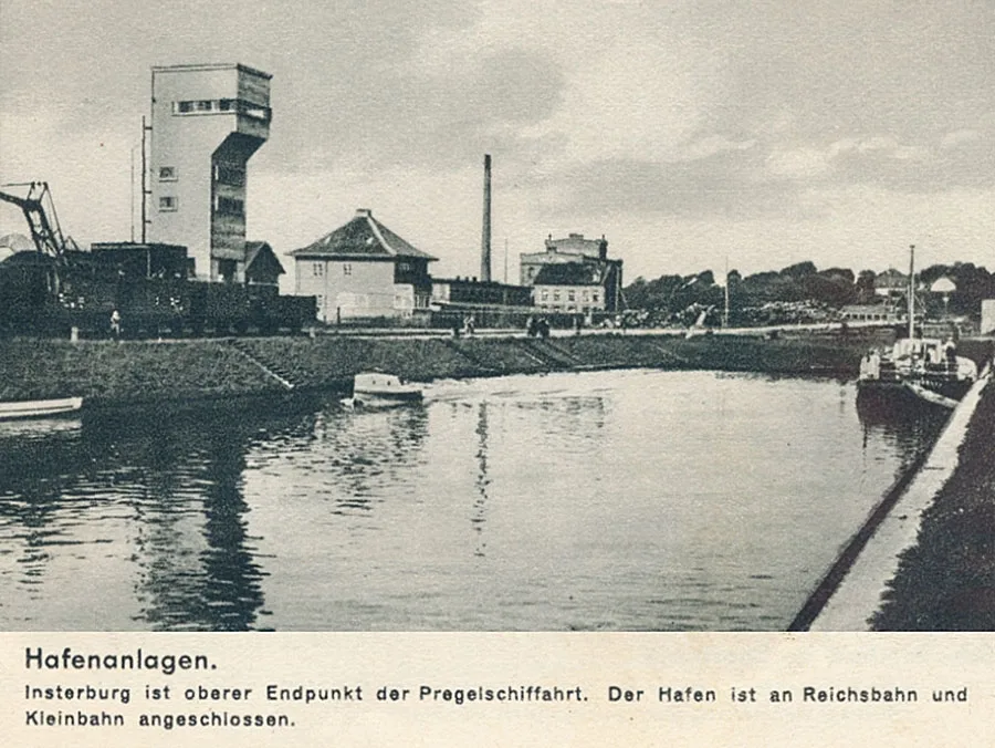 The port of Insterburg was the upper limit of navigation on the Pregel.
During the Red Army's East Prussian Operation, which included the Insterburg–Königsberg Offensive, Insterburg lay in the advance sector of the 3rd Belorussian Front.
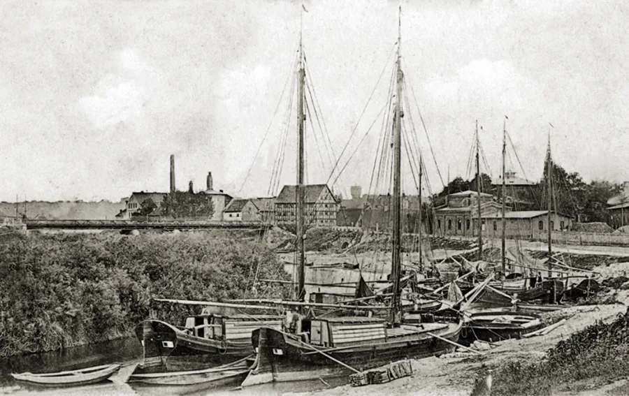 In the port of Insterburg.
The day before, the 39th Army (Lt. Gen. I.I. Lyudnikov, 1902–76) had broken through the front north of Insterburg. To exploit this success, the front committed its most battle-ready army, the 11th Guards (Col. Gen. K.N. Galitsky, 1897–1967). As a result, Insterburg was stormed from the north, north-east and north-west. While the assault was being prepared, captured documents revealed that the town was defended by only two regiments and had to be taken at once, before enemy reserves arrived. The situation was complicated by the fact that the 5th Army, advancing on Insterburg from the east, lagged well behind the 11th Guards Army. Moreover, the 11th Guards Army had to carry out two tasks at the same time: to continue the advance on Wehlau (Znamensk) and to storm Insterburg in order to secure its left flank. The army's main strike force therefore pressed on westward, while the 36th Guards Rifle Corps (16th and 18th Guards Rifle Divisions) was assigned to take the town, supported from the east by formations of the 5th Army.
On 19 January 1945 the first fighting broke out on the approaches to Insterburg. On 20 January 1945 ground-attack and bomber aircraft struck the town, and on 21 January 1945 at 22:00, after a 20-minute artillery barrage, the assault on Insterburg began.
The 58th Guards Rifle Regiment (deputy regimental commander Lt. Col. A.A. Grigoryev) forced the Pregel near Nettingen (Krasnaya Gorka), half-encircling the town. The 18th Rifle Division (Maj. Gen. G.I. Karizhsky, 1895–1971) advanced from the direction of Georgenburg (Mayovka) with the 51st and 53rd Guards Rifle Regiments, supported by the attached 75th Tank Regiment. The 16th Rifle Division (Maj. Gen. M.A. Pronin, 1892–1978) attacked Sprindt (the area of today's Chernyakhovskogo Street) with the 43rd and 49th Rifle Regiments. The capture of the bridges over the Inster and the Angerapp intact contributed to the success. Until 04:00 fighting raged on the northern outskirts of Insterburg. Then the 53rd Regiment pushed along Hindenburgstraße into the town centre. By 05:30 the strongpoints of resistance had been suppressed. At dawn the 16th Division occupied the north-eastern outskirts, while units of the 5th Army, which had by then caught up, began entering the town from the east. Soldiers of the 51st and 53rd Regiments reached the south-western and western outskirts of Insterburg, crushing the last pocket of resistance near the railway station. At 10:00 Major General Karizhsky reported the capture of Insterburg. However, insufficiently effective coordination between the 5th Army and the 11th Guards Army allowed the regrouped enemy forces to launch several counterattacks and to shell the troops in the town. At 15:00 the most powerful counterattack, supported by an armoured train, was mounted, and part of the Soviet troops in the town were even encircled. Only the commitment of the reserve battalions of the 18th Guards Rifle Division and a self-propelled artillery battalion, together with a deep envelopment of the enemy by the 53rd Regiment, forced the Germans, threatened with encirclement, to fall back from the town.
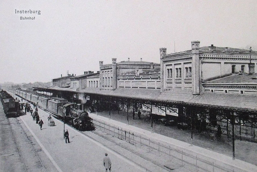 The railway station of Insterburg.
The last pockets of resistance were eliminated by 20:00 on 22 January 1945. The Red Army's losses in killed during the storming of Insterburg are estimated at about 4,000 soldiers and officers, more than its personnel losses in the capture of Königsberg.
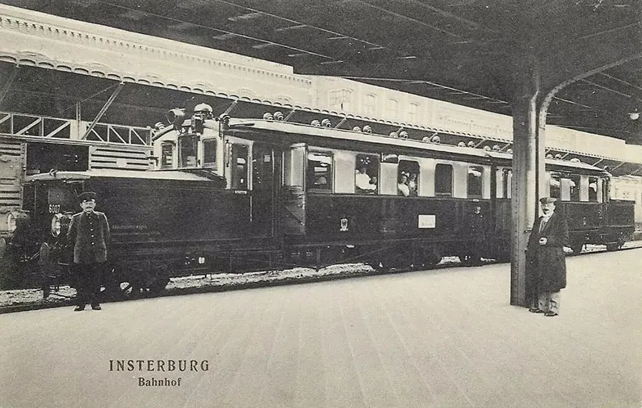 At the railway station of Insterburg.
The town's first post-war inhabitants were Soviet military personnel and the remaining German civilian population. Civic life was managed by civil affairs departments attached to the military commandant's offices set up immediately after the capture of Insterburg. Mass settlement by people from other regions of the USSR began after the government decree of 9 July 1946.
On 7 September 1946 Insterburg was renamed Chernyakhovsk.
An electrical substation and a 200-line telephone exchange were restored in the town. By the end of 1946, 20 km of the municipal water supply network had been put back into operation. In 1946 four schools opened at once: a secondary school, a primary school, a German school and a school for working youth. In the same year an officers' club, a house of culture, a town library and a children's library, a teacher training college, a factory apprenticeship (FZO) school, two kindergartens and a reception and distribution centre for homeless children were opened. After restoration, the railway station, the “Put v kommunu” (“Road to the Commune”) industrial cooperative and the tannery, cannery and vehicle repair works resumed operation. Metalworking and joinery workshops were set up to serve the townspeople. In the food industry, the meat-processing plant, the bakery complex, the food-processing works, the brewery and the confectionery factory were brought back into operation. In addition, a breeding farm for East Frisian cattle was established.
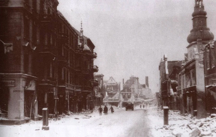 Insterburg in the first post-war winter.
Although the town still lay in ruins (60% of its buildings had been damaged or destroyed in the assault), the Lokomotiv sports society was founded and a football team formed in 1947, and a sports hall opened by the autumn of 1947. Incidentally, as early as 1948 the first regional Spartakiad was held, at which the Insterburg team took second place.
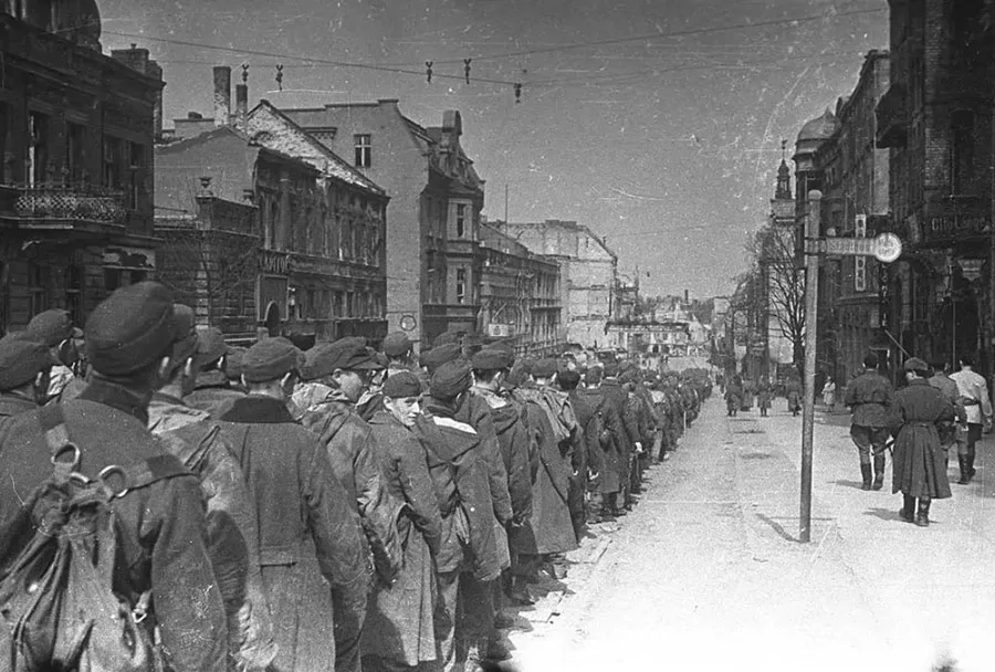 German prisoners of war on Hindenburgstraße.
Also in 1947, the Chernyakhovsk district and town executive committees were formed, and authority passed from the military commandant's offices to civilian bodies. By the end of 1947 radio broadcasting had been set up and the district newspaper “Kommunist” had begun publication. Two cinemas, the “Salyut” and the “Udarnik”, opened. Several shops started trading, among them a large department store.
In 1948 Chernyakhovsk railway station became fully operational. Three long-distance trains from Kaliningrad to Moscow, Riga and Vilnius began running through the town. There were also local passenger trains from Chernyakhovsk to Kaunas and Gusev.
On 1 July 1948 the Kaliningrad–Chernyakhovsk airmail route opened. Bus services were also established from Chernyakhovsk to Kaliningrad and to the district centres of the region.
Also in 1948, freight and passenger steamer services were organised between Gvardeysk and Chernyakhovsk. In the same year a monument to I.D. Chernyakhovsky was erected by German prisoners of war. Industry developed too: a nail and wire-mesh plant (the future “TekhMash” works) went into operation, the municipal industrial works began producing oak chairs and ceramics, and a creamery and a sweets workshop opened.
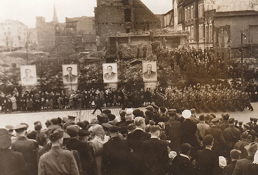 A demonstration in post-war Chernyakhovsk.
The 1950s were years of rapid population growth for Chernyakhovsk. Yet the pace of construction could not keep up with people's need for housing. Moreover, at the end of the 1940s some 300 houses lacked even such basic amenities as running water.
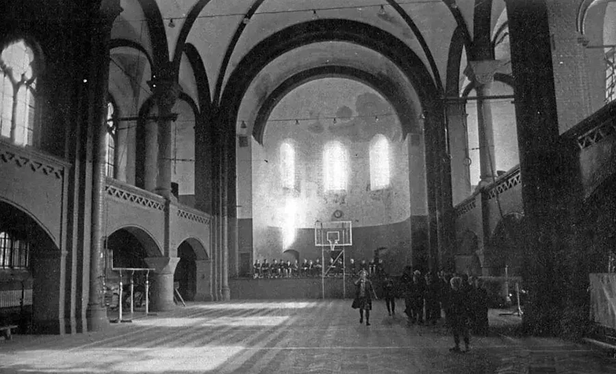 A sports hall in the Reformed Church of Insterburg.
As early as 1951 the first outline plan for the layout and development of the town was approved. 140 ruined buildings were demolished; by 1952 the town had 970 residential buildings, all of them supplied with electricity, and 519 of them had running water and sewerage.
Alongside housing, public buildings and facilities were also built. In 1954 the Lokomotiv stadium, seating 3,000 spectators, was opened.
By the end of the 1950s Chernyakhovsk had six schools (including a railway school), three kindergartens, three crèches with 205 places, a teacher training college, a Pioneers' house, two houses of culture, three film-screening venues and a town park.
Medical care was provided by three hospitals (a district hospital, a children's hospital and an infectious diseases hospital), a maternity home, tuberculosis and dermatovenereological clinics, an ambulance station, a sanitary and epidemiological station and first-aid posts.
In 1954 the Chernyakhovsk brewery was converted into a soft drinks factory.
By 1 January 1959, the number of residential buildings in Chernyakhovsk had risen to 1,427. The average living space per inhabitant was 6.67 m2, which was clearly inadequate even by comparison with the region as a whole, which had never been known for an abundance of housing.
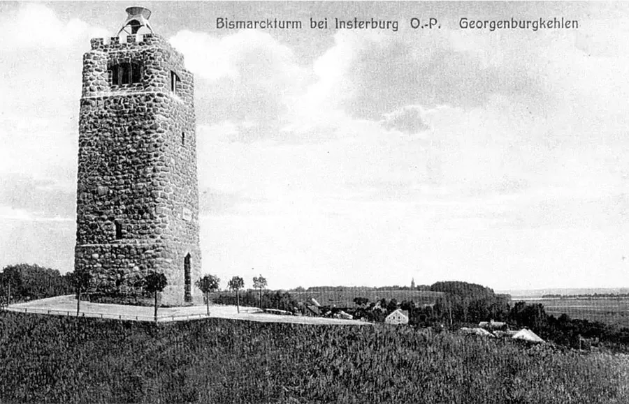 The observation deck of the Bismarck Tower offered a view of Insterburg and of the confluence of the Instruch and Angrapa rivers, where the Pregolya begins.
In the 1960s, the town continued to develop as a local industrial hub and as the administrative centre for the surrounding rural settlements. Agriculture also saw a certain degree of success.
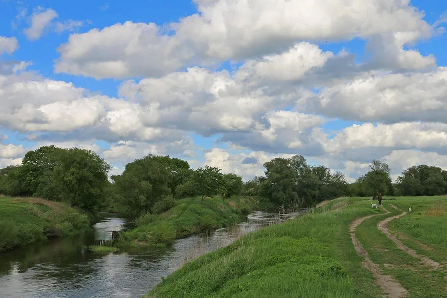 The confluence of the Instruch and Angrapa rivers, where the Pregolya has its source.
As early as 1953, a district agricultural exhibition opened in Chernyakhovsk. In 1957, the Chernyakhovsk District ranked first among the districts of the RSFSR for growth in livestock production. In 1960, the Kaliningrad State Stud Farm No. 7 was established on the basis of the Chernyakhovsk state stables, specialising in Trakehner and Hanoverian horses.
An asphalt and concrete plant opened in 1960. In the same year, the ceramics factory began producing faience. In 1964, the nail and wire mesh factory started manufacturing parts for automatic machine tools, and in 1965 it became the Avtomatkommunmash plant.
In 1968, a branch of the Kaliningrad Machine-Building Plant was opened; in 1975 it became the Chernyakhovsk Machine-Building Plant.
In addition to the existing educational institutions, the 1960s saw the opening of an evening music school (1961), a boarding school (1962) and Vocational School No. 12 (1963). A new secondary school for 690 pupils also opened in the mid-1960s.
By this time, the town had acquired all the features of a typical large district centre: specialised shops appeared, such as “Detsky Mir” (Children’s World), “Footwear”, “Clothing”, “Household Goods” and “Cultural Goods”. Five-storey apartment blocks typical of the period, the so-called “Khrushchevkas”, were built. In 1969, the 600-seat widescreen cinema “Oktyabr” opened. The housing problem was only partially solved: by 1969 there were 8.4 square metres per resident, an improvement on the 1950s, but still short of sanitary standards and of the average housing provision in the USSR.
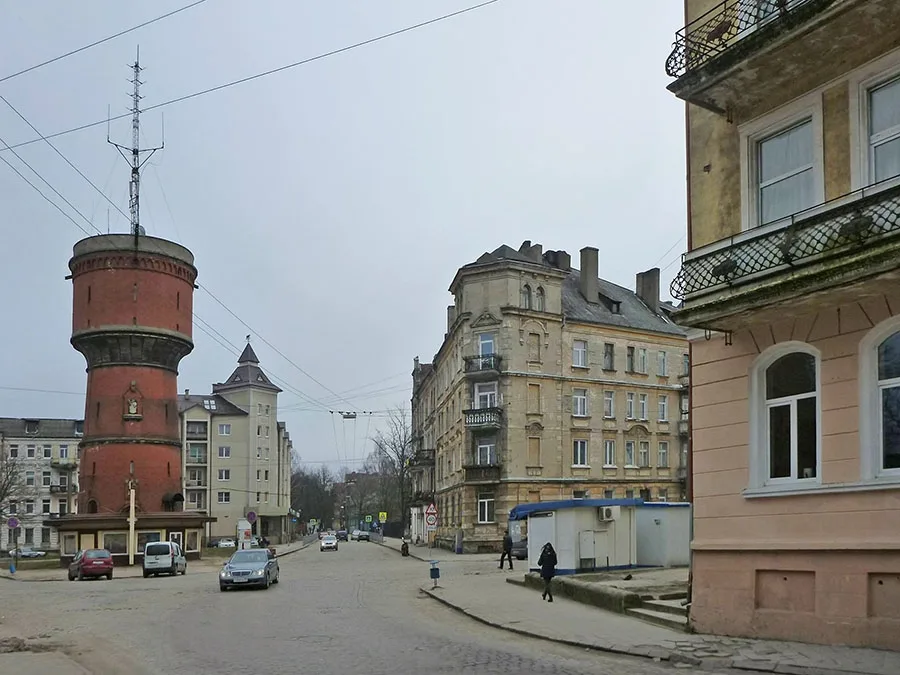 The water tower of Insterburg.
In the early 1970s, the third general development plan was adopted, under which housing provision for the town’s residents was to be increased through the construction of standard five-storey buildings and, in selected spots, nine-storey ones.
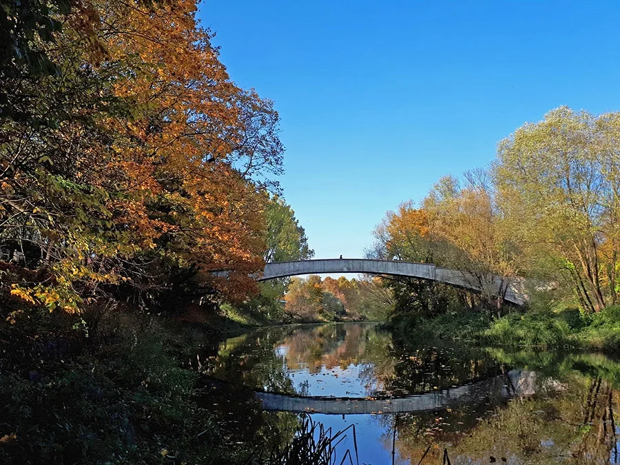 Arched footbridge over the Angrapa.
And while housing still posed serious problems, in other respects Chernyakhovsk could be described as a “dynamically developing district centre”. In 1970, for instance, the town’s House of Culture was named the best in the RSFSR. In 1971, an industrial and agricultural exhibition of the district’s products was organised by local efforts.
In 1977, Chernyakhovsk was declared a winner of the all-Union socialist competition and awarded the Challenge Red Banner of the CPSU Central Committee, the USSR Council of Ministers, the All-Union Central Council of Trade Unions and the Komsomol Central Committee.
At the same time, the Chernyakhovsk meat-processing plant took first place nationwide in the socialist competition among meat industry enterprises. At the very beginning of the 1970s, a local history museum was opened at the House of Pioneers. In 1972, the ruins of the Luther Church were finally demolished. In 1973, the town gained a branch of the design institute Kaliningradkolkhozproekt, which drew up construction projects for rural areas. The network of consumer services and catering expanded, and a large-panel housing construction plant was launched.
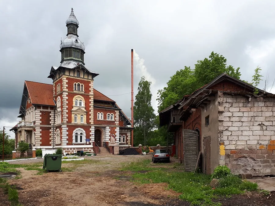 Villa Brandes has served the town as Combined-Type Kindergarten No. 1 since 2008.
Industrial development in Chernyakhovsk continued in the 1980s. In 1981, the meat-processing plant received the Challenge Red Banner for the second time. New production facilities kept opening: a winery and a base of the Kaliningradavtodor quarry association were established. In keeping with the spirit of the times, a Special Design Bureau for Robotics was set up.
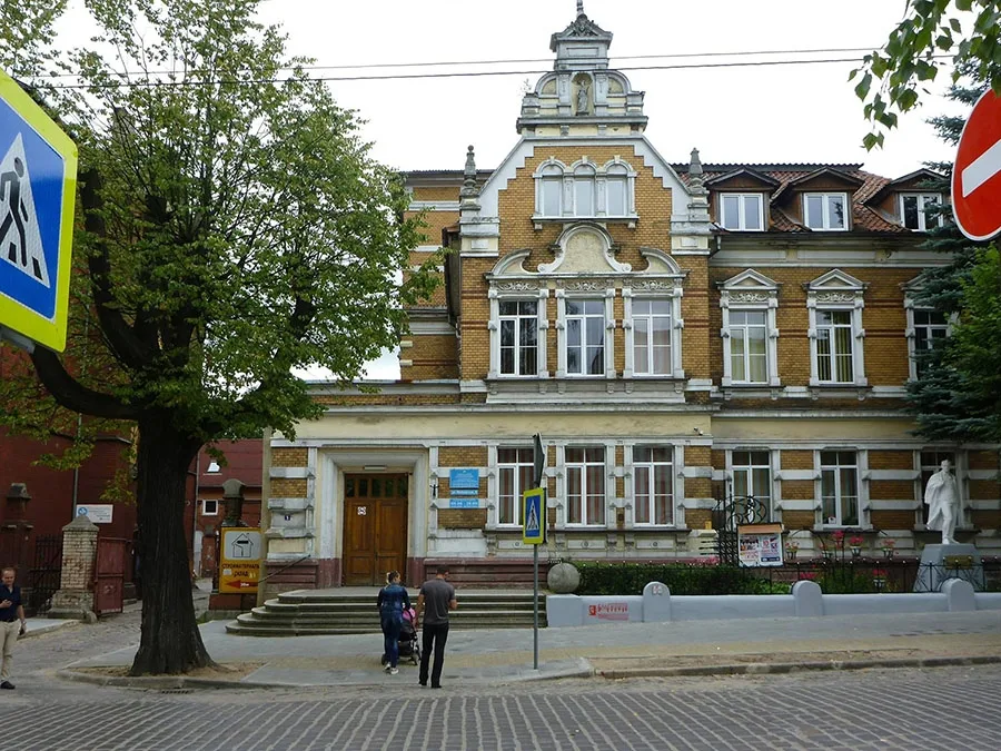 Villa of Hermann Czybulinski, now the Chernyakhovsk Children’s Music School.
The consumer sector grew as well: Chernyakhovsk had 2 restaurants, 5 canteens, 1 cafeteria, 1 pelmeni house, 28 grocery shops and 12 shops selling manufactured goods, 2 bookshops, 2 district consumer cooperatives and 6 departmental shops.
The 1990s were extremely difficult for all the district towns of the region, Chernyakhovsk included. Until then, the entire industrial infrastructure had been geared to state orders and guaranteed purchase volumes. With the arrival of the market economy, the general decline in industrial output and the growth of imports, the products of many enterprises were no longer in demand. Only the food industry enjoyed steady demand. The TekhMash plant, the ceramics factory and the asphalt and concrete plant closed. The town’s cinema network was dissolved and the “Udarnik” and “Oktyabr” cinemas were shut down: the former was turned into a cultural and leisure centre, the latter into a metal structures production facility.
In 1990, an Orthodox church opened in the building of the Reformed Church, and in the Church of St. Bruno Catholic services resumed after a break of 45 years.
In 1991, a motorised rifle division was redeployed from Germany to Chernyakhovsk. In the same year, the new School No. 3 for 980 pupils opened, and a customs office was set up at the railway station. In 1995, Chernyakhovsk hosted a stage of the Equestrian World Cup for the first time. In 1997, the settlements of Mayovka and Timiryazevo were incorporated into Chernyakhovsk, and that same year the new School No. 8 welcomed its first pupils. At Insterburg Castle, the first work to clear the grounds was carried out. A museum was opened in one of the castle buildings, and the castle grounds also began to be used for various public events.
In 2003, the Chernyakhovsk wine and brandy plant began producing brandy. Production of mineral fertilisers was launched. In 2006, the memorial to the 12th Uhlan Regiment near the castle was restored.
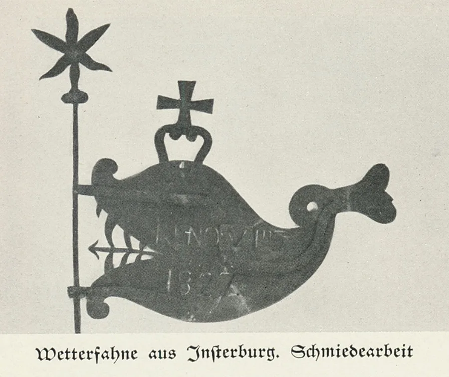 Insterburg weathervane (1827).
Today, Chernyakhovsk is the second-largest town in the Kaliningrad Region.
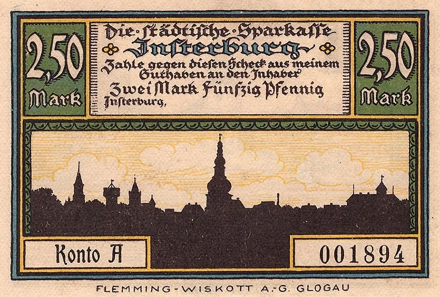 Insterburg notgeld with a face value of 2.5 marks. (German Notgeld, “emergency money”, issued in Germany and Austria by local authorities and by non-governmental organisations from 1914 to 1924 in response to the economic crisis, the shortage of cash and hyperinflation.)
The town covers an area of about 4,500 hectares and has 200 streets, 5 squares and more than 4,500 buildings. Its municipal infrastructure includes 9 bridges, 3 parks and 25 public gardens.
The backbone of industry in Chernyakhovsk is still the food industry (spirits, meat and confectionery), along with mechanical engineering and woodworking, including furniture making. There is a peat extraction company, as well as facilities producing household electronics and fertilisers. Several construction companies are registered in the town, and there is a plant manufacturing plastic windows.
In 2020, a large-scale reconstruction and improvement of the historic town centre began in Chernyakhovsk.
For Reference
Brief information on the estates and villages that belonged to the Insterburg municipality or became part of the town of Chernyakhovsk.
Until 1928, the Abschruten fishery belonged to the Gutsbezirk (manorial district) of Pieragienen / Pieragienen (Michurino). It was part of the parish of Insterburg, Land / Insterburg, Land, based at the Luther Church / Lutherkirche in Insterburg. In 1871, the Abschruten fishery consisted of a single residential building. On 30.09.1928, when the Gutsbezirk of Pieragienen was converted into a rural municipality of the same name (called Angerlinde / Angerlinde from 1938), the Abschruten fishery became part of it. Today, the site is occupied by the residential building at No. 41 Chernyakhovskogo Street.
Until 13 September 1861, Albertshof was called Sweigershöfchen and was an estate within the municipality of Insterburg. In 1871 the estate had two residential buildings. In the 20th century, Albertshof was home to one of the state farms attached to the Georgenburg stud (Mayovka), devoted to breeding and improving the Trakehner horse. Today this is the site of the intersection of Chapayeva Street and 2nd Chapayeva Lane.
Amalienhof was founded in 1838 as Abbau Till. Then, until about 1867, it was called Abbau Ziehe. Amalienhof had the status of an establishment (Etablissement), which belonged to neither a rural community nor a Gutsbezirk. In 1871 Amalienhof had one residential building, occupied by a single family. From the 19th century a brickworks operated in Amalienhof, remaining in existence right up to the Second World War. In the 20th century, Amalienhof was home to a state farm of the Georgenburg stud, devoted to breeding and improving the Trakehner horse. Today Amalienhof is the area around Motornaya Street.
In the 19th century, Abbau Eckert was called Kehlershof. In the 20th century, Abbau Eckert was likewise home to one of the state farms for breeding and improving the Trakehner horse. Around 1939, Abbau Eckert was renamed Insterburg-Kehlershof. When Chernyakhovsk station was expanded, the site of the former estate was taken over by the construction of the station's New West Yard.
Eckertshof was founded in 1826 as Eckertshöfchen. In 1871 and 1895 the estate had three houses. In the 20th century, Eckertshof was home to a state farm attached to the Georgenburg stud (Mayovka), devoted to breeding and improving the Trakehner horse. In the years before the war, a factory, a brickworks and a sawmill stood near the estate. Today this is the area of Kurchatova Street near house No. 28.
Around 1785, Ernstfelde was called Leitnershof; the name later changed to Abbau Kamswyken.
The Ernstfelde estate belonged to the rural community of Kamswyken (now part of Chernyakhovsk) and to the rural parish of Insterburg (Insterburg, Land), based at the Lutherkirche in Insterburg. On 11 March 1874, together with the community, the Ernstfelde estate was incorporated into the newly established Amtsbezirk of Kraupischkehmen (Zalivnoye). On 10 October 1912, the Ernstfelde estate, with 1,000 Morgen of land and a brickworks, was sold by its former owner Gehrmann to Oberamtmann Kopp for 512,000 marks. As of 2023, the site of the estate is occupied by the summer cottages of the Druzhba gardening association.
Until 1804, Grünhof was called Beckenhöfchen. In 1871 Grünhof had three residential buildings. In the years before the war it was an estate with a brickworks. During the war an air-raid shelter was built on the site of the brickworks, and it survives to this day. As of 2023, the site of the estate itself is a patch of wasteland, partly occupied by garages.
Herrmannshof was founded in 1822 as Hermannshöfchen. In 1871 Herrmannshof had four residential buildings, and a park had been laid out. In the 20th century, Herrmannshof was home to a state farm attached to the Georgenburg stud (Mayovka). Today this is the area near the checkpoint of the Chernyakhovsk air base. Nearby stands an abandoned aviators' club.
Heynehof is mentioned in 1839 as Heynehöfchen. In 1871 Heynehof had two residential buildings. The estate had a station on the Insterburg–Warnheide narrow-gauge railway. In the years before the war a brickworks operated on the estate. After the war, Heynehof fell within the area of the expanded Chernyakhovsk military airfield.
Jakobsruh was founded as a coaching inn at the fork of the roads to Gerdauen (Zheleznodorozhny) and Darkehmen (Ozyorsk). The inn at Jakobsruh remained in business right up to the Second World War. Today this is the area at the end of Chapayeva Street by Lake Chapayevskoye.
Janzonsruh was founded as an estate on 13 April 1840. The estate originally belonged to the municipality of Insterburg. In 1871 Janzonsruh had two residential buildings. On 5 July 1950, Janzonsruh was renamed the settlement of Yarki. In 1955 the settlement had six houses; by 1984 only three remained. In the 1990s the settlement was home to the auxiliary farm of a local military unit. In 1997 the settlement had five registered houses. In 2000 it was incorporated into the town of Chernyakhovsk. As of 2021, the settlement had seven households.
Kammershof was a manor farm (Vorwerk) within the town of Insterburg. Today the site of the farm is occupied by houses at the end of Zaozyornaya Street.
Kamswyken is mentioned as early as Peter von Dusburg's "Chronicle of the Prussian Land" as the Prussian stronghold of Kamenisvike on the Angerapp River (called Arsa in the chronicle). In 1275, during the uprising of the Prussians of Nadrovia, the Landmeister of the Teutonic Order Konrad von Thierberg der Ältere (d. 1279) captured the stronghold, which was defended by 200 warriors. All the men were killed, and the women and children were taken prisoner.
Kamswyken has been known as a settlement since 1536. Records mention a headman named Greger who lived here and ran the Schulzenamt of Georgischen, or Gregerschen. After 1539 the settlement appears in documents as Comswigk or Kamswigk. By 1554 the name had become Kamswieken. By 1785 it was a peasant village of nine households under royal patronage, belonging to the Kreis of Insterburg. By 1815 the village had come to be called Alt-Kamswicken. It belonged to the Amt of Althof (Portovoye) and had 12 households.
From 1818, Kamswyken was a village forming a rural community in the Landkreis of Insterburg. The village belonged to the rural parish of Insterburg (Insterburg, Land), based at the Lutherkirche in Insterburg. In 1871 Kamswyken had 15 residential buildings, home to 58 families and five single persons. By 1905 the number of houses in Kamswyken had risen to 20, and on the eve of the Second World War there were already 43.
As of 2023, the site of the former Kamswyken is occupied by Krasnoflotskiye Dachi Street.
Lenkeningken was founded around 1531. Around 1539 it was called Lanckinicken, then from 1561 Lankenningken, and from 1698 Lenkeningken.
In the 19th century, Lenkeningken was an estate which from 1867 formed a Gutsbezirk in the Landkreis of Insterburg. The estate belonged to the rural parish of Insterburg (Insterburg, Land), based at the Lutherkirche in Insterburg. In 1871 Lenkeningken had five residential buildings, home to five families. On 11 March 1874, the Gutsbezirk of Lenkeningken was incorporated into the newly established Amtsbezirk of Kraupischkehmen (Zalivnoye). On 17 June 1876, the municipality of Insterburg bought a 1.2-hectare plot from the Lenkeningken estate for the construction of a brewery. No later than 1908, the Lenkeningken estate itself was incorporated into the town of Insterburg. In 1932 it was given the name Georgenhorst.
After the war, buildings stood here until the 1970s. Maps from the 1990s show partly ruined structures on the territory of the former Lenkeningken. Today this is a patch of wasteland between the railway station (for Sovetsk) and the Angrapa.
Luxenberg was founded as a tavern with a coaching inn. In 1865 the Insterburg–Tilsit railway (Chernyakhovsk–Sovetsk) was laid past Luxenberg, and a station was built on it at Luxenberg. On 1 September 1909, a narrow-gauge branch line was opened from Luxenberg to the station at the Pregel Gate (Chernyakhovsk, 1 Oktyabrskaya Street). Today (2023), the intersection of Leningradskaya and Kirova Streets lies near the former Luxenberg.
The Pätsch brickworks was founded after 1820. In 1939 it was renamed Insterburg-Pätsch. Today this is part of the town in the area of Pobedy Street and 4th Pobedy Lane.
Sprindt was founded no later than 1539 as the Schweicslauken estate. It is also recorded as Schwitslaukenn (from 1540) and Schweitslauken (from 1542). In 1871 the estate had four residential buildings. At the end of the 19th century, the estate's land began to be built up with town houses. In February 1945, during the storming of Insterburg, Sprindt lay in the path of one of the Red Army's main thrusts. As of 2023, it is an urban neighbourhood in the area of Chernyakhovskogo, Slavyanskaya, Kirova and Chernyshevskogo Streets and Chernyakhovskogo Lane.
Tannenhof was founded around 1860. In 1871 Tannenhof had one residential building. Today it consists of a couple of houses and a few outbuildings at the end of Chapayeva Street, beyond Lake Chapayevskoye.
Population of the municipality of Insterburg – Chernyakhovsk over time: 1790 – 4,274; 1809 – 4,500; 1819 – 5,094; 1864 – 11,659; 1867 – 13,741; 1871 – 14,4392; 1875 – 16,303; 1885 – 20,914; 1890 – 22,227; 1910 – 31,624; 1925 – 39,311; 1933 – 41,230; 1939 – 48,711; 1946 – 8,5483; 1947 – 16,3304; 1950 (Jan.) – 25,123; 1950 (May) – 26,854; 1951 – 29,376; 1953 – 35,537; 1959 – 29,063; 1970 – 33,446; 1979 – 35,576; 1989 – 39,622; 1992 – 40,600; 2002 – 44,323; 2009 – 39,874; 2010 – 40,449; 2012 – 39,597; 2013 – 38,571; 2014 – 37,948; 2015 – 37,521; 2016 – 37,037; 2017 – 36,423; 2018 – 35,888; 2019 – 35,432; 2020 – 35,398 inhabitants.
Population of the Abschruten fishery: 1871 – 6, 1905 – 6 inhabitants.
Population of Albertshof: 1871 – 72 inhabitants.
Population of Amalienhof over time: 1867 – 6, 1871 – 9 inhabitants.
Population of Eckertshöfchen over time: 1871 – 47, 1895 – 63 inhabitants.
Population of Ernstfelde: 1905 – 28 inhabitants.
Population of Grünhof: 1871 – 78 inhabitants.
Population of Hermannshof: 1871 – 88 inhabitants.
Population of Heinehof: 1871 – 45 inhabitants.
Population of Heinsterbruch: 1871 – 44 inhabitants.
Population of Janzonsruh – Yarki over time: 1871 – 35, 1984 – 10, 1997 – 14 inhabitants.
Population of Kamswyken over time: 1815 – 69, 1867 – 268, 1871 – 226, 1905 – 177, 1925 – 121, 1933 – 119, 1939 – 149 inhabitants.
Population of Lenkeningken over time: 1867 – 40, 1871 – 38, 1885 – 85 inhabitants.
Population of Sprindt: 1871 – 135 inhabitants.
Population of Tannenhof: 1871 – 24 inhabitants.
Population of the Tilsiter Bahnhof station: 1871 – 4 inhabitants.
Population of the Eydtkuhner Bahnhof station: 1871 – 78 inhabitants.
Population of the correctional institution: 1871 – 683 inhabitants.
Population of the knacker's yard: 1871 – 7 inhabitants.
Population of the Drebolienen estate: 1871 – 36 inhabitants.
Population of Waldhaus Drebolienen: 1871 – 6 inhabitants.
Population of Eichenthal: 1871 – 58 inhabitants.
Population of Johannsthal over time: 1871 – 20, 1885 – 9, 1905 – 5 inhabitants.
Composition of the population of the municipality of Insterburg in 1871: Protestants – 13,961, Catholics – 147, other Christians – 57, Jews – 274, children under 10 – 2,864, literate – 9,787 (86%), blind – 11, deaf-mute – 20, insane – 23.
Composition of the population of Insterburg in 1925: Protestants – 36,797, Catholics – 1,174, Orthodox – 86, Jews – 338, other denominations – 809, atheists – 107.
Composition of the population of Amalienhof in 1871: all 9 Protestants, children under 10 – 3, literate – 6 (100%).
Composition of the population of Kamswyken in 1871: all 226 Protestants, children under 10 – 66, literate – 73 (out of 153 surveyed, 48%), blind – 1.
Composition of the population of Kamswyken in 1939: under 6 – 24, aged 6–14 – 18, aged 14–65 – 94, over 65 – 13; in agriculture and forestry – 56, in industry and crafts – 36, in trade and transport – 16; self-employed – 21, white-collar employees – 14, manual workers – 72.
Composition of the population of Lenkeningken in 1871: all 38 Protestants, children under 10 – 13, literate – 17 (74%), blind – 1, insane – 1.
Number of houses in Kamswyken: 1785 – 9, 1871 – 15, 1905 – 20, 1925 – 16, 1939 – 43.
Farms in Kamswyken by size in 1939: 0.5–5 ha – 5, 5–10 ha – 2, 10–20 ha – 1, 20–100 ha – 1, over 100 ha – 1.
See also Mayovka
1 — the settlements of Mayovka (Georgenburg) and Portovoye (Althof-Insterburg) are covered in separate articles.
2 — including 12,282 inhabitants in the town of Insterburg proper, 536 on outlying farmsteads, 99 at 5 brickworks and 62 in 10 linemen's houses.
3 — including 4,014 Germans.
4 — including 789 Germans.
Photos: bildarchiv-ostpreussen.de, pastvu.com, Mikhail Ogorodnikov.
Translated from Russian with the help of AI (Claude, Anthropic), October 2026.