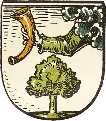
 Coat of arms of Labiau
Labiau is first mentioned as Labiowe in a treaty of 1258 on the division of lands between the Teutonic Order and the local bishop. This date became the official founding year of Labiau.
In 1274, after the end of the Second Prussian Uprising, construction began on a timber-and-earth fortification. It stood where the Laba River (Deima) flowed into the Kurisch-Haff (Curonian Lagoon), whose shoreline at that time ran close to Labiau. In 1277–78 an Order detachment under the Vogt of Sambia, Dietrich von Liedelau, was stationed at Labiau; it later set off by water to conquer the lands of the Scalovians on the banks of the Memel (Neman). The detachment destroyed the Prussian fortification of Raganita. In response, a Scalovian force of 400 warriors likewise entered the mouth of the Laba by water; under cover of darkness they burst into the fortress of Labiau, slaughtered the garrison and burned the fortress itself. However, as early as 1288 Labiau Castle is mentioned again, now as the seat of a Komtur, which means it had by then been fully rebuilt. The knight Wernike (Werniko) appears as Komtur of Labiau. But already in 1289, when the main front of the struggle against the pagans moved to the banks of the Neman, Labiau lost its status as a Komturei, and the new Ragnit Castle (Neman) became the centre of the Komturei.
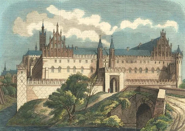
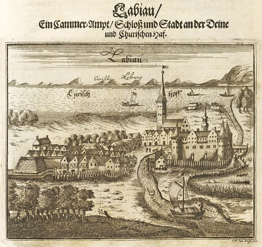 Engraving by Christoph Hartknoch, 17th century.
During the period of the Order's campaigns against Lithuania, Labiau Castle served as a staging post for the Order's warriors and was used as a supply depot for such campaigns. At the same time, Labiau repeatedly became the target of Lithuanian retaliatory attacks.
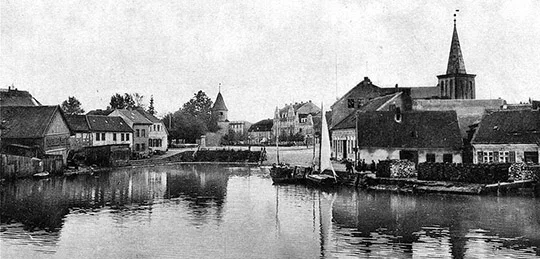
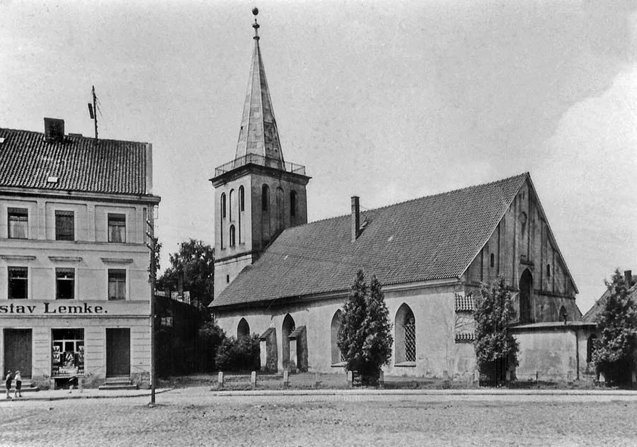 Church of Labiau.
In 1347 forces led by Kęstutis and Algirdas ravaged the surroundings of Labiau but did not dare to storm the castle itself. In 1352 the attack was repeated, but Labiau Castle held a large detachment of Order knights under the Komtur and future Marshal Henning Schindekopf (c. 1330–1370). This detachment made a sortie when part of the Lithuanian army, commanded by Kęstutis's son Patirke, was passing the castle on its way back to Lithuania with its spoils. The Lithuanian force was routed and driven into a bog, where most of the warriors perished, and Patirke himself was taken prisoner. After these raids, in 1360, construction of a stone Labiau Castle began. The new castle was a four-wing building with an adjoining outer bailey (Vorburg). Thanks to a dug canal, the castle was surrounded by water on all sides.
At the end of the 14th century a settlement grew up by the castle walls, which by 1400 had 500 inhabitants. From 1408 a church of St George is mentioned on the grounds of the outer bailey; it remained in use until 1541.
From 1372 work began on straightening and widening the course of the Laba, after which it became the artificial watercourse Deime (Deima). Work on building a canal from the Deima to the Neman continued in 1395–1410. In 1430 a lock was built near Labiau. By 1437 the settlement by Labiau Castle had no fewer than nine taverns.
In 1454, at the very beginning of the Thirteen Years' War (1454–66), rebel forces from Wehlau and Allenburg (Druzhba) approached Labiau Castle. However, the castle garrison under Albrecht Sparukel put up stubborn resistance, and the supporters of the Prussian Confederation failed to take the castle.
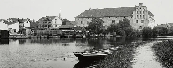
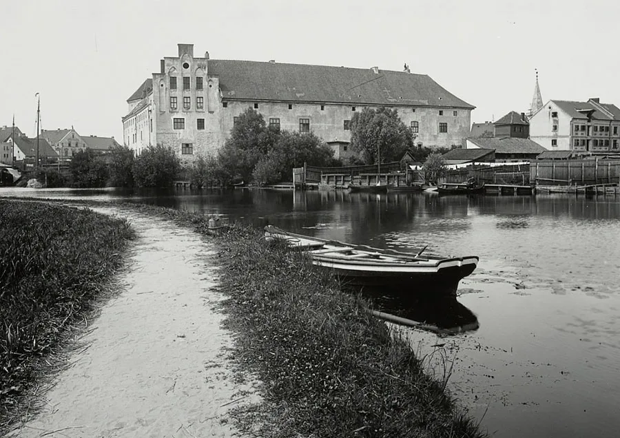 Labiau Castle on the bank of the Deima.
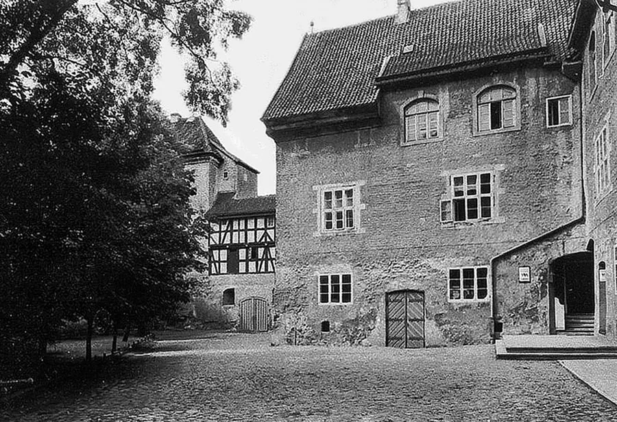 Courtyard of Labiau Castle.
After the secularisation of the Teutonic Order (1525), Duke Albrecht of Brandenburg gave Labiau Castle to his future wife Dorothea as a wedding gift. After her death (1547), the castle belonged in 1565–68 to Albrecht's second wife, Anna Maria of Brunswick.
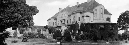
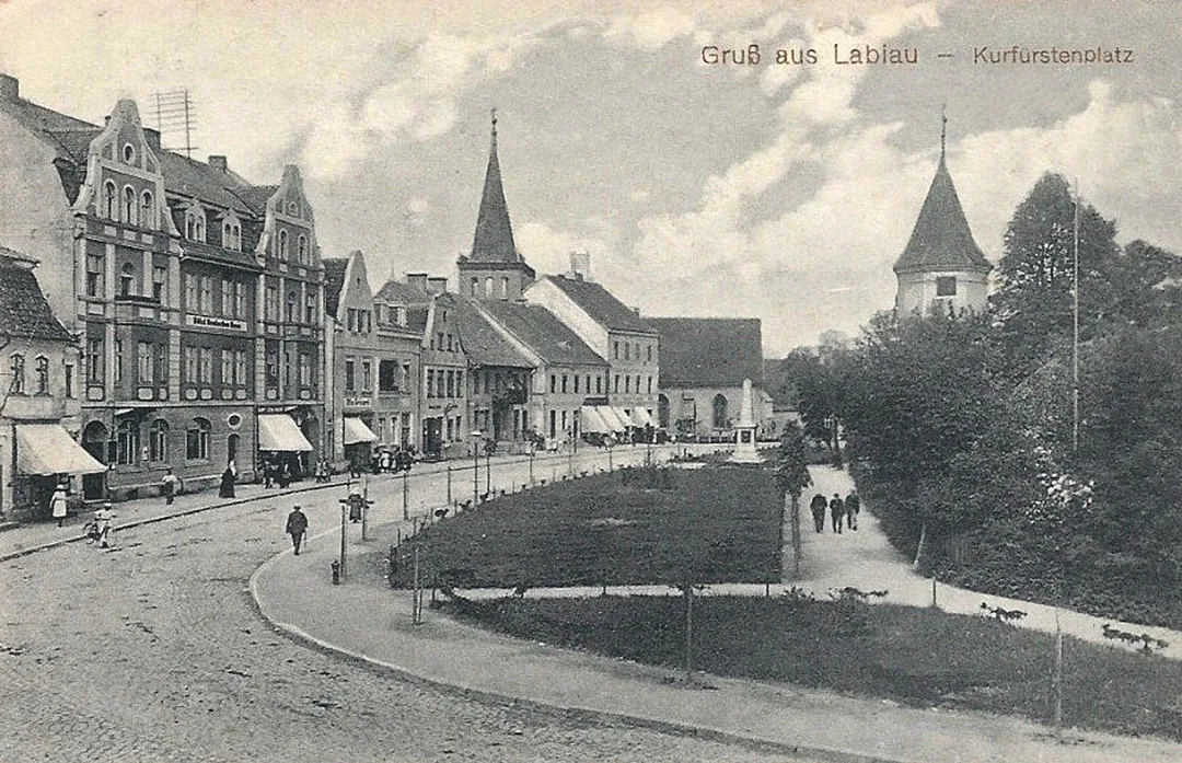
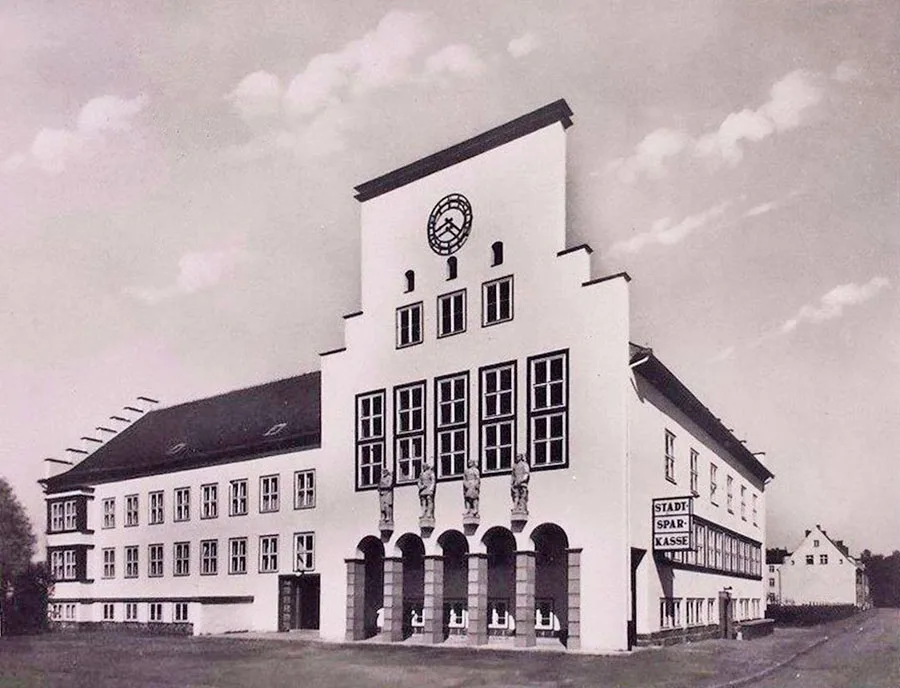 Town hall of Labiau (not preserved).
On 28.07.1642 the settlement by the castle received town rights. From the same year, annual fairs were held in Labiau.
On 20.11.1656 a treaty between Prussia and Sweden was signed at Labiau Castle, under which the Duchy of Prussia gained independence and undertook to take part in the Polish–Swedish War on Sweden's side. In 1657 the town was surrounded by fortifications in the form of an earthen rampart and bastions. The castle was also rebuilt; it now served as the citadel of a bastioned fortress.
In 1679 the army of the Great Elector Frederick William passed through Labiau during the famous sleigh march known as "the Hunt on the Curonian Lagoon" or "the Great Ice Manoeuvre". In 1679–89 a new canal, the Groß Friedrichsgraben, was dug from Labiau alongside the old Order canal, which had already fallen into disrepair. Major fires are recorded in the town in 1685, 1689 and 1721. In 1709–10 a plague epidemic claimed the lives of many inhabitants of Labiau and the surrounding area.
From 1752 Labiau became the seat of a Hauptamt that belonged to the Kammeramt of Tapiau (Gvardeysk). The Seven Years' War (1756–63) largely passed Labiau by, although the plans of the Prussian Field Marshal Lehwaldt took the ramparts of the Labiau fortress into account as a defensive position.
The events of the war against Napoleon in 1807, on the other hand, affected Labiau directly. In the course of that year, retreating Russian regiments, the King of Prussia Frederick William III and units of the French army all passed through the town, which lay on the shortest road to Tilsit. At the very beginning of 1813, French and Russian units again passed through the town, but now in the opposite direction and in the reverse order.
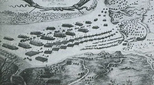
The French army, harassed by constant attacks from the Russian vanguard, decided to use the Deime River to break away from the Russian army. On 03.01.1813 the largest battle on East Prussian territory during the Russian offensive took place at Labiau. The French 7th Infantry Division (Gen. Ch. Grandjean) was attacked in its positions by vanguard units of the First Separate Infantry Corps of the Russian army (Maj. Gen. D. D. Shepelev) and driven from them. The Russian troops then entered Labiau without giving the enemy time to burn the bridge. The pursuit of the French with bayonet charges continued in the streets of the town. The French were driven out of Labiau and continued their rapid retreat towards Königsberg.
Following the administrative reform, in 1818 Labiau became the seat of the district (Kreis, from 1939 Landkreis) of the same name. Labiau itself at that time consisted of the municipality of Labiau and the estate districts (Gutsbezirke) Labiau Schloß (Labiau Castle) and Labiau Mühle (Labiau Mill). In 1871 the municipality of Labiau had 242 dwelling houses; three more houses belonged to the Labiau Castle estate and one house to the Labiau mill. On 09.04.1874 the Gutsbezirke Labiau Castle and Labiau Mill were included in the newly established Amtsbezirk Pareyken (from 1938 Schakaulack, Zelyonoye). However, already on 16.03.1876 Labiau Castle became part of the municipality of Labiau, and on 18.06.1877 the Labiau mill followed.
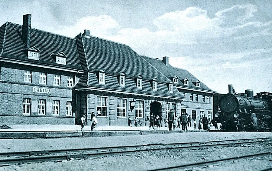 Railway station of Labiau.
In 1889 the Königsberg–Labiau railway was built, and in 1891 it was extended to Tilsit (Sovetsk). At the end of the 19th century a fish processing plant, several sawmills and a ship repair yard were built in Labiau.
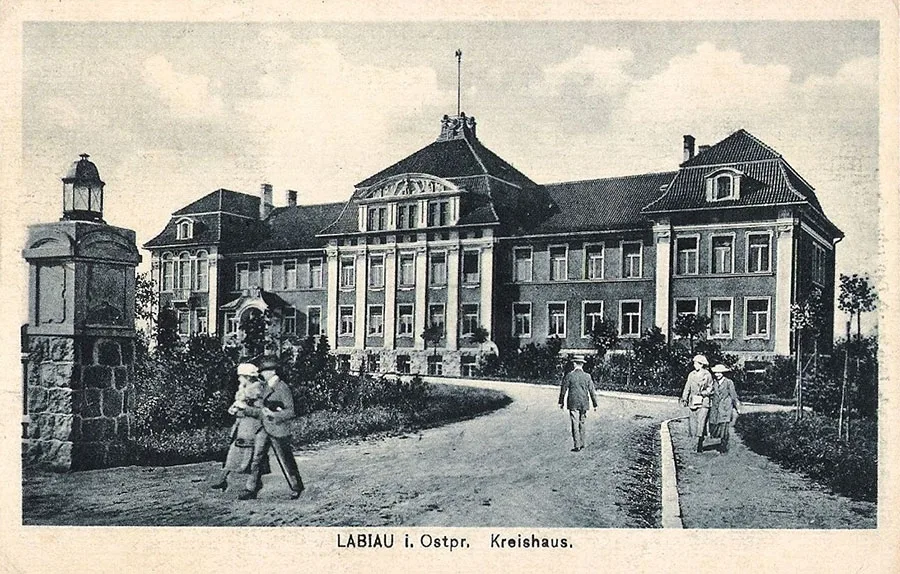 Kreishaus (district administration building) of Labiau.
Before the First World War, Labiau had branches of a state bank and a private bank, a post office, an administrative court and a school inspectorate.
In 1930 Labiau had 390 houses and 1,278 outbuildings. The town's industries included a gasworks, a cement works, a dairy, a brewery, a meat-processing plant, a clog factory, a weaving workshop, a roller mill, a boatyard and three sawmills. Education was represented by an elementary school, a secondary school, a vocational school and a shipbuilding school; healthcare by the district hospital; and social services by an old people's home. As befitted a district centre, the town had administrative and judicial bodies, a fisheries and water management authority, and financial institutions. There were horse and cattle markets in the town.
On the evening of 22.01.1945, units of the 90th and 103rd Rifle Corps of the 43rd Army reached the Deima River near Labiau. As it turned out that the bridge over the Deima had been blown up by the enemy, wooden decking and improvised means were used to cross the river. The divisions of the 103rd Rifle Corps attacked the town from the north, and the divisions of the 54th Rifle Corps from the south. Labiau was finally taken by the evening of 24.01.1945.
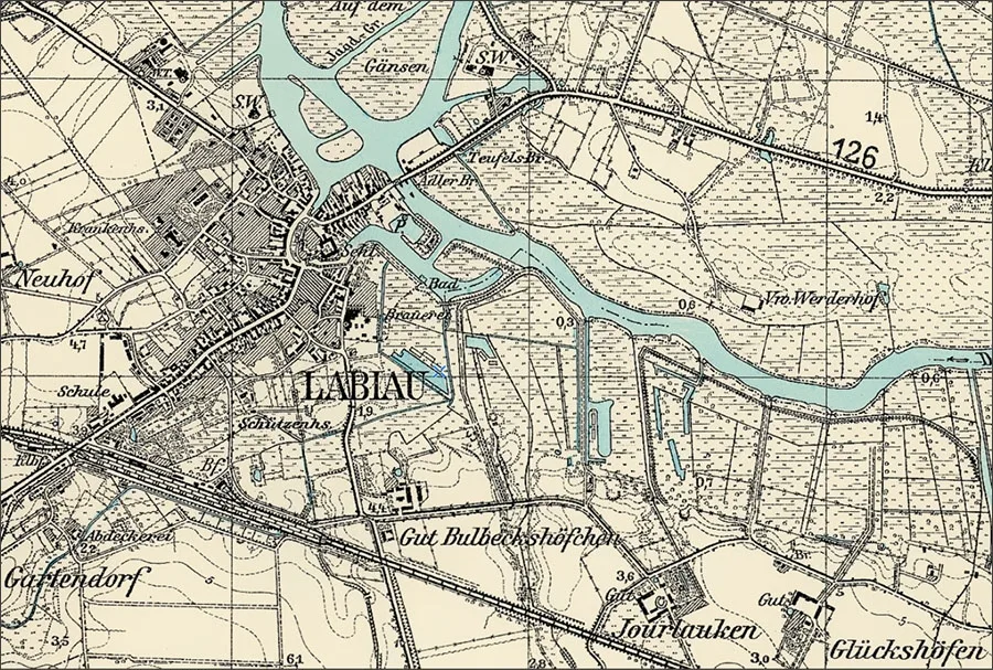
On 07.09.1946 Labiau was renamed the town of Polessk. The Polessk District was created at the same time. The localities of Neuhof, Gartendorf, Bulbeckshöfchen, Jourlauken, Glückshöfen, Kreutzweg, the Klein Naujock head forestry, Radtkenhöfen and Werderhof (see below) were not officially renamed and de facto became part of the town of Polessk. In 1947 the boundaries of the town of Polessk were defined: Grabenhof became the settlement of Ilyinka within Polessk, Glückshöfen and Kreutzweg became the settlement of Zagorodny within Polessk, the Groß Naujock forestry became the settlement of Aleyevka within Polessk, and the Klein Naujock head forestry became the Polessk forestry in the settlement of Aleyevka (Polessk).
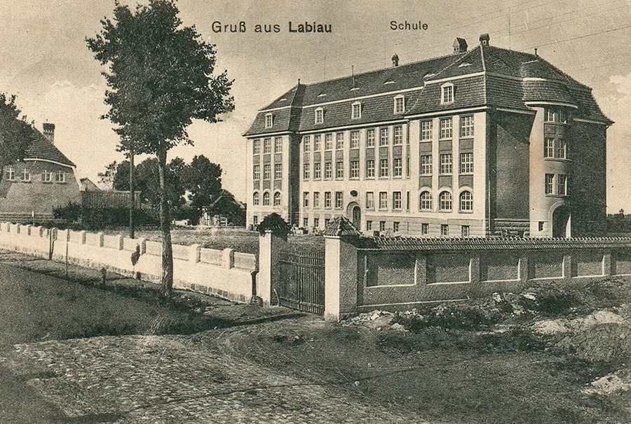 Labiau school on Königsberger Straße.
As early as 1945–46, two Russian primary schools and 12 German schools were opened in the district, as well as a 60-bed hospital for Soviet citizens and an 80-bed one for Germans. On 01.09.1946 a secondary school opened in Polessk.
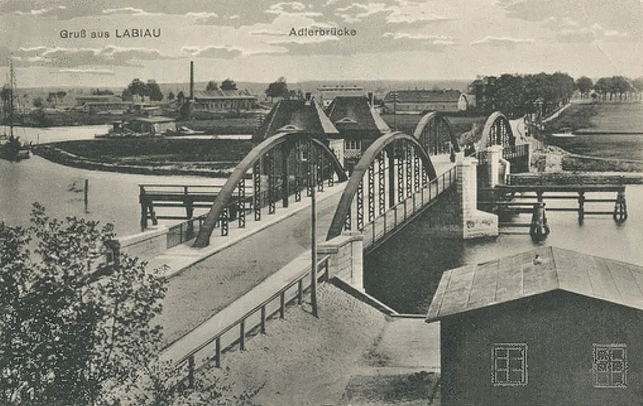 Eagle Bridge (Adlerbrücke) over the Deima.
By 1947 the town had restored a 54 kW power station, a brewery, a flour mill, a bread-baking plant and a district food-processing plant. The "Krasny Oktyabr" industrial cooperative operated, comprising a fishing team and sewing, shoemaking and joinery workshops. The gasworks was not restored. There were also five shops and two catering establishments. 1,542 sq m of housing was restored, and the buildings of the House of Culture, the cinema, the library, the town council and the district executive committee were repaired. A water main, a power grid, a radio relay hub for 150 receivers, a 10-line telephone exchange, and a post and telegraph office were put into operation. By October 1947, 290 of the 320 buildings had been restored. The town had an outpatient clinic, a polyclinic and a sanitary-epidemiological station. In 1948 the Polessk fish processing plant began production. In 1949 the district hospital was repaired and began admitting patients. By 1949 the retail network comprised 34 outlets. By the end of the 1940s, 11 industrial enterprises with 1,043 workers were operating in Polessk and the district. In the 1950s, 40,000 sq m of housing was built in the town. In 1989 an advisory centre of the Leningrad Agricultural Institute was opened, which in 1961 was converted into a branch.
In the 1950s the fish processing plant became the town's main enterprise, and from 1955 it processed not only river fish but also ocean catch.
The Polessk school moved into a restored building on Kaliningradskaya Street, while the old building on Teatralnaya Street continued to house a seven-year (later eight-year) school. The fish processing plant acquired its own housing stock of six buildings and a fleet of 20 vessels. By 1956 it already employed more than 500 people. In 1957 a new bakery producing 15 tonnes a day was built.
In 1960 a children's music school was opened in the building of the Catholic chapel.
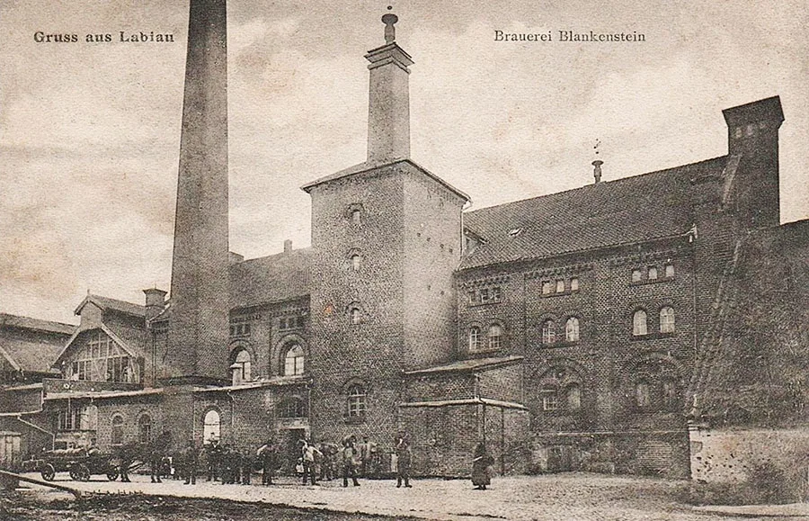 Brewery Blankenstein.
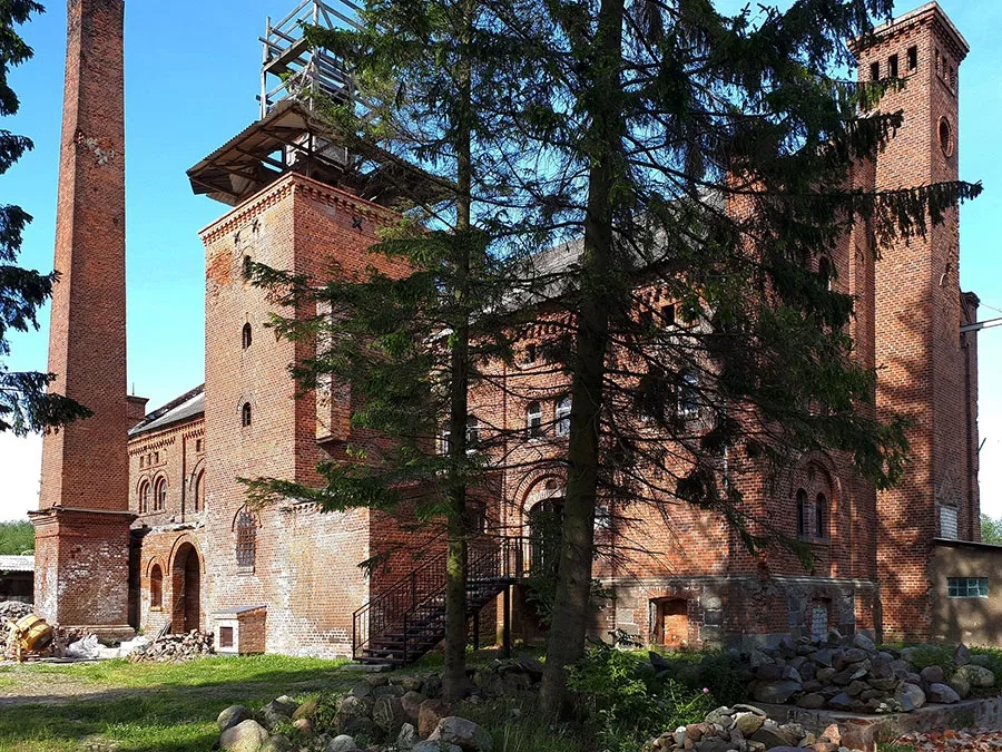 At present (early 2020s) the brewery is being actively restored.
In 1963 Polessk had 324 state-owned residential buildings and several dozen departmental ones, as well as 1,200 sq m of privately owned housing. Nevertheless, the housing problem persisted: there were 7.4 sq m of living space per inhabitant, which was 75% of the regional average.
In the early 1970s a peat enterprise and mechanical workshops began operating, and in 1976 a compound feed plant turned out its first products. In 1988 the Polessk fish cannery also started producing canned meat. Nevertheless, the general economic decline of the late 1980s and early 1990s had an extremely negative effect on the situation in the town. Output fell, and many enterprises closed or were on the verge of closing.
As of 2010, the main industry in the town was food processing (96%). There were also two furniture companies. The town had a secondary school, Lyceum No. 21, a branch of the Saint Petersburg State Agrarian University, a children's music school, a children's and youth sports school, a centre for children's creativity and a youth club. There were also the "Znamya" cultural and leisure centre, the Polessk centralised library system with 13 branches, and a House of Culture. The newspaper "Polessky Vestnik" was published. In 2014 the Polessk secondary school moved into a new building.
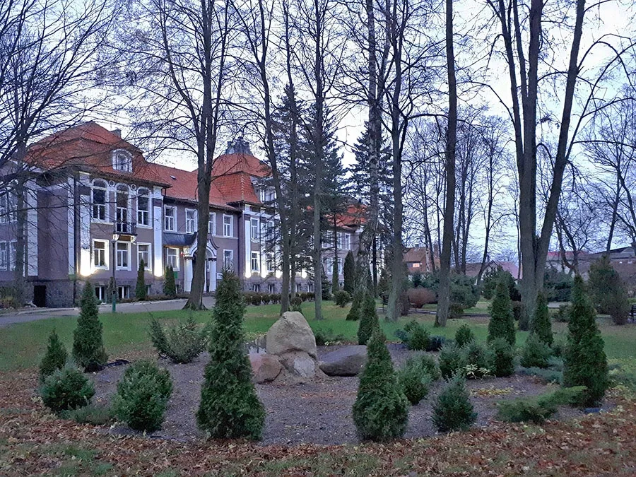
Sights: Labiau Castle, the Adlerbrücke (Eagle Bridge), the water tower, the railway water tower, the post office building (1892), the Kreishaus (1912–13), Albert Blankenstein's brewery (1840), the school building (1910), the chapel building (1928), old German residential buildings, two mass graves of Soviet soldiers (547 people, monument 1948, and 197 people, monument 1948).
Population: 1400 – 500, 1782 – 2129, 1867 – 4355, 1871 – 4339, 1885 – 4744, 1925 – 5088, 1939 – 6527, 1948 – 2336, 1950 – 5300, 1959 – 5400, 1960 – 5564, 1970 – 5600, 1979 – 6300, 1989 – 6900, 2002 – 7400, 2009 – 7600 inhabitants.
For Reference
Population of the Gutsbezirk Labiau Castle: 1867 – 84, 1871 – 72 inhabitants.
Population of the Labiau mill: 1867 – 22, 1871 – 20 inhabitants.
Population of Neuhof: 1905 – 23 inhabitants.
Population of Gartendorf: 1905 – 119 inhabitants.
Population of Bulbeckshöfchen: 1905 – 58 inhabitants.
Population of Jourlauken: 1867 – 62, 1871 – 61, 1905 – 59, 1910 – 52 inhabitants.
Population of the community of Kreutzweg: 1867 – 37, 1871 – 56, 1905 – 31, 1910 – 27, 1933 – 242, 1939 – 224 inhabitants.
Population of Glückshöfen: 1867 – 58, 1871 – 58, 1905 – 25, 1910 – 32 inhabitants.
Population of Grabenhof: 1867 – 5, 1871 – 7 inhabitants.
Population of Radtkenhöfen: 1867 – 35, 1871 – 52, 1905 – 6, 1910 – 0 inhabitants.
Population of Werderhof: 1905 – 12 inhabitants.
Population of the Gutsbezirk Klein Naujock: 1867 – 54, 1871 – 44, 1933 – 38, 1939 – 40 inhabitants.
Population of the Groß Naujock forestry: 1905 – 7 inhabitants.
Neuhof was founded in 1833 as a Vorwerk (outlying farm) within the municipality of Labiau (Polessk). The Vorwerk consisted of one large farmstead and belonged to the parish of Labiau.
Gartendorf was founded as a Vorwerk of the Viehof estate (Tyulenino) in Kreis Labiau (Polessk). The Vorwerk belonged to the parish of Labiau (Polessk) and was part of the Gutsbezirk Viehof (Tyulenino). On 09.04.1874 the Vorwerk, as part of the Gutsbezirk Viehof, was included in Amtsbezirk Pareyken (Zelyonoye). On 30.09.1928, following the abolition of the Gutsbezirk Viehof, the Vorwerk of Gartendorf became part of the municipality of Labiau (Polessk).
Bulbeckshöfchen was an estate that belonged to the municipality of Labiau (Polessk). The estate belonged to the parish of Labiau. In 1889 Labiau railway station was built near Bulbeckshöfchen.
Jourlauken is first mentioned in 1371. After 1820 it was called Jorlaucken. In the 19th century the Jourlauken estate formed a Gutsbezirk in Kreis Labiau (Polessk). The estate belonged to the parish of Labiau (Polessk). On 09.04.1874 the Gutsbezirk Jourlauken was included in the newly established Amtsbezirk Pareyken (from 1938 Schakaulack, Zelyonoye). In 1891 the Labiau–Tilsit (Polessk–Sovetsk) railway was laid past Jourlauken, but no station was built on it for the estate's residents. That said, it was only 1.3 km by road from the estate to Labiau station. On 30.09.1928 the Gutsbezirk Jourlauken was abolished, and the estate became part of the rural community of Kreutzweg (Zagorodny, Polessk).
Kreutzweg was a village forming a rural community in Kreis (from 1939 Landkreis) Labiau (Polessk). The village belonged to the parish of Labiau. In 1871 the village had four dwelling houses. On 09.04.1874 the rural community of Kreutzweg was included in the newly established Amtsbezirk Pareyken (from 1938 Schakaulack, Zelyonoye). In 1891 the Labiau–Tilsit (Polessk–Sovetsk) railway was laid past Jourlauken, but no station was built on it for the village's residents. To catch a train, the residents of Kreutzweg could travel 1.4 km by road to Stellienen station (from 1938 Deimetal, Lugovoye). On 18.01.1904 the community was given 23 plots of former forest land from the forest Gutsbezirk Klein Naujock (Polessk, part), and on 14.02.1905 another 3.7 ha of communal meadowland. In addition, on 21.03.1925 the community received more than 6 ha from the Gutsbezirk Westenhöfen (Zelyonoye, part). On 30.09.1928 the abolished Gutsbezirke Jourlauken (Polessk, part) and Glückshöfen (Zagorodny, Polessk) were incorporated into the rural community of Kreutzweg. In the pre-war years the village had a school.
Glückshöfen was an estate forming a Gutsbezirk in Kreis Labiau (Polessk). The estate belonged to the parish of Labiau (Polessk). In 1871 the estate had three dwelling houses. On 09.04.1874 the Gutsbezirk Glückshöfen was included in the newly established Amtsbezirk Pareyken (from 1938 Schakaulack, Zelyonoye). The first head of the Amtsbezirk, in 1874–78, was the owner of the Glückshöfen estate, Richard Wagner. In 1891 the Labiau–Tilsit (Polessk–Sovetsk) railway was laid past Glückshöfen, but no station was built on it for the estate's residents; the nearest station to the village was Labiau (2.2 km by road). On 30.09.1928 the Gutsbezirk Glückshöfen was abolished, and the estate became part of the rural community of Kreutzweg (Zagorodny, Polessk).
Grabenhof was an estate forming a Gutsbezirk in Kreis (from 1939 Landkreis) Labiau (Polessk). The estate belonged to the parish of Labiau (Polessk). On 09.04.1874 the Gutsbezirk Grabenhof was included in the newly established Amtsbezirk Groß Friedrichsgraben (from 1928 Amtsbezirk Hindenburg, Belomorskoye). No later than 1908 the estate lost its independence and became part of the Gutsbezirk Gründen (Zelyonoye). According to other sources, it became part of the rural community of Groß Friedrichsgraben I (from 1918 Hindenburg, Belomorskoye). In the pre-war years the estate had a coaching inn and a sawmill.
The Klein Naujock head forestry was called Pöppeln until 1902. The head forestry (Oberförsterei) formed a forest Gutsbezirk in Kreis Labiau (Polessk), which included the forest lands and the subordinate forestries. The Pöppeln (Klein Naujock) head forestry belonged to the parish of Labiau (Polessk). In 1871 the Gutsbezirk Pöppeln consisted of five units (forestries), each with one dwelling house. On 09.04.1874 Amtsbezirk Pöppeln was established in Landkreis Labiau, comprising the central part of the forest Gutsbezirk. The Agilla forestry with the surrounding area became part of Amtsbezirk Groß Friedrichsgraben (from 1928 Amtsbezirk Hindenburg, Belomorskoye). On 24.11.1902 the forest Gutsbezirk Pöppeln was renamed Klein Naujock. On 14.03.1903 Amtsbezirk Pöppeln was also renamed Klein Naujock. On 30.09.1928 part of the forest Gutsbezirk Klein Naujock – the Klein Naujock head forestry itself and the Groß Naujock forestry – became part of the municipality of Labiau (Polessk), while only the forest lands themselves remained in Amtsbezirk Klein Naujock. But already on 01.01.1936 these forestries returned to the forest Gutsbezirk Klein Naujock.
The Groß Naujock forestry belonged to the forest Gutsbezirk Pöppeln (from 1902 Klein Naujock, from 1938 Erlenwald) in Kreis (from 1939 Landkreis) Labiau (Polessk). The forestry belonged to the parish of Labiau (Polessk). On 30.09.1928 the Groß Naujock forestry (without its subordinate forest lands) was incorporated into the municipality of Labiau. But already on 01.01.1936 the forestry returned to the forest Gutsbezirk Klein Naujock.
Radtkenhöfen was an estate forming a Gutsbezirk in Kreis Labiau (Polessk). The estate belonged to the parish of Labiau (Polessk). In 1871 Radtkenhöfen had three houses. On 09.04.1874 the Gutsbezirk Radtkenhöfen was included in the newly established Amtsbezirk Reikeninken (from 1938 Reiken, Vskhody, later Podsobny). On 18.06.1909 the main part of the Gutsbezirk Radtkenhöfen became part of the municipality of Labiau, and 5.5 ha of land passed under the administration of the community of Reikeninken (Vskhody, later Podsobny). In the pre-war years the estate had a smithy.
Werderhof was a Vorwerk within the municipality of Labiau (Polessk). The Vorwerk consisted of one large farmstead and belonged to the parish of Labiau.
Population composition of the town of Labiau in 1871: Protestant Christians – 4189, Catholics – 24, other Christians – 1, Jews – 125, children under 10 – 1008, literate – 2630 (80%), blind – 6, deaf-mute – 13, insane – 8.
Population composition of the Gutsbezirk Domain Labiau Castle in 1871: all 72 – Protestant Christians, children under 10 – 10, literate – 33 (53%).
Population composition of the Labiau mill in 1871: all 20 – Protestant Christians, children under 10 - 5, literate – 10 (50%).
Population composition of the Gutsbezirk Jourlauken in 1871: all 61 – Protestant Christians, children under 10 – 16, literate 43 (96%).
Population composition of the community of Kreutzweg in 1871: all 56 – Protestant Christians, children under 10 – 12, literate – 35 (80%).
Population composition of Glückshöfen in 1871: all 58 – Protestant Christians, children under 10 – 18, literate 28 (72%(, deaf-mute – 1.
Population composition of Grabenhof in 1871: all 7 – Protestant Christians, no children under 10, literate – 7 (100%).
Population composition of the forest Gutsbezirk Klein Naujock in 1871: all 44 – Protestant Christians, children under 10 – 4, literate – 34 (85%).
Population composition of Radtkenhöfen in 1871: Protestant Christians – 50, Catholics – 2, children under 10 – 15, literate – 21 (58%), insane – 1.
The parish of Labiau comprised: Adlig Bärwalde (Ivanovka, part), Alt Pustlauken (from 1938 Hallenau, Lugovoye), Alt Rinderort (Zalivino), Brandlauken (from 1938 Brandfelde, Svobodny), Bulbeckshöfchen (Polessk, part), Eichwalde (54°50'33'' N 21°08'34'' E), Friedrichsburg (Furmanovka), Gartendorf (Polessk, part), Glückshöfen (Zagorodny, Polessk), Goltzhausen (Ivanovka, part), Grabenhof (Ilyinka, Polessk), Groß Bärwalde (Ivanovka, part), Groß Ernstburg (Ivanovka, part), Försterei Groß Naujock forestry (from 1938 Hindenburg, Aleyevka, Polessk), Groß Poppeln (Rechki), Groß Reikeninken (from 1938 Reiken, Podsobny), Hindenburg (Belomorskoye), Imbärwalde (Ivanovka, part), Jourlauken (from 1938 Kleinkreuzweg, Polessk, part), Klein Bärwalde (Ivanovka, part), Klein Ernstburg (Ivanovka, part), Oberförsterei Klein Naujock head forestry (from 1938 Erlenwald, Polessk, forestry), Klein Poppeln (forestry 54°49'01'' N 21°08'52'' E), Klein Reikeninken (from 1938 Kleinreiken (Vskhody), Kleinhof (54°51'52'' N 21°08'56'' E), Kreutzweg (Zagorodny, Polessk), Labagienen (from 1938 Haffwinkel, Zalivino), Labiau (Polessk), Neu Bärwalde (Ivanovka, part), Neu Pustlauken (Lugovoye, part), Neu Rinderort (Zalivino, part), Neuhof (Polessk, part), Ottoburg (54°46'38'' N 21°09'53'' E), Peldszen (from 1938 Deimemünde (54°53'12'' N 21°05'50'' E), Radtkenhöfen (Polessk, part), Rehwinkel (Furmanovka, part), Steinfeld (Trudovoye), Stellienen (from 1938 Deimetal, Lugovoye), Thegenwalde (54°46'39'' N 21°06'57'' E), Viehof (Tyulenino), Waldhausen (Druzhnoye), Werderhof (Polessk, part), Westenhöfen (Zelyonoye, part).
The forest Gutsbezirk Klein Naujock comprised: the Klein Naujock head forestry (Aleyevka, Polessk), the Groß Naujock forestry (Aleyevka, Polessk), the Agilla forestry / Försterei Agilla (Belomorskoye, part), the Lenkhügel forestry / Försterei Lenkhügel (54°52'15'' N 21°12'49'' E), the Schönbruch forestry / Försterei Schönbruch (Sholokhovo, part).
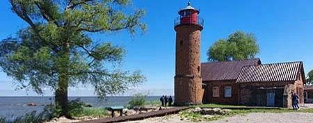
Present-day photos by Mikhail Ogorodnikov.
Translated from Russian with the help of AI (Claude, Anthropic), October 2026.