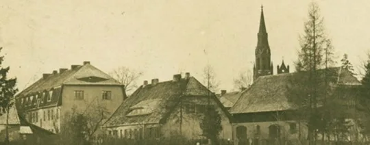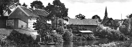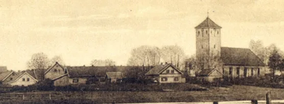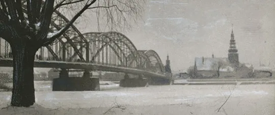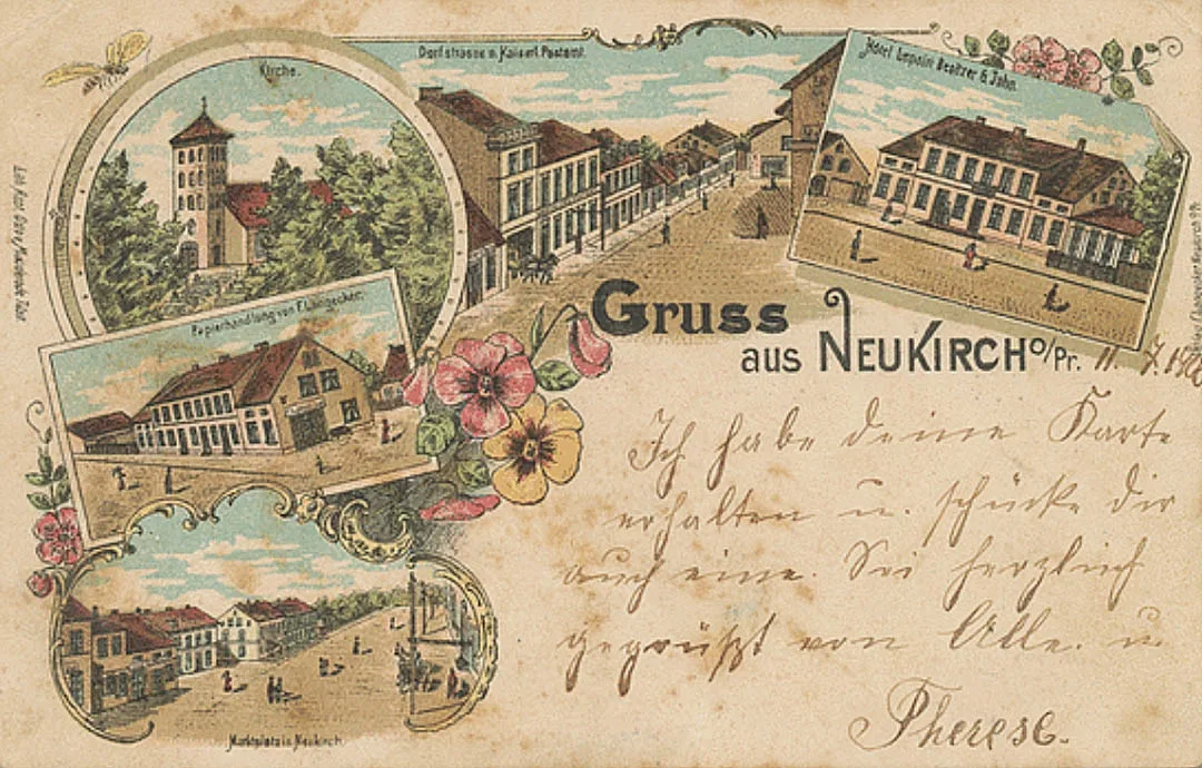
Neukirch is first mentioned at the beginning of the 17th century as Joneykischken. In 1635 a wooden church and a school were built here. In 1729–40, with the assistance of King Frederick II, a new brick church was built in Joneykischken. In 1785 the village was renamed Neukirch-Joneykischken.
Neukirch-An Ziegelberg was the second village whose merger with Neukirch-Joneykischken led to the formation of the community of Neukirch. The village formed a rural community in the Landkreis of Niederung (from 1938 Elchniederung) and belonged to the parish of Neukirch (Timiryazevo).
On 26.03.1874 the Amtsbezirk of Neukirch was formed, comprising nine rural communities: Alleckneiten (from 1938 Kurwensee, 55°06'16'' N 21°38'24'' E), An Rokaiten (from 1938 Kneinrokitten, Kamskoye), Budelischken (from 1938 Hoheneiche, Groznoye), Dwarrehlischken (from 1930 Herrendorf, Solontsy), Neukirch-An Ziegelberg (Timiryazevo, part), Neukirch-Joneykischken (Timiryazevo, part), Rokaiten (from 1938 Rokitten, 55°06'19'' N 21°37'36'' E), Selseningken (from 1938 Selsen, Timiryazevo, part) and Ziegelberg (Timiryazevo, part). The first head of the Amtsbezirk was an estate owner from Neukirch-Joneykischken named Stantien. On 08.07.1905 the rural communities of Neukirch-An Ziegelberg and Neukirch-Joneykischken were merged into the new rural community of Neukirch. After that the composition of the Amtsbezirk of Neukirch did not change until 1945.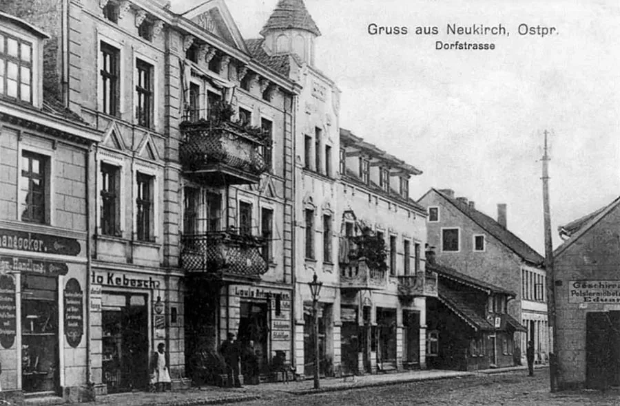
In 1902 the narrow-gauge (750 mm) Elchniederungsbahn railway was laid through Neukirch, and a passenger platform was built on it in the village.
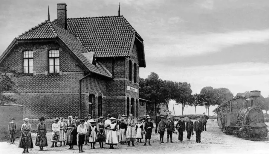
The line ran from Adlig Groß Brittanien (Shcheglovka) and by 1911 had been extended to Karkeln (Mysovka) and Kryszahnen (from 1938 Seckenburg, Zapovednoye). In 1903 the villages of Neukirch-An Ziegelberg and Neukirch-Joneykischken became the first localities in the Elchniederung district to have acetylene gas lighting installed.
In August 1914 Neukirch was occupied by the Russian army under the command of General Rennenkampf. The settlement suffered minor damage in the fighting.
In the 1930s a modern dairy was built, producing 25 tonnes of milk a day. Before the war the village had a school, a dairy, a small engineering works and a windmill. An agricultural fair was held every Friday. Neukirch had a railway connection, and there was a station in the village. From 1933 the head of the Amtsbezirk of Skirbst (from 1938 Heideckshof, Slobodskoye) was based in Neukirch.
On 12.10.1944 the inhabitants were evacuated because of the Soviet advance. On 16.01.1945 part of the Volkssturm and the remaining local inhabitants withdrew from the village.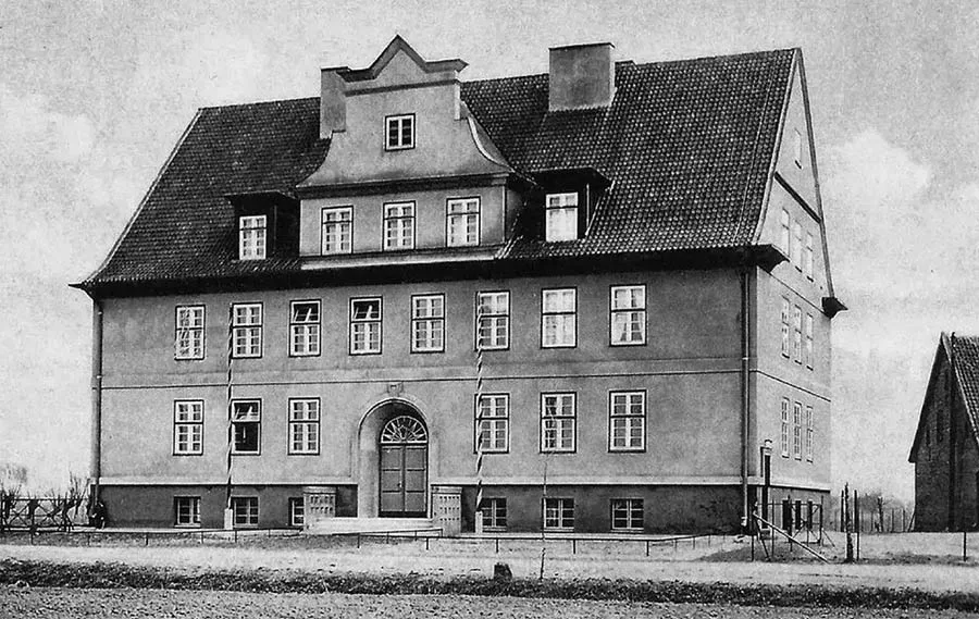
On 20.01.1945 Neukirch was taken by soldiers of the 325th Rifle Division of the 43rd Army. In February 1946 State Farm No. 21 was formed.
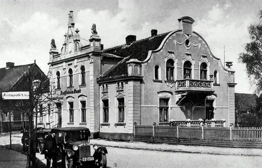
On 17.06.1947 Neukirch was renamed the settlement of Timiryazevo. At the same time the Timiryazevo village soviet was formed. In 1948 the German population was deported to Germany. On 05.07.1950 An Rokaiten was renamed the settlement of Kamskoye, and Gilkendorf the settlement of Uvaly. Selseningken and Ziegelberg were not officially renamed and became part of the settlement of Timiryazevo de facto. In 1972 the settlement of Timiryazevo had 173 houses, a school, a pig farm and a stadium. By that time the farmsteads of the settlement of Kamskoye and two of the four farmsteads of the settlement of Uvaly had become part of Timiryazevo. These localities were removed from the register no later than 1975. In the 1980s there was an agricultural aviation airfield on the western outskirts of Timiryazevo. In 1995 a fire broke out in the church building, which was being used as a warehouse, and the church was badly damaged as a result. As of 2020 the settlement had about 200 houses. It had a school, a House of Culture, a library, a feldsher-midwife station, a post office and grocery shops.
Coordinates of the settlement: 55°05'05'' N 21°36'44'' E (Neukirch), 55°05'03'' N 21°35'29'' E (Ziegelberg), 55°05'32'' N 21°37'58'' E (An Rokaiten), 55°05'05'' N 21°33'55'' E (Gilkendorf), 55°05'37'' N 21°36'53'' E (Selseningken), 55°04'21'' N 21°37'00'' E (Heberwerk Neukirch-Joneykischken).
Sights: church ruins (1740), a semi-rotunda, mass grave of Soviet soldiers, monument to Timiryazev, old German buildings.
Population: 1905 – 1,206, 1910 – 1,185, 1925 – 1,329, 1933 – 1,374, 1938 – 1,487, 1939 – 1,594, 2002 – 1,105, 2010 – 1,158, 2012 – 1,170, 2017 – 1,115 inhabitants.
Population of Ziegelberg: 1905 – 139, 1910 – 137, 1925 – 158, 1933 – 153, 1939 – 134 inhabitants.
Population of the An Rokaiten community: 1905 – 66, 1910 – 67, 1925 – 39, 1933 – 35, 1939 - 29 inhabitants.
Population of Gilkendorf: 1905 – 104, 1910 – 112, 1925 – 107, 1933 – 90, 1939 – 94 inhabitants.
Population of Selseningken: 1904 – 74, 1910 – 61, 1933 – 72, 1939 – 82 inhabitants.
Population of the Heberwerk (pumping station) Neukirch-Joneykischken: 1905 – 4 inhabitants.
Population of the dairy and steam mill: 1905 – 16 inhabitants.
Population of the steam brickworks: 1905 – 14 inhabitants.
Population of the Neukirch-Joneykischken mill: 1905 – 6 inhabitants.
FOR REFERENCE
Ziegelberg was a village forming a rural community in the Landkreis of Niederung (from 1938 Elchniederung). The village belonged to the parish of Neukirch (Timiryazevo). On 26.03.1874 the community of Ziegelberg was included in the newly established Amtsbezirk of Neukirch (Timiryazevo). At the end of the 19th century a windmill operated in Ziegelberg, but it was later dismantled. Ziegelberg had a brickworks, from which the village took its name. Ziegelberg was also home to a dairy and a steam mill (Meierei und Dampfmühle), which had the status of a locality.
An Rokaiten was a village forming a rural community in the Landkreis of Niederung (from 1938 Elchniederung). The village belonged to the parish of Neukirch (Timiryazevo). The community of An Rokaiten also included a steam brickworks (Dampfziegelei) with the status of a locality (54°05'31'' N 21°37'19'' E, now outlying farmsteads of Timiryazevo). In 1874 the community of An Rokaiten was included in the newly established Amtsbezirk of Neukirch (Timiryazevo). At the end of the 19th century two windmills operated in An Rokaiten, but they were later dismantled.
Gilkendorf was a village forming a rural community in the Landkreis of Niederung (from 1938 Elchniederung). The village belonged to the parish of Neukirch (Timiryazevo). In 1874 the community of Gilkendorf was included in the newly established Amtsbezirk of Wolfsberg (Vetryanka).
Selseningken was a village forming a rural community in the Landkreis of Niederung (from 1938 Elchniederung). The village belonged to the parish of Neukirch (Timiryazevo). On 26.03.1874 the community of Selseningken was included in the newly established Amtsbezirk of Neukirch (Timiryazevo).
The parish of Neukirch comprised: Adlig Althof-Skirbst (Slobodskoye), Adlig Groß Skirbst (Graviynoye), Adlig Kreywehlen (from 1938 Adelau, Solontsy), Alleckneiten (from 1938 Kurwensee, 55°06'16'' N 21°38'24'' E), Alt Bogdahnen (from 1938 Altbolzfelde, 55°08'01'' N 21°38'42'' E), An Rokaiten (from 1938 Kleinprokitten, Kamskoye), An Wolfsberg (55°06'55'' N 21°31'38'' E), Aschenberg (Dolinovka), Bartscheiten (from 1938 Oswald, Tumanovka), Bogdahnen (from 1938 Bolzfelde, Verkhny Biser), Budehlischken (from 1938 Hoheneiche, Groznoye), Dampziegelei (Timiryazevo, part), Doblienen (Dublinino), Dwarrehlischken (from 1938 Herrendorf, Solontsy), Gilkendorf (Uvaly), Gronwalde (55°01'55'' N 21°35'16'' E), Gumbehlischken (from 1938 Elchholz, Graviynoye), Hohenwiese (Dubrovka), Heberwerk Neukirch-Joneykischken (Timiryazevo, part), Ibenberg (Tryokhgornoye), Johannsdorf (Romashkino), Klein Skirbst (from 1938 Kleinheideckshof, Slobodskoye), Köllmisch Schnecken (Vesyoloye), Köllmisch Skirbst (55°02'28'' N 21°36'41'' E), Lakendorf (Bogunovo), Langenberg (Privolye), Lausberg (55°07'04'' N 21°31'01'' E), Leitwarren (Abrikosovka), Leitwarren-Lessen (55°04'01'' N 21°35'53'' E), Lentenbude (Uglovoye), Lessen (55°03'35'' N 21°35'20'' E), Lindendorf (55°04'24'' N 21°31'14'' E), Mägdeberg (55°06'13'' N 21°30'16'' E), Meierei und Dampfmühle (Timiryazevo, part), Neu Bogdahnen (from 1938 Bolzhagen, Nizhny Biser), Neuendorf (55°07'45'' N 21°32'44'' E), Neufrost (Svetloye), Neukirch (Timiryazevo), Pawarszen (from 1938 Kleinwarschen, Slavnoye), Polenzenberg (55°06'11'' N 21°31'37'' E), Rokaiten (from 1938 Rokitten, 55°06'19'' N 21°37'36'' E), Schönrohr (55°04'33'' N 21°34'11'' E), Selseningken (from 1938 Selsen, Timiryazevo, part), Skirbst (from 1938 Heideckshof, Pastukhovo), Stobingen (Pridorozhnoye), Tranatenberg (Kamyshino), Wolfsberg (Vetryanka), Wolfsdorf (Sentsovo), Ziegelberg (Timiryazevo, part).
See also Kamskoye and Uvaly.
Translated from Russian with the help of AI (Claude, Anthropic), October 2026.