Nil admirari – Be astonished at nothing.
And rooks are coughing in the empty park.
The benches are getting wet.
J. Brodsky
To sense the aura of the park, to "see the light" and appreciate its soul, to understand the significance of this green landscape zone of the city, one needs at least some acquaintance with the history of the old city district of Haberberg, where the park was laid out. After all, as we know, "beauty is in the eye of the beholder" (O. Wilde).
Haberberg is the southernmost district of the central part of the old city, greatly elongated and originally consisting of a single street, later of two – Unterhaberberg (Bagrationa Street) and Oberhaberberg (Olshtynskaya Street) – linked by one narrow cross street. After the old 17th-century ramparts were demolished, the southernmost street appeared – Artilleriestraße, which ran almost right next to the defences newly built by the middle of the 19th century, and later still Haberberger Wallstraße and Friedländer Wallstraße (both streets now form Kalinina Avenue). At the end of the 19th century, owing to the intensive construction going on in the district, Haberberg's parallel streets were connected by some fifteen short cross streets (one of them was named after Hippel, Lord Mayor and President of Königsberg (now Omskaya Street).
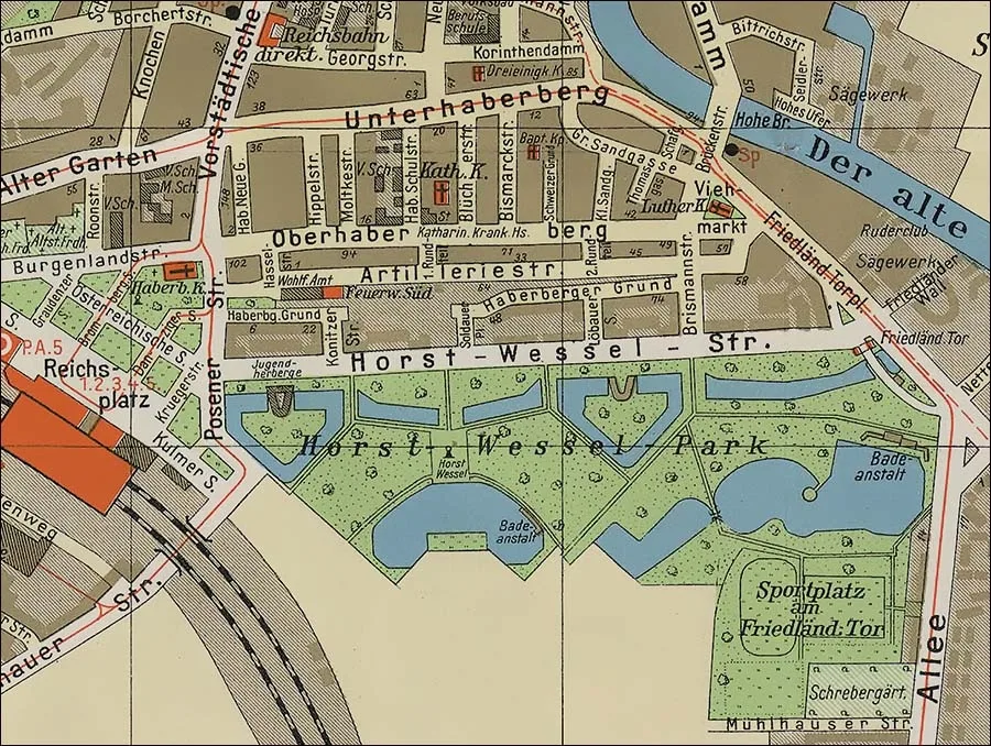 Haberberg on a map of Königsberg (1938).
The village of Haberberg is first mentioned in 1327 as land belonging to the Order.
In 1522 it was given to the inhabitants of the town of Kneiphof (Kant Island) by Duke Albrecht of Brandenburg, as is generally believed, for their loyalty during the Polish–Teutonic War of 1519–21: to keep the Polish troops out of the town, the people of Kneiphof had burned down the whole of Haberberg and the Vorstadt to the north of it (the "suburb" that protected Königsberg from attack from the south). Later these southern districts of the city were rebuilt.
To the east of the Haberberg settlement, roughly where the Friedland Gate appeared much later, lay the hamlet of Neuendorf, and between it and Haberberg stretched a large oak forest, later used to build the Vorstadt. Here too, on the bank of the Pregel, rose a huge sand hill that supplied the city with sand for building.
On the western side, Haberberg adjoined another small village, which stretched all the way to Nasser Garten (literally "wet garden", in fact low-lying, flood-prone meadows and fens with many old man-made dykes built at various times to save the city from floods, and extensive vegetable gardens that went on supplying the city with vegetables even in the 20th century).
Although it lay among wet meadows, Haberberg nevertheless repeatedly experienced the destructive power of fire; one fire, on 10 May 1775, caused a million thalers' worth of damage. Perhaps that is why at the end of the 19th century the southernmost part of the old city still had the features of a provincial suburb, with one- and two-storey private houses surrounded by front gardens, vegetable plots and lush orchards, and was poor in architectural sights. At that time Haberberg was bounded in the west by Kronenstraße (the southern part of Leninsky Avenue), while in the east it adjoined the Friedland Gate and Viehmarkt square (the "Horse" and later "Cattle" Market; in Kaliningrad this is the square at the junction of Dzerzhinskogo Street and B. Khmelnitskogo Street).
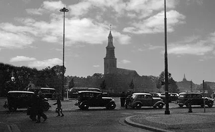
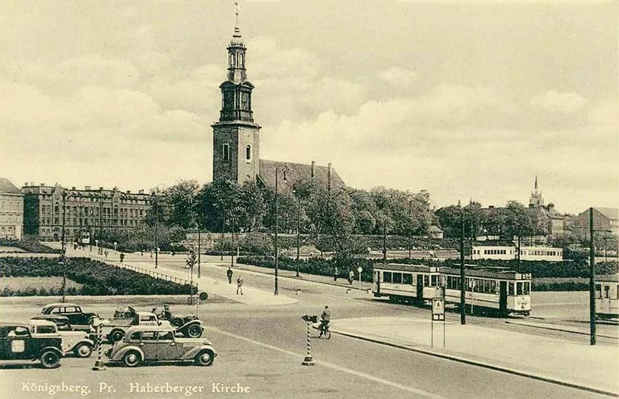 The Haberberg Church greeted visitors who arrived in the city by train.
It was near the Cattle Market that the huge sand hill once stood – a natural deposit of sand in the Pregel valley, which the people of Königsberg were reminded of by the names of two Haberberg lanes – Groß and Klein Sandgasse, Great Sand Lane and Little Sand Lane (in Kaliningrad, B. Pesochnaya Street).
For a long time one of Haberberg's few architectural sights was the Haberberg Church, built on one of the seven hills of Königsberg. Construction of the church on the high Haberberg hill, with its gentle eastern and northern slopes, began in 1653 and, owing to a shortage of funds, lasted until 1683; in that same year an organ by the famous master Casparini was installed here.
The church was struck by lightning twice: in 1747 it burned out completely and was restored from 1753 to 1756; in 1783 the church survived the lightning strike. From then until April 1945 the Haberberg Church, 57 m long, 27 m wide and up to 36 m high (77 m with the tower), adorned the highest point of the district. In 1774 a gilded angel weighing 76 kg and 2.2 m tall appeared on the spire (the gilding was renewed in 1820). The church's vaulted ceiling of Swedish granite was supported by 14 pilasters; the altar with its fine carving and paintings cost the parishioners 2,976 guilders. Today the House of Arts stands on this site, while the Olshtyn restaurant and, until recently, a kindergarten in a pre-war building that once housed the clergy's flats occupy the eastern part of the cemetery that used to lie beside the church. In this cemetery, in 1566, the bodies of three of the closest councillors of Duke Albrecht of Brandenburg – Funck, Schnell and Horst – were secretly buried in an unknown spot; they had been executed without the knowledge of the aged ruler for their part in the intrigues of his adviser and favourite Scalichius, who had enormous influence over the duke.
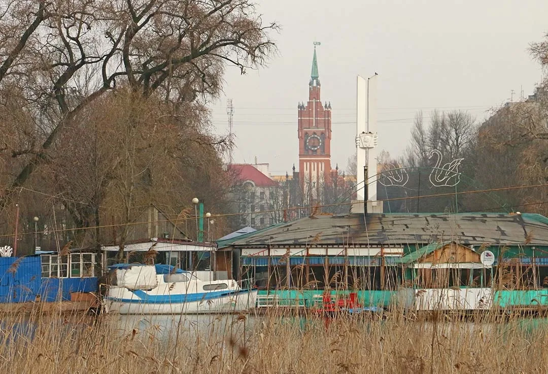
At the end of the 19th century the city bought many small plots in Haberberg from the local residents, and in place of the little houses with their gardens and vegetable plots, 4–5-storey buildings (residential and public) were erected on the old streets and on some fifteen new ones, turning this idyllic backwater of the city into an entirely new district. On Viehmarkt square, where the Cattle Market had long been held, the Luther Church was built in 1907 in the Renaissance style (demolished in 1976).
The last fire in the history of German Haberberg, when everything burned to the ground, took place in April 1945.
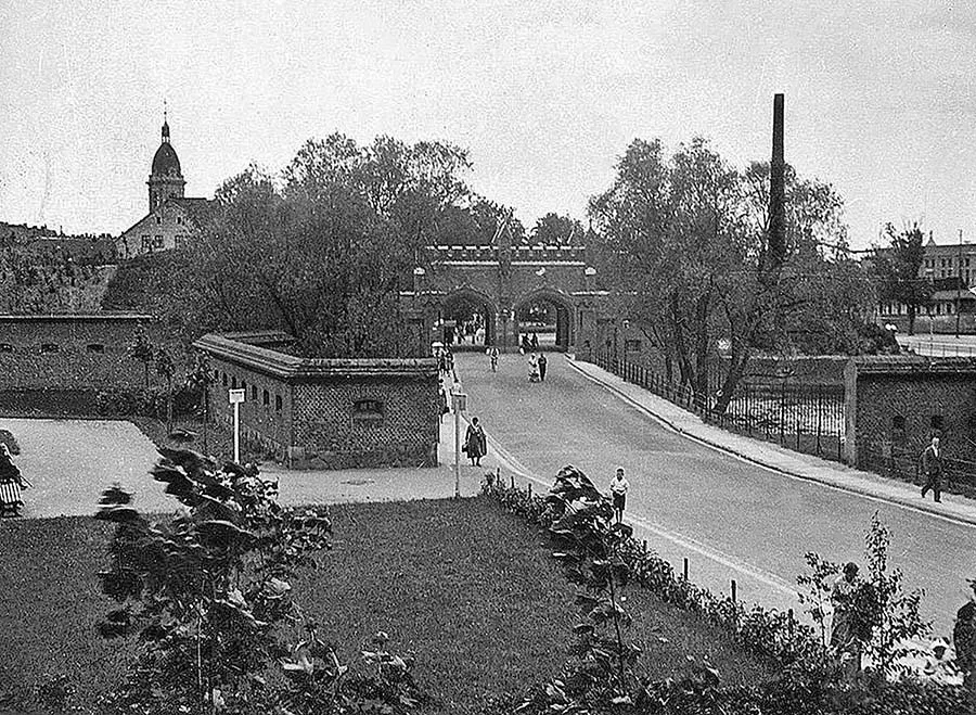 The Friedland Gate and the spire of the Luther Church in Haberberg.
The history of Kaliningrad's Park named after the 40th Anniversary of the Komsomol [renamed Yuzhny], which lies in the south of the central part of the city, in the Moskovsky District, not far from the South Station, began relatively recently – at the very end of the 1920s and the beginning of the 1930s.
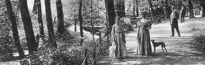
On the 1910 plan of Königsberg, the green zone by the fortifications of the Southern Front is a relatively small area (no more than 300 m at its widest), containing a sports ground and a small pond with a bathing place, and called the Sportpark. On the 1931 plan, however, the green zone is already shown in full.
And so, in the southern part of this old city district, once a remote suburb of the town of Kneiphof called Haberberg, which means "Oat Hill", a new green zone appeared, which by 1935 already had a unified layout and spatial design. That year saw the completion of the planting of trees in avenues, groups and stands that would later shape the appearance of an extensive park of 60 hectares, with 14 hectares of seven ponds and a large sports ground.
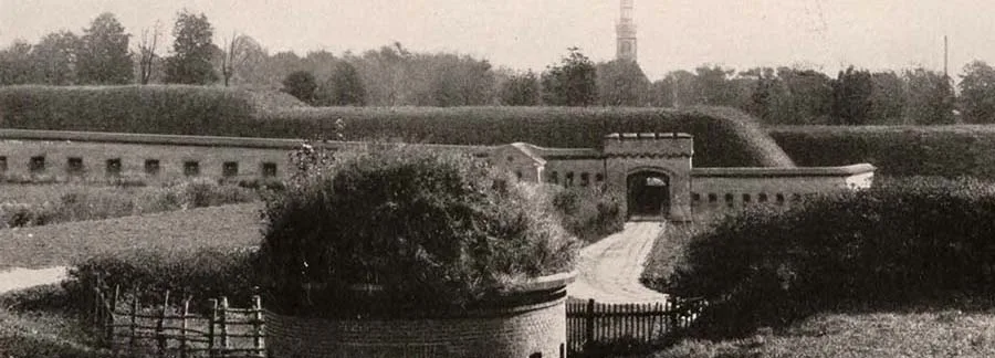
The new green space occupied the glacis of the defensive rampart and incorporated fragments of the fortifications of the Southern Front, which became part of the park's structure as architectural elements: the Haberberg and Friedland ravelins, the cavaliers of the same names, i.e. sections of the rampart and city wall with embrasures lying between the ravelins, and the Friedland Gate (Friedländer Tor), built in 1858–62 and in 1864 adorned with sculptures of the Grand Commander Friedrich von Zollern on the city side and of the fifteenth Grand Master of the Teutonic Order, Siegfried von Feuchtwangen, founder of the Middle Castle at Marienburg (sculptor Wilhelm Ludwig Stürmer, 1812–64). The gate opened the road from Königsberg towards the small town of Friedland on the river Alle (now the town of Pravdinsk on the river Lava), south-east of the provincial capital.
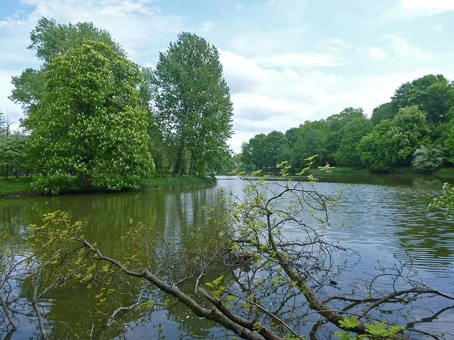 A chestnut in bloom on the bank of the Eastern Pond.
Count Friedrich von Zollern was one of three brothers of the Order who survived that battle. The niche once occupied by his statue stood empty for a long time. But in the summer of 2008 the lost statue of the Grand Commander, recreated under the 1992 intergovernmental agreement on cultural cooperation between the Russian Federation and Germany by the St Petersburg firm Naslediye, was returned to its place.
On the outer side of the gate, also in a niche, stands the statue of the Grand Master of the Teutonic Order Siegfried von Feuchtwangen, placed here probably because it was he who in 1309 moved the residence of the Grand Masters of the Teutonic Order from Venice to the fortress of Marienburg (now Malbork, Poland), as a result of which Königsberg Castle found itself close to the Order's capital and was used as the residence of the commander of the Teutonic Order's army. In his hands the Grand Master, proudly surveying the wide distances, holds a scroll and the fortress castle of Marienburg, built at his command. For a long time this statue of the early 14th-century Grand Master had no head, like many other sculptures in Königsberg. Besides the head, many details and fragments of the statue were lost, namely: the left hand, the left foot, the folds of the cloak on the left side, part of the castle in the Master's hands, part of the scroll in his left hand, and the lower part of the console on which the statue stands. But in 2006 the statue was restored by Russian restorers. (The restoration work was financed by the German Ministry of Culture.)
It was in fact with the greening of this section of the fortifications, preserved as an architectural monument in the fast-growing city, that the creation of the park began; by the end of the 1930s its territory would be extended as far as the sports ground "By the Friedland Gate", which by then included a football pitch, wrestling areas and, a little later, a tennis court and an open-air swimming pool with a bathing place.
The earth embankments of the ravelins and cavaliers were landscaped, flights of steps were added where needed to link the different levels, and the first promenade appeared along Haberberger Wallstraße and Friedländer Wallstraße (now Kalinina Avenue), lined with horse chestnuts.
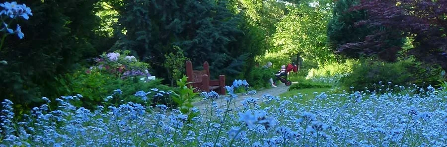
… And today, under the lush crowns of these chestnuts, within the damp and, strange as it may seem, quiet double avenue (right next to it heavy traffic roars along the avenue), the soul wearied by the bustle of the city finds rest, and the eye of the unhurried stroller is captivated by the mysterious overgrown ponds and by the city park that has grown up over a little more than seventy years, planned, like all the zones of the "Green Belt", as an area accessible from several sides.
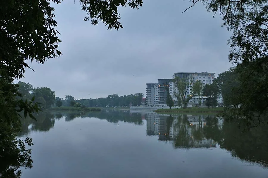 The Eastern Pond at the blue hour.
A guidebook to Königsberg from 1838 mentions a "huge park with old bastions and tree-adorned ramparts, with grounds for wrestling, tennis and other sports, with two bathing places and equipped beaches, an open-air pool with a diving tower, boating, and many playgrounds and lawns for family recreation".
The layout and style of the park across its whole territory are ambiguous, owing to the traditional approach in garden and park design of always combining the regular, linearly precise style typical of the formal parts of a park with the freer landscape style, in which the landscape architect strives to create the effect of a natural setting with an abundance of views succeeding one another.
The northern part of the park, designed on the somewhat raised artificial relief of the earth ramparts and based on the strict lines of the ravelins, of five ponds that are fragments of the moat, and of linear tree plantings, is unquestionably regular in style.
The southern area, laid out later, with its natural flat relief, two picturesque man-made ponds with intricate shorelines, beaches, extensive glades enlivened by small groups of trees with different crown shapes and foliage colours, with alternating open and semi-open spaces, a small fountain, secluded benches and a network of footpaths, is designed mainly in the style of a landscape park.
When the park was being created, four roads were laid across the moat, an essential feature of fortifications, as a result of which the park was adorned with five ponds of different shapes, two of which follow the outlines of the Haberberg Ravelin (in the western part of the park) and the Friedland Ravelin (in the eastern part). The wide straight roads leading from the entrances into the depths of the park are not lined with trees; trees merely accentuate the corners of the ponds, whose shorelines are emphasised by avenues: on the north side a double row of horse chestnuts (along Kalinina Avenue), on the south side likewise mainly a double row of Norway maples. A single row of Norway maples is used to accentuate the southern shoreline of the two ponds by the Haberberg Ravelin.
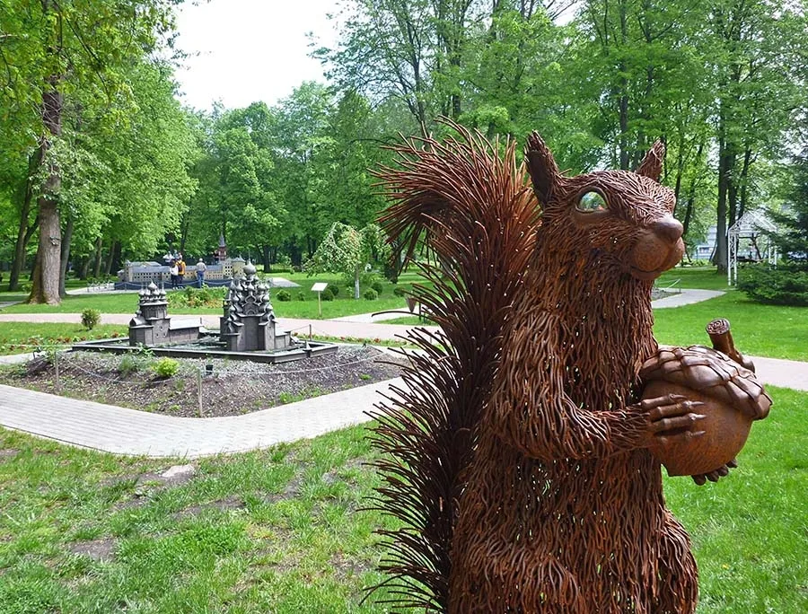 A squirrel from the "History in Architecture" miniature park.
One of the four park roads, laid east of the Friedland Ravelin, was a continuation of Brismannstraße, which crossed the whole park from north-east to south-west. This street began at Haberberg's former Cattle Market, the memory of which was preserved in the name Viehmarkt, where at the beginning of the 20th century the Protestant Luther Church was built on the site of the slaughterhouse (not far from the Hohe Brücke / High Bridge).
Today this is Oktyabrskaya Street, in the section that connects B. Khmelnitskogo Street with Kalinina Avenue, while the bridge connects Bagrationa Street with Oktyabrsky Island (formerly called Lomse).
Crossing the park, Brismannstraße led to the locomotive depot and other railway facilities lying to the south.
The large drawbridge at the Friedland Gate and the smaller drawbridge of the Friedland Ravelin, the road to the Friedland Gate, which once provided one of the ways into Königsberg, encircled by its defensive rampart, and part of the earthworks by the gate were preserved when the park was laid out, as an expressive component of its landscape structure.
During this period of the park's formation, its future southern part already had, besides the sports ground, two man-made ponds, needed both to enliven, adorn and drain the flat relief and for sport and recreation. The appearance of the ponds is recorded in the 1927 atlas of Königsberg and in the 1928 guide map of Königsberg.
One of the ponds, the western one, is arc-shaped and larger than the second, eastern one, which lies on the edge of the park next to Aweider Allee (Alleya Smelykh, "Avenue of the Brave"). This eastern pond is connected by a narrow channel with the pond by the Friedland Gate and also, probably, outside the park, underground, with a backwater of the Old Pregel that separated the sites of the shipbuilding and sawmill enterprises located here from the late 1920s.
In 1931 the eastern pond still has its former shape of an irregular trapezium and the same water area, but several channels have already been dug from it towards the through road across the park, evidently intended for boating or for competitive rowing. By 1938 the area of the pond has grown considerably, and its water now stretches from the eastern boundary of the park to the street that crosses the park. The outline of the shore has changed, becoming more intricate and picturesque: an artificial peninsula and capes appear, two of which, facing each other, are linked by a small suspension footbridge (the footbridge has survived, but by 2006 it was in ruins). The approaches to the footbridge at each end are accentuated by mighty willows. In the eastern part of the pond, on its northern bank, near the artificial peninsula, there were a municipal bathing place and a boat station (1927).
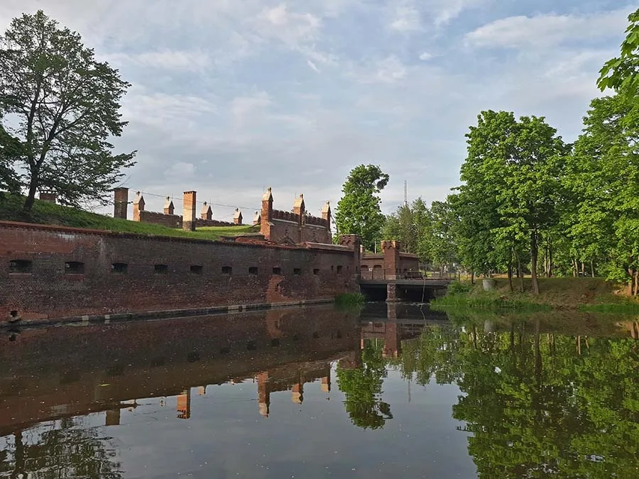 A restored fragment of the fortress wall by the Friedland Gate.
Several footpaths converged crosswise at a small resting place furnished with benches and overlooking the suspension footbridge. Nearby, by the main avenue-road, a café was built as a permanent structure on foundations; it was approached by an avenue bordered by a dense wall of hornbeams (cut down by 2006).
On the extensive area adjoining the pond on its northern side, open, enclosed and semi-open spaces were combined in almost equal proportions, formed by avenues and groups of trees, with a sunlit glade in the centre of the area. Here one can single out the parallel double avenue of maples which, as already mentioned, emphasises the shoreline of the narrow northern pond, and an avenue repeating it, lined on one side with English oak. Here, too, maples, black poplar and willows were planted in groups, as well as solitary willows, oaks and a white poplar.
Along the southern shore of the pond, horse chestnuts were planted in single and double avenues. Some of the plantings outside the avenue were designed to form an enclosed type of spatial structure. For this purpose limes, hornbeams and maples were planted here in small groups around the sports ground. To the left and right of the sports ground there was completely open space, partly green lawns for sport (in the eastern part) and partly still undeveloped (in the western part).
In the centre of the park, west of the main avenue, the large East Prussia Hall with 6,000 seats was built in 1938: a concert and sports complex measuring 100 x 50 m, i.e. occupying 0.5 hectares of the park. The building was made of glass and wood on a metal frame, with a colonnaded entrance on the façade; on the east side there was a terrace and a rostrum for rallies (architect Professor Kurt Frick, engineer Heinz Bar). The building burned down completely during the Second World War (possibly as a result of arson), but its foundations and plinth survive in the park to this day. Ever since the remains of the hall ceased to be used for rallies and festivities in the 1980s–90s, the basement rooms have been extremely littered, cluttered and flooded, and they absurdly occupy the central part of a park conceived in the landscape style.
The outline of the western part of the park, lying between five ponds (four of them bound it on the north, one on the south), is shaped by the clear lines of the northern ponds, but the southern pond – an open-air swimming pool – softens this severity, dictated by the ramparts, with the smoothness of its shoreline and gives the south-western part of the park a gently rounded form in keeping with the image of a green zone in the landscape style.
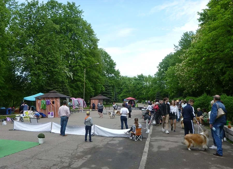 A dog show when the chestnuts are in bloom.
Open spaces predominated in this part of the park, divided down the middle into two equal halves by a wide road linking it with the city (today with Kalinina Avenue).
On the right, the maple avenue is adjoined by a stand of black poplar, Norway maple and sycamore, and here, standing on their own in all the splendour of mighty, fully developed trees, are specimens of English oak, common hornbeam and Schwedler's Norway maple (i.e. the red-leaved form). To the left of the road the glade is fringed by a stand of black poplar.
The southern shoreline of the arc-shaped pond – the pool with the diving tower – is emphasised by groups of willows. South of the platform with the diving tower, the outline of the pond becomes more complex with two small triangular ponds separated by a narrow strip of land leading to the tower.
The distinctive features of this park's spatial structure are undoubtedly the vast open spaces of sunny glades, which predominate in area, and the remarkably clear lines of the shady avenues in its northern part. The geometric precision of these avenues, which cross the park from west to east, is emphasised by the identical trees that form them: the northernmost avenues are of chestnuts, and a little further south come the symmetrical bends of the maple avenue. The dominant elements of the park are the fragments of the fortifications and the 14 hectares of water that once helped make the defensive rampart impregnable.
… Every garden has its own symbolism, which is often incomprehensible to contemporaries but is conveyed to them and to future generations through feelings… This park, undoubtedly impressive in its size and the might of its trees, has a complex aura: it was ambivalent from the outset and has been burdened by the subsequent stages of its history… Here you feel yourself on an island of the old days, of quiet charm and vague sadness, yet at the same time in our present, and you clearly see "a huge, ruined city, bitterly reeking of fires and gunpowder… Wherever you turn your eyes, they come upon the dead." (Yu. Ivanov, "Look Back Along the Way").
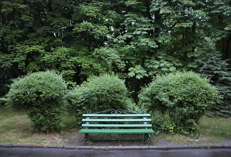 Fifty shades of green.
Like the many other green zones that E. Schneider "strung" on Königsberg's Green Belt, this park was conceived as a place of recreation for ordinary townspeople and was laid out at the expense of the city treasury.
That is probably why its plantings consist not of the exotic trees so beloved in private Prussian gardens but of ordinary European species – oak, elm, hornbeam, lime, maple and even fast-growing poplars and willows. Only the box elder (negundo) and the silver maple are introduced species, native to North America; the horse chestnut comes from the Caucasus and the Balkan Peninsula but has long been used in plantings as if it were a native species. To make the plantings decorative and striking, the park used such techniques of garden design as "bouquet" crowns, where several saplings are placed in one planting hole and grow together at the base of their trunks (the unusually striking result is a lush, voluminous crown), as well as shaped crowns, clipped green hornbeam walls and shrub forms of trees.
An analysis of the structure and layout of the park shows that the creation of the green space had not been completed by the end of the 1930s. In terms of layout and structure, the southern part of the park remained undeveloped. This was apparently not just a matter of time. The reason may have lain in a reorientation of public values and the emergence of a new approach, a different view of how this park should be shaped given the vastness of its territory: from a comfortable "green island" for quiet recreation amid a noisy, densely populated city, the park turned into an area for sports and paramilitary training, for mass Nazi gatherings, one of the centres for the ideological indoctrination of young people. In 1938 the park was named after Horst Wessel, a Nazi killed in one of the many brawls and clashes typical of the period when the fascist regime was taking shape, and in the centre of the park a monument to the Nazi storm troopers was erected (on the wide road in the western part of the park, opposite the open-air swimming pool – the pond with the diving tower).
What could be more symbolic than laying out gardens and parks on former fortifications after so terrible a war as the First World War was for Europe – for that is exactly how many of Königsberg's green spaces were created… But gardens were arranged differently at different times, each era in its own way: for contemplation, for love and trysts, for society festivities and for philosophical walks. Usually gardens are laid out for comfort and the enjoyment of life, for peace and joy. That is how this park, too, was laid out, but… It was destined to live through two stages of its German history: in the early 1930s, a green space for ordinary townspeople with simple amenities – avenues that would one day be pleasant to stroll along, a small fountain, boats on the pond, pavilions serving coffee and rolls, a stadium; in the late 1930s, a paramilitary sports park, a military brass band, a ground for the physical and spiritual education of young Nazis.
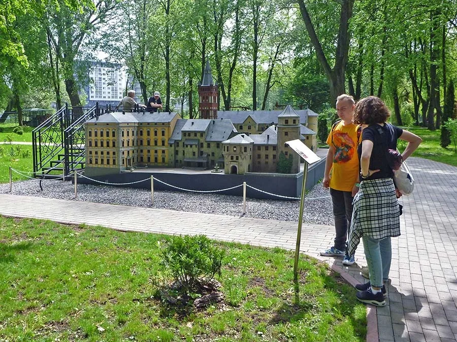 A model of Königsberg Castle.
From 1945 to this day, the third period of its history has been under way – a park for the citizens of Kaliningrad – a long period, but not a very productive one for the park.
Probably, immediately after the end of the Second World War, this green area, like many others, had no owner. In the north-eastern corner of the park, on a hill preserved during the park's creation as a fragment of the earthworks of the Friedland Gate, graves of Soviet citizens from 1946–48 still survive. And so, even now, in the 21st century, they lie in the unconsecrated ground of Königsberg's fortifications. In 1948 the park was named "Matrossky" (Sailors' Park), probably because it was under the jurisdiction of the Twice Red Banner Baltic Fleet; ten years later, in 1958, it was renamed the Park named after the 40th Anniversary of the All-Union Leninist Young Communist League.
Following Resolution No. 85 of the USSR Council of Ministers of 22 January 1988, "On Measures to Preserve Parks That Are Cultural Monuments and to Further Develop the Art of Garden and Park Design", the Kaliningrad Regional Executive Committee also adopted a decision of the same name, No. 120 of 7 July 1988, declaring the Park named after the 40th Anniversary of the Komsomol a heritage park.
At present [early 21st century] the area of the park has shrunk sharply to 40 hectares, as the ravelins and some other areas have been alienated and are no longer part of the park. The park has lost its status as a historic architectural and landscape complex but has retained its natural landscape features and its structure and layout. Until now the park has been managed by the municipal enterprise "Park of Culture and Recreation named after the 40th Anniversary of the Komsomol". According to the current master plan of Kaliningrad, the park is a public green space, "a multifunctional park of city-wide importance. Active recreation for citizens includes fishing, sports, and walking and training dogs…".
The park administration is housed in the former bathhouse building, sharing the premises with a veterinary clinic and a gravestone workshop, which rent their premises from the park. Along the former Friedland road, the customers of both establishments drive their cars into the city park, which in this spot looks particularly unsightly, aggravating the already sad result of long years of neglect and degradation of a park "into the creation of which the labour of many generations has been invested and which should play an important role in the cultural and environmental education of working people…" (from the decision "On Measures…", No. 120, 1988). Industrial enterprises, warehouses and workshops are closing in on the park from the north and south.
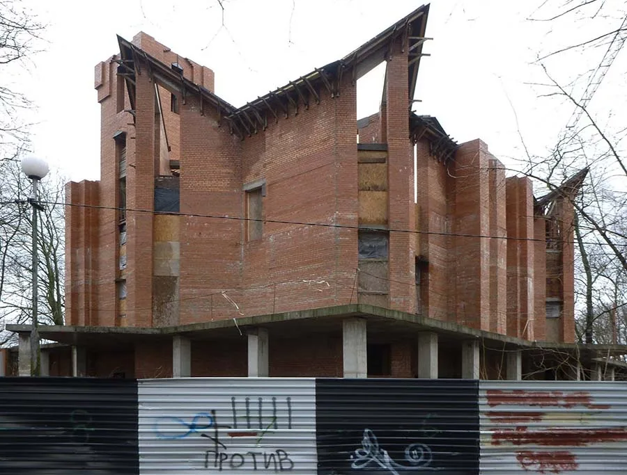 The mosque that never was. A very strange story from the first quarter of the 21st century.
Since the 1990s, the ravelins have been used by various organisations as warehouses, workshops and shops. The Friedland road serves as vehicle access to them, although it used to be part of the park.
The drawbridge of the Friedland Ravelin, despite its protected status as a historic monument, was destroyed relatively recently because the ravelin itself houses warehouses and the owners of the goods did not want access to them from the park side. It is a pity that we do not know their names, or the names of those who permitted this historic act and took it upon their conscience (and probably never will).
The Friedland Gate, with its passages tightly sealed, has in recent years functioned as a small museum of objects found and collected in the park. Exhibitions are held here more and more often, and a visit to this museum is a pleasure. [Today (2024) the gate is one of the best museums in the city. — Ed.]
The large drawbridge by the Friedland Gate has been destroyed, and in the post-war decades at that. In the 1950s the boat station by the large pond with the suspension footbridge gave way to a Summer Theatre, now in ruins, on which a dog-training ground has sprung up in improvised fashion (the walls of the building are gradually being taken apart).
Part of the park on the Kiyevskaya Street side was given over to the railway workers' Palace of Culture, and its extensive car park swallowed up a large green area. The site of the sports ground "By the Friedland Gate" has survived (it is now the Lokomotiv stadium), but the open spaces next to it have turned into waterlogged, in places boggy land, randomly overgrown with self-seeded trees and shrubs. When the ponds were cleaned, the slurry – in plain words, mud – was dumped right here, in the far corner of the "park home", on the former gymnastics grounds. This part of the park currently serves neither a functional nor a transit purpose, all the more so as it is hemmed in by a reinforced concrete plant and numerous workshops and garages.
When the green area was being created, great attention was paid to the arrangement and operation of the park's water network, resulting in a complex system of engineering structures that ensured a favourable regime for the park's bodies of water.
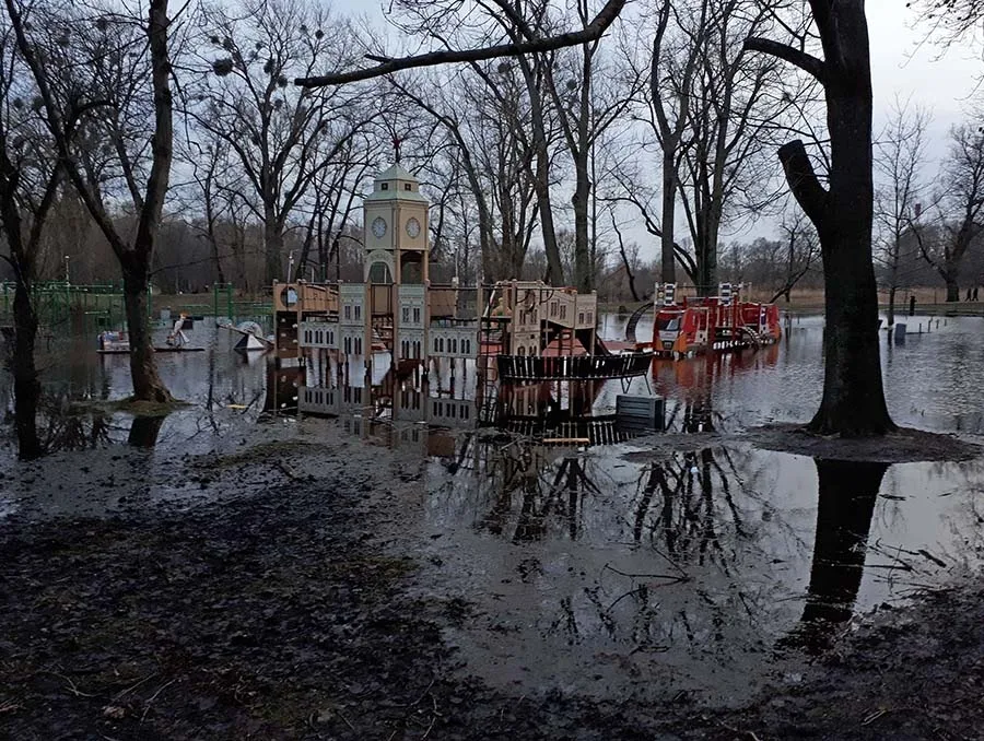 A playground in February 2022.
At present [early 21st century] one of the five culverts has been completely destroyed, disrupting the water exchange in two ponds, the fourth and the fifth.
Because there is no debris screen, household rubbish that gets into the ponds clogs the culverts, which hampers water exchange between the ponds and worsens their sanitary condition and their hydrological and water-level regimes. The ponds are fed by surface and ground water. In the south-eastern part of the first pond, adjoining Dzerzhinskogo Street, there is an overflow well that discharges water into the storm sewer and is supposed to regulate the water level in the ponds. Water exchange between the two ponds in the southern part of the park takes place through the culvert connecting them, which is half-ruined and submerged. The outflow of both ponds is regulated into the river Pregolya through a conduit that begins on Alleya Smelykh Street (at present heavily silted up). One observes "waterlogging of the area around the ponds owing to the lack of surface runoff from low-lying spots".
In total, there are eight storm-sewer outlets into the ponds in the park.
The western pond (the pre-war open-air pool with a diving tower) has become shallow, the tower is gone, and the two triangular ponds have become overgrown (especially the western one) and can only be guessed at from their outlines. On the northern shore of the pond there is a small viewing platform, behind the monument "To the Komsomol Heroes Who Fell in the Storming of Königsberg" (sculptor L. Ponomaryova, architect A. Kostanov). The monument stands on the wide road linking the park with the city. Before the war, a monument to the fascist storm troopers stood here.
In the northern part of the park, on the central avenue, there is a memorial stone "To the Hero Airmen" who died during the storming of Königsberg on 7 April 1945 (their remains were found when the park's ponds were being cleaned). Carved on a large granite boulder are words of gratitude, appreciation and sorrow addressed to the crew of an Il-2 ground-attack aircraft of the 74th Guards Ground Attack Aviation Regiment, Guards Senior Lieutenant Yefim Maksimovich Isayev (1913–1945) and Guards Starshina Grigory Panteleymonovich Bereza (1922–1945). The return of historical names, now to Kaliningrad's history…
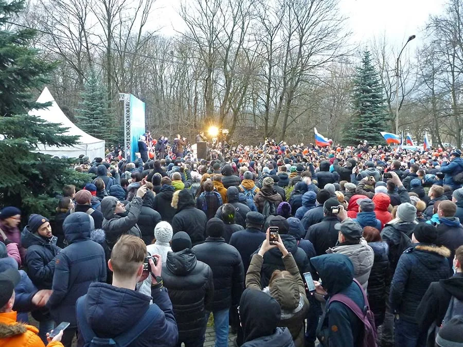 An opposition rally in 2017. It is history now!
Year after year, considerable parts of the park's territory are taken away from it. First the ravelins were removed, then a plot for the railway workers' Palace of Culture, and in the summer of 2006 the chestnut avenue that bounded the park on the south was cut down.
The land was allocated for the construction of residential buildings, which were indeed built on the park's own territory, no more than 100 m from the pond. The landscape park shrank to 40 hectares. A circus and a mosque were soon to be built here as well. [In the end the circus was never built, and the mosque was never completed. — Ed.] I would like to dwell in a little more detail on the housing construction in the park area. The developer is Novy Format LLC, whose founder is one single person holding a 100% share with a nominal value of 10,000 roubles. The aim of the project: construction of three 10-storey apartment buildings with parking for 175 cars, office premises and a public promenade along Alleya Smelykh Street, with utility areas for drying laundry, areas for rubbish bins and guest parking. The project was carried out on the basis of a decree of the Mayor of Kaliningrad allocating this plot. The owner of this plot of park land is the city administration. The boundaries of the allocated plot run as follows: to the north, the park pond; to the south, residential buildings; to the west, the stadium; to the east, Alleya Smelykh. The project received all the required positive assessments, including that of the expert commission of the State Environmental Review. The building permit dated 04.10.2006 was issued by the city administration's committee for architecture and urban planning. The built-up area is 0.6 hectares, the landscaped area within the boundaries 1.7 hectares, and the area of future greenery 0.4 hectares. In total, roughly 2.7 hectares of park land. … No comment is needed. Only it is unclear why the chestnut avenue was cut down. It could have screened everything mentioned above, which, on top of everything, is now called Manhattan Park…
Many of the park's trees are in poor condition, which is explained not so much by their age (70–80 years is no age for maples, limes or even Berlin poplars) as by the waterlogging of the area and the long absence of care. At the end of the 1990s the northern part of the park was put into some kind of order, decrepit trees and self-seeded growth were removed, and as a result the northern maple and chestnut avenues are still very fine today. But the waterlogged southern part of the park, badly neglected over long years, needs landscaping – above all restoration of the optimal hydrological regime of the area – as well as a well-considered layout, since before the war the landscaping of the southern part of the park was never completed.
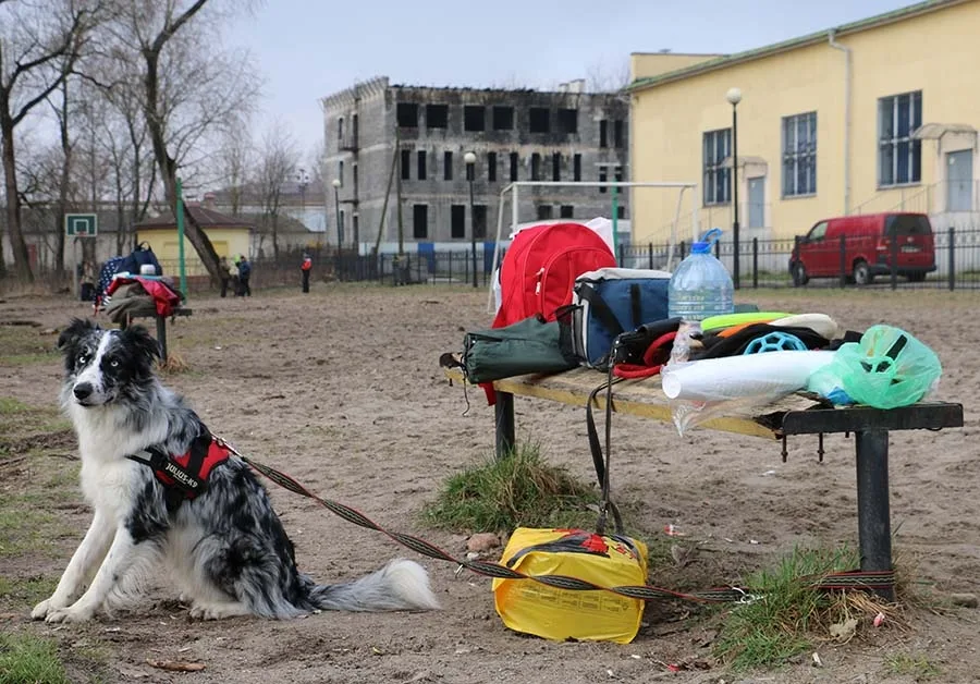 A competitor in the city agility championship.
Random plantings of the post-war decades, dictated solely by the availability of free land, in the park's vast open spaces – which give it its character as a green zone open to all – together with the abundant self-seeded trees that have sprung up, considerably distort the park's original layout, hinder its perception and, moreover, create an excess of unsafe enclosed spaces.
The new plantings were mainly saplings of silver birch (Betula pendula), European white elm (Ulmus laevis), blue spruce (Picea pungens) and the glaucous blue spruce (Picea pungens glauca) so popular in Soviet times. The self-seeded trees in this park are above all black alder (Alnus glutinosa), crack willow (Salix fragilis), almond willow (Salix trianobra), small-leaved lime (Tilia cordata), the fastigiate form of poplar (Populis), and common or European ash (Fraxinus exselsior).
Nevertheless, the plantings dating from the park's formation – the trees of the avenues, groups and small stands, a little over eighty years old – Norway maple (Acer platanoides), sycamore maple, or sycamore ("tree of sorrow") (A. pseudoplatanus), silver maple (A. sacharinum), Schwedler's Norway maple (A. platanoides schwedleri), purple sycamore (A. pseudoplatanus "Purpurescens"), box elder (A. negundo), common hornbeam (Carpinus betulus), English oak (Qercus robur), horse chestnut (Aesculus hippocastanum), small-leaved lime (Tilia cordata), black poplar (Populus nigra), white poplar (P. alba), Berlin poplar and Lombardy poplar (cultivated forms), crack willow (Salix fragilis) and almond willow (S. trianobra) – still have good prospects; they account for the historical and aesthetic value of the park and make clear the need to restore this park area, whose landscapes, largely preserving their layout and spatial features, offer a great but little-used recreational capacity.
The need for the existence and further development of this, the only large public green space in the south of Kaliningrad, is beyond question – but without the ruins and foundations of something that has long since ceased to exist, without the boggy, littered banks of neglected ponds, without the sense of a dramatic past and the aggressive neglect of the present. Kaliningrad is a tragic city in which the sorrowful space of Königsberg constantly makes itself felt, but one would like to think that the history of this park lies not in its fortifications (they have sensibly been assigned the role of fragments of mid-19th-century historical architecture), nor in the former rallies of militant Nazi crowds. No, this history was undoubtedly created by Homo faber – Man the Maker; that is what the dark avenues, the man-made ponds and the sunny glades tell us… Silent song…
Photos by Mikhail Ogorodnikov
Translated from Russian with the help of AI (Claude, Anthropic), October 2026.