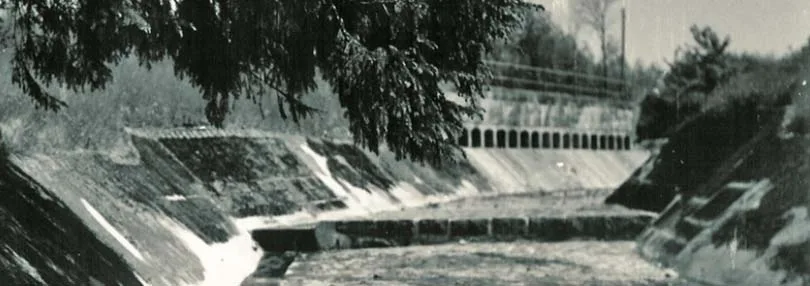
Galtgarben, the highest point of Samland, can be reached from Königsberg by the highway leading from the Steindamm Gate (Steindammer Tor), but the footpath along the Landgraben (Landgraben, a unique drainage ditch from the days of the Order which at the same time served as a drinking-water canal — ed. note) is far more convenient and pleasant.
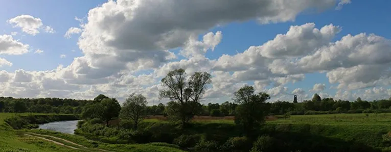
Along the way you will come across many romantic views, such as the pastoral scenery on the shore of Philipp's Pond (Philippsteich) by the Abken (Abken) farmstead.
The hilly shores of the Wargen Church Pond (Wargener Kirchenteich, today Shkolny Pond), partly covered with woods to the north, east and south, are among the most charming spots in Samland (Samland). The relief of the shoreline, with remains of ancient fortifications and defensive ramparts, shows that these places have long been considered fit for habitation.
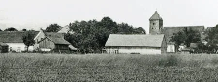
The church of the village of Wargen (Wargen, now the settlement of Kotelnikovo in Zelenogradsk District) stands on a promontory jutting into the smooth surface of the pond from the east. It was built in the 14th century on the site of a castle of the Teutonic Order, remains of which can still be seen in its foundations and in those of the neighbouring parsonage.
Near the village rises a hill called Castle Hill (Schlossberg), a hillfort from pagan times surrounded by ramparts and ditches.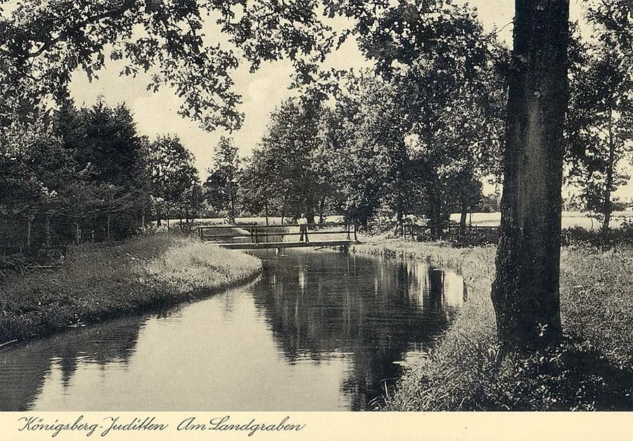 The Landgraben within the city limits of Königsberg.
Opposite the church, on the western shore, Count von Lehndorff (Heinrich Ahasverus Emil August von Lehndorff, 1829—1905), whose possessions include the lands of the neighbouring estate of Warglitten (Warglitten), built himself the magnificent Preyl (Preyl) palace last year.
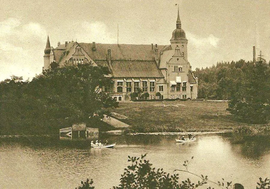 Preyl Palace on the shore of the Wargen Church Pond.
(Nothing remains in Kotelnikovo of the Wargen castle and church. The Schlossberg, also known as the Burgberg, cannot be found on today's publicly available Russian maps; it lies south of the pond, on a small spur. The name Wargen comes from the Prussian language — ed. note)
Further south, by the Preyl farmstead, we can see a memorial stone. The inscription on the cast-iron plaque adorning it records that on this spot, on 8 September 1879, during the imperial manoeuvres, Kaiser Wilhelm I and his son Crown Prince Wilhelm mounted their horses, and General Heinrich von Lehndorff offered them a cup of water.
(The Preyl farmstead no longer exists; it stood south of the Schlossberg on the other side of the highway, and the Warglitten (Warglitten) estate lay in the same direction, a little further on. After the war, in 1945, Preyl Palace housed a hospital; later the palace was dismantled, and in recent times a luxurious villa was built on its foundations, which rumour links with the name of one of the post-Soviet governors of the Kaliningrad Region — ed. note)
Until the middle of the 19th century, a notable event in the life of Königsberg was the so-called Wargen Fools' Fair (Wargener Narrenmarkt), held every September in Wargen.
Those returning home from the fair would put on masks and dress up as wood sprites, and indulge in all sorts of buffoonery to the sound of rattles, whistles and clappers.
Leaving the banks of the Landgraben and Wargen, which lies fourteen kilometres from Königsberg, and heading north-west, we soon reach the village of Wiekau (Wiekau). Here we can look at the reservoir (today Veliky Pond near the settlement of Kolosovka), recently built to supply Königsberg with water.
Walking another kilometre west, we find ourselves at the foot of the wooded Galtgarben hill. 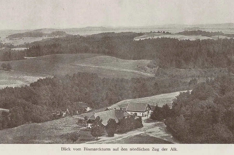
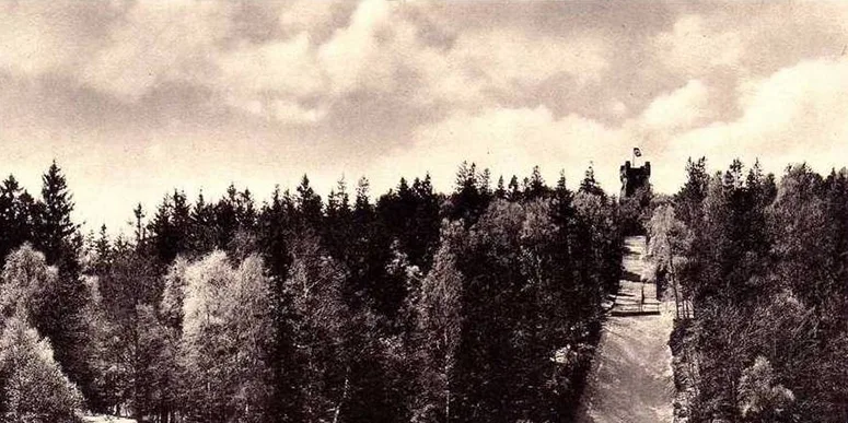
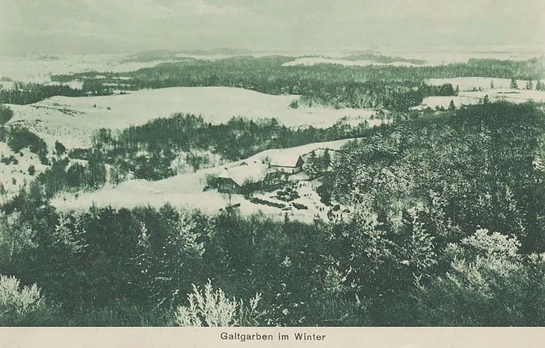
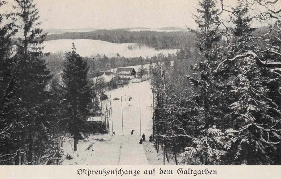 Summer and winter views from Galtgarben looking north.
From the summit there is a fine view of the surrounding countryside. Galtgarben lies in the southern part of the Alk range (Alkgebirge), whose hills stretch across Samland from north to south, from Pobethen (Pobethen, now Romanovo) to Medenau (Medenau, now Logvino).
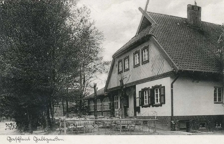
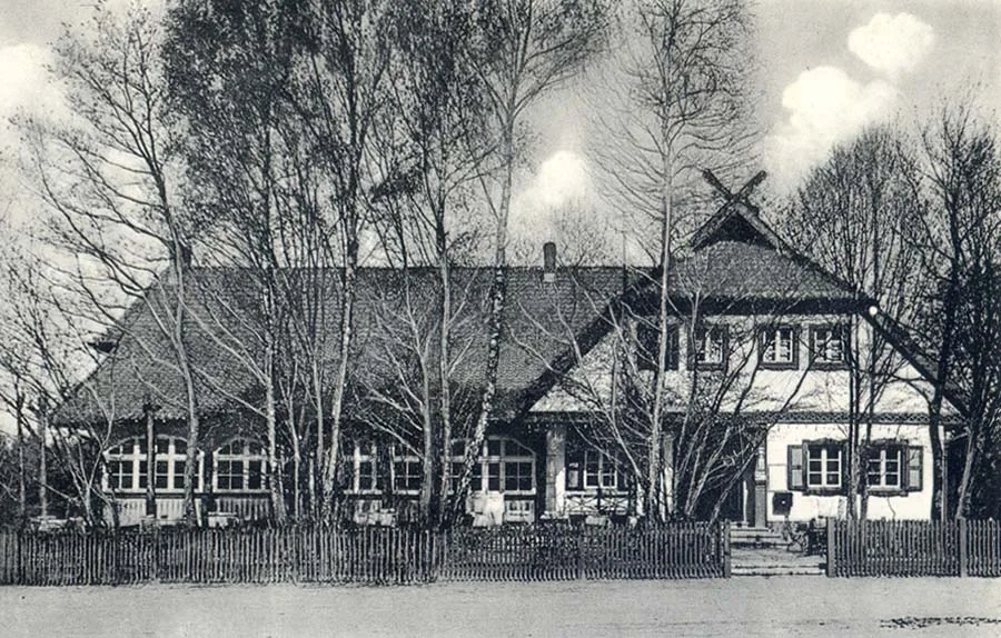
The restaurant and guesthouse at the foot of Galtgarben — the very one visible from above (see above).
Galtgarben rises 110 metres above sea level and 46 metres above its foot. It is the natural central point of Samland (the Sambian Peninsula). The summit is overgrown with forest and cannot be seen from below; we can glimpse it only thanks to a cutting running from west to east. In 1894 a wooden observation tower 10 metres high was erected at the very top. It offers breathtaking views over the expanses of Samland, a rolling plateau that slopes noticeably towards the south. That is why most of the peninsula's brooks and streams flow from north to south and empty into the lagoon.
In the western part of the peninsula the northern coast is steep. The streams that flow into the sea here have carved real ravines as they force their way to it.
(The name of the hill comes from the Prussian language, in which "Galt" is a proper name and "garben" means hill. The name of the Alk range (the chain of hills) is also of Prussian origin — ed. note)
In pagan times an earthwork resembling a fortress appeared on Galtgarben, which was formerly called the Rinauberg (Rinauberg). The ramparts and ditches survive to this day; according to legend, they were built by the Prussian chieftain Samo. Later the Bishop of Samland built the castle of Rinau here. But by 1399 the castle no longer existed.
(The name Rinau comes from the Prussian language and is apparently derived from the old name of this area, Erino. Ed. note)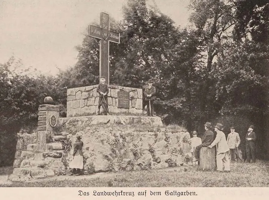 The Landwehr Cross on the summit of the hill.
Today the iron cross of the Landwehr (the Prussian militia) towers over the summit of Galtgarben, set on a granite pedestal (see above). The cross was raised on 27 September 1818 in memory of the War of Liberation against Napoleonic France.
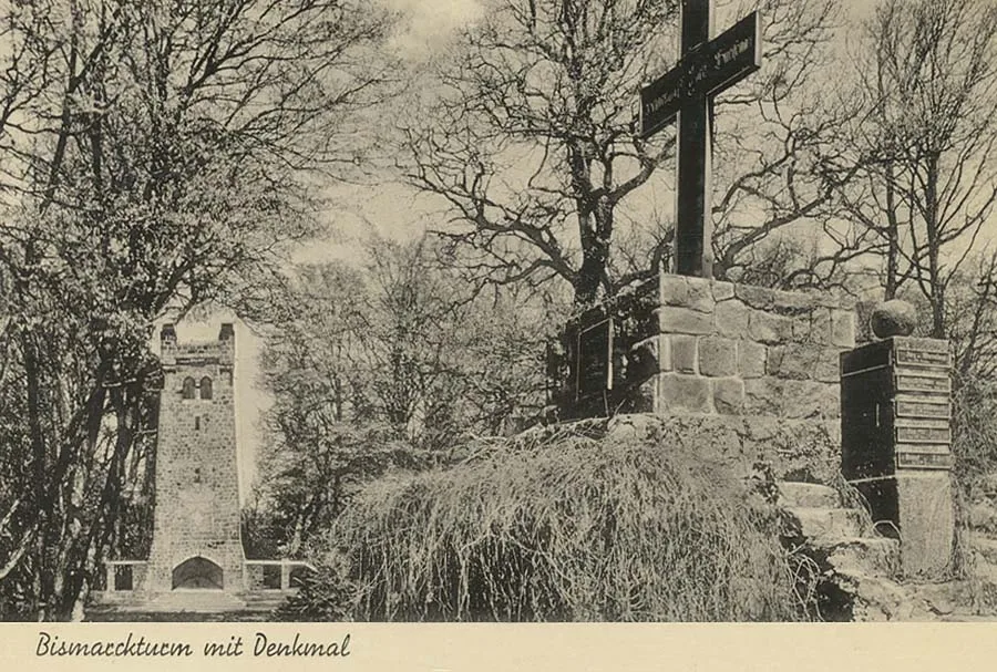 In the early 20th century one of the four Bismarck towers in East Prussia was built next to the cross.
The monument was restored in 1888. It bears the inscription "With God for King and Fatherland", the motto of the Order of the Iron Cross. On the reverse are the names Scharnhorst, York, Gneisenau (Scharnhorst, York, Gneisenau). A separate plaque lists the battles in which Prussian soldiers fought victoriously against the French in the campaign of 1813–1815, which ended with the signing of the peace treaties in Paris on 30 May 1814 and 20 November 1815. South of the cross is a large cenotaph (an earthen symbolic burial mound) erected in honour of the soldiers who fell in the War of Liberation. On its memorial plaque one can read the following words: "Thousands gave their lives for the fatherland, covering themselves with immortal glory. 1818." This mound became a symbolic common grave.
North of the mound, in the shade of old birches, rests the man at whose call the people of Königsberg erected this monument to the fallen: War Councillor Johann Scheffner (Johann Georg Scheffner, 1736–1820). At the head of the grave stands a wooden memorial board bearing lines from his poem:
To him who set the iron cross on Galtgarben
It matters not today: no praise can touch him now,
his only joy is the haven of silence.
So let all those who gaze upon this hill
sense here the Hand Divine.
And may they go down to the grave as nobly
as he once walked there, hiding his sorrow.
At Scheffner's suggestion, every year on 18 October (the first time was in 1817) students in large, noisy groups, and many citizens of Königsberg with them, come to the hill to light a bonfire and solemnly pay tribute to the heroes of the War of Liberation. A similar celebration was first held on 18 June 1818 in memory of the heroes of the Battle of Waterloo (Belle Alliance). This date was observed until 1848. The care and upkeep of the monument are now the responsibility of the provincial administration.
(Today the summit of Galtgarben is closed to visitors, and there is no publicly available information about what is there now. It is known for certain, however, that nothing remains of the former structures — ed. note)
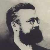
Johann Georg Scheffner was born on 8 August 1736 in Königsberg and studied law at the Albertina. In 1757 he became private secretary to Duke Karl of Holstein-Beck. In 1759 he secretly left the province, then occupied by the Russians. As a soldier, Scheffner fought in the battles of the Seven Years' War and ended it with the rank of Fähnrich (officer cadet). After the peace was concluded, in 1765 he became secretary of the War and Domains Chamber in Königsberg, then served in the same capacity in Gumbinnen, then again in Königsberg and in Marienwerder. After selling the estates of Sprintlack and Elertswalde (Sprintlack und Elertswalde) in 1796, he returned to Königsberg. He drew a well-earned pension of 700 thalers a year, and founded and maintained the Botanical Garden. Johann Scheffner was a brave, diligent, scientifically educated man devoted to his homeland. He was on friendly terms with many great men of our fatherland: Kant, Hamann, Kraus, Hippel, Borowski, Stein, Arndt, York. Queen Luise held him in high esteem and corresponded with him. Nor should we discount his popularity as a writer and poet, whose autobiography is a valuable source for students of the nation's history. Johann Scheffner died on 16 August 1820.
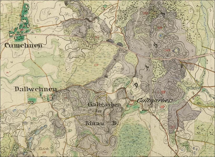 Galtgarben on a map of Samland from the second half of the 19th century.
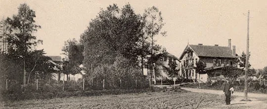
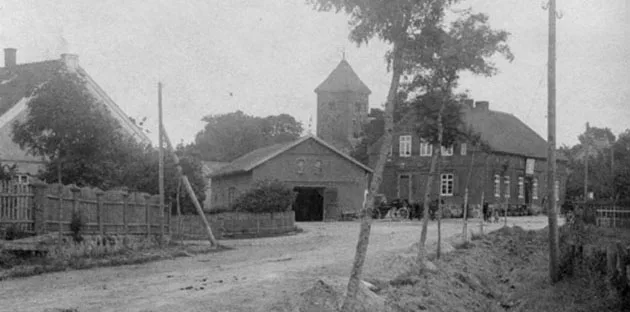
On the way back we walk 10 kilometres south-west of Galtgarben to Powayen (Powayen, now the settlement of Shipovka, Svetly Urban District), from where we return to Königsberg by the train from Pillau.
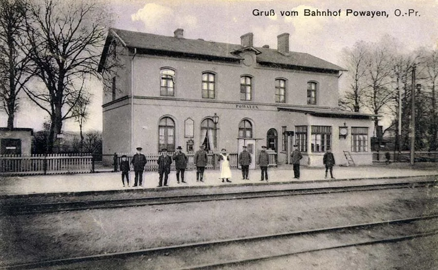 The railway station in the village of Powayen.
On the way to the station we will admire the wooded hillsides, pass through Prielacken (Prielacken, now Bratskoye) and approach Medenau, an ancient Prussian settlement near which in 1255 the future King of Bohemia Ottokar (Přemysl Otakar II, Přemysl Ottokar II) defeated the Samland Prussians. Of the fortress that the Bishop of Samland founded here, not a trace remains.
The church in Medenau was built of fieldstone in the Gothic style in the 14th century; a tower was added later.
On the parish land near Kathrinhöfen (Kathrinhöfen) stands a monument to the emperor — a fine granite obelisk crowned with an eagle. It was erected in 1881 by the landowner Löwner (Löwner) in memory of Kaiser Wilhelm I (Wilhelm Friedrich Ludwig von Preußen, 1797–1888), who was here during manoeuvres and reviewed a parade.
(The name "Medenau" can be translated from Prussian as "forest settlement". Some ruins remain of the church, but the monument to the Kaiser can no longer be found — ed. note)
Photos on this page: Bildarchiv Ostpreußen / bildarchiv-ostpreussen.de.
Translated from Russian with the help of AI (Claude, Anthropic), October 2026.