When the Teutonic Order built Balga Castle in 1239 and Brandenburg Castle in 1266, it immediately began to settle the commanderies subordinate to them. Despite devastating wars, there were many settlements of the native inhabitants, the Prussians, here between the rivers Pregel (Pregel / now the Pregolya) and Alle (Alle / Lava) and the lagoon Frisches Haff (Frisches Haff / Vistula Lagoon).
The Order, however, sought to Germanise this region, that is, to found German towns, villages and estates and to populate them with Germans.
The Order's castles of Balga (Balga) and Brandenburg (Brandenburg) were at that time, as a rule, governed by energetic and far-sighted men. From the end of the 13th century onwards they systematically settled their districts with German farmers. Thus new German settlements sprang up beside the old Prussian villages. Forests cleared on virgin land provided the German settlers with living space and sustenance.
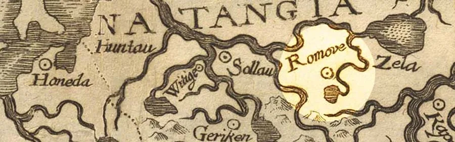
At key points in Natangia1 the towns of Heiligenbeil, Zinten (Zinten), Preußisch Eylau (Preußisch Eilau), Kreuzburg (Kreuzburg), Friedland (Friedland), Landsberg (Landsberg) and Domnau (Domnau) came into being. They became important transport, economic and later also cultural centres for the growing German rural population.
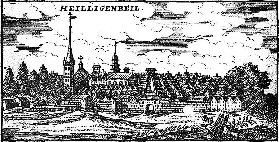 Heiligenbeil in an old engraving.
Almost all the towns of Natangia were founded at the very beginning of the 14th century, and Heiligenbeil is probably the oldest of them. Unfortunately, the exact year of its foundation is unknown, so 1301 is usually given. The first mention of Heiligenbeil dates from 1330.
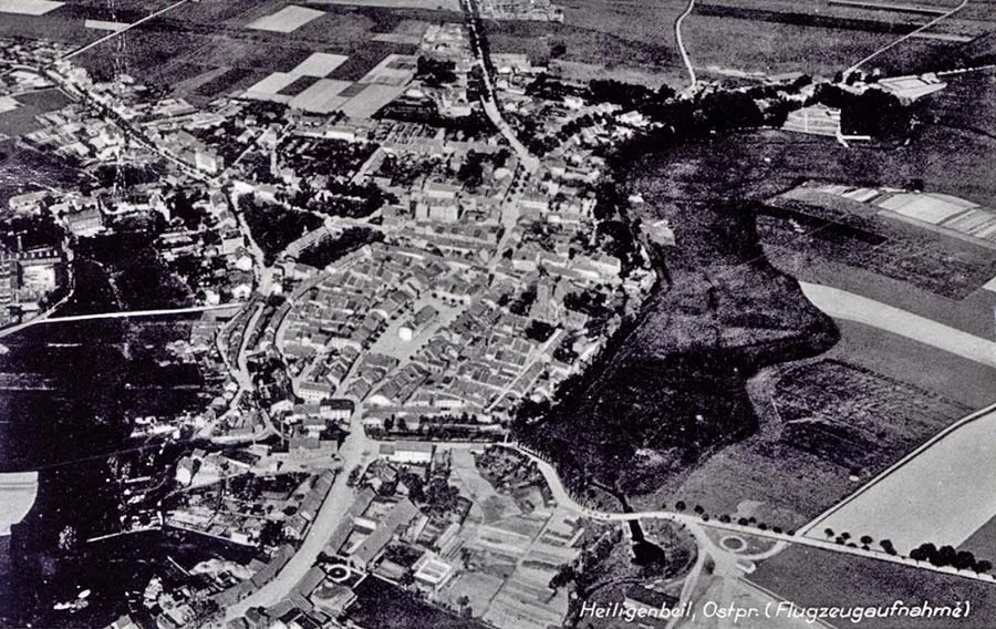 View of Heiligenbeil from a Zeppelin, looking towards Königsberg (the lagoon is off-frame to the left).
Why was Heiligenbeil built precisely here, in the valley of the Jarft? There may have been two main reasons. In prehistoric times the vast forests that covered almost the entire south of the Heiligenbeil district ended at the rivers Bahnau (Bahnau / Mamonovka) and Jarft, while in its western part there were many Prussian settlements. They, like the new German villages that arose here at the beginning of the 14th century, needed an economic centre, a market. Moreover, here, at the confluence of the Bahnau and the Jarft, there was a Prussian sanctuary, which later came to be called the "Holy Grove".
This sanctuary was meant to protect a Prussian settlement with a small fortress. Its name has been preserved in the chronicles: Swentomest (Swentomest, where swintas = holy, mesta = place).
Remarkably, the town was originally called just that, Heiligenstadt (Heiligenstadt), the "Holy Town", and only later became Heiligenbeil.
What could have been more natural than to found a German community here, in a place so favourable in terms of both nature and history! The rectangular town plan, with its grid of streets and an equally rectangular market square in the centre, still bears witness to the layout devised by the Order's officials.
Some sections of the town walls and moat have survived largely intact to this day, although wars and fires often destroyed the town on the Jarft and changed its appearance in many ways. Heiligenbeil had much to endure during the War of the Cities (the Thirteen Years' War, 1454–66)2 and the Horsemen's War (1520–21)3. In 1463 and 1520 it was burned down completely by the Poles. The fires of 1677 and 1807 also destroyed most of the town and the last medieval buildings still standing by then.
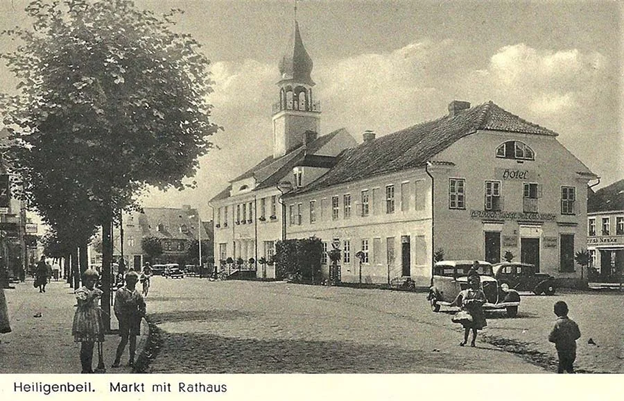 The town hall of Heiligenbeil.
The old town hall was destroyed as early as 1520, and its successor was reduced to ruins in 1807. At that same time, in December 1807, the old arcaded houses on the market square that had survived into the 19th century also fell victim to the fire.
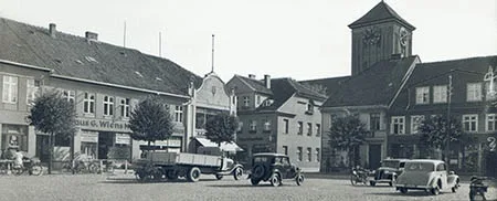
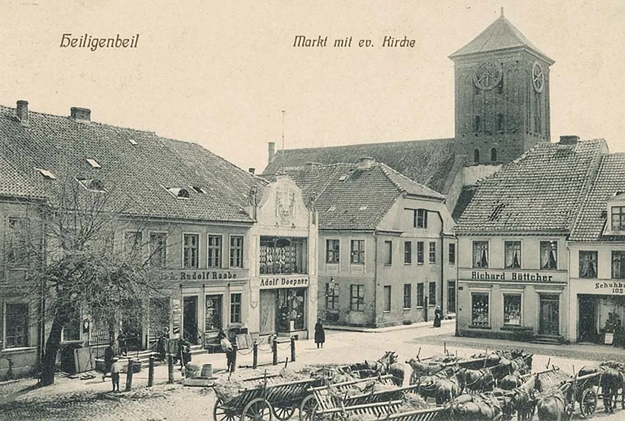 The central square (market), the pharmacy (centre) and the Lutheran church.
The last town hall, which we inhabitants of Heiligenbeil remember for its distinctive portal and tower, was turned into ruins and ashes in March 1945.
Even the Protestant church, with its massive tower whose flat pyramid roof blended so well into the surrounding landscape, had, after the fires of 1677 and 1788, retained until 1945 only scant remnants of medieval architecture, namely in its unique main portal and in the sacristy with its eight-part star vault. Today these witnesses of Gothic architecture have been destroyed as well.
Nothing remains of the two town gates which, until 1807, guarded the peace of Heiligenbeil like eternally wakeful sentries.
Of the Augustinian monastery (it stood in the east of the town, just outside the town wall, and existed from 1372 to 1520) nothing has survived except a few names of the surrounding fields.
By 1945 only one medieval institution had survived: St George's Hospital. It traces its origins to the St George's Court near Heiligenbeil, first mentioned in 1416. In 1563 Duke Albrecht (Albrecht von Brandenburg-Ansbach) re-founded this hospital and endowed it with the former monastery lands. In 1865 a large brick building was erected and a garden laid out on the square that later received the name Feyerabendplatz (Feyerabendplatz), right by the town wall.
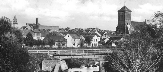
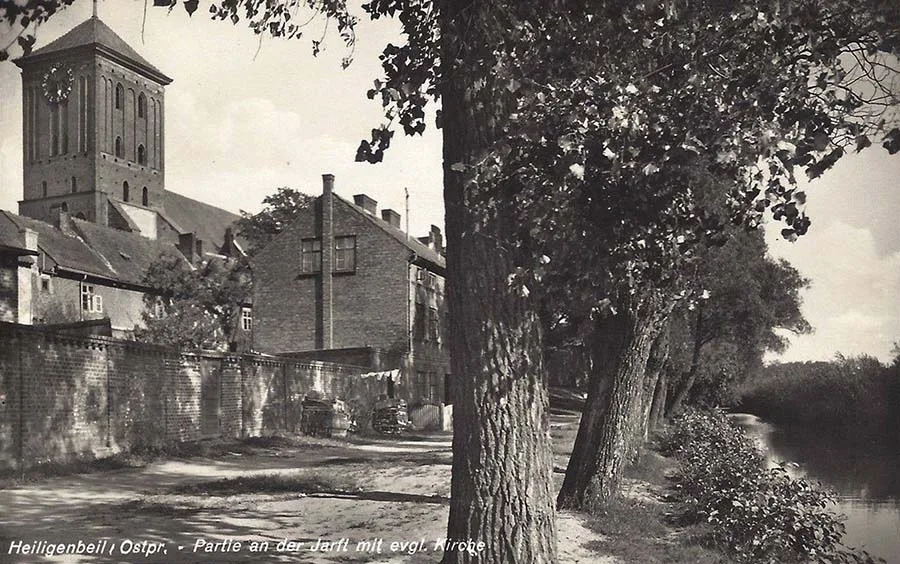 View of the Lutheran church through the trees on the riverbank.
What trials the inhabitants of the town on the Jarft have had to endure from the time of the Order to the present day! Wars and fires, epidemics and famine, plunder and persecution ruined the population, reducing it but not wiping it out, making it poor but not entirely penniless.
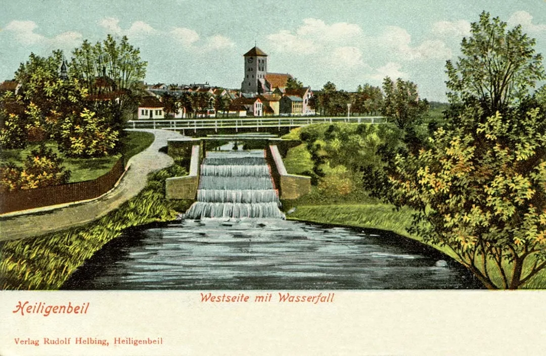
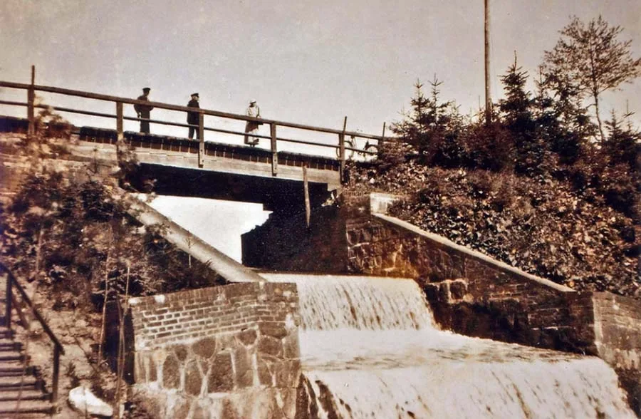 The dam with its spillway, which in Heiligenbeil was called the "waterfall".
Bearing the heavy blows of fate, the people of Heiligenbeil rebuilt their town, invited new citizens and led a modest but dignified existence until about 1900.
From the 16th to the 18th century Heiligenbeil beer enjoyed such an impeccable reputation that it was exported in huge quantities. For a long time the town was also famous for its excellent wheat bread. For more than two centuries the turners of Heiligenbeil dominated the market with their spinning wheels, wooden reels and toys. The output of its mills was shipped to Berlin, Braunschweig and Danzig, and the agricultural implements of the "East German Machine Works" were sold not only in East Prussia but throughout the Baltic region and even in Africa and elsewhere, bringing prosperity to the inhabitants and benefit to the town.
From the 17th to the early 19th century, and in recent times from 1936 to 1945, Heiligenbeil was predominantly a garrison town where units of well-known regiments were stationed.
The town's location is also very favourable. In the Middle Ages all the roads in this part of Prussia passed through it. It therefore often became the venue for various important state events. When the first highway was built in East Prussia, it too ran through Heiligenbeil.
It was here, on 1 January 1511, that the last Grand Master of the Teutonic Order in Prussia was elected: the Hohenzollern Margrave Albrecht of Brandenburg.
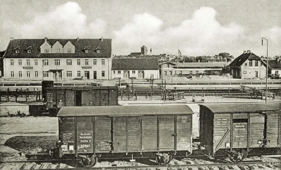 The railway station of Heiligenbeil.
In 1853 our town also became a station on the very first railway line in the Province of East Prussia, Königsberg – Berlin. It was from here, in 1938, that construction began on the Heiligenbeil – Zinten branch line.
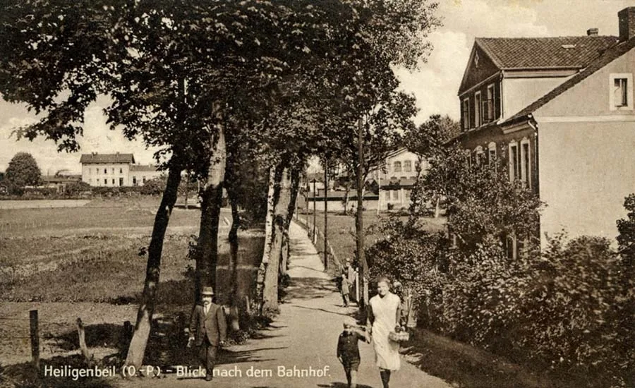 The footpath to the railway station.
On 1 April 1819 Heiligenbeil was raised to the status of a district town, despite its peripheral position within the newly created district of Heiligenbeil.
As early as the time of the Order there was a Latin school here, which prepared many burghers' sons for study at the universities of Europe. It was abolished only in 1811. The town school4 took over some of its tasks. Next to it there was also a charity school for poor children. The two schools were merged into a single town school in August 1910.
From 1879 Heiligenbeil also had an agricultural school, which was well known throughout the province.
It closed in 1927. The school building was handed over to the newly founded secondary school. In addition, Heiligenbeil had a continuation school, which later became a vocational school, and from 1927 an agricultural winter school for young farmers.
Until about 1900 the town on the Jarft was predominantly a town of farmers and craftsmen. In earlier times the brewers played the leading role in its economy. Later the craftsmen also gained importance and influence, joining the council and thus the town administration.
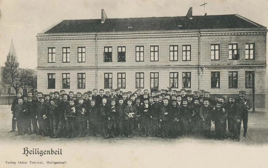 Group photo of pupils in front of the school building.
After the victorious Prussian wars of the second half of the 19th century, several branches of industry in Heiligenbeil received an impetus for development at once.
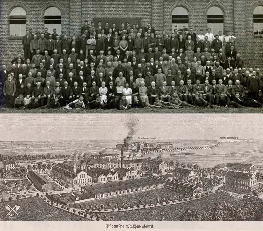 Workers and staff (above) of the "East German Machine Works".
In 1869 a simple blacksmith, Rudolf Wermke (Rudolf Wermke) from Stolzenberg (Stolzenberg), built a forge in the town, which he gradually expanded, as his ploughs were in great demand. After Wermke's death the company grew into the "East German Machine Works" (Ostdeutsche Maschinenfabrik), which produced a range of agricultural equipment. Its trademark was two crossed axes, and thanks to the quality of its products it was popular not only at home. The facilities created for the workers and staff of this machine works in Heiligenbeil by its managers (F. Bartels / F. Bartels, and from 1938 Heßmer) were also exemplary.
The flour mill, built in the time of the Order, passed in 1828 into the private ownership of the Dous (Dous) family of millers, and in 1844 to the Zarniko (Zarniko) family.
In the summer of 1918 it was acquired by the "Purchasing and Sales Cooperative" and, under the direction of its manager Franz Wunderlich (Franz Wunderlich), became an industrial enterprise that milled and sold tens of thousands of hundredweight of grain every year.
After the First World War the sawmills of Carl Stolt and Eugen Hinzke (Carl Stolt & Eugen Hinzke) brought considerable profits. They supplied timber to the town and district of Heiligenbeil. The firm of Fritz Werning & Co. (Fritz Werning & Co.), established on 1 October 1900 on the basis of the Laubschat and Becker sawmills (Laubschat und Becker), became a large enterprise with a steam sawmill in Rosenberg (Rosenberg) and a construction business, including a reed-weaving works in Heiligenbeil. It carried out numerous building, civil engineering and other projects in Heiligenbeil and its surroundings.
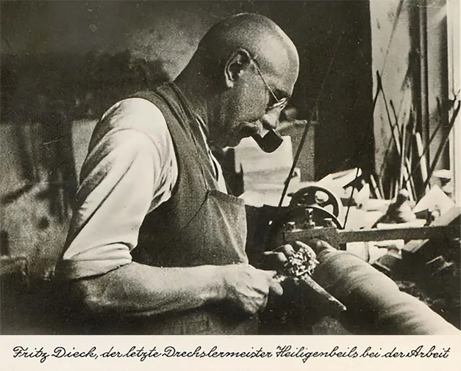 Fritz Dick, the last of Heiligenbeil's master turners, at work.
Around 1875 Hermann Eggert founded an enterprise which, thanks to his partnership with the engineer Emil Becker, enjoyed a certain renown until the end of the First World War under the name "Eggert and Becker Machine Works" (Maschinenfabrik Eggert und Becker).
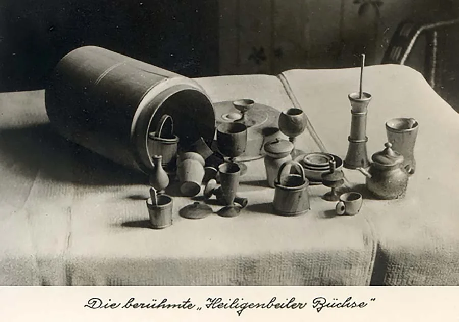 The famous "Heiligenbeil barrel" with doll's tableware.
The enterprise went bankrupt, and the mechanical engineer Pritzkuleit (Pritzkuleit) built a new business in its place, whose value grew, above all thanks to a large filling station on Königsberger Straße.
From 1914 Werner Frischbutter's (Werner Frischbutter) sand-lime brick works, formerly owned by Riedel (Riedel), operated in Rosenberg. Its bricks were in great demand. The products of Heiligenbeil's cement works, Flakowski und Przygodda (Flakowski und Przygodda), were used mainly for building wells and pumps.
In the 1930s the construction company Erich Komos (Erich Komos), the Gerlach (Gerlach) light-metal works and the Döhler (Döhler) pudding factory also settled in our town.
In 1936–37 an air base was built near the town as a specialised defence enterprise linked to an airfield and an air force unit; it became the largest industrial complex in the district. It mainly produced parts for military aircraft, and Luftwaffe (Luftwaffe) equipment was also serviced and repaired there. Some 3,000 employees of the new enterprise, who had moved here from various parts of Germany, made a substantial contribution to the town's development.
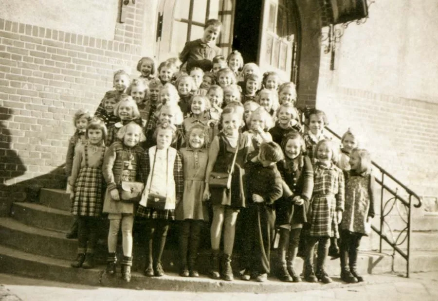 First-grade girls of Heiligenbeil.
With every new enterprise, and from the mid-1930s also with the transfer of more and more military units, the population of Heiligenbeil grew. In 1871 our town had 3,385 inhabitants,
in 1891, 3,810;
in 1910, 4,821;
in 1925, 5,178;
in 1933, 5,623;
in 1939, 12,100 inhabitants.
From 1871 to 1910 the increase was 142%, from 1925 to 1939 it was 203%, and if we compare the population figures for 1871 and 1939, we see an increase of 357%! In almost 70 years the population of our town grew more than three and a half times. In the war year of 1944 more than 16,000 people lived in Heiligenbeil, although it is not known how many of them were permanent residents.
This economic upswing was possible only thanks to the use of technological advances.
In addition to a slaughterhouse, a gas supply, a water supply and a sewerage system were built. The town was electrified. The district hospital, erected in 1887, was extended and modernised in 1931 and 1937. Its building also housed the State Health Office.
The pharmacy is first mentioned in 1709. It belonged to the families Falz (Falz), Weinberger (Weinberger), Friebel (Friebel), Brickmann (Brickmann), Wittrin (Wittrin), Sonntag (Sonntag), Eichholz (Eichholz ) and, from 1895, Mertens (Mertens).
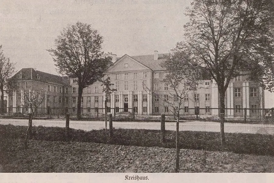 The new Kreishaus of Heiligenbeil.
When the district office buildings on Feyerabendplatz became too small for the district's growing administrative tasks, in 1923–24 the district administration built on Königsberger Straße a Kreishaus (Kreishaus) that was imposing by provincial standards, and which survived 1945 almost undamaged.
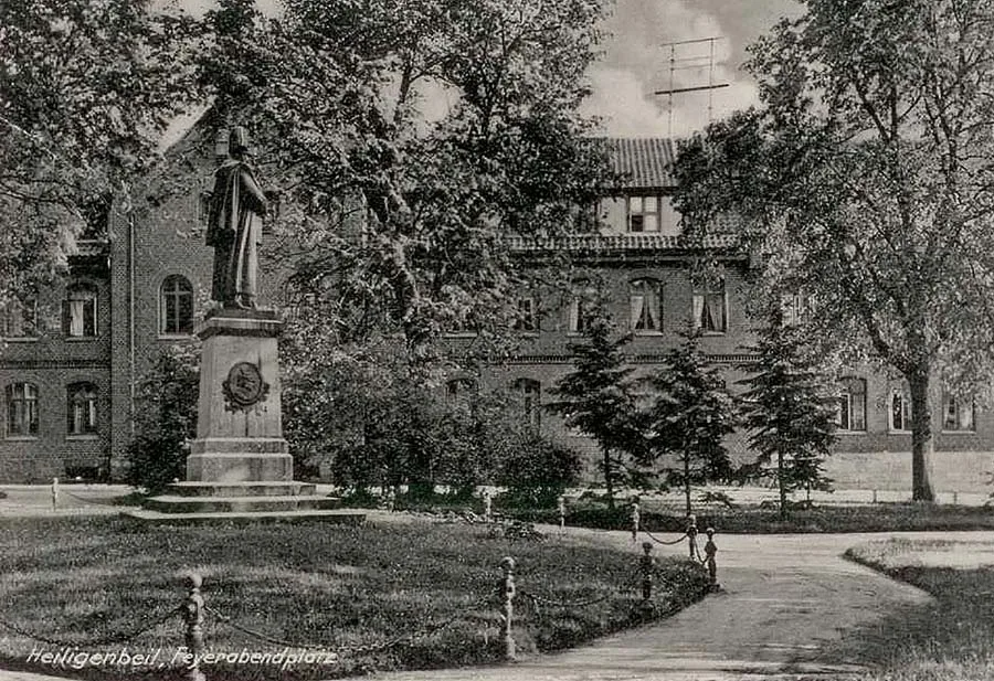 Feyerabendplatz with the monument to Kaiser Wilhelm I.
The town's drive for development showed itself in the construction not only of individual new houses but of whole districts: the residential quarter behind the Kreishaus, the one by the barracks and, above all, the "Garden City" (Gartenstadt) between the "Factory Hill" (Fabrikerberg) and the Rosenberg district. Heiligenbeil stretched for 5 km in a north-easterly direction, from the Süd estate (Siedlung Süd) along the old Waltersdorf highway (Waltersdorfer Kunststraße) and from the industrial works to the harbour of Rosenberg.
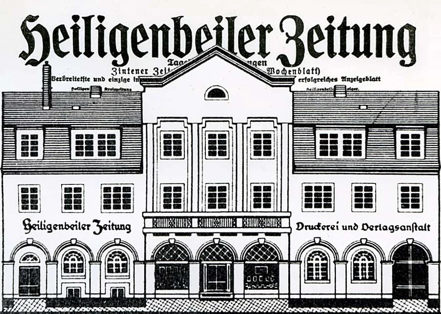
Besides the new buildings of the district court and the tax office, the editorial building of the newspaper "Heiligenbeiler Zeitung" (Heiligenbeiler Zeitung) also became an ornament of the town.
Starting out as an insignificant printing shop, from the 1920s the business, equipped with modern printing presses, was able to take on large outside orders and print the daily newspaper "Heiligenbeiler Zeitung", later renamed "Natanger Tageblatt" (Natanger Tageblatt). In the bloody days of March 1945 the last newspaper for the remaining German part of East Prussia was printed here.
The mayor and the town fathers also took care of green spaces and public areas: on a former meadow they laid out Feyerabendplatz, a square much loved by the townspeople, with monuments to Mayor August Feyerabend (August Feyerabend) and Kaiser Wilhelm I (Wilhelm I). Next to the park-like Marksmen's Garden, the Louis-Schröder-Platz (Louis-Schröder-Platz) was laid out in honour of Mayor Louis Schröder (Louis Schröder). rising above the valley of the Jarft.
From there the Philosophers' Path led along the bank of the Jarft to the locks and the waterfall. Luther Square (Lutherplatz), the sports ground and the swimming pool were also popular spots.
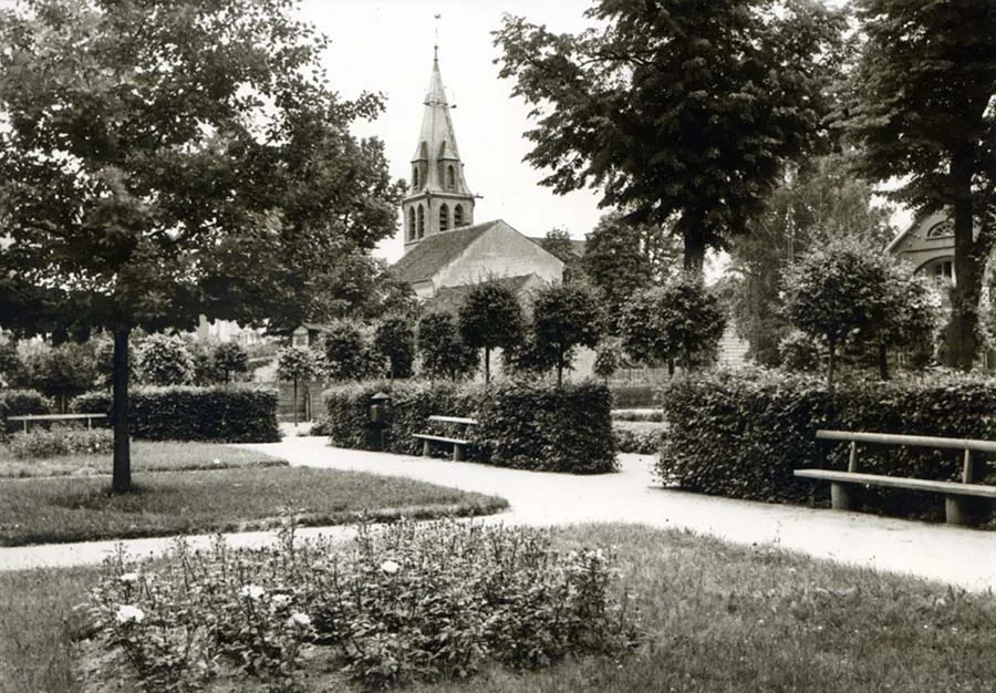 Lutherplatz and the spire of the Catholic church.
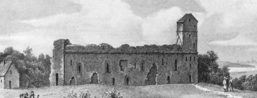
And those who wished to enjoy the picturesque local countryside went hiking to the Spruce Grove, to the Maiberg (Maiberg) hill near the Bahnau valley (Bahnautal) by Wermten (Wermten), to Damerau (Damerau), to the Hospitalwald (Hospitalwald) with the wonderful valley of the Jarft and the Lateinerberg (Lateinerberg) hill; they walked along the shore of the Haff near Follendorf (Foliendorf) and Leysuhnen (Leisuhnen), wandered along the hilly coast near Balga and in the Büsterwald (Büsterwald), and climbed up to the majestic ruins of the Order's castle at Balga, where they also visited the local museum and admired the magnificent panoramic views. What familiar and beloved home paths and home names! They live on in our hearts and memories.
Heiligenbeil used to be little known, but after the terrible winter of 1944–45 it went down in history.
It was a refuge and a gateway for more than three-quarters of a million displaced, persecuted, destitute and wounded people, who made the hard journey into the unknown through icy nights, storm and snow, in fear and haste, across the treacherous ice of the Frisches Haff, in order to escape suffering and death. And yet for hundreds of them fate had decreed that they should remain in our town: at the beginning of March 1945 around a thousand refugees were buried here alone. At the end of March 1945, as a result of the fiercest fighting, Heiligenbeil was reduced entirely to ruins.
NOTES
1.Natangia (Natangen) is the territory on the southern bank of the river Pregel (Pregel, now the Pregolya). To the west Natangia is washed by the waters of the Frisches Haff lagoon (Frisches Haff, Vistula Lagoon). To the east of Natangia lies Barta (Barten), and to the south Warmia (Ermland).
2.The War of the Cities (Preußischer Städtekrieg, 1454–1466) is another name for the Thirteen Years' War (German: Dreizehnjährige Krieg) between the Kingdom of Poland and the Teutonic Order. The name reflects the fact that the war began with an uprising of the Prussian towns against the Order's rule, and that leagues of towns, above all the Prussian Confederation, played a key role in the fighting. As a result of the war Poland gained access to the Baltic Sea, and the Teutonic Order became a vassal of the Polish Crown.
3.The Horsemen's War (German: Reiterkrieg, 1519–1521) is another name for the Polish–Teutonic War, which ended with the signing of a truce in 1521.
4.The so-called "School for the Town Population" (with eight to ten grades; 18th–19th centuries).
Source
Photos
Bildarchiv Ostpreußen bildarchiv-ostpreussen.de.
● Editor's note: Read on VisitPrussia.com an interview with the translator of German and, in particular, Prussian fairy tales, our regular contributor Tatyana Kolivay, who runs her own blog, where countless other parables, legends and fairy tales in her translations have been published.
Translated from Russian with the help of AI (Claude, Anthropic), October 2026.