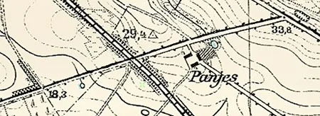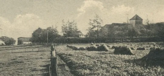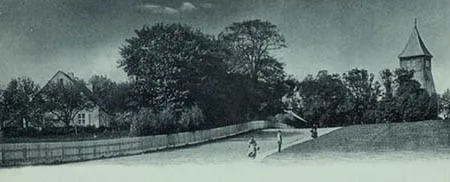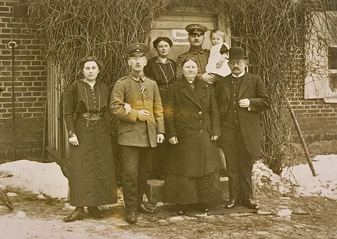
Heiligenkreutz is first mentioned in 1260. According to legend, during the conquest of the Sudau (Zudau) region, which stretched from the Baltic Sea to Pobethen (Romanovo), the first cross was erected here. To commemorate this event, on 24 December 1353 Bishop Jacobus of Samland (d. 1358) founded a chapel in Heiligenkreutz, which later became the local church. Hence the name of the village: Heiligenkreutz (German: Heiligen Kreutz) means "Holy Cross". In the 14th century Heiligenkreutz belonged to the Kammeramt Sudau.
In 1767 there was a fire in the church, after which it underwent a major renovation. In 1785 Heiligenkreutz was classified as a "Kulm" estate and church (Cölmisch Gut, Kirche) with nine households. By 1818 the number of households had not changed, but the settlement now had the status of a royal and "Kulm" village, in other words a royal village with property held under medieval Kulm law (Königliches und Cöllmisch Dorf). In 1832 an organ was installed in the Heiligenkreutz church. In 1869 the church building was enlarged.
In the 19th century Heiligenkreutz consisted administratively of the "Kulm" estate of Heiligenkreutz and the Heiligenkreutz parsonage farm (Pfarrhof).
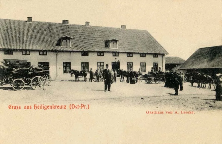 A. Lemke's guest house in Heiligenkreutz.
The Heiligenkreutz estate formed a Gutsbezirk from 1867 in the Kreis Fischhausen (merged into the Landkreis Samland in 1939) and belonged to the parish of Heiligenkreutz. In 1871 the Heiligenkreutz estate had five dwelling houses, home to 18 families. On 13 June 1874 the Gutsbezirk Heiligenkreutz was included in the newly established Amtsbezirk Heiligenkreutz. In 1879 the Heiligenkreutz estate owned 357 ha of land (40th place among the 140 Gutsbezirke of the Kreis), and its annual net profit was 3,500 marks (55th place in the Kreis). On 26 May 1899 the Heiligenkreutz estate lost its independence and was incorporated as a Vorwerk into the newly formed Gutsbezirk Palmnicken (Yantarny). On 30 September 1928 the Vorwerk and the village of Heiligenkreutz became a single locality.
The Heiligenkreutz parsonage farm had the status of an estate and from 1867 formed a Gutsbezirk in the Kreis Fischhausen. In 1871 the Heiligenkreutz parsonage farm had five dwelling houses, home to seven families and one bachelor. When the Amtsbezirk Heiligenkreutz was formed in 1874, the status of the parsonage farm had not been determined; only on 12 February 1904, by decision of the authorities, did it receive the status of a rural community, and at the same time it was included in the Amtsbezirk Heiligenkreutz as a full member. However, as early as 23 October 1911 the Heiligenkreutz community was abolished and incorporated into the Gutsbezirk Palmnicken (Yantarny). On 30 September 1928 the village of Heiligenkreutz was merged with the Vorwerk Heiligenkreutz, and the merged village passed from the Gutsbezirk Palmnicken (Yantarny) to the Wangnicken community (Yantarovka). At the same time the Gutsbezirk Bersnicken (Yagodnoye) was abolished and also incorporated into the Wangnicken community (Yantarovka). On 1 December 1928 the rural community of Wangnicken (Yantarovka) was renamed the Heiligenkreutz community.
Amtsbezirk Heiligenkreutz. On 13 April 1874 Amtsbezirk No. 42 Heiligenkreutz was established in the Kreis Fischhausen, comprising five rural communities: Bieskobnicken (Okhotnoye), Groß Hubnicken (Sinyavino), Ihlnicken (Sarayevo), Klein Hubnicken (Klenovoye) and Wangnicken (Yantarovka), as well as two Gutsbezirke: Bersnicken (Yagodnoye) and Heiligenkreutz (Krasnotorovka). On 12 February 1904 the Heiligenkreutz parish received the status of a rural community, while the Vorwerk Heiligenkreutz became part of the Amtsbezirk as part of the Gutsbezirk Palmnicken (Yantarny). On 25 May 1910 the communities of Groß Hubnicken and Klein Hubnicken passed to the Amtsbezirk Palmnicken (Yantarny). On 23 October 1911 the Heiligenkreutz community was abolished and incorporated into the Gutsbezirk Palmnicken. On 30 September 1928 the Gutsbezirk Bersnicken was abolished and incorporated into the Wangnicken community, to which the village of Heiligenkreutz also passed. On 1 December 1928 the Wangnicken community was renamed the Heiligenkreutz community. As a result of these changes, the Amtsbezirk Heiligenkreutz consisted of two rural communities: Bieskobnicken (Okhotnoye) and Heiligenkreutz (Krasnotorovka). Its composition did not change again until 1945.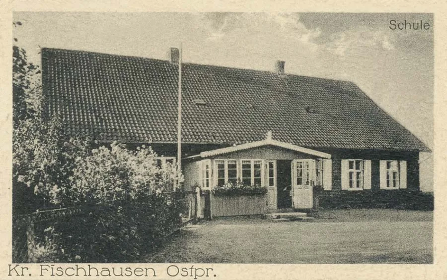 The school and the post office in Heiligenkreutz were in the same building (pictured).
On 17 November 1947 Heiligenkreutz was renamed the settlement of Krasnotorovka.
Initially it became part of the Yantarny Village Council. In 1955 Krasnotorovka had 25 houses. In 1959–60, after the Yantarny Village Council was abolished, Krasnotorovka became the centre of a new village council, but this was soon abolished. From 1960 it belonged to the Povarovka Village Council. In the 1960s the church, which had earlier been turned into a club, was destroyed after yet another fire. As of 1984 the settlement had a dairy farm. In the 1990s there was a school in Krasnotorovka, but it was later closed. As of 2020 the settlement has 88 residential and public buildings.
Sights: the foundations of the church (1353).
Population change: 1984 – 240, 2002 – 639, 2010 – 610, 2012 – 584 inhabitants.
Population change of the Heiligenkreutz Gutsbezirk: 1818 – 61, 1867 – 109, 1871 – 117, 1885 – 118, 1895 – 116 inhabitants.
Population change of the Heiligenkreutz parsonage farm and community: 1818 – 61, 1867 – 44, 1871 – 37, 1885 – 15, 1895 – 49, 1905 – 40, 1910 – 0, 1925 – 408, 1933 – 431, 1939 – 429 inhabitants.
Population of the Heiligenkreutz Gutsbezirk in 1871: all 117 Evangelical Christians, children under 10 – 28, literate – 65 (75%).
Population of the Heiligenkreutz parsonage farm in 1871: all 37 Evangelical Christians, children under 10 – 9, literate – 22 (79%).
For reference
Heiligenkreutz parish: Alt Katzkeim (Tolbukhino, later Barkasovo), Bersnicken (Yagodnoye), Bieskobnicken (Okhotnoye), Birkenhof (Storozhevoye), Brüsterort (Mayak), Finken (Molodogvardeyskoye), Groß Dirschkeinm (Donskoye), Groß Kuhren (Primorye), Grünwalde (54°53'29'' N 20°04'24'' E), Ihlnicken (Sarayevo), Forsthaus Katzkeim (Storozhevoye), Klein Kuhren (Filino), Klycken (Klyukvennoye), Kreislacken (Bakalino), Mandtkeim (Maysky), Marscheiten (Maryinskoye), Neu Katzkeim (Barkasovo), Nöttnicken (Prislovo), Rosenort (54°57'20'' N 19°58'46'' E), Schalben (Orekhovo), Wangnicken (Yantarovka), Forsthaus Wilhelmshorst (54°53'25'' N 20°03'24'' E), Woydiethen (Listovoye), Zapelwipp (54°56'01'' N 19°58'18'' E).
Photos: bildarchiv-ostpreussen.de.
Translated from Russian with the help of AI (Claude, Anthropic), October 2026.