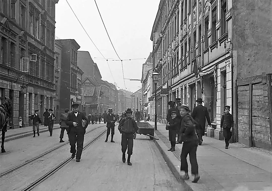
South of the high ground on which Neuroßgarten (Neu-Roßgarten) stands, on the former floodplain meadows of the Pregel, lies one of the western suburbs of the Altstadt (Altstadt), called the Laak (Laak). The word Laak comes to us from the Low Saxon dialect of German and means a flooded place or a marshy meadow. Besides the already mentioned Lower Rollberg (Unter Rollberg), the Laak is connected with the districts on the Neuroßgarten plateau by Church Hill Street (Neu-Roßgärter Kirchenberg, now Yerevanskaya Street), which is passable for vehicles.
The longest street of the Laak, which bears the same name as the district itself, adjoins in the east the old Laak Gate of the Altstadt (Schwanen Thor / Laken Thor; Laak Gate is the second name of the Swan Gate. Ed.) and Altstadt Long Street (Altstädtische Langgasse). From there it runs westwards as far as Ausfall Gate Lane (Ausfallthorgasse). Its eastern part, from the Laak Gate to the New Canal (Neuen Graben, now Krasnoyarskaya Street), is called Lower Laak (Unter Laak). The western part, from the New Canal to the Ausfall Gate, is Upper Laak (Ober Laak).
In the 16th century there was no trace of these streets. The documents of that time mention only the City Yard of the Altstadt (Altstädtische Stadthof). At the beginning of the 17th century a row of flimsy little houses stood on what is now Lower Laak, huddled right up against the Neuroßgarten high ground. The southern part of the Laak was not yet settled, although a road from the west to the New Canal had already been laid.
(In comparatively recent times, apparently until the mid-13th century, one of the arms of the Pregel flowed through the Laak. Then it silted up, and the area turned into a marshy lowland. Gradually, through laborious drainage work and the construction of canals to carry off the water, this part of the city was turned into a residential and industrial district. Editor's note.)
So, if we walk west along Altstadt Long Street, leaving behind the Altstadt Gymnasium (Altstädtischen Gymnasium), we will see on the right the opening of Lower Rollberg, while on the left Building Yard Lane (Bauhofsgasse) will lead off; it took its name from the Altstadt building yard, which is now completely separated from it by the building of the municipal pawnshop.
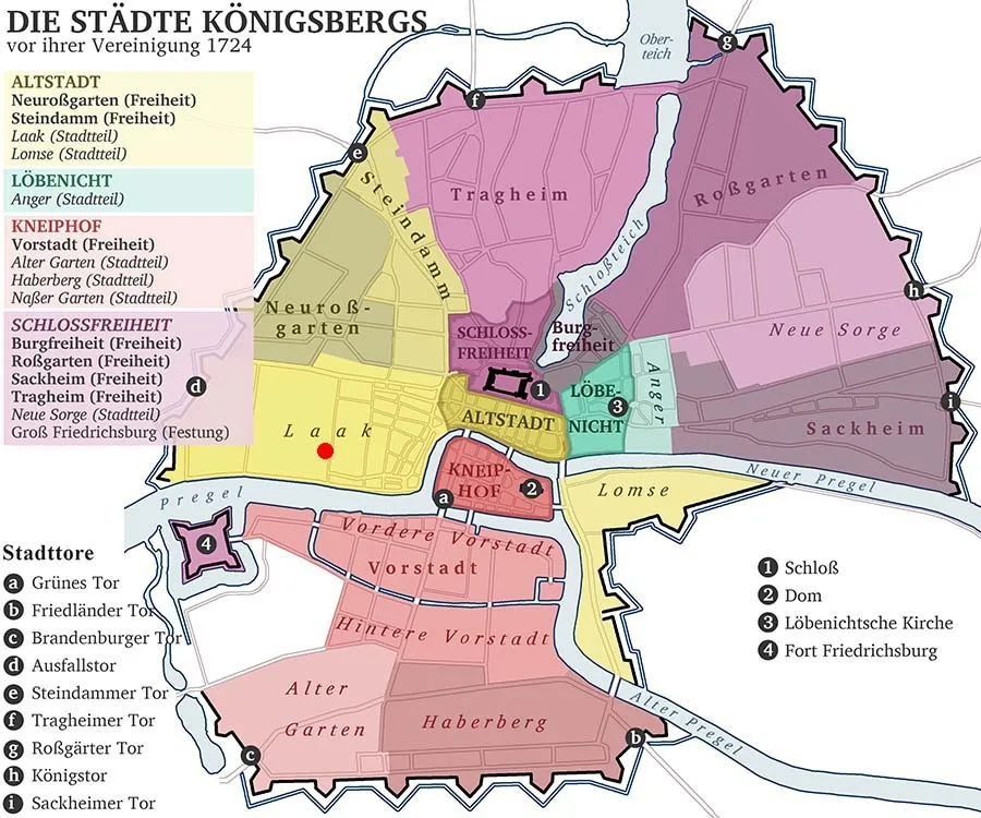 The Laak on a reconstructed map of the towns, suburbs and districts of Königsberg before their unification in 1724.
At the corner of Lower Laak and Building Yard Lane stands the building of the City Fire Station (Städtischen Feuerwehr), equipped with the latest technology.
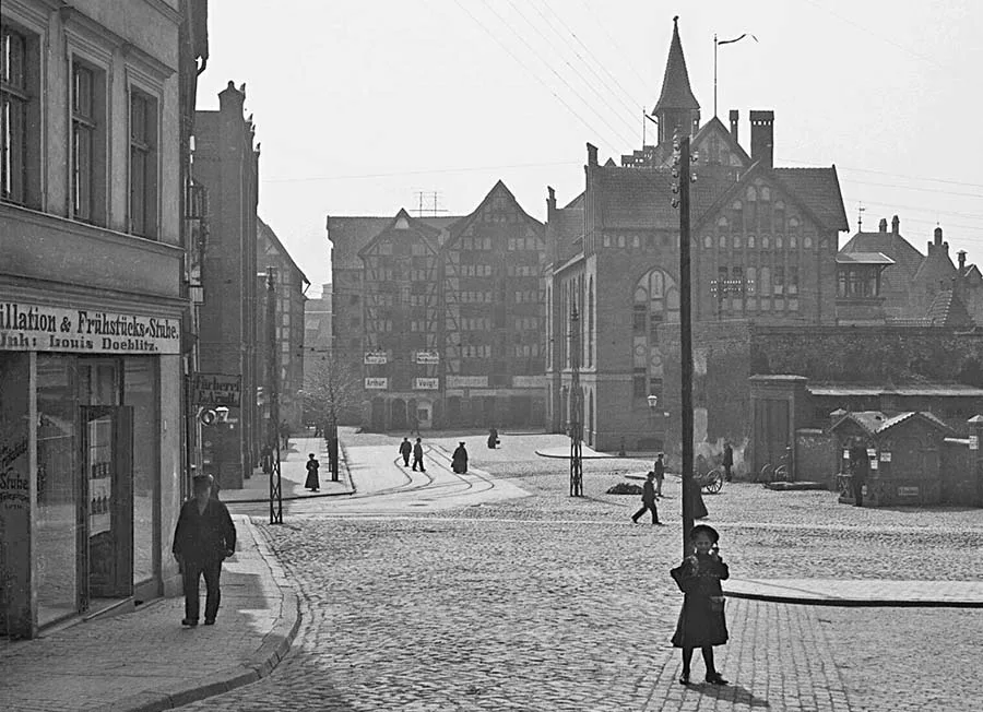 View of Building Yard Lane and the City Fire Station from Lower Rollberg.
(This describes the area of today's Victor Hugo Street, where the Yunost sports complex stands. All that remains of Königsberg in this area is a water and sewage pumping station. The buildings of the City Yard and the fire station shared the sad fate of the Laak and the neighbouring Altstadt, which were razed to the ground. Editor's note.)
In former times fires were put out mainly by the local residents. But since neither they nor the firemen had any real experience of fighting fire, they very rarely managed to master the flames. Fires were the curse of Königsberg; the port warehouses burned especially often. Until 1773 the city had no unified fire service. Even schoolchildren were taught to fight fires. All the city's inhabitants were divided into 33 fire brigades. Those who did not want to join them could buy themselves out.
The catastrophic fire of 1811 prompted the magistrate to call on the young men of the merchant class to form a Society for the Rescue of Movable Property (Mobiliar-Rettungsverein). An even more substantial reform of firefighting followed in 1859, when the city's Professional Fire Brigade (Berufs-Feuerwehr) was founded. This body was created on the model of a similar one in Berlin. At its head was a director, with two fire masters under him. The brigade consisted of 13 officers and 72 men, 60 of whom were qualified firemen.
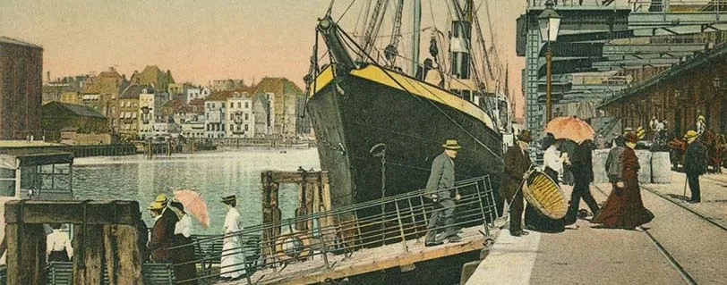
At present the fire brigade in Königsberg is divided into three units: Altstadt, Löbenicht and Kneiphof (Altstadt, Löbenicht, Kneiphof). Each must keep horses, always ready to turn out, exclusively for the needs of the fire brigade. Besides these three main fire stations, there is a fire post at the railway goods station in the port (Kaibahnhof). The Royal Eastern Railway (Königl. Ostbahn) allocates six thousand marks a year for its upkeep. There is a similar post on the castle tower, maintained by the government.
To ensure fire safety on performance days, fire crews are on duty at the City Theatre.
Private individuals may also use the services of the firemen for a fee. The guardrooms of the fire stations are connected with all parts of the city by telegraph, telephone and an automatic fire alarm on number 72.
Besides its main task, the fire brigade had to carry out certain kinds of work that also required qualified specialists. These mostly had to do with building wells, pipelines and other similar infrastructure. In 1895–96 the municipality allocated 109,870 marks for the upkeep of the fire brigade.
The Altstadt City Yard (Altstädtische Stadthof) in Stable Lane (Stallengasse) serves the cause of keeping the city clean and tidy. The yard has everything necessary for this: horses, carts and other equipment. This service clears away street rubbish, all kinds of waste, snow and ice. When there was no sewerage system, its responsibilities also included the collection and removal of night soil.
(It was noted above that the City Yard was in the area of the Yunost sports complex. Stable Lane was later renamed in honour of the famous poet and became Simon-Dach-Straße (Simon Dach Straße). Had it survived, it would link Krasnoyarskaya and Victor Hugo Streets at their northern ends. Editor's note.)
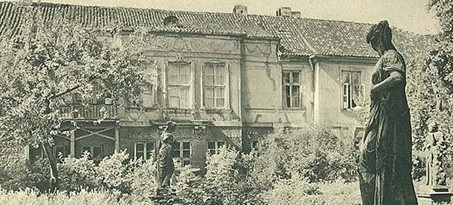
Walking further west and reaching Upper Laak, we will see on the right the state elementary school for boys and girls (Volksschulegebäude für Knaben und Mädchen). Very close to it stands the building of the Anatomical Theatre, built in 1887. (The school stood on the site of today's twelve-storey block No. 19, next to School-Lyceum No. 23 on Moskovsky Prospekt. The Anatomy building was further west and has not survived. Editor's note.)
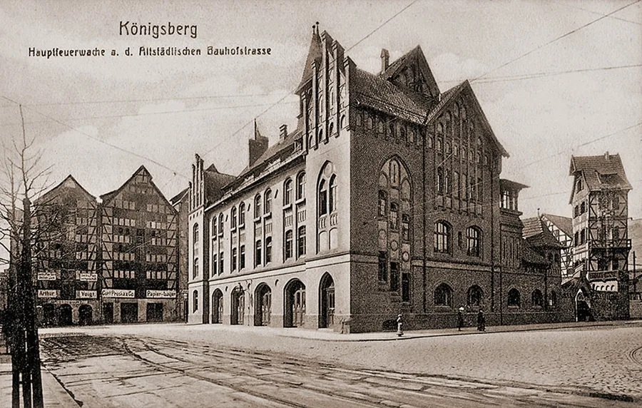 The City Fire Station; on the right, the port fire watchtower.
At the end of Upper Laak is the Union Foundry works (Uniongießerei), owned by a joint-stock company.
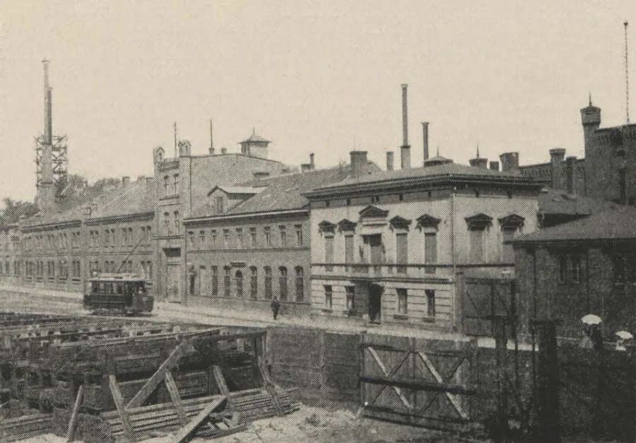
The foundry on Upper Laak.
The enterprise was founded in 1828 by the Englishman Charles Hughes (Charles Huges) and the merchants Dultz (Carl August Dultz, 1794-1868), Laubmeyer (Ernst Friedrich Wilhelm Laubmeyer) and Schnell (Gustav Schnell). This works is extremely important both for Königsberg and for the whole of East Prussia. In 1894 it employed 643 workers, as well as 44 clerks, foremen and engineers, a number that naturally fluctuated. Its turnover was 2,260,000 marks. The foundry produced 29,500 hundredweight of iron castings and 980 hundredweight of metal castings. Thirty-eight locomotives were delivered to customers. (At the beginning of the 19th century this production was moved to the Schichau area. Later it was converted into a shipyard. Today it is called Yantar and continues to operate successfully. Editor's note.)
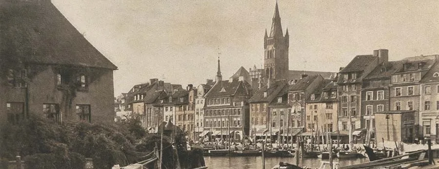
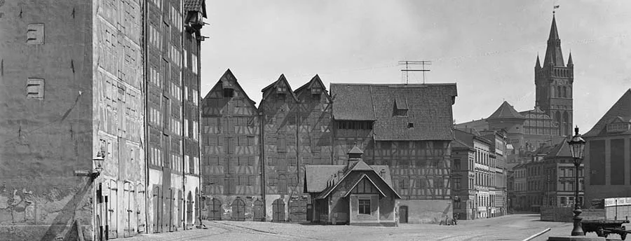
The streets of the Laak running south, which lead us to the Pregel, are Old Canal Street, Licent Street and New Canal Street (Alter Graben, Licent-Grabenstraße, Neuer Graben; respectively today's Yuriya Savenko, Mariupolskaya and Krasnoyarskaya Streets). At the beginning of the 17th century these streets did not yet exist (there were ditches in their place! Ed.), but there were the lanes perpendicular to them, Stable, Bird, Rope and Watering Lanes (respectively Stallgasse, Vogelgasse, Reifschlägergasse, Tränkgasse), built up with warehouses and stretching from the Hundegatt westwards into the depths of the district. Most of the warehouses in these lanes have kept their old Speicher marks (Speicher- / Handelsmarken)
(The lanes were in the area of today's Yunost sports complex and have not survived. In terms of today's orientation, the territory of the Laak suburb occupied a narrow strip stretched from east to west, taking up half the space between Moskovsky Prospekt to the north and the river to the south, from Victor Hugo Street in the east to General Galitsky Street in the west. Editor's note.)
Photos on this page: Bildarchiv Ostpreußen / bildarchiv-ostpreussen.de.
Translated from Russian with the help of AI (Claude, Anthropic), October 2026.