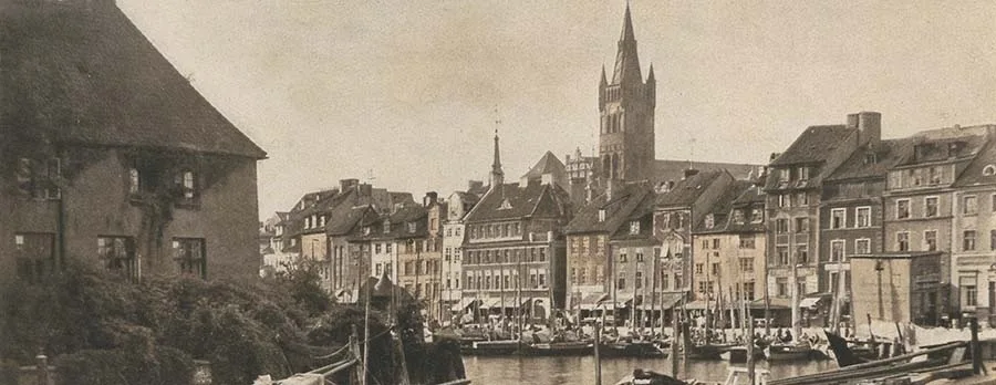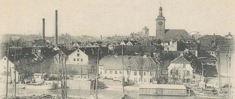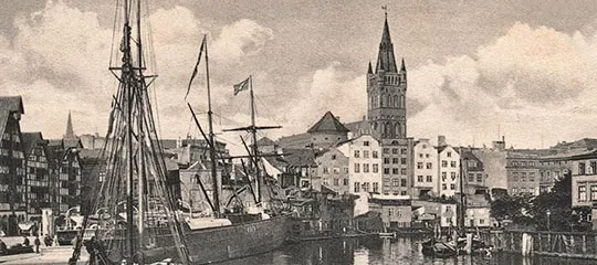
Rivers, as we know, were the main lines of communication in the Middle Ages — waterways in the warm season and sledge roads in winter. For transporting large volumes of building timber, floating it down a river was in fact the only economically viable route. In summer, moreover, a river is a reliable defence of a territory against enemy troops, since holding a riverbank is far easier than fighting in open country. But when transport routes have to be laid across the current, the river becomes a serious obstacle and calls for bridges or ferry crossings. This short historical and geographical digression is needed to understand the role of the island of Lomse in the fate of Königsberg and why it developed the way it did and not otherwise.
The name Lomse, like most place names in the vicinity of Königsberg, came from the Prussian language. The Prussians used this word for marshy ground by a river, which fully matched reality. Lomse was the lowest-lying (relative to sea level) and most frequently flooded of all the areas that were ever part of Königsberg. The groundwater level here rose from west to east, turning the eastern part into a real bog.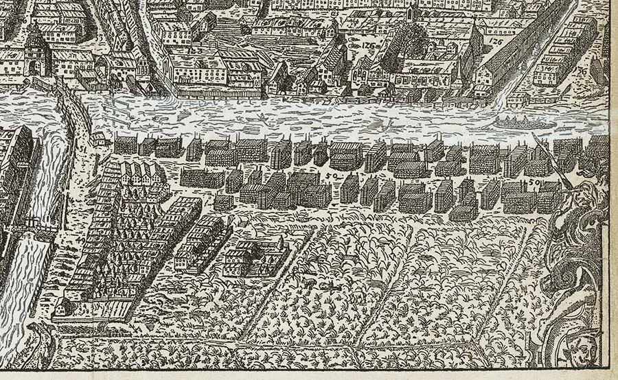 The north-western part of the island of Lomse on Bering's plan (1613).
The island of Lomse is mentioned in 1286, when town rights were granted to the Altstadt. This territory (among others) was assigned to the town for economic use. Lomse, like the Laak, had the status of a part of the town (Stadtteil), not of a liberty (Freiheit).
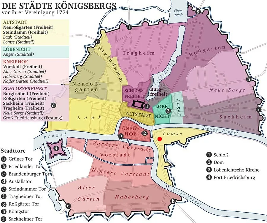 Lomse on a reconstructed map of the towns, liberties and districts of Königsberg before their unification in 1724.
The land on the island was handed over to the Altstadt on condition that it be used only for storing timber. Since in describing ancient times we inevitably come back to the present day and look at everything from the standpoint of our own time, today such areas are called "industrial zones". It is part of the town, as it were, yet not intended for people to live in. And if anyone does live in an industrial zone, it is against the rules. Of course, the Altstadt townspeople could have expanded the range of economic activities on Lomse, but they quickly realised that farming and grazing cattle on the island had no future, unlike using its banks for storing and sawing timber. This spot on Lomse became known as the "Wood Meadow" (Holzwiesen), and later the street of the same name, Holzwiesenstraße, began from it. But Lomse really began to develop as a warehouse district only from 1404, when the Wood Bridge (Holz-Brücke) was built. Over this bridge the inhabitants of the Altstadt could at last reach the island freely, without using boats and barges. The square at the end of the bridge was used for trading cattle and was named the "Ox Market" (Ochsenmarkt). Later the Altstadt slaughterhouse was built on this spot, and it operated here until the end of the 19th century. At that time townspeople sought to move such insanitary facilities as cattle markets and slaughterhouses outside the town.
From the "Ox Market" a street gradually developed along the bank facing the Kneiphof and the Vorstadt. To keep the buildings on it from being flooded by surge waters, the street was built on an earth dam.
The dam steadily grew towards the opposite (southern) shore of the island, and so a tempting idea arose: to extend the dam to the end of Lomse, build a bridge there across the Old Pregel and thus obtain a road to Natangia and Poland bypassing the Kneiphof. The point is that the Altstadt had received permission to build a bridge in the southern part of the island as early as 1377 from Grand Master Winrich von Kniprode (1310–82), but the start of construction kept being postponed for various reasons. Naturally, the people of the Kneiphof saw through this plan and, alarmed by such prospects, began appealing to the authorities of the Order. In response, in 1434 Grand Master Paul von Rusdorf (1385–1441) held talks with the Altstadt, after which he assured the Kneiphof council that only barns and cattle sheds would be built along the bank, and at an agreed distance from the water. The Altstadt would have no port facilities, fairs or residential quarters on Lomse.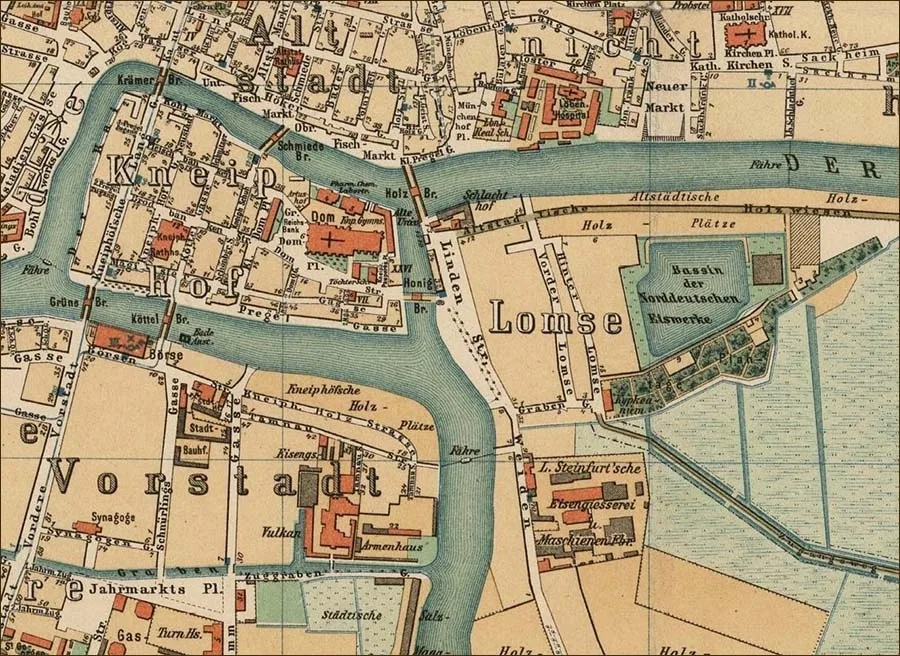 The island of Lomse on a map of Königsberg (1885).
The dam, which became known as the "Willow Dam" (Weidendamm), continued to advance southwards, but the bridge across the Old Pregel was built only in 1520, in the last years of the State of the Teutonic Order.
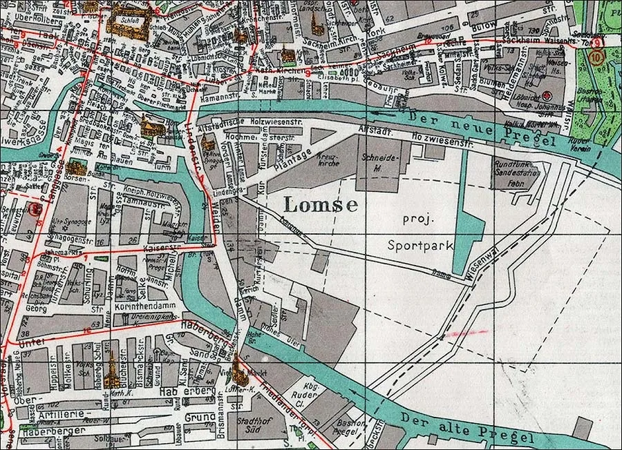 Lomse on the pre-war map of 1944.
To be quite precise, it is known that by 1520 the bridge, called the New Bridge (Neue Brücke), already existed. Sometimes 1500 or thereabouts is given as the date of its construction. With the appearance of the New Bridge the Altstadt finally obtained an overland route to the south of Prussia bypassing the Kneiphof. But the latter was not to be outdone and in 1542 "pushed through" permission to build its own bridge from the island of Kneiphof to the island of Lomse. The Neue Brücke was not a drawbridge. To let boats and barges pass, it had to be made higher than the other Königsberg bridges. Therefore over time it was renamed the High Bridge (Hohe-Brücke).
It should be noted here that the development of Lomse was still much slower than that of the other town lands and liberties, and the reason was the same bogs and floods. Nevertheless, on the first known plan of Königsberg (Braun's plan, 1581) we can see that the bank of Lomse facing the Kneiphof is already provided with a dam, along the eastern side of which stand houses.
Perhaps the Altstadt townspeople were helped in developing the marshy areas by the Dutch, who began settling in Königsberg under Duke Albrecht and had experience of draining land in their homeland. Whether this was so or not, land reclamation work on the island was carried out vigorously.
The next plan of the town (Bering's plan, 1613) shows that the number of cross streets built up with houses had reached at least three, and two more streets ran along the embankment of the New Pregel. But these two streets were not built up with houses; timber was stored on them in neat stacks. Near the New Bridge a tavern, likewise called the New Tavern (Neuer Krug), was built in 1559; its owner was obliged to act as bridge keeper. For a long time this tavern, with a massive fence resembling a fortification, was the only building in the southern part of the Weidendamm.
When in 1626 construction began on a ring of bastions around the Königsberg towns and their liberties, its designer, the professor of mathematics Johannes Straus (1590–1630), faced the problem of continuing this ring on the island of Lomse. The canons of fortification required the fortress to be as close to a circle in shape as possible. On Lomse, however, the continuation of this circle would have run across very marshy ground, and the eastern part of the island itself was considered impassable for an army with siege artillery. Therefore the bastioned front here followed the boundary of the inhabited area. As a result the trace of the fortification line acquired a re-entrant angle, which, according to the theory current in the 17th century, meant a weak point in the defence. Here, in the centre of the front, a so-called hornwork was used — a fortification element introduced into the practice of fortress building by the Dutch in order to remedy the inherent shortcomings of the bastion system.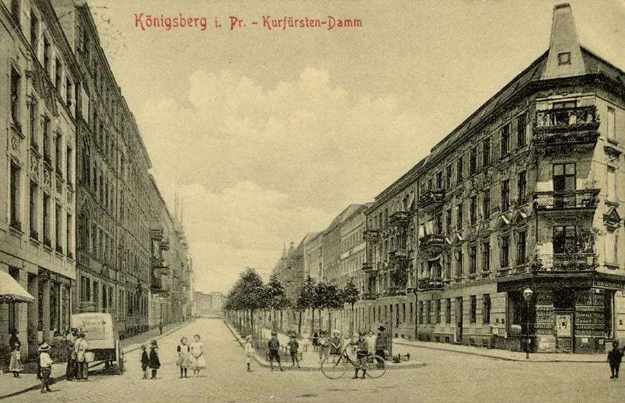 Kurfürstendamm.
The use of a hornwork was something of an exotic rarity in Eastern Europe; at any rate, nowhere else in the defences of Königsberg was one ever found. Besides this hornwork, the fortifications on Lomse consisted of two demi-bastions (by both arms of the Pregel) and one bastion.
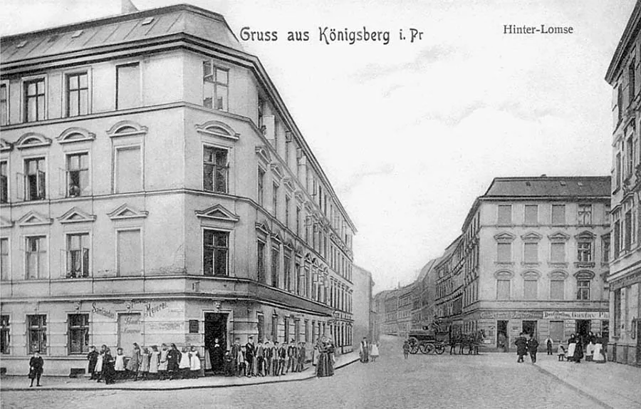 Hinterlomse.
The next 200 years passed for Lomse without any radical changes or significant events. The district was hardly built up at all; in many places the town quarters did not even reach the ramparts. The timber yards, on the other hand, expanded considerably — the Wood Meadow now stretched along the river right up to the town boundary. Compared with the other districts of the town, time here seemed to stand still. But that does not mean that nothing interesting happened here at all in those 200 years. Certain episodes in the history of Lomse deserve mention.
In the 17th century the greatest attraction of Lomse was the poetry circle of Simon Dach (1605–59), a Prussian poet, professor and rector of the Albertina. Today he is usually remembered in connection with the famous song "Ännchen von Tharau", for which he wrote the words. But his contemporaries could have told much more about him. They noted not only his poetic talent, calling Dach "the father of Prussian poetry", but also his exceptional personal qualities, his eagerness to help talented students, to promote and support his poet friends, and to settle fairly the issues that arose at the university.
Dach was loved and respected by his colleagues, ordinary Königsbergers loved his poems, members of the Hohenzollern dynasty supported him in every way, and Elector George William called him his court poet.
Simon Dach was one of the first to write "high poetry" in German rather than in Latin. It is believed that it was Dach who gathered around himself the poets and musicians of Königsberg: Heinrich Albert (1604–51), Johann Stobaeus (1580–1646), Robert Roberthin (1600–48), Christoph Kaldenbach (1613–98), Johann Titz (1619–89) and others, although Roberthin is sometimes named as the initiator of this association. Unlike the guilds of poets and musicians that had existed before, Dach's circle had no statutes or privileges; it was purely a creative association based on the personal friendship of its members. The friends gathered in Heinrich Albert's garden on the Weidendamm, in a summer arbour among pumpkins and marrows. They often wrote humorous quatrains on the pumpkins, which is why Dach's circle itself came to be called the "Pumpkin Hut" (Kürbislaube or Kürbishütte). The "Pumpkin Hut" was frequented not only by people of creative professions but also by art lovers, among them influential officials. Heinrich Albert himself became famous for his music to that very song, "Ännchen von Tharau".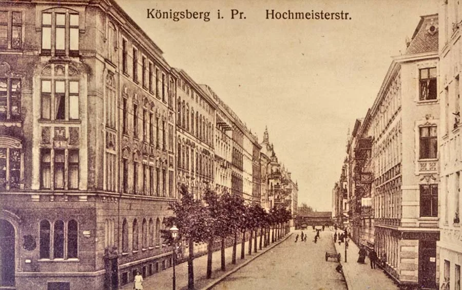 Hochmeisterstraße.
His contemporaries admired his organ playing in the cathedral, where he was the official organist. The "Pumpkin Hut" existed until 1641, when the area where Heinrich Albert's garden lay fell within the zone of rampart construction.
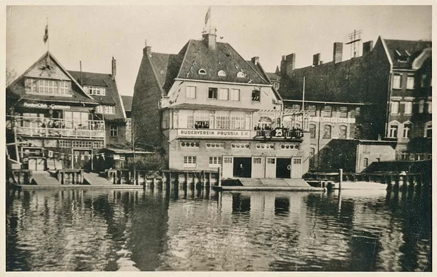 The boathouse of the Prussia Rowing Club at Weidendamm 18–20.
The unification of the Pregel towns, their liberties and districts into a single Königsberg, which took place on 13.06.1724, finally removed all the artificial restrictions on the development of Lomse. Only the objective natural factors remained, because of which Königsbergers continued to regard the island of Lomse as a storage and agricultural appendage. In 1742, with the support of King Frederick II, mulberry plantations were laid out on Lomse. In 1750 the first 20 pounds of raw silk were obtained. But on the whole the experiment of developing silk production in Königsberg can be considered a failure — during the harsh winter of 1771–72 the trees froze. On the other hand, this initiative of the Prussian king later gave its name to a street, which was simply called Plantage.
At the end of the 18th century an anatomical theatre was set up on Lomse near the Honey Bridge. By that time such institutions had turned from places of spectacle and entertainment into purely scientific establishments, where students learned the secrets of the structure of the human body and the techniques of surgery. But this was not the only institution on Lomse connected with the local university.
At some time in the first half of the 18th century, Hinterlomse was home to Johann David Kypke (1692–1758), professor of logic and metaphysics and doctor of theology, who, among many other merits, was a teacher of Immanuel Kant.
Professor Kypke had a nephew, Georg David Kypke (1724–79), who had been a friend of Kant's since their schooldays together at the Collegium Fridericianum. Like Kant, he too graduated from the University of Königsberg and some time later returned to it as professor of Oriental languages. In 1778 Kypke founded a hostel for students from poor families, which was named the "Kypkenaum" in his honour. It was located on Hinterlomse. A year later Georg Kypke died, leaving in his will 10,000 thalers, on which 13 students were to be maintained at the "Kypkenaum".
Only the coming 19th century, the age of iron and steam, of factories and railways, added features of industrialisation to the image of Lomse. At the beginning of the 19th century, on the site of the tavern by the High Bridge, emigrants from England opened a tannery, which was simply called the "English Leather Factory" / Englische Leder Fabrique. Somewhat later a sugar factory began operating in its place. That factory in turn closed by 1860, and a sawmill started work next to the High Bridge.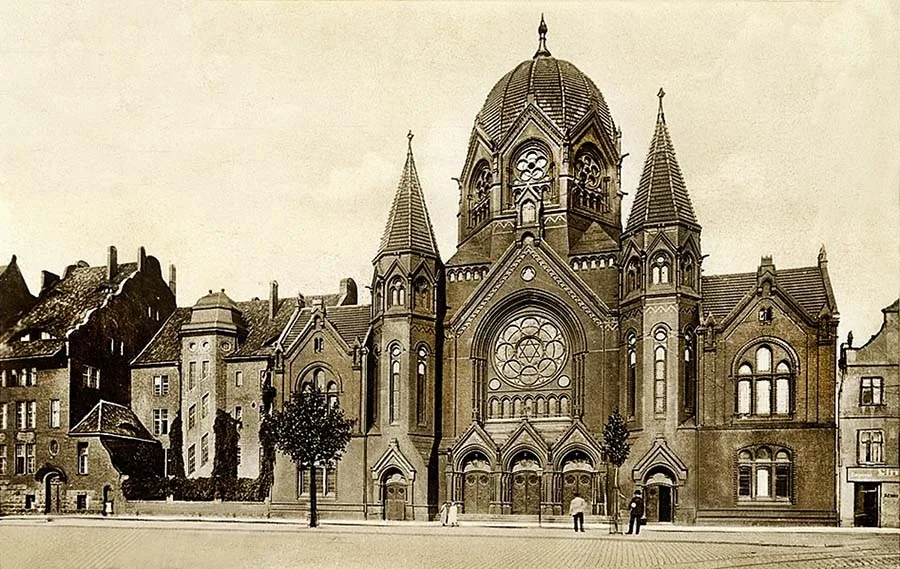 The New Synagogue on Lindenstraße.
In 1843–45 the foundry and engineering works of Leopold Steinfurt (1804–64) was built on the Weidendamm. Until the end of the 19th century this works was the largest industrial enterprise on the island.
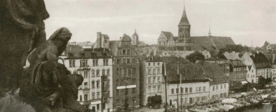
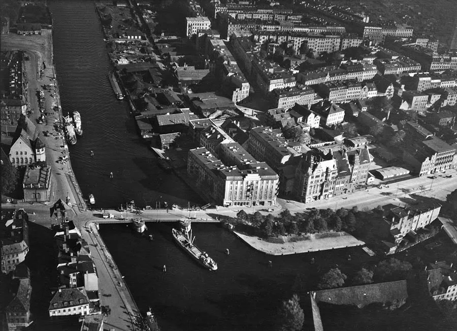 A bird's-eye view of the Pregel and Lomse (1930s). The synagogue is already gone...
In 1871, after the death of its founder, the company acquired a second plot to expand production. Later, however, this site too proved too cramped. In 1903 the process of moving the works' shops to Ratshof began; it was completed by 1906.
In 1843 work began on the construction of the Second Rampart Ring of Königsberg. And once again the front on Lomse became a stumbling block for the fortification commission. This time it was decided not to break the regular line of the fortress ring and to build its section in the uninhabited part of the island. Initially the design by Lieutenant General Ernst Ludwig von Aster (1778–1855) envisaged building four ravelins on Lomse. However, by the time the main works were completed in 1862, nothing had been built on Lomse. This section of the fortress was returned to only in 1889, when the very fortification value of the bastioned ring had been called into serious question. On Lomse they confined themselves to a simple earth rampart with a ditch in front of it. Roughly in the centre of the rampart an earthen Meadow Lunette / Wiesen-Lünette was also built, and the front on Lomse itself likewise received the name Meadow Front / Wiesen-Front.
1894 can be considered the year when mass construction of residential buildings began on the island of Lomse. Barns and warehouses were gradually demolished, and apartment houses rose in their place.
Building did not, however, advance into the interior of the island: the new houses were still grouped on Lindenstraße, the Weidendamm and a few other nearby streets. They were built (by the standards of pre-war Königsberg) without much architectural embellishment, which was sometimes criticised by residents and visitors. The former "Ox Market" was planted with lime trees, and the resulting square was used as an ordinary market, which was named Lindenmarkt. It was located right next to the New Synagogue.
At the end of the 19th century tram rails appeared on Lomse. Tram service along Lindenstraße and the Weidendamm began on 06.03.1898. There was also a branch turning off to the island of Kneiphof over the Honey Bridge. However, when the Imperial Bridge (Kaiser-Brücke) was built in 1905, the tram lines over the Honey and High Bridges were kept as service tracks. Now routes 1 and 11 ran from the Vorstadt over the Imperial Bridge, then across Lomse, and left towards the Löbenicht over the Wood Bridge.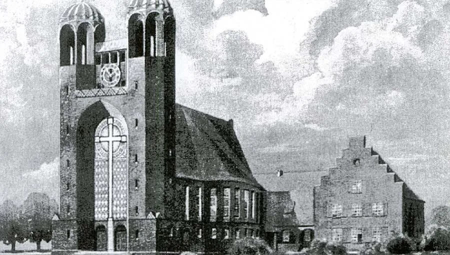 Church of the Cross.
In 1894 Lomse was chosen as the site for building the New Synagogue. The old one on Synagogenstraße / Synagogen Straße in the Vorstadt could no longer hold everyone who wished to attend. Construction of the synagogue was completed in 1896. It belonged to the Liberal Jewish community.
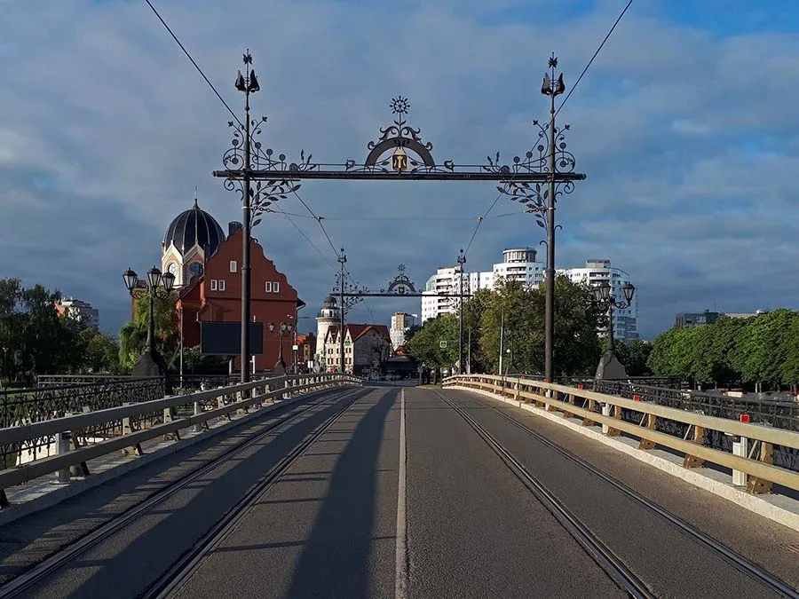 The Wood Bridge in the 21st century (2024).
Followers of Liberal Judaism (unlike the Orthodox) believed that Jews should take an active part in public life and adapt to their surroundings rather than blindly follow ancient canons. The new Liberal synagogue rose on the site of a warehouse (Speicher) demolished for this purpose. The building turned out unconventional and easily recognisable. Next to the New Synagogue, in 1904, an orphanage for Jewish children was built (architect Fritz Behrendt, 1877–1967). Its building has survived to this day.
The sporting life of Lomse should also be mentioned. As early as the days of royal Prussia, the channel between Lomse and the Kneiphof was used by skating enthusiasts as a rink. One could also skate on the Castle Pond (Schlossteich), but the ice there cost money. The headquarters of the best-known Königsberg rowing club, "Prussia", was on the Weidendamm. And at the end of Altstädtische Holzwiesenstraße, on the bank of the New Pregel, there was a rowing base with boathouses for sports boats.
Before the war there were plans to build a complex of open-air sports facilities on the empty part of Lomse (roughly where the present stadium is), but these plans were never realised.
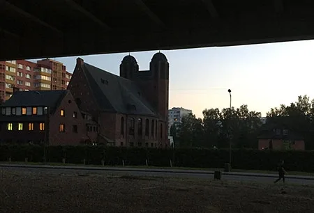
In 1930–33 the first Christian church was built on Lomse — the Church of the Cross / Kreuzkirche. The building, designed by the Berlin architect Arthur Kickton (1861–1944), departed considerably from the canonical image of a Lutheran church and stood out among the other churches of Königsberg. Incidentally, the architect Kickton himself was known for taking part in the restoration of East Prussian churches destroyed during the First World War, and was regarded as a great expert on the religious buildings of Germany.
After that, there were two terrible nights in the life of Lomse. The first came on the night of 9 to 10 November 1938. On that night, which became known as "Kristallnacht", a planned wave of anti-Jewish pogroms swept across Germany. In Königsberg, among other things, Nazi thugs burned down the New Synagogue on the island of Lomse. The second night (29–30.08.1944) was a direct consequence of the first. It received no name of its own, but it is known as the second bombing of Königsberg by the British Royal Air Force. The buildings of Lomse fell within its zone. Most of the buildings on the island burned out, but in the overall mass of damaged and destroyed buildings in Königsberg they made up only a small part. And seven months later, during the operation to take the city (6–9 April 1945), assault groups of the 3rd Belorussian Front passed through Lomse.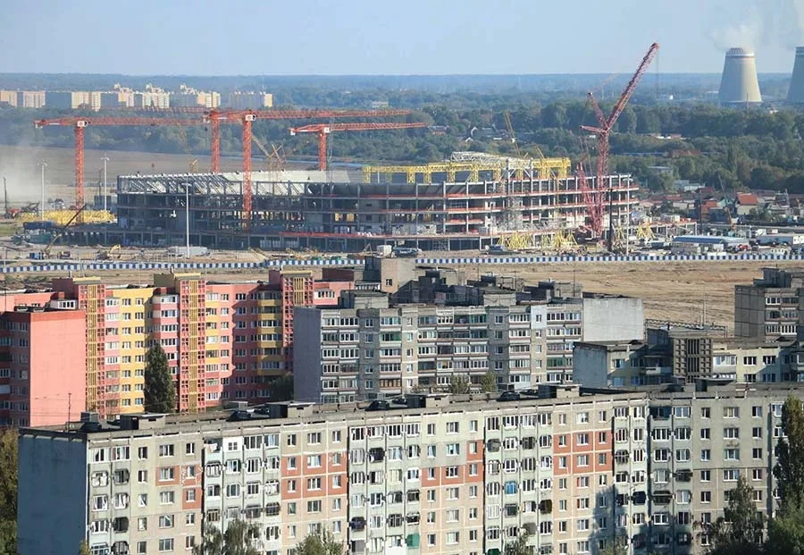 Construction of the "Rostec Arena" stadium (2016).
After the fighting ended, Lomse came under the administration of Kommandatura No. 4 (the 4th district of Königsberg). After administration was handed over to the civil authorities, on 25 July 1947 Lomse became part of the Moskovsky district of Kaliningrad. The island was given a new name — Oktyabrsky (October Island).
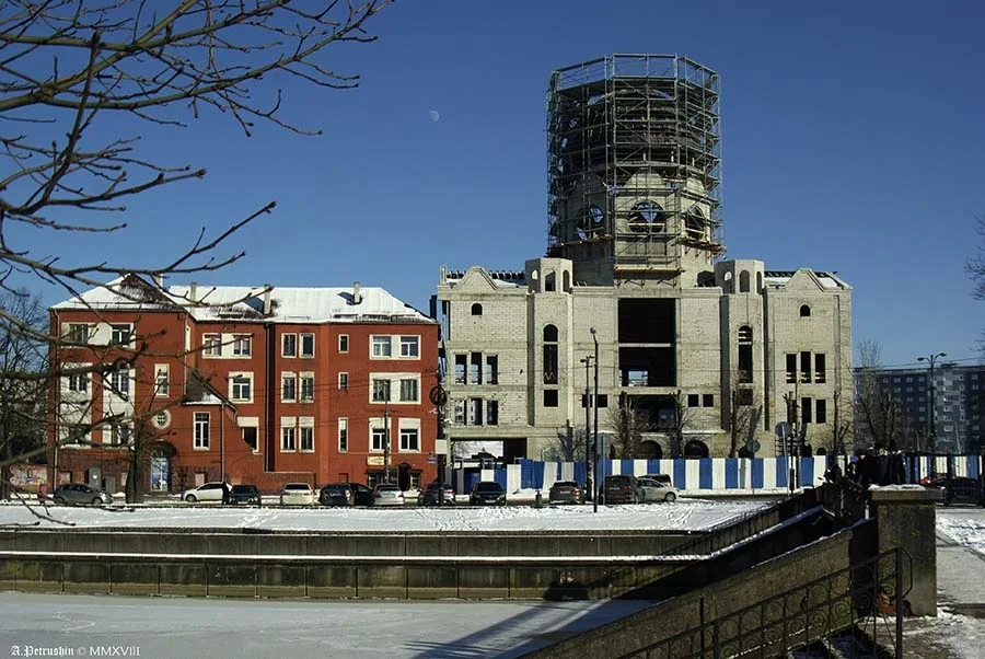 Construction of the synagogue (2018).
But this name not only failed to catch on among the people, who called it simply "the Island", but also turned out not to be fully legalised. For a long time it was one of the most, as they say today, depressed places in the city. There was more than enough waste ground in post-war Kaliningrad for restoring and building housing, so there was no need to build or repair anything on "the Island" right after the war. A tram service was launched along Oktyabrskaya Street. Getting off at the "Levaya Naberezhnaya" (Left Embankment) stop beyond the island of Kneiphof (by then already renamed Tsentralny Island), Kaliningraders found themselves in a fenced-off area that housed the "Market for Manufactured Goods for the Sale of Personal Belongings and Household Items", popularly known as the "barakholka" (flea market). It was opened on 24.03.1968 as a "forced measure". Here people sold and bought clothes and shoes, haberdashery, crockery and other household items.
Some were getting rid of old things that were still usable, some were "pushing" items that did not fit, but a considerable share of the traders were the so-called fartsovshchiki, black marketeers reselling imported goods bought up from sailors. The sailors themselves and members of their families were also present at the "barakholka" as sellers.
If you needed to buy brand-name jeans, Italian boots, imported or Riga cosmetics, records of foreign performers, a good fashionable coat or a fur hat — the best (and sometimes the only) choice was here. True, the prices were steep. Towards the end of the 1970s American cigarettes, Japanese electronic watches and imported radio equipment also began to appear here.
Besides the flea market, there was a small industrial zone with warehouses on the island near the ruined Kaiser Bridge. At the beginning of Oktyabrskaya Street the building of the Jewish orphanage stood alone. In the distance one could see the partly damaged building of the Church of the Cross, which Soviet guidebooks for some reason called the "Polish church". In the "church" there was a factory making and repairing fishing nets, but few Kaliningraders even suspected it. The rest of the island was occupied by waste ground (where the pre-war buildings had stood) and allotment gardens (somewhat further east). It seemed that history had made a fantastic loop in time — the former Lomse was once again being settled by farmers and gardeners, warehouse workers and traders.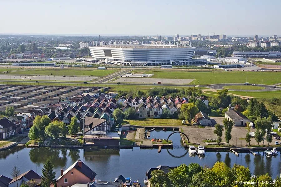 Oktyabrsky Island.
Only at the turn of the 1970s and 1980s did architects turn their attention to the island. By that time a plant producing large-panel building elements had started working in Kaliningrad, and so Oktyabrsky Island was built up exclusively with prefabricated panel buildings.
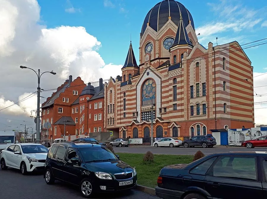 The New Synagogue on Oktyabrskaya Street (formerly Lindenstraße).
The first of them appeared in 1982–83 (4 and 6 General Karbyshev Embankment), and at the time they were among the tallest buildings in Kaliningrad, ten storeys high. The opinions of Kaliningraders themselves were diametrically opposed. Some thought that living in such buildings was comfortable and prestigious, others criticised both the buildings and the place where they were built. However, the housing shortage was so acute then that supporters and opponents of panel buildings alike were glad to move in. By the end of the 1980s some thirty buildings of five to ten storeys and several shops had been built. But no schools or kindergartens were provided for the residents. Molotoboynaya, Kuznechnaya, Mogilyovskaya and Gomelevskaya streets, which had previously been mere tracks across waste ground, disappeared from the city maps. Instead new streets appeared: Solnechny Boulevard (1986), Veteranov Embankment (1986) and General Pavlov Street (1987). None of these three streets had any connection with pre-war times, since they were designed and laid out without regard to the old maps.
Only Veteranov Embankment can, at a great stretch, be compared with the Königsberg embankment Hohes Ufer.
In 1985 the city authorities launched a project, ambitious for those times, to build the Second Overpass Bridge, which was to cross Oktyabrsky Island and both arms of the Pregolya. Construction began briskly but soon turned into a frozen unfinished project. As local humorists said at the time: now we have two sights — the House of Soviets, where nobody works, and a bridge nobody drives on. In 1988 the Church of the Cross was handed over to the Russian Orthodox Church (Moscow Patriarchate) to be turned into an Orthodox church. In the 1990s the island lived the ordinary life of a residential suburb and nothing remarkable happened there. Except that a couple of nine-storey buildings were declared unsafe because the ground beneath them turned out to be too unstable, and one of them was even dismantled.
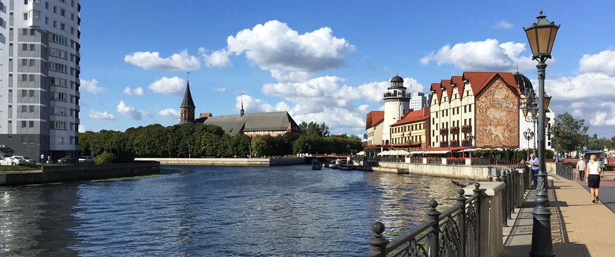
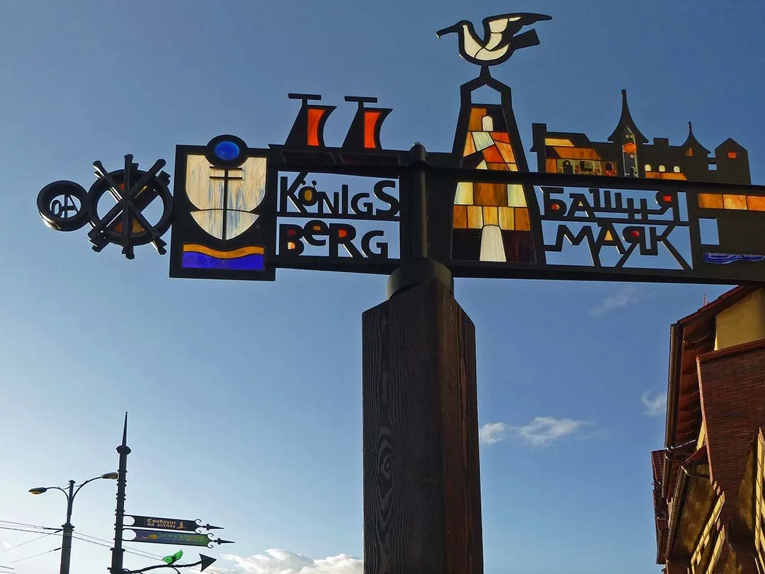
In 2005, for the 750th anniversary of Königsberg, a new pedestrian drawbridge resembling the old one in appearance was built on the site of the Kaiser-Brücke. The old name was considered inappropriate, and the bridge was named "Jubilee". In the following years construction began on the "Fishing Village" complex — the industrial zone on the riverbank was demolished and replaced by pseudo-historical buildings dominated by a lighthouse.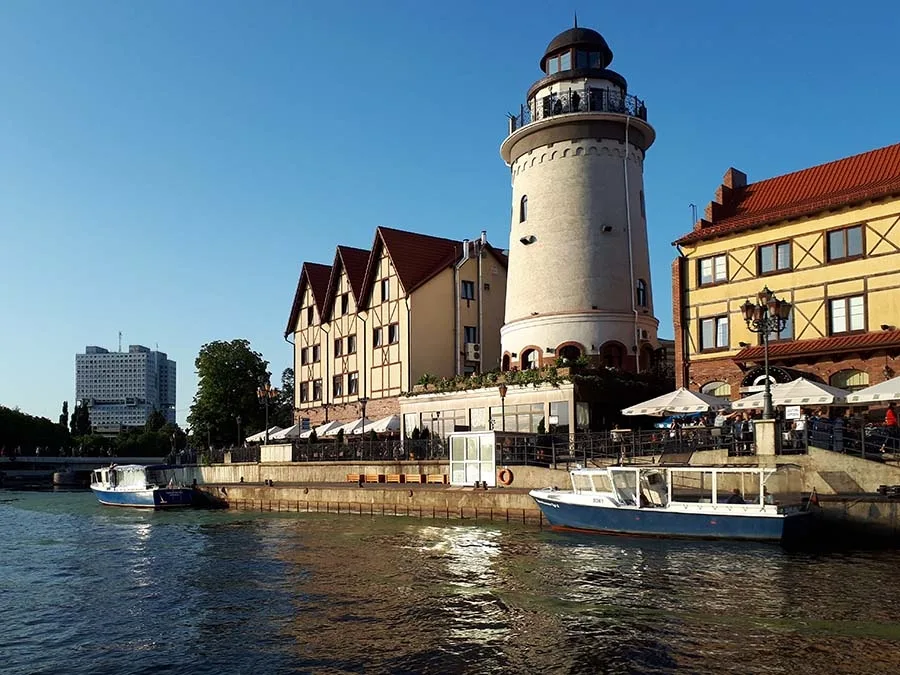 The "Fishing Village", with the House of Soviets, dismantled in 2024, in the background.
Among lovers of the city's history the "Fishing Village" aroused rather negative feelings — neither geographically, nor by its name, nor by its style, nor by its building materials did it correspond in any way to the idea of preserving and recreating historical buildings. But tourists took to the complex, as numerous photos on social networks testify.
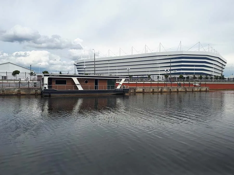 View of the "Rostec Arena" stadium from the Pregolya.
The radical reconstruction of the island, however, began somewhat later — in time for the opening of the 2018 FIFA World Cup. A detailed description of all the work carried out would take up too much space and could be the subject of a separate article. So we shall confine ourselves to a list: the second overpass was demolished and rebuilt (2015), the western part of Lomse was raised with fill on a massive scale, and the "Kaliningrad" football stadium (now "Rostec Arena", 2018) was built with an extensive car park and roads around it. At the same time the High Bridge was rebuilt. The Wood Bridge was thoroughly repaired and given elements of its pre-war appearance. Construction of the Eastern Overpass was begun (but not finished), although even before the World Cup one could drive onto the island along it. In addition, in 2016 Oktyabrsky Island at last acquired a school of its own. There were also accompanying negative effects: during the construction of the stadium and car park the fortress rampart and the Meadow Lunette, which had never been registered as a historical monument in time, were completely destroyed. Ecologists complained that the natural nesting sites of river and marsh birds had been destroyed. The demolition of the dacha plots, many of which lacked properly executed documents, was accompanied by scandals and protests.
At the same time the famous "Lomse mines" were paved over with asphalt. The point is that in Königsberg the island of Lomse was used for the disposal of solid household waste. To put it simply, there were rubbish dumps there. It was in them that, for many years, connoisseurs of the material culture of the vanished city dug in search of valuable glass and porcelain artefacts.
In 2011 the foundation stone of the recreated synagogue was laid. Its ceremonial opening took place on 08.11.2018, almost exactly 80 years after its destruction. The new building, as in the case of the Jubilee Bridge, is not an exact copy of the pre-war one. Moreover, it was built using modern reinforced-concrete technology. But on the whole the design and the very idea of constructing a building similar in its exterior can be called successful.
At present the second stage of building development on the island is under way; it is intended to be turned into a business and cultural district with elements of housing and park areas. On 03.08.2018, by a federal law, Oktyabrsky Island received the status of a special economic zone, more often called an "offshore zone". At the same time its name — "Oktyabrsky" — was officially legalised. Only time will tell what these changes will bring Kaliningraders.
A short list of the streets of Lomse
(as of 1928–33)
Altstädtische Holzwiesenstraße has been known since the days of the Order as the road to the "Wood Meadow" (Holzwiese), from which it took its name. After the war, by order of the Special Military District of 23.11.1945, it was renamed Drovyanaya ("Firewood") Street, which was quite a good choice of name, being a close translation of the ancient one. However, on 18.19.1980, by a decision of the Kaliningrad executive committee, Drovyanaya Street was merged with Molotoboynaya Street into General Karbyshev Embankment. After the war several barrack-type houses were built along the bank; they were demolished in the early 1980s when the island was built up with panel buildings. The only pre-war building surviving on the street is the "Prussia" rowing club, now the base of the "Dynamo" rowing sports society.
Bittrichstraße, a little street in the southern part of Lomse, ran from Seidlerstraße to the Weidendamm. It came into being in the 1910s. It was not renamed after the war. No pre-war buildings have survived on it. Today it is part of General Pavlov Street behind the building at 57 Oktyabrskaya Street.
Weidendamm ("Willow Dam"): it is hard to say whether the name of this street came from the willow thickets on the bank or from the use of willow rods to strengthen the earth dam. Construction of the dam began in 1455. There was a road here at least by 1520, when the New Bridge (Neue Brücke), later renamed the High Bridge (Hohen-Brücke), was built at the end of the Weidendamm. From that time to our day the street has firmly held the title of the "main" street of the island. On 23.11.1945, by decree of the commander of the Special Military District, the Weidendamm was merged with Lindenstraße and Brückestraße into Vladimirskaya Street. But this name did not last long, and as early as 01.08.1946 the city civil affairs administration gave Vladimirskaya a new name — Oktyabrskaya. No pre-war buildings remain on the Weidendamm. In 1985–91 several panel buildings were built along the odd-numbered side of the street. In 2006–10 the pseudo-historical "Fishing Village" complex was erected on the even-numbered side.
Wiesenwallstraße: the street appeared at the end of the 19th century and ran along the inner side of the defensive rampart. It was not renamed after the war and in time became a nameless road in a gardening partnership. It was filled in during the construction of the stadium.
Seidlerstraße, a small street, came into being in the 1910s and led from Hohes Ufer into the interior of the island. It was not renamed after the war. The utility buildings near it were demolished after 1966. In 2017 the eastern wing of the building at 57 Oktyabrskaya Street was built on the site of the street.
Kurfürstendamm: according to the plan, the street was to run from north to south across Lomse, parallel to the Weidendamm, some 200 metres east of it, but its southern part was never completed. On 23.11.1945 it was renamed Mogilyovskaya Street, but in fact it ceased to exist after the war. No pre-war buildings have survived on it. In 1982–83 the panel buildings at 4 and 6 General Karbyshev Embankment were built roughly along the line of the street.
Lindengrabenstraße, a small street leading from Lindenstraße to Plantage. It came into being around the middle of the 17th century, and by the beginning of the 18th century it already appeared under the name Lindengrabengasse. Next to it ran the ditch of the same name, the Lindengraben. It was not renamed after the war and disappeared. Today its site is the car park of the "Victoria" supermarket.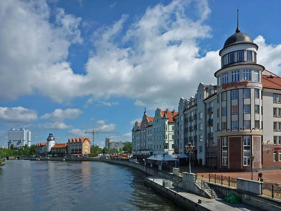 The Kaiserhof Hotel (right) in the New Fishing Village.
Lindenstraße came into being around 1404 as the "Ox Market" (Ochsenmarkt). It later became the busiest street on Lomse. It was home (from 1896) to the New Liberal Synagogue and the Lindenmarkt. Trams No. 1 and No. 11 ran along the street. After the war it was merged with the Weidendamm and Brückestraße and renamed Vladimirskaya Street. However, as early as 01.08.1946 the street was named Oktyabrskaya, and Lindenstraße became part of it. One pre-war building has survived on Lindenstraße — the orphanage for Jewish children (1904), which is a listed cultural heritage site.
Plantage came into being in the 19th century on the site of the unsuccessful mulberry plantings. After the war, on 23.11.1945, it was renamed Nivelirnaya Street, but as early as 1948 it was called Drovyanoy Lane, and then it became part of Kuznechnaya Street. The only pre-war building surviving on this street is the Church of the Cross. Several two-family houses were built next to it in the post-war years. In 1982–83 panel buildings were erected on the site of the street. The little houses at the end of the street were vacated and demolished around 1985 during construction of the Second Overpass. And in 2001 the "Victoria" supermarket was built at its beginning. Plantage is sometimes associated with today's Solnechny Boulevard, but in reality they have nothing in common.
Vorderlomse ("Near Lomse") ran parallel to and in the immediate vicinity of Hinterlomse ("Far Lomse"). After the war, on 23.11.1945, it was renamed Gomelskaya Street. But in reality it no longer existed as a street.
Hinterlomse ("Far Lomse"). The charitable student hostel "Kypkenaum" was located on Hinterlomse. It was not renamed after the war. Today the "Victoria" supermarket stands on the site of the "Kypkenaum".
Hohes Ufer, a small street along the bank of the Old Pregel, came into being in the 1910s. It was not renamed after the war. The industrial buildings near it were demolished after 1966. Today part of Veteranov Embankment in front of the Second Overpass Bridge lies here.
Hochmeisterstraße, a street in the north-western part of the island, ran parallel to Altstädtische Holzwiesenstraße but was considerably shorter. It appeared at the end of the 19th century. On 23.11.1945 it was renamed Molotoboynaya Street, but in fact it ceased to exist after the war. No pre-war buildings have survived. In 1983 the panel building at 4 General Karbyshev Embankment was built across the former Hochmeisterstraße.
Scheffnerstraße, a small street that came into being at the beginning of the 20th century. The street connected Hochmeisterstraße and Plantage. It was not renamed after the war and disappeared. Today its site is occupied by an area with retail kiosks and the courtyard of the building at 18 General Karbyshev Embankment.
Steinfurtstraße came into being in 1905 with the construction of the Imperial Bridge. The street led from the Weidendamm to this bridge. It was not renamed after the war. Today this is the area of the "Fishing Village" by the Jubilee Bridge.
Photos on this page: Bildarchiv Ostpreußen, Mikhail Ogorodnikov, Aleksey Petrushin.
– – – – – – – – –
The chapter "Lomse"
from the book by local authors "Königsberg Local History",
published at the end of the 19th century
In 2012–2014 "Pregola", the literary supplement to the "Baltic Almanac",
published a translation, by an unknown translator, of the book by the Königsberg authors Dr Richard Armstedt, professor at the Altstadt Gymnasium, and Dr Richard Fischer, senior teacher at the Kneiphof Gymnasium, "Königsberg Local History" ("Heimatkunde von Königsberg i. Pr.", 1895, Kommissionsverlag von Wilhelm Koch, Königsberg). The idea of the publication belonged to Igor Vladimirovich Afonin. The text was adapted and annotated by Aleksey Borisovich Gubin and Igor Fyodorovich Avtukhov. That book had a separate chapter on the island of Lomse. Lightly edited, we offer it to your attention as a supplement to the text by
Aleksey Yevgenyevich Petrushin.
– – – – – – – – –
Lomse
To visit the remaining part of the town that belonged to the Altstadt, let us cross the Holzbrücke (Wood Bridge) to the other bank of the Pregel. Here we find ourselves on an island lying east of the Kneiphof. As late as 1535 the inhabitants of the Altstadt were not allowed to build anything on Lomse. Yet cellars, cattle stalls and sheds, nicknamed cabbage stores, quietly appeared there as if by themselves. Soon houses began to turn up as well.
Only in our time (the book, let us recall, was written in the early 1890s — ed.) has this part of the town begun to attract attention — in 1894 the Königsberg administration drew up a development plan for the island of Lomse, including the extension of Uferstraße (Bank Street) to the Lithuanian Barrier (Litthauerbaum): the warehouses on the eastern side of Lime Street (Lindenstraße, now Oktyabrskaya Street) are to give way to residential buildings. The synagogue (Synagoge) now under construction will undoubtedly become the pride of this part of the town. On 27 May 1894 its foundation stone was laid. The marshy soil required a pile foundation, into which pine logs 12–13 m long were driven. The monumental structure will have an imposing dome crowned with a six-pointed Star of David — a symbol of eternity. The planned width of the façade is 23.5 metres.
The New Synagogue will consist of the main synagogue with the sanctuary, the pre-synagogue with a vestibule, and large ancillary rooms such as a wedding hall, a meeting hall, a confirmation hall and a library.
All these rooms will be housed in the northern and southern side wings. The hall of the main synagogue building will have 1,450 seats. Special places in the galleries are set aside for women. The building will be heated, and electric lighting is planned.
The total estimate, including the cost of the land, came to 700,000 marks. The design was produced by the Berlin firm "Architects Cremer and Wolffenstein" ("Architekten Cremer & Wolffenstein in Berlin"). Construction is scheduled to be completed by 1896.
(The synagogue was indeed built by 1896. On "Kristallnacht" in 1938 the Nazis burned it down. In the 2010s the synagogue was built again — ed.)
The slaughterhouse corporation (Schlachthof) is located in the immediate vicinity of the Wood Bridge (Holzbrücke). Once construction of the huge new slaughterhouse in Rosenau (Rosenau, 19 August 1895) is completed, the old slaughterhouses will be demolished. The town paid the butchers' corporation compensation of 220,000 marks for the demolition of the old slaughterhouses and the associated reduction of its privileges. The Altstadt Wood Meadows (Altstädtischen Holzwiesen, now General Karbyshev Embankment), stretching along the Pregel opposite the Löbenicht, serve their age-old purpose: they are a place for storing all kinds of timber.
Lime Street, or, as it is also called, the Lime Market (Linden Markt, now Oktyabrskaya Street), was called the Ox Market (Ochsenmarkt) until 1811. It is connected with the Kneiphof (Kneiphof) by the Honey Bridge (Honigbrücke). The houses on this street stand only on its eastern side. The bank of the Pregel south of the Honey Bridge is almost empty and serves as a mooring place for small river steamers.
Lomse is divided into Near and Far Lomse (Vorder- / Hinter-Lomse). Both these streets lie behind the synagogue and run parallel to the Lime Market.
(This division had practically lost its significance by the very beginning of the 20th century. Vorder-Lomse and Hinter-Lomse streets lay very close together behind the synagogue — ed.)
The etymology of the name "Lomse" has not yet been convincingly established. At any rate, no connection has been found with the name of the fortress of Łomża near the town of Narew (Narew).
(The name "Lomse" is linked with an old Slavic meaning: boggy meadow, marsh — ed.)
On Lomse there is a home for poor students, the Kypkeanum (Kypkeanum). The building was named after the professor of Oriental languages Kypke (Georg David Kypke, 1724–1779), who bequeathed 10,000 thalers for the construction of this hostel.
Behind the Kypkeanum lies the Plantation (Plantage), a notable part of the local landscape. It was founded by order of the magistrate in 1753, which in turn followed an order of Frederick the Great of 1742. The king wanted to establish mulberry plantations in Königsberg for subsequent silk production. The town, the guilds and the crafts promoted this project as best they could. Attempts were also made to sow dye plants. However, after some initial successes, it had to be admitted with disappointment that neither the climate nor the soil favoured the success of the undertaking. (Add the floods of the Pregel to the list!) By 1779 most of the plants had perished, and in 1783 the plantation grounds were sold to several buyers, among whom was Professor Kypke. Besides Plantage, attempts to establish mulberry trees in Königsberg were made in several other places. (These attempts proved unsuccessful.)
The Willow Dam (Weidendamm, the southern half of today's Oktyabrskaya Street) was banked up with earth as early as 1455, but even in 1613 there was not a single house here. Only a small inn nestled by the High Bridge. In our days (let us recall that the book was written in the 1890s — ed.) the street is built up with modern houses. But they too suffer from floods. One of the most important structures here is von Steinfurt's engineering works (Maschinenfabrik von Steinfurt).
(The German word "Weide" has two meanings — pasture and willow. Both meanings suit this place. During the Thirteen Years' War a protective dam was built here so that detachments of the hostile Kneiphof could not get into the Altstadt. As for Steinfurt's works, it was later moved to another place — to the site of today's Railway Carriage Works. On today's island of Lomse, one could say, nothing of the old remains except the annexe of the synagogue. The book does not mention that just south of the Honey Bridge in the 17th century there was a small garden with the "Pumpkin Hut" (Kürbishütte / Kürbislaube), where local lovers of poetry and music of the time gathered, among them the poet Simon Dach. It was here, perhaps, that the famous song "Ännchen von Tharau" was born — ed.)
Translated from Russian with the help of AI (Claude, Anthropic), October 2026.