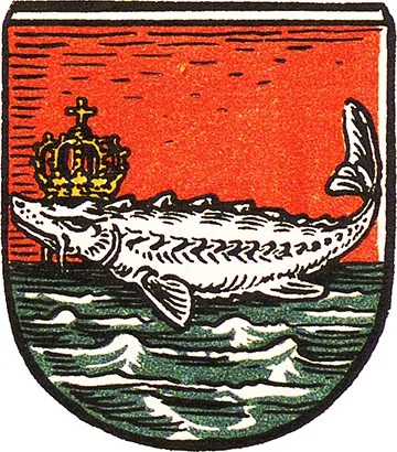
 Coat of arms
of Pillau
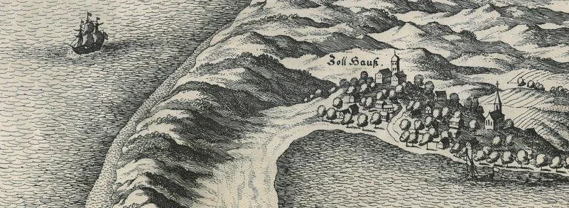
The settlement of Wogram on the site of the present-day town is first mentioned in 1258. In 1363 and 1430, the settlement of Pil (Pile, Pillen) is mentioned. The official year of the town's foundation is 1686.
On 10.09.1510, a violent storm broke through a new strait between Samland and the Vistula Spit, replacing the old one on whose shore Lochstedt Castle stood. In 1543, the first blockhouse was built in Pillau. In 1550, work began on earthen defensive ramparts; in 1601 the ramparts were renewed, and in the 1625–70s brick fortifications were built. In 1626–35, Pillau belonged to Sweden; in 1632, on the orders of the Swedish king Gustav II Adolf (according to other sources, in 1735 on the instructions of the Elector of Brandenburg and Duke of Prussia Georg Friedrich), the military engineer Abraham zu Dohna began building a bastioned citadel. In 1642 and on 18.10.1662, Elector Frederick William visited Pillau, the second time with troops to suppress a revolt of the towns.
In 1697, Pillau welcomed the Grand Embassy of Peter I. Peter later visited Pillau twice more: in 1711 and in 1716.
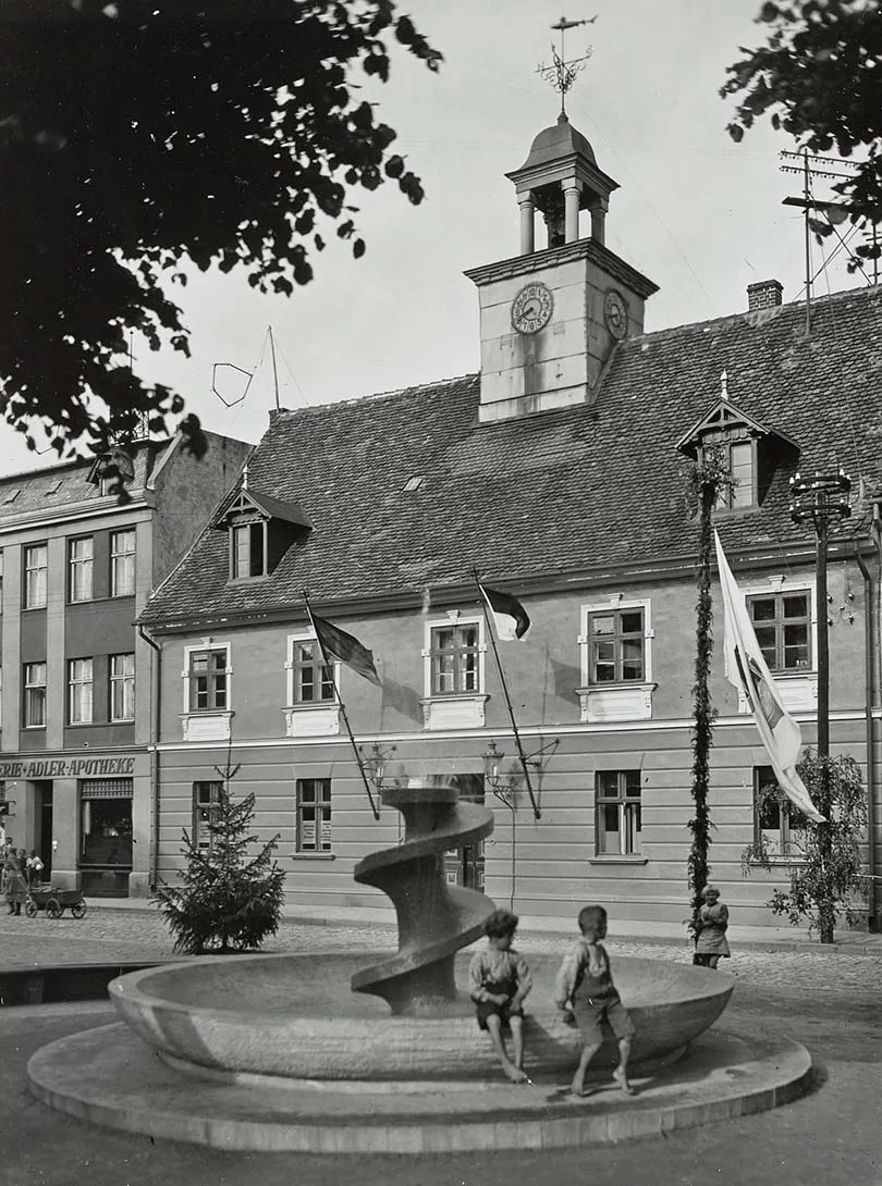
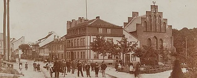
The fountain in front of the town hall on Market Square.
On 18.01.1725, Pillau received town status. From 24.01.1758 to 1762, during the Seven Years' War, it was under Russian administration.
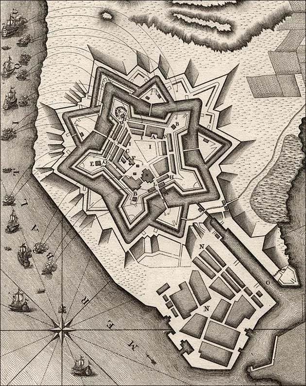
Pillau Fortress looks most impressive from on board the ISS.
On 01.06.1807, French troops blockaded the town, but entered it only after the Peace of Tilsit was concluded. The French entered Pillau a second time on 30.04.1812 and surrendered it to the Russian army without a fight on 26.01.1813.
In the 1850s, the town acquired a local newspaper and a telegraph. On 11.09.1865, a railway connection with Königsberg was opened. In 1871, Pillau Fortress was reconstructed. On 15.11.1901, the sea canal was opened. In 1902, Pillau, Alt Pillau and Wogram were merged.
On 09.11.1918, a revolutionary uprising broke out in the town: a Workers' and Soldiers' Council was set up and some of the ships were seized, but on 09.03.1919 the uprising was suppressed. In 1921, Pillau became a German naval base.
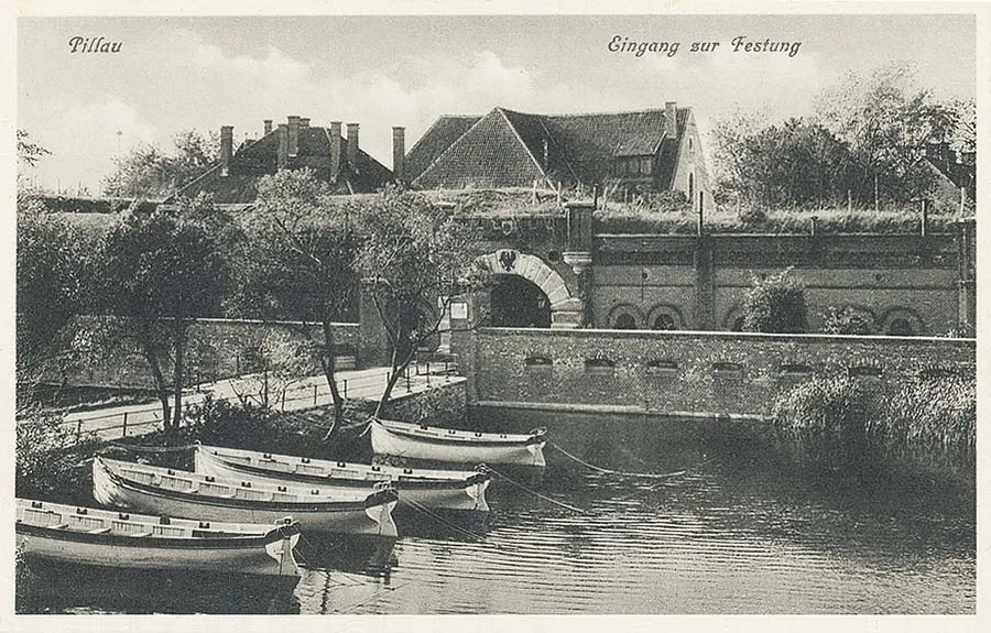 The boat station at the main entrance to the fortress.
In 1934, construction of an airfield began. In 1935, the Himmelreich barracks were built. In 1938, a promenade was laid out along the seashore.
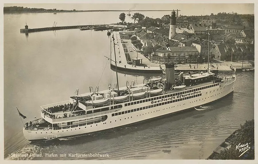 A liner of the East Prussian shipping line docking in the port of Pillau.
On 25–26 April 1945, Pillau was taken by storm by units of the Red Army.
On 27.11.1946, the town was renamed Baltiysk. Since 1952, it has been a naval base of the Baltic Fleet of the Soviet/Russian Navy. In 2004, a commercial port was opened in Baltiysk. In 2008, the Baltiysk District was created.
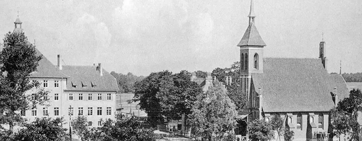
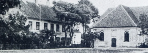
Sights: the citadel (1632, a facility of the Twice Red Banner Baltic Fleet), the forts "Stiehle" (1889) and "Eastern" (1889), the "Neuhäuser Schanze" fortification (1887–97), Soviet rangefinder towers, Pillau Lighthouse (1813-16), the Lutheran church (1866) and the Catholic church (1910), the former district court building (1903, now the Naval Museum), the pilot tower (1936), the former school (1903–10, now a gymnasium), a barracks complex (1904), the northern and southern moles (1883), the water towers (1904 and 1927), the railway water tower (1905), the mass grave of Soviet soldiers (259 people, monument 1949), the Naval Officers' House (1934), the monument to G. Hagen (1887), the monument to V. Lenin (1961), a memorial complex (1976), the memorial to the torpedo-boat heroes (1987), the monument to the victims of the Stalag I A camp (1990s), the monument to Peter I (1998), the monument to Empress Elizabeth (2004).
Sights on the Baltic Spit: the "Old Lunette" museum, Fort "Western" (1869–71), Neutief airfield (1937–39), the mass grave of Soviet soldiers (1,063 people, monument 1952).
Population over time: 1768 – 1,123, 1782 – 1,300, 1810 – 2,315, 1816 – 2,521, 1828 – 3,674, 1831 – 3,929, 1875 – 3,196, 1880 – 3,225, 1890 – 3,303, 1905 – 7,374, 1910 – 7,079, 1933 – 7,577, 1939 – 10,980, 1959 – 17,378, 1979 – 23,568, 2002 – 33,252, 2010 – 32,697, 2012 – 32,778, 2014 – 32,922, 2015 – 33,095, 2016 – 33,212, 2017 – 33,181, 2018 – 33,317, 2019 – 33,551, 2020 – 33,658 inhabitants.
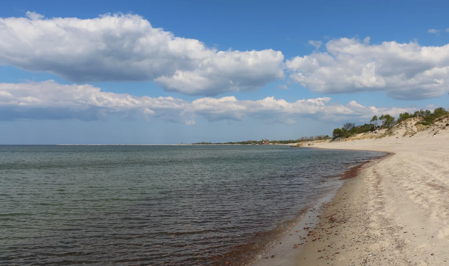
Modern photo (at the very top): Mikhail Ogorodnikov.
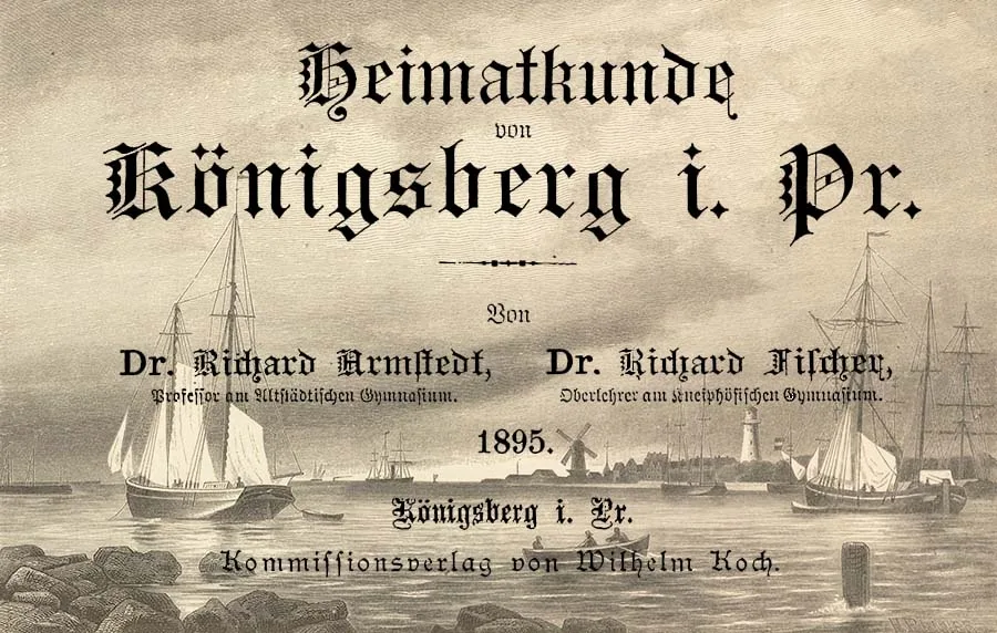
An excerpt from the chapter "The Shores of Samland"
from the book by local authors "Königsberg Local Studies",
published at the end of the 19th century
In 2012–2014, "Pregolya", the literary supplement to the "Baltic Almanac", published a translation of "Königsberg Local Studies" ("Heimatkunde von Königsberg i. Pr.", 1895, Kommissionsverlag von Wilhelm Koch, Königsberg) by the Königsberg authors Dr Richard Armstedt, professor at the Altstadt Gymnasium, and Dr Richard Fischer, senior teacher at the Kneiphof Gymnasium, made by an unknown translator. The idea of publishing it came from Igor Vladimirovich Afonin. The text was adapted and annotated by Aleksey Borisovich Gubin and Igor Fyodorovich Avtukhov. The book contained a separate chapter on the surroundings of Königsberg, part of which is devoted to the Frisches Haff lagoon, the spit and the town of Pillau. Having edited it substantially, we present it to you as a supplement to the text by Aleksey Yevgenyevich Petrushin.
– – – – – – – – –
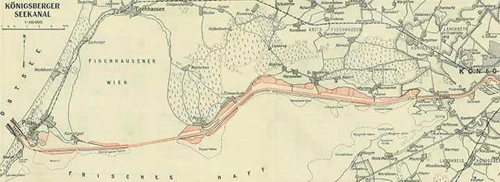
The Frisches Haff lagoon is shaped like a quadrilateral stretching from south-west to north-east. Its length is about 65 kilometres, its width from 9 to 22 kilometres, and its area 860 square kilometres. Its average depth is 3 to 5 metres. The depth of the fairway between Pillau (Pillau) and the mouth of the Pregel is about four metres, which is clearly insufficient for modern shipping. A canal 6.5 metres deep, protected from sand drift by a dam, is currently being built along the northern shore of the lagoon.
At Pillau, the Frisches Haff is connected to the Baltic Sea by a strait called the Tief (Tief, which can be translated as fairway or waterway — editor's note) To avoid confusion with the old strait, the strait at Pillau used to be called the Neutief (New Strait). The old strait was near the locality of Alttief (Alttief, literally "Old Strait"), on the spit opposite Balga Castle. It became unnavigable in 1456, because "guests" from Danzig, seeking to cut off the Teutonic Order's access to the sea, sank five ships in it. The present strait near Pillau already existed in the 14th century but was blocked by a dam. In 1497, a violent storm swept it away. In 1510, after dredging, the strait at Pillau was opened to shipping.
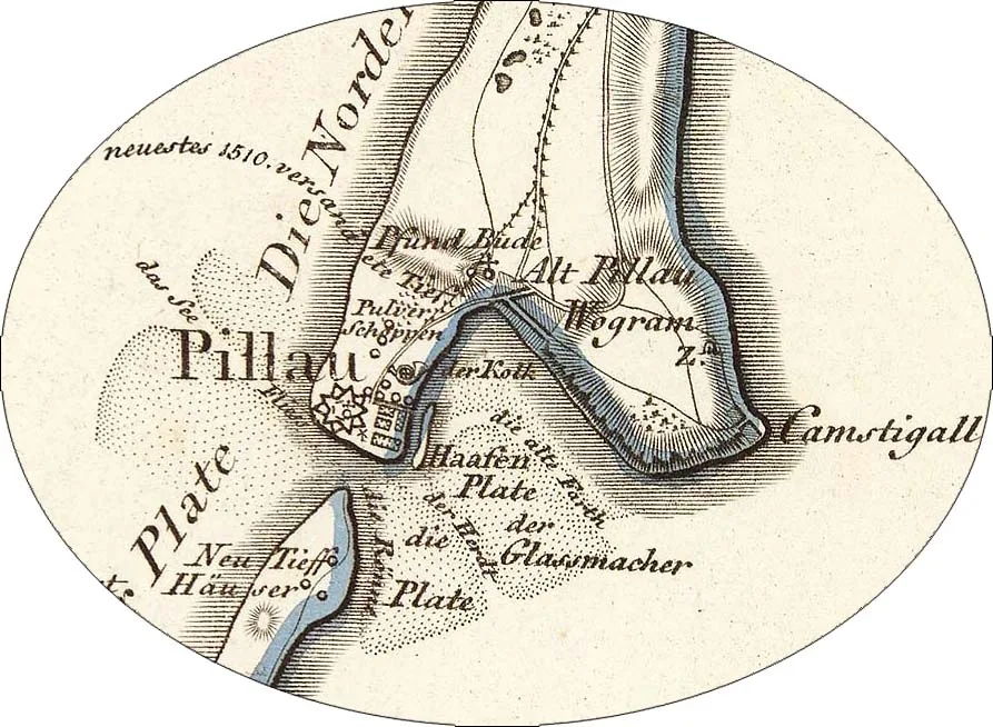
1. neuestes 1510. versandete Tief
(the newest strait, silted up in 1510)
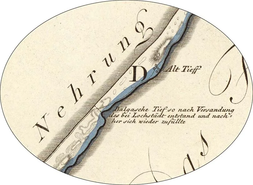
2. Balgasche Tief so nach Versandung des bei Lochstädt entstand und nach her sich wieder zufüllte
(the strait opposite Balga, dug after the Lochstedt strait silted up and later filled in again)
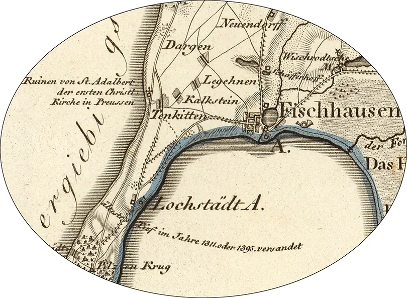
3. ältestes Tief im Jahre 1311. oder 1395. versandet
(the oldest strait, silted up in 1311 or 1395)
The fresh water of the lagoon mixes only slowly with the waters of the Baltic Sea; it even differs in colour from sea water. Its current can sometimes be observed along the western coast of Samland from Pillau to Cape Brüsterort (Brüsterort, now Taran).
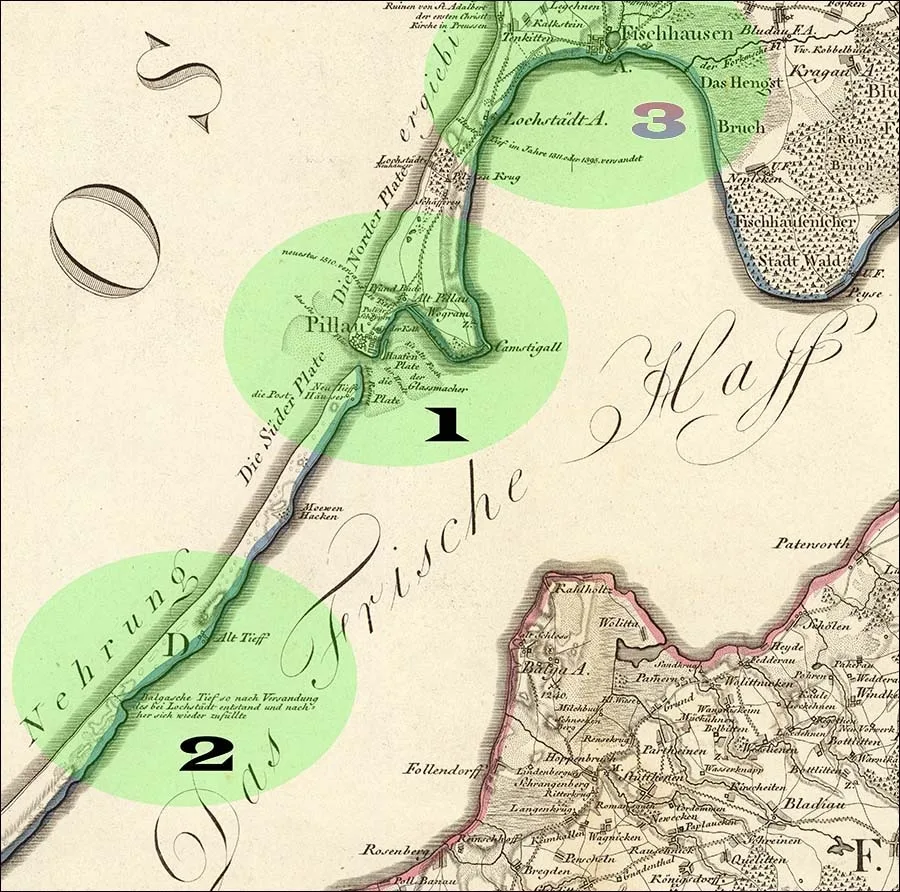 This map of the Frisches Haff and its three details (gestochen von C.Jäck Berlin 1803, see above) are not direct illustrations to the excerpt from Armstedt and Fischer's "Königsberg Local Studies", which speaks of two straits (1 and 2 – the Old and the New). They present a hypothesis that there was an Oldest Strait (3) near Lochstedt Castle – something already questioned in 1891 by the local historian Adolf Bötticher (Adolf Bötticher, 1842–1901), who, citing a certain Panzer, suggested that the strait at Lochstedt "is an invention of Simon Grunau" – editor's note.
Conversely, when the wind blows from the west, salty sea water rushes through the strait into the Frisches Haff, and if a storm lasts several days, it even reaches Königsberg via the Pregel.
(The name Frisches Haff most likely comes from the German word "frisch" (Frisch) – fresh, cool. Other theories link it to borrowings from the Prussian language or even suggest that the shores of the lagoon may once have been inhabited by Frisians, who now live in northern Germany and the Netherlands. The ethnonym "Frisians", in turn, presumably goes back to the Old Germanic words Frese, Fries – "edge", "shore", that is, literally "coast dwellers" – editor's note.)
Between the lagoon and the sea, in the southern part of the sandy spit running from north to south, lies the small town of Pillau. Thanks to its exceptionally advantageous location, its first-class harbour, the growth of trade and the beauty of its natural surroundings, Pillau has become very popular.
In 1626, in order to secure a convenient position in his struggle against Poland, the Swedish king Gustavus Adolphus (Gustav II Adolf, 1594–1632) captured Pillau and ordered redoubts to be built here, which became the basis of the future fortress.
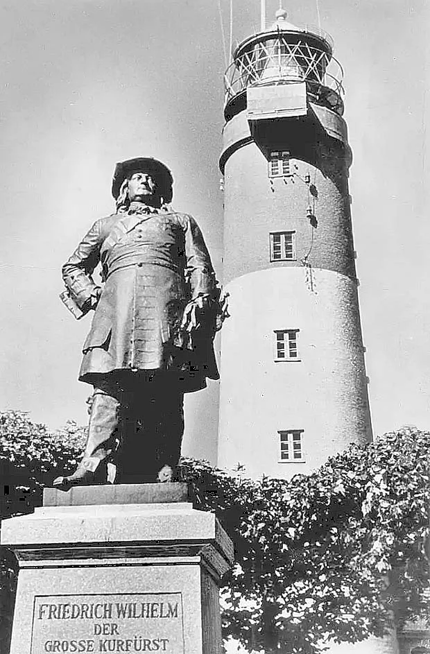
The monument to the Great Elector against the backdrop of the lighthouse.
In 1680, the Great Elector (Friedrich Wilhelm, 1620–1688) expanded the small local settlement by building a shipyard and later a naval harbour, which was to serve as the starting point for his overseas expeditions.
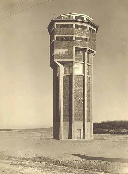
The water tower by the architect Hans Hopp.
He also drew up the plan for expanding Pillau Fortress to its present form, but its implementation began on a large scale only under King Frederick I (Friedrich I, 1657–1713) in the first half of the 18th century. In the process, stones were used from the ancient castles of Balga, Lochstedt and Fischhausen, which were demolished for this purpose at the time. Frederick the Great (Friedrich II. der Große, 1712–1786) did not consider the fortress at Pillau important and from 1770 began gradually selling it off and demolishing it. But his nephew and successor Frederick William II (Friedrich Wilhelm II. von Preußen, 1744–1797) restored the fortress completely. At the same time, the defensive capacity of the Pillau citadel was improved by building additional outworks, and it has survived to this day.
In 1807, the fortress played a significant role. On 18 June, after Napoleon's victory at the Battle of Friedland (14.06.1807), a French detachment arrived at Pillau and demanded the surrender of the fortress. When this was refused, the French laid siege to it.
Although the spit and the outskirts of the town were occupied by the enemy, the fortress garrison defended itself bravely until the conclusion of the Peace of Tilsit. In 1813, Pillau became the first Prussian fortress to be liberated from the French. It was then that Oberleutnant von Tresckow (von Tresckow), with only 300 soldiers at his disposal, moved against the French general Castella (Pierre François Gilbert Castella, 1751–1825), who commanded 1,600 men, and forced him to abandon the fortress and the town.
Pillau now has about 3,300 inhabitants. Pillau received town rights on 18 January 1725. Its coat of arms shows a sturgeon wearing an amber crown. Pillau's importance stems above all from its role as Königsberg's ice-free outer harbour, which remains open to shipping even in the harshest winters.
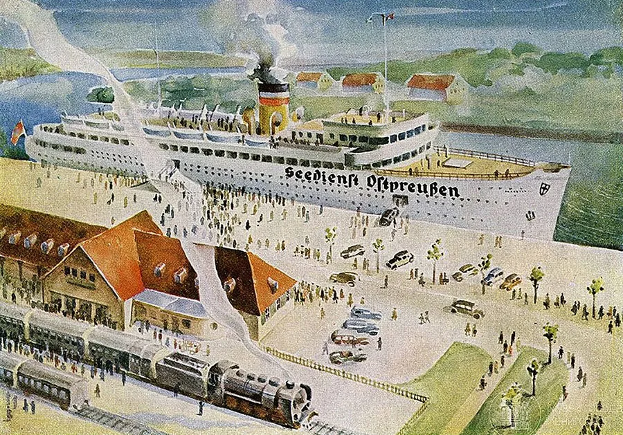 The railway station in Pillau stood right on the pier.
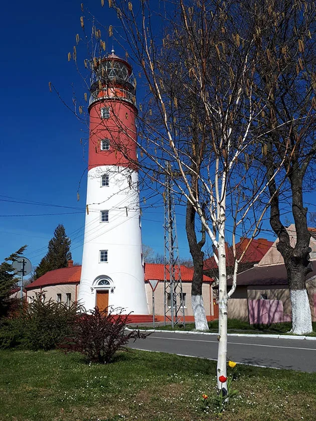
The safety of ships entering Pillau is ensured above all by the lighthouse, built in 1805–1813 on the site of the old, dilapidated pilot tower.
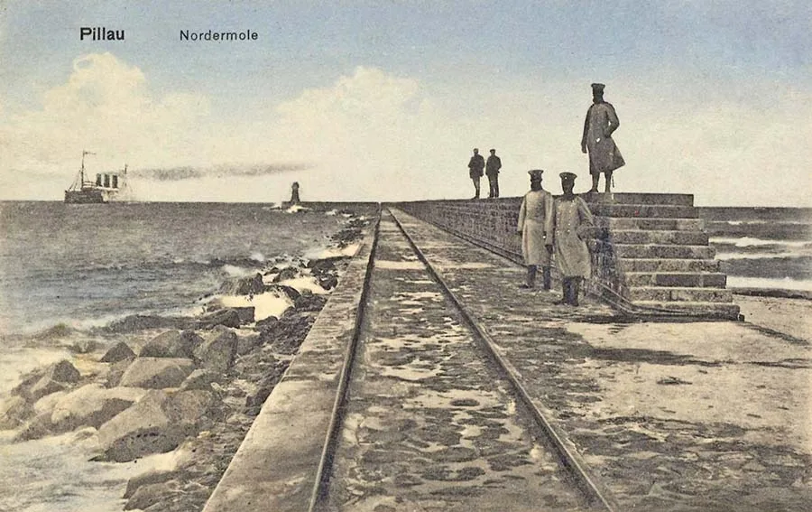 The north mole, protecting the entrance to Pillau harbour.
It stands 31.38 m above sea level, and a flag on the lighthouse indicates the direction of the current in the strait. At night, its bright lamp shows sailors the way. From the lighthouse's observation platform there is a magnificent panorama of the town, the harbour and the expanses of water all around.
Two massive moles protecting the entrance to the strait and the harbour were built at the beginning of the 19th century. They extend about a kilometre into the sea, forming an indestructible barrier against the waves. A small lighthouse stands at the tip of the north mole. Responsibility for the safety of traffic through the strait lies with the pilot service. Its building, erected in 1815, stands on the shore of the lagoon.
Among Pillau's harbours, special mention should be made of the inner harbour in the east. This harbour is protected from the lagoon's waves by the Russian Dam (Russische Damm), built in 1759–1760 by the Russians, to whom East Prussia then belonged.
Today it serves the needs of the shipyard and the many workshops nearby. A second dam, stretching east of the Russian one, encloses the so-called Petroleum Harbour (Petroleumhafen), where ships carrying petroleum products moor. The former chief building director Hagen (Gotthilf Hagen, 1797–1884) played an important role in creating and modernising all these splendid structures. The merchants of Königsberg paid tribute to him by erecting a granite monument to him on the Russian Dam in 1887.
North of the harbours, not far from the twin villages of Alt-Pillau and Wogram (Zwillingsdörfer Alt-Pillau und Wogram), rises the Schwalbenberg or Schwalkeberg (Schwalbenberg / Schwalkeberge, Swallow Hill), from whose height one can enjoy a magnificent view of the town, the ships and the smooth waters of the lagoon. The summit is crowned by the brick landmark known as the "Landmarke" (Landmarke), whose shape resembles an open book.
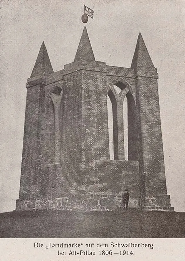
The "Landmarke" on the Schwalbenberg.
The landmark is 14 metres high. It was built in 1812 and consists of three columns, with a pointed spire and a weather vane above the central one. The columns are linked by walls with Gothic arches.
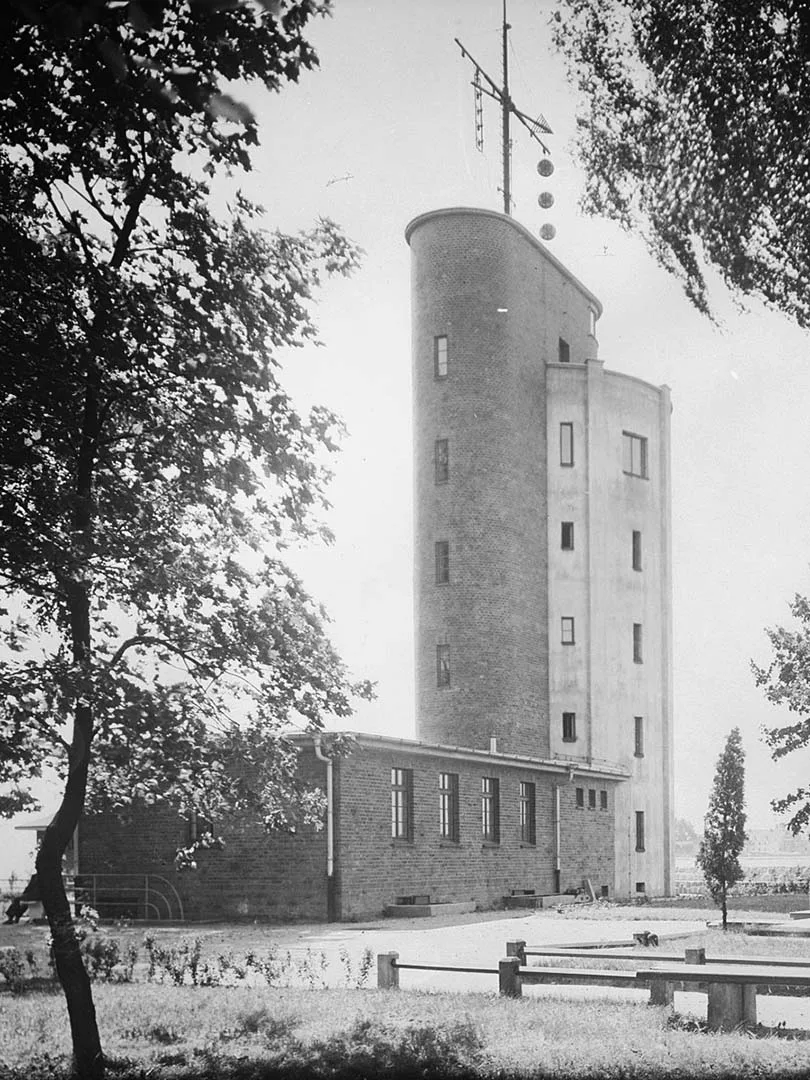
The pilot tower, built in the 20th century.
(According to other sources, the "Landmarke", designed by Schinkel (Karl Friedrich Schinkel, 1781–1841), appeared in Pillau in 1806 and was blown up in 1914 for unknown reasons. The term "Landmarke" goes back to Masonic traditions, in which it means "rules" or "commandments". This most likely explains its shape. The town's name "Pillau" comes from the Prussian word "pil", meaning fortress. The first records of a Prussian settlement here date from 1258 – editor's note.)
The surroundings of Pillau were once covered with dense forests all the way to Fischhausen (Fischhausen). But when the Swedes tried to attack Pillau by land in 1657, the fortress commandant Pierre de la Cave (Pierre de la Cave, 1605–1679) ordered all the trees to be ruthlessly felled almost as far as Lochstedt (Lochstedt), and on the spit as far as Alttief (Alttief). As a result, the sands began advancing rapidly almost at once, threatening even the harbour. It became clear that reforestation measures would have to be taken, but work began only in 1793. As a result, a new suburb appeared north of Pillau – today's Plantage district (Plantage). Trees were also planted on the dunes in the neighbouring resort of Neuhäuser (now the settlement of Mechnikovo, part of the town of Baltiysk). In this way, General de la Cave's mistake was corrected.
The seaside resort of Neuhäuser (Neuhäuser, now the settlement of Mechnikovo within the town limits of Baltiysk) lies six kilometres north of Pillau. The first thing to appear here was a colony of villas belonging to wealthy Königsberg merchants. Now it receives more than a thousand holidaymakers every year.
After the railway was built, the place grew more attractive and expanded rapidly. At some distance from the station, the building of the local spa house (Kurhaus) rises on a beautiful hill. Right at the edge of the surf, a beach pavilion (Strandhalle) was built on the sand. Further south in the forest, closer to Pillau, an observation tower stands on the Jubilee Height (Jubiläumshöhe). There is also a superb view of the sea and the surroundings from the Pancake Hill (Pfannkuchenberg), the highest point in this part of the spit.
North of Neuhäuser, the peninsula is covered across its entire width by deciduous forest with magnificent old trees. It is divided by the railway line and the road to Pillau and is known in its western part as the Mushroom Forest (Pilzenwald) and in its eastern part as the Lagoon Forest (Hafswald). This is the northernmost place where a significant number of European purple beeches, also known as "copper beeches", still survive.
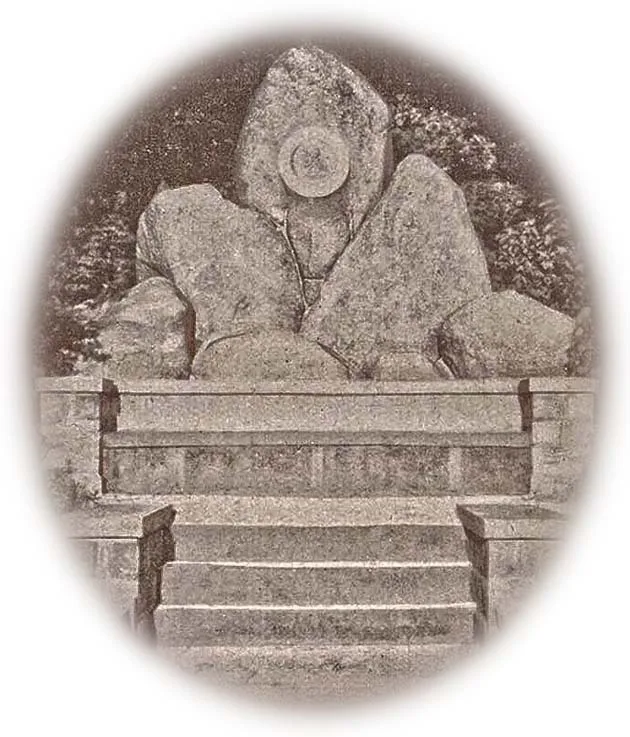
Monument to Building Director Hagen.
Photo: Bildarchiv Ostpreußen.
Translated from Russian with the help of AI (Claude, Anthropic), October 2026.