 Coat of arms
of Ragnit
Until 1277 (or until 1275 according to other sources) the Prussian (Scalovian) stronghold of Ragnita stood near the present-day town of Neman. In that year the Vogt of Sambia, Dietrich von Liedelau / Liedelau, led a campaign, sailing by ship from the mouth of the Memel to Ragnita. The stronghold was attacked by a detachment of the Order. After several assaults the garrison was slaughtered and the inhabitants taken prisoner. In the course of this or the following (1279) expedition the neighbouring Scalovian stronghold of Ramige (Rambynas) was also destroyed.
After Prussian resistance had been crushed in 1283, it became necessary to defend the territories already taken against the Samogitians, and plans were also being made for further expansion into Lithuania. This required strongholds on the Memel (Neman). One of them was the Order's castle of Landeshut, founded in 1289 on the ramparts of the destroyed Ragnita.
The founder of the castle is considered to be Brother Meinhard von Querfurt / Querfurt (d. 1299), appointed Landmeister of Prussia in 1288. Over time the castle came to be called by the old name Ragnita, which gradually (by 1326) turned into Ragnit.
It is assumed that the castle measured 109 x 50 m, towered above the Memel and had several separate outer baileys. Given the castle's strategic importance, a strong garrison of 40 brothers of the Order and 100 men-at-arms was stationed there under the command of the castle's first Komtur, Berthold von Brühaven / Bruehaven. The commandery was moved here in 1289 from Labiau / Labiau (Polessk), as the latter had lost some of its military importance. Another castle of the Order, Schalauerburg, was built in the vicinity of Ragnit.
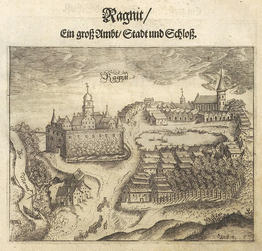 Ragnit. Engraving by Christoph Hartknoch, 17th century.
As early as 1290 a detachment of the Order made its first sortie from Ragnit Castle into Lithuanian lands; it ended in failure – the detachment was lured into an ambush and wiped out. In 1295 it was the Lithuanian forces that twice attacked Ragnit; both times they failed to take the castle, but the suburbs and outer baileys of Ragnit and Schalauerburg were ravaged.
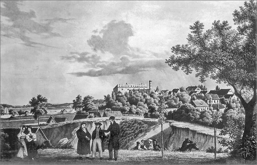 View of the town and castle of Ragnit. Lithograph by an unknown artist, 1850.
The next major Samogitian attack on Ragnit came in 1315. The Order's garrison spotted the attackers in time, prepared for defence and repelled the assault. Before Christmas 1355 Ragnit Castle was badly damaged by fire. It was rebuilt over the winter of 1356, but between Easter and Pentecost another fire broke out there. To strengthen the border territory and support Ragnit, the Teutonic Knights built the castles of Wenkischken / Wenkischken and Splitter / Splitter (Sovetsk, part) and rebuilt the previously burned Schalauerburg. But as early as 1365 all of them were captured and burned by the Lithuanians.
In these circumstances Ragnit's role only grew. It is known that from the second half of the 14th century Ragnit Castle was already equipped with firearms. Thus the inventory of 04.12.1379 mentions seven guns, the inventory of 19.11.1392 two large and three small guns and 15 case-shot guns, and the inventory of 01.05.1396 six guns and 14 case-shot guns.
At the end of the 14th century, in view of increasing pressure from Lithuania, it was decided to rebuild Ragnit Castle radically and move it to a new site, since the old one, though very convenient, was too small for a larger structure. In effect this meant building a new castle.
Thirty master builders worked on the construction under the overall direction of the architect Nikolaus Fellenstein / Fellenstein from Koblenz, who is also known for the castles of Tilsit / Tilsit (Sovetsk) and Bütow / Bütow (Bytów, Poland). Documents also state that in 1403 craftsmen from Danzig / Danzig (Gdańsk, Poland), Elbing / Elbing (Elbląg, Poland), Balga / Balga (Vesyoloye), Marienburg / Marienburg (Malbork, Poland) and from Pomerania took part in building Ragnit. From Sambia alone about 1,200 people were sent to the works. The construction of the castle became an event of national importance; building materials were supplied from different parts of the Order's state. By 1397 the foundations and cellars had been completed and work began on the walls, which was finished by the summer of 1402. In the same year the rafters and roof were put up. Also by 1402, 2.3 t of white glass and another 0.2 t of coloured glass had been delivered to the site, and finishing work began. In 1403 the castle was already occupied, but further construction continued until 1409: in 1404 the moat, a dam and the castle pond were built, in 1404–05 a temporary dansker, and by 1405 work on the castle itself had been completed. In 1406 an outer bailey, a defensive walkway and a tower were built. In 1407–08 the west wing was painted with coats of arms. In 1409 Grand Master Ulrich von Jungingen / Jungingen (1360–1410) arrived at the castle, and in his presence Ragnit Castle was consecrated. According to the inventory of 1407, the castle had 11 guns, 18 case-shot guns and 248 crossbows. The crushing defeat of the Order's army at the Battle of Grunwald on 15.07.1410 prevented the planned construction of a permanent dansker. An inspection in 1420 already noted the unsatisfactory condition of the temporary dansker.
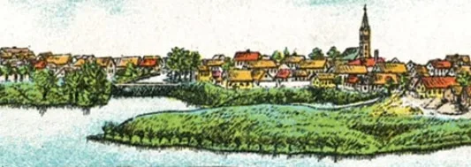
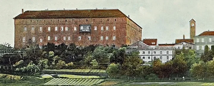
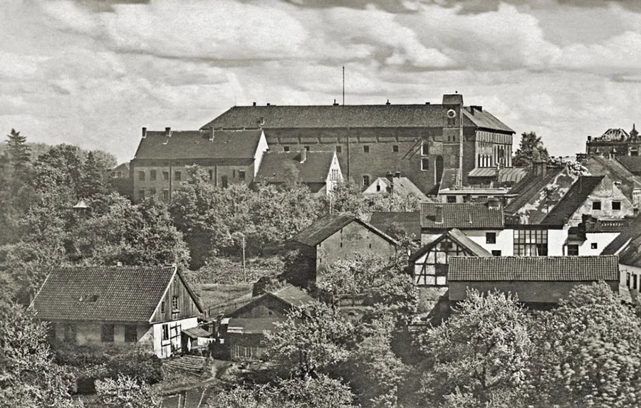 Panorama of Ragnit with a view of the castle.
During the Thirteen Years' War (1454–66) Ragnit Castle was captured by supporters of the Prussian Confederation; in 1455 the Order's troops took it back from them. Around 1517 the first church was built in the settlement by Ragnit Castle, which received the same name.
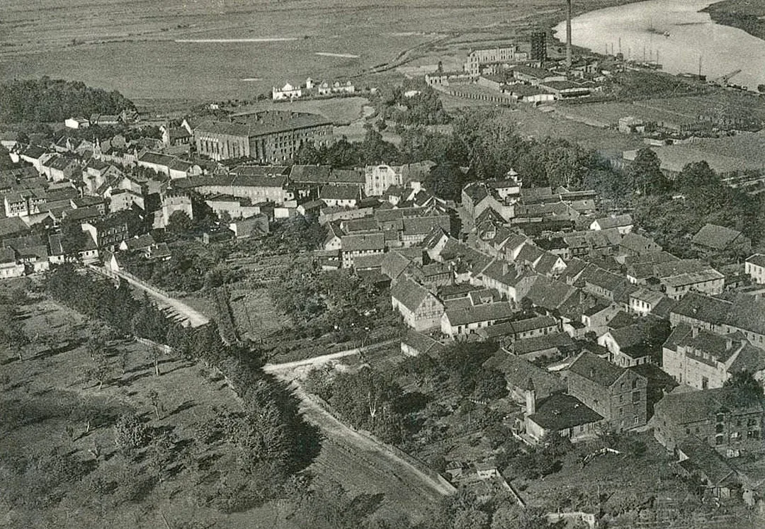
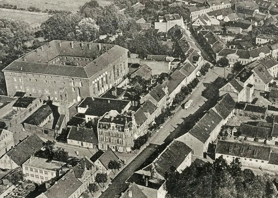 View of Ragnit Castle and the Market Square from a bird's-eye view.
After the secularisation of the Order in 1525 the former commanderies became Hauptämter (“main offices”). The Hauptamt of Ragnit was also formed; it included ordinary Ämter (or Schulzenämter), which administered rural districts with communal villages, and Domänenämter (from 1722), which administered royal estates (domains) that were leased out. Ragnit Castle now housed the residence of the head of the Hauptamt and various administrative institutions.
In 1548, since the Order's fortifications were hopelessly outdated, it was decided to build fortifications of ramparts and bastions around the castle on the north, south and east, but apparently these intentions were never carried out. In 1648 dilapidated buildings at the castle were demolished.
In 1709–11 another plague epidemic swept through Ragnit, as through the whole of Prussia, considerably reducing the number of its inhabitants. The measures taken by King Frederick William I to attract settlers to the region to make up for the population losses culminated in 1722 in the granting of town rights to Ragnit.
In 1723 the defensive wall by the castle was dismantled. The court architect Joachim Ludwig Schultheiß von Unfriedt / Unfriedt drew up a plan for building the centre of the new town. Also under Frederick William I the town was surrounded by a palisade.
The first church in Ragnit was burned during the advance of the Russian army in 1757 in the Seven Years' War (1756–63). The new church was built in 1772 on the same site.
After 1800 Ragnit Castle began to be used as a prison, which entailed considerable alteration of the medieval rooms. During the War of the Fourth Coalition (in Soviet and Russian historiography, the Russo-Prussian-French War) a great fire broke out in Ragnit in 1807. It was followed by another plague epidemic, which claimed the lives of 260 people.
From 1818 Ragnit was the centre of the newly created Kreis (district) of the same name. On the night of 2–3 August 1828 a major fire broke out at Ragnit Castle, and it burned out completely. By 1840 the castle had been restored; its rooms now housed the town and district court as well as a prison. In 1849 a military tribunal was added to these institutions, and in 1879 an administrative court.
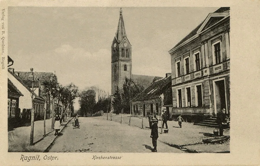 The Ragnit church on a postcard by the local publisher B.Quednau.
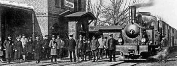
In 1871 the municipality of Ragnit included, besides the town itself, another 14 localities and suburbs with a total of 212 dwelling houses. In 1892 the Tilsit – Stallupönen / Tilsit – Stallupönen (Sovetsk – Nesterov) railway was run through Ragnit, and a station was built on it in the town.
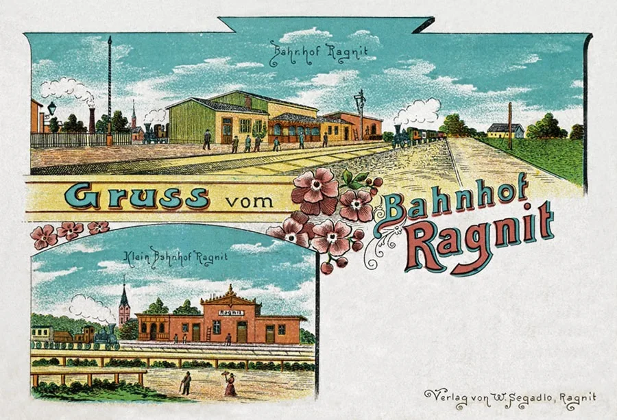 The Ragnit railway stations on a postcard by the local publisher W.Segadlo.
In 1912 the pulp and paper company Zellstofffabrik Ragnit AG was founded. Woodworking and the pulp and paper industry became the basis of Ragnit's economy. At the beginning of the 20th century children were taught at a secondary school and a private boys' school. There was a seminary for advanced teacher training and an agricultural winter school. The town also housed the district administration, a court, a post office and a customs office. Market days were Wednesday and Saturday.
On 16.08.1922 Ragnit lost its status as a district centre, as the Kreis of Ragnit was merged with the Landkreis of Tilsit (Sovetsk) into a single Landkreis of Tilsit-Ragnit, with Tilsit as its centre.
On 30.09.1928 the abolished Gutsbezirk of Althof-Ragnit / Althof Ragnit (Michurinskoye), consisting of the Althof-Ragnit estate itself and the outlying farm of Althof-Krakonischken / Althof-Krakonischken (from 1936 Althof / Althof, 55°03'54'' N, 22°01'58'' E), was incorporated into the municipality of Ragnit. On 01.01.1931 the rural community of Dorlauken / Dorlauken (from 1938 Dorfelde / Dorfelde, 55°00'55'' N, 22°03'09'' E) also became part of Ragnit. As a result, in 1931 the municipality of Ragnit comprised only 11 localities and suburbs in all: the town of Ragnit, Althof-Krakonischken, Althof-Ragnit (Michurinskoye), Bernhardshof (Neman, part), Glossinehlen / Glossinehlen (from 1938 Glossen / Glossen, 55°05'02'' N, 21°59'57'' E), Hagelsberg (Neman, part), Dorlauken, Fabiansruh (Neman, part), Heilsberg (“Voskhod” garden partnership), Lehrhof-Ragnit (Neman, part), Lerchenberg / Lerchenberg (55°00'53'' N, 22°02'24'' E). The municipality had 421 dwelling houses and 1,810 outbuildings. The town had a pulp and paper mill, a brickworks and a gasworks, a plywood factory and an engineering works, and a brewery. There was a river port on the Memel, through which grain and other cargo were shipped.
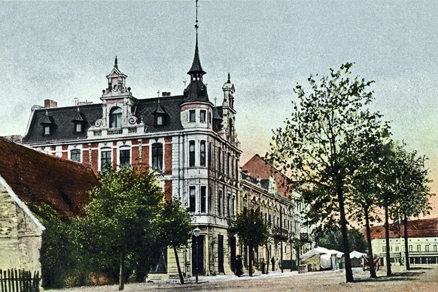 The Market Square of Ragnit.
During the Red Army's East Prussian Operation, which began on 13.01.1945, Ragnit lay in the zone of the offensive in the Tilsit direction. The Wehrmacht abandoned the town without fierce fighting. On the morning of 18.01.1945 soldiers of the 263rd Rifle Division (Col. K. G. Cherepanov) of the 54th Rifle Corps of the 43rd Army entered the town.
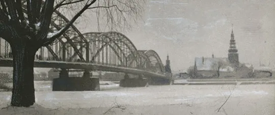
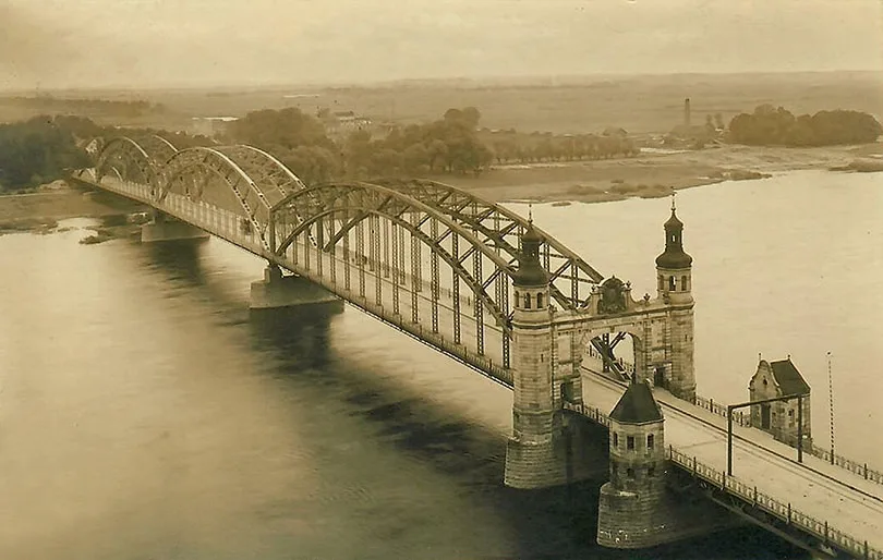
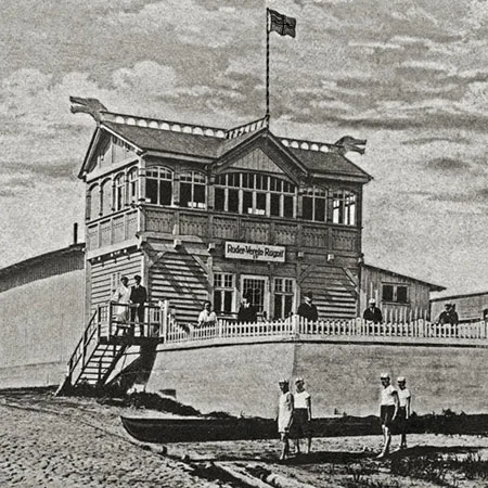
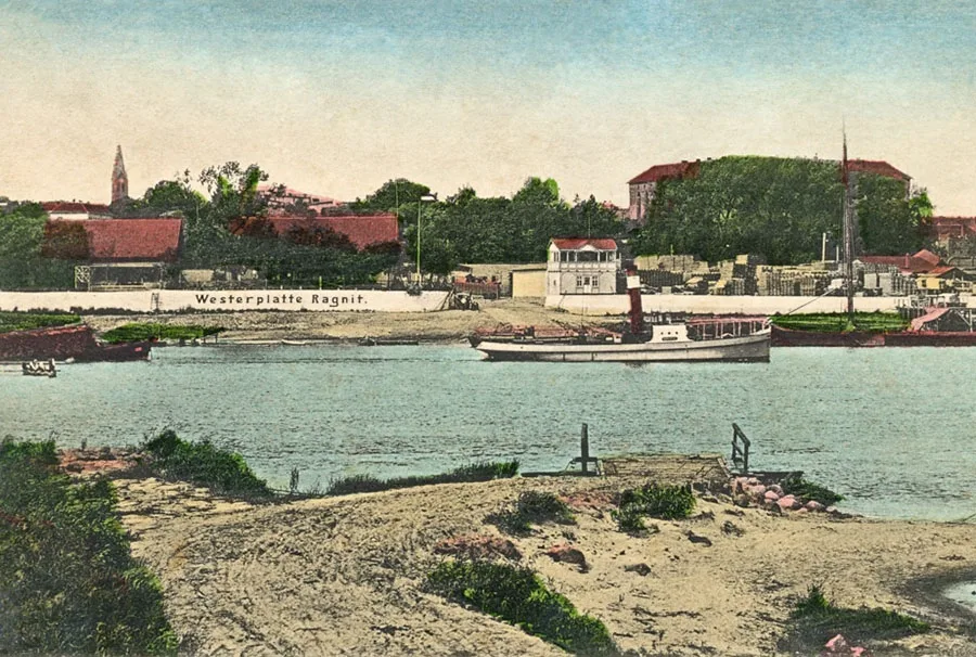 The Ragnit landing stage. View from the opposite bank of the Memel (Neman).
Although Ragnit was taken with minimal destruction, the post-war condition of its industrial facilities was unsatisfactory. The town's enterprises had been put out of action, and the main equipment dismantled and removed. Work at Ragnit's enterprises was resumed in stages as the workshops were restored. As early as 1945 a sulphite alcohol plant was started up, which later became part of the Neman Pulp and Paper Mill. Specialists from Kuibyshev and from the Moscow, Voronezh and Penza regions arrived to restore the town's pulp and paper industry. The Neman Pulp and Paper Mill itself (then still Ragnit) was established on 11.05.1945. A year later it produced its first batch of finished products. Also in 1946 the main high-voltage lines were restored and a pumping station was put into operation, giving the town's population and enterprises central water supply. In October an FZO (factory apprenticeship) school was set up at the mill, which began training workers for it.
On 17.06.1947 Ragnit was renamed the town of Neman, which became part of Sovetsk District. On 25.07.1947 Neman was granted the status of a town of regional subordination and became the centre of Sovetsk District (renamed Neman District on 04.04.1958).
In 1947, besides the pulp and paper mill, which became the town's core enterprise, Neman also had a municipal fuel depot, a municipal industrial combine, a municipal utilities department and the “Vperyod” and “30 Years of October” production cooperatives. In 1948 a 30-place kindergarten for the mill's employees opened. In the same year the district newspaper “Leninets” began to appear, and a furniture factory and a municipal food-processing combine started work. In 1948 Neman had 13 grocery shops, two manufactured-goods shops, five bakeries, three canteens, seven snack bars and two tea rooms. In 1949 the Neman bread-baking plant started work.
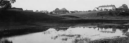
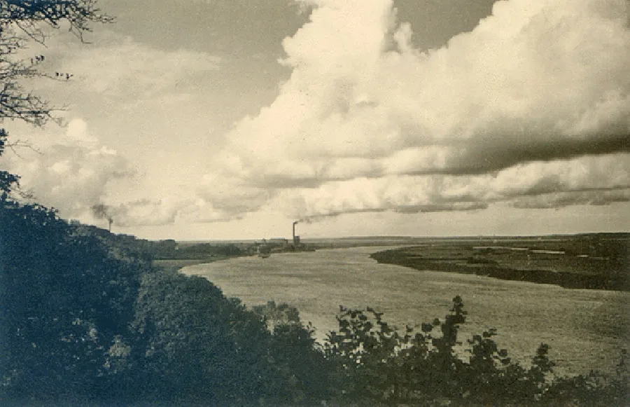 View of the Memel River (Neman) and Ragnit from Tussainen.
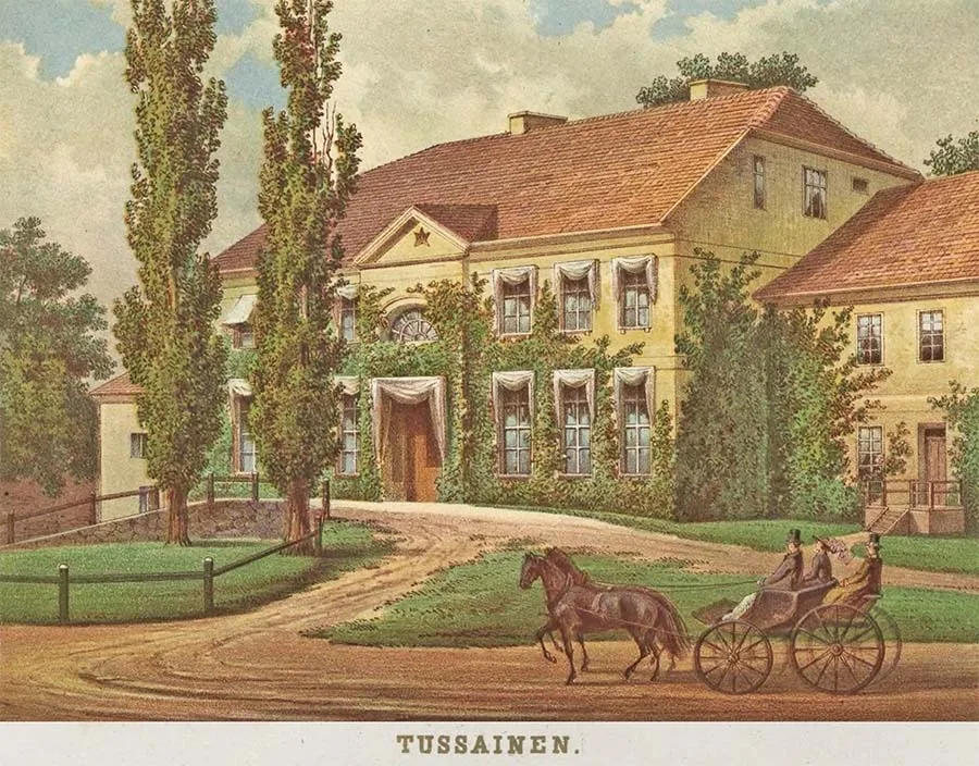
Soviet families initially lived in the Tussainen manor, but after 1948 the manor house was blown up for unknown reasons.
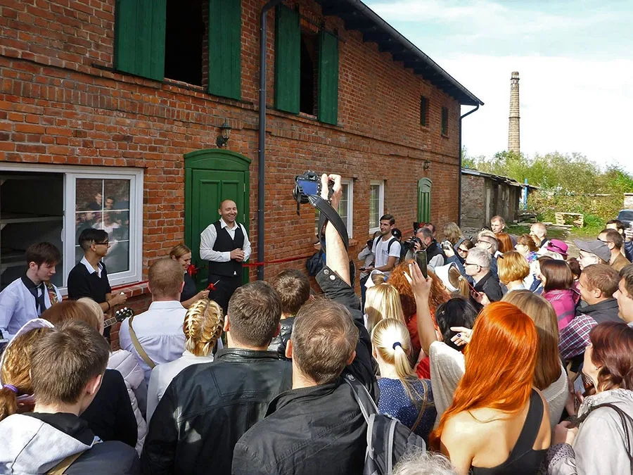 Opening of the “Tilsit-Ragnit Region Cheese Dairy”, 1 October 2016.
The network of educational and cultural institutions also developed. In 1948 the town had a primary and a secondary school, and as early as 1949 a school for working youth and another primary school opened in addition. In 1948 a library was operating in Neman, and in 1949 the “Rodina” cinema opened. In 1951 the club of the Neman Pulp and Paper Mill began operating. In 1949 the Neman–Sovetsk train was launched, and in 1950 shuttle taxis between the towns also went into service. On 05.07.1950 Tussainen was renamed the settlement of Chapayevo; it would become part of the town of Neman only around 1972. By 1955 medical facilities comprised a 100-bed hospital, a 25-place medical unit, a women's clinic and three feldsher posts. The first 60-place crèche opened.
In 1957 staff of Kaunas University of Technology carried out a detailed photographic survey of the ruins of Ragnit Castle.
In 1963 a new woodworking enterprise was launched – the future Neman Building Structures Plant. In the 1960s the healthcare problem was fully solved: the town acquired three hospital facilities with 170 places. There were two crèches with 160 places and two kindergartens. At that time Neman had two bread shops, a dairy shop, a farm produce shop, a haberdashery, a school supplies shop, a second-hand consignment shop and a rental outlet. In 1962 the territory of Neman District was divided between Slavsk and Krasnoznamensk Districts, but as early as 1965 Neman District was restored and the town regained its status as a district centre. In the 1960s a children's music school and a consumer services centre appeared in Neman.
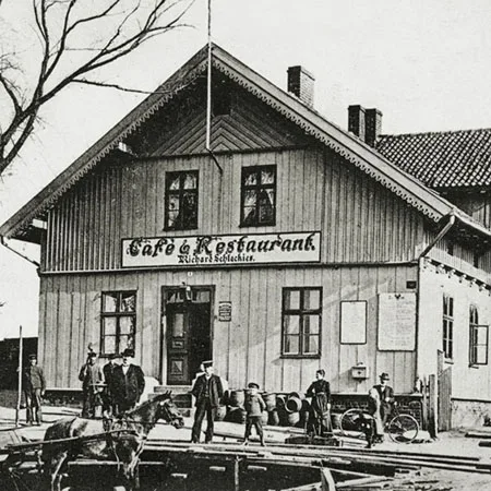
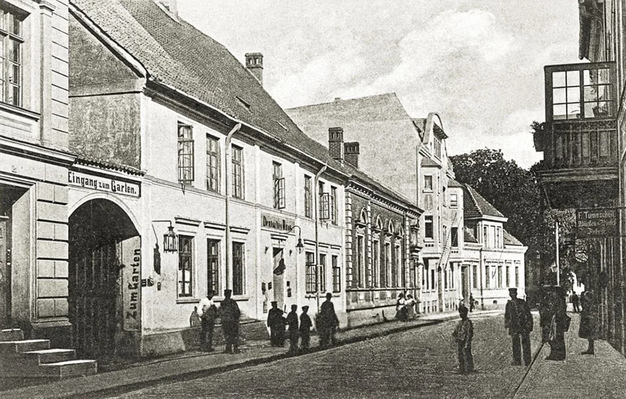 Hotel and restaurant Deutsches Haus on Polish Street (now Pobedy Street).
In the 1970s the Neman Pulp and Paper Mill was a supplier of high-quality pulp and paper, whose products were sold throughout the USSR.
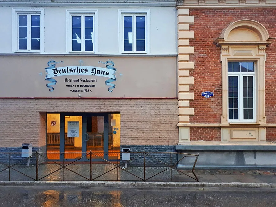 Office of the castle and cheese dairy on Pobedy Street (formerly Polish Street).
The town itself became noticeably more attractive to live in: in education there were secondary, eight-year, evening and children's music schools, as well as four kindergartens, a House of Culture, the mill's club, the “Rodina” cinema, three libraries, a House of Pioneers, two department stores (“Neman” and “Neva”), a large bookshop, the “Aist” café, a restaurant, a bathhouse and a stadium.
In 1976 the feature film “Twenty Days Without War” was shot at Ragnit Castle, during which one of the castle's inner walls was blown up. In 1977 another film, “The Soldier and the Elephant”, was shot in Neman, but this time no damage was done to the historical heritage. Remarkably, according to published reports, in 1979 the oldest resident of the region, N. P. Lomakina, who had then turned 125, lived in Neman (this claim appears highly doubtful). In the 1980s the town gained a fashion atelier, a consumer services house, two new cafés, a TV repair shop and a transport agency. There were 14 grocery shops and seven manufactured-goods shops, and a radio broadcasting office opened.
Life in Neman, as in the whole country, changed abruptly with the onset of “perestroika” and the transition to market relations. In 1992 the Neman municipal trade organisation was dissolved, and all the retail outlets belonging to it were privatised.
In 1993 the pulp and paper mill, the building structures plant and the bakery became joint-stock companies. Numerous cooperatives opened and closed, lasting from 2 to 14 years. Among the positive changes was the development of tourism (primarily from Germany). The “Neman-Plön” society had the castle's clock tower repaired. In 1995 the film “I Am a Russian Soldier” was shot at Ragnit Castle, again using pyrotechnics. As a result of corporatisation the pulp and paper mill passed to a foreign owner and in 1998 stopped production. At the same time problems arose with heating and hot water supply, which had been provided by the plant's combined heat and power station. The bakery was closed at the same time. The mill did, however, resume work in 2000 after another resale. Moreover, by 2004–05 the Neman Pulp and Paper Mill was once again considered a leading enterprise in the industry, highly profitable, holding the necessary certificates and exporting its products. Soon, however, the enterprise was seized for the owners' debts, and the creditors began dismantling the buildings for building materials and selling off the equipment.
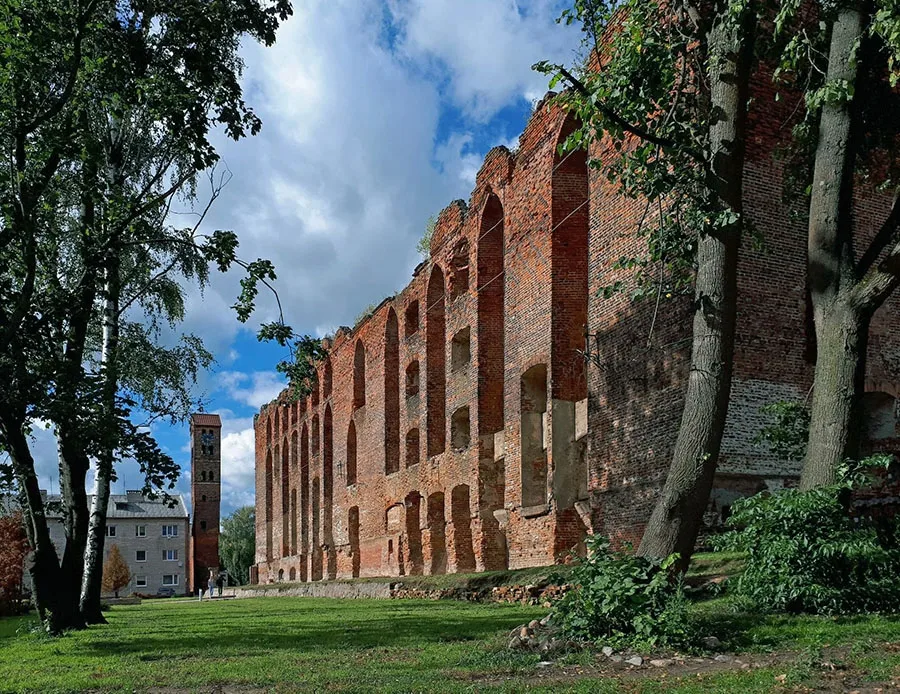 Ragnit Castle, 2020.
In 2004 gas supply reached the town through a newly built gas pipeline. In 2010 deputies of the regional duma handed over the ruins of Ragnit Castle to the Russian Orthodox Church.
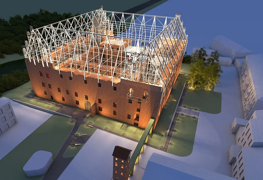 Reconstruction project for Ragnit Castle.
In 2017 the building structures enterprise resumed work. In 2018, after a series of scandals and criminal cases against its owners, Neman Pulp and Paper Mill LLC was liquidated.
In 2019 Ragnit Castle was leased by a local entrepreneur; its grounds were cleared by volunteers, and work began on stabilising the ruins and making them more attractive to tourists. As of 2021 the town had 40 streets, eight lanes, 10 cafés, four bank branches, two hotels and a stadium. There are two schools, two kindergartens and a district hospital (children's, adult and infectious-disease wings and an outpatient clinic). The site of the Tussainen manor is now crossed by the boundary of the town cemetery, and several buildings also stand there. The site of former Fabiansruh is now occupied by the Neman motor transport company, and the site of Bernhardshof by residential buildings Nos. 105, 107 and 109 on Pobedy Street. Of the Heilsberg farm, apparently no traces remain; the “Voskhod” garden partnership has been laid out on its site. At Lehrhof-Ragnit the buildings were demolished in the early 1980s, and today there is waste ground there. On the site of Hagelsberg there is a tree-covered stretch of the Neman bank next to the ruins of the workshops of paper mill No. 2.
Sights: ruins of Ragnit Castle (14th–15th centuries), church (1772), hospital building (late 19th century), town school (1903), water tower (1903), agricultural school (early 20th century), residential buildings of the late 19th – early 20th centuries, memorial to those who fell in the First World War (1924, restored 1991), public building (1930s), mass grave of Soviet soldiers (90 people, memorial 1948), monument to the Prussian princess Ragneta (2012).
Population dynamics of Ragnit-Neman: 1782 – 1882, 1802 – 2083, 1810 – 1777, 1816 – 2018, 1821 – 1990, 1843 – 2791, 1867 – 3638, 1871 – 3687, 1875 – 3875, 1880 – 3580, 1890 – 3953, 1895 – 4591, 1905 – 4908, 1910 – 5535, 1925 – 7780, 1933 – 9293, 1939 – 10,061, 1947 (Jan.) – 30141, 1959 – 9459, 1970 – 11,613, 1979 – 12,492, 1989 – 13,821, 1996 – 13,800, 1998 – 13,500, 2002 – 12,714, 2010 – 11,798, 2012 – 11,677, 2013 – 11,589, 2014 – 11,346, 2015 – 11,346, 2016 – 11,130, 2017 – 10,931, 2018 – 10,867, 2019 – 10,864, 2020 – 10,756 inhabitants.
Composition of the population of Ragnit in 1871: Evangelical Christians – 3603, Catholics – 19, other Christians – 24, Jews – 41, children under 10 – 814, literate – 2120 (75%), blind – 5, deaf-mute – 4, insane – 9.
1 – excluding military personnel; including 464 Germans.
For reference
Tussainen lay in an area settled by Prussian tribes back in the pre-Teutonic period.
Tussainen was owned by the von Sanden / Sanden family, known in Prussia since the 16th century. The family line began with Philipp Sanden (d. 1672/73), who worked as a clerk for Elector Frederick William. Over the centuries members of this family owned the ancestral estate of Hans-Pandieben / Hans-Pandieben, which was renamed Tussainen by 1785. It was a huge area that included the picturesque locality of Daubas / Daubas with the Böttcher-Krug / Böttcher-Krug inn (55°01'21'' N, 22°05'34'' E), the outlying farms of Karlsberg / Karlsberg (Korobovo) and Tracken / Tracken (55°00'31'' N, 22°02'40'' E), Georgenwalde / Georgenwalde, part of the village of Ober Eißeln / Ober Eißeln (Ryadino holiday centre) with 100 Morgen (25.5 ha) of land in a large park, and a hunting lodge. The estate lay in the very beautiful locality of Daubas, overlooking the Memel (Neman). Near the manor house there were large farm buildings, as well as houses for the estate workers, a tree nursery, a wheelwright's workshop, a smithy and the estate inn. In addition, from 1874 the Gutsbezirk of Tussainen included the Schillis / Schillis forestry (from 1938 Heidewald / Heidewald, 55°01'25'' N, 22°11'11'' E). The Tussainen estate belonged to the parish of Ragnit / Ragnit (Neman). On 15.04.1874 the Gutsbezirk of Tussainen was included in the newly established Amtsbezirk of Ober Eißeln / Ober Eißeln (Gorino).
At the end of the 19th century the large estate began to break up. In 1895 the outlying farm of Karlsberg (Korobovo) with 125 ha of land was sold to the farmer Loleit / Loleit. Then part of the estate in Unter Eißeln / Unter Eißeln (Bolshoye Selo) was sold, and in 1908 part of the estate in Ober Eißeln (Gorino). In 1911 the Schillis forestry was sold to the state. Finally, in 1926–27 the lands near the villages of Tussainen (Chapayevo), Endruhnen / Endruhnen (from 1938 Wenderoth / Wenderoth, Vspolye) and Tracken were handed over to numerous settlers, while the last heir, Hans-Sebastian Freiherr von Sanden-Tussainen, was left with only a small part of the former estate – a few hundred hectares of land with the Daubas forest, two inns and part of the village of Ober Eißeln.
On 30.09.1928 the Gutsbezirk of Tussainen was abolished and merged with the rural community of Jautelischken / Jautelischken (from 1938 Tehlen / Tehlen, Kupriyanovo) and the Gutsbezirk of Endruhnen (Vspolye) from the Amtsbezirk of Titschken / Titschken (Podgornoye) into the new rural community of Tussainen. The new community brought together dozens of farms, with both a permanent population and people who came here for farm work. 80–100 children from the community attended the multi-class school located on the road to Ragnit (Neman). A considerable part of the inhabitants worked in the factories of Ragnit, most of them in pulp and plywood production. The village had two inns, craft and trading businesses and a gendarmerie post.
Population dynamics of the Tussainen community: 1933 – 510, 1939 – 491 inhabitants.
Population dynamics of the Gutsbezirk of Tussainen: 1867 – 350, 1871 – 317, 1905 – 255, 1910 – 263 inhabitants
Composition of the population of Tussainen in 1871: Evangelical Christians – 315, Catholics – 2, children under 10 – 83, literate – 155 (68%), insane – 1.
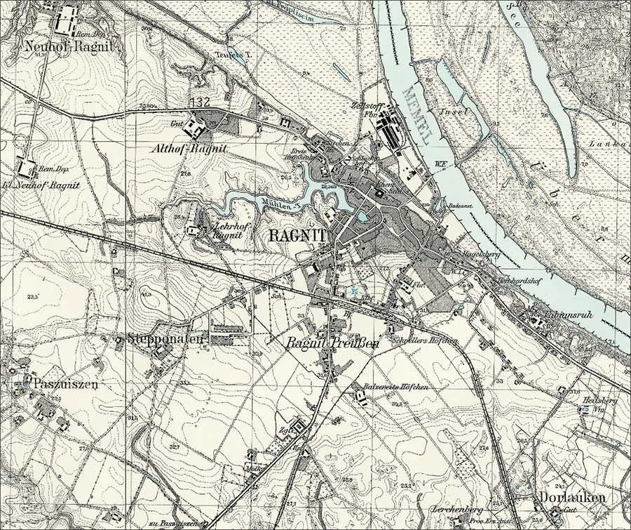
Ragnit-Preußen is mentioned in 1785 as a village with 22 households. By 1820 the number of households had fallen to 20. By 1871 it was a locality within the town of Ragnit with 16 households.
Bernhardshof was founded no later than 1815 as a suburb of Ragnit and was part of the municipality. Bernhardshof belonged to the parish of Ragnit.
Hagelsberg was first a suburb and later a district of the town of Ragnit. It belonged to the parish of Ragnit. In 1871 Hagelsberg had four households; in 1895 their number fell to three, and in 1905 to two.
Fabiansruh was a holding consisting of a single farmstead and was part of the municipality of Ragnit. Fabiansruh belonged to the parish of Ragnit. In the pre-war years Fabiansruh had a windmill and a sawmill.
Heilsberg was founded on 14.10.1840 as an outlying farm belonging to the municipality of Ragnit. The farm belonged to the parish of Ragnit.
Lehrhof-Ragnit was founded as a horse-breeding estate in 1850 and belonged to the local stud administration, while being administratively subordinate to the municipality of Ragnit. Lehrhof-Ragnit belonged to the parish of Ragnit.
Population dynamics of Ragnit-Preußen: 1820 – 163, 1871 – 280 inhabitants.
Population dynamics of Hagelsberg: 1871 – 46, 1895 – 28, 1905 – 17 inhabitants.
Population dynamics of Dorlauken: 1867 – 20, 1871 – 17, 1905 – 17, 1910 – 16 inhabitants.
Population of Bernhardshof: 1905 – 92 inhabitants.
Population of Fabiansruh: 1905 – 21 inhabitants
Population of Heilsberg: 1905 – 16 inhabitants.
Population of Lehrhof-Ragnit: 1905 – 55 inhabitants.
Population of Althof-Krakonischken: 1905 – 4 inhabitants.
Population of Glossinehlen: 1905 – 4 inhabitants.
Population of Lerchenberg: 1905 – 65 inhabitants.
Composition of the Hauptamt of Ragnit c. 1701: Schulzenämter: Leuken / Leuken (Streltsovo), Lasdehnen / Lasdehnen (administrative centre at Neuhof-Lasdehnen / Neuhof-Lasdehnen, Smolenskoye), Tullen / Tullen (Tushino), Usespiauen / Usespiauen (Nikitovka), Daynen / Daynen (54°44'59'' N, 22°46'04'' E), Kraupischken / Kraupischken (Ulyanovo), Saumerau / Saumerau (Zagorskoye), Schaudienen / Schaudienen (Vinogradnoye), Patilsit / Patilsit (Otradnoye), the Übermemel district / Übermemelscher Kreis; Domänenämter (from 1722): Althof-Ragnit / Althof Ragnit (Michurinskoye), Dörschkehmen / Dörschkehmen (54°45'40'' N, 22°38'03'' E), Gerskullen / Gerskullen (Gannovka), Grumbkowkaiten / Grumbkowkaiten (Pravdino), Uschpiaunen / Uschpiaunen (Nikitovka), Kassigkehmen / Kassigkehmen (Kasikėnai, Lithuania), Löbegallen / Löbegallen (Tolstovo), Schreitlaugken / Schreitlaugken (Šereitlaukis, Lithuania), Sommerau / Sommerau (Zagorskoye).
Composition of the parish of Ragnit: Alexen / Alexen (54°58'09'' N, 22°02'06'' E), Althof-Krakonischken / Althof-Krakonischken (from 1936 Althof / Althof, 55°03'54'' N, 22°01'58'' E), Althof-Ragnit / Althof Ragnit (Michurinskoye), Bernhardshof / Bernhardshof (Neman, part), Bittehnen-Schillehnen / Bittehnen-Schillehnen (Bitėnai, Lithuania), Bittehnen-Uszbitschen / Bittehnen-Uszbitschen (Bitėnai, Lithuania), Bludischken / Bludischken (54°57'28'' N, 22°02'01'' E), Brohnen / Brohnen (Gorkino, part), Charlottenwalde / Charlottenwalde (Shirokodolye), Dorlauken / Dorlauken (from 1938 Dorfelde / Dorfelde, 55°00'56'' N, 22°03'07'' E), Endruhnen / Endruhnen (from 1938 Wenderoth / Wenderoth, Vspolye), Fabiansruh / Fabiansruh (Neman, part), Girschunen / Girschunen (55°02'20'' N, 21°57'21'' E), Glossinehlen / Glossinehlen (from 1938 Glossen / Glossen, 55°05'02'' N, 21°59'57'' E), Groosten / Groosten (Gorkino), Neuhof-Ragnit / Neuhof-Ragnit (Kotelnikovo), Gudgallen / Gudgallen (from 1938 Großfelde / Großfelde, Gudkovo), Hagelsberg / Hagelsberg (Neman, part), Heilsberg / Heilsberg (“Voskhod” garden partnership), Ikschen / Ikschen (from 1938 Bergdorf / Bergdorf, Nikitino), Jatelischken / Jatelischken (from 1938 Tehlen / Tehlen, Kupriyanovo), Jonienen / Jonienen (from 1938 Tilsenau / Tilsenau, Otvazhnoye, then Gudkovo), Karlsberg / Karlsberg (Korobovo), Kaukerwethen / Kaukerwethen (54°57'38'' N, 22°01'22'' E), Kiauschälen / Kiauschälen (Kleinmark / Kleinmark, Krasnoye Selo), Kindschen / Kindschen (from 1938 Groß Kindschen / Groß Kindschen, Iskra), Klapaten / Klapaten (from 1938 Angerwiese / Angerwiese, Krasnoye Selo), Klein Neuhof-Ragnit / Klein Neuhof-Ragnit (Akulovo), Krakonischken / Krakonischken (Krakianiškiai, Lithuania), Vorwerk Krakonischken / Vorwerk Krakonischken (from 1938 Neuhof-Kraken / Neuhof-Kraken, 55°04'53'' N, 22°00'53'' E), Kurschen / Kurschen (Rakitino), Lehrhof-Ragnit / Lehrhof-Ragnit (Neman, part), Lerchenberg / Lerchenberg (55°00'53'' N, 22°02'24'' E), Lepalothen / Lepalothen (Loten / Loten, Druzhinino), Mattischken / Mattischken (from 1938 Klingsporn / Klingsporn, Zhuravlyovo), Ober Eißeln / Ober Eißeln (from 1938 Obereißeln / Obereißeln, Gorino), Palentienen / Palentienen (from 1938 Palen / Palen, Dubravino), Paskallwen / Paskallwen (from 1938 Schalau / Schalau, Dubki), Paszuiszen / Paszuiszen (from 1938 Altengraben / Altengraben, Ruchyi), Pellehnen / Pellehnen (from 1938 Dreidorf / Dreidorf, Zhdanki), Pötischken / Pötischken (from 1938 Flachdorf / Flachdorf, Ivovoye), Petratschen / Petratschen (from 1938 Petersfelde / Petersfelde, Petrovo), Pröwoiszen / Pröwoiszen (from 1938 Scheiden / Scheiden, Barvenkovo), Schuppinnen / Schuppinnen (from 1938 Schuppenau / Schuppenau, Zharovo, later Vetrovo), Sobersken / Sobersken (from 1938 Bersken / Bersken, Valtsovo), Steinegger / Steinegger (Gorkino, part), Stepponaten / Stepponaten (from 1938 Steffenshof / Steffenshof, Michurino, part), Stiemerau / Stiemerau (54°58'59'' N, 21°59'04'' E), Titschken / Titschken (from 1938 Tischken / Tischken, Podgornoye), Tracken / Tracken (55°00'31'' N, 22°02'40'' E), Tussainen / Tussainen (Chapayevo, later Neman, part), Wallullen / Wallullen (from 1938 Wallenfelde / Wallenfelde, 54°58'36'' N, 22°00'47'' E), Willmantienen / Willmantienen (from 1938 Willmansdorf / Willmansdorf, 55°02'10'' N, 21°55'11'' E), Woydehnen / Woydehnen (from 1938 Wodehnen / Wodehnen, Vetrovo).
Photos on this page: Bildarchiv Ostpreußen, bildarchiv-ostpreussen.de, Mikhail Ogorodnikov.
Translated from Russian with the help of AI (Claude, Anthropic), October 2026.