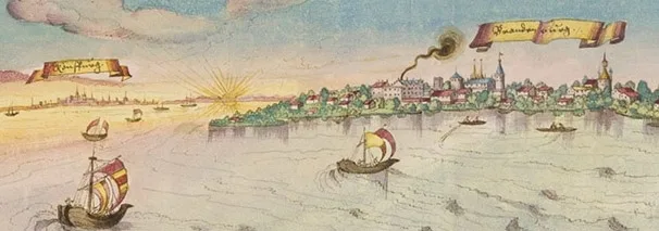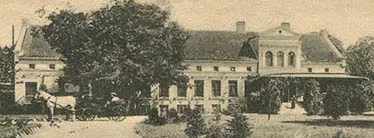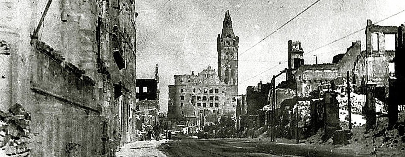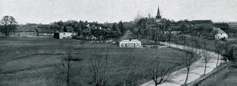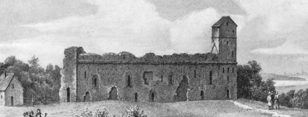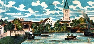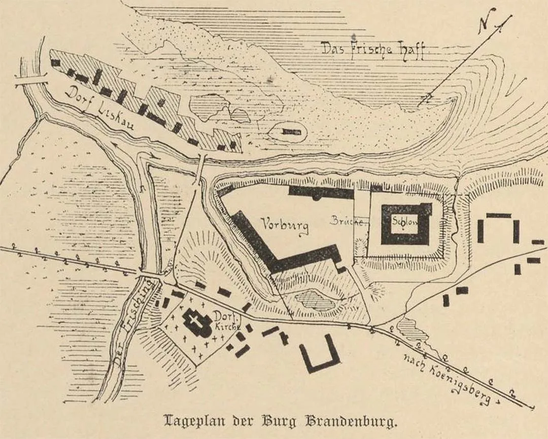
A settlement existed on the site of Brandenburg even before the Teutonic invasion of these lands in 1246. Immediately after the margrave's departure, the wooden castle was captured and burned by the Prussians. In 1267 it was rebuilt by the knights of the Order, and at that time Friedrich von Holdenstete became the castle's first Komtur while also serving as Marshal of the Order (1266–69). The Komturei of Brandenburg existed until 1499 and was the largest in the Order. Throughout the entire Teutonic period of East Prussian history, the castle was regarded as one of the Order's key defensive strongholds.
Soon after its founding, the wooden castle was attacked by rebel Prussians led by Glappo. The rebels captured almost the entire castle, but a detachment of crusaders under Komtur Friedrich von Holdenstete arrived, managed to retake it and rescued the remnants of the garrison who had taken refuge in the tower.
In 1267 (according to other sources, in 1269) Brandenburg Castle was nevertheless burned by the Prussians. Immediately after its destruction, Margrave Otto III of Brandenburg once again led an army to Prussia and rebuilt the castle, stationing his own troops there. In 1272–90 Brandenburg was rebuilt in stone. From 1322 the castle housed a relic: a fragment of the cross on which Christ was crucified. In the 14th century a church was built in Brandenburg, and in 1380 Günther von Hohenstein, Komtur of Brandenburg and the Order's diplomat in Lithuania, was buried there. By 1408 Brandenburg already had a school; in 1422 there were two mills, and by 1425 three.
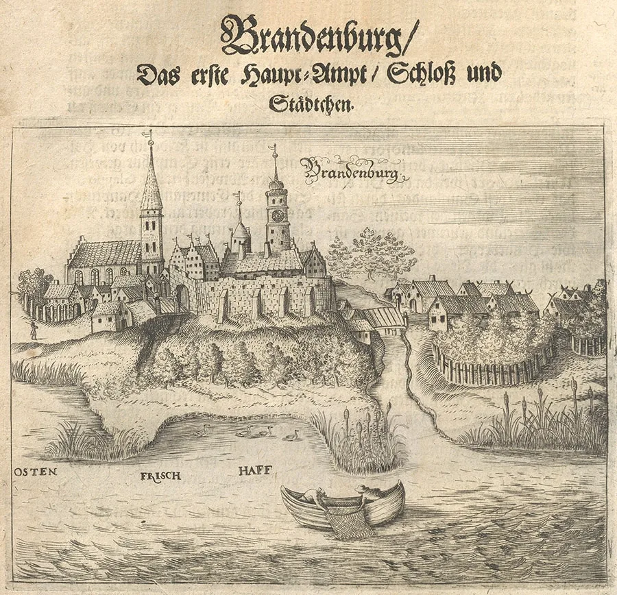
During the Great War of 1409–11, Markward von Salzbach, Komtur of Brandenburg, was taken prisoner by the Poles at the Battle of Grunwald (1410) and executed.
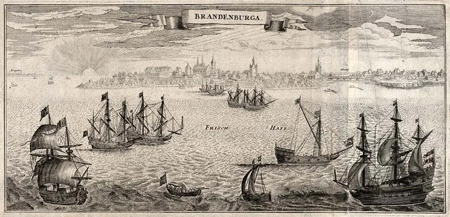
From 1415 to 1422 the deposed Grand Master of the Order, Heinrich Reuß von Plauen, was held under arrest in the castle. In 1437–38 the convent of Brandenburg Castle consisted of 30 knights of the Order and two priests.
Brandenburg Church was built on the same bank of the river as the castle. It is first mentioned in 1433, although it was founded as early as the 14th century.
In 1454, during the Thirteen Years' War, Brandenburg Castle suffered serious damage. In the course of the fighting, Brandenburg was seized by the men of Kneiphof, who had sided with the Prussian Confederation. However, on 11.04.1455 Heinrich Reuß von Plauen, Komtur of Elbing and Grand Hospitaller of the Order, arrived at the castle, and the garrison of Confederation supporters surrendered to his troops without a fight. On 04.04.1456 the castle was bombarded from ships belonging to rebellious Danzig, setting the Vorburg on fire. Yet by the end of that same year, 1456, the castle had been largely restored. Overall, the Thirteen Years' War devastated the Komturei of Brandenburg and brought its economy into decline.
From 1467 to 1499 the Komtur of Brandenburg simultaneously held the office of Grand Hospitaller of the Order.
In 1513 Albrecht von Brandenburg, Grand Master of the Order, granted the settlement beneath the castle walls the right of free trade.
Brandenburg suffered once again during the “Riders' War” (1519–21). On 23.05.1520 Polish troops laid siege to Brandenburg, while the fleet of Danzig blockaded it from the lagoon. After a two-day siege in which the besiegers used artillery, the Brandenburg garrison, which had no artillery of its own, capitulated on honourable terms and left the castle with its weapons and banners. Following a truce in early July 1520, Brandenburg was captured again, this time by the people of Danzig. Only in February 1521 did Albrecht's troops manage to clear Brandenburg and the surrounding lands of the Polish army. After the war, Brandenburg Castle was rebuilt once more, though part of the Vorburg was lost.
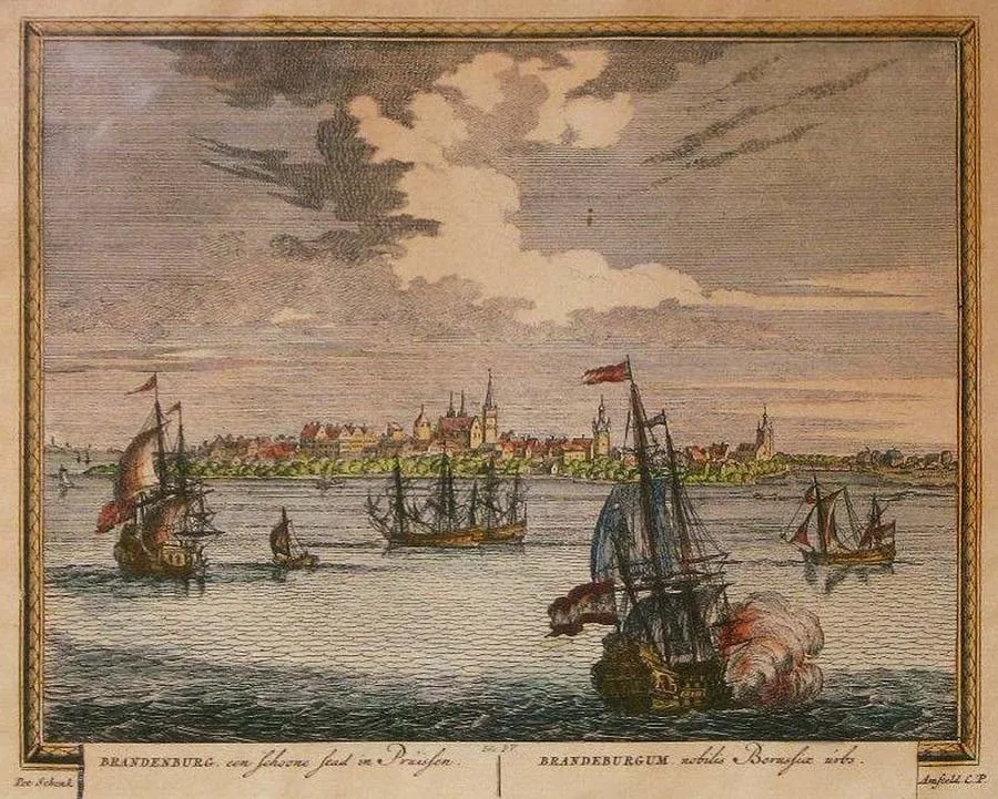
After the secularization of the Order in 1525, the castle served as the residence of the head of the Amt Brandenburg until 1752.
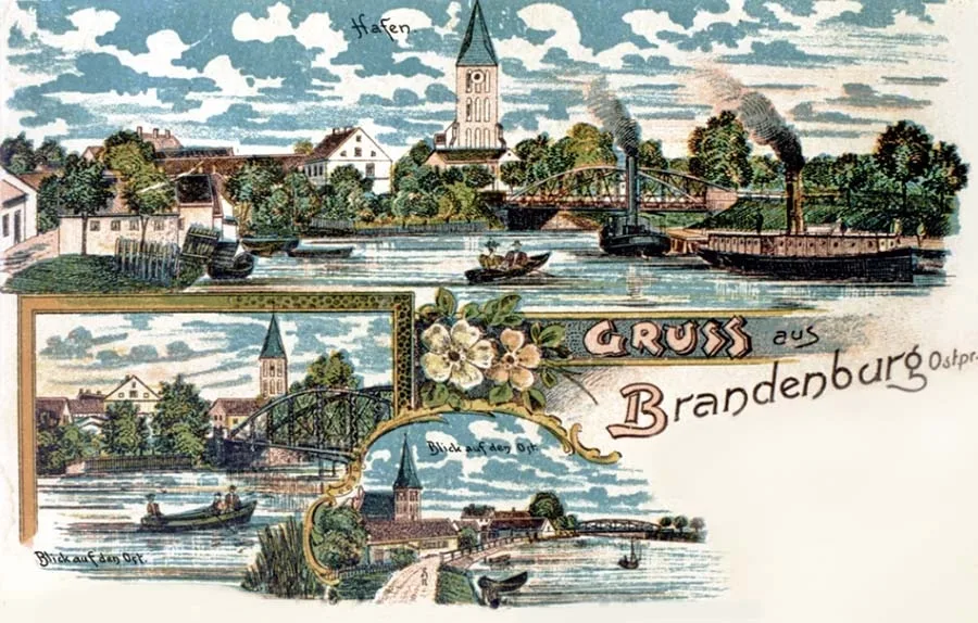 Postcard "Greetings from Brandenburg".
In 1604 the settlement by Brandenburg Castle had 50 households and 7 taverns. During the epidemic of 1629, Elector George William and his retinue stayed in Brandenburg. In 1655 Elector Frederick William and his wife visited Brandenburg Castle. From 1716 to 1732 the 12th Cuirassier Regiment was quartered in Brandenburg. In 1725 Brandenburg received a coat of arms but was never granted town status; instead it was designated a “market village” (Matktdorf). In that same year, 1725, a harbour for ships was built at Brandenburg; it was modernized in 1884. In 1776 the wings of Brandenburg Castle began to be dismantled for building material.
During the Napoleonic Wars, on 05.01.1813, the retreating troops of the French marshals Macdonald (1765–1840) and Ney (1769–1815), some 10,000 soldiers with only eight guns, were gathered in Brandenburg. The French were demoralized and poorly armed, and many of them were sick or wounded. Moreover, they feared that their line of retreat would be cut off. A detachment under Major General I.I. Diebitsch-Zabalkansky blockaded the enemy in Brandenburg, waited for reinforcements and then drove the French out of the town by force of arms.
In 1817, during the construction of a road along the Frisches-Haff (Kaliningrad Lagoon), an iron bridge was built in Brandenburg across the Frisching (Prokhladnaya) River.
In the 19th century Brandenburg consisted of two administrative units: the Brandenburg Domäne estate and the village of Brandenburg Flecken (later Klein Brandenburg).
From 1818 the village of Brandenburg Flecken formed a rural municipality in Kreis Heiligenbeil (Mamonovo) and belonged to the parish of Brandenburg. It was divided into the following districts: Oberflecken (the part of the village north of the Frisching, mainly around the castle), Unterflecken (the part of the village south of the Frisching) and Brandenburg Damm (the part of the village between the mouth of the Frisching and its small backwater). In addition, the municipality of Brandenburg Flecken included the small hamlet of Regienenhof (part of Voronovo) and outlying farmsteads (Abbauten). In 1871 the municipality of Brandenburg Flecken had 114 residential houses, home to 330 families and 16 single persons. Of these, 107 houses were in the village of Brandenburg itself, two belonged to Regienenhof (part of Voronovo) and five were outlying farmsteads. On 11.06.1874 the rural municipality of Brandenburg Flecken was incorporated into the newly established Amtsbezirk Brandenburg (from 1935 Amtsbezirk Brandenburg (Frisches Haff)). The first head of the Amtsbezirk, in 1874–84, was the hotel owner and district tax inspector Thiel. Later, residents of the village held this post in 1904–08 (the landowner Dornbusch) and (probably) from 1933 (Mayor Tobien).
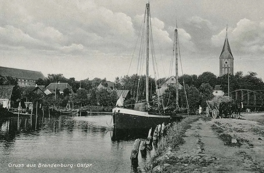
On 30.09.1928 the municipalities of Klein Brandenburg (Ushakovo) and Klein Hoppenbruch (Ulyanovka), together with the Gutsbezirk Domäne Brandenburg (Ushakovo) minus the Vorwerk Kranzberg, were merged into the new rural municipality of Brandenburg.
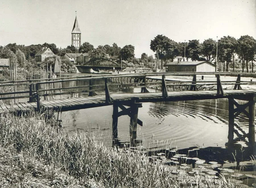 Wooden bridge over the Prokhladnaya River from Naberezhnaya Street to the “Ushakovo Shipyards” (no longer standing).
By 1929, besides the village and estate of Brandenburg themselves, the rural community of Brandenburg also included the villages of Königlich Tengen (from 1928 Tengen, 54°36'18'' N 20°17'44'' E), Korschenruh (Ladygino) and Reginenhof (part of Voronovo), as well as the Vorwerk (outlying farm) of Kainen (part of Voronovo).
From 1867, the Brandenburg Domäne formed a Gutsbezirk (estate district) in Kreis Heiligenbeil (Mamonovo). Besides the castle itself, the Gutsbezirk Domäne Brandenburg comprised the Vorwerke of Kranzberg (from 1928 Cranzberg, 54°34'47'' N 20°19'09'' E) and Cainen (from 1912 Alt Cainen1, part of Voronovo). The latter was also often referred to simply as Cainen. Domäne Brandenburg belonged to the parish of Brandenburg. In 1871, the Gutsbezirk Domäne Brandenburg had 18 residential buildings, home to 41 families. Of these, eight houses stood on the Brandenburg estate itself and five on each of the Vorwerke. On 11 June 1874, the Gutsbezirk Domäne Brandenburg was incorporated into the newly established Amtsbezirk Brandenburg. Residents of Domäne Brandenburg held the post of head of the Amtsbezirk in 1884–1904 (Oberamtmann and Amtsrat Rosenow) and from 1908, probably until 1933 (administrator, estate tenant and Oberamtmann Rosenow).
In 1879, the Gutsbezirk Domäne Brandenburg owned 1,030 ha of land. The estate's annual net profit amounted to 20,934 marks.
On 30 September 1928, the Gutsbezirk Domäne Brandenburg was abolished and (without the Vorwerk of Kranzberg) incorporated into the new rural community of Brandenburg. In 1932, the Brandenburg state estate had 379 ha of land, including 182 ha of arable land, 55 ha of meadows, 110 ha of pasture, 6 ha of forest, 14 ha of orchards and vegetable gardens and 6 ha of water. The farm kept 43 horses, 200 head of cattle (including 65 cows) and 80 pigs. The estate's tenant was Emil Michell.
Amtsbezirk Brandenburg
On 11 June 1874, Amtsbezirk No. 2 Brandenburg was established in Kreis Heiligenbeil (Mamonovo). It comprised two rural communities, Brandenburg Flecken (Ushakovo) and Klein Hoppenbruch (Ulyanovka), and two Gutsbezirke: Domäne Brandenburg (Ushakovo) and the forest Gutsbezirk of Brandenburger Heide, Forst (part of Novo-Moskovskoye, 54°34'11'' N 20°12'57'' E). The Brandenburg mill (Mühle Brandenburg) also belonged to the Amtsbezirk.
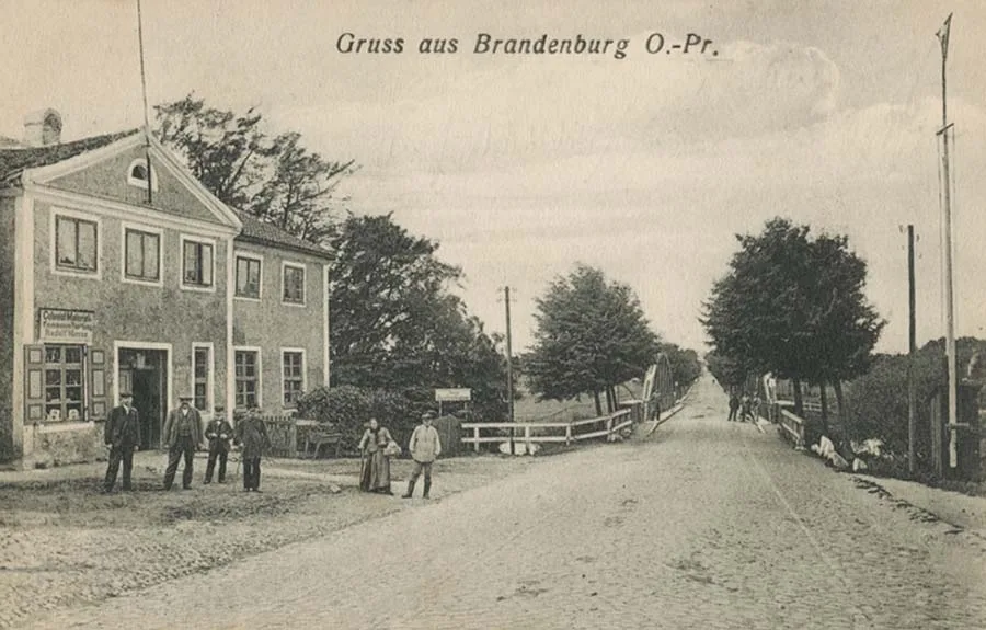 The road from Brandenburg (Ushakovo) towards Ludwigsort (Ladushkin).
On 21 August 1877, the Brandenburg mill lost its independent status and became part of the Gutsbezirk Domäne Brandenburg.
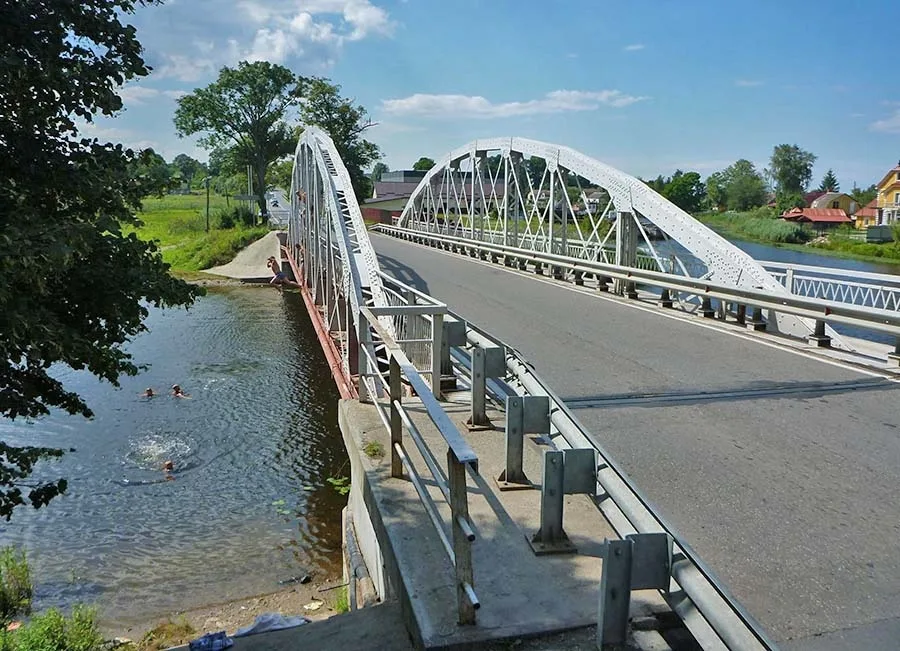 Children bathing by the bridge over the little Prokhladnaya (Frisching) River.
By 1908, the forest Gutsbezirk of Brandenburger Heide had been renamed the forest Gutsbezirk of Preußisch Eylau, Forst.
On 30 September 1928, the communities of Klein Brandenburg (Ushakovo) and Klein Hoppenbruch (Ulyanovka) and the Gutsbezirk Domäne Brandenburg (Ushakovo) were merged into the new rural community of Brandenburg. At the same time, the Vorwerk of Kranzberg passed to the rural community of Schoyschen (from 1938 Schoschen) in Amtsbezirk Pokarben. On 15 November 1928, the forest Gutsbezirk of Preußisch Eylau was dissolved, and its northern part became part of the rural community of Brandenburg. From then on, Amtsbezirk Brandenburg consisted of the single rural community of Brandenburg, and its composition remained unchanged until 1945.
From 1928, the rural community of Brandenburg consisted of Domäne Brandenburg; the villages of Klein Brandenburg (Ushakovo), Tengen, Korschenruh (Ladygino), Klein Hoppenbruch (Ulyanovka) and Reginenhof (part of Voronovo); the Vorwerk of Alt Cainen mit Neu Cainen (part of Voronovo); and the Brandenburger Heide forester's house (part of Novo-Moskovskoye). Before the war, a dairy operated in the village of Brandenburg.
On 13 March 1945, the 16th Guards Rifle Division (Major General M.A. Pronin, 1892–1978) of the 26th Guards Rifle Corps, 11th Guards Army, began the battle for Brandenburg, cut the Brandenburg–Königsberg highway and took the settlement on 17 March 1945. By 20 March 1945, units of the 36th Guards Rifle Corps (Lieutenant General P.K. Koshevoy, 1904–76) had reached the lagoon.
On 17 June 1947, Brandenburg was renamed the settlement of Ushakovo. The Ushakovo Village Council was created at the same time, but until July 1947 its administration was based in Pinnau (Zelenovo from 17 November 1947), after which it moved to Ushakovo. Until 1962, the Ushakovo Village Council belonged to Ladushkin District, and thereafter to Bagrationovsk District.
 A pumpjack in Ushakovo — oil is extracted here.
In 1955, the settlement had 86 houses and a school. In 1965, the Ushakovo Village Council was abolished, and Ushakovo itself became part of the Novomoskovsky Village Council. As of 2022, the settlement has about 370 residential and public buildings, a kindergarten, a library and a rural medical station. The small-craft repair company “Ushakovo Shipyards” operates here. A centre for the development of gifted children has opened on the site of a former children's health camp. The settlement also has grocery shops and a catering establishment.
Sights: the ruins of Brandenburg Castle, the ruins of the 14th-century church, a mass grave of Soviet soldiers (575 people, memorial erected in 1950), and the Lenzenberg hillfort (54°36'27'' N 20°12'53'' E). In 1240–60, a timber-and-earth castle of the Teutonic Order stood here. According to Peter of Dusburg, in 1260 Volrad, the Vogt of Natangia and Warmia, invited members of the Prussian nobility to the castle for negotiations and a feast, and during the night burned the castle down together with the sleeping Prussian chieftains. Traces of ditches and ramparts can still be made out on the castle site.
Population: 1984 – 310, 2002 – 864, 2010 – 812 inhabitants.
For reference
Population of the community of Brandenburg Flecken / Brandenburg: 1867 – 1565, 1871 – 14342, 1885 – 1387, 1905 - 1274, 1925 – 1250, 1939 – 1595 inhabitants.
Population of the Gutsbezirk Brandenburg: 1867 – 261, 1871 – 214, 1885 – 291, 1905 – 247, 1910 – 245 inhabitants.
Composition of the population of the Gutsbezirk Brandenburg: Protestants – 208, Catholics – 6, children under 10 – 78, literate – 85 (63%), insane – 1.
Composition of the population of the rural community of Brandenburg Flecken in 1871: Protestants – 1428, Jews – 6, children under 10 – 348, literate – 773 (72%), deaf-mute – 6, insane – 8.
Composition of the population of Königlich Tengen in 1871: all 32 Protestants, children under 10 – 6, literate – 19 (73%).
Population of Königlich Tengen: 1867 – 34, 1871 – 32, 1885 – 32, 1905 – 50, 1910 – 52 inhabitants.
Population of Korschenruh: 1905 – 47 inhabitants.
Population of Reginenhof: 1871 – 27, 1905 – 22 inhabitants.
Population of Kranzberg: 1871 – 34 inhabitants.
Population of Cainen: 1871 – 86 inhabitants.
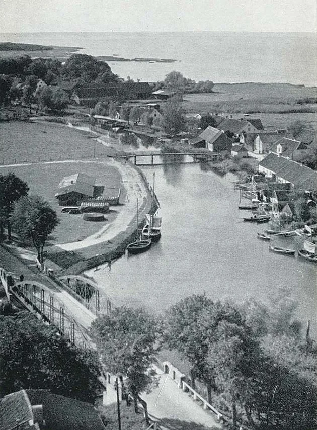
Composition of the Brandenburg parish: Albehnen (Gorki), Brandenburg (Ushakovo), Dümpelkrug (54°38'28'' N 20°17'59'' E), Friedrichshof (54°35'48'' N 20°19'07'' E), Honigbaum (54°36'53'' N 20°18'51'' E), Klein Hoppenbruch (Ulyanovka), Kamnicken (54°36'30'' N 20°20'23'' E), Korschenruh (Ladygino), Kranzberg (54°34'47'' N 20°19'09'' E), Morken (54°36'02'' N 20°20'06'' E), Pinnau (Zelenovo), Pokarben (54°36'39'' N 20°18'02'' E), Reginenhof (54°36'13'' N 20°16'36'' E), Schoischen (from 1938 Schoschen, 54°36'01'' N 20°19'39'' E), Tengen (54°36'18'' N 20°17'46'' E), Wedderau (part of Razdolnoye).
___________________
1 – later formed the double Vorwerk Alt Cainen mit Neu Cainen (from 1938 Alt Kainen mit Neu Kainen, part of Voronovo).
2 – including 1,383 inhabitants in the village of Brandenburg Flecken itself and 24 in the outlying farmsteads.
Photos on this page: Bildarchiv Ostpreußen / bildarchiv-ostpreussen.de, Mikhail Ogorodnikov.
Translated from Russian with the help of AI (Claude, Anthropic), October 2026.