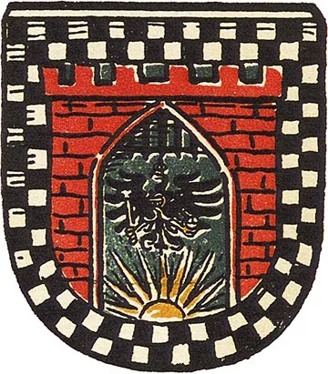
Coat of arms
of Schirwindt
Schirwindt is first mentioned in 1516 as Scherwint. Construction of Schirwindt's first church began in 1546. In 1549 a parish was established, and the church building was completed in 1559. In 1640 or 1641 the church burned down. In 1656, during the Polish–Swedish War, Schirwindt suffered a Tatar invasion. In 1688 Elector Frederick William allocated money for building materials for a new church. In 1694–1710 a temporary building with a thatched roof was prepared for services; in 1737 a small tower was added to it. In 1709–10 a plague epidemic caused mass deaths among the inhabitants of Schirwindt.
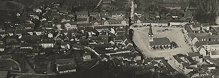
In 1725 Schirwindt went from being a parish village to a town; for this purpose Frederick William I allocated funds for the construction of the required 20 houses. In 1732 the resettlement of families from Salzburg to the Schirwindt area began; in 1744 there were seven Salzburg families numbering 24 people in the town. In 1753 a major renovation of the church began, which in effect amounted to a new building.
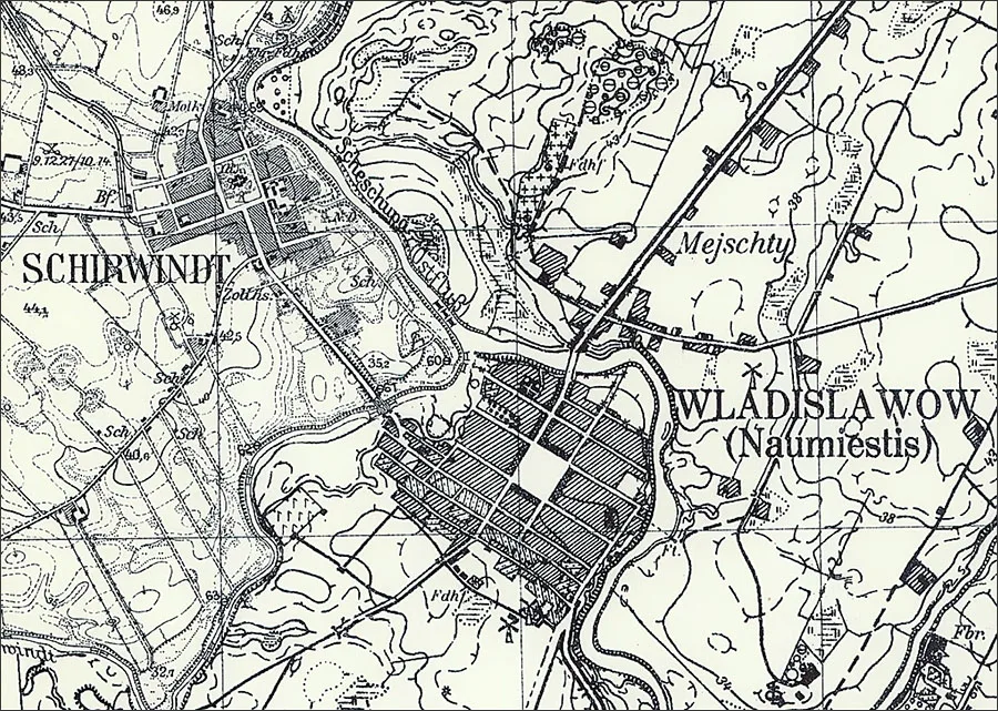
In 1807 Marshal Ney's 30,000-strong army was stationed in Schirwindt. The town suffered raids by marauders. A contribution of 17,000 thalers was exacted from the municipality. In 1813, when the Prussian Landwehr was being organised, many inhabitants of Schirwindt enlisted in it as volunteers.
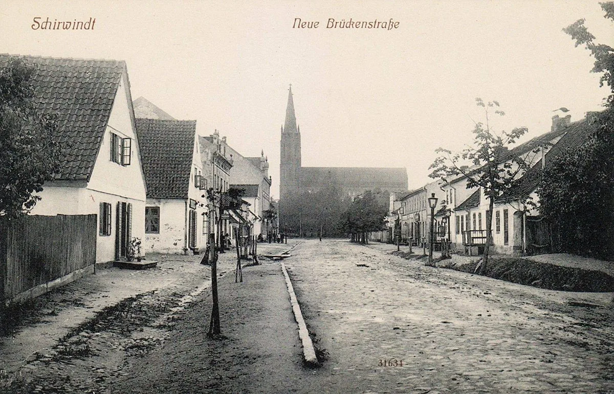
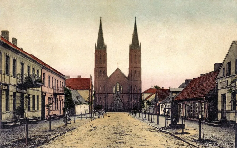
In 1818, as a result of the administrative reform, Schirwindt became part of the Landkreis Pillkallen (from 1938 Kreis Schloßberg, Dobrovolsk). Schirwindt's church, for which a new tower was built in 1818, was the parish church for 42 villages and estates in the area. In 1845 King Frederick William IV visited the town for the first time, and during his visit the question of building a new church was raised. On 03.08.1850 the foundation stone of the new church was laid. On 14.09.1856 the church, which was named the Immanuel Church and built to a design by F. A. Stüler, was opened during King Frederick William IV's third visit to the town (the second had taken place in 1854).
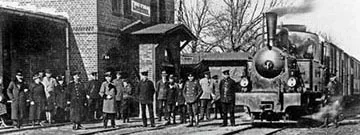
In 1900–01 a branch of the Pillkallen narrow-gauge railway (Pillkaller Kleinbahn) was extended to Schirwindt. The track gauge was originally 750 mm, but in 1916–17 it was widened to 1,000 mm. At the same time a station on this line was opened in Schirwindt. In the 1910s Schirwindt was considered the smallest town in Germany.
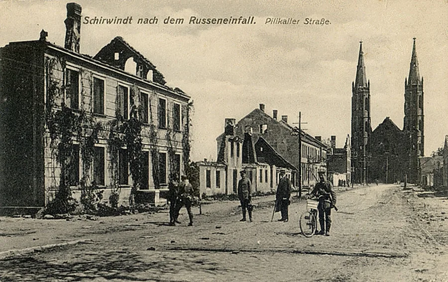
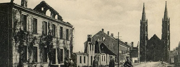
Schirwindt suffered very heavy destruction during the fighting of 1914–15.
On 17.08.1914 the town was taken in battle by the Russian 1st Army (2nd Cavalry Division, 53rd Infantry Division, 56th Infantry Division, 5th Rifle Brigade), as a result of which it was badly destroyed for the first time. In September 1914 it was recaptured by the German army, but on 12.11.1914 it was taken again by Russian troops. On 12.02.1915 it was recaptured once more by the German army. Of all the buildings, only the church survived. After the war Schirwindt was rebuilt with the help of the city of Bremen in time for the 200th anniversary of its town status in 1925. On 07.06.1925 the restored Immanuel Church was reconsecrated. Before the Second World War the town had an oil mill, a railway station and two windmills, including the largest windmill in East Prussia. From April 1941 to June 1942 a camp for prisoner-of-war officers, Oflag-60, was located near Schirwindt, and from January to March 1944 a branch of the Stalag-I D/Z camp operated there.
On 31.07.1944 Schirwindt was bombed, after which the decision was taken to evacuate the civilian population. On 17.10.1944 it was taken by troops of the 5th and 39th Armies of the Red Army. In the course of fierce fighting the town was fatally destroyed, leaving only 2 houses standing.
Schirwindt was the first German town to be taken by Soviet troops.
Amtsbezirk Schirwindt
On 08.04.1874 Amtsbezirk No. 27 Schirwindt was established in the Landkreis Pillkallen, comprising 12 rural municipalities: Augstupönen (from 1938 Hochweiler, 54°48'04'' N 22°52'08'' E), Baltruschen (from 1938 Sorgenfelde, 54°49'36'' N 22°48'01'' E), Birkenfelde (54°49'27'' N 22°50'11'' E), Gettkandten (later Gettkanten, 54°46'11'' N 22°49'20'' E), Goberischken (from 1938 Gobern, 54°46'49'' N 22°49'14'' E), Jodupönen (from 1938 Nassfelde, 54°47'36'' N 22°48'02'' E), Maurutschatschen (from 1938 Grenzfelde, 54°45'36'' N 22°48'24'' E), Paplienen (from 1938 Moormühle, 54°49'01'' N 22°49'01'' E), Parschen (54°46'49'' N 22°47'57'' E), Paßuißen (54°49'40'' N 22°47'43'' E), Schilleningken (from 1938 Ostdorf, Samarskoye), Warupönen (from 1928 Lindenhof, 54°48'21'' N 22°48'50'' E), as well as 3 Gutsbezirke: Dwarischken (from 1938 Löbelhorst, 54°49'30'' N 22°52'19'' E), Samelucken (from 1938 Grenzfelde, 54°46'00'' N 22°48'17'' E) and Warupönen (54°48'19'' N 22°49'02'' E). Despite its name, the Amtsbezirk Schirwindt did not include the town of Schirwindt itself, and the heads of the Amtsbezirk never lived in Schirwindt.
On 14.09.1923 the municipality of Baltruschen was merged into the municipality of Paßuißen, which was at the same time renamed Baltruschen. On 30.09.1928 the Gutsbezirk of Dwarischken became part of the rural municipality of Schilleningken (Samarskoye). On 17.10.1928 the Gutsbezirk of Samelucken was incorporated into the municipality of Maurutschatschen, which was renamed Grenzfelde. At the same time the Gutsbezirk of Warupönen was incorporated into the municipality of Warupönen, which was renamed Lindenhof. As a result, the Amtsbezirk Schirwindt came to consist of 11 rural municipalities: Augstupönen, Baltruschen, Birkenfelde, Gettkanten, Goberischken, Grenzfelde, Jodupönen, Lindenhof, Paplienen, Parschen and Schilleningken (Samarskoye); its composition did not change thereafter until 1945.
On 17.11.1947 Schirwindt was renamed the settlement of Kutuzovo.
Kutuzovo initially became part of the Pobedino village council. Kutuzovo ended up on the territory of the Dobrovolsk military training ground, and the ruins of its houses (including the church) were used as building material for reconstruction work in the neighbouring Lithuanian town of Kudirkos Naumiestis.
Since the territory of Kutuzovo was in a closed zone, the settlement effectively ceased to exist. Nevertheless, in 1975 the settlement of Kutuzovo appears on the list of registered localities. After the collapse of the USSR, Border Post No. 4 of military unit 2114, named after Kubov, was stationed in Schirwindt; it was disbanded no later than 2015, and the area with its five remaining buildings was abandoned. In the 2000s a memorial cross was erected on the site of Schirwindt's church. In the 2020s access to the settlement was closed, because the territory is used by the Russian Ministry of Defence as an air force training range.
Sights: military cemetery (176 Russian and 154 German soldiers, 1914), destroyed after the war, restored in the 1990s.
Population: 1782 – 1,2301, 1802 – 1,331, 1810 – 1,208, 1816 – 1,1392, 1821 – 1,078, 1831 – 1,075, 1905 – 1,302, 1910 – 1,151, 1926 – 1,124, 1933 – 1,179, 1939 – 1,090, 1984 – 10, 2002 – 18 inhabitants.
1 — excluding the garrison.
2 — including 1,109 Protestants and 30 Catholics.
For reference
The Schirwindt parish included: Augstupönen (from 1938 Hochweiler, 54°48'04'' N 22°52'08'' E), Baltruschen (from 1938 Sorgenfelde, 54°49'36'' N 22°48'01'' E), Baragehlen (from 1938 Hauptmannsdorf, 54°45'57'' N 22°45'40'' E), Barsden (54°48'08'' N 22°45'19'' E), Berszeningken (from 1938 Fichtenhöhe), Birkenfelde (54°49'27'' N 22°50'11'' E), Budupönen (from 1938 Moosbach, Ovrazhkino), Daynen (from 1938 Deinen, 54°44'59'' N 22°46'04'' E), Doristhal (Razino), Dwarischken (from 1938 Löbelhorst, 54°49'30'' N 22°52'19'' E), Eichenfelde (54°47'40'' N 22°50'37'' E), Gettkandten (later Gettkanten, 54°46'11'' N 22°49'20'' E), Goberischken (from 1938 Gobern, 54°46'49'' N 22°49'14'' E), Groß Königsbruch (54°50'24'' N 22°50'01'' E), Jodupönen (from 1938 Nassfelde, 54°47'36'' N 22°48'02'' E), Jodzahlen (from 1938 Herbstfelde, 54°51'13'' N 22°48'46'' E), Kaptainischken (from 1938 Hauptmannsdorf, 54°46'03'' N 22°44'51'' E), Kaunohnen (from 1938 Marderfelde, 54°47'13'' N 22°42'40'' E), Kermuschienen (from 1938 Landmannsfelde, 54°46'15'' N 22°42'09'' E), Kischen (from 1938 Zweihuben, 54°45'39'' N 22°42'27'' E), Klein Königsbruch (54°52'00'' N 22°48'25'' E), Klein Kubinehlen (54°46'04'' N 22°41'17'' E), Kummetschen (from 1938 Fichtenhöhe, 54°51'32'' N 22°50'35'' E), Maurutschatschen (from 1938 Grenzfelde, 54°45'36'' N 22°48'24'' E), Neuhof (54°53'22'' N 22°48'56'' E), Nowischken (from 1938 Brämerhusen, Beregovoye), Paplienen (from 1938 Moormühle, 54°49'01'' N 22°49'01'' E), Parschen (54°46'49'' N 22°47'57'' E), Paschillballen (54°46'45'' N 22°46'56'' E), Paßuißen (54°49'40'' N 22°47'43'' E), Petzingken (from 1938 Petzingen, 54°44'30'' N 22°42'03'' E), Pieragen (from 1938 Nicklashagen, 54°46'59'' N 22°45'20'' E), Samelucken (from 1938 Grenzfelde, 54°46'00'' N 22°48'17'' E), Schilleningken (from 1938 Ostdorf, Samarskoye), Schimkuhnen (from 1938 Schwarzenberge, 54°44'51'' N 22°42'42'' E), Schirwindt (Kutuzovo), Schönbruch (54°51'01'' N 22°47'32'' E), Urbantatschen (from 1938 Urbanshöhe, 54°45'14'' N 22°43'58'' E), Vielemühe (54°52'42'' N 22°48'12'' E), Warupönen (from 1928 Lindenhof, 54°48'21'' N 22°48'50'' E), Gut Warupönen (54°48'19'' N 22°49'02'' E), Wöszupchen (from 1938 Auengrund, 54°47'08'' N 22°43'42'' E), Wöszupöhlen (from 1938 Wöschen, 54°47'21'' N 22°43'55'' E).
Translated from Russian with the help of AI (Claude, Anthropic), October 2026.