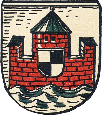
Coat of arms
of Tilsit
Tilsit is first mentioned in documents of the Teutonic Order in 1385 as an old Prussian fortification from which one of the campaigns into Lithuania was launched. In 1404, construction began here on Tilsit Castle, which stood on the old Prussian ramparts where the Tilsete (Tilzha) flows into the Memel (Neman). As a Pflegeramt, Tilsit Castle belonged to the commandery of Ragnit (Neman) and served as a border stronghold on the Memel, guarding against Lithuanian raids. There were several such castles along the Memel. One of them, Kaustritten, stood four kilometres east of Tilsit and was destroyed in a Lithuanian raid in 1382.
Tilsit Castle was intended to take the place of Kaustritten in the Order's defensive system.
A traditional dam was built on the Tilsete, creating a pond. Water from the pond flowed through three artificial channels into the castle moat, so that the castle and its outer bailey were completely surrounded by water. Documents from 1406 record the name of the master builder from Danzig who directed the construction: Hannus Boppe. The castle walls were completed in 1408.
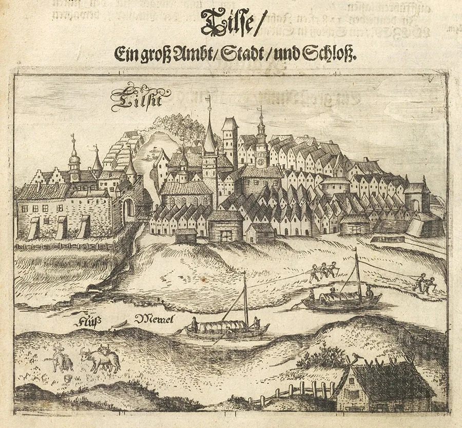 Tilsit in an engraving by Christoph Hartknoch, 17th century.
The Great War (1409–11) prevented Tilsit Castle from being fully completed. It is known, however, that the main wing had been built by 1410. In 1411, Tilsit Castle was besieged and seriously damaged. Once the fighting was over, the castle was repaired, and a settlement grew up beneath its walls.
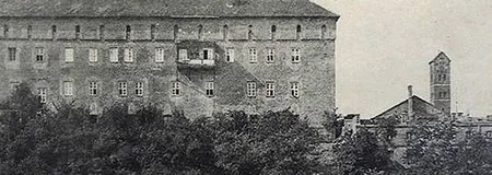
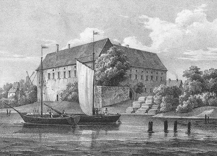 Tilsit Castle.
In 1466, Tilsit Castle appears in the documents of the Second Peace of Thorn. Documents from 1514 indicate that the settlement of Tilsit had a tavern and a Franciscan friary.
After the secularisation of the Order (1525), Duke Albrecht of Brandenburg ordered restoration work on the castle in 1537. In 1549, a school opened in the settlement of Tilsit. The first church in Tilsit is mentioned in 1551. On 2 December 1551, in this church, Duke Albrecht attended the election of the town council and judges before granting Tilsit its town rights. Eleven months later, on 2 November 1552, the settlement of Tilsit received Kulm town law from the duke. In 1565, a town hall and a courthouse were built. In 1586, a Latin school was opened. In 1598–1612, a new church was built on the site of the first one, which had been demolished owing to its dilapidated state.
In 1670–71, since the Order castle had become hopelessly outdated as a fortification, earthen ramparts with a bastioned layout were built around its walls.
In 1695–99, the town church was rebuilt and given a tower with a dome and a spire. In 1698, a post office opened in Tilsit. As a town on the border with Lithuania, Tilsit hosted a military garrison from the early 18th century. In 1716, it numbered 700 cavalrymen.
In 1709–10, a plague epidemic swept through Tilsit and the surrounding area, killing almost half of the town's inhabitants. In 1732, through the efforts of King Frederick William I, 140 families of religious refugees, mostly from Salzburg, were resettled in Tilsit. In 1754, a new town hall was built in Tilsit.
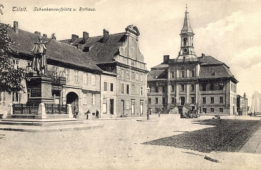 Tilsit Town Hall faced Schenkendorfplatz, where a monument to the poet stood.
During the Seven Years' War (1756–63), Tilsit was one of the first towns to be occupied by the Russian army. The town was taken without a fight on 19 July 1757 by a corps under the command of General V.V. Fermor. At the end of July 1757, Field Marshal S.F. Apraksin appointed Colonel I.I. Numers commandant of Tilsit.
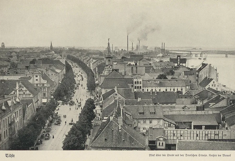 View from the Order Church in Tilsit onto Deutsche Straße; left of centre, the spire of the Reformed Church graces the town skyline, in the centre is the town hall, and on the right the railway bridge across the Memel (Neman).
After Apraksin's army withdrew and a new campaign into Prussia followed, Tilsit was under Russian administration from 3 January 1758 to 6 August 1762. Throughout those years, Tilsit served as a supply transit base, and in 1762 it also became a key point in the withdrawal of the Russian army.
In 1767, a floating (pontoon) bridge was built across the Memel (Neman) in Tilsit. In 1795, the commander of the dragoon regiment quartered in the town lived in Tilsit Castle. In 1799–1801, Commercial Councillor Gottschald built two wind-powered sawmills in Tilsit, after which the town became a traditional centre of woodworking. In 1803, construction began on a highway to Taplacken (Talpaki), which was not completed until 1834.
Tilsit gained worldwide fame in 1807, when the Peace of Tilsit between France and Russia, which ended the War of the Fourth Coalition, was signed there. This was preceded by the passage through Tilsit of numerous units of the Russian army, which had been defeated at the Battle of Friedland (14 June 1807). By the evening of 17 June, the first Russian troops had entered Tilsit, secured the crossing over the Memel and begun redeploying to its right bank.
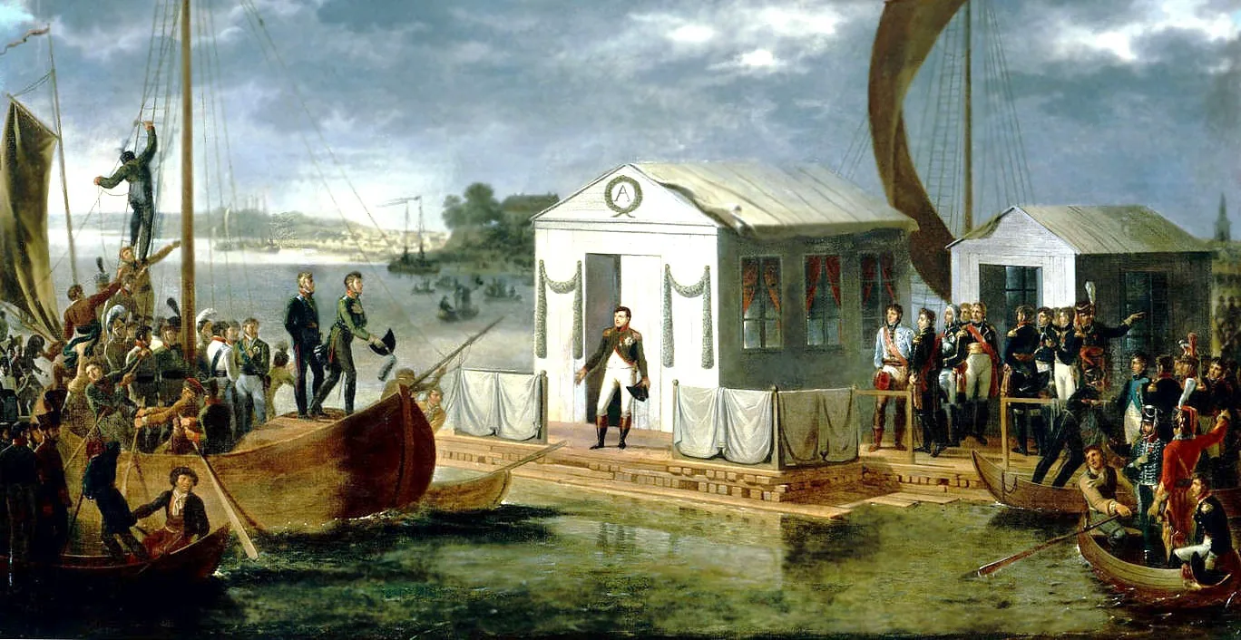
Napoleon arrived outside Tilsit with his troops on 19 June, and there he was handed a proposal for an armistice. Preparations began for a meeting of the two emperors. Napoleon pointedly ignored the attempts of the King of Prussia, Frederick William III, to become a party to the treaty, stressing that he was making peace with Russia alone. On 25 June, the emperors met for the first time on a raft with a pavilion in the middle of the Memel.
Frederick William III and Queen Louise also came to Tilsit. On 6 July 1807, Queen Louise met Napoleon in Tilsit to plead for milder peace terms for Prussia. On 7 July 1807, Napoleon and Alexander I signed the Treaty of Tilsit.
In December 1812, Tilsit once again became a transit point for troops: the French army was retreating, while the Russian army was setting out on its campaigns abroad.
In 1820, Tilsit Castle was bought by the municipality and became the seat of the town court. In 1823, the Jakobsruhe town park was opened. In 1830, a synagogue was built in Tilsit. In 1833, the important Berlin–St. Petersburg postal route, which passed through Tilsit, was opened. Around 1842, a steam mill was set up on the grounds of Tilsit Castle, and in 1844 it was converted into an engineering works. In 1843–51, the Catholic Church of the Ascension of Christ was built. In 1865, a telegraph office was built, connecting the town by telegraph lines with Insterburg (Chernyakhovsk), Gumbinnen (Gusev) and Memel (Klaipėda).
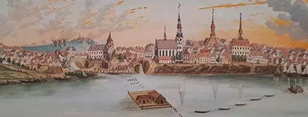
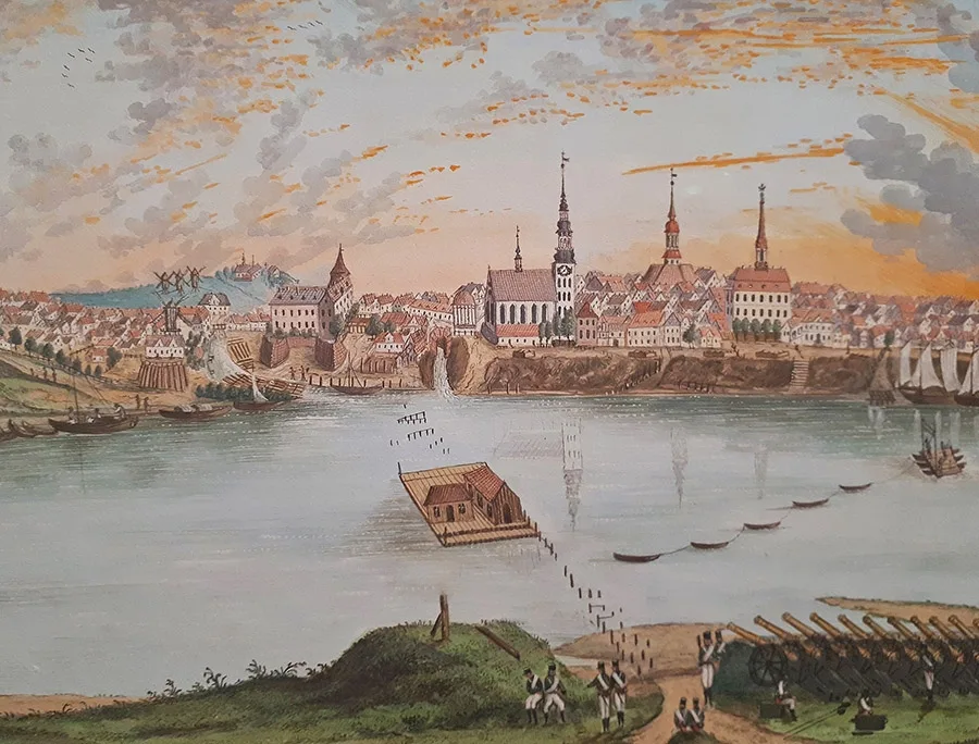 Panorama of Tilsit, the river and the raft on which, after the defeat of the Russian army at Friedland in June 1807, the negotiations between Napoleon and Alexander I took place.
In 1863–65 a railway branch line to Insterburg (Chernyakhovsk) was built, and on 16 June 1865 the first train from Königsberg arrived in Tilsit along it. After a railway bridge across the Memel (Neman) was built in 1875–76, trains began running through to the station in Memel (Klaipėda).
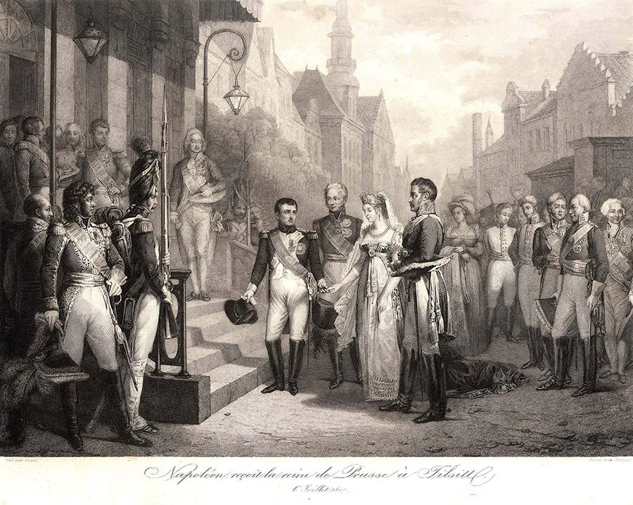 1807. Napoleon, the Prussian royal couple (centre) and the Russian Tsar Alexander I in Tilsit.
In 1871 the municipality of Tilsit comprised, in addition to the town itself, 11 suburban settlements. In 1873 a paper mill was built in the castle, but as early as 1876 it burned down. This did enormous damage to the castle, on whose ruins lime production is now located.
In 1895 Tilsit became an independent urban district (Stadtkreis Tilsit). In 1898 a new water tower was built. In December 1900 a power station was put into operation, which made it possible to open a tram line in the town on 26 July 1901. Also in 1900 the Reformed Church was built, and in the same year the Tilsit Gymnasium moved into a new building. As of 1910, Tilsit had two schools (one for boys and one for girls), a Realgymnasium, a court, a post office, a customs office and a state bank. The town was home to a garrison: two battalions of the "von Boyen" Infantry Regiment and the "Prinz Albrecht von Preußen" Dragoon Regiment. In 1910 the Queen Luise Theatre was built, and in 1912 yet another water tower was erected in Tilsit — the tallest in East Prussia at the time.
With the outbreak of the First World War and the Russian army's East Prussian operation, the First Mounted Detachment of Her Majesty's Cuirassiers (Rittmeister Chebyshev) was redeployed to the Tilsit area on 23 August 1914. And as early as 26 August 1914 the town was occupied by the Russian army.
On 28 August 1914 Colonel Bogdanov, who had been appointed commandant, arrived in Tilsit. Certain restrictions were imposed (a curfew from 9 p.m. and a ban on selling alcohol to soldiers), yet despite them the town lived almost as in peacetime until September 1914. A composite detachment under the command of General V.V. Malm (1857–1926), consisting of an infantry regiment, an artillery battalion and two Cossack sotnias, mainly guarded railway facilities and bridges and maintained order in the town.
It was not until 12–13 September 1914 that fighting broke out around Tilsit. General Malm's detachment stationed in Tilsit was not informed in time of the general withdrawal of the Russian 1st Army from the Tilsit area. The German 9th Landwehr Brigade cut off the garrison's lines of retreat. The Landwehr soldiers were supported by the inhabitants of Tilsit, who began firing on the Russian troops. Amid the general confusion and a partial breakdown of command, the Russian garrison was split into two parts: one fought its way out of the encirclement, while the other gave battle on the outskirts of the town. This group, consisting mainly of soldiers of the Gatchina Infantry Regiment (Col. A.V. Volkov, 1869–1915), was completely routed. The enemy captured the baggage train and the artillery. General Malm and Colonel Volkov were also taken prisoner. The fallen Russian soldiers were buried in the Forest Cemetery.
On 1 April 1919 the villages of Kallkappen (now part of Sovetsk), Splitter (now part of Sovetsk), Stolbeck (now part of Sovetsk) and Tilsit-Preußen (now part of Sovetsk) were incorporated into the Stadtkreis and municipality of Tilsit.
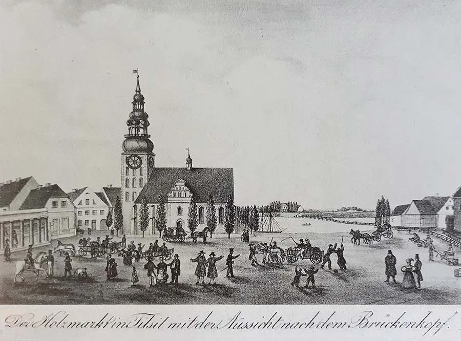 Tilsit's Holzmarkt with a view of the German Church, the crossing over the Memel and Brückendorf.
After the end of the First World War, considerable territory on the right bank of the Memel was severed from the Landkreis Tilsit. As a result, Tilsit itself ended up on the German–Lithuanian border, and on 1 July 1922 the Landkreis Tilsit and the Kreis Ragnit were merged into the Landkreis Tilsit-Ragnit.
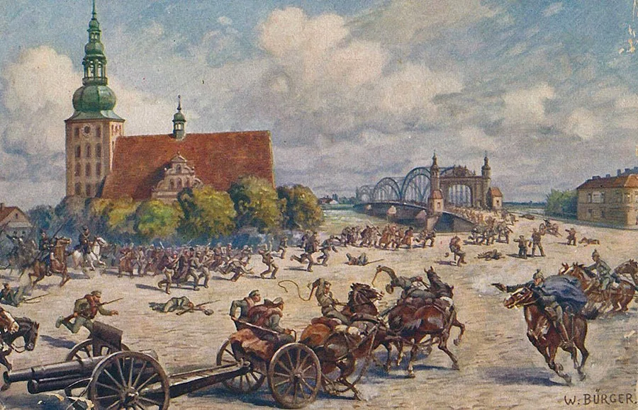 The German 9th Landwehr Brigade cuts off the Russian garrison of Tilsit from its lines of retreat.
In 1924–25 an airport was built in Tilsit. In April 1926 the first transport aircraft, flying the Königsberg–Tilsit–Memel route, landed on its runway. By 1931 the greatly expanded town had 2,673 residential buildings and 13,868 outbuildings. The municipality comprised 16 settlements and suburbs. Tilsit's industry was represented by a pulp mill, several sawmills, a gasworks, a brewery, and brick, leather, distilling and cheese-making plants. In 1935 a Thingplatz — an amphitheatre for mass events — was opened in Tilsit's Jakobsruhe park.
The fighting of 1945 caused substantial damage to Tilsit's urban infrastructure. The Queen Luise Bridge was destroyed and the town's public utilities were put out of action.
As of November 1946 the town had 1,317 houses in proper condition. Nevertheless, owing to the small number of remaining and newly arrived residents, there were more than 29 sq m of living space per person.
On 11 May 1946 the People's Commissariat of the Pulp and Paper Industry issued an order to restore paper production in Tilsit. Initially, prisoners of war took part in the reconstruction work, and from December 1945 Soviet construction and installation specialists began to arrive. From January 1946 the pulp and paper mill began turning out its first products (wrapping paper). By mid-1946 its workforce had reached 1,351. In 1946 rail service between Tilsit and Insterburg (Sovetsk–Chernyakhovsk) was resumed.
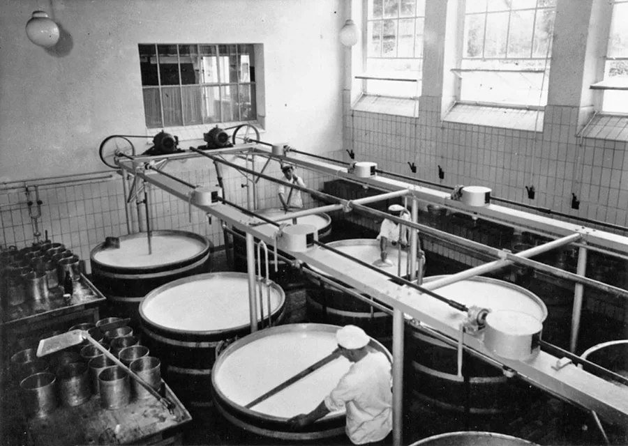 Production of the famous local cheese, Tilsiter, which made the town famous all over the world.
On 7 September 1946 Tilsit was renamed Sovetsk, a town of oblast subordination. Formally it became the centre of the Sovetsk District, but all the district institutions were immediately located in Neman. On 25 July 1947 the centre of the Sovetsk District officially moved to the town of Neman.
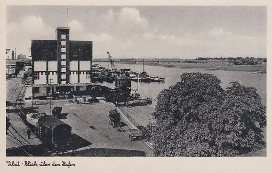 The port — one of the most important places in the town.
In the course of 1947, about half of the German citizens (830 people) were sent from Sovetsk to the Soviet zone of occupied Germany. The rest were deported in 1948.
By the end of 1947 the town had a working pulp and paper mill, a lime works, a sawmill, a brewery, a yeast factory, a sulphite alcohol plant (closed in 1948), a brick and tile works (closed in 1949), a soap works and a flour mill. By 1948 the "Krasny Pishchevik" enterprise had begun producing sweets and other confectionery, and in 1949 a dairy was put into operation.
In 1947 the wooden bridge across the Neman and the railway bridge were restored. In the summer of 1947 a passenger river service began operating on the Kaliningrad–Gvardeysk–Polessk–Sovetsk route. In 1948 rail services were opened between Kaliningrad and Sovetsk and between Kaliningrad and Klaipėda via Sovetsk. A local train also ran between Sovetsk and Neman. In 1948 airmail flights from Kaliningrad to Sovetsk began.
By the beginning of 1947 Sovetsk already had five schools: two primary schools, an incomplete secondary school, a secondary school and an incomplete secondary school for Germans. In 1948 a teacher training college opened (closed in 1956).
There were also two kindergartens, nine healthcare institutions, a Pioneers' House and a House of Culture. Twenty-three shops and seven catering establishments were opened for the townspeople. In 1947 the first issue of the town newspaper "Bolshevik" (later "Znamya Kommunizma") came out. On 24 September 1947, by decision of the town executive committee, the German names of 148 streets and lanes were changed.
In 1948, the Spartak cinema opened in the building of the former German Capitol cinema. The following year, 1949, the Chapayev cinema opened. Work on improving the streets and public spaces began in 1948, and the town was landscaped with greenery. The remains of Soviet soldiers were moved from their original burial sites to a common mass grave. A T-34 tank was installed on the town's central square as a memorial to the Great Patriotic War.
In 1949, a school for cultural and educational workers and a film technical college were established. In 1950, a sanatorium for patients with bone and joint tuberculosis admitted its first patients. In 1951, a school for agricultural machine operators opened, along with a factory apprenticeship school for the baking industry.
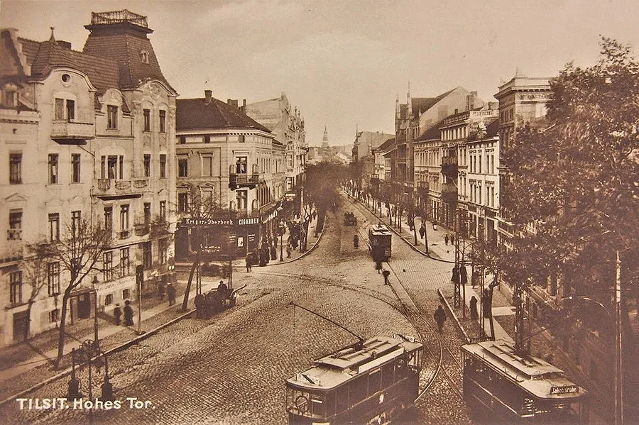 Hohe Straße, which became Sovetsk's main pedestrian street after the Second World War.
Sovetsk went on to develop as the educational, cultural, industrial and transport hub of the north-east of the region.
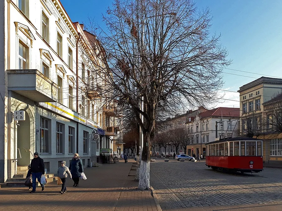 Pobedy Street (formerly Hohe Straße), whose potential remains for future generations to unlock.
In 1955, the first phase of the meat-processing plant was put into operation, the Sovetsk Pulp and Paper Mill produced a trial batch of high-grade offset paper, and the carpet workshop of the Pobeda artel (later a factory) turned out its first carpets. In 1956, the Sovetsk Drama Theatre opened. The 1950s also saw the opening of the Pulp and Paper Mill's House of Culture and a park of culture and recreation. In 1960, the Baltic Fleet's ship-engineering workshops in Sovetsk were converted into a ship-repair yard carrying out major overhauls of small fishing vessels. Also in 1960, a relay centre was opened, allowing the residents of Sovetsk to watch television programmes in high quality. The town had 7,500 radio outlets and two newspapers. By 1961, the food industry of Sovetsk comprised a flour-milling plant, a meat-processing plant and a bread-baking plant, as well as a dairy, a cheese factory, a yeast factory, a brewery and a fruit cannery. Pupils in Sovetsk could attend 12 schools, including four secondary schools, a boarding school (from 1956), a children's music school and a fine arts studio. For younger children there were seven nurseries and 12 kindergartens. Healthcare was provided by seven institutions, including a children's outpatient clinic, a dermatology clinic and dental clinics.
There were four libraries, several gyms, and four permanent and one mobile film projection units. The town had 82 shops and 35 canteens.
In 1963, the Pobeda factory was reorganised as the Sovetsk Druzhba carpet factory, and in 1965 it became a hosiery factory, which, besides nylon and stretch stockings, also produced carpets and clothing. In 1970, the town had 15 industrial enterprises. In 1974, they were joined by a garment factory fitted with the most modern equipment. By 1975, Sovetsk had 118 retail outlets and around 40 catering establishments. Of the town's housing stock, 85.8% had running water, 82.3% sewerage and 84% gas. The only remaining problem was central heating, which only 36.2% of homes in Sovetsk had. There were also 10,000 radio outlets and 1,285 telephones. In 1975, the town had nine schools, four vocational schools, a film technical college, a college for cultural and educational workers, 22 pre-school institutions, eight hospitals, a sanitary and epidemiological station, nine feldsher and midwife stations, an infants' home, 22 libraries, two Houses of Culture, two cinemas, two stadiums and 13 sports halls. In 1979, Sovetsk took first place in the region for urban improvement. In 1984, the Sovetsk bus station was built, and a food market opened at the same time.
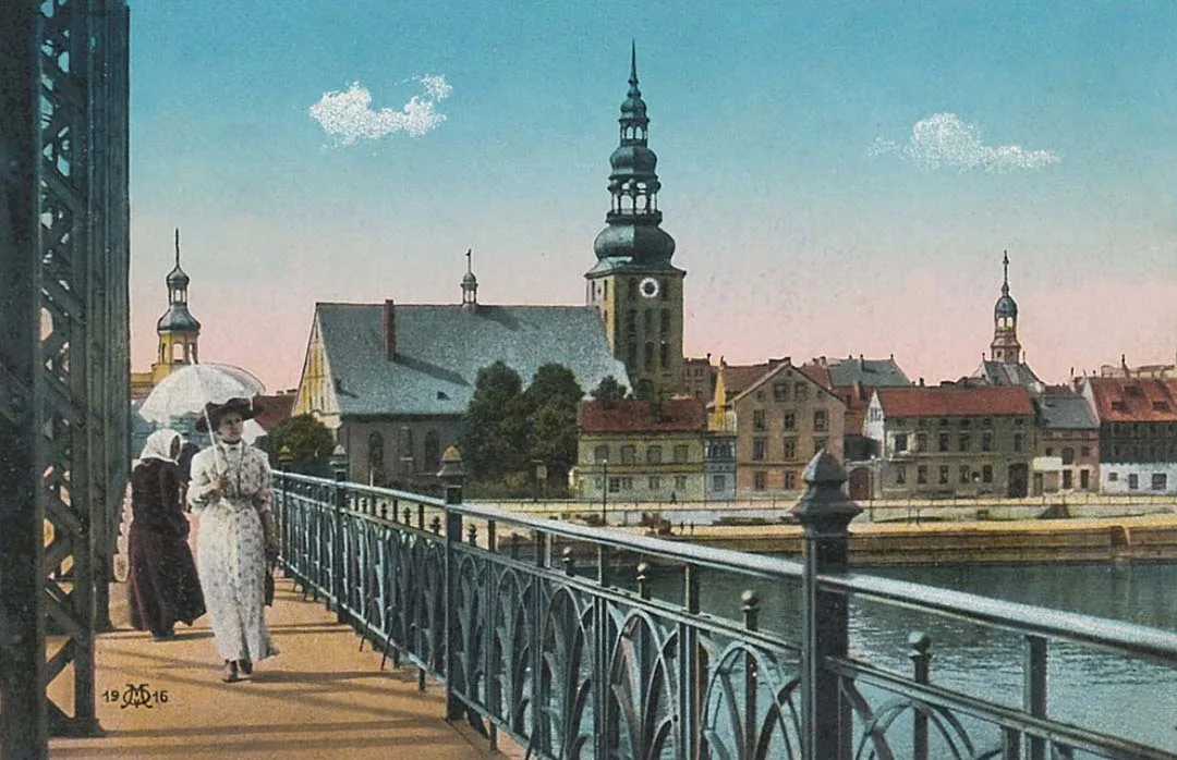
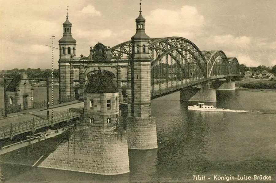 The symbol of Tilsit, the Queen Louise Bridge, was adorned with iron trusses before the Second World War.
With the onset of perestroika, public life in the town became more active. From 1987, cultural events began to be held with the participation of delegations from Lithuania and Poland.
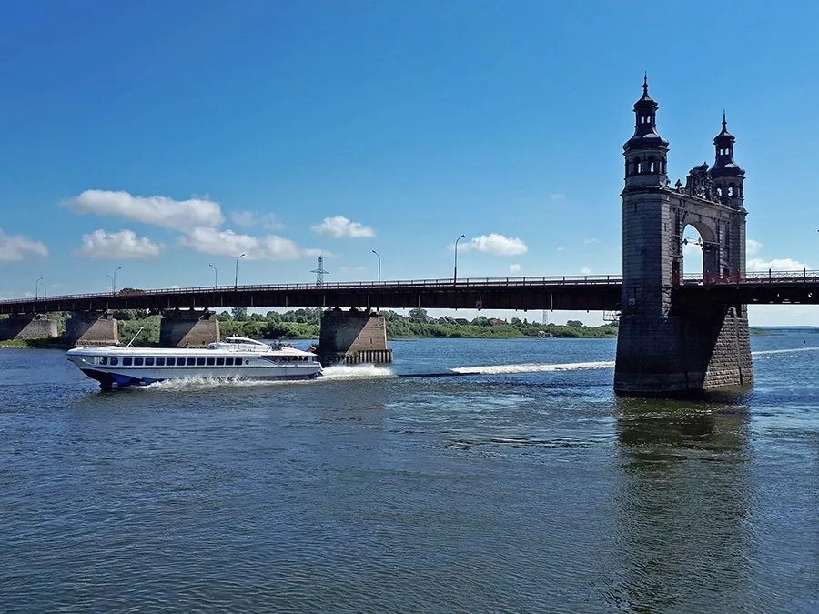 The 21st century. The Queen Louise Bridge and the Lithuanian “Raketa” hydrofoil, plying the Kaunas – Nida – Kaunas route.
In 1988, an Orthodox community was registered in Sovetsk. From 1989, a Lithuanian cultural society was active. The transition to a market economy had mixed effects on the enterprises of Sovetsk. The pulp and paper plant installed foreign equipment and began producing high-grade paper. The garment factory tried to launch a range of fashionable clothing. Other enterprises, however, struggled to adapt to the market and faced serious difficulties.
In 1991, a branch of the medical college opened in Sovetsk. The Museum of Town History began operating in 1992. In 1993, the Sovetsk theatre ceremonially celebrated its centenary, demonstrating that it traced its origins to the pre-war theatre, and its posters increasingly referred to it as the “Tilsit Theatre”. In 1994, a Roman Catholic community was registered in Sovetsk.
In industry, things were far less rosy, as enterprises closed one after another: Druzhba-2 JSC (1996), the Fishing Vessel Shipyard (1997), the Sovetsk Reinforced Concrete Products Plant (1998), the Raduga Machine-Building Plant (2000), the Fermented Dairy Products Plant (2001), the Fruit Cannery (2002) and Baltmebel JSC (2005). In 1997, the Kaliningrad–Sovetsk train was cancelled; in 1999, the bus service to Krasnoznamensk was discontinued; and in 2001, the Sovetsk pier stopped receiving vessels. The town's economy reoriented itself towards transporting goods (including contraband) to and from Lithuania. In 2003, a Lithuanian consulate opened in Sovetsk, and in 2004 the Queen Louise Bridge was restored.
In 2008, the Sovetsk Pulp and Paper Plant closed down as a result of competition from foreign suppliers and the inadequate competence of its managers and owners.
By 2010, the garment factory's production facilities occupied just one floor, while the rest was leased out. Its products did not meet modern standards, which only aggravated the factory's financial problems. A characteristic feature of the 2000s (as in other towns of the region) was the growing share of small businesses in production (up to one third), but these businesses did not always appear reliable and were often set up as one-off structures for a particular project or deal. Nevertheless, it is noted that the situation with production and jobs in Sovetsk is better than in other small towns in the eastern part of the Kaliningrad Region. In 2020, reconstruction and repair work was carried out in the central part of Sovetsk.
Today, the site of the former Tilsit-Preussen is occupied by Timiryazeva and Kutuzova Streets; the site of Stolbeck by houses on Nevskogo Street; the site of Senteinen by Splavnaya and Zelyonaya Streets; the site of Splitter and Schillgallen by the town hospital and houses on Chapayeva Street; the site of Ballgarden by Lermontova, Moskovskaya and Montazhnaya Streets; the site of Ballgardehlen by house No. 43 on Selskaya Street; the site of Bendiglauken by Chernyakhovskogo Street; the site of Kallkappen by an industrial zone and housing along Kaliningradskoye Shosse; and the site of the Punkt estate by farm buildings at the end of Kutuzova Street.
Sights: the ruins of Tilsit Castle (15th century), the Queen Louise Bridge (1907, 1947), the railway bridge (1875), the synagogue building (1830), the half-timbered warehouses of the merchants' guild (1835), a memorial stone and an oak planted to commemorate victory in the Franco-Prussian War, the Catholic church (1843–51), the Reformed church (1900), the Lutheran church (1909–11), the railway station (1865), the military court building (1868), the barracks of the Lithuanian Dragoon Regiment (1878), a water tower (1898), a water tower (1912), the railway water tower (1916), the Tilsit Theatre (1893), the gymnasium building (1900), the Queen Louise Theatre building (1910), numerous residential buildings from the late 19th and early 20th centuries, Jakobsruhe Park with its monument to Queen Louise, the “Forest Cemetery, where 485 soldiers of the Russian Imperial Army, 514 German soldiers (1914–15), one Romanian soldier and 153 Soviet prisoners of war (1941–44) are buried, the Thingplatz (“Green Theatre”, 1935), the memorial complex at the mass grave of Soviet soldiers (386 people, memorial 1975), a mass grave of Soviet soldiers (74 people), a burial site of Soviet prisoners of war (45 people, 1941–42), the Monument to the Liberator Soldier (1991), the Tilsit Tram Monument (2012), the monument to Queen Louise (2014 copy), and numerous post-war monuments and sculptural compositions.
For Reference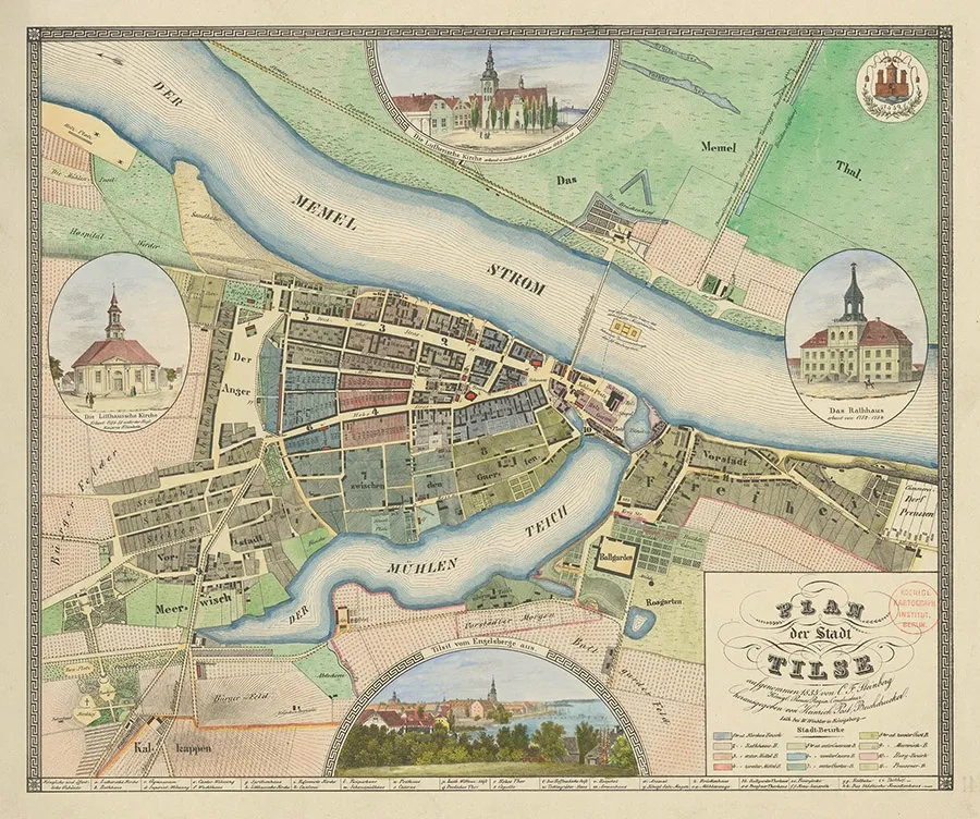
Tilsit-Preussen is first recorded in 1540, when families of Skalvian peasants lived here. In 1619 a certain Gabriel Nimmerjahn received a small house and one Morgen of land here under Kulm law. After the plague epidemic of 1709–10 the area was left depopulated. In 1736, under Frederick William I's programme for resettling deserted lands, religious refugees from France and Nassau arrived here. Tilsit-Preussen is next mentioned in 1741 as the village of Alt Preussen, which on 20 December was placed under the administration of the Tilsit magistrate. In 1785 Alt Preussen appears in documents as a village under Kulm law on the king's personal lands. On 3 February 1858 the landholding of Paszelgsten (Bolshiye Polyany), together with its mill, was annexed to Tilsit-Preussen. In 1872 the village of Tilsit-Preussen was removed from Tilsit's administration to form the rural municipality of Tilsit-Preussen in the Kreis of Tilsit (from 1 April 1896 the Landkreis of Tilsit). The village belonged to the Tilsit-Stadt parish. On 25 March 1874 the rural municipality of Tilsit-Preussen was incorporated into the newly established Amtsbezirk of Tilsit-Preussen. The heads of the Amtsbezirk were always residents of Tilsit-Preussen: from 1874 the landowner Kark, and from 1902 the estate owner Kairies. On 1 April 1919 the municipality of Tilsit-Preussen lost its independence and was incorporated into the municipality of Tilsit. In the pre-war years Tilsit-Preussen had a primary school and two brickworks.
Amtsbezirk No. 28 Tilsit-Preussen was established on 25 March 1874 in the Kreis of Tilsit. It comprised two rural municipalities: Kallkappen (now part of Sovetsk) and Tilsit-Preussen (now part of Sovetsk). By 1908 the Gutsbezirk of Paszelgsten (Bolshiye Polyany) had also become part of the Amtsbezirk of Tilsit-Preussen. On 1 April 1919 the municipality of Tilsit-Preussen was removed from the Amtsbezirk and incorporated into the municipality of Tilsit. On 24 March 1921 the remaining localities of the Amtsbezirk of Tilsit-Preussen were also transferred to the municipality of Tilsit, and the Amtsbezirk itself was abolished.
The village of Stolbeck in 1875–1818 formed a single administrative unit with the village of Splitter (now part of Sovetsk), which lay on the opposite bank of the Schmalupp (Uzkaya) river and the Splitterscher Mühlen-Teich pond. The village belonged to the Amt of Linkuhnen (Rzhevskoye). The peasants of Splitter-Stolbeck held a hereditary right to their land, but without the right to sell it freely (Erbfrei).
From 1818 the village of Stolbeck formed a rural municipality in the Kreis of Tilsit (from 1 April 1896 the Landkreis of Tilsit). The village belonged to the Tilsit-Land parish of the Lithuanian Church of Tilsit (Litauische Kirche). In 1841 a synagogue was opened in Stolbeck, with a Jewish cemetery nearby. In 1865 the Königsberg–Tilsit railway was laid along the eastern edge of Stolbeck, and from then on it separated Tilsit from Stolbeck. In 1871 Stolbeck had 59 residential buildings. On 25 March 1874 the rural municipality of Stolbeck was incorporated into the newly established Amtsbezirk of Stolbeck. In 1905 Stolbeck had 61 houses. The village was also home to two barracks and several cemeteries. On 1 April 1919 the rural municipality of Stolbeck lost its independence and was incorporated into the municipality of Tilsit. In the pre-war years Stolbeck had a school.
On 25 March 1874 Amtsbezirk No. 23 Stolbeck was established in the Kreis of Tilsit, comprising three rural municipalities: Schillgallen (now part of Sovetsk), Splitter (now part of Sovetsk) and Stolbeck (now part of Sovetsk). On 1 April 1919 the rural municipalities of Splitter (now part of Sovetsk) and Stolbeck (now part of Sovetsk) passed to the Stadtkreis of Tilsit and the municipality of Tilsit. On 24 March 1921 Schillgallen (now part of Sovetsk), the only remaining rural municipality of the Amtsbezirk of Stolbeck, was transferred to the Amtsbezirk of Weynothen (Oktyabrskoye). The Amtsbezirk of Stolbeck was abolished at the same time.
Splitter was founded in 1360 as a fortress. It was probably a simple earthwork fortification. At about the same time a dam was built on the Schmalupp (Uzkaya) river, and two watermills were erected on the resulting Splitter mill pond (Spletterscher Mühlen-Teich). In 1365 a Lithuanian army of some 4,000 warriors campaigned in Prussia and destroyed Splitter. Yet as early as 1384 it is mentioned in the Annals of Thorn as an active fortification. At the end of the 14th century a settlement of Prussian Skalvians grew up by the fortress. Documents from 1403 and 1404 mention major building works at Splitter: 122,000 bricks and timber were delivered here. On 8 February 1411 the Samogitians, led by Ramautas Valimaitis, plundered Splitter. The fortress itself was probably damaged beyond repair, after which it was decided not to rebuild it but to secure this stretch of the frontier with the new castle of Tilsit instead. In 1491 and 1495 documents of the Komturei of Ragnit mention a certain Simon who held land allotments in Splitter. In 1540 the tax records of Tilsit mention an estate with 183 peasants in Splitter belonging to Moritz von Perschkau, Burggraf of Tilsit. In 1552 the ruined fortifications of Splitter appear in a charter as the "castle hill". From then on Splitter existed solely as a settlement.
On 30–31 January 1679 a battle took place near Splitter between the army of the Great Elector Frederick William and retreating units of the Swedish army under Field Marshal Henrik Horn. The Prussian vanguard of 1,000 horsemen, commanded by Colonel Joachim Hennigs von Treffenfeld, attacked the Swedish rearguard straight off the march. The next day, 31 January 1679, the entire Prussian cavalry engaged the Swedes. The battle ended in a decisive Prussian victory. Around 1,000 fallen Swedish soldiers were buried in the so-called "Swedish cemetery" in Splitter, which survived until 1945.
In 1875–1818 the village of Splitter formed a single administrative unit with the village of Splitter (now part of Sovetsk), which lay on the opposite bank of the Smalupp river and the Splitterscher Mühlen-Teich pond. The combined village belonged to the Amt of Linkuhnen (Rzhevskoye) and numbered 13 households. Its inhabitants held a hereditary right to their land, without the right to sell it freely (Erbfrei). The village also owned the royal watermill of Ballgarden and the Splitter inn (Splitterscher Krug).
From 1818 the village of Splitter formed a rural municipality in the Kreis of Tilsit (from 1 April 1896 the Landkreis of Tilsit). The village belonged to the Tilsit-Land parish of the Lithuanian Church of Tilsit (Litauische Kirche). In 1871 Splitter had 26 residential buildings with 80 households (78 families and 2 single persons). On 25 March 1874 the rural municipality of Splitter was incorporated into the newly established Amtsbezirk of Stolbeck (now part of Sovetsk). Throughout the existence of the Amtsbezirk of Stolbeck (until 24 March 1921) its heads were always residents of Splitter: the landowner Stephani (from 1874), the municipal head Gombert (from 1910) and the retired Rittmeister Reiner (from 1917). On 1 April 1919 the rural municipality of Splitter lost its independence and was incorporated into the municipality of Tilsit. In the pre-war years Splitter had a school.
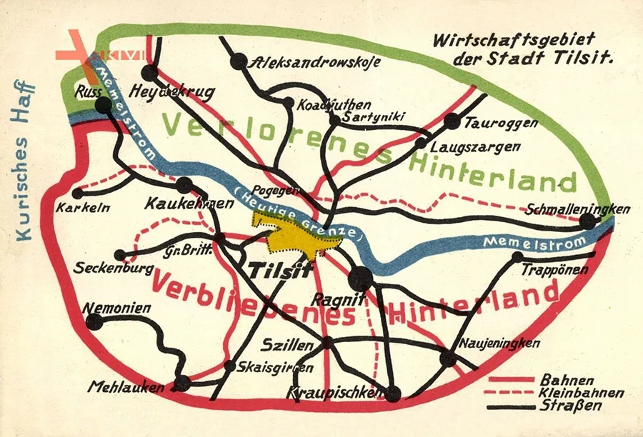 Postcard with a map of the road network around Tilsit. Red lines: railways; red dashed lines: narrow-gauge railways; black lines: highways.
Senteinen is mentioned in 1563 as a village that had belonged since 1486 to Moritz von Perschkau, Burggraf of Tilsit. In 1785 it appears as a Vorwerk of the royal domain of Ballgarden (now part of Sovetsk). From 1818 Senteinen was a village forming a rural municipality in the Landkreis of Tilsit (from 1 July 1922 in the Landkreis of Tilsit-Ragnit). The village belonged to the Tilsit-Stadt parish. In 1871 the municipality of Senteinen consisted of two settlements with 26 residential buildings and 61 households (57 families and 4 single persons). On 25 March 1874 the rural municipality of Senteinen was incorporated into the newly established Amtsbezirk of Ballgarden (now part of Sovetsk). In 1905 Senteinen had 54 residential buildings. On 1 July 1922 the municipality of Senteinen lost its independence and became part of the municipality of Tilsit, while a small part of it passed to the rural municipality of Eromeiten (from 1938 Ehrenfelde; now Zlatoustye).
Schillgallen was a village forming a rural municipality in Landkreis Tilsit (from 1 July 1922 in Landkreis Tilsit-Ragnit). The village belonged to the church parish of Tilsit Town / Tilsit-Stadt. In 1871 the municipality of Schillgallen consisted of three settlements with 77 residential houses and 192 households (182 families and 10 single men). On 25 March 1874 the rural municipality of Schillgallen was incorporated into the newly established Amtsbezirk Stolbeck (now part of Sovetsk). On 24 March 1921 the municipality of Schillgallen was transferred to Amtsbezirk Weynothen (Oktyabrskoye). On 1 July 1922 the rural municipality of Schillgallen lost its independence and became part of the municipality of Tilsit.
Ballgarden is first mentioned in 1785 as a royal Domänenamt. In the 19th century Ballgarden was an estate forming a Gutsbezirk in Landkreis Tilsit (from 1 July 1922 in Landkreis Tilsit-Ragnit). The estate belonged to the church parish of Tilsit Town / Tilsit-Stadt. In 1840 Ballgarden had five residential houses. By 1871 the Gutsbezirk of Ballgarden already had eight residential houses, occupied by 38 families. Besides the estate itself (five residential houses), the Gutsbezirk included the outlying farmsteads of Abbau Ballgarden / Abbau Ballgarden with two residential houses and the sheep farm of Ballgarden / Schäferei Ballgarden with one residential house. On 25 March 1874 the Gutsbezirk of Ballgarden was incorporated into the newly established Amtsbezirk Ballgarden. On 25 February 1898 the Gutsbezirk of Ballgarden was abolished, and the Ballgarden estate was incorporated into Tilsit as a town district.
Amtsbezirk No. 27 Ballgarden was established in Kreis Tilsit on 25 March 1874. It comprised seven rural municipalities: Bartukeiten / Bartukeiten (from 1938 Bartenhöh / Bartenhöh, Barsukovka), Bendiglauken / Bendiglauken (now part of Sovetsk), Birjohlen / Birjohlen (from 1938 Birgen / Birgen, 55°02'53'' N 21°55'49'' E), Moritzkehmen / Moritzkehmen (55°02'48'' N 21°53'49'' E), Pamletten / Pamletten (Strelochnoye, later part of Barsukovka), Raukothienen / Raukothienen (from 1938 Rauken / Rauken, 55°01'04'' N 21°52'42'' E) and Senteinen / Senteinen (now part of Sovetsk), as well as four Gutsbezirke: Ballgarden (now part of Sovetsk), Ballgardehlen / Ballgardehlen (now part of Sovetsk), Birjohlen / Birjohlen (55°02'55'' N 21°55'47'' E) and Paszelgsten / Paszelgsten (from 1938 Siedelhöhe / Siedelhöhe, Dubki). After the Gutsbezirk of Ballgarden was abolished on 25 February 1898 and incorporated into Tilsit as one of its districts, Amtsbezirk Ballgarden was renamed Kallkappen.
Ballgardehlen is mentioned in the 19th century as an estate held under limited hereditary tenure (Erbfreigut). In the 19th century Ballgardehlen formed a Gutsbezirk in Landkreis Tilsit and belonged to the church parish of Tilsit Town / Tilsit-Stadt. In 1840 Ballgardehlen had one residential house. By 1871 Ballgardehlen already had two residential houses, occupied by a single family. On 25 March 1874 the Gutsbezirk of Ballgardehlen was incorporated into the newly established Amtsbezirk Ballgarden (now part of Sovetsk). But as early as the turn of the 20th century the Ballgardehlen estate lost its status as a separate locality and became part of the municipality of Tilsit.
Kallkappen was founded no later than 1785. From 1818 Kallkappen was a village forming a rural municipality in Landkreis Tilsit (from 1 July 1922 in Landkreis Tilsit-Ragnit). The village belonged to the church parish of Tilsit Town / Tilsit-Stadt. On 25 March 1874 the rural municipality of Kallkappen was incorporated into the newly established Amtsbezirk Tilsit-Preussen (now part of Sovetsk). After 25 February 1898 the rural municipality of Kallkappen was transferred to Amtsbezirk Ballgarden (now part of Sovetsk), which was renamed Kallkappen at the same time. Heinrich Wander / Wander, a pensioner from Kallkappen, served as head of the Amtsbezirk in 1902–10. On 1 April 1919 the municipality of Kallkappen lost its independence and was incorporated into the municipality of Tilsit.
Amtsbezirk Kallkappen at the time of its formation consisted of seven rural municipalities: Bartukeiten / Bartukeiten (from 1938 Bartenhöh / Bartenhöh, Barsukovka), Bendiglauken / Bendiglauken (now part of Sovetsk), Kallkappen (now part of Sovetsk), Moritzkehmen / Moritzkehmen (55°02'48'' N 21°53'49'' E), Pamletten / Pamletten (Strelochnoye, later part of Barsukovka), Raukothienen / Raukothienen (from 1938 Rauken / Rauken, 55°01'04'' N 21°52'42'' E) and Senteinen / Senteinen (now part of Sovetsk). After the municipality of Kallkappen became part of Tilsit on 1 April 1919, Amtsbezirk Kallkappen was abolished (24 March 1921), and its rural municipalities formed the new Amtsbezirk Moritzkehmen.
Bendiglauken was founded no later than 1785. From 1818 Bendiglauken was a village forming a rural municipality in Landkreis Tilsit (from 1 July 1922 in Landkreis Tilsit-Ragnit). The village belonged to the rural church parish of Tilsit-Land / Tilsit-Land at the Lithuanian Church of Tilsit / Litauische Kirche. In 1871 Bendiglauken had 26 residential houses with 49 households. On 25 March 1874 the rural municipality of Bendiglauken was incorporated into the newly established Amtsbezirk Ballgarden (now part of Sovetsk). However, on 24 March 1921 Amtsbezirk Ballgarden was abolished, and the municipality of Bendiglauken was transferred to the new Amtsbezirk Moritzkehmen / Moritzkehmen (55°02'48'' N 21°53'49'' E). On 21 October 1925 Amtsbezirk Moritzkehmen was in turn dissolved as well, and Amtsbezirk Bendiglauken was formed in its place. In the pre-war period Bendiglauken had a school, two brickworks and a lineman's hut.
Amtsbezirk Bendiglauken at the time of its foundation on 25 October 1925 consisted of five rural municipalities: Bartukeiten / Bartukeiten (from 1938 Bartenhöh / Bartenhöh, Barsukovka), Bendiglauken (now part of Sovetsk), Birjohlen / Birjohlen (from 1938 Birgen / Birgen), Pamletten / Pamletten (Strelochnoye, later part of Barsukovka) and Raukothienen / Raukothienen (from 1938 Rauken / Rauken). On 6 April 1933 the municipality of Birjohlen was transferred to Amtsbezirk Paskallwen / Paskallwen (from 1938 Schalau / Schalau, Dubki). On 1 October 1938 the municipality of Bartenhöh (Barsukovka) lost its independence and became part of the municipality of Pamletten (Strelochnoye). The Amtsbezirk, by then renamed Bendigsfelde, now consisted of three municipalities: Bendigsfelde (now part of Sovetsk), Pamletten (Strelochnoye, later Barsukovka) and Rauken. Its composition remained unchanged until 1945.
The estate of Punkt, called Sternkopf / Sternkopf until 1895, was part of the municipality of Tilsit and belonged to the church parish of Tilsit Town / Tilsit-Stadt.
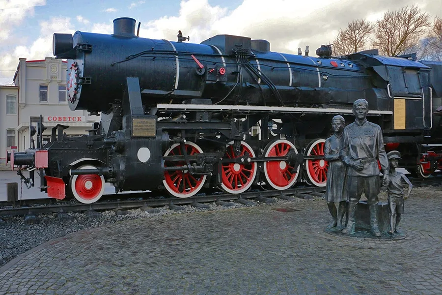 Monument to the first settlers at Sovetsk railway station.
Population of Tilsit-Sovetsk over time: 1782 – 7,701, 1852 – 13,748, 1867 – 19,476, 1871 – 20,251, 1880 – 21,400, 1885 – 22,422, 1890 – 34,539, 1910 – 34,539, 1925 – 50,831, 1933 – 57,286, 1939 – 59,105, 1946 (Nov.) – 13,3651, 1947 – 15,7952, 1959 – 31,941, 1970 – 38,456, 1989 – 41,881, 2002 – 43,224, 2008 – 42,456, 2009 – 42,619, 2010 – 41,705, 2012 – 41,941, 2013 – 41,802, 2014 – 41,630, 2015 – 41,212, 2016 – 40,984, 2017 – 40,486, 2018 – 39,752, 2019 – 39,150, 2020 – 38,963 inhabitants.
1 – including 2,100 Germans.
2 – including 1,659 Germans in Jan. 1947.
Population of Tilsit-Preussen over time: 1871 – 1,378, 1885 – 1,481, 1905 – 1,513, 1910 – 1,588 inhabitants.
Population of Stolbeck over time: 1867 – 1,228, 1871 – 1,142, 1885 – 1,160, 1905 – 1,411, 1910 – 1,728 inhabitants.
Population of Splitter over time: 1867 – 323, 1871 – 335, 1885 – 770 inhabitants.
Population of Senteinen over time: 1867 – 271, 1871 – 276, 1885 – 431, 1905 – 545, 1910 – 584 inhabitants.
Population of Bendiglauken over time: 1867 – 314, 1871 – 280, 1885 – 255, 1905 – 312, 1910 – 274, 1939 – 440 inhabitants.
Population of Schillgallen over time: 1867 – 684, 1871 – 717, 1885 – 639, 1905 – 790, 1910 – 972 inhabitants.
Population of Ballgarden over time: 1840 – 107, 1867 – 201, 1871 – 196, 1885 – 201 inhabitants.
Population of Ballgardehlen over time: 1840 – 11, 1867 – 13, 1871 – 18 inhabitants.
Population of Kallkappen over time: 1871 – 674, 1885 – 850 inhabitants.
Composition of the population of Tilsit in 1871: Evangelical Christians – 18,953, Catholics – 588, other Christians – 195, Jews – 515, children under 10 – 4,101, literate – 13,216 (84%), blind – 21, deaf-mute – 27, insane – 23.
Composition of the population of Stolbeck in 1871: Evangelical Christians – 1,107, Catholics – 30, Jews – 5, children under 10 – 285, literate – 572 (68%), blind – 2, deaf-mute – 1.
Population of Splitter in 1871: Evangelical Christians – 331, Catholics – 2, Jews – 2, children under 10 – 85, literate – 116 (51%), deaf-mute – 2.
Population of Senteinen in 1871: Evangelical Christians – 272, Catholics – 3, Jews – 1, children under 10 – 59, literate – 162 (79%), blind – 1, deaf-mute – 1.
Population of Bendiglauken in 1871: Evangelical Christians – 274, Catholics – 1, other Christians – 5, children under 10 – 75, literate – 108 (54%), blind – 2, deaf-mute – 1.
Population of Schillgallen in 1871: Evangelical Christians – 682, Catholics – 7, Jews – 28, children under 10 – 195, literate – 235 (46%), blind – 1, deaf-mute – 3, deaf-mute – 3.
Population of Ballgarden in 1871: Evangelical Christians – 191, Catholics – 5, children under 10 – 49, literate – 97 (66%).
Modern photos by Mikhail Ogorodnikov.
Translated from Russian with the help of AI (Claude, Anthropic), October 2026.